Cinder Hill

Settlement in Staffordshire

England

Cinder Hill

Northway Traffic Lights The view on the Sedgley estate, Dudley.
Northway Traffic Lights Credit: Gordon Griffiths

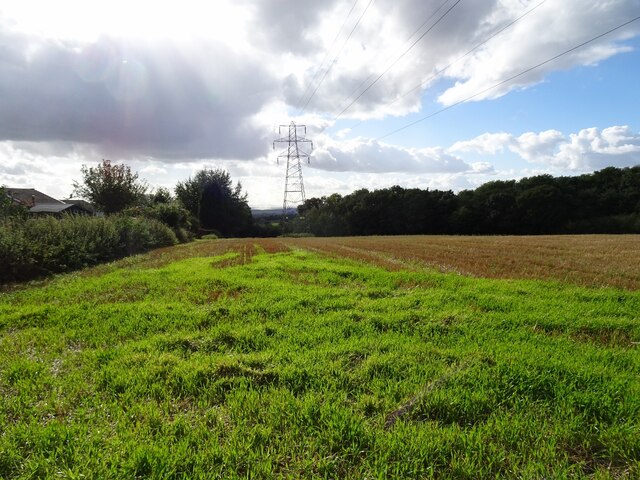
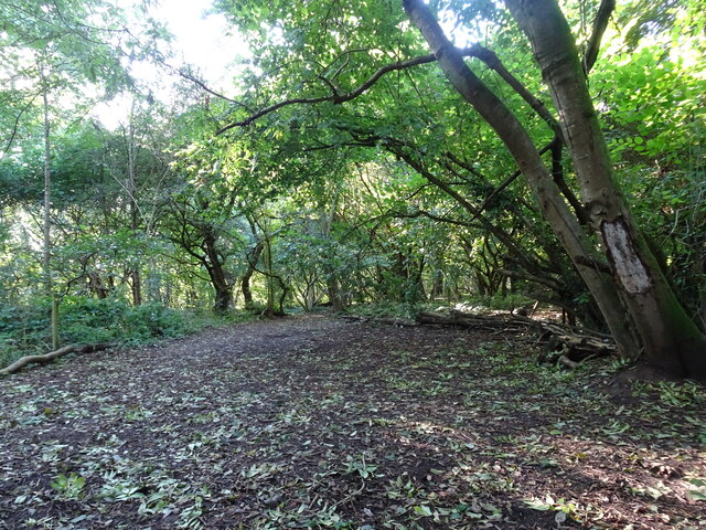
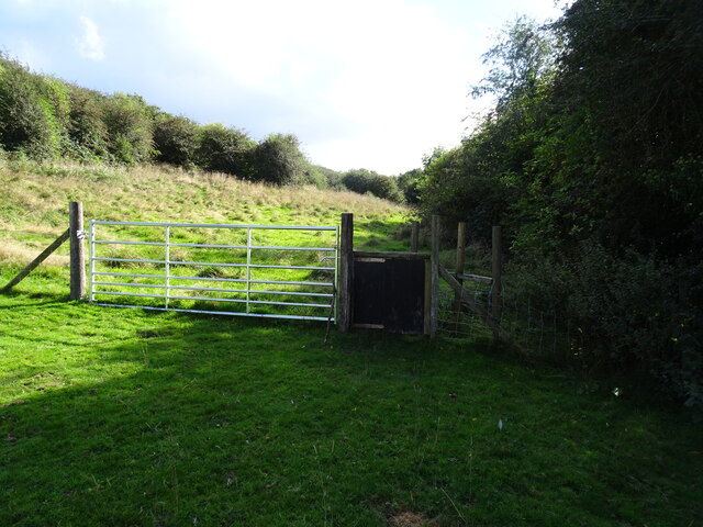
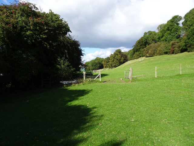
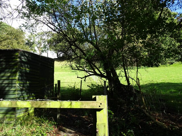
Cinder Hill is a small village located in the county of Staffordshire, England. Situated about 4 miles east of the town of Rugeley, it lies within the Cannock Chase District. The village is surrounded by picturesque countryside, with rolling hills and woodlands which are part of the wider Cannock Chase Area of Outstanding Natural Beauty.

Cinder Hill has a rich history dating back many centuries. It was originally a mining community, with coal being the primary natural resource in the area. The village thrived during the industrial revolution, with several collieries operating in the vicinity. However, the decline of the coal industry in the mid-20th century led to the closure of these mines.

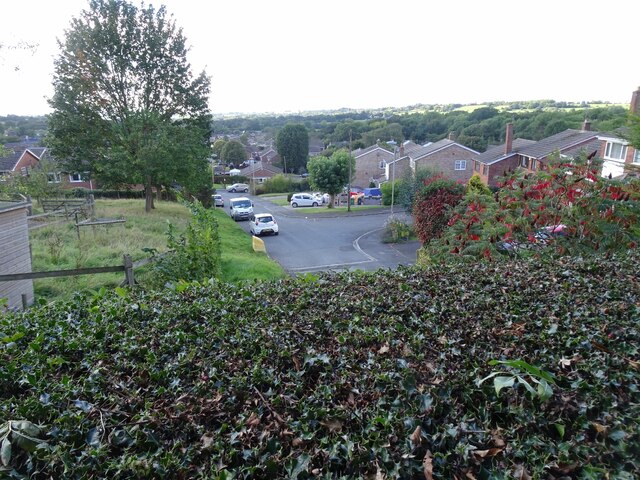
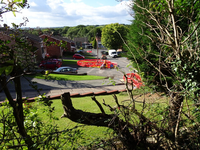
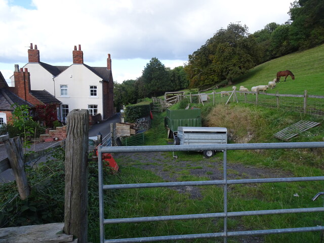
Today, Cinder Hill is a tranquil and close-knit community, known for its peaceful atmosphere and beautiful surroundings. The village comprises mainly residential properties, with a few local businesses catering to the needs of the residents. The nearby Cannock Chase offers ample opportunities for outdoor activities such as hiking, cycling, and wildlife spotting.

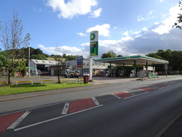
Cinder Hill benefits from excellent transport links, with the A51 road passing through the village, providing easy access to nearby towns and cities. The village also has a regular bus service connecting it to Rugeley and other surrounding areas.

In terms of amenities, Cinder Hill has a community center, a primary school, and a village hall which serves as a hub for various social events and gatherings. The residents take pride in their community and actively participate in local initiatives and organizations, fostering a strong sense of belonging and community spirit.

If you have any feedback on the listing, please let us know in the comments section below.

Cinder Hill Images

Images are sourced within 2km of 52.546023/-2.108354 or Grid Reference SO9294. Thanks to Geograph Open Source API. All images are credited.

Northway Traffic Lights The view on the Sedgley estate, Dudley.
Northway Traffic Lights
The view on the Sedgley estate, Dudley.
New Bike Racks The view in the Northway Sedgley.
New Bike Racks
The view in the Northway Sedgley.
Alderdale Avenue View The view on the Northway Estate, Sedgley.
Alderdale Avenue View
The view on the Northway Estate, Sedgley.
Swallowfields  Road The view on the Northway Estate, Sedgley.
Swallowfields Road
The view on the Northway Estate, Sedgley.
Kineton Rise The view on the Northway Estate, Sedgley.
Kineton Rise
The view on the Northway Estate, Sedgley.
Alder Coppice Trees The view of the Weeping Willows on the Northway Estate, Sedgley.
Alder Coppice Trees
The view of the Weeping Willows on the Northway Estate, Sedgley.
Autumn Scene The view on the first day of autumn in Sedgley Hall Farm Park.
Autumn Scene
The view on the first day of autumn in Sedgley Hall Farm Park.
Edge Hill Drive  View from Sedgley Hall Farm Path, over the Northway Estate.
Edge Hill Drive
View from Sedgley Hall Farm Path, over the Northway Estate.
Kineton Rise View The view of the Close off the Northway in Sedgley.
Kineton Rise View
The view of the Close off the Northway in Sedgley.
Beacon Centre The view of the Beacon Centre for the blind on the Wolverhampton Sedgley border.
The view of the old building in November 2006 <a href="https://www.geograph.org.uk/photo/272346">SO9195 : The Beacon Centre for the Blind</a>.
Beacon Centre
The view of the Beacon Centre for the blind on the Wolverhampton Sedgley border. The view of the old building in November 2006 SO9195 : The Beacon Centre for the Blind.
No Petrol The view of the BP Petrol station on the Wolverhampton Road, Sedgley.
The shortage of petrol due to panic buying and a shortage of HGV drivers.
No Petrol
The view of the BP Petrol station on the Wolverhampton Road, Sedgley. The shortage of petrol due to panic buying and a shortage of HGV drivers.
Hopeful Price The view of the £0 price at the BP Petrol station on the Wolverhampton Road, Sedgley.
The shortage of petrol due to panic buying and a shortage of HGV drivers.
Hopeful Price
The view of the £0 price at the BP Petrol station on the Wolverhampton Road, Sedgley. The shortage of petrol due to panic buying and a shortage of HGV drivers.
Pylon View The view over the fields alongside the Northway Estate in Sedgley.
Pylon View
The view over the fields alongside the Northway Estate in Sedgley.
Woodland Scene The view in Alder Coppice Ancient Woodland on the Northway Estate, Sedgley.
Woodland Scene
The view in Alder Coppice Ancient Woodland on the Northway Estate, Sedgley.
Northway Stile The view of the path near Hickmerelands Lane, Sedgley.
Northway Stile
The view of the path near Hickmerelands Lane, Sedgley.
Northway Field The view of the path near Hickmerelands Lane, Sedgley.
Northway Field
The view of the path near Hickmerelands Lane, Sedgley.
Northway Farm The view of the Old Farm on Hickmerelands Lane Sedgley.
Northway Farm
The view of the Old Farm on Hickmerelands Lane Sedgley.
Field View The view from the Hickmerelands Lane footpath, Sedgley.
Field View
The view from the Hickmerelands Lane footpath, Sedgley.
Show me another place!

Cinder Hill is located at Grid Ref: SO9294 (Lat: 52.546023, Lng: -2.108354)

Unitary Authority: Wolverhampton

Police Authority: West Midlands

What 3 Words

///bared.public.digs. Near Bilston, West Midlands

Related Wikis

Coseley Urban District

Coseley Urban District was a local government district in Staffordshire which was created in 1894.It was made up of the villages of Brierley (now Bradley...

Sarah Hughes Brewery

Sarah Hughes Brewery in Sedgley, in the Black Country of England, dates from the Victorian era. It was bought by Sarah Hughes in 1921 and brewed until...

Woodcross

Woodcross is a residential area of Coseley, West Midlands, England. It is set within the City of Wolverhampton, though the area traditionally existed within...

Beacon Hill, Sedgley

Beacon Hill in Sedgley, England, is one of the highest points in the West Midlands, at 237 metres (778 ft) above sea level. From the summit, Wolverhampton...

Nearby Amenities

Located within 500m of 52.546023,-2.108354
Traffic Signals
Source: bing
Lat/Long: 52.5457617/-2.1053335
Post Box
Operator: Royal Mail
Operator Wikidata: Q638098
Lat/Long: 52.5494115/-2.1106734
Bus Stop
Dovedale Rd / Camberley Crescent
NaPTANAreaCode: 43000727301
Bus: yes
Naptan AtcoCode: 43000727301
Naptan Bearing: NW
Naptan BusStopType: MKD
Naptan CommonName: Camberley Crescent
Naptan Indicator: adj
Naptan NaptanCode: nwmjgpaj
Naptan PlusbusZoneRef: BHAMNWS
Naptan Status: ACT
Naptan StopType: BCT
Naptan Street: DOVEDALE RD
Naptan Towards: Bilston, Wolverhampton
Naptan Verified: no
Public Transport: platform
Route Ref: 81;224
Shelter: yes
Shelter Ref: 104205
Source: WMCA
Lat/Long: 52.5496755/-2.1110511
Bus Stop
Dovedale Rd / Camberley Crescent
Bus: yes
Naptan AtcoCode: 43000727302
Naptan Bearing: SE
Naptan BusStopType: MKD
Naptan CommonName: Camberley Crescent
Naptan Indicator: after
Naptan NaptanCode: nwmtwtjw
Naptan PlusbusZoneRef: BHAMNWS
Naptan Status: ACT
Naptan StopType: BCT
Naptan Street: DOVEDALE RD
Naptan Towards: Coseley
Naptan Verified: no
Public Transport: platform
Route Ref: 81;224
Source: WMCA
Lat/Long: 52.550053/-2.1112143
Bus Stop
Woodcross St / Bellevue St
NaPTANAreaCode: 43000727701
Bus: yes
Naptan AtcoCode: 43000727701
Naptan Bearing: NE
Naptan BusStopType: MKD
Naptan CommonName: Bellevue St
Naptan Indicator: opp
Naptan Landmark: Bellevue Court Nursing Home
Naptan NaptanCode: nwmjgpdj
Naptan PlusbusZoneRef: BHAMNWS
Naptan Status: ACT
Naptan StopType: BCT
Naptan Street: WOODCROSS ST
Naptan Towards: Wolverhampton
Naptan Verified: no
Public Transport: platform
Route Ref: 81
Shelter: yes
Shelter Ref: 104207
Source: WMCA
Lat/Long: 52.5501123/-2.1053005
Bus Stop
Woodcross St / Bellevue St
NaPTANAreaCode: 43000727702
Bus: yes
Naptan AtcoCode: 43000727702
Naptan Bearing: SW
Naptan BusStopType: MKD
Naptan CommonName: Bellevue St
Naptan Indicator: adj
Naptan Landmark: Bellevue Court Nursing Home
Naptan NaptanCode: nwmjgpdm
Naptan PlusbusZoneRef: BHAMNWS
Naptan Status: ACT
Naptan StopType: BCT
Naptan Street: WOODCROSS ST
Naptan Towards: Coseley
Naptan Verified: no
Public Transport: platform
Route Ref: 81;223
Shelter: yes
Shelter Ref: 104222
Source: WMCA
Lat/Long: 52.5496978/-2.1063319
Bus Stop
Woodcross St / Wathan Avenue
Bus: yes
Naptan AtcoCode: 43000727801
Naptan Bearing: NE
Naptan BusStopType: MKD
Naptan CommonName: Wathan Avenue
Naptan Indicator: opp
Naptan NaptanCode: nwmjgpdp
Naptan PlusbusZoneRef: BHAMNWS
Naptan Status: ACT
Naptan StopType: BCT
Naptan Street: WOODCROSS ST
Naptan Towards: Wolverhampton
Naptan Verified: no
Public Transport: platform
Route Ref: 81;223
Source: WMCA
Lat/Long: 52.548509/-2.1086591
Bus Stop
Woodcross St / Wathan Avenue
Bus: yes
Naptan AtcoCode: 43000727802
Naptan Bearing: SW
Naptan BusStopType: MKD
Naptan CommonName: Wathan Avenue
Naptan Indicator: adj
Naptan NaptanCode: nwmjgpdt
Naptan PlusbusZoneRef: BHAMNWS
Naptan Status: ACT
Naptan StopType: BCT
Naptan Street: WOODCROSS ST
Naptan Towards: Coseley
Naptan Verified: no
Public Transport: platform
Route Ref: 81;223
Source: WMCA
Lat/Long: 52.5484186/-2.1086441
Bus Stop
Dovedale Rd / Falcon Crescent
Bus: yes
Naptan AtcoCode: 43000727902
Naptan Bearing: SE
Naptan BusStopType: MKD
Naptan CommonName: Falcon Crescent
Naptan Indicator: before
Naptan NaptanCode: nwmtawtg
Naptan PlusbusZoneRef: BHAMNWS
Naptan Status: ACT
Naptan StopType: BCT
Naptan Street: DOVEDALE RD
Naptan Towards: Sedgley
Naptan Verified: no
Public Transport: platform
Route Ref: 223;224
Source: WMCA
Lat/Long: 52.5492176/-2.1104158
Bus Stop
Hall Lane / Robert Wynd
Bus: yes
Naptan AtcoCode: 43000728101
Naptan Bearing: NW
Naptan BusStopType: MKD
Naptan CommonName: Robert Wynd
Naptan Indicator: opp
Naptan NaptanCode: nwmjgpgd
Naptan PlusbusZoneRef: BHAMNWS
Naptan Status: ACT
Naptan StopType: BCT
Naptan Street: HALL LANE
Naptan Towards: Wolverhampton
Naptan Verified: no
Public Transport: platform
Route Ref: 81;224
Source: WMCA
Lat/Long: 52.5472508/-2.1082873
Bus Stop
Hall Lane / Robert Wynd
NaPTANAreaCode: 43000728102
Bus: yes
Naptan AtcoCode: 43000728102
Naptan Bearing: SE
Naptan BusStopType: MKD
Naptan CommonName: Robert Wynd
Naptan Indicator: after
Naptan NaptanCode: nwmtwmtw
Naptan PlusbusZoneRef: BHAMNWS
Naptan Status: ACT
Naptan StopType: BCT
Naptan Street: HALL LANE
Naptan Towards: Coseley
Naptan Verified: no
Public Transport: platform
Route Ref: 81;223;224
Shelter: yes
Shelter Ref: 104223
Source: WMCA
Lat/Long: 52.5470445/-2.1076822
Bus Stop
Gorge Rd / Hall Lane
NaPTANAreaCode: 43000728201
Asset Ref: 404221
Bus: yes
Naptan AtcoCode: 43000728201
Naptan Bearing: SW
Naptan BusStopType: MKD
Naptan CommonName: Hall Lane
Naptan Indicator: opp
Naptan NaptanCode: nwmtawtj
Naptan PlusbusZoneRef: BHAMNWS
Naptan Status: ACT
Naptan StopType: BCT
Naptan Street: GORGE RD
Naptan Towards: Sedgley
Public Transport: platform
Route Ref: 223;224;229
Shelter: yes
Shelter Ref: 404221
Source: WMCA
Towards: Sedgley
Lat/Long: 52.5455483/-2.1058003
Bus Stop
Roberts Wynd / Hall Lane
Bus: yes
Naptan AtcoCode: 43007281001
Naptan Bearing: NE
Naptan BusStopType: MKD
Naptan CommonName: Hall Lane
Naptan Indicator: after
Naptan Landmark: The Horse and Jockey
Naptan NaptanCode: nwmtwtpd
Naptan PlusbusZoneRef: BHAMNWS
Naptan Status: ACT
Naptan StopType: BCT
Naptan Street: ROBERTS WYND
Naptan Towards: Bilston
Naptan Verified: no
Public Transport: platform
Route Ref: 223
Source: WMCA
Lat/Long: 52.5474038/-2.1080222
Bus Stop
Hurst Rd / Hall La
NaPTANAreaCode: 43007282501
Asset Ref: 104206
Bus: yes
Naptan AtcoCode: 43007282501
Naptan Bearing: E
Naptan BusStopType: MKD
Naptan CommonName: Hall La
Naptan Indicator: adj
Naptan Landmark: Adj Post Office
Naptan NaptanCode: nwmtpmdg
Naptan PlusbusZoneRef: BHAMNWS
Naptan Status: ACT
Naptan StopType: BCT
Naptan Street: HURST RD
Naptan Towards: Bilston
Public Transport: platform
Route Ref: 229
Shelter: yes
Shelter Ref: 104206
Source: WMCA
Towards: Bilston
Lat/Long: 52.5460647/-2.1040765
Bus Stop
Hall Lane / Clifton St
Bus: yes
Naptan AtcoCode: 43007752503
Naptan Bearing: SE
Naptan BusStopType: MKD
Naptan CommonName: Clifton St
Naptan Indicator: before
Naptan NaptanCode: nwmpmjda
Naptan PlusbusZoneRef: BHAMNWS
Naptan Status: ACT
Naptan StopType: BCT
Naptan Street: HALL LANE
Naptan Towards: Coseley
Naptan Verified: no
Public Transport: platform
Route Ref: 81;223;224
Source: WMCA
Lat/Long: 52.5460391/-2.1061018
Bus Stop
Hall Lane / Clifton St
Bus: yes
Naptan AtcoCode: 43007752504
Naptan Bearing: NW
Naptan BusStopType: MKD
Naptan CommonName: Clifton St
Naptan Indicator: after
Naptan NaptanCode: nwmtwgjw
Naptan PlusbusZoneRef: BHAMNWS
Naptan Status: ACT
Naptan StopType: BCT
Naptan Street: HALL LANE
Naptan Towards: Wolverhampton
Naptan Verified: no
Public Transport: platform
Route Ref: 81;223;224
Source: WMCA
Lat/Long: 52.5460574/-2.1062621
Bus Stop
Mount Rd / Dovedale Rd
Bus: yes
Naptan AtcoCode: 43007753001
Naptan Bearing: NE
Naptan BusStopType: MKD
Naptan CommonName: Dovedale Rd
Naptan Indicator: after
Naptan NaptanCode: nwmpmjdg
Naptan PlusbusZoneRef: BHAMNWS
Naptan Status: ACT
Naptan StopType: BCT
Naptan Street: MOUNT RD
Naptan Towards: Bilston
Naptan Verified: no
Public Transport: platform
Route Ref: 223
Source: WMCA
Lat/Long: 52.54964/-2.1105938
Bus Stop
Gorge Rd / Rowan Rd
Bus: yes
Naptan AtcoCode: 43000852101
Naptan Bearing: E
Naptan BusStopType: MKD
Naptan CommonName: Rowan Rd
Naptan Indicator: adj
Naptan NaptanCode: nwmjwjmj
Naptan PlusbusZoneRef: BHAMNWS
Naptan Status: ACT
Naptan StopType: BCT
Naptan Street: GORGE RD
Naptan Towards: Bilston
Public Transport: platform
Route Ref: 223;224;229
Shelter: no
Source: WMCA
Towards: Bilston
Lat/Long: 52.5438872/-2.1096357
Bus Stop
Gorge Rd / Rowan Rd
NaPTANAreaCode: 43000852102
Asset Ref: 404230
Bus: yes
Naptan AtcoCode: 43000852102
Naptan Bearing: W
Naptan BusStopType: MKD
Naptan CommonName: Rowan Rd
Naptan Indicator: opp
Naptan NaptanCode: nwmjwjmp
Naptan PlusbusZoneRef: BHAMNWS
Naptan Status: ACT
Naptan StopType: BCT
Naptan Street: GORGE RD
Naptan Towards: Sedgley
Public Transport: platform
Route Ref: 223;224;229
Shelter: yes
Shelter Ref: 404230
Source: WMCA
Towards: Sedgley
Lat/Long: 52.5436882/-2.1103604
Bus Stop
Clifton St / Hurst Rd
NaPTANAreaCode: 43000864101
Asset Ref: 404222
Bus: yes
Naptan AtcoCode: 43000864101
Naptan Bearing: SE
Naptan BusStopType: MKD
Naptan CommonName: Hurst Rd
Naptan Indicator: adj
Naptan NaptanCode: nwmjwtga
Naptan PlusbusZoneRef: BHAMNWS
Naptan Status: ACT
Naptan StopType: BCT
Naptan Street: CLIFTON ST
Naptan Towards: Coseley
Public Transport: platform
Route Ref: 81
Shelter: yes
Shelter Ref: 404222
Source: WMCA
Towards: Merry Hill, Dudley
Lat/Long: 52.54528/-2.1052011
Bus Stop
Clifton St / Hurst Rd
Asset Ref: 404223
Bus: yes
Naptan AtcoCode: 43000864102
Naptan Bearing: NW
Naptan BusStopType: MKD
Naptan CommonName: Hurst Rd
Naptan Indicator: opp
Naptan NaptanCode: nwmjwtgd
Naptan PlusbusZoneRef: BHAMNWS
Naptan Status: ACT
Naptan StopType: BCT
Naptan Street: CLIFTON ST
Naptan Towards: Wolverhampton
Public Transport: platform
Route Ref: 81
Shelter: yes
Source: WMCA
Towards: Wolverhampton
Lat/Long: 52.5453397/-2.1054019
Spar
Brand: Spar
Brand Wikidata: Q610492
Brand Wikipedia: en:SPAR (retailer)
Shop: supermarket
Lat/Long: 52.5434231/-2.114374
Telephone
Booth: KX100
Covered: booth
Lat/Long: 52.5436014/-2.1141975
Fast Food
Blue Ocean
Addr Housenumber: 128
Addr Postcode: DY3 1JF
Addr Street: Bilston Street
Cuisine: fish_and_chips
Fhrs Id: 688827
Source Addr: FHRS Open Data
Lat/Long: 52.5434455/-2.1141723
Bluecore Solutions LTD
Shop: computer
Lat/Long: 52.54343/-2.1142834
Turning Circle
Lat/Long: 52.5448906/-2.1091122
Turning Circle
Lat/Long: 52.5453141/-2.1040292
Turning Circle
Lat/Long: 52.5452807/-2.1042179
Barrier: bollard
Bicycle: yes
Foot: yes
Lat/Long: 52.5452884/-2.1041744
Crossing
Crossing: traffic_signals
Crossing Ref: pelican
Lat/Long: 52.5459549/-2.1044229
Fixme: continue
Lat/Long: 52.5435223/-2.1038164
Barrier: bollard
Bicycle: yes
Foot: yes
Lat/Long: 52.5438348/-2.1030274
Post Box
Note: no collection plate on this box today(01/09/2020).
Operator: Royal Mail
Operator Wikidata: Q638098
Post Box Mounting: brick_pillar
Post Box Type: wall
Ref: DY3 9
Royal Cypher: EIIR
Royal Cypher Wikidata: Q33102113
Source: survey
Lat/Long: 52.5459945/-2.1121469
Shop: convenience
Lat/Long: 52.5461481/-2.1121359
Barrier: cycle_barrier
Lat/Long: 52.54634/-2.1136389
Barrier: bollard
Lat/Long: 52.5463741/-2.1131411
Barrier: cycle_barrier
Lat/Long: 52.5464979/-2.1128266
Barrier: cycle_barrier
Bicycle: yes
Foot: yes
Motor Vehicle: no
Lat/Long: 52.5468912/-2.1149333
Man Made: tower
Tower Type: communication
Lat/Long: 52.5471809/-2.1148888
Power: substation
Lat/Long: 52.5465182/-2.1126089
Grit Bin
Lat/Long: 52.5472301/-2.1120384
Turning Circle
Source: bing
Lat/Long: 52.5490489/-2.1045978
Post Office
Hurst Hill Post Office
Addr Country: GB
Addr Postcode: WV14 9EU
Brand: Post Office
Brand Wikidata: Q1783168
Contact Website: https://www.postoffice.co.uk/branch-finder/1842463/hurst-hill
Ref Pol Id: 5605
Lat/Long: 52.5462368/-2.1042135
Turning Circle
Source: bing
Lat/Long: 52.5483975/-2.1066755
Turning Circle
Source: bing
Lat/Long: 52.5475111/-2.1034314
Turning Circle
Source: bing
Lat/Long: 52.5475651/-2.1022251
Cinder Hill
Place: locality
Source: OS_OpenData_StreetView
Lat/Long: 52.5467231/-2.1089419
Traffic Signals
Source: bing
Lat/Long: 52.5457458/-2.1057327
Speed Camera
Lat/Long: 52.5437367/-2.1097438
Sedgley Beacon
Ele: 235
Natural: peak
Lat/Long: 52.5473439/-2.1144677
Man Made: street_cabinet
Source: survey
Street Cabinet: communications
Lat/Long: 52.5435956/-2.1142316
Man Made: street_cabinet
Source: survey
Street Cabinet: communications
Lat/Long: 52.5436046/-2.1141646
Bus: yes
Public Transport: stop_position
Lat/Long: 52.5473721/-2.1079591
Public Transport: stop_position
Lat/Long: 52.5460917/-2.1062282
Traffic Signals
Source: bing
Lat/Long: 52.5456064/-2.1058037
Traffic Signals
Source: bing
Lat/Long: 52.5455534/-2.1055328
Dovedale Rd / Falcon Crescent
Naptan AtcoCode: 43000727901
Naptan Bearing: NW
Naptan BusStopType: CUS
Naptan CommonName: Falcon Crescent
Naptan Indicator: after
Naptan NaptanCode: nwmtawtd
Naptan Status: ACT
Naptan StopType: BCT
Naptan Street: DOVEDALE RD
Naptan Towards: Bilston
Public Transport: platform
Route Ref: 223;224
Source: WMCA
Lat/Long: 52.5486493/-2.1100876
Barrier: kissing_gate
Bicycle: yes
Foot: yes
Lat/Long: 52.5430031/-2.110114
Generator Method: photovoltaic
Generator Output Electricity: yes
Generator Source: solar
Generator Type: solar_photovoltaic_panel
Location: roof
Power: generator
Lat/Long: 52.5474472/-2.1031657
Generator Method: photovoltaic
Generator Output Electricity: yes
Generator Source: solar
Generator Type: solar_photovoltaic_panel
Location: roof
Power: generator
Lat/Long: 52.5469857/-2.1044076
Generator Method: photovoltaic
Generator Output Electricity: yes
Generator Source: solar
Generator Type: solar_photovoltaic_panel
Location: roof
Power: generator
Lat/Long: 52.5492585/-2.1076235
Generator Method: photovoltaic
Generator Output Electricity: yes
Generator Source: solar
Generator Type: solar_photovoltaic_panel
Location: roof
Power: generator
Lat/Long: 52.5492626/-2.1084148
Generator Method: photovoltaic
Generator Output Electricity: yes
Generator Source: solar
Generator Type: solar_photovoltaic_panel
Location: roof
Power: generator
Lat/Long: 52.5493327/-2.1085355
Generator Method: photovoltaic
Generator Output Electricity: yes
Generator Source: solar
Generator Type: solar_photovoltaic_panel
Location: roof
Power: generator
Lat/Long: 52.5494028/-2.1086749
Generator Method: photovoltaic
Generator Output Electricity: yes
Generator Source: solar
Generator Type: solar_photovoltaic_panel
Location: roof
Power: generator
Lat/Long: 52.5494681/-2.1087903
Tesco Express
Addr Housenumber: 128
Addr Postcode: WV14 9EU
Addr Street: Hurst Road
Brand: Tesco Express
Brand Wikidata: Q98456772
Contact Website: https://www.tesco.com/store-locator/wolverhampton/hurst-rd
Fhrs Id: 622966
Shop: convenience
Lat/Long: 52.5460568/-2.1051001
The data included in this document is from www.openstreetmap.org. The data is made available under ODbL.

Have you been to Cinder Hill?

Leave your review of Cinder Hill below (or comments, questions and feedback).