Beacon Hill

Hill, Mountain in Staffordshire

England

Beacon Hill

New Year on Northway The Northway Estate in Sedgley on New Year's Day.
New Year on Northway Credit: Gordon Griffiths

Beacon Hill is a prominent hill located in Staffordshire, England. Standing at an elevation of approximately 811 feet (247 meters), it is considered one of the highest points in the county. The hill is situated about 3 miles (5 kilometers) northeast of Penkridge, a small market town in Staffordshire.

Beacon Hill is known for its stunning natural beauty and offers breathtaking panoramic views of the surrounding countryside. Visitors can enjoy sweeping vistas of the Staffordshire countryside, with rolling hills, picturesque farmland, and charming villages stretching out as far as the eye can see.

The hill takes its name from the beacon that once stood at its summit. Historically, beacons were used as warning signals or to communicate messages over long distances. Beacon Hill's strategic location made it an ideal spot for such a purpose, as it provided a clear line of sight across the region.

Today, Beacon Hill is a popular destination for outdoor enthusiasts and nature lovers. The hill is part of a designated Area of Outstanding Natural Beauty, attracting hikers, walkers, and cyclists who come to explore its extensive network of trails. The hill's diverse wildlife and rich biodiversity also make it a haven for birdwatchers and nature photographers.

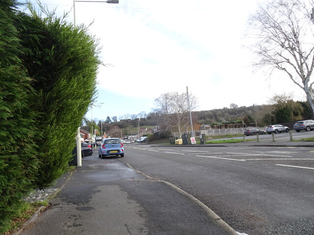
Beacon Hill is easily accessible, with a car park located at its base, providing convenient access for visitors. The hill's tranquil surroundings and peaceful atmosphere make it an ideal spot for a leisurely picnic or a relaxing day out in nature. With its natural beauty and historical significance, Beacon Hill is a must-visit destination for anyone exploring Staffordshire.

If you have any feedback on the listing, please let us know in the comments section below.

Beacon Hill Images

Images are sourced within 2km of 52.547339/-2.1153784 or Grid Reference SO9294. Thanks to Geograph Open Source API. All images are credited.

New Year on Northway The Northway Estate in Sedgley on New Year's Day.
New Year on Northway
The Northway Estate in Sedgley on New Year's Day.
Northway View The Northway Estate in Sedgley on New Year's Day.
Northway View
The Northway Estate in Sedgley on New Year's Day.
Christmas on Northway The Northway Estate in Sedgley on Christmas Day.
Christmas on Northway
The Northway Estate in Sedgley on Christmas Day.
A463 Black Country Route near Spring Vale, Wolverhampton Looking north-west towards Bilston and the M6.
A463 Black Country Route near Spring Vale, Wolverhampton
Looking north-west towards Bilston and the M6.
A463 Black Country Route near Spring Vale, Wolverhampton Looking north-west towards Bilston and the M6.
A463 Black Country Route near Spring Vale, Wolverhampton
Looking north-west towards Bilston and the M6.
A463 Black Country Route near Spring Vale, Wolverhampton Looking north-west towards Bilston and the M6. The A463 Black Country Route was built in stages between 1986 and 1992.
A463 Black Country Route near Spring Vale, Wolverhampton
Looking north-west towards Bilston and the M6. The A463 Black Country Route was built in stages between 1986 and 1992.
Anchor Lane Household Waste and Recycling Centre in Wolverhampton This is near the Black Country Route near Spring Vale. Currently, because of disputes about payment by other councils, this site can only be used by Wolverhampton residents. A recent utility bill and a photo ID are required.
Anchor Lane Household Waste and Recycling Centre in Wolverhampton
This is near the Black Country Route near Spring Vale. Currently, because of disputes about payment by other councils, this site can only be used by Wolverhampton residents. A recent utility bill and a photo ID are required.
Electricity sub-station near Deepfields, Dudley Still within the Wolverhampton boundary, this is by Anchor Lane, next to the recycling centre.
Electricity sub-station near Deepfields, Dudley
Still within the Wolverhampton boundary, this is by Anchor Lane, next to the recycling centre.
Electricity sub-station near Deepfields, Dudley Still within the Wolverhampton boundary, this is by Anchor Lane, next to the recycling centre.
Electricity sub-station near Deepfields, Dudley
Still within the Wolverhampton boundary, this is by Anchor Lane, next to the recycling centre.
Anchor Lane near Deepfields, Dudley Anchor Lane is a cul-de-sac, looking east towards Anchor Bridge across the Birmingham Canal Navigation.
Anchor Lane near Deepfields, Dudley
Anchor Lane is a cul-de-sac, looking east towards Anchor Bridge across the Birmingham Canal Navigation.
Northway Traffic Lights The view on the Sedgley estate, Dudley.
Northway Traffic Lights
The view on the Sedgley estate, Dudley.
Sewage Works View The view from the Penn Common path off the A463 near Sedgley.
Sewage Works View
The view from the Penn Common path off the A463 near Sedgley.
New Bike Racks The view in the Northway Sedgley.
New Bike Racks
The view in the Northway Sedgley.
Alderdale Avenue View The view on the Northway Estate, Sedgley.
Alderdale Avenue View
The view on the Northway Estate, Sedgley.
Swallowfields  Road The view on the Northway Estate, Sedgley.
Swallowfields Road
The view on the Northway Estate, Sedgley.
Kineton Rise The view on the Northway Estate, Sedgley.
Kineton Rise
The view on the Northway Estate, Sedgley.
Alder Coppice Trees The view of the Weeping Willows on the Northway Estate, Sedgley.
Alder Coppice Trees
The view of the Weeping Willows on the Northway Estate, Sedgley.
Autumn Scene The view on the first day of autumn in Sedgley Hall Farm Park.
Autumn Scene
The view on the first day of autumn in Sedgley Hall Farm Park.
Show me another place!

Beacon Hill is located at Grid Ref: SO9294 (Lat: 52.547339, Lng: -2.1153784)

Unitary Authority: Dudley

Police Authority: West Midlands

What 3 Words

///theme.tinsel.venue. Near Bilston, West Midlands

Related Wikis

Beacon Hill, Sedgley

Beacon Hill in Sedgley, England, is one of the highest points in the West Midlands, at 237 metres (778 ft) above sea level. From the summit, Wolverhampton...

Sarah Hughes Brewery

Sarah Hughes Brewery in Sedgley, in the Black Country of England, dates from the Victorian era. It was bought by Sarah Hughes in 1921 and brewed until...

Woodcross

Woodcross is a residential area of Coseley, West Midlands, England. It is set within the City of Wolverhampton, though the area traditionally existed within...

Spring Vale

Spring Vale is a ward of Wolverhampton City Council, West Midlands, England. It is situated SSE of the city centre, on the city's border with the Metropolitan...

Sedgley Urban District

Sedgley urban district was a local government district within Staffordshire, which was created in 1894 from the western half of the manor of Sedgley (the...

Coseley Urban District

Coseley Urban District was a local government district in Staffordshire which was created in 1894.It was made up of the villages of Brierley (now Bradley...

Sedgley

Sedgley is a town in the north of the Metropolitan Borough of Dudley, in the West Midlands, England.Historically part of Staffordshire, Sedgley is on the...

Alder Coppice

Alder Coppice is a local nature reserve in West Midlands, England. It is near Sedgley, next to the Northway Estate, in the Metropolitan Borough of Dudley...

Related Videos

Walking The Bradley Arm Canal

A walk along the full length of the Bradley Arm Canal from Deepfields Junction where the canal meets the Birmingham Main Line ...

Wrens Nest| walk about and chill

hey everyone, this is a little different to my normal videos but seeing as my last one did really well, I thought I'd upload another ...

Walking The Birmingham Mainline Canal (Part 3)

Continuing with my walk along the towpath of the Birmingham Main Line Canal. Starting where I finished in part 2, at Deepfields ...

Cotwall End LNR 1

random footage please note due to the age of these leaflets and videos some of the information above maybe out of date.

Nearby Amenities

Located within 500m of 52.547339,-2.1153784
Turning Circle
Source: bing
Lat/Long: 52.5498928/-2.1142156
Post Box
Operator: Royal Mail
Operator Wikidata: Q638098
Lat/Long: 52.5494115/-2.1106734
Bus Stop
Dovedale Rd / Camberley Crescent
NaPTANAreaCode: 43000727301
Bus: yes
Naptan AtcoCode: 43000727301
Naptan Bearing: NW
Naptan BusStopType: MKD
Naptan CommonName: Camberley Crescent
Naptan Indicator: adj
Naptan NaptanCode: nwmjgpaj
Naptan PlusbusZoneRef: BHAMNWS
Naptan Status: ACT
Naptan StopType: BCT
Naptan Street: DOVEDALE RD
Naptan Towards: Bilston, Wolverhampton
Naptan Verified: no
Public Transport: platform
Route Ref: 81;224
Shelter: yes
Shelter Ref: 104205
Source: WMCA
Lat/Long: 52.5496755/-2.1110511
Bus Stop
Dovedale Rd / Camberley Crescent
Bus: yes
Naptan AtcoCode: 43000727302
Naptan Bearing: SE
Naptan BusStopType: MKD
Naptan CommonName: Camberley Crescent
Naptan Indicator: after
Naptan NaptanCode: nwmtwtjw
Naptan PlusbusZoneRef: BHAMNWS
Naptan Status: ACT
Naptan StopType: BCT
Naptan Street: DOVEDALE RD
Naptan Towards: Coseley
Naptan Verified: no
Public Transport: platform
Route Ref: 81;224
Source: WMCA
Lat/Long: 52.550053/-2.1112143
Bus Stop
Woodcross St / Wathan Avenue
Bus: yes
Naptan AtcoCode: 43000727801
Naptan Bearing: NE
Naptan BusStopType: MKD
Naptan CommonName: Wathan Avenue
Naptan Indicator: opp
Naptan NaptanCode: nwmjgpdp
Naptan PlusbusZoneRef: BHAMNWS
Naptan Status: ACT
Naptan StopType: BCT
Naptan Street: WOODCROSS ST
Naptan Towards: Wolverhampton
Naptan Verified: no
Public Transport: platform
Route Ref: 81;223
Source: WMCA
Lat/Long: 52.548509/-2.1086591
Bus Stop
Woodcross St / Wathan Avenue
Bus: yes
Naptan AtcoCode: 43000727802
Naptan Bearing: SW
Naptan BusStopType: MKD
Naptan CommonName: Wathan Avenue
Naptan Indicator: adj
Naptan NaptanCode: nwmjgpdt
Naptan PlusbusZoneRef: BHAMNWS
Naptan Status: ACT
Naptan StopType: BCT
Naptan Street: WOODCROSS ST
Naptan Towards: Coseley
Naptan Verified: no
Public Transport: platform
Route Ref: 81;223
Source: WMCA
Lat/Long: 52.5484186/-2.1086441
Bus Stop
Dovedale Rd / Falcon Crescent
Bus: yes
Naptan AtcoCode: 43000727902
Naptan Bearing: SE
Naptan BusStopType: MKD
Naptan CommonName: Falcon Crescent
Naptan Indicator: before
Naptan NaptanCode: nwmtawtg
Naptan PlusbusZoneRef: BHAMNWS
Naptan Status: ACT
Naptan StopType: BCT
Naptan Street: DOVEDALE RD
Naptan Towards: Sedgley
Naptan Verified: no
Public Transport: platform
Route Ref: 223;224
Source: WMCA
Lat/Long: 52.5492176/-2.1104158
Bus Stop
Hall Lane / Robert Wynd
Bus: yes
Naptan AtcoCode: 43000728101
Naptan Bearing: NW
Naptan BusStopType: MKD
Naptan CommonName: Robert Wynd
Naptan Indicator: opp
Naptan NaptanCode: nwmjgpgd
Naptan PlusbusZoneRef: BHAMNWS
Naptan Status: ACT
Naptan StopType: BCT
Naptan Street: HALL LANE
Naptan Towards: Wolverhampton
Naptan Verified: no
Public Transport: platform
Route Ref: 81;224
Source: WMCA
Lat/Long: 52.5472508/-2.1082873
Bus Stop
Roberts Wynd / Hall Lane
Bus: yes
Naptan AtcoCode: 43007281001
Naptan Bearing: NE
Naptan BusStopType: MKD
Naptan CommonName: Hall Lane
Naptan Indicator: after
Naptan Landmark: The Horse and Jockey
Naptan NaptanCode: nwmtwtpd
Naptan PlusbusZoneRef: BHAMNWS
Naptan Status: ACT
Naptan StopType: BCT
Naptan Street: ROBERTS WYND
Naptan Towards: Bilston
Naptan Verified: no
Public Transport: platform
Route Ref: 223
Source: WMCA
Lat/Long: 52.5474038/-2.1080222
Bus Stop
Mount Rd / Dovedale Rd
Bus: yes
Naptan AtcoCode: 43007753001
Naptan Bearing: NE
Naptan BusStopType: MKD
Naptan CommonName: Dovedale Rd
Naptan Indicator: after
Naptan NaptanCode: nwmpmjdg
Naptan PlusbusZoneRef: BHAMNWS
Naptan Status: ACT
Naptan StopType: BCT
Naptan Street: MOUNT RD
Naptan Towards: Bilston
Naptan Verified: no
Public Transport: platform
Route Ref: 223
Source: WMCA
Lat/Long: 52.54964/-2.1105938
Bus Stop
Bilston St / Queens Rd
NaPTANAreaCode: 43000852201
Asset Ref: 404233
Bus: yes
Naptan AtcoCode: 43000852201
Naptan Bearing: W
Naptan BusStopType: MKD
Naptan CommonName: Queens Rd
Naptan Indicator: adj
Naptan NaptanCode: nwmjwjmt
Naptan PlusbusZoneRef: BHAMNWS
Naptan Status: ACT
Naptan StopType: BCT
Naptan Street: BILSTON ST
Naptan Towards: Sedgley
Public Transport: platform
Route Ref: 224;229
Shelter: yes
Shelter Ref: 404233
Source: WMCA
Towards: Sedgley
Lat/Long: 52.5432582/-2.1157468
Bus Stop
Bilston St / Queens Rd
Bus: yes
Naptan AtcoCode: 43000852202
Naptan Bearing: E
Naptan BusStopType: MKD
Naptan CommonName: Queens Rd
Naptan Indicator: opp
Naptan NaptanCode: nwmjwjmw
Naptan PlusbusZoneRef: BHAMNWS
Naptan Status: ACT
Naptan StopType: BCT
Naptan Street: BILSTON ST
Naptan Towards: Bilston
Public Transport: platform
Route Ref: 224;229
Shelter: no
Source: WMCA
Towards: Bilston
Lat/Long: 52.5435119/-2.1146809
Addr Street: Claremont Cottages
Lat/Long: 52.5429122/-2.1161618
Addr Street: Claremont Cottages
Lat/Long: 52.5430795/-2.1162281
Post Box
Operator: Royal Mail
Operator Wikidata: Q638098
Post Box Type: lamp
Ref: DY3 128
Royal Cypher: EIIR
Royal Cypher Wikidata: Q33102113
Lat/Long: 52.5434078/-2.1149797
JP's
Addr Housename: 124
Addr Street: Bilston Street
Shop: hairdresser
Lat/Long: 52.5434063/-2.1145268
Spar
Brand: Spar
Brand Wikidata: Q610492
Brand Wikipedia: en:SPAR (retailer)
Shop: supermarket
Lat/Long: 52.5434231/-2.114374
Telephone
Booth: KX100
Covered: booth
Lat/Long: 52.5436014/-2.1141975
Fast Food
Blue Ocean
Addr Housenumber: 128
Addr Postcode: DY3 1JF
Addr Street: Bilston Street
Cuisine: fish_and_chips
Fhrs Id: 688827
Source Addr: FHRS Open Data
Lat/Long: 52.5434455/-2.1141723
Bluecore Solutions LTD
Shop: computer
Lat/Long: 52.54343/-2.1142834
Addr Housenumber: 25
Addr Street: Beacon Passage
Lat/Long: 52.5444399/-2.120728
Barrier: cycle_barrier
Lat/Long: 52.5441772/-2.1202701
Bench
Lat/Long: 52.5433209/-2.1161737
Bench
Lat/Long: 52.5433558/-2.1163203
Post Box
Operator: Royal Mail
Operator Wikidata: Q638098
Post Box Type: pillar
Ref: DY3 130
Lat/Long: 52.5458212/-2.1179241
Addr Housenumber: 1
Addr Street: Springfield Green
Lat/Long: 52.5463674/-2.1191004
Addr Housenumber: 10
Addr Street: Springfield Green
Lat/Long: 52.5463335/-2.1193922
Turning Circle
Lat/Long: 52.5474012/-2.1201308
Turning Circle
Lat/Long: 52.5454066/-2.1159751
Post Box
Note: no collection plate on this box today(01/09/2020).
Operator: Royal Mail
Operator Wikidata: Q638098
Post Box Mounting: brick_pillar
Post Box Type: wall
Ref: DY3 9
Royal Cypher: EIIR
Royal Cypher Wikidata: Q33102113
Source: survey
Lat/Long: 52.5459945/-2.1121469
Shop: convenience
Lat/Long: 52.5461481/-2.1121359
Barrier: cycle_barrier
Lat/Long: 52.54634/-2.1136389
Barrier: bollard
Lat/Long: 52.5463741/-2.1131411
Barrier: cycle_barrier
Lat/Long: 52.5464979/-2.1128266
Barrier: cycle_barrier
Bicycle: yes
Foot: yes
Motor Vehicle: no
Lat/Long: 52.5468912/-2.1149333
Man Made: tower
Tower Type: communication
Lat/Long: 52.5471809/-2.1148888
Barrier: cycle_barrier
Lat/Long: 52.5476614/-2.1155832
Man Made: tower
Tower Type: communication
Lat/Long: 52.5478384/-2.1154035
Tourism: picnic_site
Lat/Long: 52.5480231/-2.1159381
Entrance: yes
Note: This is a huge gate leading into the hill
Lat/Long: 52.5509962/-2.1190299
Power: substation
Lat/Long: 52.5465182/-2.1126089
Grit Bin
Lat/Long: 52.5472301/-2.1120384
Crossing
Crossing: traffic_signals
Crossing Ref: pelican
Lat/Long: 52.5433491/-2.1154682
Cinder Hill
Place: locality
Source: OS_OpenData_StreetView
Lat/Long: 52.5467231/-2.1089419
Sedgley Beacon
Ele: 235
Natural: peak
Lat/Long: 52.5473439/-2.1144677
Beacon Hill
Natural: peak
Wikidata: Q4875944
Lat/Long: 52.548465/-2.1175222
Man Made: street_cabinet
Source: survey
Street Cabinet: communications
Lat/Long: 52.5435956/-2.1142316
Man Made: street_cabinet
Source: survey
Street Cabinet: communications
Lat/Long: 52.5436046/-2.1141646
Dovedale Rd / Falcon Crescent
Naptan AtcoCode: 43000727901
Naptan Bearing: NW
Naptan BusStopType: CUS
Naptan CommonName: Falcon Crescent
Naptan Indicator: after
Naptan NaptanCode: nwmtawtd
Naptan Status: ACT
Naptan StopType: BCT
Naptan Street: DOVEDALE RD
Naptan Towards: Bilston
Public Transport: platform
Route Ref: 223;224
Source: WMCA
Lat/Long: 52.5486493/-2.1100876
Barrier: kissing_gate
Lat/Long: 52.5507724/-2.1196737
The data included in this document is from www.openstreetmap.org. The data is made available under ODbL.

Have you been to Beacon Hill?

Leave your review of Beacon Hill below (or comments, questions and feedback).