Croo Clough

Valley in Lancashire Rossendale

England

Croo Clough

Old Boundary Marker on Bacup Old Road Municipal Boundary Marker on the east side of Bacup Old Road, southeast of its junction with the A671 Burnley Road. On the boundary of Cliviger parish and the former Newchurch parish. One of a series marking the boundary of Bacup Borough.

Milestone Society National ID: LA_BACCLI02pb
Old Boundary Marker on Bacup Old Road Credit: C Chatham

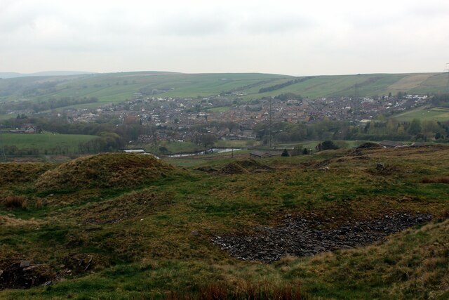
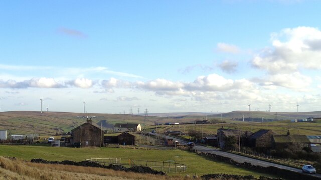
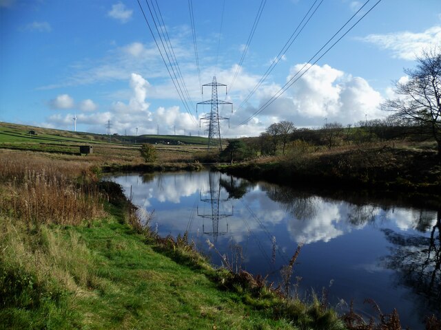
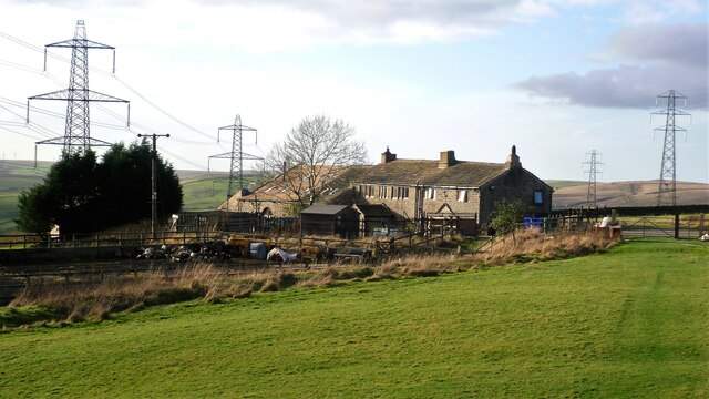
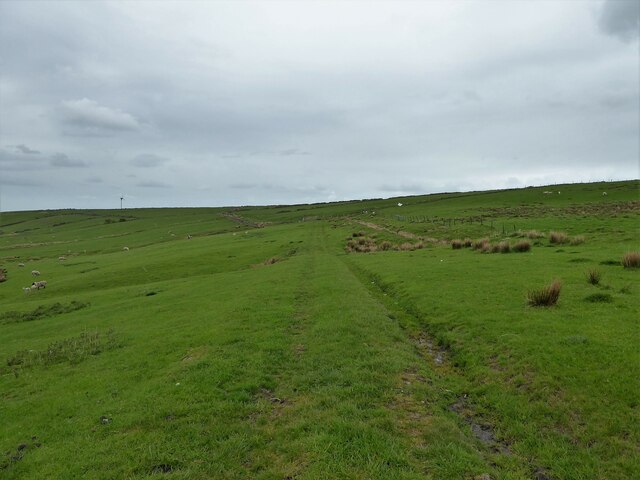
Croo Clough is a picturesque valley located in Lancashire, England. Situated in the southern part of the county, this charming valley is nestled amidst rolling hills and lush greenery. It is renowned for its natural beauty and tranquil surroundings, making it a popular destination for nature enthusiasts and hikers.

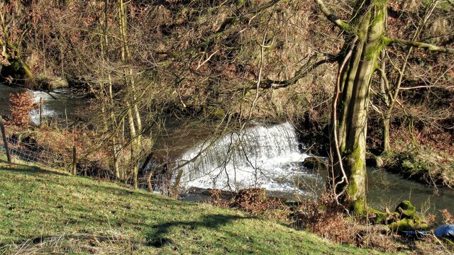
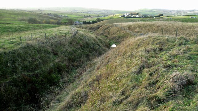
The valley is characterized by its idyllic landscape, with a meandering river flowing through it. The sound of the flowing water adds to the peaceful ambiance of Croo Clough, providing a soothing backdrop for visitors. The valley is also home to diverse wildlife, including various bird species, which adds to its natural charm.

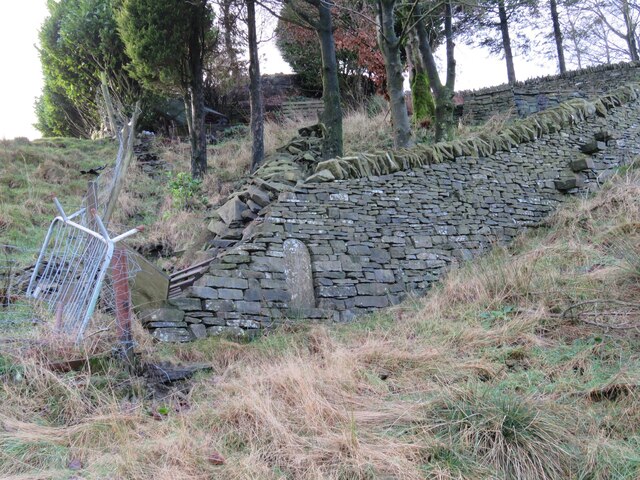
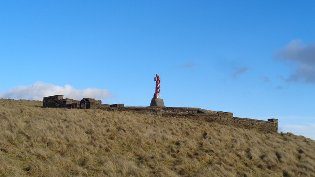
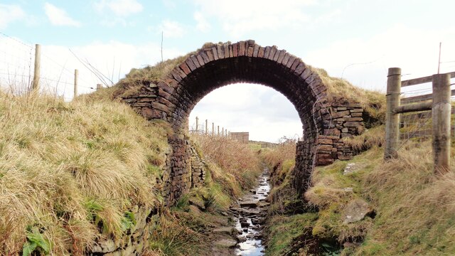
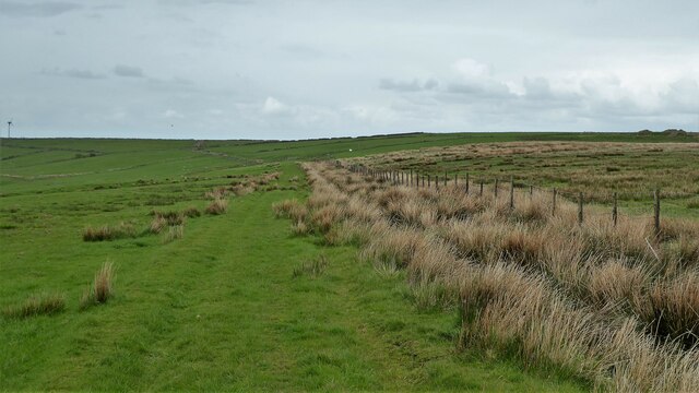
Croo Clough offers several walking and hiking trails, allowing visitors to explore its stunning scenery. These trails take visitors through dense woodlands, alongside the river, and up to the hilltops, providing breathtaking panoramic views of the surrounding countryside. The valley is also dotted with charming stone bridges, adding to its picturesque appeal.

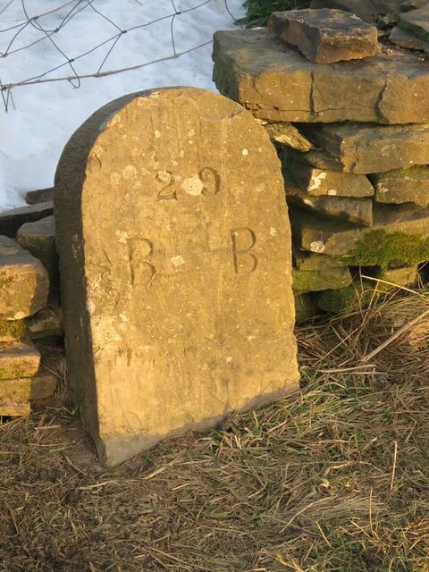
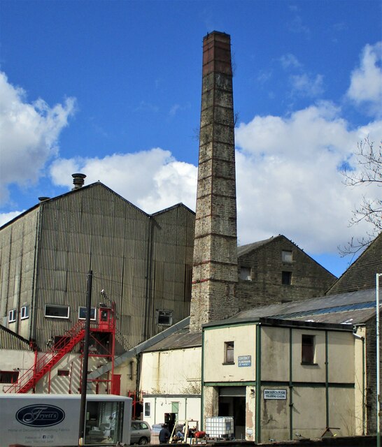
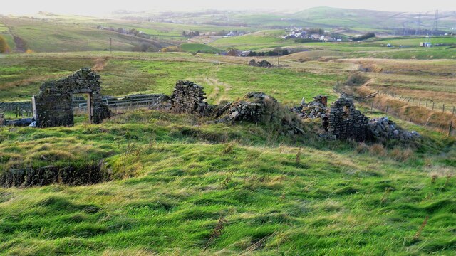
In addition to its natural attractions, Croo Clough is also known for its historical significance. The valley is home to several ancient ruins and archaeological sites, which offer a glimpse into the area's rich past. These include remnants of old settlements and stone structures, adding an element of intrigue to the valley's allure.

Overall, Croo Clough in Lancashire is a haven for nature lovers and history enthusiasts alike. Its stunning landscapes, diverse wildlife, and historical significance make it a must-visit destination for those seeking a peaceful and immersive experience in the heart of Lancashire's countryside.

If you have any feedback on the listing, please let us know in the comments section below.

Croo Clough Images

Images are sourced within 2km of 53.722563/-2.2195832 or Grid Reference SD8525. Thanks to Geograph Open Source API. All images are credited.

Old Boundary Marker on Bacup Old Road Municipal Boundary Marker on the east side of Bacup Old Road, southeast of its junction with the A671 Burnley Road. On the boundary of Cliviger parish and the former Newchurch parish. One of a series marking the boundary of Bacup Borough.

Milestone Society National ID: LA_BACCLI02pb
Old Boundary Marker on Bacup Old Road
Municipal Boundary Marker on the east side of Bacup Old Road, southeast of its junction with the A671 Burnley Road. On the boundary of Cliviger parish and the former Newchurch parish. One of a series marking the boundary of Bacup Borough. Milestone Society National ID: LA_BACCLI02pb
Old Boundary Marker west of Burnley Road Municipal Boundary Marker set in a drystone wall beside the disused tramway of Deerplay Colliery, 75 metres west of the B671 Burnley Road. On the boundary of Cliviger parish and the former Newchurch parish. One of a series marking the boundary of Bacup Borough. Inscribed 31 / B B.

Milestone Society National ID: LA_BACCLI03pb
Old Boundary Marker west of Burnley Road
Municipal Boundary Marker set in a drystone wall beside the disused tramway of Deerplay Colliery, 75 metres west of the B671 Burnley Road. On the boundary of Cliviger parish and the former Newchurch parish. One of a series marking the boundary of Bacup Borough. Inscribed 31 / B B. Milestone Society National ID: LA_BACCLI03pb
Village of Weir As seen from the edge of Heald Moor
Village of Weir
As seen from the edge of Heald Moor
Weir and District War Memorial On Deerplay Hill
Weir and District War Memorial
On Deerplay Hill
Farms on Burnley Road View towards Bacup from Weir War Memorial on Deerplay Hill
Farms on Burnley Road
View towards Bacup from Weir War Memorial on Deerplay Hill
Broadclough Mill On Burnley Road
Broadclough Mill
On Burnley Road
Bridge Arch on Old Meadows Road Old OS maps do not indicate any purpose for this bridge, either tramway or path. It is fitting to be on the Irwell Sculpture Trail now and could be a piece of art
Bridge Arch on Old Meadows Road
Old OS maps do not indicate any purpose for this bridge, either tramway or path. It is fitting to be on the Irwell Sculpture Trail now and could be a piece of art
Massive Gate Piers At Far Old Meadows, but not apparently an entrance
Massive Gate Piers
At Far Old Meadows, but not apparently an entrance
Weir on River Irwell Below Dog Pits Lane
Weir on River Irwell
Below Dog Pits Lane
Former Reservoirs for Irwell Spring Print Works View from Heald Lane used by the Irwell Sculpture Trail
Former Reservoirs for Irwell Spring Print Works
View from Heald Lane used by the Irwell Sculpture Trail
Solar Panels at former Deerplay Colliery Site Around the lagoons that are cleaning the mine water coming from the former colliery
Solar Panels at former Deerplay Colliery Site
Around the lagoons that are cleaning the mine water coming from the former colliery
Harrow Stiles Lane Used by Rossendale Way. At this point by Sod Hey Farm the farm track surface appears to have been laid using a very wet cement mix with little aggregate
Harrow Stiles Lane
Used by Rossendale Way. At this point by Sod Hey Farm the farm track surface appears to have been laid using a very wet cement mix with little aggregate
Approaching Clifton On the Rossendale Way
Approaching Clifton
On the Rossendale Way
A side clough of Shepherd Clough An unnamed clough south of Clifton and on a path that has been a public right of way but seems to have been extinguished as such around Clifton. There is a stile into the clough coming from the south but no proper facility out to approach Clifton
A side clough of Shepherd Clough
An unnamed clough south of Clifton and on a path that has been a public right of way but seems to have been extinguished as such around Clifton. There is a stile into the clough coming from the south but no proper facility out to approach Clifton
Remains of Dean Head There are two distinct ruins at Dean Head and this is the building to the north
Remains of Dean Head
There are two distinct ruins at Dean Head and this is the building to the north
Snow blower on farm At Lower Mow Graine Farm, is the blower for the upland farm use or for the nearby golf course?
Snow blower on farm
At Lower Mow Graine Farm, is the blower for the upland farm use or for the nearby golf course?
Track on the hillside above Brex Farm The track runs along the side of  the fenced off rough open access land
Track on the hillside above Brex Farm
The track runs along the side of the fenced off rough open access land
Track on the hillside above Middle Brex Farm The track continues past the wind turbine on the horizon to Far and Middle Bank End
Track on the hillside above Middle Brex Farm
The track continues past the wind turbine on the horizon to Far and Middle Bank End
Show me another place!

Croo Clough is located at Grid Ref: SD8525 (Lat: 53.722563, Lng: -2.2195832)

Administrative County: Lancashire

District: Rossendale

Police Authority: Lancashire

What 3 Words

///district.wages.throat. Near Bacup, Lancashire

Related Wikis

A671 road

The A671 is a road in the North West of England, that runs between Oldham, Greater Manchester and Worston, near Clitheroe, Lancashire. Major towns on the...

Water, Lancashire

Water is a hamlet in the borough of Rossendale, in Lancashire, England. Located north of the village of Lumb. It is mostly made of a few homes, farms,...

Weir, Lancashire

Weir is a village to the north of Bacup in the Rossendale borough of Lancashire, England, and immediately south of the boundary with the Borough of Burnley...

Broadclough

Broadclough – historically Broad Clough (meaning "broad valley") – is a village located to the north of Bacup (where population details are included),...

Lumb, Rawtenstall

Lumb is a small village in the Rossendale district of Lancashire, England. It lies in the valley of the Whitewell Brook, 3 miles (5 km) north east of Rawtenstall...

Whitewell Brook

Whitewell Brook is a minor river in Lancashire, England. It is 4.34 miles (6.99 km) long and has a catchment area of 7.67 square miles (19.86 km2).The...

Bacup Borough F.C.

Bacup Borough Football Club is a football club based in Bacup, Lancashire, England. The club are currently members of the North West Counties League Division...

Rossendale (UK Parliament constituency)

Rossendale was a parliamentary constituency in the Lancashire, England. Created in 1885, it elected one Member of Parliament (MP) to the House of Commons...

Have you been to Croo Clough?

Leave your review of Croo Clough below (or comments, questions and feedback).