Goat Cleugh

Valley in Northumberland

England

Goat Cleugh

Carriers' Way south of Dodd Reservoir A hill walker on the Carriers' Way heading towards Killhope Law, the hill to the right side of the image. Dodd Reservoir is above the camera position, also to the right, but out of view.
Carriers' Way south of Dodd Reservoir Credit: Trevor Littlewood

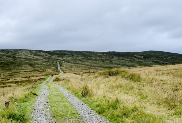
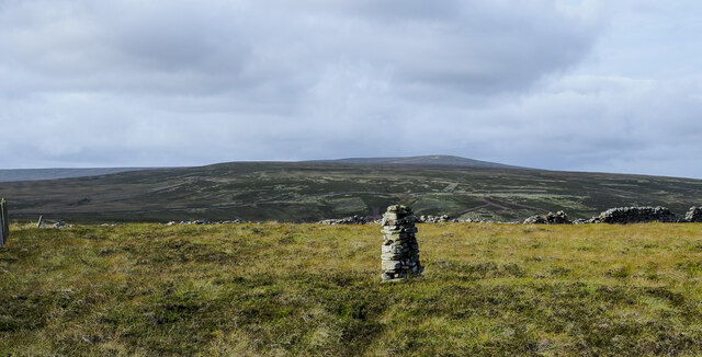
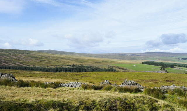
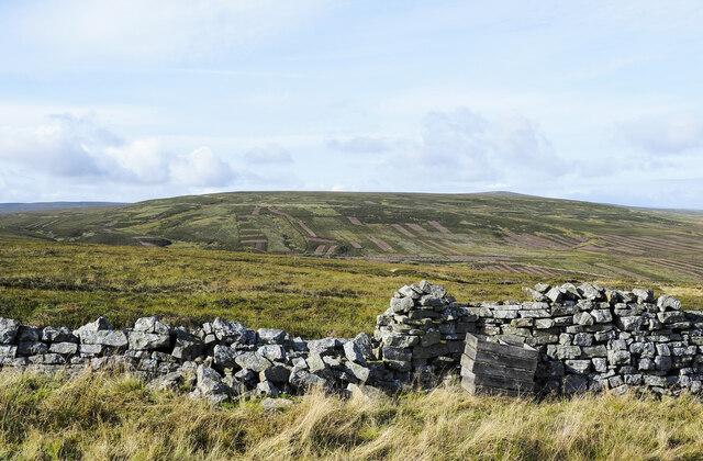
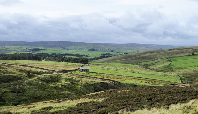
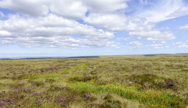
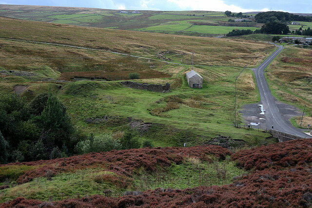
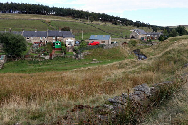
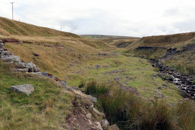
Goat Cleugh is a picturesque valley located in the county of Northumberland, England. Situated in the northern part of the county, it is known for its stunning natural beauty and tranquil surroundings. The valley is nestled between rolling hills and is characterized by its lush greenery, meandering streams, and diverse wildlife.

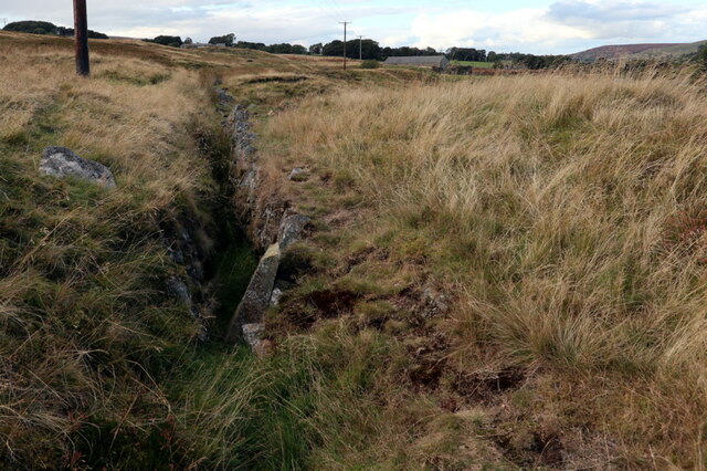
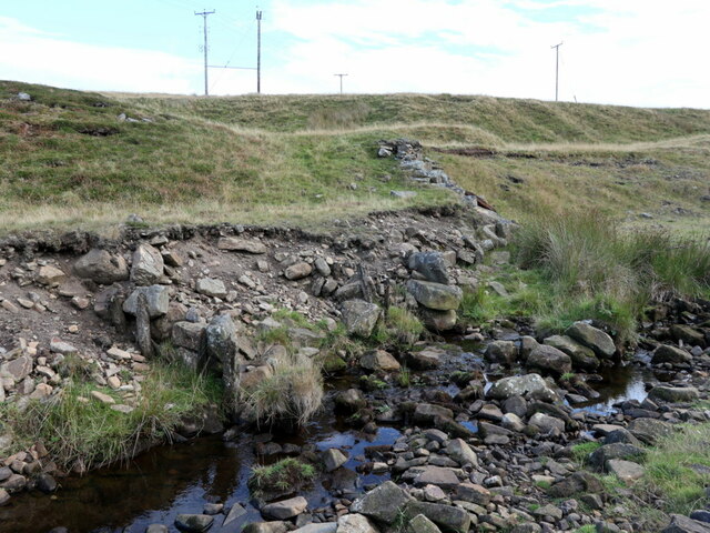
The name "Goat Cleugh" originates from the Old Norse language, with "cleugh" meaning a narrow, steep-sided valley. This aptly describes the topography of the area, as the valley is indeed narrow and enclosed by steep slopes on either side.

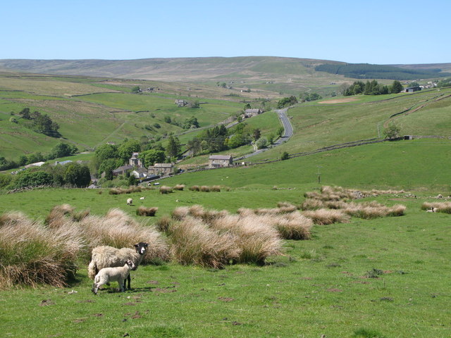
The valley is a popular destination for nature lovers and hikers, offering numerous walking trails that showcase the area's natural wonders. Visitors can explore the valley's dense woodlands, where oak, ash, and beech trees dominate the landscape, providing habitat for various bird species and small mammals.

One of the highlights of Goat Cleugh is the presence of several cascading waterfalls, which add to the valley's charm and serenity. These waterfalls are fed by the streams that flow through the valley, creating a peaceful ambiance and providing an ideal spot for relaxation and contemplation.

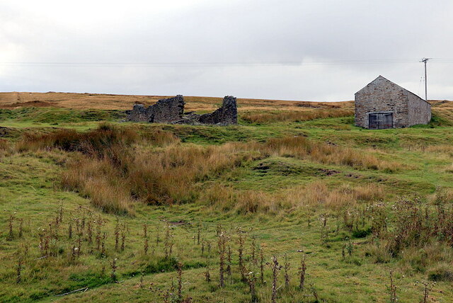
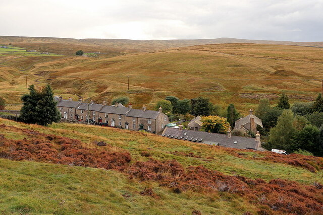
Although Goat Cleugh is predominantly a rural area, there are a few scattered farms and cottages, adding to its idyllic countryside atmosphere. The valley offers a peaceful retreat away from the hustle and bustle of modern life, allowing visitors to reconnect with nature and enjoy the tranquility it provides.

In conclusion, Goat Cleugh is a stunning valley in Northumberland, renowned for its natural beauty, walking trails, cascading waterfalls, and abundant wildlife. It is a haven for nature enthusiasts seeking a peaceful escape in the heart of the English countryside.

If you have any feedback on the listing, please let us know in the comments section below.
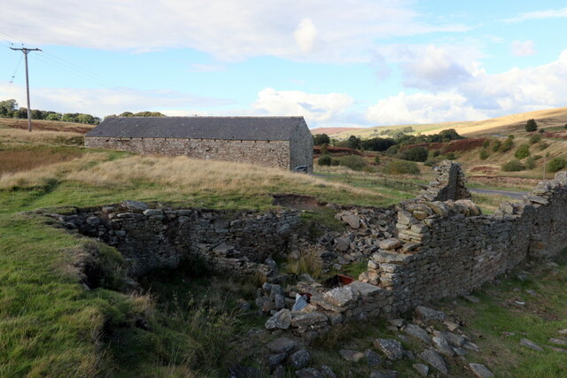
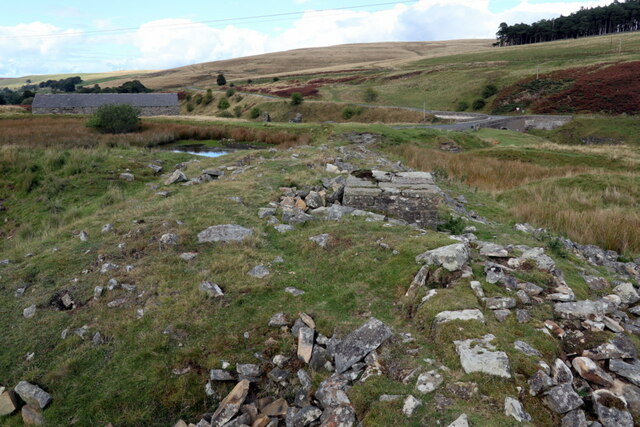
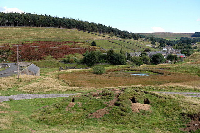
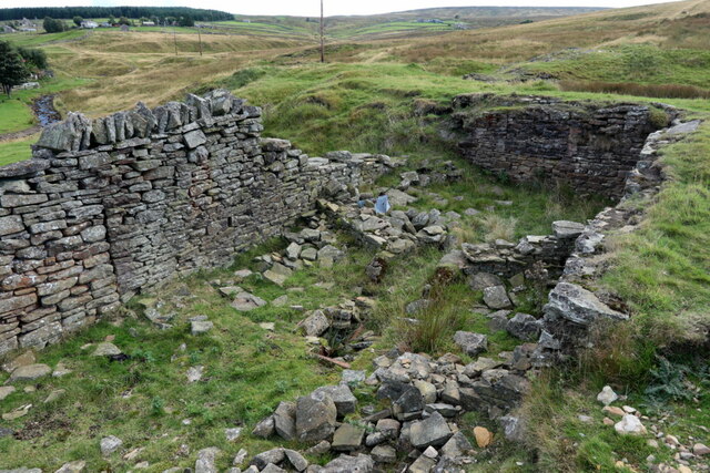
Goat Cleugh Images

Images are sourced within 2km of 54.796892/-2.2254048 or Grid Reference NY8544. Thanks to Geograph Open Source API. All images are credited.

Carriers' Way south of Dodd Reservoir A hill walker on the Carriers' Way heading towards Killhope Law, the hill to the right side of the image. Dodd Reservoir is above the camera position, also to the right, but out of view.
Carriers' Way south of Dodd Reservoir
A hill walker on the Carriers' Way heading towards Killhope Law, the hill to the right side of the image. Dodd Reservoir is above the camera position, also to the right, but out of view.
Summit cairn on Burtree Fell The summit of Burtree Fell is flat. Its accepted high point lies to the east of a ruined wall although OS mapping gives a spot height of 612 m. closer to the wall which is shown in the image. The cairn is a more impressive one than has been seen there on earlier visits . There's a trig point not far away to the east but at 607 m., it's lower.
Killhope Law is in the distance.
Summit cairn on Burtree Fell
The summit of Burtree Fell is flat. Its accepted high point lies to the east of a ruined wall although OS mapping gives a spot height of 612 m. closer to the wall which is shown in the image. The cairn is a more impressive one than has been seen there on earlier visits . There's a trig point not far away to the east but at 607 m., it's lower. Killhope Law is in the distance.
Parked vehicles and trailers at Allenheads The area beyond the low wall is part of the site of the Beaumont Mine which was originally a lead mine but more recently it was worked for fluorspar. The bays in the distance separated by stepped walls date from the lead mining phase.
Parked vehicles and trailers at Allenheads
The area beyond the low wall is part of the site of the Beaumont Mine which was originally a lead mine but more recently it was worked for fluorspar. The bays in the distance separated by stepped walls date from the lead mining phase.
Moorland beyond ruined wall at Pike Dike Nook Pike Dike Nook is a location on moorland south of Allenheads at or close to the southern point of a coniferous plantation.
 Killhope Law is the more pointed skyline hill to the left in the image; right from it is Carrshield Moor.
Moorland beyond ruined wall at Pike Dike Nook
Pike Dike Nook is a location on moorland south of Allenheads at or close to the southern point of a coniferous plantation. Killhope Law is the more pointed skyline hill to the left in the image; right from it is Carrshield Moor.
Moorland beyond ruined wall The wall is on the north-western slope of Burtree Fell. The wooden boxes beside it are used by gamekeepers for supplying, out on the moorland, grit for the use of grouse.
The broad ridge extending into the distance goes over Westend Moor to Killhope Law.
Moorland beyond ruined wall
The wall is on the north-western slope of Burtree Fell. The wooden boxes beside it are used by gamekeepers for supplying, out on the moorland, grit for the use of grouse. The broad ridge extending into the distance goes over Westend Moor to Killhope Law.
Ruined buildings on slope of Byerhope The valley cutting through the image is Byerhope, hope being a term meaning valley. The line of trees at the left side of the image conceal Byerhope Reservoir, a relic of the local lead mining industry. Several ruined buildings  can be seen between the trees and the camera location; the one partly hidden by the nearest of them is Heather View.
Ruined buildings on slope of Byerhope
The valley cutting through the image is Byerhope, hope being a term meaning valley. The line of trees at the left side of the image conceal Byerhope Reservoir, a relic of the local lead mining industry. Several ruined buildings can be seen between the trees and the camera location; the one partly hidden by the nearest of them is Heather View.
Incipient stream groove with bog asphodel Grass with a few clumps of flowering heather dominate the moorland but there's a winding groove which has the yellow flowers of bog asphodel, (Narthecium ossifragum). As its name suggests the plant favours wetter areas, such as the stream groove.
Incipient stream groove with bog asphodel
Grass with a few clumps of flowering heather dominate the moorland but there's a winding groove which has the yellow flowers of bog asphodel, (Narthecium ossifragum). As its name suggests the plant favours wetter areas, such as the stream groove.
Site of Allenheads Smelt Mill (Lead), Dirt Pot On the right side of the photo is the road which leads over the moors to Coalcleugh. The terraced houses known as Slag Hill can be seen in the distance on the right. The remains of Mill Dam, (now filled with reeds) can be seen just left of the existing building (possibly the smeltmill peat store). The other masonry structure is in the centre just below the reservoir. The course of the horizontal flue can be seen extending to the left, directly below the lefthand end of the Mill Dam.
Site of Allenheads Smelt Mill (Lead), Dirt Pot
On the right side of the photo is the road which leads over the moors to Coalcleugh. The terraced houses known as Slag Hill can be seen in the distance on the right. The remains of Mill Dam, (now filled with reeds) can be seen just left of the existing building (possibly the smeltmill peat store). The other masonry structure is in the centre just below the reservoir. The course of the horizontal flue can be seen extending to the left, directly below the lefthand end of the Mill Dam.
Buildings at site of Allenheads Lead Smelt Mill "Lead smelting mill built by the Blacketts in the early 18th century. By 1821 it had three ore hearths, one roasting furnace, and one slag hearth in operation. The mill closed in 1870. Surviving remains consist of a 3118m long flue, a row of deserted cottages and an overgrown reservoir. The mill was mainly for smelted ores for Allenheads and Coalcleugh mines, but was kept to working capacity by ores from Weardale mines. The mill closed in 1870. It had horizontal flues 3410 yards (3118m) long for carrying off the fumes."
Northumberland HER (7251): <span class="nowrap"><a title="https://archaeologydataservice.ac.uk/archsearch/record?titleId=961364" rel="nofollow ugc noopener" href="https://archaeologydataservice.ac.uk/archsearch/record?titleId=961364">Link</a><img style="margin-left:2px;" alt="External link" title="External link - shift click to open in new window" src="https://s1.geograph.org.uk/img/external.png" width="10" height="10"/></span>
Ordnance Survey Durham Sheet XV (Surveyed: 1858, Published: 1861): <span class="nowrap"><a title="https://maps.nls.uk/view/102341530" rel="nofollow ugc noopener" href="https://maps.nls.uk/view/102341530">Link</a><img style="margin-left:2px;" alt="External link" title="External link - shift click to open in new window" src="https://s1.geograph.org.uk/img/external.png" width="10" height="10"/></span>
OS 25 inch published 1897: <span class="nowrap"><a title="https://maps.nls.uk/geo/explore/side-by-side/#zoom=17.8&lat=54.81260&lon=-2.23440&layers=168&right=BingSat" rel="nofollow ugc noopener" href="https://maps.nls.uk/geo/explore/side-by-side/#zoom=17.8&lat=54.81260&lon=-2.23440&layers=168&right=BingSat">Link</a><img style="margin-left:2px;" alt="External link" title="External link - shift click to open in new window" src="https://s1.geograph.org.uk/img/external.png" width="10" height="10"/></span>

The large stone building (which remains in use) is shown in the same location on the first edition 6" OS and may retain parts of an original building of the smeltmill. The ruined stonework to its south is also on in the location of an older building although this is shown as a sheepwash on the 2nd edition 25" OS (Published: 1897) and in a photo (c.1967) from the Allen Valleys Local History Group: <span class="nowrap"><a title="http://www.allenvalleyslocalhistory.org.uk/photo/allenheads-1967-0013-003/" rel="nofollow ugc noopener" href="http://www.allenvalleyslocalhistory.org.uk/photo/allenheads-1967-0013-003/">Link</a><img style="margin-left:2px;" alt="External link" title="External link - shift click to open in new window" src="https://s1.geograph.org.uk/img/external.png" width="10" height="10"/></span> <span class="nowrap"><a title="https://web.archive.org/web/20220925115434/http://www.allenvalleyslocalhistory.org.uk/photo/allenheads-1967-0013-003/" rel="nofollow ugc noopener" href="https://web.archive.org/web/20220925115434/http://www.allenvalleyslocalhistory.org.uk/photo/allenheads-1967-0013-003/">Archive Link</a><img style="margin-left:2px;" alt="External link" title="External link - shift click to open in new window" src="https://s1.geograph.org.uk/img/external.png" width="10" height="10"/></span>

The smeltmill horizontal flue originally extended to the south-west to a location high up on Middlehope Moor.
Buildings at site of Allenheads Lead Smelt Mill
"Lead smelting mill built by the Blacketts in the early 18th century. By 1821 it had three ore hearths, one roasting furnace, and one slag hearth in operation. The mill closed in 1870. Surviving remains consist of a 3118m long flue, a row of deserted cottages and an overgrown reservoir. The mill was mainly for smelted ores for Allenheads and Coalcleugh mines, but was kept to working capacity by ores from Weardale mines. The mill closed in 1870. It had horizontal flues 3410 yards (3118m) long for carrying off the fumes." Northumberland HER (7251): LinkExternal link Ordnance Survey Durham Sheet XV (Surveyed: 1858, Published: 1861): LinkExternal link OS 25 inch published 1897: LinkExternal link The large stone building (which remains in use) is shown in the same location on the first edition 6" OS and may retain parts of an original building of the smeltmill. The ruined stonework to its south is also on in the location of an older building although this is shown as a sheepwash on the 2nd edition 25" OS (Published: 1897) and in a photo (c.1967) from the Allen Valleys Local History Group: LinkExternal link Archive LinkExternal link The smeltmill horizontal flue originally extended to the south-west to a location high up on Middlehope Moor.
Remains of flue near Allenheads Lead Smelt Mill "Lead smelting mill built by the Blacketts in the early 18th century. By 1821 it had three ore hearths, one roasting furnace, and one slag hearth in operation. The mill closed in 1870. Surviving remains consist of a 3118m long flue, a row of deserted cottages and an overgrown reservoir. The mill was mainly for smelted ores for Allenheads and Coalcleugh mines, but was kept to working capacity by ores from Weardale mines. The mill closed in 1870. It had horizontal flues 3410 yards (3118m) long for carrying off the fumes."
Northumberland HER (7251): <span class="nowrap"><a title="https://archaeologydataservice.ac.uk/archsearch/record?titleId=961364" rel="nofollow ugc noopener" href="https://archaeologydataservice.ac.uk/archsearch/record?titleId=961364">Link</a><img style="margin-left:2px;" alt="External link" title="External link - shift click to open in new window" src="https://s1.geograph.org.uk/img/external.png" width="10" height="10"/></span>
Ordnance Survey Durham Sheet XV (Surveyed: 1858, Published: 1861): <span class="nowrap"><a title="https://maps.nls.uk/view/102341530" rel="nofollow ugc noopener" href="https://maps.nls.uk/view/102341530">Link</a><img style="margin-left:2px;" alt="External link" title="External link - shift click to open in new window" src="https://s1.geograph.org.uk/img/external.png" width="10" height="10"/></span>
OS 25 inch published 1897: <span class="nowrap"><a title="https://maps.nls.uk/geo/explore/side-by-side/#zoom=17.8&lat=54.81260&lon=-2.23440&layers=168&right=BingSat" rel="nofollow ugc noopener" href="https://maps.nls.uk/geo/explore/side-by-side/#zoom=17.8&lat=54.81260&lon=-2.23440&layers=168&right=BingSat">Link</a><img style="margin-left:2px;" alt="External link" title="External link - shift click to open in new window" src="https://s1.geograph.org.uk/img/external.png" width="10" height="10"/></span>

The large stone building (which remains in use) is shown in the same location on the first edition 6" OS and may retain parts of an original building of the smeltmill. The ruined stonework to its south is also on in the location of an older building although this is shown as a sheepwash on the 2nd edition 25" OS (Published: 1897) and in a photo (c.1967) from the Allen Valleys Local History Group: <span class="nowrap"><a title="http://www.allenvalleyslocalhistory.org.uk/photo/allenheads-1967-0013-003/" rel="nofollow ugc noopener" href="http://www.allenvalleyslocalhistory.org.uk/photo/allenheads-1967-0013-003/">Link</a><img style="margin-left:2px;" alt="External link" title="External link - shift click to open in new window" src="https://s1.geograph.org.uk/img/external.png" width="10" height="10"/></span> <span class="nowrap"><a title="https://web.archive.org/web/20220925115434/http://www.allenvalleyslocalhistory.org.uk/photo/allenheads-1967-0013-003/" rel="nofollow ugc noopener" href="https://web.archive.org/web/20220925115434/http://www.allenvalleyslocalhistory.org.uk/photo/allenheads-1967-0013-003/">Archive Link</a><img style="margin-left:2px;" alt="External link" title="External link - shift click to open in new window" src="https://s1.geograph.org.uk/img/external.png" width="10" height="10"/></span>

The smeltmill horizontal flue originally extended to the south-west to a location high up on Middlehope Moor.
Remains of flue near Allenheads Lead Smelt Mill
"Lead smelting mill built by the Blacketts in the early 18th century. By 1821 it had three ore hearths, one roasting furnace, and one slag hearth in operation. The mill closed in 1870. Surviving remains consist of a 3118m long flue, a row of deserted cottages and an overgrown reservoir. The mill was mainly for smelted ores for Allenheads and Coalcleugh mines, but was kept to working capacity by ores from Weardale mines. The mill closed in 1870. It had horizontal flues 3410 yards (3118m) long for carrying off the fumes." Northumberland HER (7251): LinkExternal link Ordnance Survey Durham Sheet XV (Surveyed: 1858, Published: 1861): LinkExternal link OS 25 inch published 1897: LinkExternal link The large stone building (which remains in use) is shown in the same location on the first edition 6" OS and may retain parts of an original building of the smeltmill. The ruined stonework to its south is also on in the location of an older building although this is shown as a sheepwash on the 2nd edition 25" OS (Published: 1897) and in a photo (c.1967) from the Allen Valleys Local History Group: LinkExternal link Archive LinkExternal link The smeltmill horizontal flue originally extended to the south-west to a location high up on Middlehope Moor.
Site of Allenheads Lead Smelt Mill from west "Lead smelting mill built by the Blacketts in the early 18th century. By 1821 it had three ore hearths, one roasting furnace, and one slag hearth in operation. The mill closed in 1870. Surviving remains consist of a 3118m long flue, a row of deserted cottages and an overgrown reservoir. The mill was mainly for smelted ores for Allenheads and Coalcleugh mines, but was kept to working capacity by ores from Weardale mines. The mill closed in 1870. It had horizontal flues 3410 yards (3118m) long for carrying off the fumes."
Northumberland HER (7251): <span class="nowrap"><a title="https://archaeologydataservice.ac.uk/archsearch/record?titleId=961364" rel="nofollow ugc noopener" href="https://archaeologydataservice.ac.uk/archsearch/record?titleId=961364">Link</a><img style="margin-left:2px;" alt="External link" title="External link - shift click to open in new window" src="https://s1.geograph.org.uk/img/external.png" width="10" height="10"/></span>
Ordnance Survey Durham Sheet XV (Surveyed: 1858, Published: 1861): <span class="nowrap"><a title="https://maps.nls.uk/view/102341530" rel="nofollow ugc noopener" href="https://maps.nls.uk/view/102341530">Link</a><img style="margin-left:2px;" alt="External link" title="External link - shift click to open in new window" src="https://s1.geograph.org.uk/img/external.png" width="10" height="10"/></span>
OS 25 inch published 1897: <span class="nowrap"><a title="https://maps.nls.uk/geo/explore/side-by-side/#zoom=17.8&lat=54.81260&lon=-2.23440&layers=168&right=BingSat" rel="nofollow ugc noopener" href="https://maps.nls.uk/geo/explore/side-by-side/#zoom=17.8&lat=54.81260&lon=-2.23440&layers=168&right=BingSat">Link</a><img style="margin-left:2px;" alt="External link" title="External link - shift click to open in new window" src="https://s1.geograph.org.uk/img/external.png" width="10" height="10"/></span>

The large stone building (which remains in use) is shown in the same location on the first edition 6" OS and may retain parts of an original building of the smeltmill. The ruined stonework to its south is also on in the location of an older building although this is shown as a sheepwash on the 2nd edition 25" OS (Published: 1897) and in a photo (c.1967) from the Allen Valleys Local History Group: <span class="nowrap"><a title="http://www.allenvalleyslocalhistory.org.uk/photo/allenheads-1967-0013-003/" rel="nofollow ugc noopener" href="http://www.allenvalleyslocalhistory.org.uk/photo/allenheads-1967-0013-003/">Link</a><img style="margin-left:2px;" alt="External link" title="External link - shift click to open in new window" src="https://s1.geograph.org.uk/img/external.png" width="10" height="10"/></span> <span class="nowrap"><a title="https://web.archive.org/web/20220925115434/http://www.allenvalleyslocalhistory.org.uk/photo/allenheads-1967-0013-003/" rel="nofollow ugc noopener" href="https://web.archive.org/web/20220925115434/http://www.allenvalleyslocalhistory.org.uk/photo/allenheads-1967-0013-003/">Archive Link</a><img style="margin-left:2px;" alt="External link" title="External link - shift click to open in new window" src="https://s1.geograph.org.uk/img/external.png" width="10" height="10"/></span>

The smeltmill horizontal flue originally extended to the south-west to a location high up on Middlehope Moor.
Site of Allenheads Lead Smelt Mill from west
"Lead smelting mill built by the Blacketts in the early 18th century. By 1821 it had three ore hearths, one roasting furnace, and one slag hearth in operation. The mill closed in 1870. Surviving remains consist of a 3118m long flue, a row of deserted cottages and an overgrown reservoir. The mill was mainly for smelted ores for Allenheads and Coalcleugh mines, but was kept to working capacity by ores from Weardale mines. The mill closed in 1870. It had horizontal flues 3410 yards (3118m) long for carrying off the fumes." Northumberland HER (7251): LinkExternal link Ordnance Survey Durham Sheet XV (Surveyed: 1858, Published: 1861): LinkExternal link OS 25 inch published 1897: LinkExternal link The large stone building (which remains in use) is shown in the same location on the first edition 6" OS and may retain parts of an original building of the smeltmill. The ruined stonework to its south is also on in the location of an older building although this is shown as a sheepwash on the 2nd edition 25" OS (Published: 1897) and in a photo (c.1967) from the Allen Valleys Local History Group: LinkExternal link Archive LinkExternal link The smeltmill horizontal flue originally extended to the south-west to a location high up on Middlehope Moor.
Remains of structure at site of Allenheads Lead Smelt Mill Shown as a 'sheepwash' on early Ordnance Survey sheets but the old OS maps suggest that it was built on the remains of an earlier structure of the Lead Smelt Mill.

"The sheep dip was situated on the site of the Smelt Mill. It was on the south side of Slag Hill, just below the dam, which held the water for the Mill.
The sheep dip was filled from this dam by releasing a sluice gate allowing water to flow through a pipe into the dip.
The sheep were first put in this area below the dip and then put into the large metal bath by a farmer. In the bath they were held in and had their heads put in by another farmer. They then climbed out, shook themselves and dripped there until they were released back onto the fell through a small gate to the right of the picture. As they went out one at a time they were counted. They were dipped in August during the war years but twice a year in the 1950’s. This sheep dip was used by all the farmers in Allenheads and Sparty Lea."
Allen Valleys Local History Group: <span class="nowrap"><a title="http://www.allenvalleyslocalhistory.org.uk/photo/allenheads-1967-0013-003/" rel="nofollow ugc noopener" href="http://www.allenvalleyslocalhistory.org.uk/photo/allenheads-1967-0013-003/">Link</a><img style="margin-left:2px;" alt="External link" title="External link - shift click to open in new window" src="https://s1.geograph.org.uk/img/external.png" width="10" height="10"/></span> <span class="nowrap"><a title="https://web.archive.org/web/20220925115434/http://www.allenvalleyslocalhistory.org.uk/photo/allenheads-1967-0013-003/" rel="nofollow ugc noopener" href="https://web.archive.org/web/20220925115434/http://www.allenvalleyslocalhistory.org.uk/photo/allenheads-1967-0013-003/">Archive Link</a><img style="margin-left:2px;" alt="External link" title="External link - shift click to open in new window" src="https://s1.geograph.org.uk/img/external.png" width="10" height="10"/></span>
Remains of structure at site of Allenheads Lead Smelt Mill
Shown as a 'sheepwash' on early Ordnance Survey sheets but the old OS maps suggest that it was built on the remains of an earlier structure of the Lead Smelt Mill. "The sheep dip was situated on the site of the Smelt Mill. It was on the south side of Slag Hill, just below the dam, which held the water for the Mill. The sheep dip was filled from this dam by releasing a sluice gate allowing water to flow through a pipe into the dip. The sheep were first put in this area below the dip and then put into the large metal bath by a farmer. In the bath they were held in and had their heads put in by another farmer. They then climbed out, shook themselves and dripped there until they were released back onto the fell through a small gate to the right of the picture. As they went out one at a time they were counted. They were dipped in August during the war years but twice a year in the 1950’s. This sheep dip was used by all the farmers in Allenheads and Sparty Lea." Allen Valleys Local History Group: LinkExternal link Archive LinkExternal link
River East Allen at Dirt Pot In the foreground is part of the aqueduct for Allenheads Lead Smelt Mill <a href="https://www.geograph.org.uk/photo/7293125">NY8546 : Line of aqueduct from Allenheads Lead Smelt Mill</a>
River East Allen at Dirt Pot
In the foreground is part of the aqueduct for Allenheads Lead Smelt Mill NY8546 : Line of aqueduct from Allenheads Lead Smelt Mill
Line of aqueduct from Allenheads Lead Smelt Mill Part of an extensive system of control of water resources at the former Lead Smelt Mill.
Line of aqueduct from Allenheads Lead Smelt Mill
Part of an extensive system of control of water resources at the former Lead Smelt Mill.
Probable remains of dam on Westend Burn A dam is shown in this location on the first edition OS 6" sheet: <span class="nowrap"><a title="https://maps.nls.uk/view/102341530" rel="nofollow ugc noopener" href="https://maps.nls.uk/view/102341530">Link</a><img style="margin-left:2px;" alt="External link" title="External link - shift click to open in new window" src="https://s1.geograph.org.uk/img/external.png" width="10" height="10"/></span>

See also: <a href="https://www.geograph.org.uk/photo/7293151">NY8546 : Westend Burn (upstream of former dam)</a>
Probable remains of dam on Westend Burn
A dam is shown in this location on the first edition OS 6" sheet: LinkExternal link See also: NY8546 : Westend Burn (upstream of former dam)
Site of Allenheads Smelt Mill (Lead), Dirt Pot "Lead smelting mill built by the Blacketts in the early 18th century. By 1821 it had three ore hearths, one roasting furnace, and one slag hearth in operation. The mill closed in 1870. Surviving remains consist of a 3118m long flue, a row of deserted cottages and an overgrown reservoir. The mill was mainly for smelted ores for Allenheads and Coalcleugh mines, but was kept to working capacity by ores from Weardale mines. The mill closed in 1870. It had horizontal flues 3410 yards (3118m) long for carrying off the fumes."
Northumberland HER (7251): <span class="nowrap"><a title="https://archaeologydataservice.ac.uk/archsearch/record?titleId=961364" rel="nofollow ugc noopener" href="https://archaeologydataservice.ac.uk/archsearch/record?titleId=961364">Link</a><img style="margin-left:2px;" alt="External link" title="External link - shift click to open in new window" src="https://s1.geograph.org.uk/img/external.png" width="10" height="10"/></span>
Ordnance Survey Durham Sheet XV (Surveyed: 1858, Published: 1861): <span class="nowrap"><a title="https://maps.nls.uk/view/102341530" rel="nofollow ugc noopener" href="https://maps.nls.uk/view/102341530">Link</a><img style="margin-left:2px;" alt="External link" title="External link - shift click to open in new window" src="https://s1.geograph.org.uk/img/external.png" width="10" height="10"/></span>
OS 25 inch published 1897: <span class="nowrap"><a title="https://maps.nls.uk/geo/explore/side-by-side/#zoom=17.8&lat=54.81260&lon=-2.23440&layers=168&right=BingSat" rel="nofollow ugc noopener" href="https://maps.nls.uk/geo/explore/side-by-side/#zoom=17.8&lat=54.81260&lon=-2.23440&layers=168&right=BingSat">Link</a><img style="margin-left:2px;" alt="External link" title="External link - shift click to open in new window" src="https://s1.geograph.org.uk/img/external.png" width="10" height="10"/></span>

The large stone building (which remains in use) is shown in the same location on the first edition 6" OS and may retain parts of an original building of the smeltmill. The ruined stonework to its south is also on in the location of an older building although this is shown as a sheepwash on the 2nd edition 25" OS (Published: 1897) and in a photo (c.1967) from the Allen Valleys Local History Group: <span class="nowrap"><a title="http://www.allenvalleyslocalhistory.org.uk/photo/allenheads-1967-0013-003/" rel="nofollow ugc noopener" href="http://www.allenvalleyslocalhistory.org.uk/photo/allenheads-1967-0013-003/">Link</a><img style="margin-left:2px;" alt="External link" title="External link - shift click to open in new window" src="https://s1.geograph.org.uk/img/external.png" width="10" height="10"/></span> <span class="nowrap"><a title="https://web.archive.org/web/20220925115434/http://www.allenvalleyslocalhistory.org.uk/photo/allenheads-1967-0013-003/" rel="nofollow ugc noopener" href="https://web.archive.org/web/20220925115434/http://www.allenvalleyslocalhistory.org.uk/photo/allenheads-1967-0013-003/">Archive Link</a><img style="margin-left:2px;" alt="External link" title="External link - shift click to open in new window" src="https://s1.geograph.org.uk/img/external.png" width="10" height="10"/></span>

The smeltmill horizontal flue originally extended to the south-west to a location high up on Middlehope Moor.
Site of Allenheads Smelt Mill (Lead), Dirt Pot
"Lead smelting mill built by the Blacketts in the early 18th century. By 1821 it had three ore hearths, one roasting furnace, and one slag hearth in operation. The mill closed in 1870. Surviving remains consist of a 3118m long flue, a row of deserted cottages and an overgrown reservoir. The mill was mainly for smelted ores for Allenheads and Coalcleugh mines, but was kept to working capacity by ores from Weardale mines. The mill closed in 1870. It had horizontal flues 3410 yards (3118m) long for carrying off the fumes." Northumberland HER (7251): LinkExternal link Ordnance Survey Durham Sheet XV (Surveyed: 1858, Published: 1861): LinkExternal link OS 25 inch published 1897: LinkExternal link The large stone building (which remains in use) is shown in the same location on the first edition 6" OS and may retain parts of an original building of the smeltmill. The ruined stonework to its south is also on in the location of an older building although this is shown as a sheepwash on the 2nd edition 25" OS (Published: 1897) and in a photo (c.1967) from the Allen Valleys Local History Group: LinkExternal link Archive LinkExternal link The smeltmill horizontal flue originally extended to the south-west to a location high up on Middlehope Moor.
Westend Burn (upstream of former dam) See photo here <a href="https://www.geograph.org.uk/photo/7293136">NY8546 : Probable remains of dam on Westend Burn</a>
Westend Burn (upstream of former dam)
Ropehaugh Cottages, Dirt Pot Mill Cottages are on the right hand side (below and above the road).

Mill Cottages were where the smelt mill workers lived. Smelters were paid more than miners and were often provided with better houses because smelting was such a highly skilled job. In the 19th and early 20th centuries several of the houses here and further along the road were shops.
Ropehaugh Cottages, Dirt Pot
Mill Cottages are on the right hand side (below and above the road). Mill Cottages were where the smelt mill workers lived. Smelters were paid more than miners and were often provided with better houses because smelting was such a highly skilled job. In the 19th and early 20th centuries several of the houses here and further along the road were shops.
Show me another place!

Goat Cleugh is located at Grid Ref: NY8544 (Lat: 54.796892, Lng: -2.2254048)

Unitary Authority: Northumberland

Police Authority: Northumbria

What 3 Words

///rear.lunging.tastes. Near Alston, Cumbria

Related Wikis

Allenheads

Allenheads is a former mining village in the Pennines to the north of Weardale in Northumberland, England. Lead extraction was the settlement's industry...

Lanehead

Lanehead is a hamlet in the civil parish of Stanhope, in County Durham, England. It lies at the head of Weardale, approximately 2 km west of Cowshill....

Cornriggs Meadows

Cornriggs Meadows is a Site of Special Scientific Interest in Upper Weardale in north-west County Durham, England. It consists of a group of fields, located...

Cornriggs

Cornriggs is a hamlet in the civil parish of Stanhope, in County Durham, England. It is situated on the north side of Weardale in the North Pennines,...

Killhope

Killhope is a small settlement at the very highest end of Weardale in the civil parish of Stanhope, in County Durham, England. Killhope Pass, the road...

Old Moss Lead Vein

Old Moss Lead Vein, also known as Killhope Head, is a Site of Special Scientific Interest in the Wear Valley district of County Durham, England. It consists...

Cowshill

Cowshill is a village in the civil parish of Stanhope, in County Durham, England. It is situated at the top of Weardale, between Lanehead and Wearhead...

Copthill

Copthill is a village in the civil parish of Stanhope, in County Durham, England. It is situated on the north side of Weardale, between Cowshill and Cornriggs...

Nearby Amenities

Located within 500m of 54.796892,-2.2254048
Barrier: cattle_grid
Lat/Long: 54.7981014/-2.2208712
Barrier: stile
Lat/Long: 54.8009239/-2.227442
Power: pole
Lat/Long: 54.7977909/-2.2194553
Power: pole
Lat/Long: 54.7979743/-2.2188729
Power: pole
Lat/Long: 54.7981858/-2.2182072
Power: pole
Lat/Long: 54.7974499/-2.2198984
Generator Method: wind_turbine
Generator Source: wind
Image: https://www.geograph.org.uk/photo/6632729
Power: generator
Lat/Long: 54.8009624/-2.2238651
The data included in this document is from www.openstreetmap.org. The data is made available under ODbL.

Have you been to Goat Cleugh?

Leave your review of Goat Cleugh below (or comments, questions and feedback).