Allenheads Park

Downs, Moorland in Northumberland

England

Allenheads Park

Summit cairn on Burtree Fell The summit of Burtree Fell is flat. Its accepted high point lies to the east of a ruined wall although OS mapping gives a spot height of 612 m. closer to the wall which is shown in the image. The cairn is a more impressive one than has been seen there on earlier visits . There's a trig point not far away to the east but at 607 m., it's lower.
Killhope Law is in the distance.
Summit cairn on Burtree Fell Credit: Trevor Littlewood

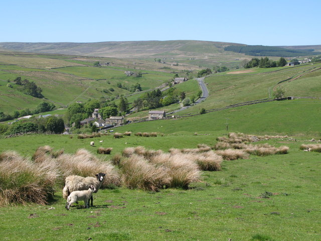
Allenheads Park is a stunning natural reserve located in the heart of Northumberland, England. Spanning over acres of diverse landscape, the park presents a picturesque blend of downs and moorland that captivates visitors with its beauty and tranquility.

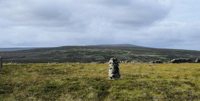
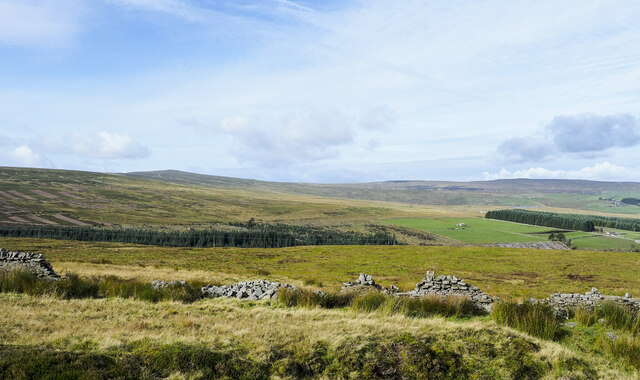
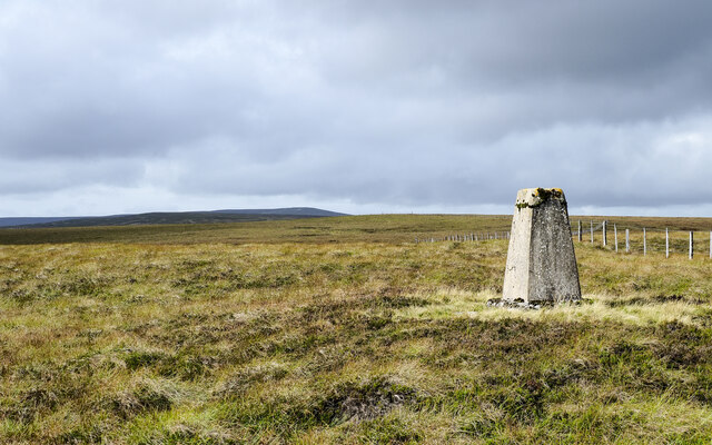
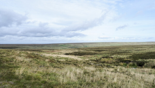
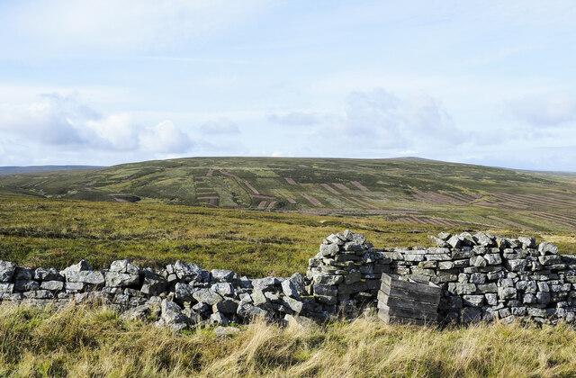
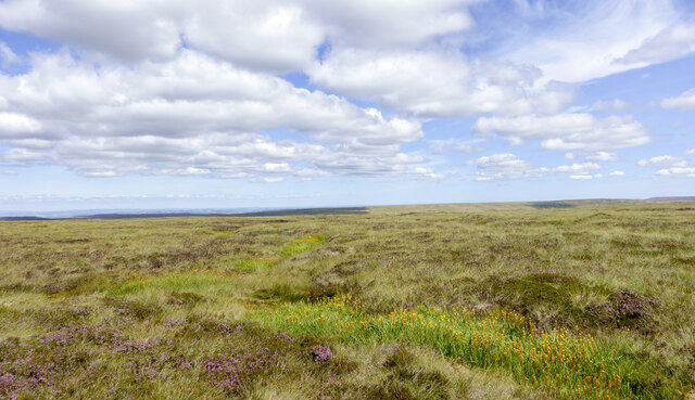
The downs of Allenheads Park are characterized by rolling hills covered in lush green grass. These gentle slopes offer breathtaking panoramic views of the surrounding countryside, providing a perfect spot for nature enthusiasts and photographers alike. The open expanses of the downs also make it an ideal location for outdoor activities such as picnicking, kite flying, and walking.

In contrast, the moorland section of the park features a more rugged terrain, with heather-clad hills and peat bogs. This moorland habitat is home to a myriad of unique plant and animal species, including rare birds like the curlew and red grouse. Visitors can explore the moorland through well-maintained walking trails, immersing themselves in the untamed beauty of the natural surroundings.

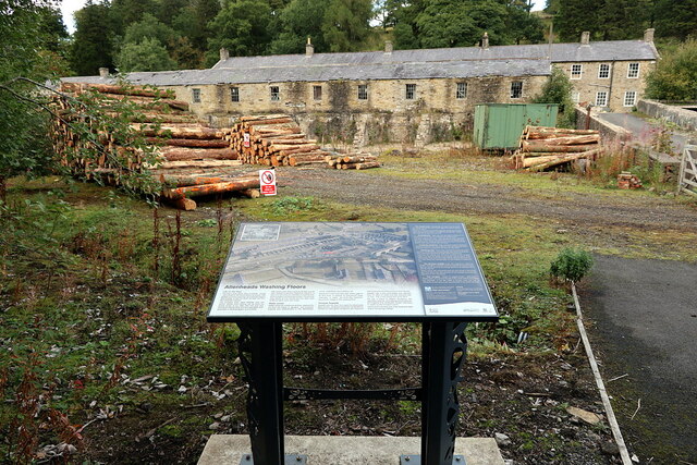
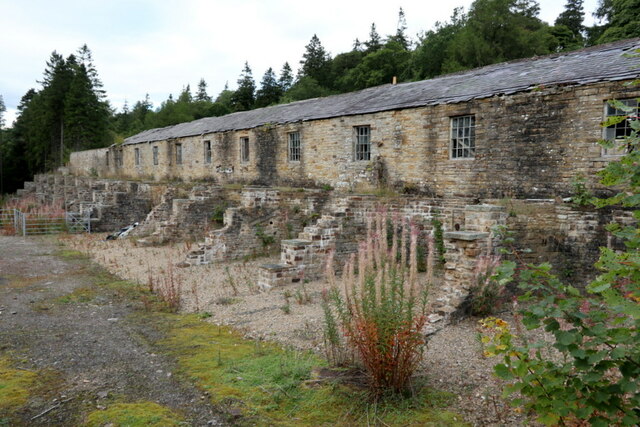
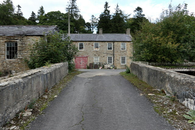
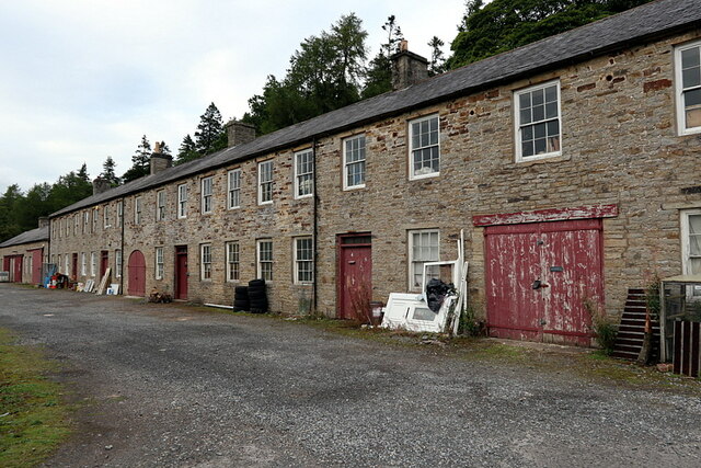
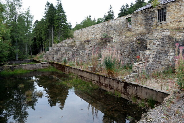
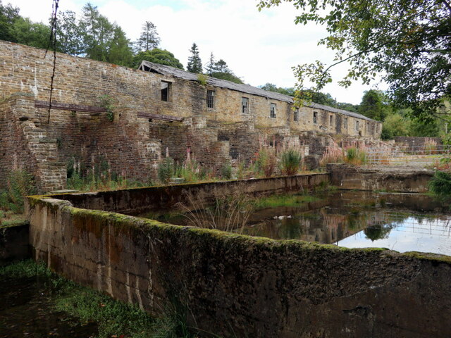
Throughout the park, there are numerous designated areas for wildlife observation, allowing visitors to observe and appreciate the diverse fauna and flora that call Allenheads Park home. The park also boasts a rich history, with remnants of old mining activity still visible in certain areas.

With its tranquil atmosphere, varied landscapes, and abundant wildlife, Allenheads Park offers a haven for nature lovers and a perfect escape from the hustle and bustle of everyday life. Whether it's a leisurely stroll through the downs or an adventurous trek across the moorland, this Northumberland gem promises an unforgettable experience for all who visit.

If you have any feedback on the listing, please let us know in the comments section below.

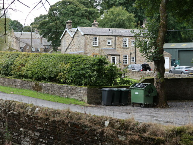
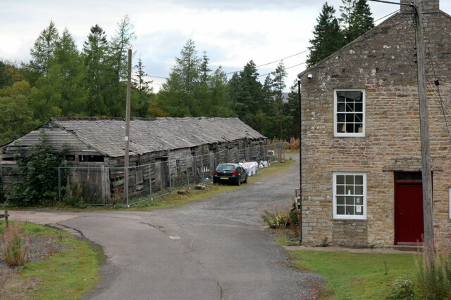
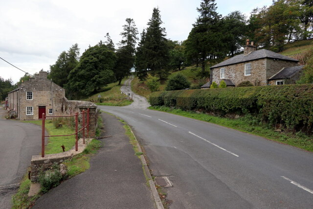
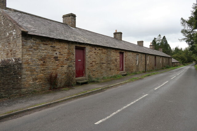
Allenheads Park Images

Images are sourced within 2km of 54.790969/-2.2258384 or Grid Reference NY8544. Thanks to Geograph Open Source API. All images are credited.

Summit cairn on Burtree Fell The summit of Burtree Fell is flat. Its accepted high point lies to the east of a ruined wall although OS mapping gives a spot height of 612 m. closer to the wall which is shown in the image. The cairn is a more impressive one than has been seen there on earlier visits . There's a trig point not far away to the east but at 607 m., it's lower.
Killhope Law is in the distance.
Summit cairn on Burtree Fell
The summit of Burtree Fell is flat. Its accepted high point lies to the east of a ruined wall although OS mapping gives a spot height of 612 m. closer to the wall which is shown in the image. The cairn is a more impressive one than has been seen there on earlier visits . There's a trig point not far away to the east but at 607 m., it's lower. Killhope Law is in the distance.
Parked vehicles and trailers at Allenheads The area beyond the low wall is part of the site of the Beaumont Mine which was originally a lead mine but more recently it was worked for fluorspar. The bays in the distance separated by stepped walls date from the lead mining phase.
Parked vehicles and trailers at Allenheads
The area beyond the low wall is part of the site of the Beaumont Mine which was originally a lead mine but more recently it was worked for fluorspar. The bays in the distance separated by stepped walls date from the lead mining phase.
Moorland beyond ruined wall at Pike Dike Nook Pike Dike Nook is a location on moorland south of Allenheads at or close to the southern point of a coniferous plantation.
 Killhope Law is the more pointed skyline hill to the left in the image; right from it is Carrshield Moor.
Moorland beyond ruined wall at Pike Dike Nook
Pike Dike Nook is a location on moorland south of Allenheads at or close to the southern point of a coniferous plantation. Killhope Law is the more pointed skyline hill to the left in the image; right from it is Carrshield Moor.
Trig point on Burtree Fell The column stands at 607 m. on moorland which is not the hill's summit; that lies to the west, ahead in the image, and is five metres higher. The most distant location, well beyond the Burtree Fell summit, is Killhope Law.
Trig point on Burtree Fell
The column stands at 607 m. on moorland which is not the hill's summit; that lies to the west, ahead in the image, and is five metres higher. The most distant location, well beyond the Burtree Fell summit, is Killhope Law.
Upper groove of South Grain South Grain is a stream developing on the northern slope of Burtree Fell and flowing down into the head of Rook Hope and so to Rookhope Burn, the valley of which can be discerned in the distance.
Upper groove of South Grain
South Grain is a stream developing on the northern slope of Burtree Fell and flowing down into the head of Rook Hope and so to Rookhope Burn, the valley of which can be discerned in the distance.
Moorland beyond ruined wall The wall is on the north-western slope of Burtree Fell. The wooden boxes beside it are used by gamekeepers for supplying, out on the moorland, grit for the use of grouse.
The broad ridge extending into the distance goes over Westend Moor to Killhope Law.
Moorland beyond ruined wall
The wall is on the north-western slope of Burtree Fell. The wooden boxes beside it are used by gamekeepers for supplying, out on the moorland, grit for the use of grouse. The broad ridge extending into the distance goes over Westend Moor to Killhope Law.
Incipient stream groove with bog asphodel Grass with a few clumps of flowering heather dominate the moorland but there's a winding groove which has the yellow flowers of bog asphodel, (Narthecium ossifragum). As its name suggests the plant favours wetter areas, such as the stream groove.
Incipient stream groove with bog asphodel
Grass with a few clumps of flowering heather dominate the moorland but there's a winding groove which has the yellow flowers of bog asphodel, (Narthecium ossifragum). As its name suggests the plant favours wetter areas, such as the stream groove.
Site of Washing Floor of Beaumont Lead Mine, Allenheads "The western part of the lead ore works at Allendale include remains of a washing floor and a set of bouse teams, as well as the drainage channel of the Fawside lead level, a revetted section of the River East Allen and a section of spoil tip. They form part of a wider complex of ore works and lead mines at Allenheads that include the Fawside level (begun in 1776) and the Gin Hill shaft (dug by 1793). It was the focus of the planned industrial village of Allenheads. Lead working ended here in 1896."
Keys to the Past (N7235): <span class="nowrap"><a title="https://keystothepast.info/search-records/results-of-search/results-of-search-2/Site-Details/?PRN=N7235" rel="nofollow ugc noopener" href="https://keystothepast.info/search-records/results-of-search/results-of-search-2/Site-Details/?PRN=N7235">Link</a><img style="margin-left:2px;" alt="External link" title="External link - shift click to open in new window" src="https://s1.geograph.org.uk/img/external.png" width="10" height="10"/></span> <span class="nowrap"><a title="https://web.archive.org/web/20220925144822/https://keystothepast.info/search-records/results-of-search/results-of-search-2/Site-Details/?PRN=N7235" rel="nofollow ugc noopener" href="https://web.archive.org/web/20220925144822/https://keystothepast.info/search-records/results-of-search/results-of-search-2/Site-Details/?PRN=N7235">Archive Link</a><img style="margin-left:2px;" alt="External link" title="External link - shift click to open in new window" src="https://s1.geograph.org.uk/img/external.png" width="10" height="10"/></span>

Allenheads Lead Ore Works (Scheduled Monument 1016348): <span class="nowrap"><a title="https://historicengland.org.uk/listing/the-list/list-entry/1016348" rel="nofollow ugc noopener" href="https://historicengland.org.uk/listing/the-list/list-entry/1016348">Link</a><img style="margin-left:2px;" alt="External link" title="External link - shift click to open in new window" src="https://s1.geograph.org.uk/img/external.png" width="10" height="10"/></span>

Between 1729 and its closure in 1896, the Allenheads Mine produced over 250,000 tons of lead ore ready for smelting into lead. The modern industrial buildings beside the car park date from a failed attempt to mine fluorspar in the 1970s.
Site of Washing Floor of Beaumont Lead Mine, Allenheads
"The western part of the lead ore works at Allendale include remains of a washing floor and a set of bouse teams, as well as the drainage channel of the Fawside lead level, a revetted section of the River East Allen and a section of spoil tip. They form part of a wider complex of ore works and lead mines at Allenheads that include the Fawside level (begun in 1776) and the Gin Hill shaft (dug by 1793). It was the focus of the planned industrial village of Allenheads. Lead working ended here in 1896." Keys to the Past (N7235): LinkExternal link Archive LinkExternal link Allenheads Lead Ore Works (Scheduled Monument 1016348): LinkExternal link Between 1729 and its closure in 1896, the Allenheads Mine produced over 250,000 tons of lead ore ready for smelting into lead. The modern industrial buildings beside the car park date from a failed attempt to mine fluorspar in the 1970s.
Beaumont Lead Mine building & bouse-teams Lead mine building, later saw-mill, and bouse-teams (ore storage bunkers). Mid-C19. Timber, rubble. Building has rubble west wall with 9 16-pane fixed windows, remainder of timber, possibly later but with similar windows. Bouse team of squared rubble; 14 apsidal bays divided by stepped wall, open towards former dressing floor on the west. Heavy timbers which carried a tramway survive over some bays.
Grade II Listed Buildings (1154253): <span class="nowrap"><a title="https://historicengland.org.uk/listing/the-list/list-entry/1154253" rel="nofollow ugc noopener" href="https://historicengland.org.uk/listing/the-list/list-entry/1154253">Link</a><img style="margin-left:2px;" alt="External link" title="External link - shift click to open in new window" src="https://s1.geograph.org.uk/img/external.png" width="10" height="10"/></span>
Beaumont Lead Mine building & bouse-teams
Lead mine building, later saw-mill, and bouse-teams (ore storage bunkers). Mid-C19. Timber, rubble. Building has rubble west wall with 9 16-pane fixed windows, remainder of timber, possibly later but with similar windows. Bouse team of squared rubble; 14 apsidal bays divided by stepped wall, open towards former dressing floor on the west. Heavy timbers which carried a tramway survive over some bays. Grade II Listed Buildings (1154253): LinkExternal link
Road to Mine Yard, Allenheads "The western part of the lead ore works at Allendale include remains of a washing floor and a set of bouse teams, as well as the drainage channel of the Fawside lead level, a revetted section of the River East Allen and a section of spoil tip. They form part of a wider complex of ore works and lead mines at Allenheads that include the Fawside level (begun in 1776) and the Gin Hill shaft (dug by 1793). It was the focus of the planned industrial village of Allenheads. Lead working ended here in 1896."
Keys to the Past (N7235): <span class="nowrap"><a title="https://keystothepast.info/search-records/results-of-search/results-of-search-2/Site-Details/?PRN=N7235" rel="nofollow ugc noopener" href="https://keystothepast.info/search-records/results-of-search/results-of-search-2/Site-Details/?PRN=N7235">Link</a><img style="margin-left:2px;" alt="External link" title="External link - shift click to open in new window" src="https://s1.geograph.org.uk/img/external.png" width="10" height="10"/></span> <span class="nowrap"><a title="https://web.archive.org/web/20220925144822/https://keystothepast.info/search-records/results-of-search/results-of-search-2/Site-Details/?PRN=N7235" rel="nofollow ugc noopener" href="https://web.archive.org/web/20220925144822/https://keystothepast.info/search-records/results-of-search/results-of-search-2/Site-Details/?PRN=N7235">Archive Link</a><img style="margin-left:2px;" alt="External link" title="External link - shift click to open in new window" src="https://s1.geograph.org.uk/img/external.png" width="10" height="10"/></span>

Allenheads Lead Ore Works (Scheduled Monument 1016348): <span class="nowrap"><a title="https://historicengland.org.uk/listing/the-list/list-entry/1016348" rel="nofollow ugc noopener" href="https://historicengland.org.uk/listing/the-list/list-entry/1016348">Link</a><img style="margin-left:2px;" alt="External link" title="External link - shift click to open in new window" src="https://s1.geograph.org.uk/img/external.png" width="10" height="10"/></span>

Between 1729 and its closure in 1896, the Allenheads Mine produced over 250,000 tons of lead ore ready for smelting into lead. The modern industrial buildings beside the car park date from a failed attempt to mine fluorspar in the 1970s.
Road to Mine Yard, Allenheads
"The western part of the lead ore works at Allendale include remains of a washing floor and a set of bouse teams, as well as the drainage channel of the Fawside lead level, a revetted section of the River East Allen and a section of spoil tip. They form part of a wider complex of ore works and lead mines at Allenheads that include the Fawside level (begun in 1776) and the Gin Hill shaft (dug by 1793). It was the focus of the planned industrial village of Allenheads. Lead working ended here in 1896." Keys to the Past (N7235): LinkExternal link Archive LinkExternal link Allenheads Lead Ore Works (Scheduled Monument 1016348): LinkExternal link Between 1729 and its closure in 1896, the Allenheads Mine produced over 250,000 tons of lead ore ready for smelting into lead. The modern industrial buildings beside the car park date from a failed attempt to mine fluorspar in the 1970s.
Beaumont Mine workshops, Allenheads Former lead mine workshops. Mid C19. Rubble with slate roof. 2 storeys, 20 bays. 4 boarded doors with overlights, 2 cart entrances; 12-pane sash windows, some altered. 4 ridge and 2 end stone stacks. To left single storey 10-bay section with similar openings. One ground-floor room of the 2-storey section contains a hydraulic engine built by Armstrongs of Newcastle in 1847, used for pumping in the mine workings, and later to operate the estate sawmill.
Grade II Listed Buildings (1042967): <span class="nowrap"><a title="https://historicengland.org.uk/listing/the-list/list-entry/1042967" rel="nofollow ugc noopener" href="https://historicengland.org.uk/listing/the-list/list-entry/1042967">Link</a><img style="margin-left:2px;" alt="External link" title="External link - shift click to open in new window" src="https://s1.geograph.org.uk/img/external.png" width="10" height="10"/></span>
Beaumont Mine workshops, Allenheads
Former lead mine workshops. Mid C19. Rubble with slate roof. 2 storeys, 20 bays. 4 boarded doors with overlights, 2 cart entrances; 12-pane sash windows, some altered. 4 ridge and 2 end stone stacks. To left single storey 10-bay section with similar openings. One ground-floor room of the 2-storey section contains a hydraulic engine built by Armstrongs of Newcastle in 1847, used for pumping in the mine workings, and later to operate the estate sawmill. Grade II Listed Buildings (1042967): LinkExternal link
Reservoir tank & bouse-teams of Beaumont Lead Mine, Allenheads "The western part of the lead ore works at Allendale include remains of a washing floor and a set of bouse teams, as well as the drainage channel of the Fawside lead level, a revetted section of the River East Allen and a section of spoil tip. They form part of a wider complex of ore works and lead mines at Allenheads that include the Fawside level (begun in 1776) and the Gin Hill shaft (dug by 1793). It was the focus of the planned industrial village of Allenheads. Lead working ended here in 1896."
Keys to the Past (N7235): <span class="nowrap"><a title="https://keystothepast.info/search-records/results-of-search/results-of-search-2/Site-Details/?PRN=N7235" rel="nofollow ugc noopener" href="https://keystothepast.info/search-records/results-of-search/results-of-search-2/Site-Details/?PRN=N7235">Link</a><img style="margin-left:2px;" alt="External link" title="External link - shift click to open in new window" src="https://s1.geograph.org.uk/img/external.png" width="10" height="10"/></span> <span class="nowrap"><a title="https://web.archive.org/web/20220925144822/https://keystothepast.info/search-records/results-of-search/results-of-search-2/Site-Details/?PRN=N7235" rel="nofollow ugc noopener" href="https://web.archive.org/web/20220925144822/https://keystothepast.info/search-records/results-of-search/results-of-search-2/Site-Details/?PRN=N7235">Archive Link</a><img style="margin-left:2px;" alt="External link" title="External link - shift click to open in new window" src="https://s1.geograph.org.uk/img/external.png" width="10" height="10"/></span>

Allenheads Lead Ore Works (Scheduled Monument 1016348): <span class="nowrap"><a title="https://historicengland.org.uk/listing/the-list/list-entry/1016348" rel="nofollow ugc noopener" href="https://historicengland.org.uk/listing/the-list/list-entry/1016348">Link</a><img style="margin-left:2px;" alt="External link" title="External link - shift click to open in new window" src="https://s1.geograph.org.uk/img/external.png" width="10" height="10"/></span>

Between 1729 and its closure in 1896, the Allenheads Mine produced over 250,000 tons of lead ore ready for smelting into lead. The modern industrial buildings beside the car park date from a failed attempt to mine fluorspar in the 1970s.
Reservoir tank & bouse-teams of Beaumont Lead Mine, Allenheads
"The western part of the lead ore works at Allendale include remains of a washing floor and a set of bouse teams, as well as the drainage channel of the Fawside lead level, a revetted section of the River East Allen and a section of spoil tip. They form part of a wider complex of ore works and lead mines at Allenheads that include the Fawside level (begun in 1776) and the Gin Hill shaft (dug by 1793). It was the focus of the planned industrial village of Allenheads. Lead working ended here in 1896." Keys to the Past (N7235): LinkExternal link Archive LinkExternal link Allenheads Lead Ore Works (Scheduled Monument 1016348): LinkExternal link Between 1729 and its closure in 1896, the Allenheads Mine produced over 250,000 tons of lead ore ready for smelting into lead. The modern industrial buildings beside the car park date from a failed attempt to mine fluorspar in the 1970s.
Beaumont House, Allenheads Beaumont House was built in the 19th century, possibly for Lord Allendale's land agent. It is a Grade II Listed Building.
Beaumont House, Allenheads
Beaumont House was built in the 19th century, possibly for Lord Allendale's land agent. It is a Grade II Listed Building.
Former buildings of Beaumont Lead Mine, Allenheads "The western part of the lead ore works at Allendale include remains of a washing floor and a set of bouse teams, as well as the drainage channel of the Fawside lead level, a revetted section of the River East Allen and a section of spoil tip. They form part of a wider complex of ore works and lead mines at Allenheads that include the Fawside level (begun in 1776) and the Gin Hill shaft (dug by 1793). It was the focus of the planned industrial village of Allenheads. Lead working ended here in 1896."
Keys to the Past (N7235): <span class="nowrap"><a title="https://keystothepast.info/search-records/results-of-search/results-of-search-2/Site-Details/?PRN=N7235" rel="nofollow ugc noopener" href="https://keystothepast.info/search-records/results-of-search/results-of-search-2/Site-Details/?PRN=N7235">Link</a><img style="margin-left:2px;" alt="External link" title="External link - shift click to open in new window" src="https://s1.geograph.org.uk/img/external.png" width="10" height="10"/></span> <span class="nowrap"><a title="https://web.archive.org/web/20220925144822/https://keystothepast.info/search-records/results-of-search/results-of-search-2/Site-Details/?PRN=N7235" rel="nofollow ugc noopener" href="https://web.archive.org/web/20220925144822/https://keystothepast.info/search-records/results-of-search/results-of-search-2/Site-Details/?PRN=N7235">Archive Link</a><img style="margin-left:2px;" alt="External link" title="External link - shift click to open in new window" src="https://s1.geograph.org.uk/img/external.png" width="10" height="10"/></span>

Allenheads Lead Ore Works (Scheduled Monument 1016348): <span class="nowrap"><a title="https://historicengland.org.uk/listing/the-list/list-entry/1016348" rel="nofollow ugc noopener" href="https://historicengland.org.uk/listing/the-list/list-entry/1016348">Link</a><img style="margin-left:2px;" alt="External link" title="External link - shift click to open in new window" src="https://s1.geograph.org.uk/img/external.png" width="10" height="10"/></span>

Between 1729 and its closure in 1896, the Allenheads Mine produced over 250,000 tons of lead ore ready for smelting into lead. The modern industrial buildings beside the car park date from a failed attempt to mine fluorspar in the 1970s.
Former buildings of Beaumont Lead Mine, Allenheads
"The western part of the lead ore works at Allendale include remains of a washing floor and a set of bouse teams, as well as the drainage channel of the Fawside lead level, a revetted section of the River East Allen and a section of spoil tip. They form part of a wider complex of ore works and lead mines at Allenheads that include the Fawside level (begun in 1776) and the Gin Hill shaft (dug by 1793). It was the focus of the planned industrial village of Allenheads. Lead working ended here in 1896." Keys to the Past (N7235): LinkExternal link Archive LinkExternal link Allenheads Lead Ore Works (Scheduled Monument 1016348): LinkExternal link Between 1729 and its closure in 1896, the Allenheads Mine produced over 250,000 tons of lead ore ready for smelting into lead. The modern industrial buildings beside the car park date from a failed attempt to mine fluorspar in the 1970s.
Road to Allendale, Allenheads  The house on the right is Level Mouth Cottage which takes its name from the Fawside Level just below the road on the left side. It was dug in 1776, but probably reconstructed in the mid 19th century, and is part of the Beaumont Mine at Allenheads.
Road to Allendale, Allenheads
The house on the right is Level Mouth Cottage which takes its name from the Fawside Level just below the road on the left side. It was dug in 1776, but probably reconstructed in the mid 19th century, and is part of the Beaumont Mine at Allenheads.
Roadside elevation of Beaumont Mine workshops, Allenheads The other side of this building is shown here <a href="https://www.geograph.org.uk/photo/7293223">NY8645 : Beaumont Mine workshops, Allenheads</a>
Roadside elevation of Beaumont Mine workshops, Allenheads
The other side of this building is shown here NY8645 : Beaumont Mine workshops, Allenheads
Former mine buildings, Allenheads Allenheads Lead Mine closed in 1896, but this was not the end of the area’s mining story. In the 20th century, the mineral fluorite (known commercially as fluorspar) became important in the iron, steel and chemical industries. In 1969 British Steel reopened Allenheads Mine in the search for fluorspar, but the venture was unsuccessful and the mine closed again in 1981.

See photo & description here <a href="https://www.geograph.org.uk/photo/71431">NY8645 : Allenheads Mine (disused)</a>
Former mine buildings, Allenheads
Allenheads Lead Mine closed in 1896, but this was not the end of the area’s mining story. In the 20th century, the mineral fluorite (known commercially as fluorspar) became important in the iron, steel and chemical industries. In 1969 British Steel reopened Allenheads Mine in the search for fluorspar, but the venture was unsuccessful and the mine closed again in 1981. See photo & description here NY8645 : Allenheads Mine (disused)
Show me another place!

Allenheads Park is located at Grid Ref: NY8544 (Lat: 54.790969, Lng: -2.2258384)

Unitary Authority: Northumberland

Police Authority: Northumbria

What 3 Words

///fees.division.backtrack. Near Alston, Cumbria

Related Wikis

Nearby Amenities

Located within 500m of 54.790969,-2.2258384
Allenheads Park
Place: locality
Lat/Long: 54.7909999/-2.228071
Power: pole
Lat/Long: 54.7929298/-2.2196217
Power: pole
Lat/Long: 54.7919955/-2.2203852
Power: pole
Lat/Long: 54.7910586/-2.2211418
Power: pole
Lat/Long: 54.790166/-2.2218703
Power: pole
Lat/Long: 54.7892882/-2.2225848
Power: pole
Lat/Long: 54.7883982/-2.2233016
Power: pole
Lat/Long: 54.7875473/-2.2239928
Power: pole
Lat/Long: 54.7866654/-2.2247026
The data included in this document is from www.openstreetmap.org. The data is made available under ODbL.

Have you been to Allenheads Park?

Leave your review of Allenheads Park below (or comments, questions and feedback).