Code Context <figure class="figure mb-0 pt-2">
<? echo $this->Html->image($images[0]['url'], array('alt' => $images[0]['title'], 'class' => 'img-fluid mx-auto d-block')) ?>
<figcaption class="figure-caption text-center"><? echo $images[0]['title'] ?> Credit: <? echo $images[0]['ownername'] ?>
$viewFile = '/var/www/html/uk_places.millsbomb.com/app/View/Records/view.ctp'
$dataForView = array(
'meta_keywords' => 'Middle Gill',
'meta_description' => 'Middle Gill is a small valley located in the Westmorland region of England. Situated amidst the picturesque countryside, it is known for its charming rural landscapes and natural beauty. The valley is surrounded by rolling hills and dotted with quaint cottages, adding to its idyllic appeal.The...',
'title_for_layout' => 'Middle Gill Eden Westmorland',
'videos' => null,
'wikis' => array(
'batchcomplete' => '',
'query' => array(
'geosearch' => array(
[maximum depth reached]
)
)
),
'neighbours' => array(
'prev' => array(
'Record' => array(
[maximum depth reached]
)
),
'next' => array(
'Record' => array(
[maximum depth reached]
)
)
),
'para' => 'Middle Gill is a Valley in Westmorland',
'record' => array(
'Record' => array(
'id' => '245443',
'GBPNID' => '247870',
'PlaceName' => 'Middle Gill',
'GridRef' => 'NY8507',
'Lat' => '54.462401',
'Lng' => '-2.2233602',
'HistCounty' => 'Westmorland',
'Division' => null,
'AdCounty' => 'Cumbria',
'District' => 'Eden',
'UniAuth' => null,
'Police' => 'Cumbria',
'Region' => 'England',
'Alternative_Names' => null,
'Type' => 'Valley',
'description' => 'Middle Gill is a small valley located in the Westmorland region of England. Situated amidst the picturesque countryside, it is known for its charming rural landscapes and natural beauty. The valley is surrounded by rolling hills and dotted with quaint cottages, adding to its idyllic appeal.
The main feature of Middle Gill is a gently flowing river that meanders through the valley, providing a source of water and adding to the tranquility of the area. The river is flanked by lush green meadows and woodlands, creating a serene and peaceful atmosphere.
The valley is home to a diverse range of flora and fauna, making it popular among nature enthusiasts and wildlife lovers. It offers ample opportunities for birdwatching, as various species can be spotted in the area. The woodlands are also home to a variety of wildlife, including deer, rabbits, and squirrels.
Middle Gill is a haven for outdoor activities such as hiking and cycling. The surrounding hills provide numerous trails and paths that offer stunning views of the valley and beyond. The peacefulness of the area makes it an ideal spot for those seeking solace and a break from the hustle and bustle of city life.
Overall, Middle Gill, Westmorland is a charming valley that showcases the natural beauty of the Westmorland region. Its picturesque landscapes, diverse wildlife, and tranquil ambiance make it a delightful destination for nature lovers and outdoor enthusiasts alike.',
'what3words' => 'indicates.likely.drop',
'what3words_place' => 'Kirkby Stephen, Cumbria',
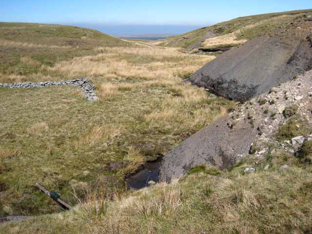
'images' => '[{"id":"2778342","title":"Bleaberry Force","grid_reference":"NY8407","realname":"Colin Gregory","monthname":"January","hash":"e223c49b","takenyear":"2012","user_id":"57588","geodist":"980.288269","description":"This impressive 30' fall is in Bleaberry Gill North East of Nine Standards Rigg, Cumbria.","url":"https:\/\/s2.geograph.org.uk\/geophotos\/02\/77\/83\/2778342_e223c49b.jpg"},{"id":"2815997","title":"Backstone Castle","grid_reference":"NY8406","realname":"Colin Gregory","monthname":"October","hash":"ad3e8af8","takenyear":"2011","user_id":"57588","geodist":"1933.507202","description":"Backstone Castle is a rocky outcrop above Backstone Beck. The elaborate name might lead unwary walkers to believe they are heading for some ancient historical site. In reality it is merely a distraction in a vast and bleak moorland setting.","url":"https:\/\/s1.geograph.org.uk\/geophotos\/02\/81\/59\/2815997_ad3e8af8.jpg"},{"id":"3502764","title":"Woofer Moor and beyond","grid_reference":"NY8609","realname":"Oliver Dixon","monthname":"June","hash":"f2a23ad2","takenyear":"2013","user_id":"3462","geodist":"1812.221680","description":"Seen from the road to Tan Hill.","url":"https:\/\/s0.geograph.org.uk\/geophotos\/03\/50\/27\/3502764_f2a23ad2.jpg"},{"id":"4349379","title":"Shale slope with boulders","grid_reference":"NY8306","realname":"Trevor Littlewood","monthname":"February","hash":"e3565b68","takenyear":"2015","user_id":"39198","geodist":"1811.577881","description":"The steep slope of black shale drops into Brownberhead Beck which drains from the eastern side of Nine Standards. The groove in which the boulders lie has been eroded: presumably loose shale has been lost with the larger rocks originally embedded in the shale, remaining.","url":"https:\/\/s3.geograph.org.uk\/geophotos\/04\/34\/93\/4349379_e3565b68.jpg"},{"id":"4349678","title":"Groove of Bog Sike","grid_reference":"NY8706","realname":"Trevor Littlewood","monthname":"February","hash":"ef731d1e","takenyear":"2015","user_id":"39198","geodist":"1636.500732","description":"Bog Sike flows in the steep sided trench with a black shaley slope on the left side of the image. The view is along the route of an old mine road.","url":"https:\/\/s2.geograph.org.uk\/geophotos\/04\/34\/96\/4349678_ef731d1e.jpg"},{"id":"4349695","title":"Shooting hut in Kettlepot Gill","grid_reference":"NY8606","realname":"Trevor Littlewood","monthname":"February","hash":"5408a3f4","takenyear":"2015","user_id":"39198","geodist":"1229.393555","description":"The hut is on the north side of Kettlepot Gill, the view being across the valley stream which may be known as Great Wygill. The building is reached by an estate road crossing the moor from the north.","url":"https:\/\/s3.geograph.org.uk\/geophotos\/04\/34\/96\/4349695_5408a3f4.jpg"},{"id":"4349902","title":"Moorland on north side of Back Gutter","grid_reference":"NY8607","realname":"Trevor Littlewood","monthname":"February","hash":"cc1cb402","takenyear":"2015","user_id":"39198","geodist":"603.058655","description":"The watercourse of Back Gutter is at the left side of the image, virtually concealed by rushes. The two wooden structures breaking the skyline are grouse butts.","url":"https:\/\/s2.geograph.org.uk\/geophotos\/04\/34\/99\/4349902_cc1cb402.jpg"},{"id":"4349929","title":"Snow beds on north side of Back Gutter","grid_reference":"NY8507","realname":"Trevor Littlewood","monthname":"February","hash":"bb907371","takenyear":"2015","user_id":"39198","geodist":"519.426575","description":"Back Gutter drains water eastwards from the slopes of moorland to the east of Nine Standards.","url":"https:\/\/s1.geograph.org.uk\/geophotos\/04\/34\/99\/4349929_bb907371.jpg"},{"id":"4349972","title":"Brownber Tarn, frozen","grid_reference":"NY8506","realname":"Trevor Littlewood","monthname":"February","hash":"003f2fcc","takenyear":"2015","user_id":"39198","geodist":"748.005615","description":"Brownber Tarn is encircled by an area of atrociously wet moorland; it lies to the east of the high grassy moorland ridge at Brownber Edge, itself east of Nine Standards. The eastern side of the tarn is pictured.","url":"https:\/\/s0.geograph.org.uk\/geophotos\/04\/34\/99\/4349972_003f2fcc.jpg"},{"id":"4350030","title":"Ridge of Brownber Edge","grid_reference":"NY8407","realname":"Trevor Littlewood","monthname":"February","hash":"a887e3be","takenyear":"2015","user_id":"39198","geodist":"759.963196","description":"Brownber Edge is an elongated dome of a ridge lying to the east of the more significant hill, Nine Standards. The view is from the featureless crest of the ridge generally north-eastwards.","url":"https:\/\/s2.geograph.org.uk\/geophotos\/04\/35\/00\/4350030_a887e3be.jpg"},{"id":"4350063","title":"Unusual section of walling near Brownberhead Beck","grid_reference":"NY8406","realname":"Trevor Littlewood","monthname":"February","hash":"7fac9490","takenyear":"2015","user_id":"39198","geodist":"1708.943848","description":"Brownberhead Beck is the foreground stream. Beyond it a walker is sitting on a curious piece of wall - if that's what it is! There are two stretches, both low, set at a right angle. The location is remote and no purpose behind the construction can be imagined. (The pole across the stream of course has a gin trap mounted on top.)","url":"https:\/\/s3.geograph.org.uk\/geophotos\/04\/35\/00\/4350063_7fac9490.jpg"},{"id":"7025942","title":"Public footpath to Kettlepot Gill","grid_reference":"NY8707","realname":"Andy Waddington","monthname":"November","hash":"bd5dd1e7","takenyear":"2021","user_id":"34816","geodist":"1637.555542","description":"The public bridleway from the Tan Hill road is signposted to "Kettlepot Bog" which is as unpromising a destination as you might hope to find anywhere. Whilst it starts off along a very well-used estate track, it veers off just before Kettlepot Gill. The estate road continues some way to a recently built shooting hut, the right of way is much older and goes to an area of old mineshafts across the Gill (and once among the shafts, simply ends). It crosses Kettlepot Gill just at its confluence with Bog Sike, and there is a bit of a causeway along the smaller stream allowing for ascent without the steep gradient that you would expect at first sight. The geological map shows the Tan Hill Coal outcropping in the bank opposite, though it is not much in evidence. However that does indicate that it is not far below the surface all around here, which is why there are lots of small pits, rather than the more substantial capped shafts that characterise workings on the Tan Hill Coal where it is rather deeper below surface. There are no waste tips here, either.","url":"https:\/\/s2.geograph.org.uk\/geophotos\/07\/02\/59\/7025942_bd5dd1e7.jpg"},{"id":"7025956","title":"Old Pit on Hugh Seat Nab","grid_reference":"NY8706","realname":"Andy Waddington","monthname":"November","hash":"fcf59922","takenyear":"2021","user_id":"34816","geodist":"1801.933716","description":"The Tan Hill Coal Seam was very near the surface under Hugh Seat Nab, but this area is near the edge of the coal which peters out a couple of kilometres to the west. It was clearly not worth sinking the sort of shafts that feature further east where the seam was deeper, but also more productive and was worked much later. These old pits occur in a more or less regular pattern about 80-100m apart, linked by paths more obvious on aerial photos than on the ground, even though they are clearly still in use by gamekeepers intent on overpopulating the moor with grouse. A public bridleway leads into the mined area, then just ends - most of the paths are not rights of way. A few of the pits, like this one, seem to have silted up and become waterproof, so now have small pools. With the first properly cold night of the season, there's a thin skin of ice, though the small snowfall is disappearing wherever the sun reaches. The last of the radiation fog is just burning off to the north.","url":"https:\/\/s0.geograph.org.uk\/geophotos\/07\/02\/59\/7025956_fcf59922.jpg"},{"id":"7025976","title":"Shooting Hut serving Kettlepot Bog","grid_reference":"NY8606","realname":"Andy Waddington","monthname":"November","hash":"cbd3581a","takenyear":"2021","user_id":"34816","geodist":"1229.393555","description":"The rather grandly named Kettlepot Road is really just an estate track from the public road west of the Tan Hill Inn. It is a public bridleway for most of its route, but the right of way turns off to cross Kettlepot Gill and head up to the old coal workings on Hugh Seat Nab. The continuation to reach this establishment is not a right of way (but this is all CROW Access Land). The hut, built in 1998, seems to have been placed about as far up the Gill as practicable, since, as the name suggests, the area where shooting takes place, Kettlepot Bog, is mostly peat hags not really ideal for a stone building, or indeed a road capable of taking Landrovers. From this point shooters must walk (or wade) if they are using the lines of butts to the west, but there is also one line of older stone-built butts sunk into the ground alongside the track for those who prefer firmer footing.","url":"https:\/\/s0.geograph.org.uk\/geophotos\/07\/02\/59\/7025976_cbd3581a.jpg"},{"id":"7025994","title":"Kettlepot Road","grid_reference":"NY8607","realname":"Andy Waddington","monthname":"November","hash":"009f10b2","takenyear":"2021","user_id":"34816","geodist":"1421.444092","description":"Originally created to serve an area of mines exploiting the Tan Hill Coal under Hugh Seat Nab and Kettlepot Bog, the track is now in use as an estate track and has been somewhat extended to the west to reach a recently built (1998) stone shooting hut <a href=\"https:\/\/www.geograph.org.uk\/photo\/7025976\">NY8606 : Shooting Hut serving Kettlepot Bog<\/a>. A public bridleway follows the track up to a point about 400m beyond the bend, but then veers off (as a much fainter path) onto Hugh Seat Nab - apparently the route to the pits this side of Kettlepot Gill never made it to right-of-way status. Neither route has any destination beyond the mining area, so any walk taking advantage of the CROW Access Land has to take on some off-piste travel - generally not too hard to the south where a good path to Ravenseat can be reached fairly quickly, but much more arduous across the peat hags towards Nine Standards Rigg.","url":"https:\/\/s2.geograph.org.uk\/geophotos\/07\/02\/59\/7025994_009f10b2.jpg"},{"id":"7160015","title":"Hill road passing through gate in fence","grid_reference":"NY8308","realname":"Trevor Littlewood","monthname":"April","hash":"f1f6cb8f","takenyear":"2022","user_id":"39198","geodist":"1965.629395","description":"The road has risen from Stowgill and here is alongside Stowgill Sike - it's off to the left. The gate is needed as a large tract of ground around Great Stowgill, (a surprisingly deep gash in the hillside), has been planted with countless young trees. The whole surrounding area has been fenced to exclude grazing sheep which might nibble at the saplings.","url":"https:\/\/s3.geograph.org.uk\/geophotos\/07\/16\/00\/7160015_f1f6cb8f.jpg"},{"id":"7428","title":"Kaber Fell, Cumbria","grid_reference":"NY8608","realname":"David Medcalf","monthname":"May","hash":"83ffa334","takenyear":"2005","user_id":"180","geodist":"1355.609741","description":"Looking west, towards Nine Standards [which are not visible at this resolution]. The stream is Potter Sike.","url":"https:\/\/s0.geograph.org.uk\/photos\/00\/74\/007428_83ffa334.jpg"},{"id":"421704","title":"Brownberhead Beck","grid_reference":"NY8406","realname":"Oliver Dixon","monthname":"May","hash":"03df8d90","takenyear":"2007","user_id":"3462","geodist":"1609.766113","description":"The sides of this moorland valley have been heavily eroded.","url":"https:\/\/s0.geograph.org.uk\/photos\/42\/17\/421704_03df8d90.jpg"}]',
'wikis' => '{"batchcomplete":"","query":{"geosearch":[{"pageid":4799406,"ns":0,"title":"Nine Standards Rigg","lat":54.4541,"lon":-2.2716,"dist":3251.8,"primary":"","url":"https:\/\/en.wikipedia.org\/wiki\/Nine_Standards_Rigg","image":"https:\/\/upload.wikimedia.org\/wikipedia\/commons\/a\/a9\/Nine_Standards_1996.jpg","extract":"Nine Standards Rigg is the summit of Hartley Fell in the Pennine Hills of England. It lies near the boundary between Cumbria and North Yorkshire, a few..."},{"pageid":39205057,"ns":0,"title":"Belah Viaduct","lat":54.489,"lon":-2.2498,"dist":3415.6,"primary":"","url":"https:\/\/en.wikipedia.org\/wiki\/Belah_Viaduct","image":"https:\/\/upload.wikimedia.org\/wikipedia\/commons\/f\/f7\/Belah_Viaduct%2C_Stainmore%2C_South_Durham_%26_Lancashire_Union_Railway_%28cut%29.jpg","extract":"The Belah Viaduct was a railway viaduct on the South Durham and Lancashire Union Railway, crossing the River Belah, in Cumbria, England, about 1 mile..."},{"pageid":1801496,"ns":0,"title":"Tan Hill, North Yorkshire","lat":54.4555,"lon":-2.16,"dist":4166.6,"primary":"","url":"https:\/\/en.wikipedia.org\/wiki\/Tan_Hill,_North_Yorkshire","image":"https:\/\/upload.wikimedia.org\/wikipedia\/commons\/7\/7b\/2013_Tan_Hill_Inn_from_south.jpg","extract":"Tan Hill (NY896067) is a high point on the Pennine Way in the Richmondshire district of North Yorkshire, England. It lies north of Keld in the civil parish..."},{"pageid":8160484,"ns":0,"title":"Barras railway station","lat":54.50308,"lon":-2.24241,"dist":4687.7,"primary":"","url":"https:\/\/en.wikipedia.org\/wiki\/Barras_railway_station","image":"https:\/\/upload.wikimedia.org\/wikipedia\/commons\/8\/8b\/Remains_of_Barras_Station_-_geograph.org.uk_-_1764515.jpg","extract":"Barras railway station was situated on the South Durham & Lancashire Union Railway between Barnard Castle and Kirkby Stephen East.\n\n\n== History ==\nThe station..."},{"pageid":8089462,"ns":0,"title":"Barras, Cumbria","lat":54.504,"lon":-2.244,"dist":4813.9,"primary":"","url":"https:\/\/en.wikipedia.org\/wiki\/Barras,_Cumbria","image":"https:\/\/upload.wikimedia.org\/wikipedia\/commons\/2\/2f\/Barn_at_Barras_Farm_-_geograph.org.uk_-_136664.jpg","extract":"Barras is a hamlet close to the River Belah, about 4 miles (6 kilometres) south-east of Brough, Cumbria, England.\nUntil the creation of the new county..."},{"pageid":19203517,"ns":0,"title":"Birkdale, North Yorkshire","lat":54.416,"lon":-2.25,"dist":5439.6,"primary":"","url":"https:\/\/en.wikipedia.org\/wiki\/Birkdale,_North_Yorkshire","image":"https:\/\/upload.wikimedia.org\/wikipedia\/commons\/a\/a6\/Sheepfold_in_Birk_Dale_-_geograph.org.uk_-_506427.jpg","extract":"Birkdale (sometimes written out as Birk Dale) is a dale in the Yorkshire Dales National Park, in North Yorkshire, England. It lies at the far western end..."},{"pageid":32895867,"ns":0,"title":"Snowdrift at Bleath Gill","lat":54.511422222222,"lon":-2.2214,"dist":5452.4,"primary":"","url":"https:\/\/en.wikipedia.org\/wiki\/Snowdrift_at_Bleath_Gill","extract":"Snowdrift at Bleath Gill is a 1955 British Transport Film documentary directed by Kenneth Fairbairn. The 10-minute-long film presents a first-hand account..."},{"pageid":10277348,"ns":0,"title":"Stainmore Summit","lat":54.509166666667,"lon":-2.1891666666667,"dist":5649.7,"primary":"","url":"https:\/\/en.wikipedia.org\/wiki\/Stainmore_Summit","image":"https:\/\/upload.wikimedia.org\/wikipedia\/commons\/1\/17\/Stainmore_Railway_Summit.JPG","extract":"Stainmore Summit is the highest point on the trans-Pennine South Durham & Lancashire Union Railway, also known as the Stainmore Railway in Northern England..."}]}}',
'videos' => null,
'places' => '{
"version": 0.6,
"generator": "Overpass API 0.7.62.1 084b4234",
"osm3s": {
"timestamp_osm_base": "2024-04-21T00:00:13Z",
"copyright": "The data included in this document is from www.openstreetmap.org. The data is made available under ODbL."
},
"elements": [
{
"type": "node",
"id": 5321837400,
"lat": 54.4586520,
"lon": -2.2206057,
"tags": {
"name": "Backgutter Head",
"place": "locality"
}
},
{
"type": "node",
"id": 5321837439,
"lat": 54.4609322,
"lon": -2.2236098,
"tags": {
"name": "Middle Gill",
"place": "locality"
}
},
{
"type": "node",
"id": 5321837440,
"lat": 54.4631600,
"lon": -2.2213421,
"tags": {
"name": "Brownber Edge",
"place": "locality"
}
},
{
"type": "node",
"id": 5321837441,
"lat": 54.4665195,
"lon": -2.2212469,
"tags": {
"name": "Brownber",
"place": "locality"
}
},
{
"type": "node",
"id": 10244278424,
"lat": 54.4607446,
"lon": -2.2290020,
"tags": {
"name": "Great Troughs",
"place": "locality"
}
}
]
}
'
)
),
'nearbyPlaces' => array(
(int) 0 => array(
'Record' => array(
[maximum depth reached]
)
)
),
'noIndex' => false,
'images' => array(
(int) 0 => array(
'id' => '2778342',
'title' => 'Bleaberry Force',
'grid_reference' => 'NY8407',
'realname' => 'Colin Gregory',
'monthname' => 'January',
'hash' => 'e223c49b',
'takenyear' => '2012',
'user_id' => '57588',
'geodist' => '980.288269',
'description' => 'This impressive 30' fall is in Bleaberry Gill North East of Nine Standards Rigg, Cumbria.',
'url' => 'https://s2.geograph.org.uk/geophotos/02/77/83/2778342_e223c49b.jpg'
),
(int) 1 => array(
'id' => '2815997',
'title' => 'Backstone Castle',
'grid_reference' => 'NY8406',
'realname' => 'Colin Gregory',
'monthname' => 'October',
'hash' => 'ad3e8af8',
'takenyear' => '2011',
'user_id' => '57588',
'geodist' => '1933.507202',
'description' => 'Backstone Castle is a rocky outcrop above Backstone Beck. The elaborate name might lead unwary walkers to believe they are heading for some ancient historical site. In reality it is merely a distraction in a vast and bleak moorland setting.',
'url' => 'https://s1.geograph.org.uk/geophotos/02/81/59/2815997_ad3e8af8.jpg'
),
(int) 2 => array(
'id' => '3502764',
'title' => 'Woofer Moor and beyond',
'grid_reference' => 'NY8609',
'realname' => 'Oliver Dixon',
'monthname' => 'June',
'hash' => 'f2a23ad2',
'takenyear' => '2013',
'user_id' => '3462',
'geodist' => '1812.221680',
'description' => 'Seen from the road to Tan Hill.',
'url' => 'https://s0.geograph.org.uk/geophotos/03/50/27/3502764_f2a23ad2.jpg'
),
(int) 3 => array(
'id' => '4349379',
'title' => 'Shale slope with boulders',
'grid_reference' => 'NY8306',
'realname' => 'Trevor Littlewood',
'monthname' => 'February',
'hash' => 'e3565b68',
'takenyear' => '2015',
'user_id' => '39198',
'geodist' => '1811.577881',
'description' => 'The steep slope of black shale drops into Brownberhead Beck which drains from the eastern side of Nine Standards. The groove in which the boulders lie has been eroded: presumably loose shale has been lost with the larger rocks originally embedded in the shale, remaining.',
'url' => 'https://s3.geograph.org.uk/geophotos/04/34/93/4349379_e3565b68.jpg'
),
(int) 4 => array(
'id' => '4349678',
'title' => 'Groove of Bog Sike',
'grid_reference' => 'NY8706',
'realname' => 'Trevor Littlewood',
'monthname' => 'February',
'hash' => 'ef731d1e',
'takenyear' => '2015',
'user_id' => '39198',
'geodist' => '1636.500732',
'description' => 'Bog Sike flows in the steep sided trench with a black shaley slope on the left side of the image. The view is along the route of an old mine road.',
'url' => 'https://s2.geograph.org.uk/geophotos/04/34/96/4349678_ef731d1e.jpg'
),
(int) 5 => array(
'id' => '4349695',
'title' => 'Shooting hut in Kettlepot Gill',
'grid_reference' => 'NY8606',
'realname' => 'Trevor Littlewood',
'monthname' => 'February',
'hash' => '5408a3f4',
'takenyear' => '2015',
'user_id' => '39198',
'geodist' => '1229.393555',
'description' => 'The hut is on the north side of Kettlepot Gill, the view being across the valley stream which may be known as Great Wygill. The building is reached by an estate road crossing the moor from the north.',
'url' => 'https://s3.geograph.org.uk/geophotos/04/34/96/4349695_5408a3f4.jpg'
),
(int) 6 => array(
'id' => '4349902',
'title' => 'Moorland on north side of Back Gutter',
'grid_reference' => 'NY8607',
'realname' => 'Trevor Littlewood',
'monthname' => 'February',
'hash' => 'cc1cb402',
'takenyear' => '2015',
'user_id' => '39198',
'geodist' => '603.058655',
'description' => 'The watercourse of Back Gutter is at the left side of the image, virtually concealed by rushes. The two wooden structures breaking the skyline are grouse butts.',
'url' => 'https://s2.geograph.org.uk/geophotos/04/34/99/4349902_cc1cb402.jpg'
),
(int) 7 => array(
'id' => '4349929',
'title' => 'Snow beds on north side of Back Gutter',
'grid_reference' => 'NY8507',
'realname' => 'Trevor Littlewood',
'monthname' => 'February',
'hash' => 'bb907371',
'takenyear' => '2015',
'user_id' => '39198',
'geodist' => '519.426575',
'description' => 'Back Gutter drains water eastwards from the slopes of moorland to the east of Nine Standards.',
'url' => 'https://s1.geograph.org.uk/geophotos/04/34/99/4349929_bb907371.jpg'
),
(int) 8 => array(
'id' => '4349972',
'title' => 'Brownber Tarn, frozen',
'grid_reference' => 'NY8506',
'realname' => 'Trevor Littlewood',
'monthname' => 'February',
'hash' => '003f2fcc',
'takenyear' => '2015',
'user_id' => '39198',
'geodist' => '748.005615',
'description' => 'Brownber Tarn is encircled by an area of atrociously wet moorland; it lies to the east of the high grassy moorland ridge at Brownber Edge, itself east of Nine Standards. The eastern side of the tarn is pictured.',
'url' => 'https://s0.geograph.org.uk/geophotos/04/34/99/4349972_003f2fcc.jpg'
),
(int) 9 => array(
'id' => '4350030',
'title' => 'Ridge of Brownber Edge',
'grid_reference' => 'NY8407',
'realname' => 'Trevor Littlewood',
'monthname' => 'February',
'hash' => 'a887e3be',
'takenyear' => '2015',
'user_id' => '39198',
'geodist' => '759.963196',
'description' => 'Brownber Edge is an elongated dome of a ridge lying to the east of the more significant hill, Nine Standards. The view is from the featureless crest of the ridge generally north-eastwards.',
'url' => 'https://s2.geograph.org.uk/geophotos/04/35/00/4350030_a887e3be.jpg'
),
(int) 10 => array(
'id' => '4350063',
'title' => 'Unusual section of walling near Brownberhead Beck',
'grid_reference' => 'NY8406',
'realname' => 'Trevor Littlewood',
'monthname' => 'February',
'hash' => '7fac9490',
'takenyear' => '2015',
'user_id' => '39198',
'geodist' => '1708.943848',
'description' => 'Brownberhead Beck is the foreground stream. Beyond it a walker is sitting on a curious piece of wall - if that's what it is! There are two stretches, both low, set at a right angle. The location is remote and no purpose behind the construction can be imagined. (The pole across the stream of course has a gin trap mounted on top.)',
'url' => 'https://s3.geograph.org.uk/geophotos/04/35/00/4350063_7fac9490.jpg'
),
(int) 11 => array(
'id' => '7025942',
'title' => 'Public footpath to Kettlepot Gill',
'grid_reference' => 'NY8707',
'realname' => 'Andy Waddington',
'monthname' => 'November',
'hash' => 'bd5dd1e7',
'takenyear' => '2021',
'user_id' => '34816',
'geodist' => '1637.555542',
'description' => 'The public bridleway from the Tan Hill road is signposted to "Kettlepot Bog" which is as unpromising a destination as you might hope to find anywhere. Whilst it starts off along a very well-used estate track, it veers off just before Kettlepot Gill. The estate road continues some way to a recently built shooting hut, the right of way is much older and goes to an area of old mineshafts across the Gill (and once among the shafts, simply ends). It crosses Kettlepot Gill just at its confluence with Bog Sike, and there is a bit of a causeway along the smaller stream allowing for ascent without the steep gradient that you would expect at first sight. The geological map shows the Tan Hill Coal outcropping in the bank opposite, though it is not much in evidence. However that does indicate that it is not far below the surface all around here, which is why there are lots of small pits, rather than the more substantial capped shafts that characterise workings on the Tan Hill Coal where it is rather deeper below surface. There are no waste tips here, either.',
'url' => 'https://s2.geograph.org.uk/geophotos/07/02/59/7025942_bd5dd1e7.jpg'
),
(int) 12 => array(
'id' => '7025956',
'title' => 'Old Pit on Hugh Seat Nab',
'grid_reference' => 'NY8706',
'realname' => 'Andy Waddington',
'monthname' => 'November',
'hash' => 'fcf59922',
'takenyear' => '2021',
'user_id' => '34816',
'geodist' => '1801.933716',
'description' => 'The Tan Hill Coal Seam was very near the surface under Hugh Seat Nab, but this area is near the edge of the coal which peters out a couple of kilometres to the west. It was clearly not worth sinking the sort of shafts that feature further east where the seam was deeper, but also more productive and was worked much later. These old pits occur in a more or less regular pattern about 80-100m apart, linked by paths more obvious on aerial photos than on the ground, even though they are clearly still in use by gamekeepers intent on overpopulating the moor with grouse. A public bridleway leads into the mined area, then just ends - most of the paths are not rights of way. A few of the pits, like this one, seem to have silted up and become waterproof, so now have small pools. With the first properly cold night of the season, there's a thin skin of ice, though the small snowfall is disappearing wherever the sun reaches. The last of the radiation fog is just burning off to the north.',
'url' => 'https://s0.geograph.org.uk/geophotos/07/02/59/7025956_fcf59922.jpg'
),
(int) 13 => array(
'id' => '7025976',
'title' => 'Shooting Hut serving Kettlepot Bog',
'grid_reference' => 'NY8606',
'realname' => 'Andy Waddington',
'monthname' => 'November',
'hash' => 'cbd3581a',
'takenyear' => '2021',
'user_id' => '34816',
'geodist' => '1229.393555',
'description' => 'The rather grandly named Kettlepot Road is really just an estate track from the public road west of the Tan Hill Inn. It is a public bridleway for most of its route, but the right of way turns off to cross Kettlepot Gill and head up to the old coal workings on Hugh Seat Nab. The continuation to reach this establishment is not a right of way (but this is all CROW Access Land). The hut, built in 1998, seems to have been placed about as far up the Gill as practicable, since, as the name suggests, the area where shooting takes place, Kettlepot Bog, is mostly peat hags not really ideal for a stone building, or indeed a road capable of taking Landrovers. From this point shooters must walk (or wade) if they are using the lines of butts to the west, but there is also one line of older stone-built butts sunk into the ground alongside the track for those who prefer firmer footing.',
'url' => 'https://s0.geograph.org.uk/geophotos/07/02/59/7025976_cbd3581a.jpg'
),
(int) 14 => array(
'id' => '7025994',
'title' => 'Kettlepot Road',
'grid_reference' => 'NY8607',
'realname' => 'Andy Waddington',
'monthname' => 'November',
'hash' => '009f10b2',
'takenyear' => '2021',
'user_id' => '34816',
'geodist' => '1421.444092',
'description' => 'Originally created to serve an area of mines exploiting the Tan Hill Coal under Hugh Seat Nab and Kettlepot Bog, the track is now in use as an estate track and has been somewhat extended to the west to reach a recently built (1998) stone shooting hut <a href="https://www.geograph.org.uk/photo/7025976">NY8606 : Shooting Hut serving Kettlepot Bog</a>. A public bridleway follows the track up to a point about 400m beyond the bend, but then veers off (as a much fainter path) onto Hugh Seat Nab - apparently the route to the pits this side of Kettlepot Gill never made it to right-of-way status. Neither route has any destination beyond the mining area, so any walk taking advantage of the CROW Access Land has to take on some off-piste travel - generally not too hard to the south where a good path to Ravenseat can be reached fairly quickly, but much more arduous across the peat hags towards Nine Standards Rigg.',
'url' => 'https://s2.geograph.org.uk/geophotos/07/02/59/7025994_009f10b2.jpg'
),
(int) 15 => array(
'id' => '7160015',
'title' => 'Hill road passing through gate in fence',
'grid_reference' => 'NY8308',
'realname' => 'Trevor Littlewood',
'monthname' => 'April',
'hash' => 'f1f6cb8f',
'takenyear' => '2022',
'user_id' => '39198',
'geodist' => '1965.629395',
'description' => 'The road has risen from Stowgill and here is alongside Stowgill Sike - it's off to the left. The gate is needed as a large tract of ground around Great Stowgill, (a surprisingly deep gash in the hillside), has been planted with countless young trees. The whole surrounding area has been fenced to exclude grazing sheep which might nibble at the saplings.',
'url' => 'https://s3.geograph.org.uk/geophotos/07/16/00/7160015_f1f6cb8f.jpg'
),
(int) 16 => array(
'id' => '7428',
'title' => 'Kaber Fell, Cumbria',
'grid_reference' => 'NY8608',
'realname' => 'David Medcalf',
'monthname' => 'May',
'hash' => '83ffa334',
'takenyear' => '2005',
'user_id' => '180',
'geodist' => '1355.609741',
'description' => 'Looking west, towards Nine Standards [which are not visible at this resolution]. The stream is Potter Sike.',
'url' => 'https://s0.geograph.org.uk/photos/00/74/007428_83ffa334.jpg'
),
(int) 17 => array(
'id' => '421704',
'title' => 'Brownberhead Beck',
'grid_reference' => 'NY8406',
'realname' => 'Oliver Dixon',
'monthname' => 'May',
'hash' => '03df8d90',
'takenyear' => '2007',
'user_id' => '3462',
'geodist' => '1609.766113',
'description' => 'The sides of this moorland valley have been heavily eroded.',
'url' => 'https://s0.geograph.org.uk/photos/42/17/421704_03df8d90.jpg'
)
),
'amp' => false
)
$meta_keywords = 'Middle Gill'
$meta_description = 'Middle Gill is a small valley located in the Westmorland region of England. Situated amidst the picturesque countryside, it is known for its charming rural landscapes and natural beauty. The valley is surrounded by rolling hills and dotted with quaint cottages, adding to its idyllic appeal.The...'
$title_for_layout = 'Middle Gill Eden Westmorland'
$videos = null
$wikis = array(
'batchcomplete' => '',
'query' => array(
'geosearch' => array(
(int) 0 => array(
[maximum depth reached]
),
(int) 1 => array(
[maximum depth reached]
),
(int) 2 => array(
[maximum depth reached]
),
(int) 3 => array(
[maximum depth reached]
),
(int) 4 => array(
[maximum depth reached]
),
(int) 5 => array(
[maximum depth reached]
),
(int) 6 => array(
[maximum depth reached]
),
(int) 7 => array(
[maximum depth reached]
)
)
)
)
$neighbours = array(
'prev' => array(
'Record' => array(
'id' => '245442',
'GBPNID' => '247869',
'PlaceName' => 'Croo Clough',
'GridRef' => 'SD8525',
'Lat' => '53.722563',
'Lng' => '-2.2195832',
'HistCounty' => 'Lancashire',
'Division' => null,
'AdCounty' => 'Lancashire',
'District' => 'Rossendale',
'UniAuth' => null,
'Police' => 'Lancashire',
'Region' => 'England',
'Alternative_Names' => null,
'Type' => 'Valley',
'description' => 'Croo Clough is a picturesque valley located in Lancashire, England. Situated in the southern part of the county, this charming valley is nestled amidst rolling hills and lush greenery. It is renowned for its natural beauty and tranquil surroundings, making it a popular destination for nature enthusiasts and hikers.
The valley is characterized by its idyllic landscape, with a meandering river flowing through it. The sound of the flowing water adds to the peaceful ambiance of Croo Clough, providing a soothing backdrop for visitors. The valley is also home to diverse wildlife, including various bird species, which adds to its natural charm.
Croo Clough offers several walking and hiking trails, allowing visitors to explore its stunning scenery. These trails take visitors through dense woodlands, alongside the river, and up to the hilltops, providing breathtaking panoramic views of the surrounding countryside. The valley is also dotted with charming stone bridges, adding to its picturesque appeal.
In addition to its natural attractions, Croo Clough is also known for its historical significance. The valley is home to several ancient ruins and archaeological sites, which offer a glimpse into the area's rich past. These include remnants of old settlements and stone structures, adding an element of intrigue to the valley's allure.
Overall, Croo Clough in Lancashire is a haven for nature lovers and history enthusiasts alike. Its stunning landscapes, diverse wildlife, and historical significance make it a must-visit destination for those seeking a peaceful and immersive experience in the heart of Lancashire's countryside.',
'what3words' => 'district.wages.throat',
'what3words_place' => 'Bacup, Lancashire',
'images' => '[{"id":"7038164","title":"Old Boundary Marker on Bacup Old Road","grid_reference":"SD8626","realname":"C Chatham","monthname":"December","hash":"dedf10dd","takenyear":"2021","user_id":"124784","geodist":"1534.117554","description":"Municipal Boundary Marker on the east side of Bacup Old Road, southeast of its junction with the A671 Burnley Road. On the boundary of Cliviger parish and the former Newchurch parish. One of a series marking the boundary of Bacup Borough.\r\n\r\nMilestone Society National ID: LA_BACCLI02pb","url":"https:\/\/s0.geograph.org.uk\/geophotos\/07\/03\/81\/7038164_dedf10dd.jpg"},{"id":"7042463","title":"Old Boundary Marker west of Burnley Road","grid_reference":"SD8726","realname":"C Chatham","monthname":"December","hash":"3219b260","takenyear":"2021","user_id":"124784","geodist":"1816.921875","description":"Municipal Boundary Marker set in a drystone wall beside the disused tramway of Deerplay Colliery, 75 metres west of the B671 Burnley Road. On the boundary of Cliviger parish and the former Newchurch parish. One of a series marking the boundary of Bacup Borough. Inscribed 31 \/ B B.\r\n\r\nMilestone Society National ID: LA_BACCLI03pb","url":"https:\/\/s3.geograph.org.uk\/geophotos\/07\/04\/24\/7042463_3219b260.jpg"},{"id":"7165767","title":"Village of Weir","grid_reference":"SD8725","realname":"Chris Heaton","monthname":"May","hash":"73c3bcab","takenyear":"2022","user_id":"3298","geodist":"1634.379028","description":"As seen from the edge of Heald Moor","url":"https:\/\/s3.geograph.org.uk\/geophotos\/07\/16\/57\/7165767_73c3bcab.jpg"},{"id":"7225296","title":"Weir and District War Memorial","grid_reference":"SD8626","realname":"Kevin Waterhouse","monthname":"February","hash":"34f009be","takenyear":"2017","user_id":"136633","geodist":"1690.151489","description":"On Deerplay Hill","url":"https:\/\/s0.geograph.org.uk\/geophotos\/07\/22\/52\/7225296_34f009be.jpg"},{"id":"7225306","title":"Farms on Burnley Road","grid_reference":"SD8626","realname":"Kevin Waterhouse","monthname":"February","hash":"bf2542eb","takenyear":"2017","user_id":"136633","geodist":"1614.722290","description":"View towards Bacup from Weir War Memorial on Deerplay Hill","url":"https:\/\/s2.geograph.org.uk\/geophotos\/07\/22\/53\/7225306_bf2542eb.jpg"},{"id":"7264023","title":"Broadclough Mill","grid_reference":"SD8624","realname":"Kevin Waterhouse","monthname":"April","hash":"6df5edd4","takenyear":"2021","user_id":"136633","geodist":"1537.028931","description":"On Burnley Road","url":"https:\/\/s3.geograph.org.uk\/geophotos\/07\/26\/40\/7264023_6df5edd4.jpg"},{"id":"7273014","title":"Bridge Arch on Old Meadows Road","grid_reference":"SD8723","realname":"Kevin Waterhouse","monthname":"March","hash":"ceb9858a","takenyear":"2022","user_id":"136633","geodist":"1896.884521","description":"Old OS maps do not indicate any purpose for this bridge, either tramway or path. It is fitting to be on the Irwell Sculpture Trail now and could be a piece of art","url":"https:\/\/s2.geograph.org.uk\/geophotos\/07\/27\/30\/7273014_ceb9858a.jpg"},{"id":"7273025","title":"Massive Gate Piers","grid_reference":"SD8724","realname":"Kevin Waterhouse","monthname":"March","hash":"53f80a13","takenyear":"2022","user_id":"136633","geodist":"1680.067993","description":"At Far Old Meadows, but not apparently an entrance","url":"https:\/\/s1.geograph.org.uk\/geophotos\/07\/27\/30\/7273025_53f80a13.jpg"},{"id":"7273032","title":"Weir on River Irwell","grid_reference":"SD8624","realname":"Kevin Waterhouse","monthname":"March","hash":"4664be0a","takenyear":"2022","user_id":"136633","geodist":"1505.895142","description":"Below Dog Pits Lane","url":"https:\/\/s0.geograph.org.uk\/geophotos\/07\/27\/30\/7273032_4664be0a.jpg"},{"id":"7334436","title":"Former Reservoirs for Irwell Spring Print Works","grid_reference":"SD8725","realname":"Kevin Waterhouse","monthname":"November","hash":"44830bba","takenyear":"2022","user_id":"136633","geodist":"1987.296021","description":"View from Heald Lane used by the Irwell Sculpture Trail","url":"https:\/\/s0.geograph.org.uk\/geophotos\/07\/33\/44\/7334436_44830bba.jpg"},{"id":"7334452","title":"Solar Panels at former Deerplay Colliery Site","grid_reference":"SD8726","realname":"Kevin Waterhouse","monthname":"November","hash":"2b4324dc","takenyear":"2022","user_id":"136633","geodist":"1941.455688","description":"Around the lagoons that are cleaning the mine water coming from the former colliery","url":"https:\/\/s0.geograph.org.uk\/geophotos\/07\/33\/44\/7334452_2b4324dc.jpg"},{"id":"7334455","title":"Harrow Stiles Lane","grid_reference":"SD8626","realname":"Kevin Waterhouse","monthname":"November","hash":"695ab05e","takenyear":"2022","user_id":"136633","geodist":"1341.098511","description":"Used by Rossendale Way. At this point by Sod Hey Farm the farm track surface appears to have been laid using a very wet cement mix with little aggregate","url":"https:\/\/s3.geograph.org.uk\/geophotos\/07\/33\/44\/7334455_695ab05e.jpg"},{"id":"7334456","title":"Approaching Clifton","grid_reference":"SD8526","realname":"Kevin Waterhouse","monthname":"November","hash":"be1ff7a8","takenyear":"2022","user_id":"136633","geodist":"935.081116","description":"On the Rossendale Way","url":"https:\/\/s0.geograph.org.uk\/geophotos\/07\/33\/44\/7334456_be1ff7a8.jpg"},{"id":"7334467","title":"A side clough of Shepherd Clough","grid_reference":"SD8525","realname":"Kevin Waterhouse","monthname":"November","hash":"b88e49a9","takenyear":"2022","user_id":"136633","geodist":"758.585327","description":"An unnamed clough south of Clifton and on a path that has been a public right of way but seems to have been extinguished as such around Clifton. There is a stile into the clough coming from the south but no proper facility out to approach Clifton","url":"https:\/\/s3.geograph.org.uk\/geophotos\/07\/33\/44\/7334467_b88e49a9.jpg"},{"id":"7334475","title":"Remains of Dean Head","grid_reference":"SD8625","realname":"Kevin Waterhouse","monthname":"November","hash":"d2a0f3d7","takenyear":"2022","user_id":"136633","geodist":"845.857422","description":"There are two distinct ruins at Dean Head and this is the building to the north","url":"https:\/\/s3.geograph.org.uk\/geophotos\/07\/33\/44\/7334475_d2a0f3d7.jpg"},{"id":"7495965","title":"Snow blower on farm","grid_reference":"SD8523","realname":"Kevin Waterhouse","monthname":"May","hash":"fb9bf9a6","takenyear":"2023","user_id":"136633","geodist":"1768.361084","description":"At Lower Mow Graine Farm, is the blower for the upland farm use or for the nearby golf course?","url":"https:\/\/s1.geograph.org.uk\/geophotos\/07\/49\/59\/7495965_fb9bf9a6.jpg"},{"id":"7495984","title":"Track on the hillside above Brex Farm","grid_reference":"SD8523","realname":"Kevin Waterhouse","monthname":"May","hash":"7900c510","takenyear":"2023","user_id":"136633","geodist":"1254.485107","description":"The track runs along the side of the fenced off rough open access land","url":"https:\/\/s0.geograph.org.uk\/geophotos\/07\/49\/59\/7495984_7900c510.jpg"},{"id":"7495994","title":"Track on the hillside above Middle Brex Farm","grid_reference":"SD8524","realname":"Kevin Waterhouse","monthname":"May","hash":"a6f22f87","takenyear":"2023","user_id":"136633","geodist":"1109.974365","description":"The track continues past the wind turbine on the horizon to Far and Middle Bank End","url":"https:\/\/s2.geograph.org.uk\/geophotos\/07\/49\/59\/7495994_a6f22f87.jpg"}]',
'wikis' => '{"batchcomplete":"","query":{"geosearch":[{"pageid":8247672,"ns":0,"title":"A671 road","lat":53.719,"lon":-2.1988,"dist":1423.7,"primary":"","url":"https:\/\/en.wikipedia.org\/wiki\/A671_road","image":"https:\/\/upload.wikimedia.org\/wikipedia\/commons\/4\/42\/A671_towards_Bacup_-_geograph.org.uk_-_504000.jpg","extract":"The A671 is a road in the North West of England, that runs between Oldham, Greater Manchester and Worston, near Clitheroe, Lancashire. Major towns on the..."},{"pageid":70014167,"ns":0,"title":"Water, Lancashire","lat":53.728,"lon":-2.24,"dist":1473,"primary":"","url":"https:\/\/en.wikipedia.org\/wiki\/Water,_Lancashire","image":"https:\/\/upload.wikimedia.org\/wikipedia\/commons\/5\/5b\/Burnley_Road_East%2C_Water%2C_Rossendale_-_geograph.org.uk_-_2264455.jpg","extract":"Water is a hamlet in the borough of Rossendale, in Lancashire, England. Located north of the village of Lumb. It is mostly made of a few homes, farms,..."},{"pageid":7590158,"ns":0,"title":"Weir, Lancashire","lat":53.723,"lon":-2.197,"dist":1486.6,"primary":"","url":"https:\/\/en.wikipedia.org\/wiki\/Weir,_Lancashire","image":"https:\/\/upload.wikimedia.org\/wikipedia\/commons\/e\/e1\/Weir_-_geograph.org.uk_-_81830.jpg","extract":"Weir is a village to the north of Bacup in the Rossendale borough of Lancashire, England, and immediately south of the boundary with the Borough of Burnley..."},{"pageid":42230824,"ns":0,"title":"Broadclough","lat":53.712,"lon":-2.203,"dist":1603.2,"primary":"","url":"https:\/\/en.wikipedia.org\/wiki\/Broadclough","image":"https:\/\/upload.wikimedia.org\/wikipedia\/commons\/f\/fc\/Broadclough%2C_Bacup_-_geograph.org.uk_-_673866.jpg","extract":"Broadclough \u2013 historically Broad Clough (meaning \"broad valley\") \u2013 is a village located to the north of Bacup (where population details are included),..."},{"pageid":43942034,"ns":0,"title":"Lumb, Rawtenstall","lat":53.72,"lon":-2.247,"dist":1826.3,"primary":"","url":"https:\/\/en.wikipedia.org\/wiki\/Lumb,_Rawtenstall","image":"https:\/\/upload.wikimedia.org\/wikipedia\/commons\/3\/36\/St_Michael_on_the_Hill_-_geograph.org.uk_-_682375.jpg","extract":"Lumb is a small village in the Rossendale district of Lancashire, England. It lies in the valley of the Whitewell Brook, 3 miles (5 km) north east of Rawtenstall..."},{"pageid":55788532,"ns":0,"title":"Whitewell Brook","lat":53.7177,"lon":-2.2489,"dist":2003.3,"primary":"","url":"https:\/\/en.wikipedia.org\/wiki\/Whitewell_Brook","image":"https:\/\/upload.wikimedia.org\/wikipedia\/commons\/3\/30\/Whitewell_Brook_-_The_Bridge_at_Ashworth_Road_-_geograph.org.uk_-_1806529.jpg","extract":"Whitewell Brook is a minor river in Lancashire, England. It is 4.34 miles (6.99 km) long and has a catchment area of 7.67 square miles (19.86 km2).The..."},{"pageid":3720536,"ns":0,"title":"Bacup Borough F.C.","lat":53.708231,"lon":-2.1998271,"dist":2056.7,"primary":"","url":"https:\/\/en.wikipedia.org\/wiki\/Bacup_Borough_F.C.","extract":"Bacup Borough Football Club is a football club based in Bacup, Lancashire, England. The club are currently members of the North West Counties League Division..."},{"pageid":5941238,"ns":0,"title":"Rossendale (UK Parliament constituency)","lat":53.708,"lon":-2.24,"dist":2104.1,"primary":"","url":"https:\/\/en.wikipedia.org\/wiki\/Rossendale_(UK_Parliament_constituency)","image":"https:\/\/upload.wikimedia.org\/wikipedia\/commons\/c\/ca\/Rossendale1974Constituency.svg","extract":"Rossendale was a parliamentary constituency in the Lancashire, England. Created in 1885, it elected one Member of Parliament (MP) to the House of Commons..."}]}}',
'videos' => null,
'places' => '{
"version": 0.6,
"generator": "Overpass API 0.7.62.1 084b4234",
"osm3s": {
"timestamp_osm_base": "2024-04-20T23:59:06Z",
"copyright": "The data included in this document is from www.openstreetmap.org. The data is made available under ODbL."
},
"elements": [
]
}
'
)
),
'next' => array(
'Record' => array(
'id' => '245444',
'GBPNID' => '247871',
'PlaceName' => 'Wetshaw Hope',
'GridRef' => 'NY8589',
'Lat' => '55.199703',
'Lng' => '-2.2272055',
'HistCounty' => 'Northumberland',
'Division' => null,
'AdCounty' => null,
'District' => null,
'UniAuth' => 'Northumberland',
'Police' => 'Northumbria',
'Region' => 'England',
'Alternative_Names' => null,
'Type' => 'Valley',
'description' => 'Wetshaw Hope is a small picturesque valley located in the county of Northumberland, England. Nestled in the northern part of the county, this tranquil valley is known for its stunning natural beauty and rich history.
Surrounded by rolling hills and dotted with lush green meadows, Wetshaw Hope offers breathtaking views of the Northumberland countryside. The valley is home to a diverse range of wildlife, including various bird species, rabbits, and deer, making it a popular spot for nature enthusiasts and birdwatchers.
The history of Wetshaw Hope dates back centuries, with evidence of human habitation in the area dating back to the Neolithic period. The valley has been inhabited continuously since then, with numerous archaeological sites and ancient ruins scattered throughout the area. Visitors can explore the remnants of ancient settlements, burial mounds, and stone circles, providing a glimpse into the valley's rich past.
Wetshaw Hope is also known for its walking trails and hiking routes, offering visitors the opportunity to explore the valley's beauty on foot. The trails wind through wooded areas, alongside babbling brooks, and up to breathtaking viewpoints, making it a haven for outdoor enthusiasts.
In addition to its natural beauty, Wetshaw Hope is home to a small, tight-knit community. The residents take pride in their valley, preserving its unique heritage and welcoming visitors with open arms.
Overall, Wetshaw Hope is a hidden gem in Northumberland, offering visitors a peaceful retreat and a chance to connect with nature and history.',
'what3words' => 'unloading.revised.yield',
'what3words_place' => 'Corsenside, Northumberland',
'images' => '[{"id":"6952108","title":"Cattle in field above Redesdale","grid_reference":"NY8690","realname":"Oliver Dixon","monthname":"September","hash":"e521367c","takenyear":"2021","user_id":"3462","geodist":"1462.453735","description":"Otterburn village <a href=\"https:\/\/www.geograph.org.uk\/gridref\/NY8893\">NY8893<\/a> can be seen to the left in the middle distance.","url":"https:\/\/s0.geograph.org.uk\/geophotos\/06\/95\/21\/6952108_e521367c.jpg"},{"id":"7476640","title":"The Pennine Way near Millstone Edge","grid_reference":"NY8490","realname":"Dave Kelly","monthname":"April","hash":"b43feb6f","takenyear":"2023","user_id":"84364","geodist":"1593.587280","description":"","url":"https:\/\/s0.geograph.org.uk\/geophotos\/07\/47\/66\/7476640_b43feb6f.jpg"},{"id":"7476643","title":"The Pennine Way near Millstone Edge","grid_reference":"NY8490","realname":"Dave Kelly","monthname":"April","hash":"0a519d19","takenyear":"2023","user_id":"84364","geodist":"1681.783325","description":"","url":"https:\/\/s3.geograph.org.uk\/geophotos\/07\/47\/66\/7476643_0a519d19.jpg"},{"id":"7476648","title":"The Pennine Way near Millstone Edge","grid_reference":"NY8390","realname":"Dave Kelly","monthname":"April","hash":"93fd38e9","takenyear":"2023","user_id":"84364","geodist":"1977.409912","description":"","url":"https:\/\/s0.geograph.org.uk\/geophotos\/07\/47\/66\/7476648_93fd38e9.jpg"},{"id":"2804459","title":"Sheep and feeders on Troughend Common","grid_reference":"NY8690","realname":"Oliver Dixon","monthname":"February","hash":"a18d0416","takenyear":"2012","user_id":"3462","geodist":"1307.137695","description":"On the skyline are the plantations on the top of East Woodburn Common.","url":"https:\/\/s3.geograph.org.uk\/geophotos\/02\/80\/44\/2804459_a18d0416.jpg"},{"id":"3177696","title":"Otterburn from the air","grid_reference":"NY8591","realname":"Thomas Nugent","monthname":"October","hash":"5b1bf58d","takenyear":"2012","user_id":"4827","geodist":"1988.397461","description":"Otterburn is in the centre of this photo which was taken from a Prague bound flight from Edinburgh.","url":"https:\/\/s0.geograph.org.uk\/geophotos\/03\/17\/76\/3177696_5b1bf58d.jpg"},{"id":"3684902","title":"Grazing land and small conifer plantation","grid_reference":"NY8690","realname":"Barbara Carr","monthname":"September","hash":"83100fe2","takenyear":"2013","user_id":"34461","geodist":"1760.808960","description":"To the southeast of the B6320. The plantation is marked on the largest-scale map.","url":"https:\/\/s2.geograph.org.uk\/geophotos\/03\/68\/49\/3684902_83100fe2.jpg"},{"id":"4226263","title":"Pennine way marker on Deer play.","grid_reference":"NY8490","realname":"steven ruffles","monthname":"October","hash":"5a687533","takenyear":"2014","user_id":"43192","geodist":"1693.493530","description":"Desolate moorland.","url":"https:\/\/s3.geograph.org.uk\/geophotos\/04\/22\/62\/4226263_5a687533.jpg"},{"id":"1875","title":"Deer Play","grid_reference":"NY8490","realname":"Andy Stephenson","monthname":"April","hash":"debaf2f3","takenyear":"2004","user_id":"11","geodist":"1502.751953","description":"Looking SE towards the summit of this remote moor.","url":"https:\/\/s3.geograph.org.uk\/photos\/00\/18\/001875_debaf2f3.jpg"},{"id":"266676","title":"Winter on Hareshaw Common","grid_reference":"NY8690","realname":"Angus","monthname":"February","hash":"e42e2a2b","takenyear":"1979","user_id":"8070","geodist":"1042.771973","description":"A low, winter's sun makes the scene sparkle on Hareshaw Comman","url":"https:\/\/s0.geograph.org.uk\/photos\/26\/66\/266676_e42e2a2b.jpg"},{"id":"611064","title":"Way marker on the Pennine Way","grid_reference":"NY8490","realname":"Pete Saunders","monthname":"November","hash":"0be5e611","takenyear":"2007","user_id":"14560","geodist":"1648.940186","description":"Near Deer Play. The Cheviot Hills are visible in the distance.","url":"https:\/\/s0.geograph.org.uk\/photos\/61\/10\/611064_0be5e611.jpg"},{"id":"611073","title":"Pennine Way near Deer Play","grid_reference":"NY8390","realname":"Pete Saunders","monthname":"November","hash":"a7cc4cd9","takenyear":"2007","user_id":"14560","geodist":"1904.625122","description":"Near to a cluster of large shakeholes on the Pennine Way near Deer Play. This ice-crusted pool may be a small shakehole. For more information on shakeholes, see: <span class=\"nowrap\"><a title=\"http:\/\/www.bbc.co.uk\/scotland\/education\/int\/geog\/limestone\/surface\/shakehole.html\" rel=\"nofollow ugc noopener\" href=\"http:\/\/www.bbc.co.uk\/scotland\/education\/int\/geog\/limestone\/surface\/shakehole.html\">Link<\/a><img style=\"margin-left:2px;\" alt=\"External link\" title=\"External link - shift click to open in new window\" src=\"https:\/\/s1.geograph.org.uk\/img\/external.png\" width=\"10\" height=\"10\"\/><\/span>","url":"https:\/\/s1.geograph.org.uk\/photos\/61\/10\/611073_a7cc4cd9.jpg"},{"id":"621205","title":"Rough grazing near Great Moor","grid_reference":"NY8590","realname":"Pete Saunders","monthname":"November","hash":"53fb7d06","takenyear":"2007","user_id":"14560","geodist":"1539.782349","description":"The Cheviots are visible in the distance.","url":"https:\/\/s1.geograph.org.uk\/photos\/62\/12\/621205_53fb7d06.jpg"},{"id":"621235","title":"Great Moor","grid_reference":"NY8590","realname":"Pete Saunders","monthname":"November","hash":"878a990c","takenyear":"2007","user_id":"14560","geodist":"586.872559","description":"This is one of the most featureless gridsquares I've geographed. But there is a good view from up here, see: <a title=\"https:\/\/www.geograph.org.uk\/photo\/621205\" href=\"https:\/\/www.geograph.org.uk\/photo\/621205\">Link<\/a>.","url":"https:\/\/s3.geograph.org.uk\/photos\/62\/12\/621235_878a990c.jpg"},{"id":"656481","title":"Bught Knowe","grid_reference":"NY8691","realname":"Peter McDermott","monthname":"January","hash":"66643d7f","takenyear":"2008","user_id":"14194","geodist":"1997.599365","description":"Bught Knowe on Troughend Common seen from Miller Burn Bridge.","url":"https:\/\/s1.geograph.org.uk\/photos\/65\/64\/656481_66643d7f.jpg"},{"id":"1782386","title":"Troughend Common","grid_reference":"NY8690","realname":"Peter McDermott","monthname":"April","hash":"2e0cb3bc","takenyear":"2010","user_id":"14194","geodist":"1893.226562","description":"The B6320 above Miller Burn on Troughend Common.","url":"https:\/\/s2.geograph.org.uk\/geophotos\/01\/78\/23\/1782386_2e0cb3bc.jpg"},{"id":"2432259","title":"Wetshaw Hope","grid_reference":"NY8589","realname":"Peter McDermott","monthname":"April","hash":"d722248d","takenyear":"2010","user_id":"14194","geodist":"490.244080","description":"View from the B6320 looking up towards Wetshaw Hope.","url":"https:\/\/s3.geograph.org.uk\/geophotos\/02\/43\/22\/2432259_d722248d.jpg"},{"id":"2432426","title":"Corsenside Common","grid_reference":"NY8687","realname":"Peter McDermott","monthname":"April","hash":"5d568e92","takenyear":"2010","user_id":"14194","geodist":"1851.085815","description":"Road on Corsenside Common.","url":"https:\/\/s2.geograph.org.uk\/geophotos\/02\/43\/24\/2432426_5d568e92.jpg"}]',
'wikis' => '{"batchcomplete":"","query":{"geosearch":[{"pageid":20499918,"ns":0,"title":"Corsenside","lat":55.199,"lon":-2.182,"dist":2869.9,"primary":"","url":"https:\/\/en.wikipedia.org\/wiki\/Corsenside","extract":"Corsenside is one of the largest parishes in Northumberland, however the area is mainly a vast expanse of rolling hills and farmland, with three tiny villages..."},{"pageid":2863437,"ns":0,"title":"Redesdale","lat":55.229,"lon":-2.186,"dist":4176.8,"primary":"","url":"https:\/\/en.wikipedia.org\/wiki\/Redesdale","image":"https:\/\/upload.wikimedia.org\/wikipedia\/commons\/d\/d1\/Elsdon_Village_-_geograph.org.uk_-_1809635.jpg","extract":"Redesdale is a valley in western Northumberland, England. It is formed by the River Rede, which rises in the Cheviots and flows down to join the North..."},{"pageid":1968960,"ns":0,"title":"Battle of Otterburn","lat":55.236944444444,"lon":-2.1947222222222,"dist":4625.4,"primary":"","url":"https:\/\/en.wikipedia.org\/wiki\/Battle_of_Otterburn","image":"https:\/\/upload.wikimedia.org\/wikipedia\/commons\/2\/24\/Otterburn_Battle.jpg","extract":"The Battle of Otterburn took place according to Scottish sources on 5 August 1388, or 19 August according to English sources, as part of the continuing..."},{"pageid":34088297,"ns":0,"title":"Percy Cross","lat":55.237,"lon":-2.1947,"dist":4631.5,"primary":"","url":"https:\/\/en.wikipedia.org\/wiki\/Percy_Cross","image":"https:\/\/upload.wikimedia.org\/wikipedia\/commons\/8\/8d\/Percy%27s_Cross_-_geograph.org.uk_-_72368.jpg","extract":"The Percy Cross (also Battle Stone) is located just off the A696, 1 kilometre (0.62 mi) from Otterburn, Northumberland, England. It was erected before..."},{"pageid":32323099,"ns":0,"title":"St John the Evangelist's Church, Otterburn","lat":55.232336111111,"lon":-2.181575,"dist":4641.7,"primary":"","url":"https:\/\/en.wikipedia.org\/wiki\/St_John_the_Evangelist%27s_Church,_Otterburn","image":"https:\/\/upload.wikimedia.org\/wikipedia\/commons\/8\/8f\/St_John%27s_Church%2C_Otterburn_-_geograph.org.uk_-_4100286.jpg","extract":"St John the Evangelist's Church is a church in Otterburn, Northumberland, northeast England, located off the A696 road.\n\n\n== History ==\nThe foundation stone..."},{"pageid":32323173,"ns":0,"title":"Otterburn Mill","lat":55.231111111111,"lon":-2.1786111111111,"dist":4658.3,"primary":"","url":"https:\/\/en.wikipedia.org\/wiki\/Otterburn_Mill","image":"https:\/\/upload.wikimedia.org\/wikipedia\/commons\/9\/9b\/Otterburn_Mill_-_geograph.org.uk_-_35480.jpg","extract":"Otterburn Mill is a former textile mill in Otterburn, Northumberland, northeast England. It lies just south of the Otterburn Tower along the A696 road..."},{"pageid":61903970,"ns":0,"title":"Great Northumberland Forest","lat":55.2029,"lon":-2.1518,"dist":4798.3,"primary":"","url":"https:\/\/en.wikipedia.org\/wiki\/Great_Northumberland_Forest","image":"https:\/\/upload.wikimedia.org\/wikipedia\/commons\/4\/40\/Lime_tree_planted_at_Kirkharle_on_launch_day.jpg","extract":"The Great Northumberland Forest is a proposed new forest in the north of England. Announced in September 2019, it is intended that up to a million trees..."},{"pageid":32307650,"ns":0,"title":"Otterburn Tower","lat":55.2325,"lon":-2.1777777777778,"dist":4809.4,"primary":"","url":"https:\/\/en.wikipedia.org\/wiki\/Otterburn_Tower","extract":"Otterburn Tower (sometimes spelled Otiburne; originally Otterburn Castle; currently Otterburn Tower Hotel) is a Grade II listed castellated, three star..."}]}}',
'videos' => '{"kind":"youtube#searchListResponse","etag":"LgldeqxlASUfgtUiqLulF4E6Tcw","regionCode":"GB","pageInfo":{"totalResults":0,"resultsPerPage":0},"items":[]}',
'places' => '{
"version": 0.6,
"generator": "Overpass API 0.7.62.1 084b4234",
"osm3s": {
"timestamp_osm_base": "2024-03-26T08:17:27Z",
"copyright": "The data included in this document is from www.openstreetmap.org. The data is made available under ODbL."
},
"elements": [
{
"type": "node",
"id": 414994375,
"lat": 55.1995291,
"lon": -2.2273937,
"tags": {
"name": "Wetshaw Hope",
"place": "locality"
}
},
{
"type": "node",
"id": 1891728764,
"lat": 55.1966914,
"lon": -2.2288763,
"tags": {
"name": "White Rigg",
"place": "locality"
}
}
]
}
'
)
)
)
$para = 'Middle Gill is a Valley in Westmorland'
$record = array(
'Record' => array(
'id' => '245443',
'GBPNID' => '247870',
'PlaceName' => 'Middle Gill',
'GridRef' => 'NY8507',
'Lat' => '54.462401',
'Lng' => '-2.2233602',
'HistCounty' => 'Westmorland',
'Division' => null,
'AdCounty' => 'Cumbria',
'District' => 'Eden',
'UniAuth' => null,
'Police' => 'Cumbria',
'Region' => 'England',
'Alternative_Names' => null,
'Type' => 'Valley',
'description' => 'Middle Gill is a small valley located in the Westmorland region of England. Situated amidst the picturesque countryside, it is known for its charming rural landscapes and natural beauty. The valley is surrounded by rolling hills and dotted with quaint cottages, adding to its idyllic appeal.
The main feature of Middle Gill is a gently flowing river that meanders through the valley, providing a source of water and adding to the tranquility of the area. The river is flanked by lush green meadows and woodlands, creating a serene and peaceful atmosphere.
The valley is home to a diverse range of flora and fauna, making it popular among nature enthusiasts and wildlife lovers. It offers ample opportunities for birdwatching, as various species can be spotted in the area. The woodlands are also home to a variety of wildlife, including deer, rabbits, and squirrels.
Middle Gill is a haven for outdoor activities such as hiking and cycling. The surrounding hills provide numerous trails and paths that offer stunning views of the valley and beyond. The peacefulness of the area makes it an ideal spot for those seeking solace and a break from the hustle and bustle of city life.
Overall, Middle Gill, Westmorland is a charming valley that showcases the natural beauty of the Westmorland region. Its picturesque landscapes, diverse wildlife, and tranquil ambiance make it a delightful destination for nature lovers and outdoor enthusiasts alike.',
'what3words' => 'indicates.likely.drop',
'what3words_place' => 'Kirkby Stephen, Cumbria',
'images' => '[{"id":"2778342","title":"Bleaberry Force","grid_reference":"NY8407","realname":"Colin Gregory","monthname":"January","hash":"e223c49b","takenyear":"2012","user_id":"57588","geodist":"980.288269","description":"This impressive 30' fall is in Bleaberry Gill North East of Nine Standards Rigg, Cumbria.","url":"https:\/\/s2.geograph.org.uk\/geophotos\/02\/77\/83\/2778342_e223c49b.jpg"},{"id":"2815997","title":"Backstone Castle","grid_reference":"NY8406","realname":"Colin Gregory","monthname":"October","hash":"ad3e8af8","takenyear":"2011","user_id":"57588","geodist":"1933.507202","description":"Backstone Castle is a rocky outcrop above Backstone Beck. The elaborate name might lead unwary walkers to believe they are heading for some ancient historical site. In reality it is merely a distraction in a vast and bleak moorland setting.","url":"https:\/\/s1.geograph.org.uk\/geophotos\/02\/81\/59\/2815997_ad3e8af8.jpg"},{"id":"3502764","title":"Woofer Moor and beyond","grid_reference":"NY8609","realname":"Oliver Dixon","monthname":"June","hash":"f2a23ad2","takenyear":"2013","user_id":"3462","geodist":"1812.221680","description":"Seen from the road to Tan Hill.","url":"https:\/\/s0.geograph.org.uk\/geophotos\/03\/50\/27\/3502764_f2a23ad2.jpg"},{"id":"4349379","title":"Shale slope with boulders","grid_reference":"NY8306","realname":"Trevor Littlewood","monthname":"February","hash":"e3565b68","takenyear":"2015","user_id":"39198","geodist":"1811.577881","description":"The steep slope of black shale drops into Brownberhead Beck which drains from the eastern side of Nine Standards. The groove in which the boulders lie has been eroded: presumably loose shale has been lost with the larger rocks originally embedded in the shale, remaining.","url":"https:\/\/s3.geograph.org.uk\/geophotos\/04\/34\/93\/4349379_e3565b68.jpg"},{"id":"4349678","title":"Groove of Bog Sike","grid_reference":"NY8706","realname":"Trevor Littlewood","monthname":"February","hash":"ef731d1e","takenyear":"2015","user_id":"39198","geodist":"1636.500732","description":"Bog Sike flows in the steep sided trench with a black shaley slope on the left side of the image. The view is along the route of an old mine road.","url":"https:\/\/s2.geograph.org.uk\/geophotos\/04\/34\/96\/4349678_ef731d1e.jpg"},{"id":"4349695","title":"Shooting hut in Kettlepot Gill","grid_reference":"NY8606","realname":"Trevor Littlewood","monthname":"February","hash":"5408a3f4","takenyear":"2015","user_id":"39198","geodist":"1229.393555","description":"The hut is on the north side of Kettlepot Gill, the view being across the valley stream which may be known as Great Wygill. The building is reached by an estate road crossing the moor from the north.","url":"https:\/\/s3.geograph.org.uk\/geophotos\/04\/34\/96\/4349695_5408a3f4.jpg"},{"id":"4349902","title":"Moorland on north side of Back Gutter","grid_reference":"NY8607","realname":"Trevor Littlewood","monthname":"February","hash":"cc1cb402","takenyear":"2015","user_id":"39198","geodist":"603.058655","description":"The watercourse of Back Gutter is at the left side of the image, virtually concealed by rushes. The two wooden structures breaking the skyline are grouse butts.","url":"https:\/\/s2.geograph.org.uk\/geophotos\/04\/34\/99\/4349902_cc1cb402.jpg"},{"id":"4349929","title":"Snow beds on north side of Back Gutter","grid_reference":"NY8507","realname":"Trevor Littlewood","monthname":"February","hash":"bb907371","takenyear":"2015","user_id":"39198","geodist":"519.426575","description":"Back Gutter drains water eastwards from the slopes of moorland to the east of Nine Standards.","url":"https:\/\/s1.geograph.org.uk\/geophotos\/04\/34\/99\/4349929_bb907371.jpg"},{"id":"4349972","title":"Brownber Tarn, frozen","grid_reference":"NY8506","realname":"Trevor Littlewood","monthname":"February","hash":"003f2fcc","takenyear":"2015","user_id":"39198","geodist":"748.005615","description":"Brownber Tarn is encircled by an area of atrociously wet moorland; it lies to the east of the high grassy moorland ridge at Brownber Edge, itself east of Nine Standards. The eastern side of the tarn is pictured.","url":"https:\/\/s0.geograph.org.uk\/geophotos\/04\/34\/99\/4349972_003f2fcc.jpg"},{"id":"4350030","title":"Ridge of Brownber Edge","grid_reference":"NY8407","realname":"Trevor Littlewood","monthname":"February","hash":"a887e3be","takenyear":"2015","user_id":"39198","geodist":"759.963196","description":"Brownber Edge is an elongated dome of a ridge lying to the east of the more significant hill, Nine Standards. The view is from the featureless crest of the ridge generally north-eastwards.","url":"https:\/\/s2.geograph.org.uk\/geophotos\/04\/35\/00\/4350030_a887e3be.jpg"},{"id":"4350063","title":"Unusual section of walling near Brownberhead Beck","grid_reference":"NY8406","realname":"Trevor Littlewood","monthname":"February","hash":"7fac9490","takenyear":"2015","user_id":"39198","geodist":"1708.943848","description":"Brownberhead Beck is the foreground stream. Beyond it a walker is sitting on a curious piece of wall - if that's what it is! There are two stretches, both low, set at a right angle. The location is remote and no purpose behind the construction can be imagined. (The pole across the stream of course has a gin trap mounted on top.)","url":"https:\/\/s3.geograph.org.uk\/geophotos\/04\/35\/00\/4350063_7fac9490.jpg"},{"id":"7025942","title":"Public footpath to Kettlepot Gill","grid_reference":"NY8707","realname":"Andy Waddington","monthname":"November","hash":"bd5dd1e7","takenyear":"2021","user_id":"34816","geodist":"1637.555542","description":"The public bridleway from the Tan Hill road is signposted to "Kettlepot Bog" which is as unpromising a destination as you might hope to find anywhere. Whilst it starts off along a very well-used estate track, it veers off just before Kettlepot Gill. The estate road continues some way to a recently built shooting hut, the right of way is much older and goes to an area of old mineshafts across the Gill (and once among the shafts, simply ends). It crosses Kettlepot Gill just at its confluence with Bog Sike, and there is a bit of a causeway along the smaller stream allowing for ascent without the steep gradient that you would expect at first sight. The geological map shows the Tan Hill Coal outcropping in the bank opposite, though it is not much in evidence. However that does indicate that it is not far below the surface all around here, which is why there are lots of small pits, rather than the more substantial capped shafts that characterise workings on the Tan Hill Coal where it is rather deeper below surface. There are no waste tips here, either.","url":"https:\/\/s2.geograph.org.uk\/geophotos\/07\/02\/59\/7025942_bd5dd1e7.jpg"},{"id":"7025956","title":"Old Pit on Hugh Seat Nab","grid_reference":"NY8706","realname":"Andy Waddington","monthname":"November","hash":"fcf59922","takenyear":"2021","user_id":"34816","geodist":"1801.933716","description":"The Tan Hill Coal Seam was very near the surface under Hugh Seat Nab, but this area is near the edge of the coal which peters out a couple of kilometres to the west. It was clearly not worth sinking the sort of shafts that feature further east where the seam was deeper, but also more productive and was worked much later. These old pits occur in a more or less regular pattern about 80-100m apart, linked by paths more obvious on aerial photos than on the ground, even though they are clearly still in use by gamekeepers intent on overpopulating the moor with grouse. A public bridleway leads into the mined area, then just ends - most of the paths are not rights of way. A few of the pits, like this one, seem to have silted up and become waterproof, so now have small pools. With the first properly cold night of the season, there's a thin skin of ice, though the small snowfall is disappearing wherever the sun reaches. The last of the radiation fog is just burning off to the north.","url":"https:\/\/s0.geograph.org.uk\/geophotos\/07\/02\/59\/7025956_fcf59922.jpg"},{"id":"7025976","title":"Shooting Hut serving Kettlepot Bog","grid_reference":"NY8606","realname":"Andy Waddington","monthname":"November","hash":"cbd3581a","takenyear":"2021","user_id":"34816","geodist":"1229.393555","description":"The rather grandly named Kettlepot Road is really just an estate track from the public road west of the Tan Hill Inn. It is a public bridleway for most of its route, but the right of way turns off to cross Kettlepot Gill and head up to the old coal workings on Hugh Seat Nab. The continuation to reach this establishment is not a right of way (but this is all CROW Access Land). The hut, built in 1998, seems to have been placed about as far up the Gill as practicable, since, as the name suggests, the area where shooting takes place, Kettlepot Bog, is mostly peat hags not really ideal for a stone building, or indeed a road capable of taking Landrovers. From this point shooters must walk (or wade) if they are using the lines of butts to the west, but there is also one line of older stone-built butts sunk into the ground alongside the track for those who prefer firmer footing.","url":"https:\/\/s0.geograph.org.uk\/geophotos\/07\/02\/59\/7025976_cbd3581a.jpg"},{"id":"7025994","title":"Kettlepot Road","grid_reference":"NY8607","realname":"Andy Waddington","monthname":"November","hash":"009f10b2","takenyear":"2021","user_id":"34816","geodist":"1421.444092","description":"Originally created to serve an area of mines exploiting the Tan Hill Coal under Hugh Seat Nab and Kettlepot Bog, the track is now in use as an estate track and has been somewhat extended to the west to reach a recently built (1998) stone shooting hut <a href=\"https:\/\/www.geograph.org.uk\/photo\/7025976\">NY8606 : Shooting Hut serving Kettlepot Bog<\/a>. A public bridleway follows the track up to a point about 400m beyond the bend, but then veers off (as a much fainter path) onto Hugh Seat Nab - apparently the route to the pits this side of Kettlepot Gill never made it to right-of-way status. Neither route has any destination beyond the mining area, so any walk taking advantage of the CROW Access Land has to take on some off-piste travel - generally not too hard to the south where a good path to Ravenseat can be reached fairly quickly, but much more arduous across the peat hags towards Nine Standards Rigg.","url":"https:\/\/s2.geograph.org.uk\/geophotos\/07\/02\/59\/7025994_009f10b2.jpg"},{"id":"7160015","title":"Hill road passing through gate in fence","grid_reference":"NY8308","realname":"Trevor Littlewood","monthname":"April","hash":"f1f6cb8f","takenyear":"2022","user_id":"39198","geodist":"1965.629395","description":"The road has risen from Stowgill and here is alongside Stowgill Sike - it's off to the left. The gate is needed as a large tract of ground around Great Stowgill, (a surprisingly deep gash in the hillside), has been planted with countless young trees. The whole surrounding area has been fenced to exclude grazing sheep which might nibble at the saplings.","url":"https:\/\/s3.geograph.org.uk\/geophotos\/07\/16\/00\/7160015_f1f6cb8f.jpg"},{"id":"7428","title":"Kaber Fell, Cumbria","grid_reference":"NY8608","realname":"David Medcalf","monthname":"May","hash":"83ffa334","takenyear":"2005","user_id":"180","geodist":"1355.609741","description":"Looking west, towards Nine Standards [which are not visible at this resolution]. The stream is Potter Sike.","url":"https:\/\/s0.geograph.org.uk\/photos\/00\/74\/007428_83ffa334.jpg"},{"id":"421704","title":"Brownberhead Beck","grid_reference":"NY8406","realname":"Oliver Dixon","monthname":"May","hash":"03df8d90","takenyear":"2007","user_id":"3462","geodist":"1609.766113","description":"The sides of this moorland valley have been heavily eroded.","url":"https:\/\/s0.geograph.org.uk\/photos\/42\/17\/421704_03df8d90.jpg"}]',
'wikis' => '{"batchcomplete":"","query":{"geosearch":[{"pageid":4799406,"ns":0,"title":"Nine Standards Rigg","lat":54.4541,"lon":-2.2716,"dist":3251.8,"primary":"","url":"https:\/\/en.wikipedia.org\/wiki\/Nine_Standards_Rigg","image":"https:\/\/upload.wikimedia.org\/wikipedia\/commons\/a\/a9\/Nine_Standards_1996.jpg","extract":"Nine Standards Rigg is the summit of Hartley Fell in the Pennine Hills of England. It lies near the boundary between Cumbria and North Yorkshire, a few..."},{"pageid":39205057,"ns":0,"title":"Belah Viaduct","lat":54.489,"lon":-2.2498,"dist":3415.6,"primary":"","url":"https:\/\/en.wikipedia.org\/wiki\/Belah_Viaduct","image":"https:\/\/upload.wikimedia.org\/wikipedia\/commons\/f\/f7\/Belah_Viaduct%2C_Stainmore%2C_South_Durham_%26_Lancashire_Union_Railway_%28cut%29.jpg","extract":"The Belah Viaduct was a railway viaduct on the South Durham and Lancashire Union Railway, crossing the River Belah, in Cumbria, England, about 1 mile..."},{"pageid":1801496,"ns":0,"title":"Tan Hill, North Yorkshire","lat":54.4555,"lon":-2.16,"dist":4166.6,"primary":"","url":"https:\/\/en.wikipedia.org\/wiki\/Tan_Hill,_North_Yorkshire","image":"https:\/\/upload.wikimedia.org\/wikipedia\/commons\/7\/7b\/2013_Tan_Hill_Inn_from_south.jpg","extract":"Tan Hill (NY896067) is a high point on the Pennine Way in the Richmondshire district of North Yorkshire, England. It lies north of Keld in the civil parish..."},{"pageid":8160484,"ns":0,"title":"Barras railway station","lat":54.50308,"lon":-2.24241,"dist":4687.7,"primary":"","url":"https:\/\/en.wikipedia.org\/wiki\/Barras_railway_station","image":"https:\/\/upload.wikimedia.org\/wikipedia\/commons\/8\/8b\/Remains_of_Barras_Station_-_geograph.org.uk_-_1764515.jpg","extract":"Barras railway station was situated on the South Durham & Lancashire Union Railway between Barnard Castle and Kirkby Stephen East.\n\n\n== History ==\nThe station..."},{"pageid":8089462,"ns":0,"title":"Barras, Cumbria","lat":54.504,"lon":-2.244,"dist":4813.9,"primary":"","url":"https:\/\/en.wikipedia.org\/wiki\/Barras,_Cumbria","image":"https:\/\/upload.wikimedia.org\/wikipedia\/commons\/2\/2f\/Barn_at_Barras_Farm_-_geograph.org.uk_-_136664.jpg","extract":"Barras is a hamlet close to the River Belah, about 4 miles (6 kilometres) south-east of Brough, Cumbria, England.\nUntil the creation of the new county..."},{"pageid":19203517,"ns":0,"title":"Birkdale, North Yorkshire","lat":54.416,"lon":-2.25,"dist":5439.6,"primary":"","url":"https:\/\/en.wikipedia.org\/wiki\/Birkdale,_North_Yorkshire","image":"https:\/\/upload.wikimedia.org\/wikipedia\/commons\/a\/a6\/Sheepfold_in_Birk_Dale_-_geograph.org.uk_-_506427.jpg","extract":"Birkdale (sometimes written out as Birk Dale) is a dale in the Yorkshire Dales National Park, in North Yorkshire, England. It lies at the far western end..."},{"pageid":32895867,"ns":0,"title":"Snowdrift at Bleath Gill","lat":54.511422222222,"lon":-2.2214,"dist":5452.4,"primary":"","url":"https:\/\/en.wikipedia.org\/wiki\/Snowdrift_at_Bleath_Gill","extract":"Snowdrift at Bleath Gill is a 1955 British Transport Film documentary directed by Kenneth Fairbairn. The 10-minute-long film presents a first-hand account..."},{"pageid":10277348,"ns":0,"title":"Stainmore Summit","lat":54.509166666667,"lon":-2.1891666666667,"dist":5649.7,"primary":"","url":"https:\/\/en.wikipedia.org\/wiki\/Stainmore_Summit","image":"https:\/\/upload.wikimedia.org\/wikipedia\/commons\/1\/17\/Stainmore_Railway_Summit.JPG","extract":"Stainmore Summit is the highest point on the trans-Pennine South Durham & Lancashire Union Railway, also known as the Stainmore Railway in Northern England..."}]}}',
'videos' => null,
'places' => '{
"version": 0.6,
"generator": "Overpass API 0.7.62.1 084b4234",
"osm3s": {
"timestamp_osm_base": "2024-04-21T00:00:13Z",
"copyright": "The data included in this document is from www.openstreetmap.org. The data is made available under ODbL."
},
"elements": [
{
"type": "node",
"id": 5321837400,
"lat": 54.4586520,
"lon": -2.2206057,
"tags": {
"name": "Backgutter Head",
"place": "locality"
}
},
{
"type": "node",
"id": 5321837439,
"lat": 54.4609322,
"lon": -2.2236098,
"tags": {
"name": "Middle Gill",
"place": "locality"
}
},
{
"type": "node",
"id": 5321837440,
"lat": 54.4631600,
"lon": -2.2213421,
"tags": {
"name": "Brownber Edge",
"place": "locality"
}
},
{
"type": "node",
"id": 5321837441,
"lat": 54.4665195,
"lon": -2.2212469,
"tags": {
"name": "Brownber",
"place": "locality"
}
},
{
"type": "node",
"id": 10244278424,
"lat": 54.4607446,
"lon": -2.2290020,
"tags": {
"name": "Great Troughs",
"place": "locality"
}
}
]
}
'
)
)
$nearbyPlaces = array(
(int) 0 => array(
'Record' => array(
'id' => '245443',
'PlaceName' => 'Middle Gill'
)
)
)
$noIndex = false
$images = array(
(int) 0 => array(
'id' => '2778342',
'title' => 'Bleaberry Force',
'grid_reference' => 'NY8407',
'realname' => 'Colin Gregory',
'monthname' => 'January',
'hash' => 'e223c49b',
'takenyear' => '2012',
'user_id' => '57588',
'geodist' => '980.288269',
'description' => 'This impressive 30' fall is in Bleaberry Gill North East of Nine Standards Rigg, Cumbria.',
'url' => 'https://s2.geograph.org.uk/geophotos/02/77/83/2778342_e223c49b.jpg'
),
(int) 1 => array(
'id' => '2815997',
'title' => 'Backstone Castle',
'grid_reference' => 'NY8406',
'realname' => 'Colin Gregory',
'monthname' => 'October',
'hash' => 'ad3e8af8',
'takenyear' => '2011',
'user_id' => '57588',
'geodist' => '1933.507202',
'description' => 'Backstone Castle is a rocky outcrop above Backstone Beck. The elaborate name might lead unwary walkers to believe they are heading for some ancient historical site. In reality it is merely a distraction in a vast and bleak moorland setting.',
'url' => 'https://s1.geograph.org.uk/geophotos/02/81/59/2815997_ad3e8af8.jpg'
),
(int) 2 => array(
'id' => '3502764',
'title' => 'Woofer Moor and beyond',
'grid_reference' => 'NY8609',
'realname' => 'Oliver Dixon',
'monthname' => 'June',
'hash' => 'f2a23ad2',
'takenyear' => '2013',
'user_id' => '3462',
'geodist' => '1812.221680',
'description' => 'Seen from the road to Tan Hill.',
'url' => 'https://s0.geograph.org.uk/geophotos/03/50/27/3502764_f2a23ad2.jpg'
),
(int) 3 => array(
'id' => '4349379',
'title' => 'Shale slope with boulders',
'grid_reference' => 'NY8306',
'realname' => 'Trevor Littlewood',
'monthname' => 'February',
'hash' => 'e3565b68',
'takenyear' => '2015',
'user_id' => '39198',
'geodist' => '1811.577881',
'description' => 'The steep slope of black shale drops into Brownberhead Beck which drains from the eastern side of Nine Standards. The groove in which the boulders lie has been eroded: presumably loose shale has been lost with the larger rocks originally embedded in the shale, remaining.',
'url' => 'https://s3.geograph.org.uk/geophotos/04/34/93/4349379_e3565b68.jpg'
),
(int) 4 => array(
'id' => '4349678',
'title' => 'Groove of Bog Sike',
'grid_reference' => 'NY8706',
'realname' => 'Trevor Littlewood',
'monthname' => 'February',
'hash' => 'ef731d1e',
'takenyear' => '2015',
'user_id' => '39198',
'geodist' => '1636.500732',
'description' => 'Bog Sike flows in the steep sided trench with a black shaley slope on the left side of the image. The view is along the route of an old mine road.',
'url' => 'https://s2.geograph.org.uk/geophotos/04/34/96/4349678_ef731d1e.jpg'
),
(int) 5 => array(
'id' => '4349695',
'title' => 'Shooting hut in Kettlepot Gill',
'grid_reference' => 'NY8606',
'realname' => 'Trevor Littlewood',
'monthname' => 'February',
'hash' => '5408a3f4',
'takenyear' => '2015',
'user_id' => '39198',
'geodist' => '1229.393555',
'description' => 'The hut is on the north side of Kettlepot Gill, the view being across the valley stream which may be known as Great Wygill. The building is reached by an estate road crossing the moor from the north.',
'url' => 'https://s3.geograph.org.uk/geophotos/04/34/96/4349695_5408a3f4.jpg'
),
(int) 6 => array(
'id' => '4349902',
'title' => 'Moorland on north side of Back Gutter',
'grid_reference' => 'NY8607',
'realname' => 'Trevor Littlewood',
'monthname' => 'February',
'hash' => 'cc1cb402',
'takenyear' => '2015',
'user_id' => '39198',
'geodist' => '603.058655',
'description' => 'The watercourse of Back Gutter is at the left side of the image, virtually concealed by rushes. The two wooden structures breaking the skyline are grouse butts.',
'url' => 'https://s2.geograph.org.uk/geophotos/04/34/99/4349902_cc1cb402.jpg'
),
(int) 7 => array(
'id' => '4349929',
'title' => 'Snow beds on north side of Back Gutter',
'grid_reference' => 'NY8507',
'realname' => 'Trevor Littlewood',
'monthname' => 'February',
'hash' => 'bb907371',
'takenyear' => '2015',
'user_id' => '39198',
'geodist' => '519.426575',
'description' => 'Back Gutter drains water eastwards from the slopes of moorland to the east of Nine Standards.',
'url' => 'https://s1.geograph.org.uk/geophotos/04/34/99/4349929_bb907371.jpg'
),
(int) 8 => array(
'id' => '4349972',
'title' => 'Brownber Tarn, frozen',
'grid_reference' => 'NY8506',
'realname' => 'Trevor Littlewood',
'monthname' => 'February',
'hash' => '003f2fcc',
'takenyear' => '2015',
'user_id' => '39198',
'geodist' => '748.005615',
'description' => 'Brownber Tarn is encircled by an area of atrociously wet moorland; it lies to the east of the high grassy moorland ridge at Brownber Edge, itself east of Nine Standards. The eastern side of the tarn is pictured.',
'url' => 'https://s0.geograph.org.uk/geophotos/04/34/99/4349972_003f2fcc.jpg'
),
(int) 9 => array(
'id' => '4350030',
'title' => 'Ridge of Brownber Edge',
'grid_reference' => 'NY8407',
'realname' => 'Trevor Littlewood',
'monthname' => 'February',
'hash' => 'a887e3be',
'takenyear' => '2015',
'user_id' => '39198',
'geodist' => '759.963196',
'description' => 'Brownber Edge is an elongated dome of a ridge lying to the east of the more significant hill, Nine Standards. The view is from the featureless crest of the ridge generally north-eastwards.',
'url' => 'https://s2.geograph.org.uk/geophotos/04/35/00/4350030_a887e3be.jpg'
),
(int) 10 => array(
'id' => '4350063',
'title' => 'Unusual section of walling near Brownberhead Beck',
'grid_reference' => 'NY8406',
'realname' => 'Trevor Littlewood',
'monthname' => 'February',
'hash' => '7fac9490',
'takenyear' => '2015',
'user_id' => '39198',
'geodist' => '1708.943848',
'description' => 'Brownberhead Beck is the foreground stream. Beyond it a walker is sitting on a curious piece of wall - if that's what it is! There are two stretches, both low, set at a right angle. The location is remote and no purpose behind the construction can be imagined. (The pole across the stream of course has a gin trap mounted on top.)',
'url' => 'https://s3.geograph.org.uk/geophotos/04/35/00/4350063_7fac9490.jpg'
),
(int) 11 => array(
'id' => '7025942',
'title' => 'Public footpath to Kettlepot Gill',
'grid_reference' => 'NY8707',
'realname' => 'Andy Waddington',
'monthname' => 'November',
'hash' => 'bd5dd1e7',
'takenyear' => '2021',
'user_id' => '34816',
'geodist' => '1637.555542',
'description' => 'The public bridleway from the Tan Hill road is signposted to "Kettlepot Bog" which is as unpromising a destination as you might hope to find anywhere. Whilst it starts off along a very well-used estate track, it veers off just before Kettlepot Gill. The estate road continues some way to a recently built shooting hut, the right of way is much older and goes to an area of old mineshafts across the Gill (and once among the shafts, simply ends). It crosses Kettlepot Gill just at its confluence with Bog Sike, and there is a bit of a causeway along the smaller stream allowing for ascent without the steep gradient that you would expect at first sight. The geological map shows the Tan Hill Coal outcropping in the bank opposite, though it is not much in evidence. However that does indicate that it is not far below the surface all around here, which is why there are lots of small pits, rather than the more substantial capped shafts that characterise workings on the Tan Hill Coal where it is rather deeper below surface. There are no waste tips here, either.',
'url' => 'https://s2.geograph.org.uk/geophotos/07/02/59/7025942_bd5dd1e7.jpg'
),
(int) 12 => array(
'id' => '7025956',
'title' => 'Old Pit on Hugh Seat Nab',
'grid_reference' => 'NY8706',
'realname' => 'Andy Waddington',
'monthname' => 'November',
'hash' => 'fcf59922',
'takenyear' => '2021',
'user_id' => '34816',
'geodist' => '1801.933716',
'description' => 'The Tan Hill Coal Seam was very near the surface under Hugh Seat Nab, but this area is near the edge of the coal which peters out a couple of kilometres to the west. It was clearly not worth sinking the sort of shafts that feature further east where the seam was deeper, but also more productive and was worked much later. These old pits occur in a more or less regular pattern about 80-100m apart, linked by paths more obvious on aerial photos than on the ground, even though they are clearly still in use by gamekeepers intent on overpopulating the moor with grouse. A public bridleway leads into the mined area, then just ends - most of the paths are not rights of way. A few of the pits, like this one, seem to have silted up and become waterproof, so now have small pools. With the first properly cold night of the season, there's a thin skin of ice, though the small snowfall is disappearing wherever the sun reaches. The last of the radiation fog is just burning off to the north.',
'url' => 'https://s0.geograph.org.uk/geophotos/07/02/59/7025956_fcf59922.jpg'
),
(int) 13 => array(
'id' => '7025976',
'title' => 'Shooting Hut serving Kettlepot Bog',
'grid_reference' => 'NY8606',
'realname' => 'Andy Waddington',
'monthname' => 'November',
'hash' => 'cbd3581a',
'takenyear' => '2021',
'user_id' => '34816',
'geodist' => '1229.393555',
'description' => 'The rather grandly named Kettlepot Road is really just an estate track from the public road west of the Tan Hill Inn. It is a public bridleway for most of its route, but the right of way turns off to cross Kettlepot Gill and head up to the old coal workings on Hugh Seat Nab. The continuation to reach this establishment is not a right of way (but this is all CROW Access Land). The hut, built in 1998, seems to have been placed about as far up the Gill as practicable, since, as the name suggests, the area where shooting takes place, Kettlepot Bog, is mostly peat hags not really ideal for a stone building, or indeed a road capable of taking Landrovers. From this point shooters must walk (or wade) if they are using the lines of butts to the west, but there is also one line of older stone-built butts sunk into the ground alongside the track for those who prefer firmer footing.',
'url' => 'https://s0.geograph.org.uk/geophotos/07/02/59/7025976_cbd3581a.jpg'
),
(int) 14 => array(
'id' => '7025994',
'title' => 'Kettlepot Road',
'grid_reference' => 'NY8607',
'realname' => 'Andy Waddington',
'monthname' => 'November',
'hash' => '009f10b2',
'takenyear' => '2021',
'user_id' => '34816',
'geodist' => '1421.444092',
'description' => 'Originally created to serve an area of mines exploiting the Tan Hill Coal under Hugh Seat Nab and Kettlepot Bog, the track is now in use as an estate track and has been somewhat extended to the west to reach a recently built (1998) stone shooting hut <a href="https://www.geograph.org.uk/photo/7025976">NY8606 : Shooting Hut serving Kettlepot Bog</a>. A public bridleway follows the track up to a point about 400m beyond the bend, but then veers off (as a much fainter path) onto Hugh Seat Nab - apparently the route to the pits this side of Kettlepot Gill never made it to right-of-way status. Neither route has any destination beyond the mining area, so any walk taking advantage of the CROW Access Land has to take on some off-piste travel - generally not too hard to the south where a good path to Ravenseat can be reached fairly quickly, but much more arduous across the peat hags towards Nine Standards Rigg.',
'url' => 'https://s2.geograph.org.uk/geophotos/07/02/59/7025994_009f10b2.jpg'
),
(int) 15 => array(
'id' => '7160015',
'title' => 'Hill road passing through gate in fence',
'grid_reference' => 'NY8308',
'realname' => 'Trevor Littlewood',
'monthname' => 'April',
'hash' => 'f1f6cb8f',
'takenyear' => '2022',
'user_id' => '39198',
'geodist' => '1965.629395',
'description' => 'The road has risen from Stowgill and here is alongside Stowgill Sike - it's off to the left. The gate is needed as a large tract of ground around Great Stowgill, (a surprisingly deep gash in the hillside), has been planted with countless young trees. The whole surrounding area has been fenced to exclude grazing sheep which might nibble at the saplings.',
'url' => 'https://s3.geograph.org.uk/geophotos/07/16/00/7160015_f1f6cb8f.jpg'
),
(int) 16 => array(
'id' => '7428',
'title' => 'Kaber Fell, Cumbria',
'grid_reference' => 'NY8608',
'realname' => 'David Medcalf',
'monthname' => 'May',
'hash' => '83ffa334',
'takenyear' => '2005',
'user_id' => '180',
'geodist' => '1355.609741',
'description' => 'Looking west, towards Nine Standards [which are not visible at this resolution]. The stream is Potter Sike.',
'url' => 'https://s0.geograph.org.uk/photos/00/74/007428_83ffa334.jpg'
),
(int) 17 => array(
'id' => '421704',
'title' => 'Brownberhead Beck',
'grid_reference' => 'NY8406',
'realname' => 'Oliver Dixon',
'monthname' => 'May',
'hash' => '03df8d90',
'takenyear' => '2007',
'user_id' => '3462',
'geodist' => '1609.766113',
'description' => 'The sides of this moorland valley have been heavily eroded.',
'url' => 'https://s0.geograph.org.uk/photos/42/17/421704_03df8d90.jpg'
)
)
$amp = false
$image = array(
'id' => '421704',
'title' => 'Brownberhead Beck',
'grid_reference' => 'NY8406',
'realname' => 'Oliver Dixon',
'monthname' => 'May',
'hash' => '03df8d90',
'takenyear' => '2007',
'user_id' => '3462',
'geodist' => '1609.766113',
'description' => 'The sides of this moorland valley have been heavily eroded.',
'url' => 'https://s0.geograph.org.uk/photos/42/17/421704_03df8d90.jpg'
)
$key = (int) 17
$img = 'https://s0.geograph.org.uk/photos/42/17/421704_03df8d90.jpg'include - APP/View/Records/view.ctp, line 101
View::_evaluate() - CORE/Cake/View/View.php, line 971
View::_render() - CORE/Cake/View/View.php, line 933
View::render() - CORE/Cake/View/View.php, line 473
Controller::render() - CORE/Cake/Controller/Controller.php, line 963
Dispatcher::_invoke() - CORE/Cake/Routing/Dispatcher.php, line 200
Dispatcher::dispatch() - CORE/Cake/Routing/Dispatcher.php, line 167
[main] - APP/webroot/index.php, line 118
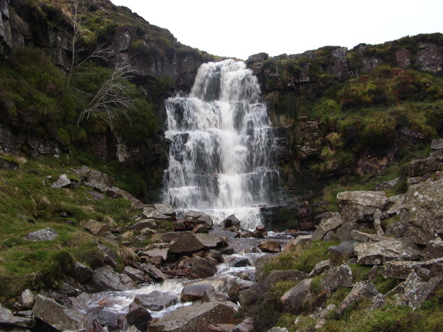
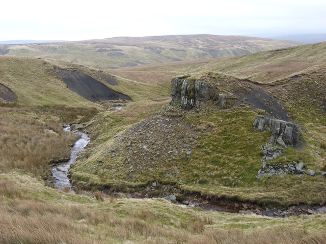

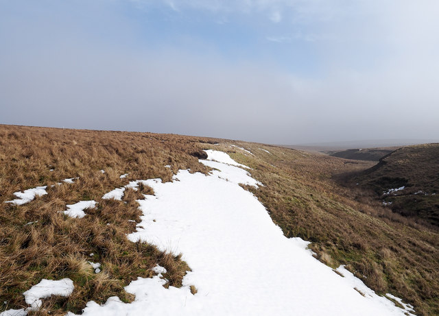
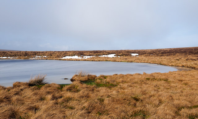
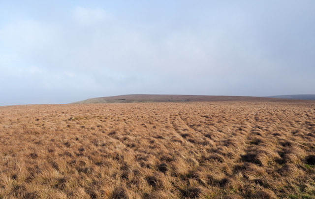
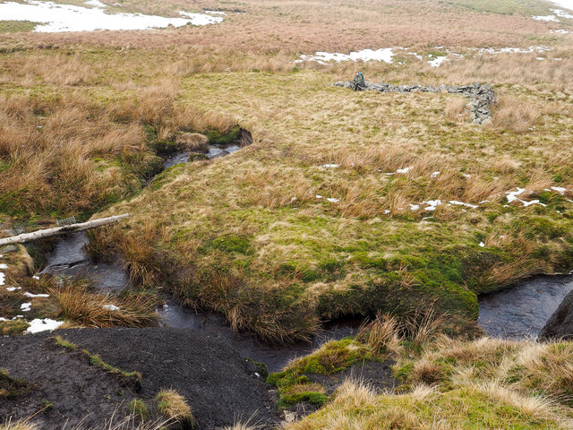


![Kaber Fell, Cumbria Looking west, towards Nine Standards [which are not visible at this resolution]. The stream is Potter Sike.](https://s0.geograph.org.uk/photos/00/74/007428_83ffa334.jpg)