Shepherd Clough

Valley in Lancashire Rossendale

England

Shepherd Clough

Weir and District War Memorial On Deerplay Hill
Weir and District War Memorial Credit: Kevin Waterhouse

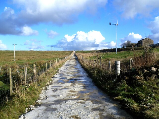
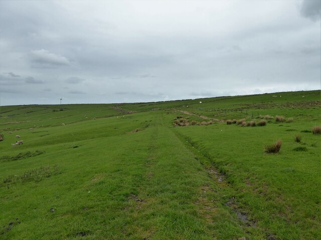
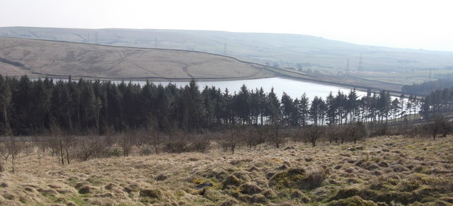
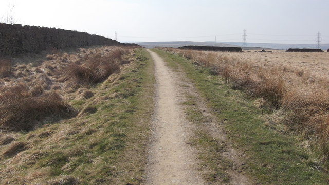
Shepherd Clough is a picturesque valley located in the county of Lancashire, England. Nestled within the stunning Pennines, this tranquil valley is a haven for nature lovers and outdoor enthusiasts. The valley is named after the Shepherd Clough stream that gracefully flows through it, adding to its serene ambiance.

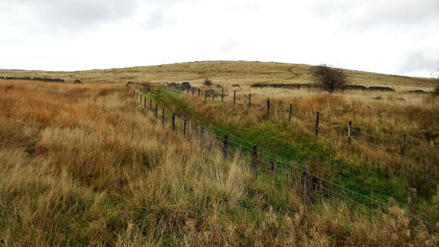
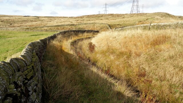
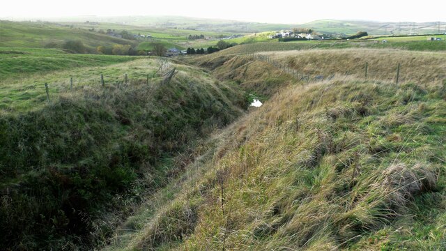
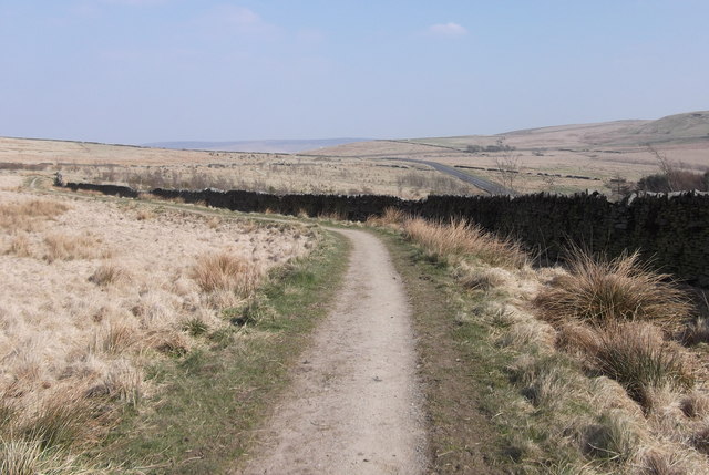
The landscape of Shepherd Clough is a sight to behold, with rolling hills and lush green meadows stretching as far as the eye can see. The valley is home to a diverse range of flora and fauna, making it an ideal destination for birdwatching and wildlife spotting. Visitors can expect to see a variety of species, including kestrels, curlews, and hares, as they explore the valley's numerous walking trails.

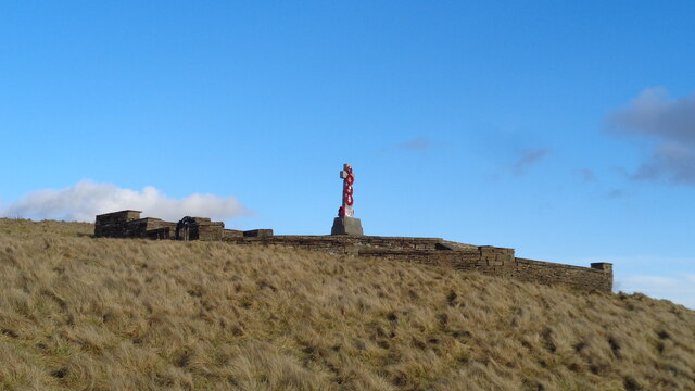
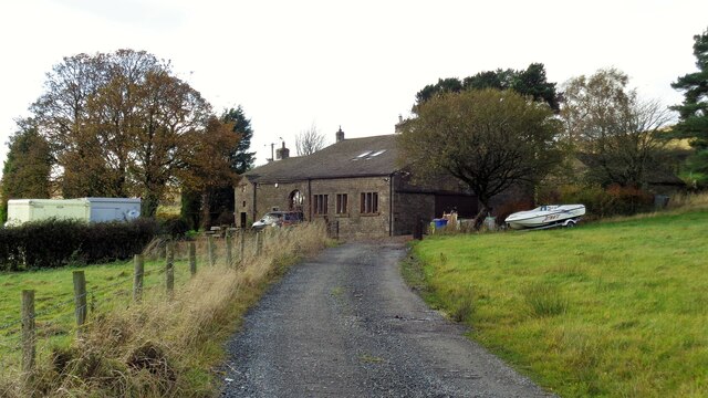
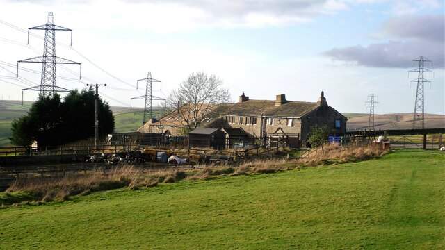
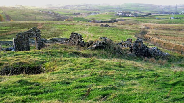
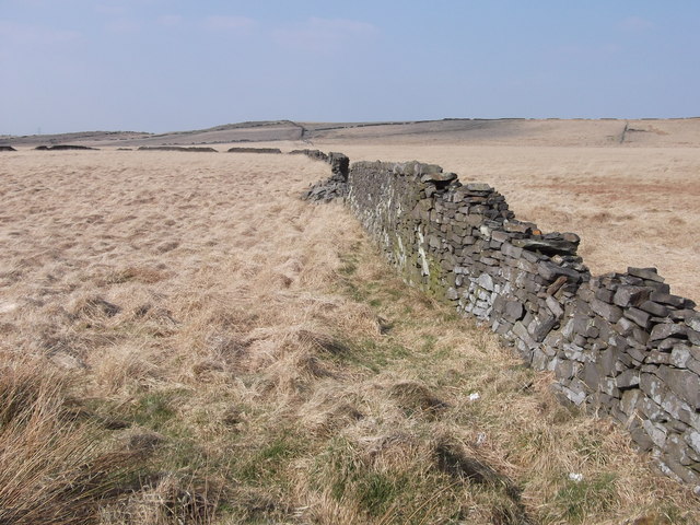
In addition to its natural beauty, Shepherd Clough is also steeped in history. The remnants of old stone buildings and walls serve as reminders of its agricultural past, with farming having been a crucial part of the valley's economy for centuries. Today, Shepherd Clough continues to be home to a small farming community, contributing to the preservation of its rural character.

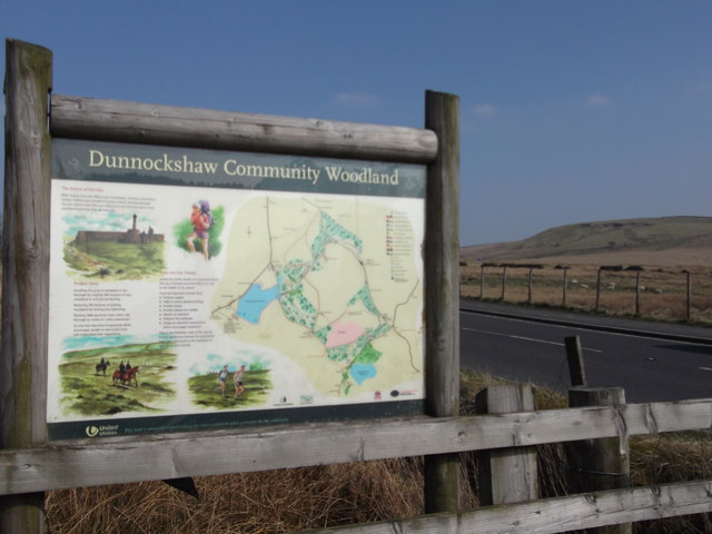
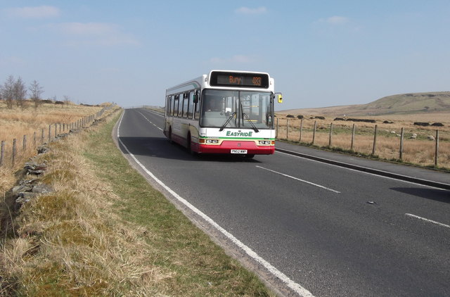
For those seeking outdoor adventures, the valley offers a range of activities such as hiking, cycling, and horseback riding. The well-maintained trails provide breathtaking views of the surrounding countryside, making them popular with both locals and tourists alike.

With its idyllic setting and rich natural heritage, Shepherd Clough is a hidden gem that offers visitors a chance to escape the hustle and bustle of city life and immerse themselves in the beauty of Lancashire's countryside.

If you have any feedback on the listing, please let us know in the comments section below.

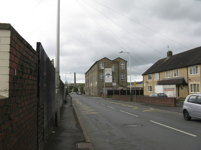
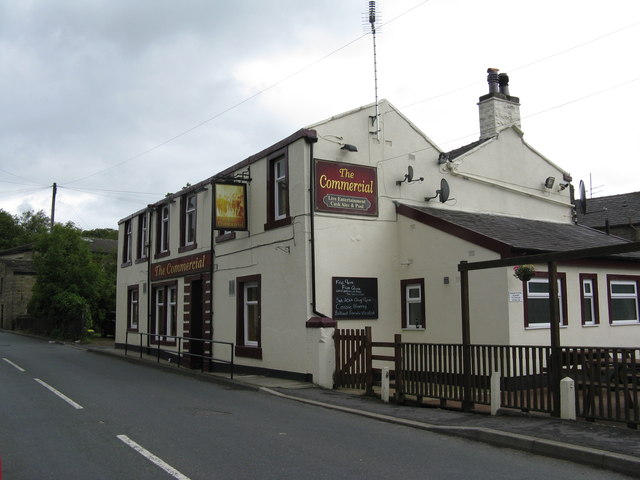
Shepherd Clough Images

Images are sourced within 2km of 53.727723/-2.2336754 or Grid Reference SD8425. Thanks to Geograph Open Source API. All images are credited.

Weir and District War Memorial On Deerplay Hill
Weir and District War Memorial
On Deerplay Hill
Farmer's Track to White Hill This track links the hill and Burnley Road (B6238) and is used by the Pennine Bridleway for part of the route
Farmer's Track to White Hill
This track links the hill and Burnley Road (B6238) and is used by the Pennine Bridleway for part of the route
Reservoir Catchwater For Clough Bottom Reservoir
Reservoir Catchwater
For Clough Bottom Reservoir
Approaching Swallow Shore
Harrow Stiles Lane Used by Rossendale Way. At this point by Sod Hey Farm the farm track surface appears to have been laid using a very wet cement mix with little aggregate
Harrow Stiles Lane
Used by Rossendale Way. At this point by Sod Hey Farm the farm track surface appears to have been laid using a very wet cement mix with little aggregate
Approaching Clifton On the Rossendale Way
Approaching Clifton
On the Rossendale Way
A side clough of Shepherd Clough An unnamed clough south of Clifton and on a path that has been a public right of way but seems to have been extinguished as such around Clifton. There is a stile into the clough coming from the south but no proper facility out to approach Clifton
A side clough of Shepherd Clough
An unnamed clough south of Clifton and on a path that has been a public right of way but seems to have been extinguished as such around Clifton. There is a stile into the clough coming from the south but no proper facility out to approach Clifton
Remains of Dean Head There are two distinct ruins at Dean Head and this is the building to the north
Remains of Dean Head
There are two distinct ruins at Dean Head and this is the building to the north
Track on the hillside above Middle Brex Farm The track continues past the wind turbine on the horizon to Far and Middle Bank End
Track on the hillside above Middle Brex Farm
The track continues past the wind turbine on the horizon to Far and Middle Bank End
Clough Bottom Reservoir, Lancashire
Dunnockshaw Community Woodland, Rossendale, Lancashire
Dunnockshaw Community Woodland, Rossendale, Lancashire Provisional Met Office rainfall figures for March indicate that the month is likely to be one of the driest on record, even with rain falling over recent days.

The UK average rainfall total from 1 to 29 March was 39.1 mm - 41% of the long-term average for the whole of the month which is 95.9 mm.

This provisional figure makes it the driest March since 1953 when 41.6 mm of rain was recorded. However, this month's figure will increase following the rain which has fallen over the last few days.

England and Wales were particularly dry, with provisional figures suggesting the month could be amongst the driest in the past 100 years.

Met Office
Dunnockshaw Community Woodland, Rossendale, Lancashire
Provisional Met Office rainfall figures for March indicate that the month is likely to be one of the driest on record, even with rain falling over recent days. The UK average rainfall total from 1 to 29 March was 39.1 mm - 41% of the long-term average for the whole of the month which is 95.9 mm. This provisional figure makes it the driest March since 1953 when 41.6 mm of rain was recorded. However, this month's figure will increase following the rain which has fallen over the last few days. England and Wales were particularly dry, with provisional figures suggesting the month could be amongst the driest in the past 100 years. Met Office
Dunnockshaw Community Woodland, Rossendale, Lancashire Most of the tree planting is to the left of the dry stone wall
Dunnockshaw Community Woodland, Rossendale, Lancashire
Most of the tree planting is to the left of the dry stone wall
Dry Stone Walls
Dry Stone Walls
"Easyride" 483 Bury Bus, B6238 Burnley Road East, Water, Lancashire
Burnley Road East, Water, Lancashire
Water, Lancashire:  Burnley Road East, looking south This is part of the B6238
Water, Lancashire: Burnley Road East, looking south
This is part of the B6238
Water, Lancashire:  The 'Commercial' Thankfully there are still a few real pubs remaining in Lancashire.
Water, Lancashire: The 'Commercial'
Thankfully there are still a few real pubs remaining in Lancashire.
Show me another place!

Shepherd Clough is located at Grid Ref: SD8425 (Lat: 53.727723, Lng: -2.2336754)

Administrative County: Lancashire

District: Rossendale

Police Authority: Lancashire

What 3 Words

///woodstove.fountain.knocking. Near Bacup, Lancashire

Related Wikis

Water, Lancashire

Water is a hamlet in the borough of Rossendale, in Lancashire, England. Located north of the village of Lumb. It is mostly made of a few homes, farms,...

Lumb, Rawtenstall

Lumb is a small village in the Rossendale district of Lancashire, England. It lies in the valley of the Whitewell Brook, 3 miles (5 km) north east of Rawtenstall...

Whitewell Brook

Whitewell Brook is a minor river in Lancashire, England. It is 4.34 miles (6.99 km) long and has a catchment area of 7.67 square miles (19.86 km2).The...

Rossendale (UK Parliament constituency)

Rossendale was a parliamentary constituency in the Lancashire, England. Created in 1885, it elected one Member of Parliament (MP) to the House of Commons...

Nearby Amenities

Located within 500m of 53.727723,-2.2336754
Dean
Place: hamlet
Source: npe
Lat/Long: 53.7276057/-2.2281393
Design: barrel
Power: tower
Lat/Long: 53.7313117/-2.2296161
Design: barrel
Power: tower
Lat/Long: 53.7317664/-2.2345666
Bus Stop
Water, Dean Lane
Bench: yes
Bus: yes
Departures Board: timetable
Naptan AtcoCode: 25001425
Naptan NaptanCode: lanampag
Public Transport: platform
Shelter: yes
Lat/Long: 53.7285121/-2.2411186
Cafe
The Water Trough
Addr City: Rossendale
Addr Housenumber: 1095
Addr Postcode: BB4 9QR
Addr Street: Burnley Road East
Cuisine: coffee_shop;breakfast;wine;brunch;lunch
Opening Hours: Tu-Th 08:30-16:30; Fr-Sa 09:00-22:00; Su 09:00-14:30
Outdoor Seating: no
Phone: +44 1706 231533
Website: https://www.watertrough.co.uk
Lat/Long: 53.7282723/-2.2411902
Addr City: Rossendale
Addr Postcode: BB4 9RA
Addr Suburb: Water
Lat/Long: 53.729127/-2.2381816
Barrier: stile
Lat/Long: 53.7238539/-2.2361109
Generator Method: wind_turbine
Generator Output Electricity: yes
Generator Source: wind
Power: generator
Lat/Long: 53.7252473/-2.2353976
Barrier: stile
Lat/Long: 53.7248406/-2.2365983
Barrier: stile
Lat/Long: 53.723994/-2.2349998
Barrier: stile
Lat/Long: 53.7240236/-2.2349001
Ford: yes
Lat/Long: 53.7246702/-2.231818
The data included in this document is from www.openstreetmap.org. The data is made available under ODbL.

Have you been to Shepherd Clough?

Leave your review of Shepherd Clough below (or comments, questions and feedback).