Forest of Rossendale

Downs, Moorland in Lancashire Rossendale

England

Forest of Rossendale

Farmer's Track to White Hill This track links the hill and Burnley Road (B6238) and is used by the Pennine Bridleway for part of the route
Farmer's Track to White Hill Credit: Kevin Waterhouse

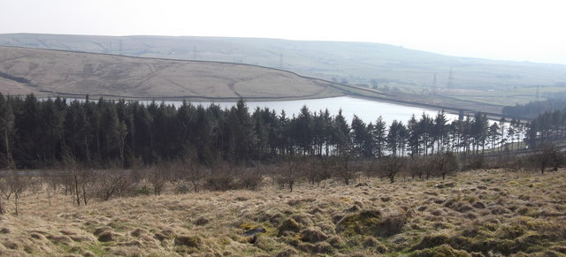
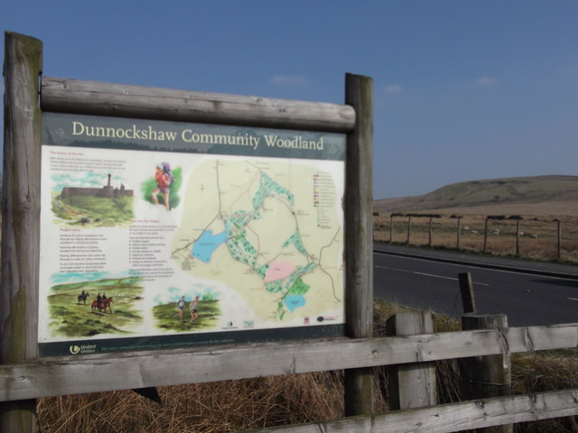
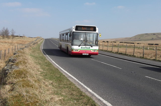
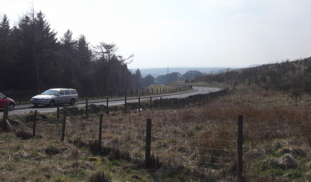
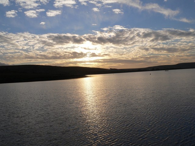
The Forest of Rossendale is a picturesque area located in the county of Lancashire, England. Spanning over 80 square miles, it is characterized by its diverse landscapes, including downs and moorland. The forest is situated in the Rossendale Valley, which is surrounded by the Pennine Hills, providing a stunning backdrop for outdoor enthusiasts.

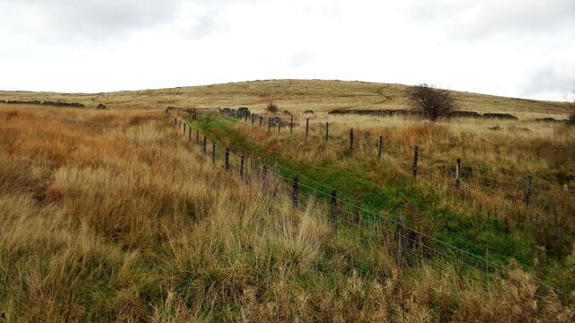
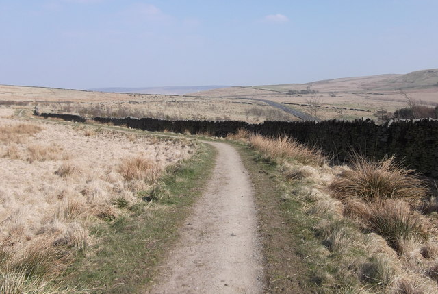
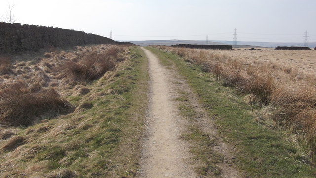
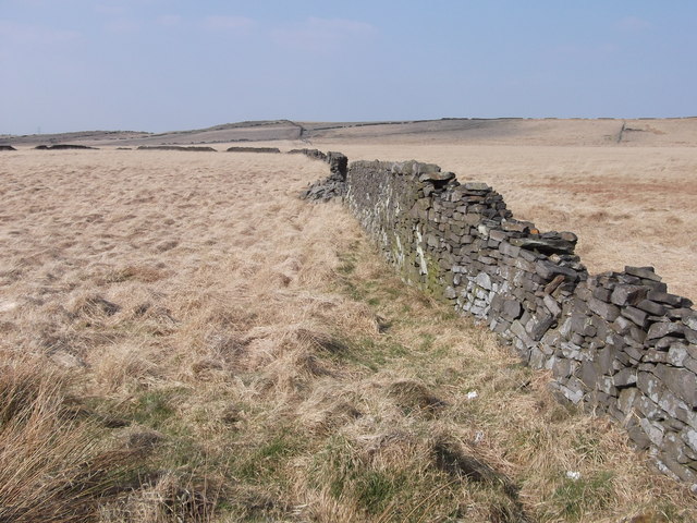
The downs of the Forest of Rossendale offer rolling hills with lush greenery and open spaces, perfect for walking, picnicking, or simply enjoying the panoramic views. The area is home to a variety of wildlife, including deer, rabbits, and a wide range of bird species, making it a popular spot for nature lovers.

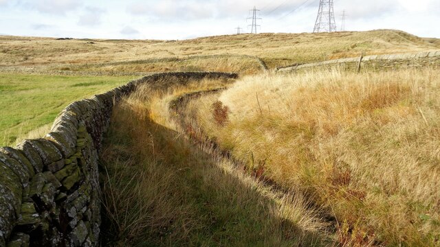
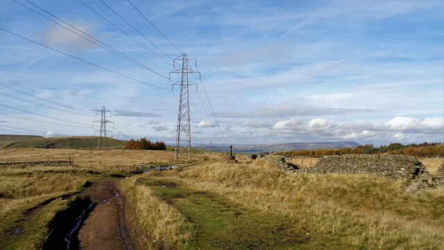
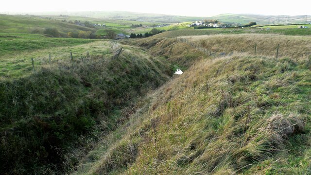
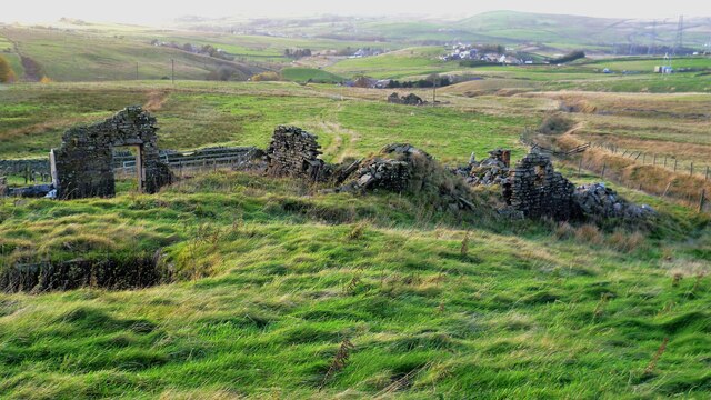
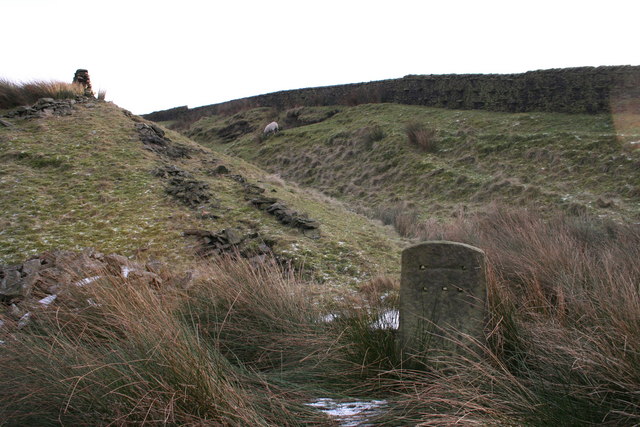
The moorland, on the other hand, presents a more rugged and wild terrain. Covered in heather and bracken, it provides a unique habitat for rare plant species and is a haven for birdwatchers. The moorland also offers numerous walking trails, allowing visitors to explore its vast expanse and discover hidden gems such as waterfalls and ancient ruins.

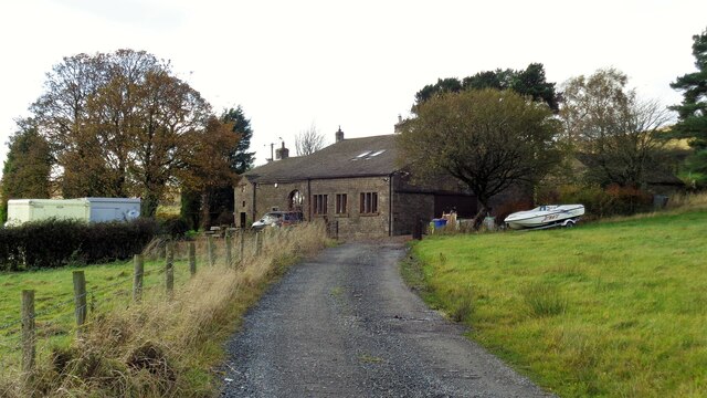
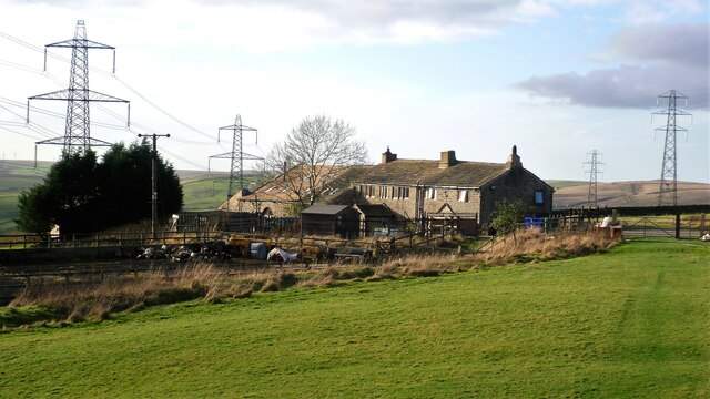
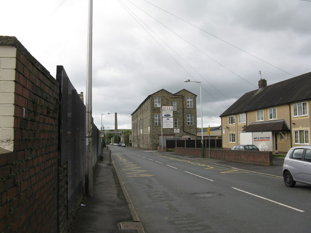
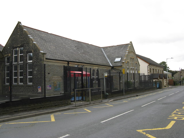
In addition to its natural beauty, the Forest of Rossendale boasts a rich history. It was once a thriving center of the textile industry during the Industrial Revolution, and remnants of its industrial past can still be seen today, with old mills and chimneys scattered throughout the landscape.

Overall, the Forest of Rossendale is a haven for those seeking tranquility and natural beauty. With its diverse landscapes, abundant wildlife, and historical significance, it is a place that caters to the interests of both nature enthusiasts and history buffs alike.

If you have any feedback on the listing, please let us know in the comments section below.

Forest of Rossendale Images

Images are sourced within 2km of 53.727851/-2.2414211 or Grid Reference SD8425. Thanks to Geograph Open Source API. All images are credited.

Farmer's Track to White Hill This track links the hill and Burnley Road (B6238) and is used by the Pennine Bridleway for part of the route
Farmer's Track to White Hill
This track links the hill and Burnley Road (B6238) and is used by the Pennine Bridleway for part of the route
Reservoir Catchwater For Clough Bottom Reservoir
Reservoir Catchwater
For Clough Bottom Reservoir
Approaching Swallow Shore
Approaching Compston's Cross On the Rossendale Way and the White Hill Circular Walk. The cross was erected in 1902 and may partly replace the two lost wayside crosses in this area
Approaching Compston's Cross
On the Rossendale Way and the White Hill Circular Walk. The cross was erected in 1902 and may partly replace the two lost wayside crosses in this area
Approaching Clifton On the Rossendale Way
Approaching Clifton
On the Rossendale Way
A side clough of Shepherd Clough An unnamed clough south of Clifton and on a path that has been a public right of way but seems to have been extinguished as such around Clifton. There is a stile into the clough coming from the south but no proper facility out to approach Clifton
A side clough of Shepherd Clough
An unnamed clough south of Clifton and on a path that has been a public right of way but seems to have been extinguished as such around Clifton. There is a stile into the clough coming from the south but no proper facility out to approach Clifton
Remains of Dean Head There are two distinct ruins at Dean Head and this is the building to the north
Remains of Dean Head
There are two distinct ruins at Dean Head and this is the building to the north
Clough Bottom Reservoir, Lancashire
Dunnockshaw Community Woodland, Rossendale, Lancashire
Dunnockshaw Community Woodland, Rossendale, Lancashire Provisional Met Office rainfall figures for March indicate that the month is likely to be one of the driest on record, even with rain falling over recent days.

The UK average rainfall total from 1 to 29 March was 39.1 mm - 41% of the long-term average for the whole of the month which is 95.9 mm.

This provisional figure makes it the driest March since 1953 when 41.6 mm of rain was recorded. However, this month's figure will increase following the rain which has fallen over the last few days.

England and Wales were particularly dry, with provisional figures suggesting the month could be amongst the driest in the past 100 years.

Met Office
Dunnockshaw Community Woodland, Rossendale, Lancashire
Provisional Met Office rainfall figures for March indicate that the month is likely to be one of the driest on record, even with rain falling over recent days. The UK average rainfall total from 1 to 29 March was 39.1 mm - 41% of the long-term average for the whole of the month which is 95.9 mm. This provisional figure makes it the driest March since 1953 when 41.6 mm of rain was recorded. However, this month's figure will increase following the rain which has fallen over the last few days. England and Wales were particularly dry, with provisional figures suggesting the month could be amongst the driest in the past 100 years. Met Office
Dunnockshaw Community Woodland, Rossendale, Lancashire Most of the tree planting is to the left of the dry stone wall
Dunnockshaw Community Woodland, Rossendale, Lancashire
Most of the tree planting is to the left of the dry stone wall
Dry Stone Walls
Dry Stone Walls
"Easyride" 483 Bury Bus, B6238 Burnley Road East, Water, Lancashire
Burnley Road East, Water, Lancashire
Water, Lancashire:  Burnley Road East, looking south This is part of the B6238
Water, Lancashire: Burnley Road East, looking south
This is part of the B6238
Water, Lancashire:  The 'Commercial' Thankfully there are still a few real pubs remaining in Lancashire.
Water, Lancashire: The 'Commercial'
Thankfully there are still a few real pubs remaining in Lancashire.
Water, Lancashire:  Water Board School
Water, Lancashire: Water Board School
Water, Lancashire:  Burnley Road East, looking north Part of the B6238. The 'Commercial' is on the right.
Water, Lancashire: Burnley Road East, looking north
Part of the B6238. The 'Commercial' is on the right.
Show me another place!

Forest of Rossendale is located at Grid Ref: SD8425 (Lat: 53.727851, Lng: -2.2414211)

Administrative County: Lancashire

District: Rossendale

Police Authority: Lancashire

What 3 Words

///bearable.jumbled.revolting. Near Bacup, Lancashire

Related Wikis

Water, Lancashire

Water is a hamlet in the borough of Rossendale, in Lancashire, England. Located north of the village of Lumb. It is mostly made of a few homes, farms,...

Lumb, Rawtenstall

Lumb is a small village in the Rossendale district of Lancashire, England. It lies in the valley of the Whitewell Brook, 3 miles (5 km) north east of Rawtenstall...

Whitewell Brook

Whitewell Brook is a minor river in Lancashire, England. It is 4.34 miles (6.99 km) long and has a catchment area of 7.67 square miles (19.86 km2).The...

Rossendale (UK Parliament constituency)

Rossendale was a parliamentary constituency in the Lancashire, England. Created in 1885, it elected one Member of Parliament (MP) to the House of Commons...

Rossendale and Darwen (UK Parliament constituency)

Rossendale and Darwen is a constituency in Lancashire represented in the House of Commons of the UK Parliament since 2010 by Jake Berry, the former Chairman...

Gambleside

Gambleside is an abandoned village located in northern Rossendale close to the boundary with Burnley's Dunnockshaw parish. In the late Middle Ages Gambleside...

Crawshawbooth

Crawshawbooth is a small village located on the edge of the Pennines in England, just north of the market town of Rawtenstall, Lancashire, and south of...

Dunnockshaw

Dunnockshaw or Dunnockshaw and Clowbridge is a civil parish in the borough of Burnley, in Lancashire, England. The parish is situated between Burnley and...

Nearby Amenities

Located within 500m of 53.727851,-2.2414211
Forest Holme
Place: hamlet
Source: npe
Lat/Long: 53.7238886/-2.2438552
Water
Place: village
Source: npe
Lat/Long: 53.7271926/-2.2413303
Bus Stop
Water, Dean Lane
Bench: yes
Bus: yes
Departures Board: timetable
Naptan AtcoCode: 25001425
Naptan NaptanCode: lanampag
Public Transport: platform
Shelter: yes
Lat/Long: 53.7285121/-2.2411186
Cafe
The Water Trough
Addr City: Rossendale
Addr Housenumber: 1095
Addr Postcode: BB4 9QR
Addr Street: Burnley Road East
Cuisine: coffee_shop;breakfast;wine;brunch;lunch
Opening Hours: Tu-Th 08:30-16:30; Fr-Sa 09:00-22:00; Su 09:00-14:30
Outdoor Seating: no
Phone: +44 1706 231533
Website: https://www.watertrough.co.uk
Lat/Long: 53.7282723/-2.2411902
Pub
The Commercial
Lat/Long: 53.7278961/-2.2414413
Addr City: Rossendale
Addr Postcode: BB4 9RA
Addr Suburb: Water
Lat/Long: 53.729127/-2.2381816
Turning Circle
Lat/Long: 53.7238934/-2.2439101
Barrier: swing_gate
Lat/Long: 53.7267818/-2.2479416
Generator Method: wind_turbine
Generator Output Electricity: yes
Generator Source: wind
Power: generator
Lat/Long: 53.7252473/-2.2353976
Barrier: stile
Lat/Long: 53.7248406/-2.2365983
Bus Stop
Water, Dean Lane
Bench: no
Bus: yes
Departures Board: timetable
Public Transport: platform
Shelter: no
Lat/Long: 53.7285378/-2.2412643
The data included in this document is from www.openstreetmap.org. The data is made available under ODbL.

Have you been to Forest of Rossendale?

Leave your review of Forest of Rossendale below (or comments, questions and feedback).