Nabb Clough

Valley in Lancashire Rossendale

England

Nabb Clough

Old Boundary Marker on Bacup Old Road Municipal Boundary Marker on the east side of Bacup Old Road, southeast of its junction with the A671 Burnley Road. On the boundary of Cliviger parish and the former Newchurch parish. One of a series marking the boundary of Bacup Borough.

Milestone Society National ID: LA_BACCLI02pb
Old Boundary Marker on Bacup Old Road Credit: C Chatham

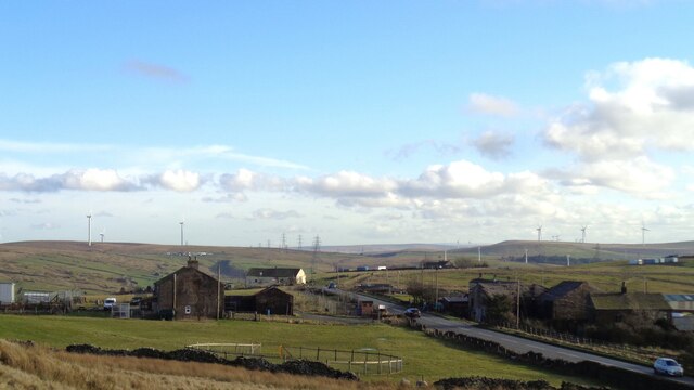
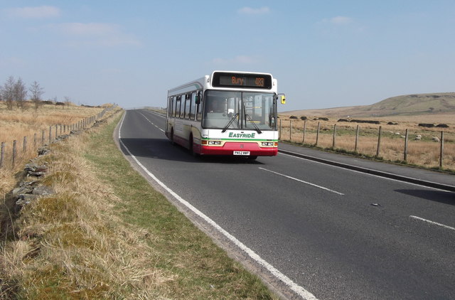
Nabb Clough is a picturesque valley located in the county of Lancashire, England. Nestled within the rolling hills of the Pennines, it is renowned for its stunning natural beauty and tranquil atmosphere. The valley is situated near the village of Ramsbottom and is part of the larger Rossendale Valley.

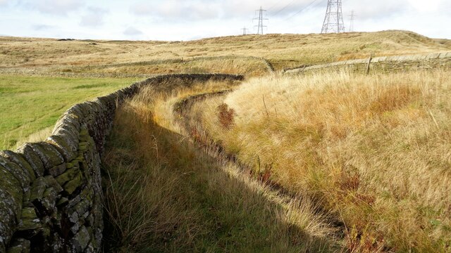
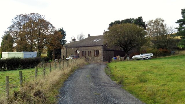
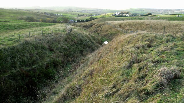
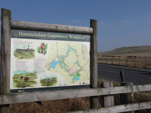
Nabb Clough is characterized by its lush green landscapes, dotted with charming stone cottages and meandering streams. The valley is surrounded by dense woodlands, creating a haven for wildlife and providing ample opportunities for outdoor activities such as hiking, birdwatching, and photography.

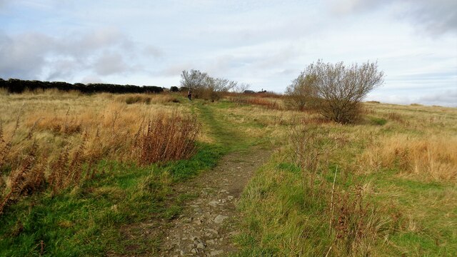
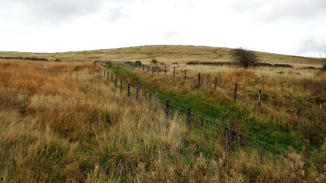
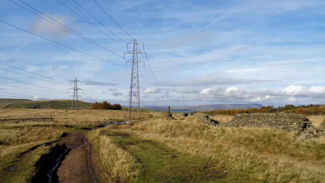
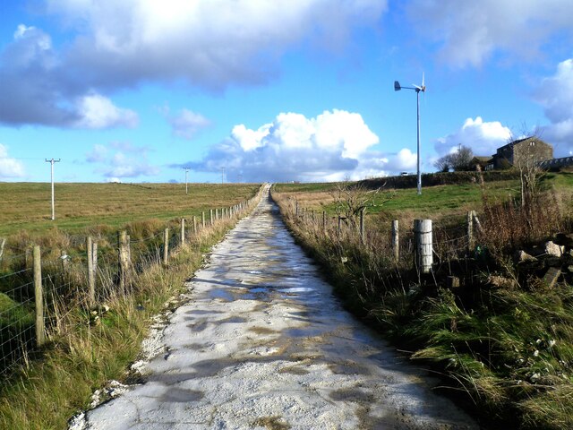
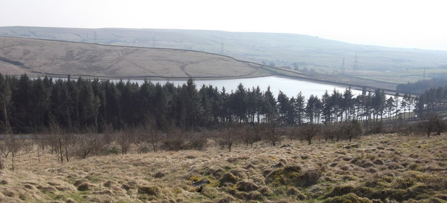
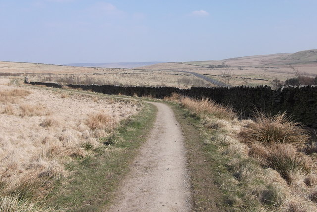
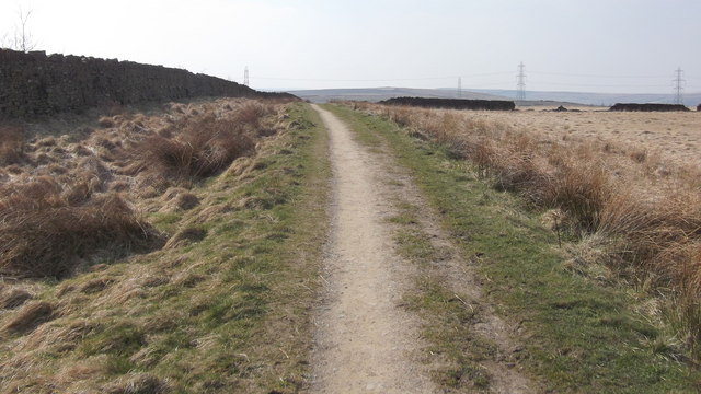
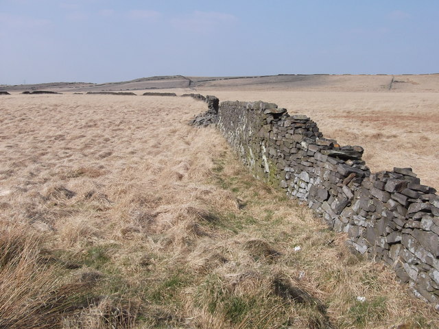
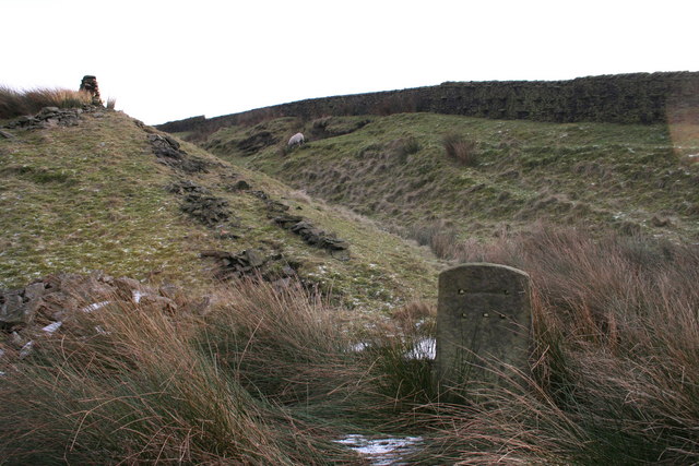
The main attraction of Nabb Clough is its picturesque walking trails, which offer breathtaking views of the surrounding countryside. The most popular route takes visitors along the clough (a local term for a steep-sided valley) and leads to the stunning Nabb Clough Reservoir. This serene body of water is a haven for anglers and is surrounded by peaceful picnic spots, perfect for a day out with family and friends.

Nabb Clough is also home to a variety of flora and fauna, including wildflowers, mosses, and ferns. The valley's rich biodiversity attracts nature enthusiasts from far and wide, who come to observe and appreciate the local wildlife.

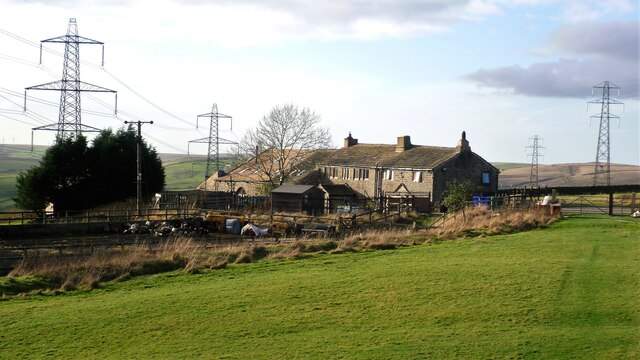
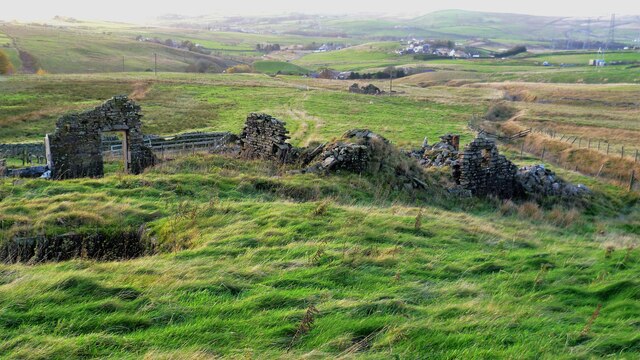
In addition to its natural beauty, Nabb Clough boasts a rich historical heritage. The valley was once a significant center for the textile industry, with many old mills and remnants of the industrial past still visible. These remnants serve as a reminder of Lancashire's industrial heritage and contribute to the unique character of the area.

Overall, Nabb Clough is a hidden gem in Lancashire, offering visitors a chance to escape the hustle and bustle of modern life and immerse themselves in the beauty of the British countryside.

If you have any feedback on the listing, please let us know in the comments section below.
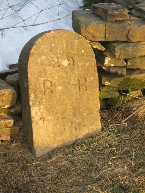
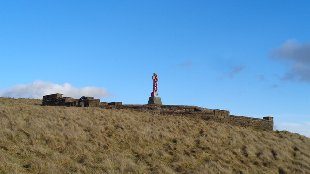
Nabb Clough Images

Images are sourced within 2km of 53.729962/-2.2332331 or Grid Reference SD8425. Thanks to Geograph Open Source API. All images are credited.

Old Boundary Marker on Bacup Old Road Municipal Boundary Marker on the east side of Bacup Old Road, southeast of its junction with the A671 Burnley Road. On the boundary of Cliviger parish and the former Newchurch parish. One of a series marking the boundary of Bacup Borough.

Milestone Society National ID: LA_BACCLI02pb
Old Boundary Marker on Bacup Old Road
Municipal Boundary Marker on the east side of Bacup Old Road, southeast of its junction with the A671 Burnley Road. On the boundary of Cliviger parish and the former Newchurch parish. One of a series marking the boundary of Bacup Borough. Milestone Society National ID: LA_BACCLI02pb
Weir and District War Memorial On Deerplay Hill
Weir and District War Memorial
On Deerplay Hill
Farms on Burnley Road View towards Bacup from Weir War Memorial on Deerplay Hill
Farms on Burnley Road
View towards Bacup from Weir War Memorial on Deerplay Hill
White Hill Circular Walk Part of the marked path near Crown Point Road which meanders such that short cuts have been made. The gravel path which is not being used is becoming overgrown and the short cuts a source of surface erosion.
White Hill Circular Walk
Part of the marked path near Crown Point Road which meanders such that short cuts have been made. The gravel path which is not being used is becoming overgrown and the short cuts a source of surface erosion.
Farmer's Track to White Hill This track links the hill and Burnley Road (B6238) and is used by the Pennine Bridleway for part of the route
Farmer's Track to White Hill
This track links the hill and Burnley Road (B6238) and is used by the Pennine Bridleway for part of the route
Reservoir Catchwater For Clough Bottom Reservoir
Reservoir Catchwater
For Clough Bottom Reservoir
Approaching Swallow Shore
Approaching Compston's Cross On the Rossendale Way and the White Hill Circular Walk. The cross was erected in 1902 and may partly replace the two lost wayside crosses in this area
Approaching Compston's Cross
On the Rossendale Way and the White Hill Circular Walk. The cross was erected in 1902 and may partly replace the two lost wayside crosses in this area
Harrow Stiles Lane Used by Rossendale Way. At this point by Sod Hey Farm the farm track surface appears to have been laid using a very wet cement mix with little aggregate
Harrow Stiles Lane
Used by Rossendale Way. At this point by Sod Hey Farm the farm track surface appears to have been laid using a very wet cement mix with little aggregate
Approaching Clifton On the Rossendale Way
Approaching Clifton
On the Rossendale Way
A side clough of Shepherd Clough An unnamed clough south of Clifton and on a path that has been a public right of way but seems to have been extinguished as such around Clifton. There is a stile into the clough coming from the south but no proper facility out to approach Clifton
A side clough of Shepherd Clough
An unnamed clough south of Clifton and on a path that has been a public right of way but seems to have been extinguished as such around Clifton. There is a stile into the clough coming from the south but no proper facility out to approach Clifton
Remains of Dean Head There are two distinct ruins at Dean Head and this is the building to the north
Remains of Dean Head
There are two distinct ruins at Dean Head and this is the building to the north
Clough Bottom Reservoir, Lancashire
Dunnockshaw Community Woodland, Rossendale, Lancashire
Dunnockshaw Community Woodland, Rossendale, Lancashire Provisional Met Office rainfall figures for March indicate that the month is likely to be one of the driest on record, even with rain falling over recent days.

The UK average rainfall total from 1 to 29 March was 39.1 mm - 41% of the long-term average for the whole of the month which is 95.9 mm.

This provisional figure makes it the driest March since 1953 when 41.6 mm of rain was recorded. However, this month's figure will increase following the rain which has fallen over the last few days.

England and Wales were particularly dry, with provisional figures suggesting the month could be amongst the driest in the past 100 years.

Met Office
Dunnockshaw Community Woodland, Rossendale, Lancashire
Provisional Met Office rainfall figures for March indicate that the month is likely to be one of the driest on record, even with rain falling over recent days. The UK average rainfall total from 1 to 29 March was 39.1 mm - 41% of the long-term average for the whole of the month which is 95.9 mm. This provisional figure makes it the driest March since 1953 when 41.6 mm of rain was recorded. However, this month's figure will increase following the rain which has fallen over the last few days. England and Wales were particularly dry, with provisional figures suggesting the month could be amongst the driest in the past 100 years. Met Office
Dunnockshaw Community Woodland, Rossendale, Lancashire Most of the tree planting is to the left of the dry stone wall
Dunnockshaw Community Woodland, Rossendale, Lancashire
Most of the tree planting is to the left of the dry stone wall
Dry Stone Walls
Dry Stone Walls
"Easyride" 483 Bury Bus, B6238 Burnley Road East, Water, Lancashire
Show me another place!

Nabb Clough is located at Grid Ref: SD8425 (Lat: 53.729962, Lng: -2.2332331)

Administrative County: Lancashire

District: Rossendale

Police Authority: Lancashire

What 3 Words

///adjusted.engulfing.into. Near Bacup, Lancashire

Related Wikis

Water, Lancashire

Water is a hamlet in the borough of Rossendale, in Lancashire, England. Located north of the village of Lumb. It is mostly made of a few homes, farms,...

Lumb, Rawtenstall

Lumb is a small village in the Rossendale district of Lancashire, England. It lies in the valley of the Whitewell Brook, 3 miles (5 km) north east of Rawtenstall...

Whitewell Brook

Whitewell Brook is a minor river in Lancashire, England. It is 4.34 miles (6.99 km) long and has a catchment area of 7.67 square miles (19.86 km2).The...

Gambleside

Gambleside is an abandoned village located in northern Rossendale close to the boundary with Burnley's Dunnockshaw parish. In the late Middle Ages Gambleside...

Nearby Amenities

Located within 500m of 53.729962,-2.2332331
Dean
Place: hamlet
Source: npe
Lat/Long: 53.7276057/-2.2281393
Design: barrel
Power: tower
Lat/Long: 53.7310388/-2.2266335
Design: barrel
Power: tower
Lat/Long: 53.7313117/-2.2296161
Design: barrel
Power: tower
Lat/Long: 53.7317664/-2.2345666
Addr City: Rossendale
Addr Postcode: BB4 9RA
Addr Suburb: Water
Lat/Long: 53.729127/-2.2381816
Power: tower
Lat/Long: 53.7332091/-2.2342372
Power: tower
Lat/Long: 53.7325998/-2.2289264
The data included in this document is from www.openstreetmap.org. The data is made available under ODbL.

Have you been to Nabb Clough?

Leave your review of Nabb Clough below (or comments, questions and feedback).