Coverdale Clough

Valley in Yorkshire Pendle

England

Coverdale Clough

Frozen puddle on Weets Hill With Pendle in the distance. Location approximate.
Frozen puddle on Weets Hill Credit: Stephen Craven

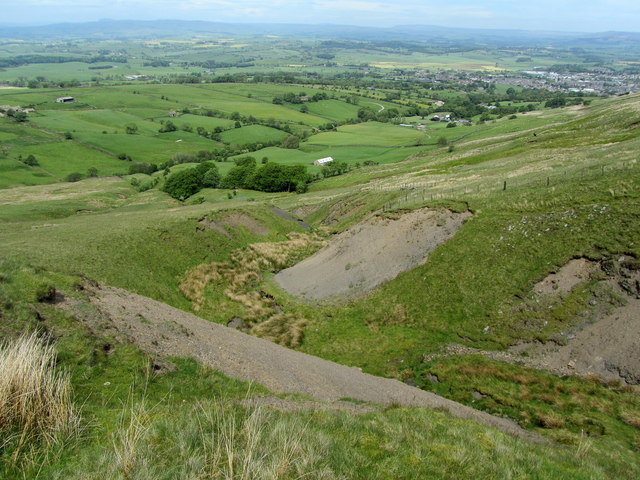
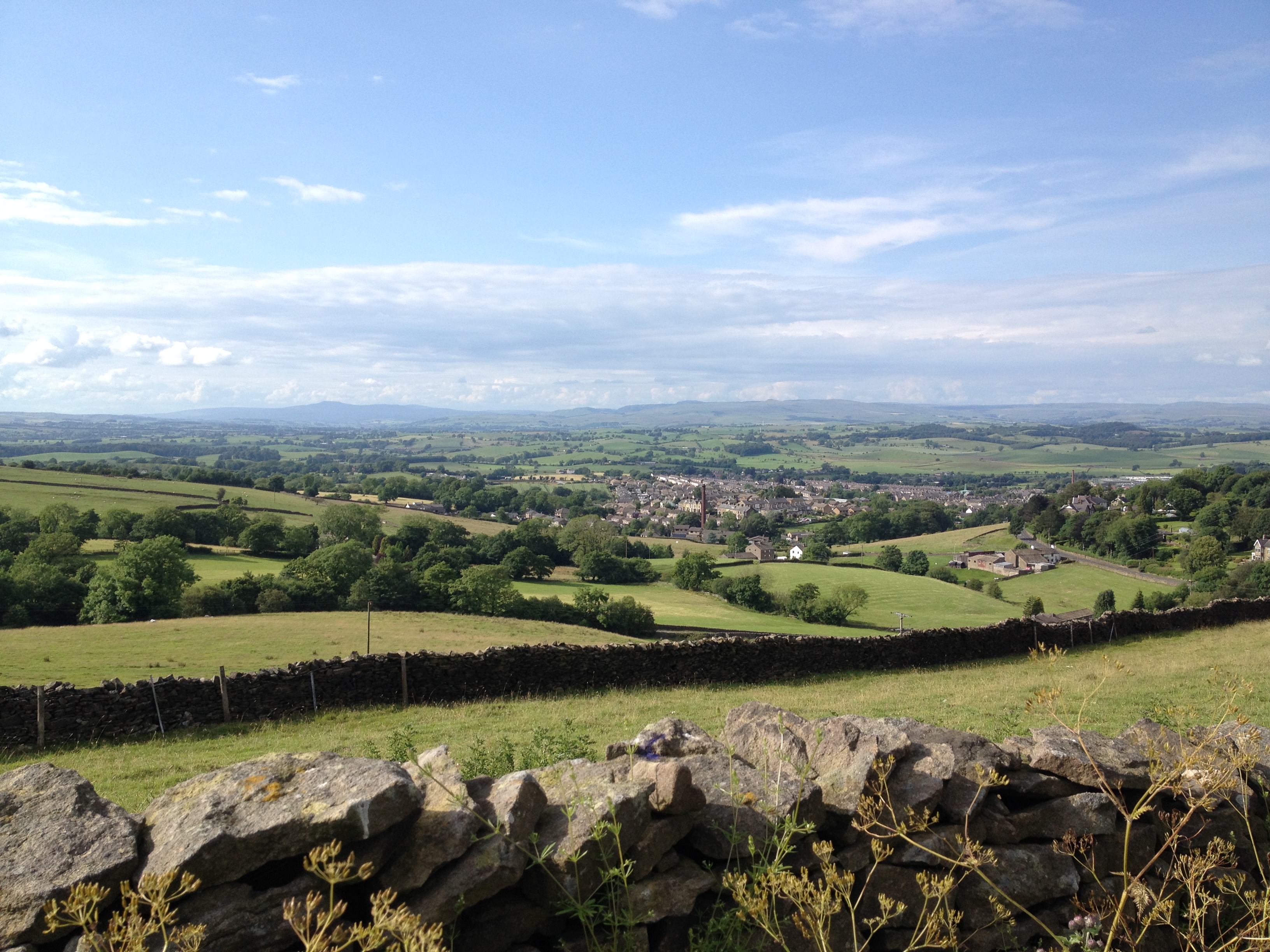
Coverdale Clough is a picturesque valley located in the Yorkshire Dales National Park in Yorkshire, England. Stretching over approximately 10 miles, the valley is characterized by its steep sides, lush greenery, and the meandering Coverdale Beck that flows through it.

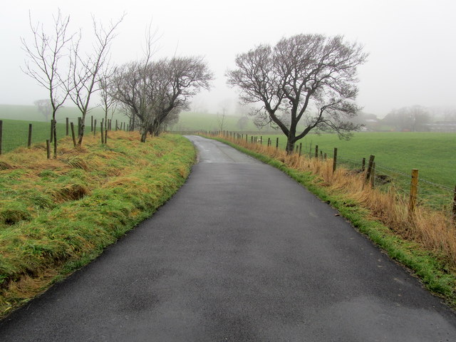
The valley is nestled between the larger and more well-known Wharfedale and Wensleydale valleys, making it a hidden gem for nature enthusiasts and hikers seeking tranquility away from the crowds. It is accessible via narrow country lanes that wind through the surrounding hills and offer breathtaking views of the rolling countryside.

Coverdale Clough is known for its diverse wildlife and rich biodiversity. The valley is home to a variety of bird species, including peregrine falcons, buzzards, and owls, making it a haven for birdwatchers. Additionally, the valley is inhabited by wild mammals such as badgers, foxes, and deer.

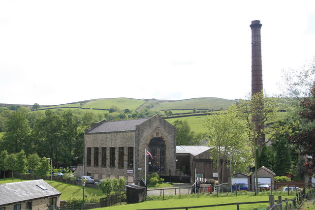
The landscape of Coverdale Clough is predominantly agricultural, with small farms dotting the valley floor and surrounding hills. The fields are often divided by traditional dry stone walls, adding to the charm of the area. The valley also boasts several small hamlets, including the picturesque village of Carlton-in-Coverdale, which offers charming stone cottages and a sense of tranquility.

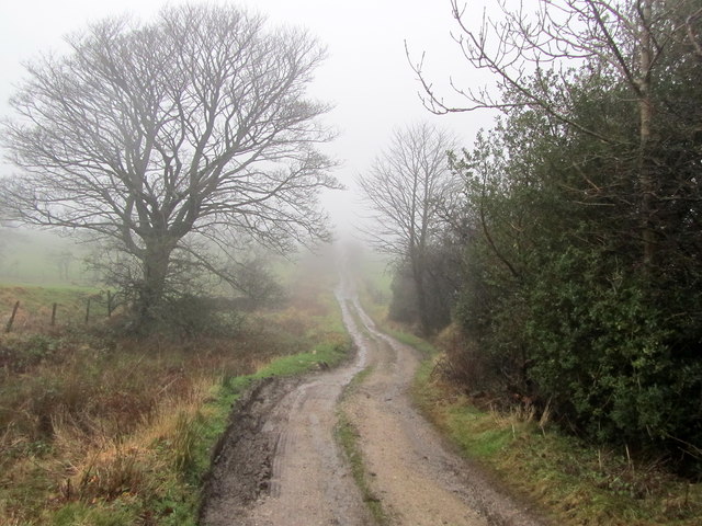
Hikers and nature lovers can explore the numerous footpaths and bridleways that crisscross the valley, providing access to the stunning natural beauty of the Yorkshire Dales. The valley offers a peaceful retreat from the hustle and bustle of daily life, with its unspoiled landscapes and idyllic countryside setting.

If you have any feedback on the listing, please let us know in the comments section below.

Coverdale Clough Images

Images are sourced within 2km of 53.914114/-2.2342744 or Grid Reference SD8446. Thanks to Geograph Open Source API. All images are credited.

Frozen puddle on Weets Hill With Pendle in the distance. Location approximate.
Frozen puddle on Weets Hill
With Pendle in the distance. Location approximate.
Raven on Weets Hill triangulation pillar It could be a crow, but compared with the size of the standard pillar it's a big bird. I'm going with raven, as  they are not unknown in the Pennines. Photographed from a distance to catch it before it inevitably flew off as I approached.
Raven on Weets Hill triangulation pillar
It could be a crow, but compared with the size of the standard pillar it's a big bird. I'm going with raven, as they are not unknown in the Pennines. Photographed from a distance to catch it before it inevitably flew off as I approached.
Weets Hill triangulation pillar The pillar is close to the 397 metre summit of the hill, which is a good vantage point. Pendle is in the background of this view, with (I think) Longridge Fell peeking up out of the valley fog beyond.
Weets Hill triangulation pillar
The pillar is close to the 397 metre summit of the hill, which is a good vantage point. Pendle is in the background of this view, with (I think) Longridge Fell peeking up out of the valley fog beyond.
Weets Hill triangulation pillar - plaque I had to wipe the snow off this plaque to read it. It is on the north side of the base of the pillar <a href="https://www.geograph.org.uk/photo/7361560">SD8544 : Weets Hill triangulation pillar</a> and reads 'In loving memory of Garth Standen 7.11.43 - 21.9.15'.
Weets Hill triangulation pillar - plaque
I had to wipe the snow off this plaque to read it. It is on the north side of the base of the pillar SD8544 : Weets Hill triangulation pillar and reads 'In loving memory of Garth Standen 7.11.43 - 21.9.15'.
A seat above the clouds The bench is just below Weets Hill triangulation pillar. With a temperature inversion filling the valley with cloud, only the tops of the Yorkshire fells could be seen in this direction. <a href="https://www.geograph.org.uk/photo/5217981">SD8544 : A bench with a view</a> shows the view on a clear day.
A seat above the clouds
The bench is just below Weets Hill triangulation pillar. With a temperature inversion filling the valley with cloud, only the tops of the Yorkshire fells could be seen in this direction. SD8544 : A bench with a view shows the view on a clear day.
View north from Weets Hill With a temperature inversion filling the valley with cloud, only the tops of the Yorkshire fells, including Ingleborough and Pen-y-Ghent, could be seen in this direction.
View north from Weets Hill
With a temperature inversion filling the valley with cloud, only the tops of the Yorkshire fells, including Ingleborough and Pen-y-Ghent, could be seen in this direction.
Rayk at Weets Hill trig. point
Gully on the Flanks of Weet Hill Above a deep gully on the northern flanks of Weets Hill
Gully on the Flanks of Weet Hill
Above a deep gully on the northern flanks of Weets Hill
On the Footpath between Brogden Hall and Barlick Barlick is what the locals refer to the town of Barnoldswick.
The photograph shows part of a little used footpath running from Brogden Hall, crossing squelchy fields before entering the western part of the town.
On the Footpath between Brogden Hall and Barlick
Barlick is what the locals refer to the town of Barnoldswick. The photograph shows part of a little used footpath running from Brogden Hall, crossing squelchy fields before entering the western part of the town.
Brogden Lane beside Kirk Clough Part of the narrow lane that runs from the north end of Barnoldswick to the A682 Gisburn/Nelson Road
Brogden Lane beside Kirk Clough
Part of the narrow lane that runs from the north end of Barnoldswick to the A682 Gisburn/Nelson Road
Driveway to Brogden Hall Access to Brogden Hall Farm from Brogden Lane
Driveway to Brogden Hall
Access to Brogden Hall Farm from Brogden Lane
On Brogden Lane The lane on a misty winters day as it descends toward Brogden Hall en route to Barnoldswick
On Brogden Lane
The lane on a misty winters day as it descends toward Brogden Hall en route to Barnoldswick
Flass House Farm in the Mist Brogden Lane passing Flass House Farm on a miserable misty winters day
Flass House Farm in the Mist
Brogden Lane passing Flass House Farm on a miserable misty winters day
Coal Pit Lane Unmetalled Lane descending gradually towards the Ribble Valley, recently adopted by the Pennine Bridleway.
Coal Pit Lane
Unmetalled Lane descending gradually towards the Ribble Valley, recently adopted by the Pennine Bridleway.
Access Drive to Coverdale The driveway seen on a rather grim misty day, from Coal Pit Lane
Access Drive to Coverdale
The driveway seen on a rather grim misty day, from Coal Pit Lane
Coal Pit Lane in Winter A bleak midwinter scene along Coal Pit Lane - recently adopted by the Pennine Bridleway National Trail
Coal Pit Lane in Winter
A bleak midwinter scene along Coal Pit Lane - recently adopted by the Pennine Bridleway National Trail
Weets Hill (1) View west-northwest across the Ribble Valley towards Longridge Fell, Parlick and the Bleasdale Fells/Forest of Bowland.
Weets Hill (1)
View west-northwest across the Ribble Valley towards Longridge Fell, Parlick and the Bleasdale Fells/Forest of Bowland.
Weets Hill (2) View northwest across the Ribble Valley towards the Forest of Bowland hills.
Weets Hill (2)
View northwest across the Ribble Valley towards the Forest of Bowland hills.
Show me another place!

Coverdale Clough is located at Grid Ref: SD8446 (Lat: 53.914114, Lng: -2.2342744)

Division: West Riding

Administrative County: Lancashire

District: Pendle

Police Authority: Lancashire

What 3 Words

///nuzzling.quilting.rope. Near Barnoldswick, Lancashire

Nearby Locations

Coverdale Clough

Related Wikis

Middop

Middop is a rural hamlet and civil parish in Lancashire, England. It is in Ribble Valley district. Middop is near the villages of Rimington and Gisburn...

Weets Hill

Weets Hill is a hill in the West Craven area of Pendle, Lancashire, England. It is 2+1⁄2 miles (4.0 km) south-west of the town of Barnoldswick and is 4...

Bracewell and Brogden

Bracewell and Brogden is a civil parish in the West Craven area of the Borough of Pendle in Lancashire, England. According to the 2001 census it had a...

St Michael's Church, Bracewell

St Michael's Church is in Bracewell Lane, Bracewell, Lancashire, England. It is an active Anglican parish church in the deanery of Skipton, the archdeaconry...

Bancroft Shed

Bancroft Shed was a weaving shed in Barnoldswick, Lancashire, England, situated on the road to Skipton. Construction was started in 1914 and the shed was...

Gisburn

Gisburn (formerly Gisburne) is a village and civil parish within the Ribble Valley borough of Lancashire, England. Historically within the West Riding...

Barnoldswick

Barnoldswick (pronounced ) is a market town and civil parish in the Borough of Pendle, in the administrative county of Lancashire, England. It is within...

Gisburn Tunnel

Gisburn Tunnel is a short railway tunnel on the Ribble Valley line in Lancashire, England. The tunnel is 157 yards (144 m) long, just to the east of Gisburn...

Nearby Amenities

Located within 500m of 53.914114,-2.2342744
Power: pole
Lat/Long: 53.9117154/-2.2398886
Power: pole
Lat/Long: 53.9123426/-2.2401005
Power: pole
Lat/Long: 53.912924/-2.240299
Power: pole
Lat/Long: 53.9137692/-2.2405994
Power: pole
Lat/Long: 53.9145591/-2.2408971
Power: pole
Lat/Long: 53.9153443/-2.2411439
The data included in this document is from www.openstreetmap.org. The data is made available under ODbL.

Have you been to Coverdale Clough?

Leave your review of Coverdale Clough below (or comments, questions and feedback).