Stogie's Cleugh

Valley in Northumberland

England

Stogie's Cleugh

Bridleway on Barrow Law Firm, frosted terrain encountered passing the lower slopes of Barrow Law.

This photograph was taken during the Coronavirus (COVID-19) pandemic of 2020/21/22.
Bridleway on Barrow Law Credit: James T M Towill

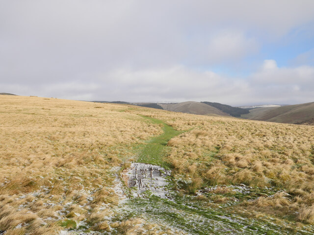
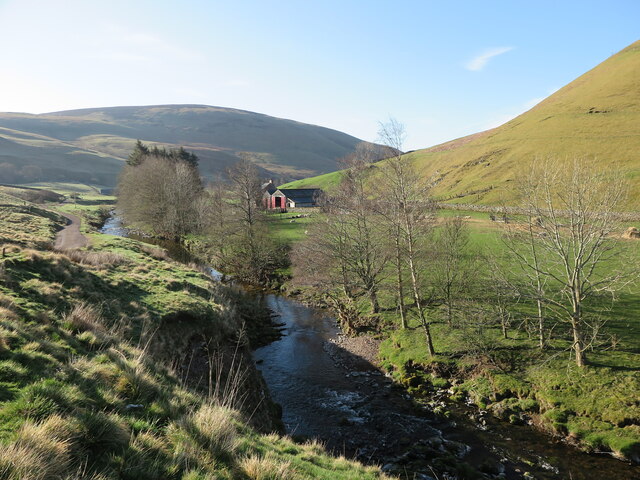
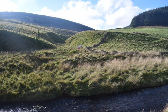
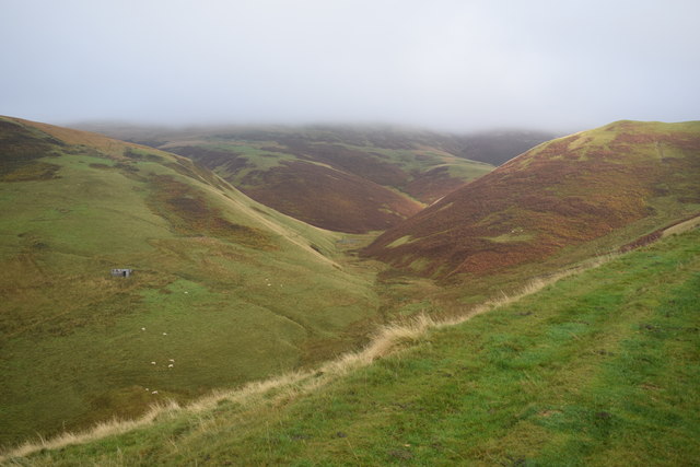
Stogie's Cleugh, located in Northumberland, is a picturesque valley renowned for its natural beauty and historical significance. Nestled amidst the rolling hills of the North Pennines, this valley offers visitors a unique and tranquil experience.

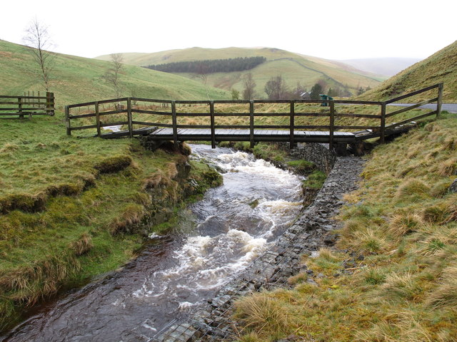
The name "Stogie's Cleugh" originates from the Old English word "cleugh," meaning a steep-sided valley. The valley is named after Stogie, a local shepherd who used to graze his sheep in the area. The valley stretches for approximately 2 miles and is surrounded by lush greenery, dense woodlands, and meandering streams.

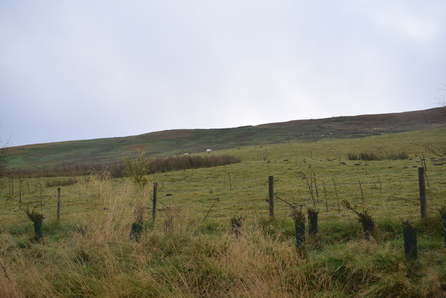
Stogie's Cleugh is known for its diverse wildlife and rich biodiversity. The valley provides a habitat for various species of birds, including rare and endangered ones. It is also home to a wide range of plant species, adding to the area's natural charm.

Aside from its natural beauty, Stogie's Cleugh also holds historical significance. The remains of ancient settlements, including Bronze Age roundhouses and Iron Age hillforts, can be found within the valley. These archaeological sites offer a glimpse into the rich cultural heritage of the region.

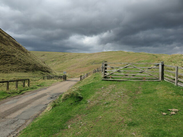
The valley provides ample opportunities for outdoor activities, such as hiking, birdwatching, and photography. The well-maintained trails and paths make it accessible for nature enthusiasts of all ages. Visitors can also enjoy picnics by the streams or simply bask in the tranquility of the surroundings.

Overall, Stogie's Cleugh is a hidden gem in Northumberland, offering visitors a chance to reconnect with nature, explore its rich history, and experience the serenity of this picturesque valley.

If you have any feedback on the listing, please let us know in the comments section below.

Stogie's Cleugh Images

Images are sourced within 2km of 55.398374/-2.2431393 or Grid Reference NT8411. Thanks to Geograph Open Source API. All images are credited.

Bridleway on Barrow Law Firm, frosted terrain encountered passing the lower slopes of Barrow Law.

This photograph was taken during the Coronavirus (COVID-19) pandemic of 2020/21/22.
Bridleway on Barrow Law
Firm, frosted terrain encountered passing the lower slopes of Barrow Law. This photograph was taken during the Coronavirus (COVID-19) pandemic of 2020/21/22.
River Coquet near Windyhaugh The River Coquet is considered to be one of Northumberland's finest rivers, and at this point passes the remote farm of Windyhaugh which is visible on the opposite side of the river. The hill in the background is Shillhope Law which overlooks the farm of Barrowburn, obscured by the riverside trees. For a selection of detailed free to download walking routes in the area visit <span class="nowrap"><a title="www.cheviotwalks.co.uk" rel="nofollow ugc noopener" href="http://www.cheviotwalks.co.uk">Link</a><img style="margin-left:2px;" alt="External link" title="External link - shift click to open in new window" src="https://s1.geograph.org.uk/img/external.png" width="10" height="10"/></span>
River Coquet near Windyhaugh
The River Coquet is considered to be one of Northumberland's finest rivers, and at this point passes the remote farm of Windyhaugh which is visible on the opposite side of the river. The hill in the background is Shillhope Law which overlooks the farm of Barrowburn, obscured by the riverside trees. For a selection of detailed free to download walking routes in the area visit LinkExternal link
Bridleway and Public Road Converge near Slymefoot The ancient cross-border route called The Street (right), which can be followed from this point in England to Hownam in Scotland, converges here with the narrow single track public road (left) which runs through Upper Coquetdale from the tiny village of Alwinton to just short of Chew Green close to the English/Scottish border. It is one of the most scenic journeys in Northumberland. For a selection of detailed free to download walking routes in the area visit <span class="nowrap"><a title="www.cheviotwalks.co.uk" rel="nofollow ugc noopener" href="http://www.cheviotwalks.co.uk">Link</a><img style="margin-left:2px;" alt="External link" title="External link - shift click to open in new window" src="https://s1.geograph.org.uk/img/external.png" width="10" height="10"/></span>
Bridleway and Public Road Converge near Slymefoot
The ancient cross-border route called The Street (right), which can be followed from this point in England to Hownam in Scotland, converges here with the narrow single track public road (left) which runs through Upper Coquetdale from the tiny village of Alwinton to just short of Chew Green close to the English/Scottish border. It is one of the most scenic journeys in Northumberland. For a selection of detailed free to download walking routes in the area visit LinkExternal link
Ordnance Survey Cut Mark This OS cut mark can be found at Rowhope Farm. It marks a point 277.283m above mean sea level.
Ordnance Survey Cut Mark
This OS cut mark can be found at Rowhope Farm. It marks a point 277.283m above mean sea level.
Ordnance Survey Cut Mark This OS cut mark can be found on a barn at Trows Farm. It marks a point 288.579m above mean sea level.
Ordnance Survey Cut Mark
This OS cut mark can be found on a barn at Trows Farm. It marks a point 288.579m above mean sea level.
Ordnance Survey Cut Mark This OS cut mark can be found on a roadside building at Blindburn. It marks a point 307.403m above mean sea level.
Ordnance Survey Cut Mark
This OS cut mark can be found on a roadside building at Blindburn. It marks a point 307.403m above mean sea level.
Sod Dyke (Turf Wall) on Barrow Law The linear mound to the left of the linear indentation running downhill is thought to be a sod dyke (turf wall) dating back to the 13th century which delineated land occupied by Henry the Crossbowman and land occupied by the Monks of Newminster
Sod Dyke (Turf Wall) on Barrow Law
The linear mound to the left of the linear indentation running downhill is thought to be a sod dyke (turf wall) dating back to the 13th century which delineated land occupied by Henry the Crossbowman and land occupied by the Monks of Newminster
Outer Green Cleugh This cleugh rises on the slopes of Rough Knowe on the south western flanks of Windy Gyle and flows into the Rowhope Burn which in turn rises close to the summit of Windy Gyle. For a selection of free to download walking routes in the area visit <span class="nowrap"><a title="www.cheviotwalks.co.uk" rel="nofollow ugc noopener" href="http://www.cheviotwalks.co.uk">Link</a><img style="margin-left:2px;" alt="External link" title="External link - shift click to open in new window" src="https://s1.geograph.org.uk/img/external.png" width="10" height="10"/></span>
Outer Green Cleugh
This cleugh rises on the slopes of Rough Knowe on the south western flanks of Windy Gyle and flows into the Rowhope Burn which in turn rises close to the summit of Windy Gyle. For a selection of free to download walking routes in the area visit LinkExternal link
Footbridge over the Rowhope Burn This small footbridge is not shown on the Ordnance Survey map. The farm in the distance is Rowhope and the hill behind it is Stob Hill. For a selection of free to download walking routes in the area visit <span class="nowrap"><a title="www.cheviotwalks.co.uk" rel="nofollow ugc noopener" href="http://www.cheviotwalks.co.uk">Link</a><img style="margin-left:2px;" alt="External link" title="External link - shift click to open in new window" src="https://s1.geograph.org.uk/img/external.png" width="10" height="10"/></span>
Footbridge over the Rowhope Burn
This small footbridge is not shown on the Ordnance Survey map. The farm in the distance is Rowhope and the hill behind it is Stob Hill. For a selection of free to download walking routes in the area visit LinkExternal link
View towards Bell Hill Downstream on the Coquet from Carshope.
View towards Bell Hill
Downstream on the Coquet from Carshope.
Part of Upper Coquetdale On the dead-end road out of Alwinton.
Part of Upper Coquetdale
On the dead-end road out of Alwinton.
River Coquet in Upper Coquetdale Looking towards Trows Road End.
River Coquet in Upper Coquetdale
Looking towards Trows Road End.
Footbridge over the River Coquet Near Carlcroft.
Footbridge over the River Coquet
Near Carlcroft.
Ford on the River Coquet Between Blindburn and Carlcroft.
Ford on the River Coquet
Between Blindburn and Carlcroft.
Trows An isolated (and unoccupied?) farmhouse in the valley of Trows Burn.
Trows
An isolated (and unoccupied?) farmhouse in the valley of Trows Burn.
Hillside of Shorthope Hill Looking up the eastern end of the hill's ridge from the path out of Trows.
Hillside of Shorthope Hill
Looking up the eastern end of the hill's ridge from the path out of Trows.
View into Loft Cleugh View across Trows Burn from the path to Windy Gyle.
View into Loft Cleugh
View across Trows Burn from the path to Windy Gyle.
View into the valley of the Carlcroft Burn Looking south towards Carlcroft in Upper Coquetdale.
View into the valley of the Carlcroft Burn
Looking south towards Carlcroft in Upper Coquetdale.
Show me another place!

Stogie's Cleugh is located at Grid Ref: NT8411 (Lat: 55.398374, Lng: -2.2431393)

Unitary Authority: Northumberland

Police Authority: Northumbria

What 3 Words

///relishes.onion.panther. Near Rochester, Northumberland

Related Wikis

Barrow Burn Meadows

Barrow Burn Meadows is a Site of Special Scientific Interest (SSSI) in north Northumberland, England. The site is a species-rich hay meadow of a sort now...

Barrow Burn

Barrowburn is a hamlet in Upper Coquetdale in the county of Northumberland, England. It comprises a working farm with associated buildings and two holiday...

Shillhope Law

Shillhope Law is a hill in the southern Cheviots, a range of hills in Northumberland, England. Shillhope Law is a relatively unremarkable member of this...

Windy Gyle

Windy Gyle is a mountain in the Cheviot Hills range, on the border between England and Scotland. Like the other hills in the area, it is rounded and grass...

Usway Burn

The Usway Burn is an upland river on the southern flanks of the Cheviot Hills, in the Northumberland National Park, England. It is a tributary of the River...

Featherwood Roman Camps

Featherwood Roman Camps are neighbouring archaeological sites in Northumberland, England, 1 mile (1.6 km) north of Featherwood and about 3 miles (5 km...

Chew Green

Chew Green is the site of the ancient Roman encampment, commonly but erroneously called Ad Fines (Latin: The Limits) on the 1885-1900 edition of the Ordnance...

Kidland

Kidland is a former civil parish, now in the parish of Alwinton in Northumberland, England, about 2 miles (3 km) northwest of Alwinton village. In 1951...

Nearby Amenities

Located within 500m of 55.398374,-2.2431393
Hindside Knowe
Place: locality
Lat/Long: 55.4016625/-2.2454655
Carshope
Place: locality
Lat/Long: 55.3950792/-2.2412405
Barrier: cattle_grid
Lat/Long: 55.3965999/-2.2444676
The data included in this document is from www.openstreetmap.org. The data is made available under ODbL.

Have you been to Stogie's Cleugh?

Leave your review of Stogie's Cleugh below (or comments, questions and feedback).