Glen Dye

Valley in Kincardineshire

Scotland

Glen Dye

Bridge of Dye Old road bridge spanning the Water of Dye. It is now superseded by a new bridge to the east.
Bridge of Dye Credit: Colin Smith

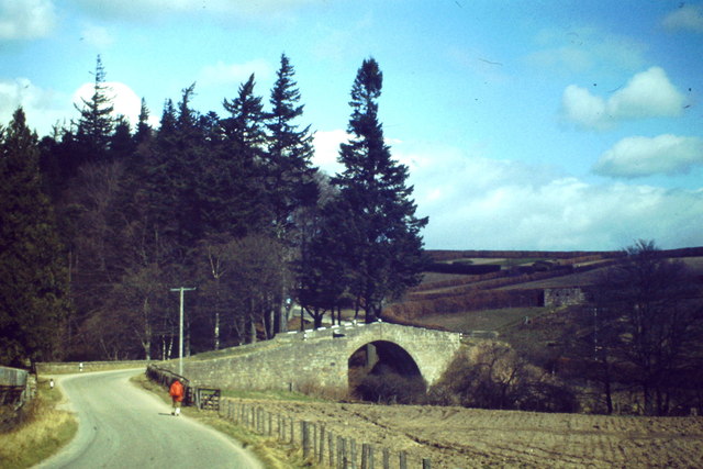
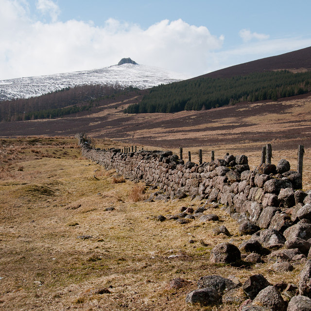
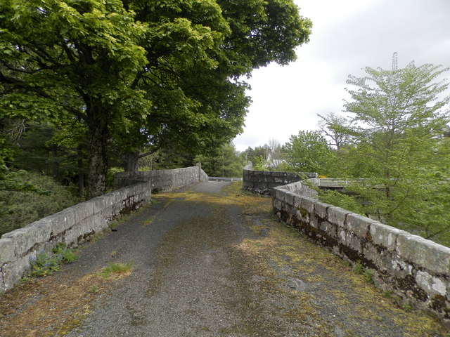
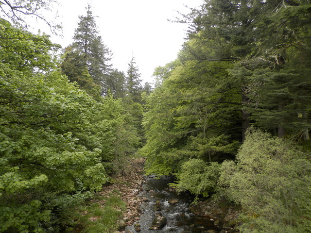
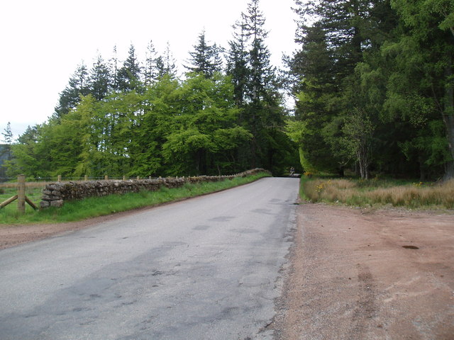
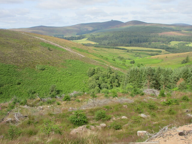
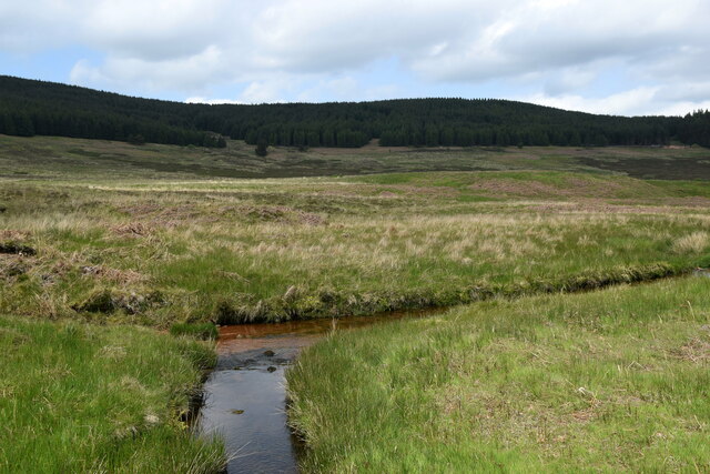
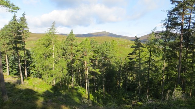
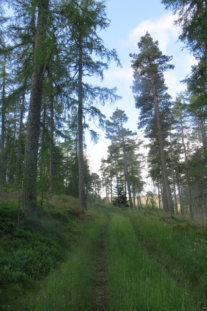
Glen Dye is a picturesque valley located in Kincardineshire, Scotland. Situated in the northeastern part of the country, it is known for its stunning natural beauty and tranquil ambiance. The valley is nestled between rolling hills and is surrounded by dense woodlands, creating a serene and secluded atmosphere.

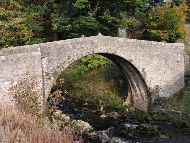
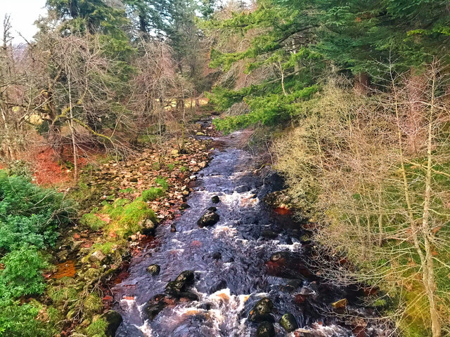
The landscape of Glen Dye is characterized by a meandering river that flows through the valley, adding to its charm. The river is teeming with various species of fish, making it a popular spot for fishing enthusiasts. Additionally, the valley is home to an abundance of wildlife, including deer, otters, and a wide variety of bird species, making it a paradise for nature lovers and wildlife enthusiasts.

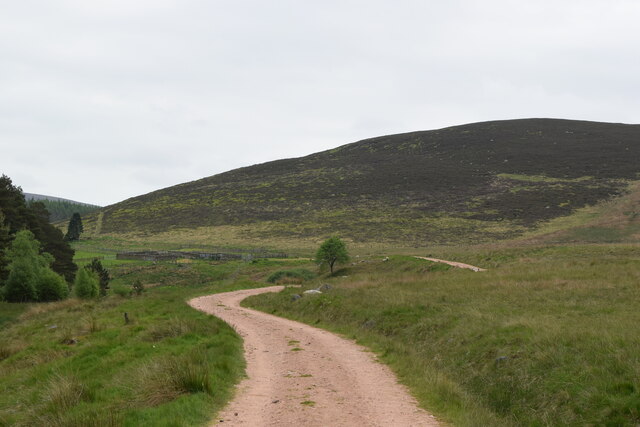
Glen Dye offers a range of outdoor activities for visitors to enjoy. Hiking and mountain biking trails crisscross the valley, providing opportunities for exploration and adventure amidst the stunning scenery. The area is also a haven for birdwatching, with numerous bird hides strategically placed for optimal viewing opportunities.

For those seeking a peaceful retreat, Glen Dye offers a selection of charming self-catering cottages and lodges. These accommodations blend seamlessly into the natural surroundings, providing a cozy and comfortable base from which to explore the valley.

Overall, Glen Dye in Kincardineshire is a hidden gem of natural beauty in Scotland. Its tranquil atmosphere, diverse wildlife, and range of outdoor activities make it an ideal destination for those seeking to immerse themselves in nature and escape the hustle and bustle of everyday life.

If you have any feedback on the listing, please let us know in the comments section below.
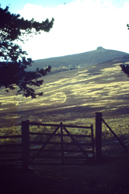
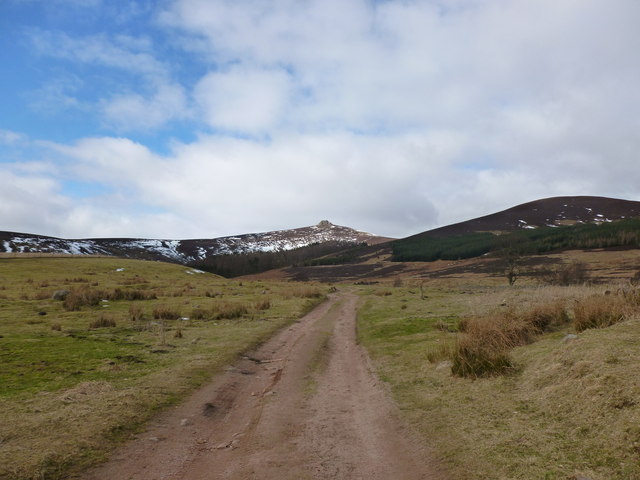
Glen Dye Images

Images are sourced within 2km of 56.970839/-2.5735976 or Grid Reference NO6586. Thanks to Geograph Open Source API. All images are credited.

Bridge of Dye Old road bridge spanning the Water of Dye. It is now superseded by a new bridge to the east.
Bridge of Dye
Old road bridge spanning the Water of Dye. It is now superseded by a new bridge to the east.
Near Glendye Lodge View from lower slopes of Scolly's Hill, across heather moorland, towards Clachnaben with its distinctive tor.
Near Glendye Lodge
View from lower slopes of Scolly's Hill, across heather moorland, towards Clachnaben with its distinctive tor.
Old bridge at Bridge of Dye The B974 passes through the small settlement at Bridge of Dye crossing the Water o' Dye by a modern bridge which replaced this one, built in 1680.
Old bridge at Bridge of Dye
The B974 passes through the small settlement at Bridge of Dye crossing the Water o' Dye by a modern bridge which replaced this one, built in 1680.
Track to Clachnaben The track heads west from Glen Dye towards Clachnaben, a popular short hillwalk
Track to Clachnaben
The track heads west from Glen Dye towards Clachnaben, a popular short hillwalk
Remains of a dyke in Glen Dye Clachnaben is in the distance
Remains of a dyke in Glen Dye
Clachnaben is in the distance
The Bridge of Dye The original Bridge of Dye
The Bridge of Dye
The original Bridge of Dye
The Water of Dye from the old Bridge of Dye
The B974 near Scolly's Cross
Bracken covered hillside Looking westwards over the gully of the Builg Burn to the bracken infested lower northern slopes of Heathery Hill, with Clachnaben in the distance.
Bracken covered hillside
Looking westwards over the gully of the Builg Burn to the bracken infested lower northern slopes of Heathery Hill, with Clachnaben in the distance.
Water of Dye
Water of Dye
Bend in the burn at Miller's Bog
Looking back down the track... ...on the way to Clachnaben.   The remains of a gravel pit (marked as such on the 1901 OS 6-inch map) can be seen in the distance.
Looking back down the track...
...on the way to Clachnaben. The remains of a gravel pit (marked as such on the 1901 OS 6-inch map) can be seen in the distance.
Path past the sheep pens
Roads in Glen Dye The meeting of two roads into the upper glen - the higher one is older while another runs alongside the Water of Dye.
Roads in Glen Dye
The meeting of two roads into the upper glen - the higher one is older while another runs alongside the Water of Dye.
Forest, Glen Dye A view over trees on steep ground towards Clachnaben.
Forest, Glen Dye
A view over trees on steep ground towards Clachnaben.
Oops, wrong turn An alternative road over Spital Hill rather than the motor road around it was taken by error.  Oh well back down the hill again, but not before admiring the fine runnable woodland.
Oops, wrong turn
An alternative road over Spital Hill rather than the motor road around it was taken by error. Oh well back down the hill again, but not before admiring the fine runnable woodland.
Logging road, Spital Hill The road climbs away from the Cairn o' Mount road and into recently planted woodland above the older forest in Glen Dye.
Logging road, Spital Hill
The road climbs away from the Cairn o' Mount road and into recently planted woodland above the older forest in Glen Dye.
Spital Hill Older forest in Glen Dye.
Spital Hill
Older forest in Glen Dye.
Show me another place!

Glen Dye is located at Grid Ref: NO6586 (Lat: 56.970839, Lng: -2.5735976)

Unitary Authority: Aberdeenshire

Police Authority: North East

What 3 Words

///rewarded.disbanded.reviewed. Near Banchory, Aberdeenshire

Related Wikis

Clachnaben

Clachnaben (archaically "Cloch-na'bain"; Scottish Gaelic: "Clach na Beinne") is a 589-metre hill in Glen Dye, Aberdeenshire, Scotland. It is a distinctive...

Water of Aven

The Water of Aven (or A'an) (Scottish Gaelic: an t-Uisge Bàn) is a tributary of the Water of Feugh, itself the largest tributary of the River Dee, Aberdeenshire...

Strachan, Aberdeenshire

Strachan is a village in Aberdeenshire, Scotland that lies along the Water of Feugh, a tributary of the River Dee, Aberdeenshire, a few miles southwest...

Cairn O' Mounth

Cairn O' Mounth/Cairn O' Mount (Scottish Gaelic: Càrn Mhon) is a high mountain pass in Aberdeenshire, Scotland. The place name is a survival of the ancient...

Nearby Amenities

Located within 500m of 56.970839,-2.5735976
Board Type: notice
Description: Map, paths and natural history information.
Information: board
Tourism: information
Lat/Long: 56.9716862/-2.5791277
Power: pole
Lat/Long: 56.9747747/-2.5713808
Power: pole
Lat/Long: 56.9742034/-2.5713671
Power: pole
Lat/Long: 56.9736246/-2.5713521
Power: pole
Lat/Long: 56.9731144/-2.5716176
Power: pole
Lat/Long: 56.9725944/-2.5718886
Power: pole
Lat/Long: 56.9720029/-2.5722033
Power: pole
Lat/Long: 56.9715688/-2.5729629
Power: pole
Lat/Long: 56.9711055/-2.573758
Power: pole
Lat/Long: 56.9706169/-2.5745956
Power: pole
Lat/Long: 56.9701164/-2.5754537
Power: pole
Lat/Long: 56.9696345/-2.5763241
Power: pole
Lat/Long: 56.9693883/-2.5772164
Power: pole
Lat/Long: 56.9691645/-2.5781197
Power: pole
Lat/Long: 56.9688407/-2.5792748
Power: pole
Lat/Long: 56.9691093/-2.5755221
Power: pole
Lat/Long: 56.9685647/-2.5746818
Power: pole
Lat/Long: 56.96805/-2.5738771
Power: pole
Lat/Long: 56.9674606/-2.573784
Power: pole
Lat/Long: 56.9669011/-2.5736992
The data included in this document is from www.openstreetmap.org. The data is made available under ODbL.

Have you been to Glen Dye?

Leave your review of Glen Dye below (or comments, questions and feedback).