Ridge Clough

Valley in Lancashire Lancaster

England

Ridge Clough

Botton Head Fell Looking down at Redscar Gill and Great Hare Clough. Thrushgill Plantation in view across the valley of the River Hindburn. Should be last picture for SD66.
Botton Head Fell Credit: Michael Graham

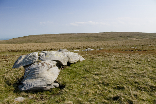
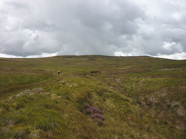
Ridge Clough is a picturesque valley located in the county of Lancashire, in the northwest region of England. Nestled within the Pennine Hills, the valley is known for its stunning natural beauty and abundant wildlife.

Covered in lush greenery and surrounded by rolling hills, Ridge Clough offers a serene and peaceful atmosphere. The valley is intersected by a gentle stream, which flows through the center, adding to the charm of the landscape. The stream is home to a variety of aquatic species, including trout and minnows.

Ridge Clough is a popular destination for nature enthusiasts and hikers alike. The valley boasts a network of well-maintained walking trails that wind through the countryside, providing panoramic views of the surrounding hills and valleys. These trails range in difficulty, catering to both casual walkers and experienced hikers.

The valley also attracts birdwatchers, as it is home to numerous species of birds, including buzzards, kestrels, and peregrine falcons. Visitors can often spot these magnificent creatures soaring high above the valley.

In addition to its natural beauty, Ridge Clough offers a rich history. The valley was once a hub for the textile industry during the Industrial Revolution, with several mills and factories dotting the landscape. Today, remnants of these industrial structures can still be seen, adding an intriguing historical dimension to the valley.

Overall, Ridge Clough is a hidden gem in Lancashire, offering visitors a chance to immerse themselves in the tranquility of nature while exploring the area's historical heritage.

If you have any feedback on the listing, please let us know in the comments section below.

Ridge Clough Images

Images are sourced within 2km of 54.039656/-2.5322074 or Grid Reference SD6560. Thanks to Geograph Open Source API. All images are credited.

Botton Head Fell Looking down at Redscar Gill and Great Hare Clough. Thrushgill Plantation in view across the valley of the River Hindburn. Should be last picture for SD66.
Botton Head Fell
Looking down at Redscar Gill and Great Hare Clough. Thrushgill Plantation in view across the valley of the River Hindburn. Should be last picture for SD66.
Hawkshead from the Salter Fell Road
Confrontation at Middle Gill Bridge The lamb was newly born and could just about wobble after its mother. I got past but another ewe just round the corner leapt the cattle grid to avoid me - I told the boys at Botton Head nearby.
Confrontation at Middle Gill Bridge
The lamb was newly born and could just about wobble after its mother. I got past but another ewe just round the corner leapt the cattle grid to avoid me - I told the boys at Botton Head nearby.
Date stone, Botton Head The farmhouse is mid-18th Century but this very weathered date stone reads 1666 with the initials II. It is Grade II listed <span class="nowrap"><a title="http://www.britishlistedbuildings.co.uk/en-182655-botton-head-farmhouse-wray-with-botton" rel="nofollow ugc noopener" href="http://www.britishlistedbuildings.co.uk/en-182655-botton-head-farmhouse-wray-with-botton">Link</a><img style="margin-left:2px;" alt="External link" title="External link - shift click to open in new window" src="https://s1.geograph.org.uk/img/external.png" width="10" height="10"/></span>
Date stone, Botton Head
The farmhouse is mid-18th Century but this very weathered date stone reads 1666 with the initials II. It is Grade II listed LinkExternal link
Dicksons They won't run short of firewood for a while.
Dicksons
They won't run short of firewood for a while.
Holmes Barn
Holmes Barn
Botton Bridge The bridge carries a track which was built when the Haweswater aqueduct was being constructed through the Forest of Bowland.
Botton Bridge
The bridge carries a track which was built when the Haweswater aqueduct was being constructed through the Forest of Bowland.
Roman Road on Tatham Fells - Bowland This Roman Road was constructed about AD76 I believe. Here we see the Roman Road agger [ridge/mound] as it descends Round Hill to follow the east side of the Hindburn valley through the hamlet of Lowgill a few miles beyond. This ancient road lead from the significant Roman cavalry fort at Ribchester [BREMETENNACVM]approx 17/18 miles back south along its course on the River Ribble. Here it strikes onward almost due north to the fort where Burrow Hall now stands just east of the River Lune. One can imagine in those ancient times supposed lesser mortals having to make way for Caesars Legions of armed might expanding and policing their Empire !
Roman Road on Tatham Fells - Bowland
This Roman Road was constructed about AD76 I believe. Here we see the Roman Road agger [ridge/mound] as it descends Round Hill to follow the east side of the Hindburn valley through the hamlet of Lowgill a few miles beyond. This ancient road lead from the significant Roman cavalry fort at Ribchester [BREMETENNACVM]approx 17/18 miles back south along its course on the River Ribble. Here it strikes onward almost due north to the fort where Burrow Hall now stands just east of the River Lune. One can imagine in those ancient times supposed lesser mortals having to make way for Caesars Legions of armed might expanding and policing their Empire !
Start of Footpath to Botton Head
Middle Gill and Middle Gill Bridge
Ruined wall on Hawkshead Looking towards Higher Salter. Small though Hawkshead may be its rocky summit does have a wonderful view towards the Three Peaks, and also convenient rocks to sit, have lunch and admire that view
Ruined wall on Hawkshead
Looking towards Higher Salter. Small though Hawkshead may be its rocky summit does have a wonderful view towards the Three Peaks, and also convenient rocks to sit, have lunch and admire that view
Ancient shooting butt on Greenbank Fell
Middle Gill
Middle Gill
Gritstone outcrops, Hawkshead A few small outcrops and boulders adorn the steep, northern flank of the hill. Looking towards White Fell.
Gritstone outcrops, Hawkshead
A few small outcrops and boulders adorn the steep, northern flank of the hill. Looking towards White Fell.
Broken wall on Hawkshead A ruined wall runs along the crest of the northern slope accompanied by a less decorative (but much more useful) post and wire fence.
Broken wall on Hawkshead
A ruined wall runs along the crest of the northern slope accompanied by a less decorative (but much more useful) post and wire fence.
Coming down Hawkshead Gill The gill is a shallow gully draining the northern slopes of Hawkshead. Close to here our right to walk within CRoW access land was challenged by a gamekeeper on a quad bike who informed us that our OS map was incorrect. I have contacted the Bowland AONB staff to enquire if this is true or if this was an incident of attempted intimidation.
Coming down Hawkshead Gill
The gill is a shallow gully draining the northern slopes of Hawkshead. Close to here our right to walk within CRoW access land was challenged by a gamekeeper on a quad bike who informed us that our OS map was incorrect. I have contacted the Bowland AONB staff to enquire if this is true or if this was an incident of attempted intimidation.
Higher Thrushgill Plantation The southern-most section of mature pine. Much of the more northerly sections have been clear-felled. Looking towards Hawkshead (408m).
Higher Thrushgill Plantation
The southern-most section of mature pine. Much of the more northerly sections have been clear-felled. Looking towards Hawkshead (408m).
Derelict brick building below Higher Thrushgill The brick walls, large windows and asbestos roof suggest that this was not a barn. Perhaps it was associated with the construction of the Haweswater Aqueduct which passes through this vicinity?
Derelict brick building below Higher Thrushgill
The brick walls, large windows and asbestos roof suggest that this was not a barn. Perhaps it was associated with the construction of the Haweswater Aqueduct which passes through this vicinity?
Show me another place!

Ridge Clough is located at Grid Ref: SD6560 (Lat: 54.039656, Lng: -2.5322074)

Administrative County: Lancashire

District: Lancaster

Police Authority: Lancashire

What 3 Words

///stormed.select.airliners. Near High Bentham, North Yorkshire

Nearby Locations

Ridge Clough

Related Wikis

White Hill (Forest of Bowland)

White Hill is a hill in the Forest of Bowland, north-western England. It lies between Slaidburn and High Bentham. The summit houses a tower and a trig...

Wolfhole Crag

Wolfhole Crag is an isolated and seldom-visited hill in the Forest of Bowland in Lancashire, England. Its seclusion is due in part to its low profile and...

Brennand Farm

Brennand Farm is often claimed to be the true centre of Great Britain. This is about seven kilometres north-west of Dunsop Bridge - which has the nearest...

Church of the Good Shepherd, Tatham

The Church of the Good Shepherd is on Tatham Fell in Lancashire, England. It is an active Anglican parish church in the deanery of Tunstall, the archdeaconry...

Have you been to Ridge Clough?

Leave your review of Ridge Clough below (or comments, questions and feedback).