Knockbrex

Settlement in Kirkcudbrightshire

Scotland

Knockbrex

Inlet, Knockbrex Bay Rock outcrops, almost covered by turf, at the side of an inlet on Knockbrex Bay. Knockbrex House can be seen over the coastal fields.
Inlet, Knockbrex Bay Credit: Jonathan Wilkins

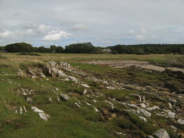
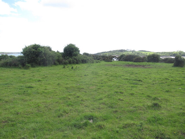
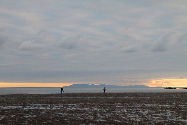
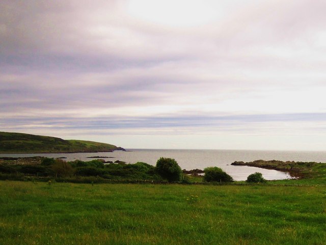
Knockbrex is a small village located in the historical county of Kirkcudbrightshire, in southwestern Scotland. Situated on the Solway Firth coast, it offers stunning views of the sea and surrounding countryside. The village is nestled amidst rolling hills and lush green fields, making it a picturesque destination for nature enthusiasts and those seeking tranquility.

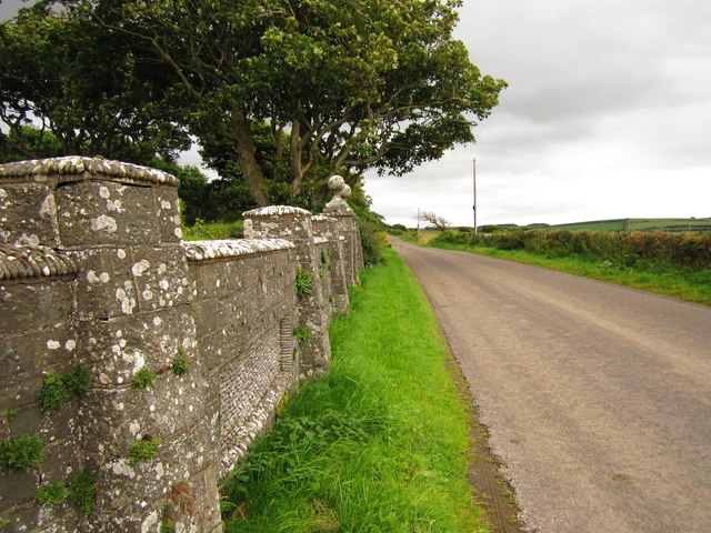
The origins of Knockbrex can be traced back to medieval times when it served as a farming community. Over the centuries, it developed into a small hamlet with a handful of traditional stone houses. Today, it retains its rustic charm and peaceful atmosphere, attracting visitors who appreciate its unspoiled beauty.

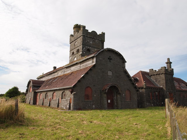
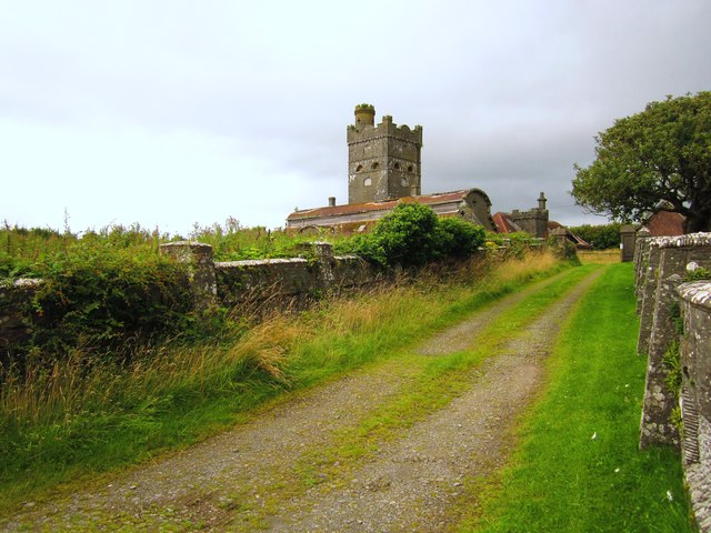
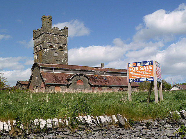
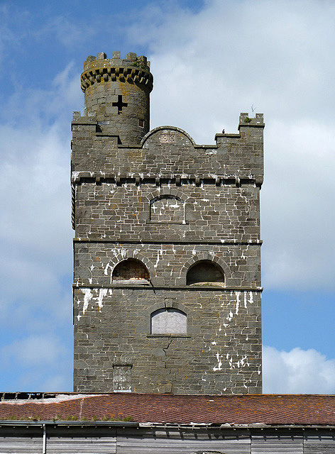
One of the main attractions in Knockbrex is Knockbrex Castle, a 19th-century mansion built in the Scottish Baronial style. This architectural gem stands proudly on a hilltop overlooking the village and offers guided tours to visitors. The castle's grounds are also open to the public, providing an opportunity to explore its gardens and enjoy panoramic views of the coastline.

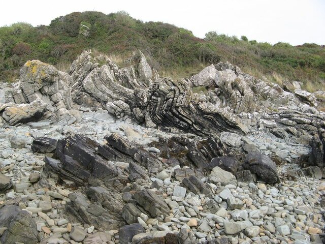
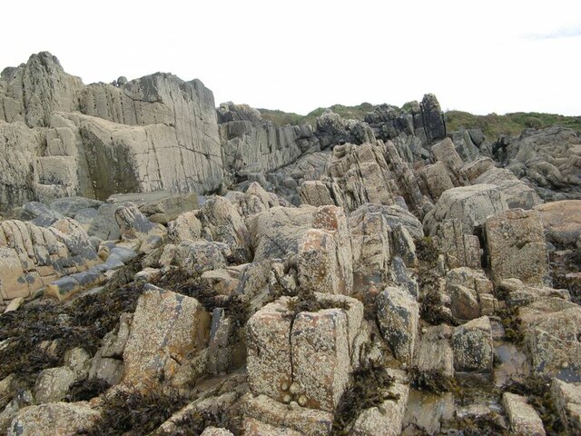
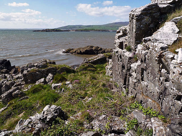
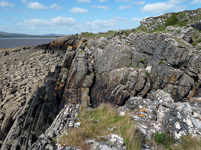
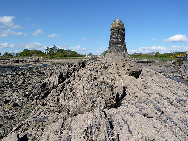
Nature lovers will find plenty to enjoy in the surrounding area. The nearby coastline offers breathtaking cliff walks and sandy beaches, perfect for leisurely strolls or picnics. The village is also close to several nature reserves, providing opportunities for birdwatching and wildlife spotting.

While Knockbrex itself is a quiet village with limited amenities, the nearby town of Kirkcudbright is easily accessible for shopping, dining, and further exploring the region's history and culture. Overall, Knockbrex is a hidden gem that offers a serene escape from the bustle of modern life, showcasing the natural beauty of Scotland's southwest coast.

If you have any feedback on the listing, please let us know in the comments section below.

Knockbrex Images

Images are sourced within 2km of 54.823984/-4.203659 or Grid Reference NX5849. Thanks to Geograph Open Source API. All images are credited.

Inlet, Knockbrex Bay Rock outcrops, almost covered by turf, at the side of an inlet on Knockbrex Bay. Knockbrex House can be seen over the coastal fields.
Inlet, Knockbrex Bay
Rock outcrops, almost covered by turf, at the side of an inlet on Knockbrex Bay. Knockbrex House can be seen over the coastal fields.
Folded strata Rock outcrops on the shore are bedded greywackes belonging to the Kirkmaiden Formation, of Silurian (Llandovery) age. Their hardness and resistance to erosion is due to their state of metamorphism through deep burial during continental collision. The folding demonstrated here was caused by differential movement along faults separating adjacent slices of sediments as they were scraped off a descending oceanic plate (an "accretionary prism").
Folded strata
Rock outcrops on the shore are bedded greywackes belonging to the Kirkmaiden Formation, of Silurian (Llandovery) age. Their hardness and resistance to erosion is due to their state of metamorphism through deep burial during continental collision. The folding demonstrated here was caused by differential movement along faults separating adjacent slices of sediments as they were scraped off a descending oceanic plate (an "accretionary prism").
Upright strata Large areas of the foreshore here comprise vertically disposed beds of Silurian greywacke which show only gentle folding. See also <a href="https://www.geograph.org.uk/photo/6968175">NX5749 : Folded strata</a> for an interpretation of the disposition and nature of the rocks here.
Upright strata
Large areas of the foreshore here comprise vertically disposed beds of Silurian greywacke which show only gentle folding. See also NX5749 : Folded strata for an interpretation of the disposition and nature of the rocks here.
Coastal pasture, Knockbrex
Low tide near Ardwall Isle Two men on the east side of Ardwall Isle were taking advantage of an evening low tide to collect some whelks.
Low tide near Ardwall Isle
Two men on the east side of Ardwall Isle were taking advantage of an evening low tide to collect some whelks.
Corseyard Dairy A real oddity, in stile it aspires to appear as a church.
Corseyard Dairy
A real oddity, in stile it aspires to appear as a church.
Unused gate Unused gate on the Knockbrex Estate.
Unused gate
Unused gate on the Knockbrex Estate.
Corseyard Dairy Corseyard Dairy, (locally known as Coo Palace) with a water tower designed to look like a medieval Scottish fortified house, constructed for the then laird of nearby Knockbrex estate, James Brown, chairman of Affleck & Brown, a Manchester department store.
<span class="nowrap"><a title="http://www.buildingsatrisk.org.uk/details/900384" rel="nofollow ugc noopener" href="http://www.buildingsatrisk.org.uk/details/900384">Link</a><img style="margin-left:2px;" alt="External link" title="External link - shift click to open in new window" src="https://s1.geograph.org.uk/img/external.png" width="10" height="10"/></span>
Corseyard Dairy
Corseyard Dairy, (locally known as Coo Palace) with a water tower designed to look like a medieval Scottish fortified house, constructed for the then laird of nearby Knockbrex estate, James Brown, chairman of Affleck & Brown, a Manchester department store. LinkExternal link
Boundary Wall A section of Corseyard Dairy, boundary wall.
Boundary Wall
A section of Corseyard Dairy, boundary wall.
Castle Haven Bay
Castle Haven Bay
Ardwall Isle This is at the southwest corner of the small tidal island in Wigtown Bay looking over to Murray’s Isles.
Ardwall Isle
This is at the southwest corner of the small tidal island in Wigtown Bay looking over to Murray’s Isles.
Navigation pillars at Knockbrex Bay Three pillars in the bay act as navigation markers for a small harbour at Knockbrex. This was viewed at low tide.
Navigation pillars at Knockbrex Bay
Three pillars in the bay act as navigation markers for a small harbour at Knockbrex. This was viewed at low tide.
A cairn on Ardwall Isle The cairn at 34m marks the high spot of this small tidal island in Wigtown Bay.
A cairn on Ardwall Isle
The cairn at 34m marks the high spot of this small tidal island in Wigtown Bay.
Ardwall Isle This is at the southwest edge of this small tidal island in Wigtown Bay at low tide.
Ardwall Isle
This is at the southwest edge of this small tidal island in Wigtown Bay at low tide.
Corseyard Dairy for sale This Gothic style dairy steading was original built for James Brown of Knockbrex. The site is currently marketed for sale and the foreground sign reads:-
Grade A Listed Edwardian Dairy
with lapsed planning for conversion
to Residential and/or Business use
Available as a whole or in 3 lots
Corseyard Dairy for sale
This Gothic style dairy steading was original built for James Brown of Knockbrex. The site is currently marketed for sale and the foreground sign reads:- Grade A Listed Edwardian Dairy with lapsed planning for conversion to Residential and/or Business use Available as a whole or in 3 lots
Corseyard Dairy Tower The Corseyard Dairy buildings are currently marketed for sale. For a wider view, see <a href="https://www.geograph.org.uk/photo/3507630">NX5948 : Corseyard Dairy for sale</a>.
Corseyard Dairy Tower
The Corseyard Dairy buildings are currently marketed for sale. For a wider view, see NX5948 : Corseyard Dairy for sale.
A navigation pillar at Knockbrex Bay This is one of three pillars that act as navigation markers for a small harbour at Knockbrex. For a view of all three pillars, see <a href="https://www.geograph.org.uk/photo/3507589">NX5849 : Navigation pillars at Knockbrex Bay</a>.
A navigation pillar at Knockbrex Bay
This is one of three pillars that act as navigation markers for a small harbour at Knockbrex. For a view of all three pillars, see NX5849 : Navigation pillars at Knockbrex Bay.
A navigation pillar at Knockbrex Bay This is one of three pillars that act as navigation markers for a small harbour at Knockbrex. The harbour is just out of shot to the right. For a view of all three pillars, see <a href="https://www.geograph.org.uk/photo/3507589">NX5849 : Navigation pillars at Knockbrex Bay</a>.
A navigation pillar at Knockbrex Bay
This is one of three pillars that act as navigation markers for a small harbour at Knockbrex. The harbour is just out of shot to the right. For a view of all three pillars, see NX5849 : Navigation pillars at Knockbrex Bay.
Show me another place!

Knockbrex is located at Grid Ref: NX5849 (Lat: 54.823984, Lng: -4.203659)

Unitary Authority: Dumfries and Galloway

Police Authority: Dumfries and Galloway

What 3 Words

///lifestyle.brightly.cuter. Near Kirkcudbright, Dumfries & Galloway

Related Wikis

Corseyard Farm

Corseyard Farm, known locally as the Coo Palace and now marketed under that name, is an architecturally unusual dairy farm near Kirkandrews in Scotland...

Plunton Castle

Plunton Castle is a ruined L-plan tower house between Kirkandrews and Gatehouse of Fleet in Dumfries and Galloway, Scotland. Built around 1575 for the...

Kirkandrews, Dumfries and Galloway

Kirkandrews, sometimes written as Kirkanders in older documents, is a coastal hamlet about 9 kilometres (6 mi) west-southwest of Kirkcudbright in Dumfries...

Islands of Fleet

The Islands of Fleet are a group of small islands in Galloway, Scotland. They are in Fleet Bay, which is part of Wigtown Bay, and is in turn part of the...

Nearby Amenities

Located within 500m of 54.823984,-4.203659
Source: PGS
Lat/Long: 54.8216495/-4.2098858
Source: PGS
Lat/Long: 54.8209793/-4.2093475
Source: PGS
Lat/Long: 54.8210295/-4.2080756
Source: PGS
Lat/Long: 54.8210652/-4.2075996
Source: PGS
Lat/Long: 54.8206404/-4.2071602
Knockbrex
Place: hamlet
Lat/Long: 54.822495/-4.2030627
Knockbrex
Naptan AtcoCode: 680000939333
Naptan Bearing: N
Naptan BusStopType: CUS
Naptan CommonName: Knockbrex
Naptan Indicator: Road End
Naptan Landmark: U36
Naptan NaptanCode: 34236546
Naptan Notes: none
Naptan Street: C8
Naptan Verified: no
Source: naptan_import
Lat/Long: 54.8233721/-4.2004698
Knockbrex
Naptan AtcoCode: 680000939444
Naptan Bearing: S
Naptan BusStopType: CUS
Naptan CommonName: Knockbrex
Naptan Indicator: opp Road End
Naptan Landmark: U36
Naptan NaptanCode: 34236547
Naptan Notes: none
Naptan Street: C8
Naptan Verified: no
Source: naptan_import
Lat/Long: 54.8233297/-4.2003274
Power: pole
Lat/Long: 54.827937/-4.2029226
Power: pole
Lat/Long: 54.8269655/-4.2023394
Power: pole
Lat/Long: 54.8258044/-4.2016396
Power: pole
Lat/Long: 54.8247371/-4.2009891
Power: pole
Lat/Long: 54.8242656/-4.2007018
Power: pole
Lat/Long: 54.8235695/-4.2002959
Power: pole
Lat/Long: 54.8229997/-4.1998876
Power: pole
Lat/Long: 54.8222954/-4.1993931
Power: pole
Lat/Long: 54.8215979/-4.1989172
Power: pole
Lat/Long: 54.8210233/-4.1984996
Power: pole
Lat/Long: 54.8209622/-4.199764
Power: pole
Lat/Long: 54.8209125/-4.2009677
Power: pole
Lat/Long: 54.8208251/-4.2024491
Power: pole
Lat/Long: 54.8216221/-4.2034195
Power: pole
Lat/Long: 54.8233383/-4.2017936
Power: pole
Lat/Long: 54.8231166/-4.2031489
Power: pole
Lat/Long: 54.8254886/-4.1996847
Power: pole
Lat/Long: 54.8262143/-4.1983783
Power: pole
Lat/Long: 54.8256781/-4.1976411
Power: pole
Lat/Long: 54.8253018/-4.1971046
Power: pole
Lat/Long: 54.8204038/-4.199014
The data included in this document is from www.openstreetmap.org. The data is made available under ODbL.

Have you been to Knockbrex?

Leave your review of Knockbrex below (or comments, questions and feedback).