Point of the Bar

Coastal Feature, Headland, Point in Kirkcudbrightshire

Scotland

Point of the Bar

Inlet, Knockbrex Bay Rock outcrops, almost covered by turf, at the side of an inlet on Knockbrex Bay. Knockbrex House can be seen over the coastal fields.
Inlet, Knockbrex Bay Credit: Jonathan Wilkins

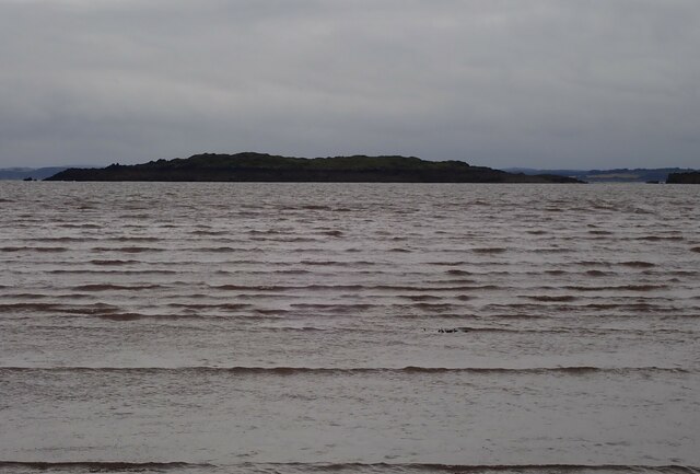
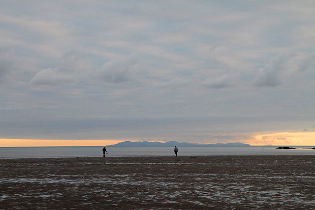
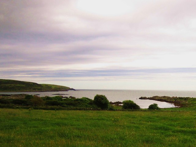
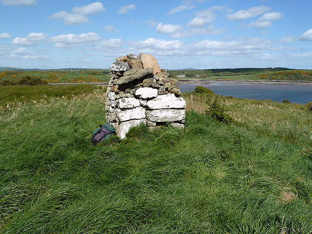
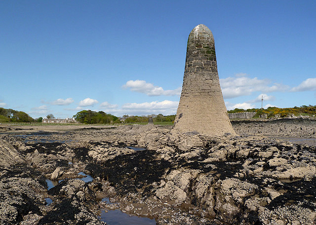
Point of the Bar is a prominent coastal feature located in Kirkcudbrightshire, Scotland. Situated on the southwestern coast, it is a headland that extends into the Irish Sea, offering breathtaking views and a rich natural environment.

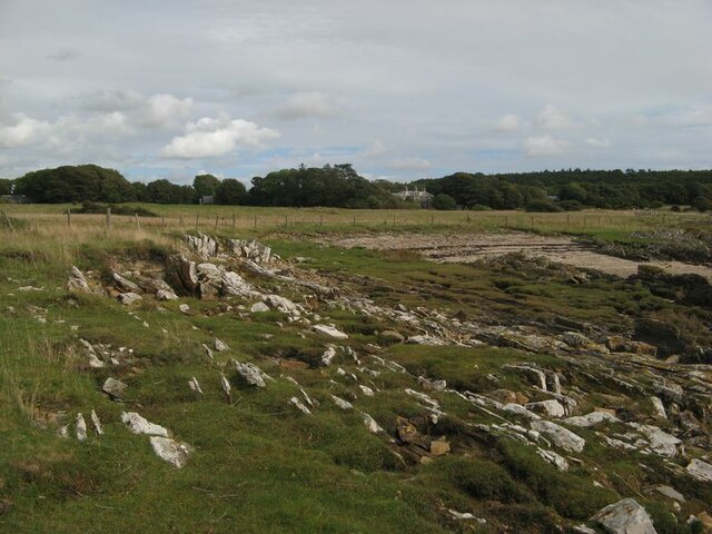
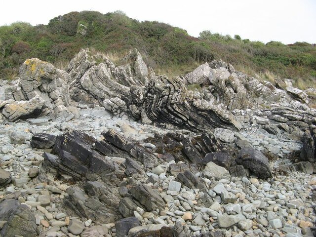
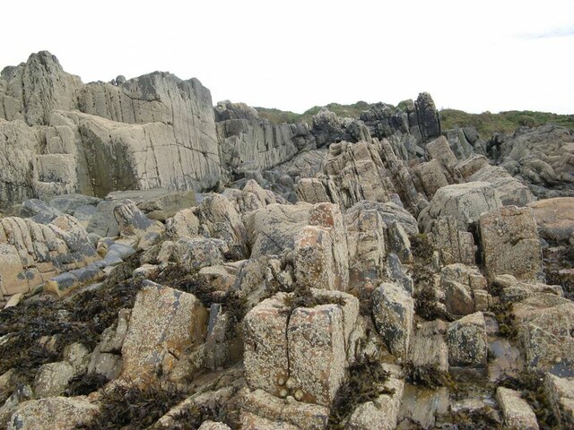
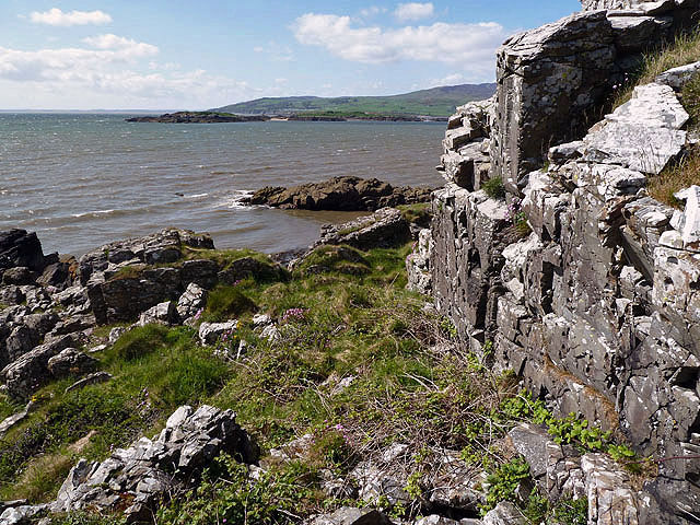
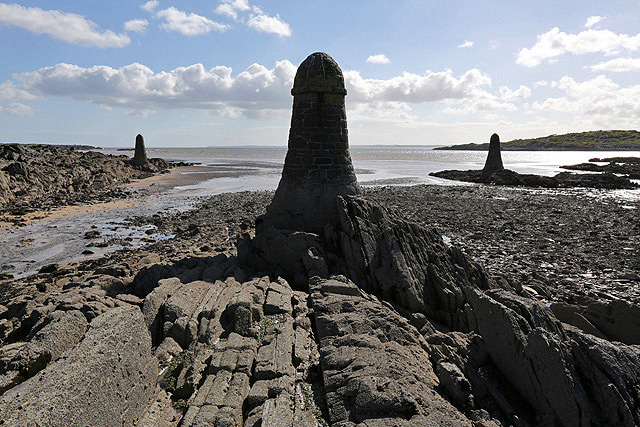
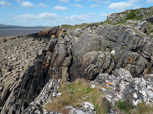
The Point of the Bar is known for its rugged beauty and dramatic cliffs that form its headland. Rising high above the sea, these cliffs are composed of various rock formations, including sandstone and shale, giving them a unique texture and color. The headland also features intricate geological features, such as caves and arches, which have been carved out by the relentless power of the waves over centuries.

The coastal area surrounding Point of the Bar is abundant in diverse wildlife. The headland serves as a key nesting site for various seabirds, including guillemots, razorbills, and fulmars. Visitors can often witness these magnificent birds soaring above the cliffs or diving into the sea in search of food. The surrounding waters are home to a variety of marine life, with seals frequently seen basking on the rocks or swimming in the shallows.

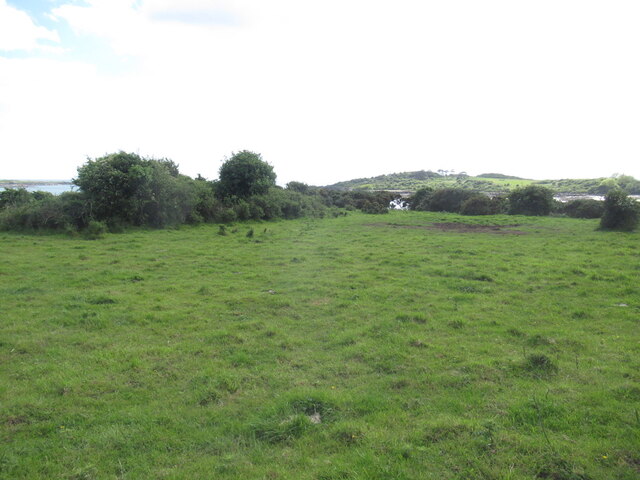
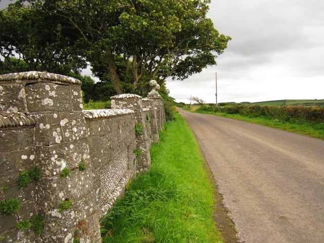
The Point of the Bar offers visitors an opportunity to immerse themselves in nature and enjoy the tranquility of the coastal environment. It is a popular spot for hiking and walking, with several trails crisscrossing the headland and offering stunning vistas along the way. The area is also a favorite among photographers, who are drawn to its dramatic scenery and ever-changing light.

In summary, Point of the Bar is a captivating headland in Kirkcudbrightshire, Scotland. With its rugged cliffs, diverse wildlife, and stunning coastal views, it is a must-visit destination for nature enthusiasts and those seeking a peaceful retreat by the sea.

If you have any feedback on the listing, please let us know in the comments section below.

Point of the Bar Images

Images are sourced within 2km of 54.816023/-4.2100624 or Grid Reference NX5849. Thanks to Geograph Open Source API. All images are credited.

Inlet, Knockbrex Bay Rock outcrops, almost covered by turf, at the side of an inlet on Knockbrex Bay. Knockbrex House can be seen over the coastal fields.
Inlet, Knockbrex Bay
Rock outcrops, almost covered by turf, at the side of an inlet on Knockbrex Bay. Knockbrex House can be seen over the coastal fields.
Folded strata Rock outcrops on the shore are bedded greywackes belonging to the Kirkmaiden Formation, of Silurian (Llandovery) age. Their hardness and resistance to erosion is due to their state of metamorphism through deep burial during continental collision. The folding demonstrated here was caused by differential movement along faults separating adjacent slices of sediments as they were scraped off a descending oceanic plate (an "accretionary prism").
Folded strata
Rock outcrops on the shore are bedded greywackes belonging to the Kirkmaiden Formation, of Silurian (Llandovery) age. Their hardness and resistance to erosion is due to their state of metamorphism through deep burial during continental collision. The folding demonstrated here was caused by differential movement along faults separating adjacent slices of sediments as they were scraped off a descending oceanic plate (an "accretionary prism").
Upright strata Large areas of the foreshore here comprise vertically disposed beds of Silurian greywacke which show only gentle folding. See also <a href="https://www.geograph.org.uk/photo/6968175">NX5749 : Folded strata</a> for an interpretation of the disposition and nature of the rocks here.
Upright strata
Large areas of the foreshore here comprise vertically disposed beds of Silurian greywacke which show only gentle folding. See also NX5749 : Folded strata for an interpretation of the disposition and nature of the rocks here.
Coastal pasture, Knockbrex
Murray's Isle South Taken far out from Carrick Bay, at the turn of a Spring Low Tide, late on a September evening 2023. The predicted tide height for low water was 1.8m. It was possible to walk further out to the isle although slightly deeper than my wellingtons would allow.
Murray's Isle South
Taken far out from Carrick Bay, at the turn of a Spring Low Tide, late on a September evening 2023. The predicted tide height for low water was 1.8m. It was possible to walk further out to the isle although slightly deeper than my wellingtons would allow.
Low tide near Ardwall Isle Two men on the east side of Ardwall Isle were taking advantage of an evening low tide to collect some whelks.
Low tide near Ardwall Isle
Two men on the east side of Ardwall Isle were taking advantage of an evening low tide to collect some whelks.
Corseyard Dairy A real oddity, in stile it aspires to appear as a church.
Corseyard Dairy
A real oddity, in stile it aspires to appear as a church.
Unused gate Unused gate on the Knockbrex Estate.
Unused gate
Unused gate on the Knockbrex Estate.
Corseyard Dairy Corseyard Dairy, (locally known as Coo Palace) with a water tower designed to look like a medieval Scottish fortified house, constructed for the then laird of nearby Knockbrex estate, James Brown, chairman of Affleck & Brown, a Manchester department store.
<span class="nowrap"><a title="http://www.buildingsatrisk.org.uk/details/900384" rel="nofollow ugc noopener" href="http://www.buildingsatrisk.org.uk/details/900384">Link</a><img style="margin-left:2px;" alt="External link" title="External link - shift click to open in new window" src="https://s1.geograph.org.uk/img/external.png" width="10" height="10"/></span>
Corseyard Dairy
Corseyard Dairy, (locally known as Coo Palace) with a water tower designed to look like a medieval Scottish fortified house, constructed for the then laird of nearby Knockbrex estate, James Brown, chairman of Affleck & Brown, a Manchester department store. LinkExternal link
Boundary Wall A section of Corseyard Dairy, boundary wall.
Boundary Wall
A section of Corseyard Dairy, boundary wall.
Castle Haven Bay
Castle Haven Bay
Ardwall Isle This is at the southwest corner of the small tidal island in Wigtown Bay looking over to Murray’s Isles.
Ardwall Isle
This is at the southwest corner of the small tidal island in Wigtown Bay looking over to Murray’s Isles.
Navigation pillars at Knockbrex Bay Three pillars in the bay act as navigation markers for a small harbour at Knockbrex. This was viewed at low tide.
Navigation pillars at Knockbrex Bay
Three pillars in the bay act as navigation markers for a small harbour at Knockbrex. This was viewed at low tide.
A cairn on Ardwall Isle The cairn at 34m marks the high spot of this small tidal island in Wigtown Bay.
A cairn on Ardwall Isle
The cairn at 34m marks the high spot of this small tidal island in Wigtown Bay.
Ardwall Isle This is at the southwest edge of this small tidal island in Wigtown Bay at low tide.
Ardwall Isle
This is at the southwest edge of this small tidal island in Wigtown Bay at low tide.
Corseyard Dairy for sale This Gothic style dairy steading was original built for James Brown of Knockbrex. The site is currently marketed for sale and the foreground sign reads:-
Grade A Listed Edwardian Dairy
with lapsed planning for conversion
to Residential and/or Business use
Available as a whole or in 3 lots
Corseyard Dairy for sale
This Gothic style dairy steading was original built for James Brown of Knockbrex. The site is currently marketed for sale and the foreground sign reads:- Grade A Listed Edwardian Dairy with lapsed planning for conversion to Residential and/or Business use Available as a whole or in 3 lots
Corseyard Dairy Tower The Corseyard Dairy buildings are currently marketed for sale. For a wider view, see <a href="https://www.geograph.org.uk/photo/3507630">NX5948 : Corseyard Dairy for sale</a>.
Corseyard Dairy Tower
The Corseyard Dairy buildings are currently marketed for sale. For a wider view, see NX5948 : Corseyard Dairy for sale.
A navigation pillar at Knockbrex Bay This is one of three pillars that act as navigation markers for a small harbour at Knockbrex. For a view of all three pillars, see <a href="https://www.geograph.org.uk/photo/3507589">NX5849 : Navigation pillars at Knockbrex Bay</a>.
A navigation pillar at Knockbrex Bay
This is one of three pillars that act as navigation markers for a small harbour at Knockbrex. For a view of all three pillars, see NX5849 : Navigation pillars at Knockbrex Bay.
Show me another place!

Point of the Bar is located at Grid Ref: NX5849 (Lat: 54.816023, Lng: -4.2100624)

Unitary Authority: Dumfries and Galloway

Police Authority: Dumfries and Galloway

What 3 Words

///home.guests.magically. Near Kirkcudbright, Dumfries & Galloway

Related Wikis

Corseyard Farm

Corseyard Farm, known locally as the Coo Palace and now marketed under that name, is an architecturally unusual dairy farm near Kirkandrews in Scotland...

Islands of Fleet

The Islands of Fleet are a group of small islands in Galloway, Scotland. They are in Fleet Bay, which is part of Wigtown Bay, and is in turn part of the...

Kirkandrews, Dumfries and Galloway

Kirkandrews, sometimes written as Kirkanders in older documents, is a coastal hamlet about 9 kilometres (6 mi) west-southwest of Kirkcudbright in Dumfries...

Water of Fleet

The Water of Fleet is a river in Scotland flowing into Fleet Bay on the Solway Firth. Its two tributaries are the Big Water of Fleet, which begins around...

Plunton Castle

Plunton Castle is a ruined L-plan tower house between Kirkandrews and Gatehouse of Fleet in Dumfries and Galloway, Scotland. Built around 1575 for the...

Borgue, Dumfries and Galloway

Borgue (pronounced /ˈbɔrɡ/; Scottish Gaelic: Borgh) is a village and parish in the Stewartry of Kirkcudbright in Dumfries and Galloway, Scotland. It lies...

Girthon Old Parish Church

Girthon Old Parish Church is a ruined ecclesiastical building in Girthon, near Gatehouse of Fleet in Dumfries and Galloway. Built around 1620 on the foundations...

Borness

Borness is a farm of around 1550 acres on the coast of Borgue Parish in the Stewartry of Kirkcudbrightshire (now part of Dumfries and Galloway). It is...

Nearby Amenities

Located within 500m of 54.816023,-4.2100624
Source: PGS
Lat/Long: 54.8120658/-4.2115231
Source: PGS
Lat/Long: 54.8119767/-4.2111261
Source: PGS
Lat/Long: 54.8200672/-4.20763
Source: PGS
Lat/Long: 54.8192125/-4.2087913
Source: PGS
Lat/Long: 54.8187891/-4.2088799
Source: PGS
Lat/Long: 54.8183563/-4.2086069
Source: PGS
Lat/Long: 54.817917/-4.209034
Source: PGS
Lat/Long: 54.8173534/-4.2091818
Source: PGS
Lat/Long: 54.8169066/-4.2094001
Source: PGS
Lat/Long: 54.8163736/-4.2094889
Source: PGS
Lat/Long: 54.8161316/-4.2097482
Source: PGS
Lat/Long: 54.8159411/-4.2096809
Source: PGS
Lat/Long: 54.8156503/-4.210403
Source: PGS
Lat/Long: 54.815243/-4.2096136
Source: PGS
Lat/Long: 54.8148582/-4.2090474
Source: PGS
Lat/Long: 54.8143293/-4.2089964
Source: PGS
Lat/Long: 54.8139501/-4.209235
Source: PGS
Lat/Long: 54.8134622/-4.2092479
Source: PGS
Lat/Long: 54.8134865/-4.2090147
Source: PGS
Lat/Long: 54.8134435/-4.2087035
Source: PGS
Lat/Long: 54.8137332/-4.2084256
Source: PGS
Lat/Long: 54.8132793/-4.207662
Source: PGS
Lat/Long: 54.8129845/-4.2074649
Source: PGS
Lat/Long: 54.8130353/-4.2068902
Source: PGS
Lat/Long: 54.8133789/-4.2055568
Source: PGS
Lat/Long: 54.8132769/-4.2049806
Source: PGS
Lat/Long: 54.8131897/-4.2047194
Source: PGS
Lat/Long: 54.8130902/-4.2041692
Knockbrex
Natural: bay
Lat/Long: 54.8204411/-4.2085954
The data included in this document is from www.openstreetmap.org. The data is made available under ODbL.

Have you been to Point of the Bar?

Leave your review of Point of the Bar below (or comments, questions and feedback).