Pinnock Hill

Hill, Mountain in Durham

England

Pinnock Hill

Track to Low Butterby Farm
Track to Low Butterby Farm Credit: David Robinson

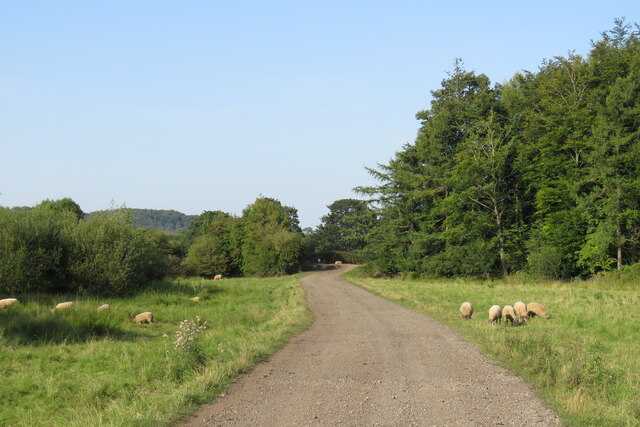
Pinnock Hill, located in County Durham, England, is a prominent hill that forms part of the Pennines range. It is situated within the North Pennines Area of Outstanding Natural Beauty, offering breathtaking views of the surrounding countryside. Rising to an elevation of approximately 500 meters (1,640 feet), Pinnock Hill is a notable landmark in the region.

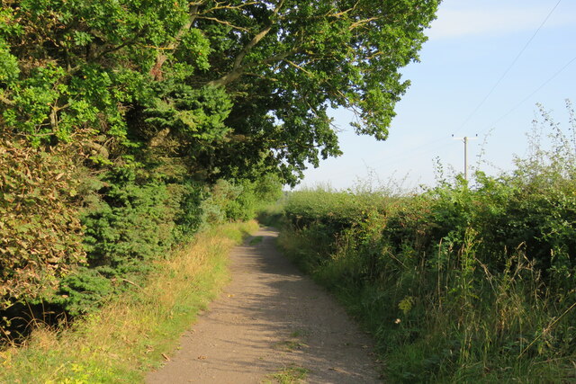
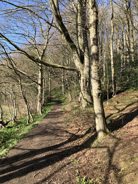
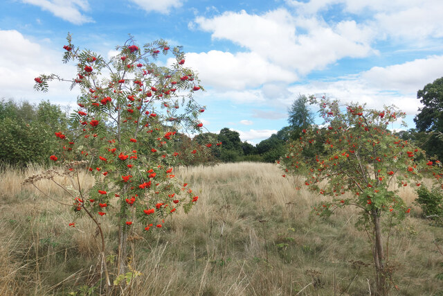
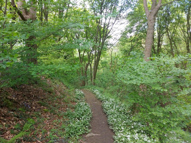
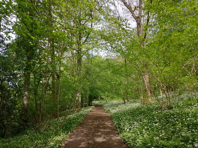
The hill is covered with a diverse range of vegetation, including heather, grasses, and scattered trees, providing a habitat for various species of wildlife. It is a popular destination for hikers and outdoor enthusiasts, as it offers a range of walking trails that cater to different levels of difficulty. Many visitors are drawn to the hill's panoramic views, which extend across the County Durham countryside and the nearby Teesdale Valley.

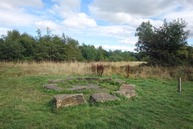
Pinnock Hill is steeped in history, with evidence of prehistoric settlements in the area. There are also remnants of Bronze Age burial mounds, indicating human occupation dating back thousands of years. The hill's strategic location made it a key vantage point during medieval times, allowing for the monitoring and defense of the surrounding areas.

Today, Pinnock Hill continues to attract visitors who seek tranquility, natural beauty, and outdoor adventure. Its close proximity to Durham City makes it easily accessible for both locals and tourists. The hill offers a peaceful retreat from the hustle and bustle of urban life, providing an opportunity to connect with nature and immerse oneself in the rich history and stunning landscapes of County Durham.

If you have any feedback on the listing, please let us know in the comments section below.
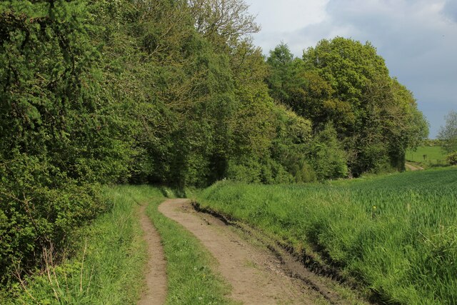
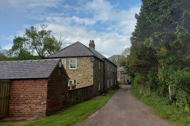
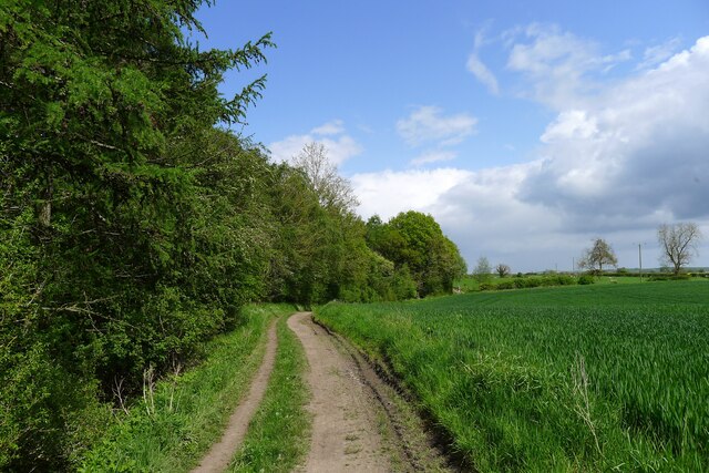
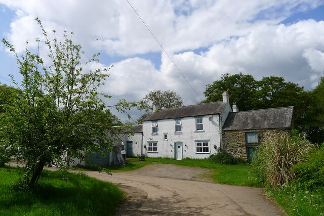
Pinnock Hill Images

Images are sourced within 2km of 54.755189/-1.5742323 or Grid Reference NZ2740. Thanks to Geograph Open Source API. All images are credited.

Track to Low Butterby Farm
Track Alongside Croxdale Wood The Weardale Way used this track from High Butterby Farm to Croxdale Hall.
Track Alongside Croxdale Wood
The Weardale Way used this track from High Butterby Farm to Croxdale Hall.
Path through Shincliffe Wood
Stone Spiral in Gary's Wood Gary's Wood is part of the Woodland Trust land at Lower Burnhall, a relatively new woodland area with extensive footpath access. It has various sculptures and stone features at intervals along the tracks.
Stone Spiral in Gary's Wood
Gary's Wood is part of the Woodland Trust land at Lower Burnhall, a relatively new woodland area with extensive footpath access. It has various sculptures and stone features at intervals along the tracks.
Rowan Trees, Low Burnhall Low Burnhall is a fairly recently established bit of forest managed by the Woodland Trust.
Rowan Trees, Low Burnhall
Low Burnhall is a fairly recently established bit of forest managed by the Woodland Trust.
Wicker Man, Low Burnhall A wickerwork figure of a miner sits beside a path in Low Burnhall Wood. There are several sculptures and features at intervals around the wood.
Wicker Man, Low Burnhall
A wickerwork figure of a miner sits beside a path in Low Burnhall Wood. There are several sculptures and features at intervals around the wood.
Wickerwork Figures, Low Burnhall Wood Some more of the wicker sculptures which can be seen in Low Burnhall Wood.
Wickerwork Figures, Low Burnhall Wood
Some more of the wicker sculptures which can be seen in Low Burnhall Wood.
Stone Circle, Low Burnhall Wood There are a lot of tracks and trails around Low Burnhall Wood with various features at intervals. Some stone, like this, some wickerwork, and some old industrial relics.
Stone Circle, Low Burnhall Wood
There are a lot of tracks and trails around Low Burnhall Wood with various features at intervals. Some stone, like this, some wickerwork, and some old industrial relics.
Durham, Cock of the North Hotel According to the OS benchmark database the OS Flush Bracket 8969 was embedded into the pub and hotel which was at this location. The pub has been demolished and replaced with new housing. It is likely the Flush Bracket has been destroyed.
Durham, Cock of the North Hotel
According to the OS benchmark database the OS Flush Bracket 8969 was embedded into the pub and hotel which was at this location. The pub has been demolished and replaced with new housing. It is likely the Flush Bracket has been destroyed.
Southern End of Croxdale Wood As seen from the Weardale Way long distance footpath - marking the beginning of a long stretch of woodland and woodland boundary walking
Southern End of Croxdale Wood
As seen from the Weardale Way long distance footpath - marking the beginning of a long stretch of woodland and woodland boundary walking
The Cottage by Croxdale Wood As seen from the Weardale Way
The Cottage by Croxdale Wood
As seen from the Weardale Way
Weardale Way beside Butterby Wood A 77 mile route following the River Wear from the sea at the Lindesfarne Memorial, Sunderland to the headwaters in the east Pennines, keeping as close as is possible to the river. It visits Lumley Castle, Durham (where the Castle and Cathedral forms a World Heritage Site), Bishop Auckland and Stanhope. After Stanhope the Way makes a northward loop to Rookhope to take in part of a tributary, Rookhope Burn.
Weardale Way beside Butterby Wood
A 77 mile route following the River Wear from the sea at the Lindesfarne Memorial, Sunderland to the headwaters in the east Pennines, keeping as close as is possible to the river. It visits Lumley Castle, Durham (where the Castle and Cathedral forms a World Heritage Site), Bishop Auckland and Stanhope. After Stanhope the Way makes a northward loop to Rookhope to take in part of a tributary, Rookhope Burn.
Weardale Way above Butterby Wood A 77 mile route following the River Wear from the sea at the Lindesfarne Memorial, Sunderland to the headwaters in the east Pennines, keeping as close as is possible to the river. It visits Lumley Castle, Durham (where the Castle and Cathedral forms a World Heritage Site), Bishop Auckland and Stanhope. After Stanhope the Way makes a northward loop to Rookhope to take in part of a tributary, Rookhope Burn.
Weardale Way above Butterby Wood
A 77 mile route following the River Wear from the sea at the Lindesfarne Memorial, Sunderland to the headwaters in the east Pennines, keeping as close as is possible to the river. It visits Lumley Castle, Durham (where the Castle and Cathedral forms a World Heritage Site), Bishop Auckland and Stanhope. After Stanhope the Way makes a northward loop to Rookhope to take in part of a tributary, Rookhope Burn.
The Weardale Way passing The Cottage and Croxdale Wood House Entering the Croxdale Hall estate
The Weardale Way passing The Cottage and Croxdale Wood House
Entering the Croxdale Hall estate
The Weardale Way passing Butterby Wood The name 'Butterby' is linked to Low Butterby Farm on the bank of the Wear, below the wood. Its name is believed to have been given by the Normans, 'beau trouvé' = well-found, and later assimilated to a more Scandinavian '-by' type of place-name <span class="nowrap"><a title="https://altogetherarchaeology.org/Place%20Names/PLACE-NAMES%20OF%20NORTHUMBERLAND%20AND%20DURHAM.pdf" rel="nofollow ugc noopener" href="https://altogetherarchaeology.org/Place%20Names/PLACE-NAMES%20OF%20NORTHUMBERLAND%20AND%20DURHAM.pdf">Link</a><img style="margin-left:2px;" alt="External link" title="External link - shift click to open in new window" src="https://s1.geograph.org.uk/img/external.png" width="10" height="10"/></span> .
The Weardale Way passing Butterby Wood
The name 'Butterby' is linked to Low Butterby Farm on the bank of the Wear, below the wood. Its name is believed to have been given by the Normans, 'beau trouvé' = well-found, and later assimilated to a more Scandinavian '-by' type of place-name LinkExternal link .
High Butterby Farm The name 'Butterby' is linked to Low Butterby Farm on the bank of the Wear, below here. Its name is believed to have been given by the Normans, 'beau trouvé' = well-found, and later assimilated to a more Scandinavian '-by' type of place-name <span class="nowrap"><a title="https://altogetherarchaeology.org/Place%20Names/PLACE-NAMES%20OF%20NORTHUMBERLAND%20AND%20DURHAM.pdf" rel="nofollow ugc noopener" href="https://altogetherarchaeology.org/Place%20Names/PLACE-NAMES%20OF%20NORTHUMBERLAND%20AND%20DURHAM.pdf">Link</a><img style="margin-left:2px;" alt="External link" title="External link - shift click to open in new window" src="https://s1.geograph.org.uk/img/external.png" width="10" height="10"/></span> .
High Butterby Farm
The name 'Butterby' is linked to Low Butterby Farm on the bank of the Wear, below here. Its name is believed to have been given by the Normans, 'beau trouvé' = well-found, and later assimilated to a more Scandinavian '-by' type of place-name LinkExternal link .
The Weardale Way through Butterby Wood A path lined with wild garlic, leading down to the River Wear.
The Weardale Way through Butterby Wood
A path lined with wild garlic, leading down to the River Wear.
Wild garlic lining the path through a haunted Shincliffe Wood The garlic protecting us from something? Shincliffe apparently means a "Cliff or bank haunted by a phantom or demon" <span class="nowrap"><a title="https://www.oxfordreference.com/display/10.1093/acref/9780199609086.001.0001/acref-9780199609086-e-11814?rskey=WWHHoj&result=11961" rel="nofollow ugc noopener" href="https://www.oxfordreference.com/display/10.1093/acref/9780199609086.001.0001/acref-9780199609086-e-11814?rskey=WWHHoj&result=11961">Link</a><img style="margin-left:2px;" alt="External link" title="External link - shift click to open in new window" src="https://s1.geograph.org.uk/img/external.png" width="10" height="10"/></span>
Wild garlic lining the path through a haunted Shincliffe Wood
The garlic protecting us from something? Shincliffe apparently means a "Cliff or bank haunted by a phantom or demon" LinkExternal link
Show me another place!

Pinnock Hill is located at Grid Ref: NZ2740 (Lat: 54.755189, Lng: -1.5742323)

Unitary Authority: County Durham

Police Authority: Durham

What 3 Words

///driver.guilty.congratulations. Near Durham, Co. Durham

Related Wikis

Oakthorpe Invitational

Oakthorpe Invitational Rugby Football Club, also known as Oakthorpe, is an invitational rugby club based in Oxfordshire. The club was founded by a group...

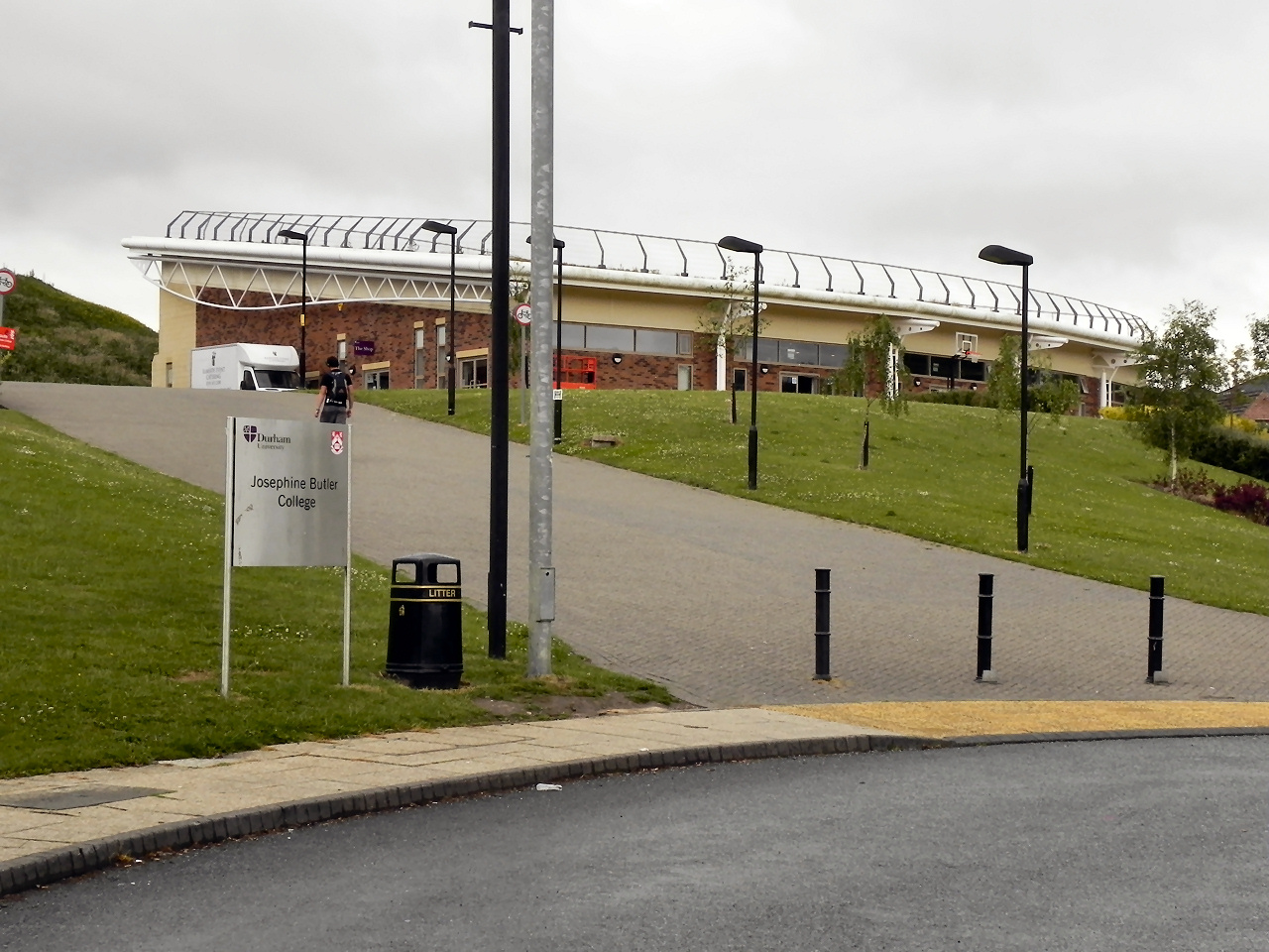
Josephine Butler College, Durham

Josephine Butler College is a constituent college of Durham University. The college was opened in 2006. It is named after Josephine Elizabeth Butler, a...

Durham University Botanic Garden

The Durham University Botanic Garden is a botanical garden located in Durham, England. The site is set in 25 acres (10 ha) of mature woodlands in the southern...

Stephenson College, Durham

Stephenson College is a college of the University of Durham in England. It was founded in 2001 as part the university's Queen's Campus in Thornaby-on...

Houghall

Houghall [pron: /ˈhɒfl/] is a hamlet in County Durham, in England. It is situated approximately 1.5 miles (2.4 km) to the south of Durham city centre....

Durham High School for Girls

Durham High School is a single-sex independent day school for girls aged 3 to 18 years old in Durham, United Kingdom. == History and current status... ==

Collingwood College, Durham

Collingwood College is a college of Durham University in England. It is the largest of Durham's undergraduate colleges with around 1800 students. Founded...
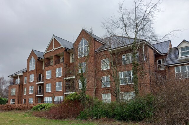
Mount Oswald

Mount Oswald is a manor house in Durham, County Durham, England. The property, which is being developed for academic and residential use, is a Grade II...

Related Videos

Durham Cathedral Tour #travel #travelvlog #uk #shorts

Durham Cathedral inside and out, including the view from the river. #shortswithcamilla #summeronyoutube.

Durham City Walk to Marketplace - Historic City in England - Walking Around 4K-HDR Walking Tour

Please subscribe and ring the , Like and share. Durham City is a beautiful historic city in North East England. It is very rare to ...

Nearby Amenities

Located within 500m of 54.755189,-1.5742323
Barrier: stile
Lat/Long: 54.7526103/-1.576369
Answer: Q
Ele: 63.09
Marker: post
Orienteering: marker
Ref: 20
Sport: orienteering
Lat/Long: 54.7566135/-1.5727696
Answer: P
Ele: 67.66
Marker: post
Note: Photo taken July 2021 clearly shows answer of P not F
Orienteering: marker
Ref: 19
Sport: orienteering
Lat/Long: 54.7595412/-1.5738359
7. Durham University Woodland
Ele: 60.21
Information: map
Tourism: information
Lat/Long: 54.7589759/-1.5734219
Bench
Ele: 68.62
Lat/Long: 54.7568325/-1.5799267
Bench
Ele: 67.66
Lat/Long: 54.7571212/-1.5797368
Bench
Ele: 66.46
Lat/Long: 54.7563516/-1.5811555
Created By: Potlatch 0.10f
Note: Wood mixed decid/conif from here on S/W
Lat/Long: 54.7553109/-1.5764861
Houghall
Description: Houses built starting 1939
Place: hamlet
Wikidata: Q11710159
Wikipedia: en:Houghall
Lat/Long: 54.7576935/-1.5682592
Houghall Hall Site?
Historic: yes
Lat/Long: 54.7563177/-1.5688205
Barrier: stile
Ele: 44.83
Lat/Long: 54.7575892/-1.5706839
Barrier: stile
Lat/Long: 54.757614/-1.5707268
6. The Old Waggonway
Ele: 42.18
Information: map
Tourism: information
Lat/Long: 54.7579359/-1.5696454
Bench
Ele: 67.66
Lat/Long: 54.756701/-1.5815614
Ele: 47.0
Traffic Calming: bump
Lat/Long: 54.7580563/-1.5682666
Ele: 43.0
Lat/Long: 54.7572817/-1.5682637
Power: pole
Lat/Long: 54.7570941/-1.5674286
Barrier: entrance
Lat/Long: 54.7529189/-1.5807728
Stone Spiral
Material: stone
Source: survey
Tourism: artwork
Lat/Long: 54.7516313/-1.5778512
Addr City: Durham
Addr Housenumber: 2
Addr Postcode: DH1 3SF
Addr Street: Farm Road
Lat/Long: 54.7570347/-1.5684678
Addr City: Durham
Addr Housenumber: 4
Addr Postcode: DH1 3SF
Lat/Long: 54.757201/-1.5684545
Addr City: Durham
Addr Housenumber: 3
Addr Postcode: DH1 3SF
Lat/Long: 54.7571586/-1.5684701
Addr City: Durham
Addr Housenumber: 11
Addr Postcode: DH1 3SF
Lat/Long: 54.7580621/-1.5684606
Addr City: Durham
Addr Housenumber: 1
Addr Postcode: DH1 3SF
Lat/Long: 54.7569839/-1.5684706
Addr City: Durham
Addr Housename: Journeys End
Addr Housenumber: 9
Addr Postcode: DH1 3SF
Lat/Long: 54.7578828/-1.5684583
Addr City: Durham
Addr Housenumber: 10
Addr Postcode: DH1 3SF
Lat/Long: 54.7579879/-1.5684473
The Bench
Leisure: fitness_station
Lat/Long: 54.7583971/-1.5790292
Pavilion I
Entrance: yes
Lat/Long: 54.7590066/-1.5782579
Explore Further
Answer: E
Hiking: yes
Information: map
Marker: plate
Ref: 160
Sport: orienteering
Tourism: information
Lat/Long: 54.7525618/-1.5763886
Walking in Low Burnhall
Hiking: yes
Information: map
Tourism: information
Lat/Long: 54.7525947/-1.5764556
Hiking: yes
Information: route_marker
Note: Salt Sulphur Trail continue W
Tourism: information
Lat/Long: 54.7513788/-1.5778966
Answer: B
Marker: post
New Answer: N
New Ref: 145
Orienteering: marker
Ref: 28
Sport: orienteering
Lat/Long: 54.7516224/-1.5779134
Hiking: yes
Information: route_marker
Note: Salt Sulphur Trail turn R
Tourism: information
Lat/Long: 54.7517239/-1.5779536
Answer: E
Marker: post
Note: Number no longer visible
Orienteering: marker
Ref: 30
Sport: orienteering
Lat/Long: 54.7510142/-1.5757039
Barrier: entrance
Lat/Long: 54.7572509/-1.5764852
Barrier: entrance
Lat/Long: 54.7571777/-1.5765406
Botanic Garden
Information: map
Tourism: information
Lat/Long: 54.7586296/-1.5756999
The data included in this document is from www.openstreetmap.org. The data is made available under ODbL.

Have you been to Pinnock Hill?

Leave your review of Pinnock Hill below (or comments, questions and feedback).