Hollinside Wood

Wood, Forest in Durham

England

Hollinside Wood

Track to Low Butterby Farm
Track to Low Butterby Farm Credit: David Robinson

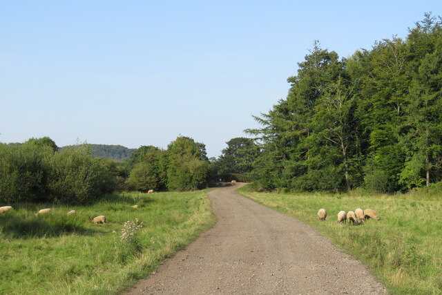
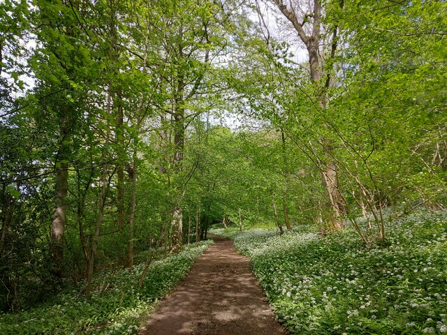
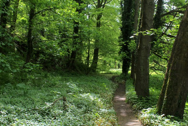
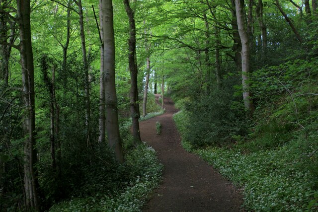
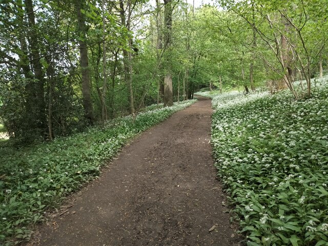
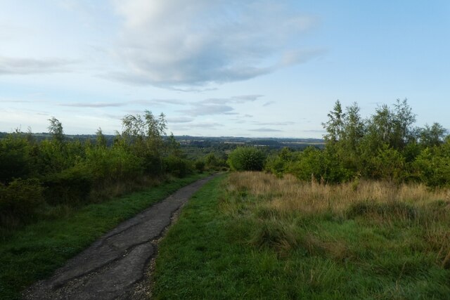
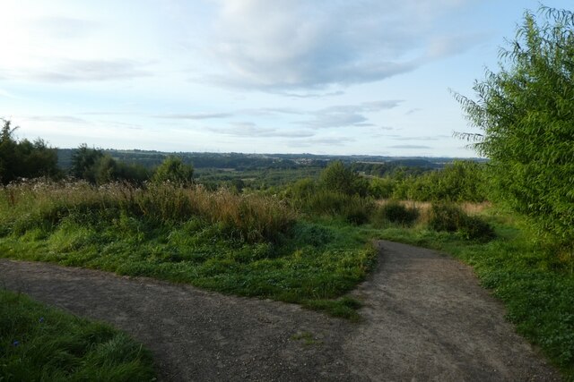
Hollinside Wood, located in Durham, England, is a picturesque forest renowned for its natural beauty and rich biodiversity. Spanning an area of approximately 220 acres, the wood is situated on the eastern slopes of the Derwent Valley, offering stunning views of the surrounding countryside.

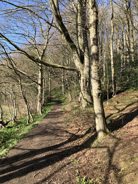
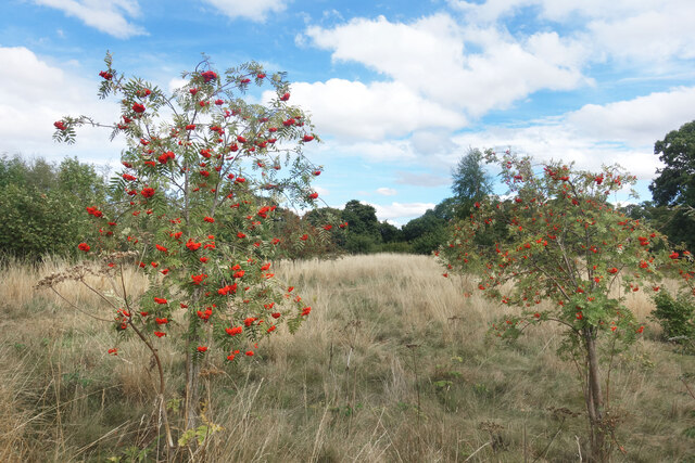
The wood is predominantly composed of deciduous trees, including oak, ash, and beech, creating a vibrant display of colors during the autumn months. The dense canopy provides a haven for a wide variety of flora and fauna, making it a popular destination for nature enthusiasts and birdwatchers.

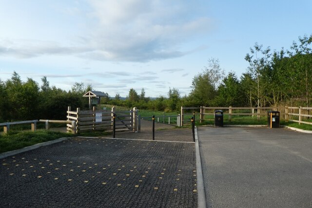
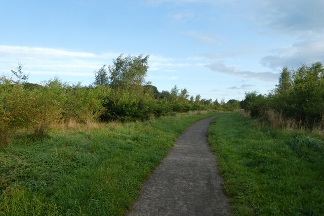
Tranquil footpaths wind their way through the wood, offering visitors the opportunity to explore and immerse themselves in the serene environment. These pathways are well-maintained, making it accessible for both casual strollers and more avid hikers.

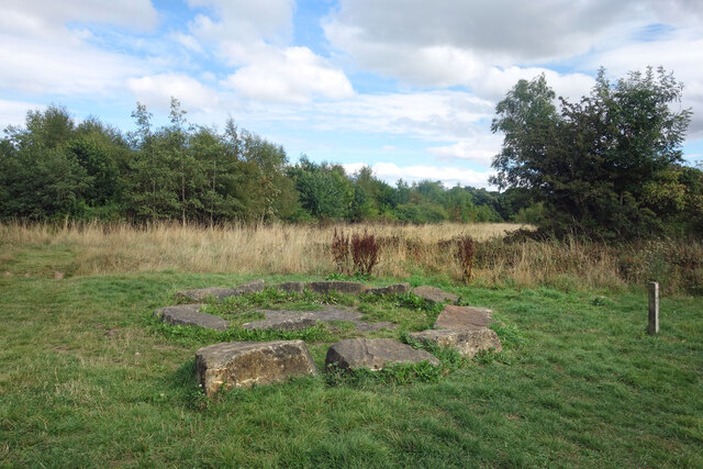
One notable feature of Hollinside Wood is its historical significance. The wood is believed to have been part of a much larger forest that covered the area during medieval times. The remnants of old boundaries and ridge and furrow formations can still be seen, providing a glimpse into the area's past.

In addition to its natural and historical allure, Hollinside Wood also serves as an important habitat for wildlife. The forest is home to a diverse range of animals, including deer, badgers, foxes, and a variety of bird species. Birdwatchers can spot woodpeckers, owls, and nuthatches among the trees.

Overall, Hollinside Wood is a captivating destination that offers visitors the opportunity to appreciate the beauty of nature, explore its historical significance, and observe the array of wildlife that calls it home.

If you have any feedback on the listing, please let us know in the comments section below.

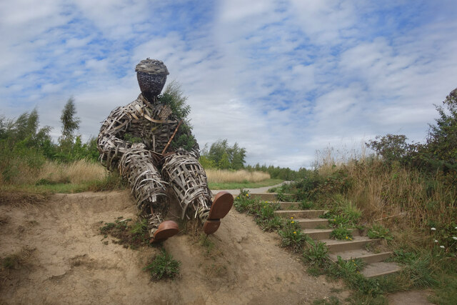
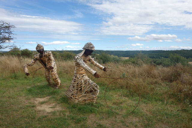
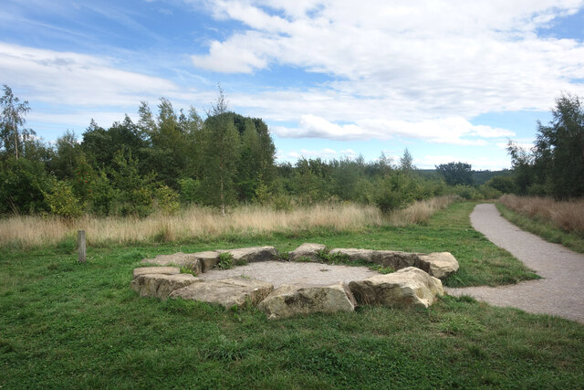
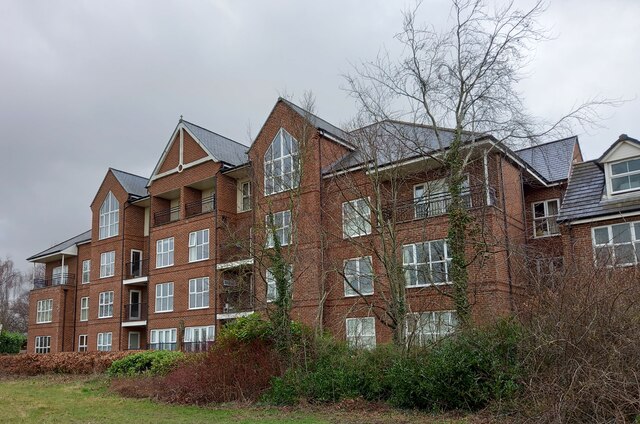
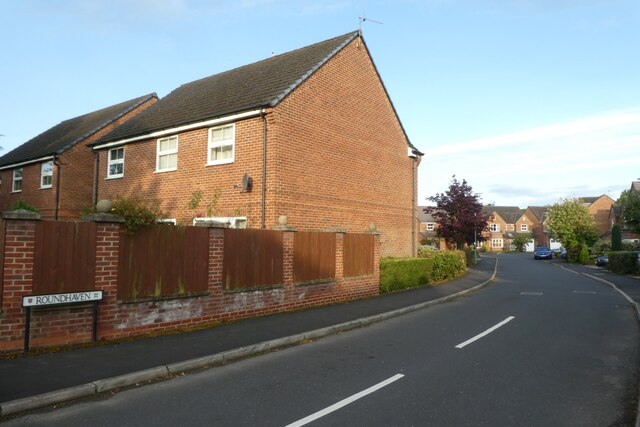
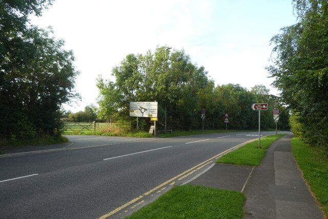
Hollinside Wood Images

Images are sourced within 2km of 54.759052/-1.574052 or Grid Reference NZ2740. Thanks to Geograph Open Source API. All images are credited.

Track to Low Butterby Farm
Path through Shincliffe Wood
Stone Spiral in Gary's Wood Gary's Wood is part of the Woodland Trust land at Lower Burnhall, a relatively new woodland area with extensive footpath access. It has various sculptures and stone features at intervals along the tracks.
Stone Spiral in Gary's Wood
Gary's Wood is part of the Woodland Trust land at Lower Burnhall, a relatively new woodland area with extensive footpath access. It has various sculptures and stone features at intervals along the tracks.
Rowan Trees, Low Burnhall Low Burnhall is a fairly recently established bit of forest managed by the Woodland Trust.
Rowan Trees, Low Burnhall
Low Burnhall is a fairly recently established bit of forest managed by the Woodland Trust.
Wicker Man, Low Burnhall A wickerwork figure of a miner sits beside a path in Low Burnhall Wood. There are several sculptures and features at intervals around the wood.
Wicker Man, Low Burnhall
A wickerwork figure of a miner sits beside a path in Low Burnhall Wood. There are several sculptures and features at intervals around the wood.
Wickerwork Figures, Low Burnhall Wood Some more of the wicker sculptures which can be seen in Low Burnhall Wood.
Wickerwork Figures, Low Burnhall Wood
Some more of the wicker sculptures which can be seen in Low Burnhall Wood.
Stone Circle, Low Burnhall Wood There are a lot of tracks and trails around Low Burnhall Wood with various features at intervals. Some stone, like this, some wickerwork, and some old industrial relics.
Stone Circle, Low Burnhall Wood
There are a lot of tracks and trails around Low Burnhall Wood with various features at intervals. Some stone, like this, some wickerwork, and some old industrial relics.
Durham, Cock of the North Hotel According to the OS benchmark database the OS Flush Bracket 8969 was embedded into the pub and hotel which was at this location. The pub has been demolished and replaced with new housing. It is likely the Flush Bracket has been destroyed.
Durham, Cock of the North Hotel
According to the OS benchmark database the OS Flush Bracket 8969 was embedded into the pub and hotel which was at this location. The pub has been demolished and replaced with new housing. It is likely the Flush Bracket has been destroyed.
Wild garlic lining the path through a haunted Shincliffe Wood The garlic protecting us from something? Shincliffe apparently means a "Cliff or bank haunted by a phantom or demon" <span class="nowrap"><a title="https://www.oxfordreference.com/display/10.1093/acref/9780199609086.001.0001/acref-9780199609086-e-11814?rskey=WWHHoj&result=11961" rel="nofollow ugc noopener" href="https://www.oxfordreference.com/display/10.1093/acref/9780199609086.001.0001/acref-9780199609086-e-11814?rskey=WWHHoj&result=11961">Link</a><img style="margin-left:2px;" alt="External link" title="External link - shift click to open in new window" src="https://s1.geograph.org.uk/img/external.png" width="10" height="10"/></span>
Wild garlic lining the path through a haunted Shincliffe Wood
The garlic protecting us from something? Shincliffe apparently means a "Cliff or bank haunted by a phantom or demon" LinkExternal link
Weardale Way below The Sliddings in Shincliffe Wood The long distance footpath during a long flirtation with woodland south of Durham
Weardale Way below The Sliddings in Shincliffe Wood
The long distance footpath during a long flirtation with woodland south of Durham
Weardale Way in Shincliffe Wood A strong pungent aroma of wild garlic permeated this section of Shincliffe Wood - quite pleasing to the nostrils
Weardale Way in Shincliffe Wood
A strong pungent aroma of wild garlic permeated this section of Shincliffe Wood - quite pleasing to the nostrils
Wild Garlic in Shincliffe Wood The woodland is carpeted in dazzling white flowers, permeating the surroundings with that pleasant garlic aroma.
Wild Garlic in Shincliffe Wood
The woodland is carpeted in dazzling white flowers, permeating the surroundings with that pleasant garlic aroma.
Roundhaven from the A177 A street off South Road in Durham.
Roundhaven from the A177
A street off South Road in Durham.
Entrance to Low Burnhall An entrance to the Woodland Trust car park off the A177 South Road near Cock o' the North roundabout.
Entrance to Low Burnhall
An entrance to the Woodland Trust car park off the A177 South Road near Cock o' the North roundabout.
Car park at Low Burnhall Low Burnhall is a Woodland Trust site to the south of Durham.
Car park at Low Burnhall
Low Burnhall is a Woodland Trust site to the south of Durham.
Track towards the car park Low Burnhall is a Woodland Trust site to the south of Durham.
Track towards the car park
Low Burnhall is a Woodland Trust site to the south of Durham.
Path in Low Burnhall Low Burnhall is a Woodland Trust site to the south of Durham.
Path in Low Burnhall
Low Burnhall is a Woodland Trust site to the south of Durham.
Junction of paths at Low Burnhall Low Burnhall is a Woodland Trust site to the south of Durham.
Junction of paths at Low Burnhall
Low Burnhall is a Woodland Trust site to the south of Durham.
Show me another place!

Hollinside Wood is located at Grid Ref: NZ2740 (Lat: 54.759052, Lng: -1.574052)

Unitary Authority: County Durham

Police Authority: Durham

What 3 Words

///hang.pools.weedy. Near Durham, Co. Durham

Related Wikis

Durham University Botanic Garden

The Durham University Botanic Garden is a botanical garden located in Durham, England. The site is set in 25 acres (10 ha) of mature woodlands in the southern...

Oakthorpe Invitational

Oakthorpe Invitational Rugby Football Club, also known as Oakthorpe, is an invitational rugby club based in Oxfordshire. The club was founded by a group...

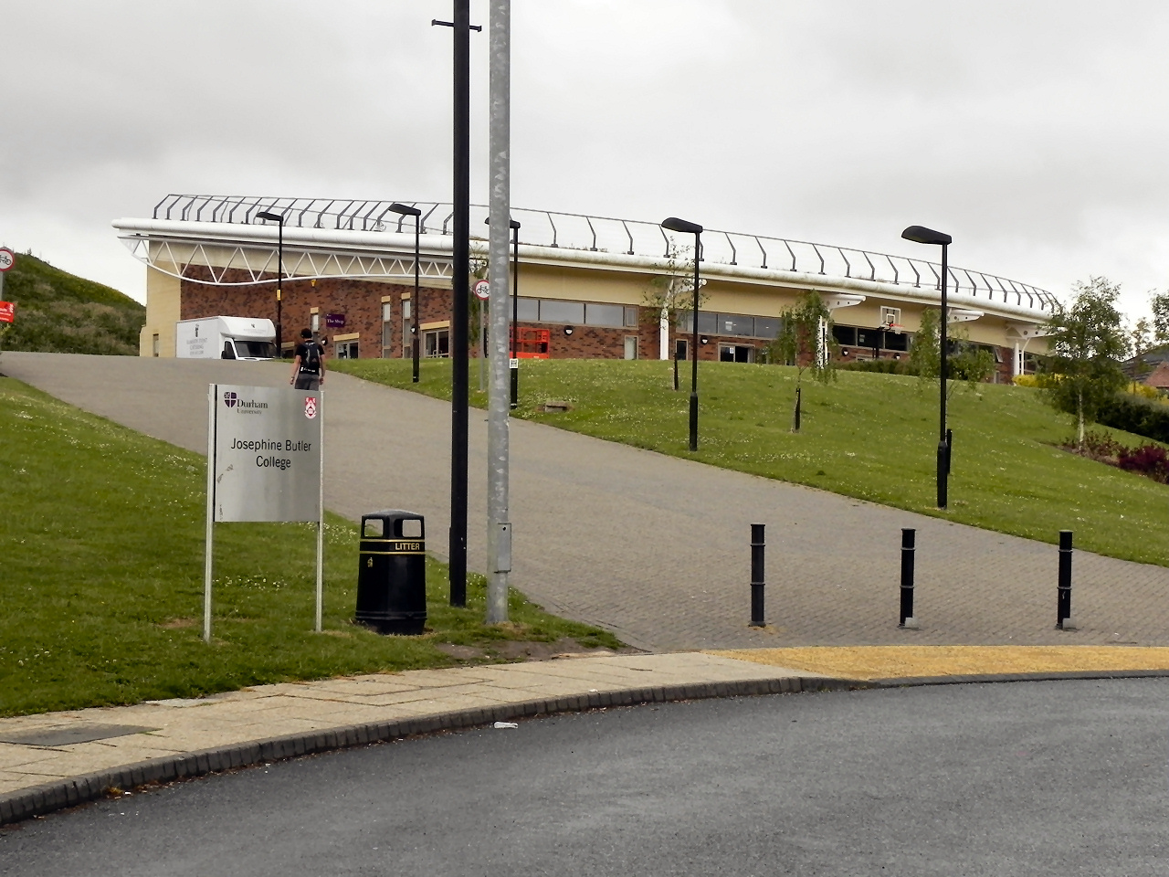
Josephine Butler College, Durham

Josephine Butler College is a constituent college of Durham University. The college was opened in 2006. It is named after Josephine Elizabeth Butler, a...

Collingwood College, Durham

Collingwood College is a college of Durham University in England. It is the largest of Durham's undergraduate colleges with around 1800 students. Founded...

Stephenson College, Durham

Stephenson College is a college of the University of Durham in England. It was founded in 2001 as part the university's Queen's Campus in Thornaby-on...

Van Mildert College, Durham

Van Mildert College (known colloquially as Mildert) is a college of Durham University in England. Founded in 1965, it takes its name from William Van Mildert...

Grey College, Durham

Grey College is a college of Durham University in England. Although it was originally planned for the college to be named Oliver Cromwell College, this...

South College, Durham

South College is a college of Durham University, which accepted its first students in autumn 2020.It is located in new buildings at Mount Oswald on Elvet...

Nearby Amenities

Located within 500m of 54.759052,-1.574052
Camera Mount: pole
Fixme: Confirm location
Man Made: surveillance
Operator: Durham University
Surveillance: public
Surveillance Type: camera
Lat/Long: 54.7628551/-1.5743509
Mini Roundabout
Direction: clockwise
Lat/Long: 54.7606618/-1.5797498
Crossing
Crossing: uncontrolled
Crossing Ref: zebra
Lat/Long: 54.760456/-1.5813799
Mini Roundabout
Direction: clockwise
Lat/Long: 54.7600004/-1.5813319
Access: customers
Barrier: full-height_turnstile
Foot: yes
Lat/Long: 54.7622018/-1.5794728
Barrier: stile
Foot: yes
Stile: stepover
Lat/Long: 54.7592804/-1.5682983
Barrier: stile
Lat/Long: 54.7584036/-1.5683908
Fungate
Artist Name: Graeme Hopper
Artwork Type: sculpture
Material: metal
Start Date: 2019
Tourism: artwork
Lat/Long: 54.759987/-1.5763423
Entrance: yes
Lat/Long: 54.7623295/-1.5749954
Entrance: main
Lat/Long: 54.762474/-1.5749504
Cafe
Botanic Garden Cafe
Addr City: Durham
Addr Postcode: DH1 3TN
Addr Street: Hollingside Lane
Fhrs Id: 303263
Operator: Durham University
Outdoor Seating: yes
Source Addr: FHRS Open Data
Lat/Long: 54.7624096/-1.5751096
Bicycle Parking
Bicycle Parking: stands
Capacity: 76
Operator: Durham University
Lat/Long: 54.7626355/-1.576435
Bench
Ele: 79.91
Lat/Long: 54.7609305/-1.5707976
Barrier: stile
Lat/Long: 54.7609929/-1.5683112
Bicycle Parking
Capacity: 20
Covered: yes
Description: Sheffield racks covered by transparent canopy.
Lat/Long: 54.7596208/-1.5816397
Bicycle Parking
Capacity: 10
Covered: no
Lat/Long: 54.7588141/-1.5804606
Bicycle Parking
Bicycle Parking: stands
Capacity: 4
Covered: no
Description: Wall-mounted stands.
Lat/Long: 54.7588989/-1.5803443
Bicycle Parking
Bicycle Parking: anchors
Capacity: 16
Covered: yes
Lat/Long: 54.7588678/-1.5800063
Answer: V
Ele: 100.82
Marker: post
New Ref: 21
Orienteering: marker
Ref: 25
Sport: orienteering
Lat/Long: 54.7622509/-1.5741584
Answer: I
Ele: 88.33
Marker: post
New Ref: 11
Orienteering: marker
Ref: 26
Sport: orienteering
Lat/Long: 54.7597352/-1.5749088
Answer: Q
Ele: 63.09
Marker: post
Orienteering: marker
Ref: 20
Sport: orienteering
Lat/Long: 54.7566135/-1.5727696
Bench
Ele: 64.77
Lat/Long: 54.7603107/-1.571806
Answer: P
Ele: 67.66
Marker: post
Note: Photo taken July 2021 clearly shows answer of P not F
Orienteering: marker
Ref: 19
Sport: orienteering
Lat/Long: 54.7595412/-1.5738359
7. Durham University Woodland
Ele: 60.21
Information: map
Tourism: information
Lat/Long: 54.7589759/-1.5734219
Bench
Ele: 68.62
Lat/Long: 54.7568325/-1.5799267
Bench
Ele: 67.66
Lat/Long: 54.7571212/-1.5797368
Created By: Potlatch 0.10f
Note: Wood mixed decid/conif from here on S/W
Lat/Long: 54.7553109/-1.5764861
Post Box
Collection Times: Mo-Fr 17:00; Sa 09:30; Su off
Ele: 37.38
Post Box Type: lamp
Ref: DH1 61
Royal Cypher: EIIR
Royal Cypher Wikidata: Q33102113
Lat/Long: 54.7583688/-1.5683211
8. Hospital Field
Ele: 50.35
Information: map
Tourism: information
Lat/Long: 54.7609709/-1.5683504
5. The Pond
Ele: 36.66
Information: map
Tourism: information
Lat/Long: 54.7587228/-1.5674118
Bench
Ele: 41.7
Lat/Long: 54.7586144/-1.567285
Bench
Ele: 38.1
Lat/Long: 54.7583024/-1.5671048
Bench
Ele: 37.86
Lat/Long: 54.7583569/-1.5672335
Answer: A
Ele: 38.58
Fixme: Confirm ref. Seem to have 2 markers with ref=6!
Marker: post
Orienteering: marker
Ref: 6
Sport: orienteering
Lat/Long: 54.7579507/-1.5674481
Ele: 39.06
Leisure: bird_hide
Lat/Long: 54.7585896/-1.5675425
Bench
Ele: 36.18
Lat/Long: 54.7583866/-1.5678601
Houghall
Description: Houses built starting 1939
Place: hamlet
Wikidata: Q11710159
Wikipedia: en:Houghall
Lat/Long: 54.7576935/-1.5682592
Houghall Hall Site?
Historic: yes
Lat/Long: 54.7563177/-1.5688205
Barrier: stile
Ele: 44.83
Lat/Long: 54.7575892/-1.5706839
Barrier: stile
Lat/Long: 54.757614/-1.5707268
6. The Old Waggonway
Ele: 42.18
Information: map
Tourism: information
Lat/Long: 54.7579359/-1.5696454
Barrier: log
Lat/Long: 54.7602072/-1.575482
Ele: 45.0
Traffic Calming: bump
Lat/Long: 54.7582494/-1.5682673
Ele: 47.0
Traffic Calming: bump
Lat/Long: 54.7580563/-1.5682666
Ele: 43.0
Lat/Long: 54.7572817/-1.5682637
Bench
Ele: 81.0
Lat/Long: 54.7605328/-1.5754873
Bench
Ele: 86.4
Lat/Long: 54.7605972/-1.5758649
Ele: 86.64
Leisure: picnic_table
Lat/Long: 54.760721/-1.5759078
Bench
Ele: 82.8
Lat/Long: 54.7606913/-1.5754443
Bench
Lat/Long: 54.7607606/-1.5756933
Bench
Ele: 82.32
Lat/Long: 54.760929/-1.5757448
Ele: 83.28
Leisure: picnic_table
Lat/Long: 54.7609191/-1.5759336
Bench
Ele: 90.25
Lat/Long: 54.7614044/-1.5750238
Ele: 78.23
Leisure: picnic_table
Lat/Long: 54.7601069/-1.5764571
Ele: 69.0
Leisure: picnic_table
Lat/Long: 54.7604536/-1.5769121
Ele: 73.0
Leisure: picnic_table
Lat/Long: 54.7605378/-1.5770408
Bench
Ele: 77.0
Lat/Long: 54.7609326/-1.5776873
Bench
Ele: 88.81
Lat/Long: 54.7604871/-1.5762588
Bench
Lat/Long: 54.7605689/-1.5761973
Bench
Ele: 93.13
Lat/Long: 54.761454/-1.5752641
Bench
Ele: 93.37
Lat/Long: 54.7615283/-1.5751869
Bench
Ele: 92.89
Lat/Long: 54.7615778/-1.5750409
Bench
Ele: 93.85
Lat/Long: 54.7616471/-1.5750409
Ele: 94.0
Leisure: picnic_table
Lat/Long: 54.7616025/-1.5750667
Ele: 94.0
Leisure: picnic_table
Lat/Long: 54.7616124/-1.5751268
Ele: 91.69
Leisure: picnic_table
Lat/Long: 54.7616521/-1.5751611
Millennium Bug
Artwork Type: sculpture
Ele: 94.0
Image: https://www.geograph.org.uk/photo/2907571
Tourism: artwork
Lat/Long: 54.7616142/-1.5750912
Bench
Ele: 92.41
Lat/Long: 54.7617164/-1.5747234
Bench
Ele: 92.17
Lat/Long: 54.7616719/-1.574629
Bench
Ele: 95.3
Lat/Long: 54.7617056/-1.5748208
Bench
Ele: 91.93
Lat/Long: 54.7617511/-1.5746719
Bench
Ele: 92.65
Lat/Long: 54.7618353/-1.574526
Bench
Ele: 91.93
Lat/Long: 54.7618947/-1.5745603
Bench
Ele: 91.0
Note: Group of benches
Lat/Long: 54.7618392/-1.574834
Bench
Ele: 91.0
Note: Group of benches
Lat/Long: 54.7618682/-1.5748034
Bench
Ele: 91.0
Lat/Long: 54.761241/-1.5758735
Bench
Ele: 97.46
Lat/Long: 54.7611915/-1.5760022
Bench
Ele: 79.19
Lat/Long: 54.7607221/-1.5765701
Bench
Ele: 80.88
Lat/Long: 54.7606864/-1.576852
Ele: 76.0
Leisure: picnic_table
Lat/Long: 54.761084/-1.57827
Toilets
Lat/Long: 54.7624279/-1.5748618
Bench
Ele: 84.72
Lat/Long: 54.761969/-1.5774185
Bench
Ele: 81.0
Lat/Long: 54.7620235/-1.5780364
Ele: 83.52
Leisure: picnic_table
Lat/Long: 54.76187/-1.5769292
Bench
Ele: 84.0
Lat/Long: 54.7618353/-1.5766031
Ele: 84.0
Leisure: picnic_table
Lat/Long: 54.7617511/-1.5785085
Bench
Ele: 72.7
Lat/Long: 54.7614886/-1.5781652
Bench
Ele: 86.88
Lat/Long: 54.7616818/-1.5762683
Bench
Ele: 88.33
Lat/Long: 54.7614936/-1.5768777
Leisure: picnic_table
Note: Estimated position.
Lat/Long: 54.7613164/-1.5771938
Bench
Ele: 90.25
Lat/Long: 54.7615827/-1.5757533
Bench
Ele: 87.85
Lat/Long: 54.7612856/-1.5767576
Bench
Ele: 87.36
Lat/Long: 54.7613351/-1.576646
Ele: 88.57
Leisure: picnic_table
Lat/Long: 54.7613252/-1.5765601
Bench
Ele: 86.88
Lat/Long: 54.7611965/-1.5767232
Ele: 89.0
Leisure: picnic_table
Lat/Long: 54.761241/-1.5765001
Bench
Ele: 88.33
Lat/Long: 54.7612212/-1.5764142
Bench
Ele: 86.16
Lat/Long: 54.761345/-1.5762855
Bench
Ele: 89.0
Lat/Long: 54.7611172/-1.5765001
Bench
Building: yes
Lat/Long: 54.7613203/-1.5761138
Bench
Ele: 85.2
Lat/Long: 54.7615926/-1.5760881
Bench
Lat/Long: 54.7611766/-1.5763542
Bench
Lat/Long: 54.7611321/-1.5764056
Waste Basket
Ele: 96.5
Lat/Long: 54.7627069/-1.5745002
Ele: 90.97
Leisure: picnic_table
Lat/Long: 54.7622265/-1.5752469
Ele: 94.09
Leisure: picnic_table
Lat/Long: 54.7619535/-1.5752077
Ele: 92.41
Leisure: picnic_table
Lat/Long: 54.7619275/-1.5751412
Leisure: picnic_table
Lat/Long: 54.7619188/-1.5750495
Ele: 93.61
Leisure: picnic_table
Lat/Long: 54.7619283/-1.5749569
Bench
Lat/Long: 54.7623497/-1.5751839
Bench
Ele: 92.89
Lat/Long: 54.7623355/-1.5750753
Ele: 91.69
Leisure: picnic_table
Lat/Long: 54.7622958/-1.5751182
Ele: 92.17
Leisure: picnic_table
Lat/Long: 54.7622612/-1.5751783
Ele: 91.93
Leisure: picnic_table
Lat/Long: 54.7622364/-1.5751182
Bench
Ele: 91.69
Lat/Long: 54.7622364/-1.5750667
Bench
Ele: 94.0
Note: Benches line both sides of path
Lat/Long: 54.7622832/-1.5749898
Leisure: picnic_table
Note: Estimated position.
Lat/Long: 54.7613118/-1.5770835
Barrier: kissing_gate
Lat/Long: 54.7611824/-1.5767074
Key years matched to a tree's rings
Board Type: nature
Information: board
Ref: F
Tourism: information
Lat/Long: 54.7608222/-1.5769422
Foxglove Post
Artist Name: Ian Hamilton-Finlay
Artwork Type: sculpture
Image: https://www.geograph.org.uk/photo/6135267
Material: wood
Tourism: artwork
Lat/Long: 54.7601998/-1.5763693
Native Trees and Woodland
Board Type: nature
Information: board
Tourism: information
Lat/Long: 54.7599587/-1.5762848
Bench
Lat/Long: 54.7602179/-1.5757377
Bench
Lat/Long: 54.7602007/-1.5757635
Bench
Lat/Long: 54.7601809/-1.5757721
Bench
Lat/Long: 54.7601561/-1.5757659
Bench
Lat/Long: 54.7601416/-1.5757361
Bench
Lat/Long: 54.7601322/-1.5756994
Bench
Lat/Long: 54.7601353/-1.5756579
Bench
Lat/Long: 54.7601425/-1.5756196
Bench
Lat/Long: 54.7601597/-1.5756032
Bench
Lat/Long: 54.7601868/-1.5756024
Power: pole
Lat/Long: 54.7574523/-1.5673628
Barrier: entrance
Lat/Long: 54.7589599/-1.568407
Barrier: entrance
Lat/Long: 54.7589131/-1.5686593
Power: pole
Lat/Long: 54.7570941/-1.5674286
Power: pole
Lat/Long: 54.7576627/-1.5668901
Bicycle Parking
Bicycle Parking: stands
Capacity: 6
Source: survey
Lat/Long: 54.7622393/-1.5793078
Bicycle Parking
Bicycle Parking: stands
Capacity: 8
Covered: yes
Operator: Durham University
Source: survey
Lat/Long: 54.7626454/-1.5744179
Alder
Board Type: nature
Information: board
Tourism: information
Lat/Long: 54.7584732/-1.5672522
Hawthorn
Board Type: nature
Information: board
Tourism: information
Lat/Long: 54.7587569/-1.5673707
Larch
Board Type: nature
Information: board
Tourism: information
Lat/Long: 54.7579994/-1.5675509
Tree
Board Type: nature
Information: board
Tourism: information
Lat/Long: 54.7586947/-1.5673365
Power: pole
Ref: 10
Lat/Long: 54.7577489/-1.566803
Bicycle Parking
Bicycle Parking: stands
Capacity: 7
Covered: yes
Description: Sheffield racks with a transparent canopy
Lat/Long: 54.7595902/-1.5794112
Bicycle Parking
Bicycle Parking: stands
Capacity: 7
Covered: yes
Description: Sheffield stands with a transparent canopy on. An eighth bicycle may fit at the edge between a stand and the side of the canopy.
Lat/Long: 54.7593466/-1.5793652
Addr City: Durham
Addr Housenumber: 2
Addr Postcode: DH1 3SF
Addr Street: Farm Road
Lat/Long: 54.7570347/-1.5684678
Addr City: Durham
Addr Housenumber: 4
Addr Postcode: DH1 3SF
Lat/Long: 54.757201/-1.5684545
Addr City: Durham
Addr Housenumber: 3
Addr Postcode: DH1 3SF
Lat/Long: 54.7571586/-1.5684701
Addr City: Durham
Addr Housenumber: 11
Addr Postcode: DH1 3SF
Lat/Long: 54.7580621/-1.5684606
Addr City: Durham
Addr Housenumber: 2
Addr Postcode: DH1 3SL
Lat/Long: 54.75864/-1.5685966
Addr City: Durham
Addr Housenumber: 1
Addr Postcode: DH1 3SL
Lat/Long: 54.758523/-1.5685996
Addr City: Durham
Addr Housenumber: 1
Addr Postcode: DH1 3SF
Lat/Long: 54.7569839/-1.5684706
Addr City: Durham
Addr Housename: Journeys End
Addr Housenumber: 9
Addr Postcode: DH1 3SF
Lat/Long: 54.7578828/-1.5684583
Addr City: Durham
Addr Housenumber: 10
Addr Postcode: DH1 3SF
Lat/Long: 54.7579879/-1.5684473
Bicycle Parking
Bicycle Parking: stands
Capacity: 7
Covered: yes
Description: Sheffield stands with a transparent canopy. Accuracy of position: +/- 10 metres.
Lat/Long: 54.7594199/-1.5793549
Bicycle Parking
Bicycle Parking: stands
Capacity: 6
Covered: yes
Lat/Long: 54.7592072/-1.5794629
Bicycle Parking
Bicycle Parking: stands
Capacity: 8
Covered: yes
Lat/Long: 54.7591467/-1.579543
Bicycle Parking
Bicycle Parking: stands
Capacity: 10
Covered: no
Description: Position accurate to +/- 10 metres.
Lat/Long: 54.759035/-1.5798709
Bicycle Parking
Bicycle Parking: stands
Capacity: 12
Covered: no
Description: Position accurate to +/- 10 metres.
Lat/Long: 54.7590638/-1.5797297
Bicycle Parking
Bicycle Parking: stands
Capacity: 2
Covered: no
Description: Wall-mounted rack. Position accurate to +/- 10 metres.
Lat/Long: 54.7590051/-1.5810876
Bicycle Parking
Bicycle Parking: stands
Capacity: 2
Covered: no
Description: Wall-mounted stand. Position accurate to +/- 10 metres.
Fixme: Please improve accuracy of location.
Lat/Long: 54.7590143/-1.5816141
Bicycle Parking
Capacity: 2
Covered: no
Description: Wall-mounted stand. Position accurate to +/- 5 metres.
Lat/Long: 54.7592158/-1.5814292
Bicycle Parking
Bicycle Parking: stands
Capacity: 26
Covered: no
Lat/Long: 54.7592915/-1.5816869
Bicycle Parking
Bicycle Parking: stands
Capacity: 10
Covered: no
Description: Sheffield stands. Position accurate to +/- 10 metres.
Lat/Long: 54.759447/-1.5808037
Entrance: main
Lat/Long: 54.7598746/-1.5816321
Bench
Inscription: In memory of Sousen Mansour Aljadid
Lat/Long: 54.7585568/-1.5817502
Pull up
Leisure: fitness_station
Lat/Long: 54.7583329/-1.580474
Seated Row
Leisure: fitness_station
Lat/Long: 54.7583038/-1.5804367
The Bench
Leisure: fitness_station
Lat/Long: 54.7583971/-1.5790292
Pavilion I
Entrance: yes
Lat/Long: 54.7590066/-1.5782579
Pavilion H
Entrance: yes
Lat/Long: 54.7591371/-1.5782036
Pavilion F & G
Entrance: yes
Lat/Long: 54.7592014/-1.5782922
Pavilion D
Entrance: yes
Lat/Long: 54.7593667/-1.578508
Pavilion E
Entrance: yes
Lat/Long: 54.7593104/-1.5784476
Pavilion B & C
Entrance: yes
Lat/Long: 54.7593516/-1.5787865
Pavilion A
Entrance: yes
Lat/Long: 54.7592867/-1.579174
Bench
Lat/Long: 54.7590259/-1.579769
Bench
Lat/Long: 54.7590159/-1.5798468
Bench
Lat/Long: 54.7589834/-1.5798227
Bench
Lat/Long: 54.7589864/-1.5797543
Waste Basket
Lat/Long: 54.7590607/-1.5797596
Pavilion A
Entrance: yes
Lat/Long: 54.7588983/-1.5799235
Bar
The Bar at Josephine Butler
Lat/Long: 54.7598791/-1.579601
Barrier: stile
Lat/Long: 54.7602029/-1.5774775
Bench
Lat/Long: 54.7601981/-1.5767755
Bench
Lat/Long: 54.7601571/-1.5767433
Shop: gift
Lat/Long: 54.7623957/-1.5749355
Artwork Type: sculpture
Tourism: artwork
Wikimedia Commons: File:Buck Statue (geograph 5908294).jpg
Lat/Long: 54.7630751/-1.5766642
Barrier: entrance
Lat/Long: 54.7572509/-1.5764852
Barrier: entrance
Lat/Long: 54.7571777/-1.5765406
Botanic Garden
Information: map
Tourism: information
Lat/Long: 54.7586296/-1.5756999
Building Levels: 2
Entrance: yes
Lat/Long: 54.7631873/-1.5721159
Building Levels: 1
Entrance: yes
Lat/Long: 54.7631246/-1.5714507
Building Levels: 1
Entrance: yes
Lat/Long: 54.7631308/-1.572553
Building Levels: 1
Entrance: main
Lat/Long: 54.7630379/-1.5719823
Answer: G
Marker: post
Orienteering: marker
Ref: 18
Sport: orienteering
Lat/Long: 54.7618889/-1.5737217
Answer: Z
Marker: post
Orienteering: marker
Ref: 6
Sport: orienteering
Lat/Long: 54.7606508/-1.5692693
Man Made: mast
Tower Type: communication
Lat/Long: 54.7629876/-1.574159
Leisure: outdoor_seating
Lat/Long: 54.7621411/-1.5750226
Vessels of Life
Tourism: artwork
Lat/Long: 54.7608025/-1.575999
Artwork Subject: heron
Artwork Type: sculpture
Image: https://www.geograph.org.uk/photo/3609693
Tourism: artwork
Lat/Long: 54.7619957/-1.5751386
Parking Space
Capacity: 6
Parking Space: disabled
Lat/Long: 54.7606805/-1.5812846
The data included in this document is from www.openstreetmap.org. The data is made available under ODbL.

Have you been to Hollinside Wood?

Leave your review of Hollinside Wood below (or comments, questions and feedback).