Buck's Hill

Hill, Mountain in Durham

England

Buck's Hill

Track to Low Butterby Farm
Track to Low Butterby Farm Credit: David Robinson

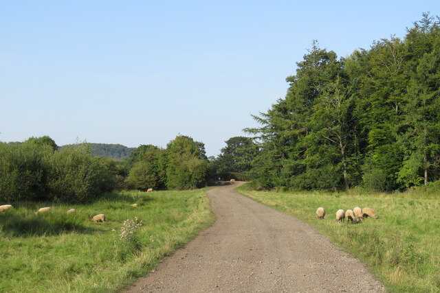
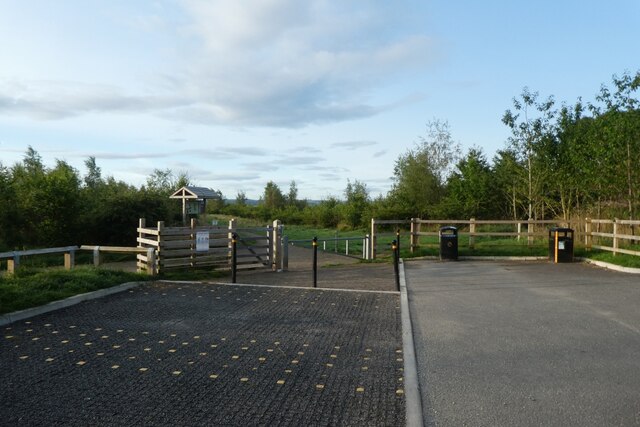
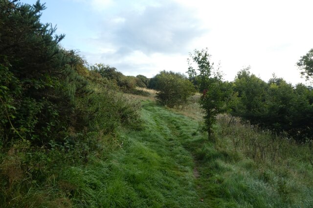
Buck's Hill is a notable landmark located in Durham, a city in the northeastern part of the United Kingdom. Standing at an elevation of approximately 80 meters, Buck's Hill is classified as a hill rather than a mountain due to its relatively modest height. It is situated in the western part of Durham, near the neighborhoods of Newton Hall and Framwellgate Moor.

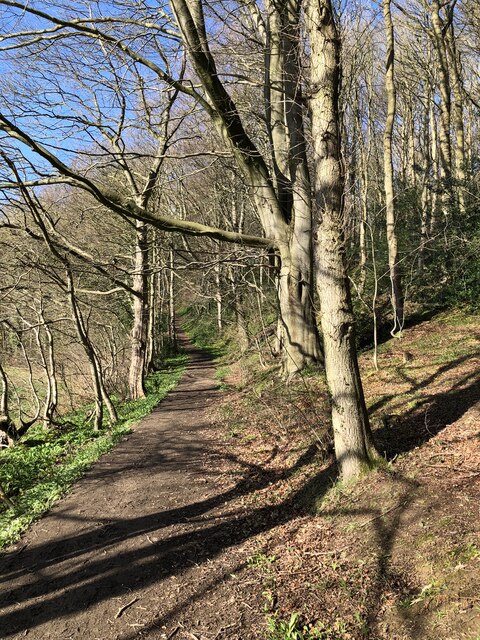
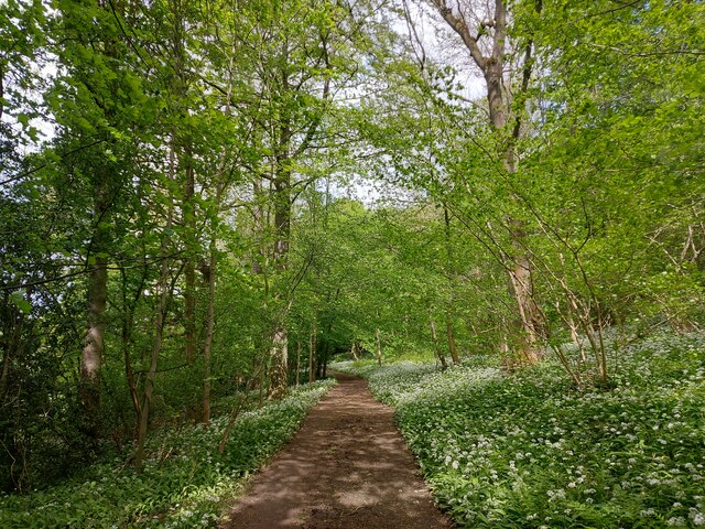
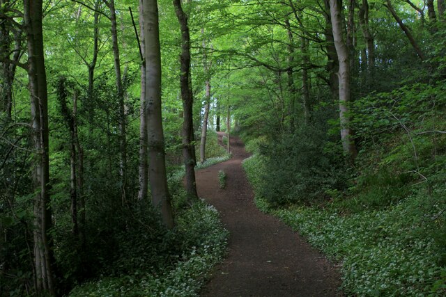
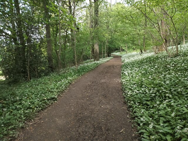
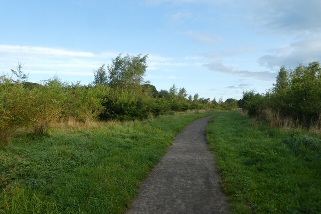
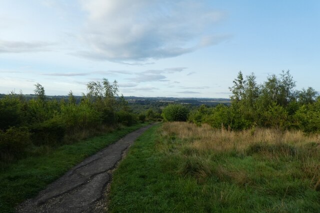
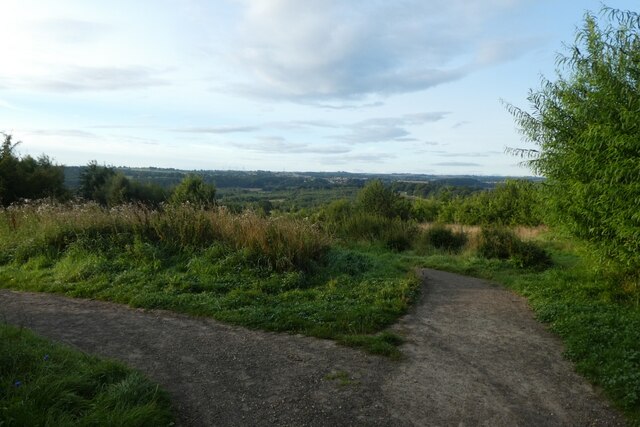
The hill is characterized by its gentle slopes, covered with lush green vegetation, which provides a picturesque view of the surrounding areas. It offers a peaceful and serene environment, making it a popular spot for locals and tourists seeking to enjoy nature and engage in outdoor activities such as walking, jogging, and picnicking.

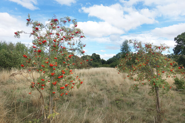
Buck's Hill is also home to a variety of wildlife, including rabbits, birds, and occasional deer sightings. The diverse flora and fauna add to the overall charm and appeal of the area. It is not uncommon to witness nature enthusiasts and photographers capturing the beauty of the hill's landscape.

Additionally, Buck's Hill has historical importance in Durham, as it is believed to have been a significant vantage point during medieval times. The hill provided a strategic location for military purposes and offered a commanding view of the city and its surroundings.

Overall, Buck's Hill in Durham is a scenic and historically significant landmark, attracting both nature lovers and history enthusiasts alike. Its tranquil ambiance and stunning views make it an ideal destination for those seeking a peaceful retreat or an opportunity to explore the rich heritage of the region.

If you have any feedback on the listing, please let us know in the comments section below.
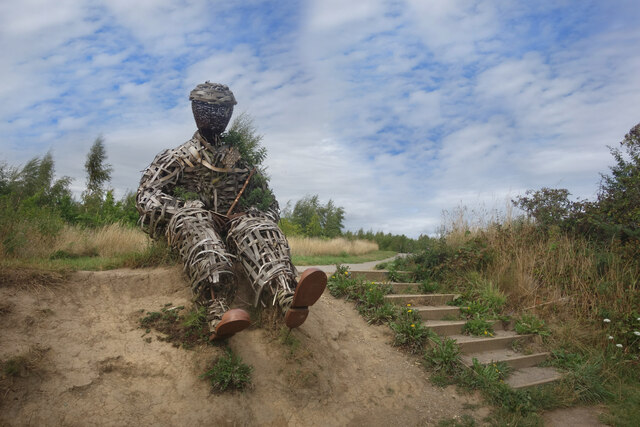
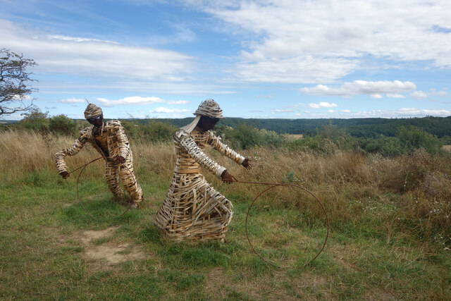
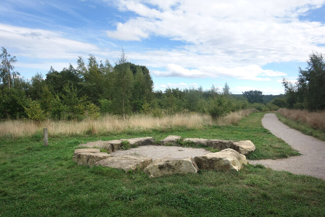
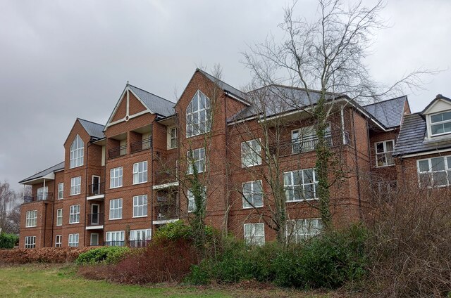
Buck's Hill Images

Images are sourced within 2km of 54.76228/-1.5719823 or Grid Reference NZ2740. Thanks to Geograph Open Source API. All images are credited.

Track to Low Butterby Farm
Path through Shincliffe Wood
Stone Spiral in Gary's Wood Gary's Wood is part of the Woodland Trust land at Lower Burnhall, a relatively new woodland area with extensive footpath access. It has various sculptures and stone features at intervals along the tracks.
Stone Spiral in Gary's Wood
Gary's Wood is part of the Woodland Trust land at Lower Burnhall, a relatively new woodland area with extensive footpath access. It has various sculptures and stone features at intervals along the tracks.
Rowan Trees, Low Burnhall Low Burnhall is a fairly recently established bit of forest managed by the Woodland Trust.
Rowan Trees, Low Burnhall
Low Burnhall is a fairly recently established bit of forest managed by the Woodland Trust.
Wicker Man, Low Burnhall A wickerwork figure of a miner sits beside a path in Low Burnhall Wood. There are several sculptures and features at intervals around the wood.
Wicker Man, Low Burnhall
A wickerwork figure of a miner sits beside a path in Low Burnhall Wood. There are several sculptures and features at intervals around the wood.
Wickerwork Figures, Low Burnhall Wood Some more of the wicker sculptures which can be seen in Low Burnhall Wood.
Wickerwork Figures, Low Burnhall Wood
Some more of the wicker sculptures which can be seen in Low Burnhall Wood.
Stone Circle, Low Burnhall Wood There are a lot of tracks and trails around Low Burnhall Wood with various features at intervals. Some stone, like this, some wickerwork, and some old industrial relics.
Stone Circle, Low Burnhall Wood
There are a lot of tracks and trails around Low Burnhall Wood with various features at intervals. Some stone, like this, some wickerwork, and some old industrial relics.
Durham, Cock of the North Hotel According to the OS benchmark database the OS Flush Bracket 8969 was embedded into the pub and hotel which was at this location. The pub has been demolished and replaced with new housing. It is likely the Flush Bracket has been destroyed.
Durham, Cock of the North Hotel
According to the OS benchmark database the OS Flush Bracket 8969 was embedded into the pub and hotel which was at this location. The pub has been demolished and replaced with new housing. It is likely the Flush Bracket has been destroyed.
Wild garlic lining the path through a haunted Shincliffe Wood The garlic protecting us from something? Shincliffe apparently means a "Cliff or bank haunted by a phantom or demon" <span class="nowrap"><a title="https://www.oxfordreference.com/display/10.1093/acref/9780199609086.001.0001/acref-9780199609086-e-11814?rskey=WWHHoj&result=11961" rel="nofollow ugc noopener" href="https://www.oxfordreference.com/display/10.1093/acref/9780199609086.001.0001/acref-9780199609086-e-11814?rskey=WWHHoj&result=11961">Link</a><img style="margin-left:2px;" alt="External link" title="External link - shift click to open in new window" src="https://s1.geograph.org.uk/img/external.png" width="10" height="10"/></span>
Wild garlic lining the path through a haunted Shincliffe Wood
The garlic protecting us from something? Shincliffe apparently means a "Cliff or bank haunted by a phantom or demon" LinkExternal link
Weardale Way in Shincliffe Wood A strong pungent aroma of wild garlic permeated this section of Shincliffe Wood - quite pleasing to the nostrils
Weardale Way in Shincliffe Wood
A strong pungent aroma of wild garlic permeated this section of Shincliffe Wood - quite pleasing to the nostrils
Wild Garlic in Shincliffe Wood The woodland is carpeted in dazzling white flowers, permeating the surroundings with that pleasant garlic aroma.
Wild Garlic in Shincliffe Wood
The woodland is carpeted in dazzling white flowers, permeating the surroundings with that pleasant garlic aroma.
Roundhaven from the A177 A street off South Road in Durham.
Roundhaven from the A177
A street off South Road in Durham.
Entrance to Low Burnhall An entrance to the Woodland Trust car park off the A177 South Road near Cock o' the North roundabout.
Entrance to Low Burnhall
An entrance to the Woodland Trust car park off the A177 South Road near Cock o' the North roundabout.
Car park at Low Burnhall Low Burnhall is a Woodland Trust site to the south of Durham.
Car park at Low Burnhall
Low Burnhall is a Woodland Trust site to the south of Durham.
Track towards the car park Low Burnhall is a Woodland Trust site to the south of Durham.
Track towards the car park
Low Burnhall is a Woodland Trust site to the south of Durham.
Path in Low Burnhall Low Burnhall is a Woodland Trust site to the south of Durham.
Path in Low Burnhall
Low Burnhall is a Woodland Trust site to the south of Durham.
Junction of paths at Low Burnhall Low Burnhall is a Woodland Trust site to the south of Durham.
Junction of paths at Low Burnhall
Low Burnhall is a Woodland Trust site to the south of Durham.
Path near the Wear in Low Burnhall Low Burnhall is a Woodland Trust site to the south of Durham.
Path near the Wear in Low Burnhall
Low Burnhall is a Woodland Trust site to the south of Durham.
Show me another place!

Buck's Hill is located at Grid Ref: NZ2740 (Lat: 54.76228, Lng: -1.5719823)

Unitary Authority: County Durham

Police Authority: Durham

What 3 Words

///craft.lodge.broker. Near Durham, Co. Durham

Related Wikis

Collingwood College, Durham

Collingwood College is a college of Durham University in England. It is the largest of Durham's undergraduate colleges with around 1800 students. Founded...

Durham University Botanic Garden

The Durham University Botanic Garden is a botanical garden located in Durham, England. The site is set in 25 acres (10 ha) of mature woodlands in the southern...

Grey College, Durham

Grey College is a college of Durham University in England. Although it was originally planned for the college to be named Oliver Cromwell College, this...

Trevelyan College, Durham

Trevelyan College (known colloquially as Trevs) is a college of Durham University, England. Founded in 1966, the college takes its name from social historian...

Institute for Computational Cosmology

The Institute for Computational Cosmology (ICC) is a Research Institute at Durham University, England. It was founded in November 2002 as part of the Ogden...

Josephine Butler College, Durham

Josephine Butler College is a constituent college of Durham University. The college was opened in 2006. It is named after Josephine Elizabeth Butler, a...

Oakthorpe Invitational

Oakthorpe Invitational Rugby Football Club, also known as Oakthorpe, is an invitational rugby club based in Oxfordshire. The club was founded by a group...

Durham University Department of Engineering

The Department of Engineering at Durham University is the department engaged in the teaching and research of engineering across a broad range of disciplines...

Nearby Amenities

Located within 500m of 54.76228,-1.5719823
Camera Mount: pole
Fixme: Confirm location
Man Made: surveillance
Operator: Durham University
Surveillance: public
Surveillance Type: camera
Lat/Long: 54.7628551/-1.5743509
Access: customers
Barrier: full-height_turnstile
Foot: yes
Lat/Long: 54.7622018/-1.5794728
Traffic Signals
Lat/Long: 54.7633998/-1.5785012
Barrier: stile
Foot: yes
Stile: stepover
Lat/Long: 54.7592804/-1.5682983
Barrier: stile
Lat/Long: 54.7584036/-1.5683908
Crossing
Bicycle: yes
Crossing: uncontrolled
Kerb: flush
Tactile Paving: yes
Lat/Long: 54.765642/-1.5757315
Barrier: cattle_grid
Lat/Long: 54.7661977/-1.5688078
Crossing
Button Operated: yes
Crossing: traffic_signals
Crossing Island: no
Tactile Paving: yes
Traffic Signals: pedestrian_crossing
Traffic Signals Direction: both
Traffic Signals Sound: yes
Lat/Long: 54.7639591/-1.5778408
Entrance: main
Lat/Long: 54.7648847/-1.5757017
Traffic Calming: bump
Lat/Long: 54.7648403/-1.5751672
Fixme: Entrance?
Lat/Long: 54.7644428/-1.5758558
Crossing
Crossing: unmarked
Crossing Island: no
Kerb: flush
Tactile Paving: no
Lat/Long: 54.764102/-1.5754534
Entrance: main
Lat/Long: 54.7639781/-1.5754085
Fungate
Artist Name: Graeme Hopper
Artwork Type: sculpture
Material: metal
Start Date: 2019
Tourism: artwork
Lat/Long: 54.759987/-1.5763423
Entrance: yes
Lat/Long: 54.7623295/-1.5749954
Entrance: main
Lat/Long: 54.762474/-1.5749504
Cafe
Botanic Garden Cafe
Addr City: Durham
Addr Postcode: DH1 3TN
Addr Street: Hollingside Lane
Fhrs Id: 303263
Operator: Durham University
Outdoor Seating: yes
Source Addr: FHRS Open Data
Lat/Long: 54.7624096/-1.5751096
Barrier: cycle_barrier
Ele: 85.68
Lat/Long: 54.7658161/-1.571356
Ele: 96.26
Lat/Long: 54.7639151/-1.5712714
Ele: 84.72
Lat/Long: 54.7640785/-1.5789076
Barrier: bollard
Lat/Long: 54.7639816/-1.5779115
Barrier: bollard
Lat/Long: 54.7641756/-1.5789522
Barrier: cycle_barrier
Lat/Long: 54.766724/-1.5711888
Bicycle Parking
Bicycle Parking: stands
Capacity: 76
Operator: Durham University
Lat/Long: 54.7626355/-1.576435
Ele: 78.71
Lat/Long: 54.7661995/-1.5750634
Ele: 84.48
Lat/Long: 54.7666198/-1.573378
Bench
Ele: 104.91
Lat/Long: 54.7653676/-1.5709607
Bench
Ele: 79.91
Lat/Long: 54.7609305/-1.5707976
Barrier: stile
Lat/Long: 54.7609929/-1.5683112
Bench
Ele: 94.09
Lat/Long: 54.7641494/-1.5674416
Answer: L
Ele: 84.48
Marker: post
Orienteering: marker
Ref: 12
Sport: orienteering
Lat/Long: 54.7638466/-1.5660142
Remains of one end of a bridge of some kind?
Ele: 71.26
Lat/Long: 54.7637575/-1.5651129
Post Box
Ref: DH1 52
Lat/Long: 54.7634292/-1.5783148
Traffic Calming: bump
Lat/Long: 54.7662795/-1.5688205
Answer: B
Ele: 98.9
Marker: post
Orienteering: marker
Ref: 16
Sport: orienteering
Lat/Long: 54.7652584/-1.5746652
Ele: 91.21
Lat/Long: 54.7655902/-1.5736095
Ele: 97.46
Lat/Long: 54.7649613/-1.5749399
Ele: 78.47
Lat/Long: 54.7655753/-1.5771028
Covered: no
Ele: 96.5
Leisure: picnic_table
Tourism: picnic_site
Lat/Long: 54.7642363/-1.5751101
Answer: V
Ele: 100.82
Marker: post
New Ref: 21
Orienteering: marker
Ref: 25
Sport: orienteering
Lat/Long: 54.7622509/-1.5741584
Answer: I
Ele: 88.33
Marker: post
New Ref: 11
Orienteering: marker
Ref: 26
Sport: orienteering
Lat/Long: 54.7597352/-1.5749088
Bench
Ele: 64.77
Lat/Long: 54.7603107/-1.571806
Answer: P
Ele: 67.66
Marker: post
Note: Photo taken July 2021 clearly shows answer of P not F
Orienteering: marker
Ref: 19
Sport: orienteering
Lat/Long: 54.7595412/-1.5738359
7. Durham University Woodland
Ele: 60.21
Information: map
Tourism: information
Lat/Long: 54.7589759/-1.5734219
Isolation Hospital site
Created By: Potlatch 0.10f
Historic: site
Lat/Long: 54.7609024/-1.5664611
Post Box
Collection Times: Mo-Fr 17:00; Sa 09:30; Su off
Ele: 37.38
Post Box Type: lamp
Ref: DH1 61
Royal Cypher: EIIR
Royal Cypher Wikidata: Q33102113
Lat/Long: 54.7583688/-1.5683211
8. Hospital Field
Ele: 50.35
Information: map
Tourism: information
Lat/Long: 54.7609709/-1.5683504
5. The Pond
Ele: 36.66
Information: map
Tourism: information
Lat/Long: 54.7587228/-1.5674118
Ele: 39.06
Leisure: bird_hide
Lat/Long: 54.7585896/-1.5675425
Barrier: log
Lat/Long: 54.7602072/-1.575482
Bicycle Parking
Capacity: 8
Lat/Long: 54.7642558/-1.5695327
Bicycle Parking
Capacity: 20
Lat/Long: 54.7653066/-1.5723407
Bicycle Parking
Capacity: 7
Lat/Long: 54.7653334/-1.5719401
Bicycle Parking
Capacity: 16
Lat/Long: 54.7650151/-1.5731091
Bicycle Parking
Bicycle Parking: stands
Capacity: 8
Operator: Durham University
Lat/Long: 54.7644457/-1.5721442
Bench
Ele: 81.0
Lat/Long: 54.7605328/-1.5754873
Bench
Ele: 86.4
Lat/Long: 54.7605972/-1.5758649
Ele: 86.64
Leisure: picnic_table
Lat/Long: 54.760721/-1.5759078
Bench
Ele: 82.8
Lat/Long: 54.7606913/-1.5754443
Bench
Lat/Long: 54.7607606/-1.5756933
Bench
Ele: 82.32
Lat/Long: 54.760929/-1.5757448
Ele: 83.28
Leisure: picnic_table
Lat/Long: 54.7609191/-1.5759336
Bench
Ele: 90.25
Lat/Long: 54.7614044/-1.5750238
Ele: 78.23
Leisure: picnic_table
Lat/Long: 54.7601069/-1.5764571
Ele: 69.0
Leisure: picnic_table
Lat/Long: 54.7604536/-1.5769121
Ele: 73.0
Leisure: picnic_table
Lat/Long: 54.7605378/-1.5770408
Bench
Ele: 77.0
Lat/Long: 54.7609326/-1.5776873
Bench
Ele: 88.81
Lat/Long: 54.7604871/-1.5762588
Bench
Lat/Long: 54.7605689/-1.5761973
Bench
Ele: 93.13
Lat/Long: 54.761454/-1.5752641
Bench
Ele: 93.37
Lat/Long: 54.7615283/-1.5751869
Bench
Ele: 92.89
Lat/Long: 54.7615778/-1.5750409
Bench
Ele: 93.85
Lat/Long: 54.7616471/-1.5750409
Ele: 94.0
Leisure: picnic_table
Lat/Long: 54.7616025/-1.5750667
Ele: 94.0
Leisure: picnic_table
Lat/Long: 54.7616124/-1.5751268
Ele: 91.69
Leisure: picnic_table
Lat/Long: 54.7616521/-1.5751611
Millennium Bug
Artwork Type: sculpture
Ele: 94.0
Image: https://www.geograph.org.uk/photo/2907571
Tourism: artwork
Lat/Long: 54.7616142/-1.5750912
Bench
Ele: 92.41
Lat/Long: 54.7617164/-1.5747234
Bench
Ele: 92.17
Lat/Long: 54.7616719/-1.574629
Bench
Ele: 95.3
Lat/Long: 54.7617056/-1.5748208
Bench
Ele: 91.93
Lat/Long: 54.7617511/-1.5746719
Bench
Ele: 92.65
Lat/Long: 54.7618353/-1.574526
Bench
Ele: 91.93
Lat/Long: 54.7618947/-1.5745603
Bench
Ele: 91.0
Note: Group of benches
Lat/Long: 54.7618392/-1.574834
Bench
Ele: 91.0
Note: Group of benches
Lat/Long: 54.7618682/-1.5748034
Bench
Ele: 91.0
Lat/Long: 54.761241/-1.5758735
Bench
Ele: 97.46
Lat/Long: 54.7611915/-1.5760022
Bench
Ele: 79.19
Lat/Long: 54.7607221/-1.5765701
Bench
Ele: 80.88
Lat/Long: 54.7606864/-1.576852
Ele: 76.0
Leisure: picnic_table
Lat/Long: 54.761084/-1.57827
Toilets
Lat/Long: 54.7624279/-1.5748618
Bench
Ele: 84.72
Lat/Long: 54.761969/-1.5774185
Bench
Ele: 81.0
Lat/Long: 54.7620235/-1.5780364
Ele: 83.52
Leisure: picnic_table
Lat/Long: 54.76187/-1.5769292
Bench
Ele: 84.0
Lat/Long: 54.7618353/-1.5766031
Ele: 84.0
Leisure: picnic_table
Lat/Long: 54.7617511/-1.5785085
Bench
Ele: 72.7
Lat/Long: 54.7614886/-1.5781652
Bench
Ele: 86.88
Lat/Long: 54.7616818/-1.5762683
Bench
Ele: 88.33
Lat/Long: 54.7614936/-1.5768777
Leisure: picnic_table
Note: Estimated position.
Lat/Long: 54.7613164/-1.5771938
Bench
Ele: 90.25
Lat/Long: 54.7615827/-1.5757533
Bench
Ele: 87.85
Lat/Long: 54.7612856/-1.5767576
Bench
Ele: 87.36
Lat/Long: 54.7613351/-1.576646
Ele: 88.57
Leisure: picnic_table
Lat/Long: 54.7613252/-1.5765601
Bench
Ele: 86.88
Lat/Long: 54.7611965/-1.5767232
Ele: 89.0
Leisure: picnic_table
Lat/Long: 54.761241/-1.5765001
Bench
Ele: 88.33
Lat/Long: 54.7612212/-1.5764142
Bench
Ele: 86.16
Lat/Long: 54.761345/-1.5762855
Bench
Ele: 89.0
Lat/Long: 54.7611172/-1.5765001
Bench
Building: yes
Lat/Long: 54.7613203/-1.5761138
Bench
Ele: 85.2
Lat/Long: 54.7615926/-1.5760881
Bench
Lat/Long: 54.7611766/-1.5763542
Bench
Lat/Long: 54.7611321/-1.5764056
Waste Basket
Ele: 96.5
Lat/Long: 54.7627069/-1.5745002
Ele: 90.97
Leisure: picnic_table
Lat/Long: 54.7622265/-1.5752469
Ele: 94.09
Leisure: picnic_table
Lat/Long: 54.7619535/-1.5752077
Ele: 92.41
Leisure: picnic_table
Lat/Long: 54.7619275/-1.5751412
Leisure: picnic_table
Lat/Long: 54.7619188/-1.5750495
Ele: 93.61
Leisure: picnic_table
Lat/Long: 54.7619283/-1.5749569
Bench
Lat/Long: 54.7623497/-1.5751839
Bench
Ele: 92.89
Lat/Long: 54.7623355/-1.5750753
Ele: 91.69
Leisure: picnic_table
Lat/Long: 54.7622958/-1.5751182
Ele: 92.17
Leisure: picnic_table
Lat/Long: 54.7622612/-1.5751783
Ele: 91.93
Leisure: picnic_table
Lat/Long: 54.7622364/-1.5751182
Bench
Ele: 91.69
Lat/Long: 54.7622364/-1.5750667
Bench
Ele: 94.0
Note: Benches line both sides of path
Lat/Long: 54.7622832/-1.5749898
Leisure: picnic_table
Note: Estimated position.
Lat/Long: 54.7613118/-1.5770835
Barrier: kissing_gate
Lat/Long: 54.7611824/-1.5767074
Key years matched to a tree's rings
Board Type: nature
Information: board
Ref: F
Tourism: information
Lat/Long: 54.7608222/-1.5769422
Foxglove Post
Artist Name: Ian Hamilton-Finlay
Artwork Type: sculpture
Image: https://www.geograph.org.uk/photo/6135267
Material: wood
Tourism: artwork
Lat/Long: 54.7601998/-1.5763693
Native Trees and Woodland
Board Type: nature
Information: board
Tourism: information
Lat/Long: 54.7599587/-1.5762848
Bench
Lat/Long: 54.7602179/-1.5757377
Bench
Lat/Long: 54.7602007/-1.5757635
Bench
Lat/Long: 54.7601809/-1.5757721
Bench
Lat/Long: 54.7601561/-1.5757659
Bench
Lat/Long: 54.7601416/-1.5757361
Bench
Lat/Long: 54.7601322/-1.5756994
Bench
Lat/Long: 54.7601353/-1.5756579
Bench
Lat/Long: 54.7601425/-1.5756196
Bench
Lat/Long: 54.7601597/-1.5756032
Bench
Lat/Long: 54.7601868/-1.5756024
Bus Stop
Oriental Museum
Naptan AtcoCode: 13005103D
Naptan Bearing: SE
Naptan CommonName: Oriental Museum
Naptan Indicator: south east bound
Naptan Landmark: Landmark not known
Naptan NaptanCode: durdgtwm
Naptan Notes: entrance to elvet hill car park- elvet hill rd- Durham
Naptan PlusbusZoneRef: DRHM
Naptan Street: Elvet Hill Road
Naptan Verified: no
Source: naptan_import
Lat/Long: 54.7636481/-1.5793696
Bus Stop
South Road Colleges
Bench: no
Naptan AtcoCode: 13005573B
Naptan Bearing: NE
Naptan CommonName: South Road Colleges
Naptan Indicator: north east bound
Naptan Landmark: Landmark not known
Naptan NaptanCode: durdmdmd
Naptan Notes: 2 southend- south road (a177)- Durham
Naptan PlusbusZoneRef: DRHM
Naptan Street: A177 South Road
Naptan Verified: no
Shelter: yes
Source: naptan_import
Lat/Long: 54.7631617/-1.5789493
Bus Stop
South Road Colleges
Naptan AtcoCode: 13005573F
Naptan Bearing: SW
Naptan CommonName: South Road Colleges
Naptan Indicator: south west bound
Naptan Landmark: Landmark not known
Naptan NaptanCode: durdmdmg
Naptan Notes: 15m sw of entrance to the botanic gardens- south road (a177)- Durham
Naptan PlusbusZoneRef: DRHM
Naptan Street: A177 South Road
Naptan Verified: no
Source: naptan_import
Lat/Long: 54.7636077/-1.57808
Description: View of the Cathedral
Tourism: viewpoint
Lat/Long: 54.7642116/-1.5676769
Power: pole
Transformer: distribution
Lat/Long: 54.7594728/-1.5661132
Entrance: main
Wheelchair: yes
Lat/Long: 54.7650701/-1.5718144
Crossing
Crossing: uncontrolled
Crossing Ref: zebra
Lat/Long: 54.7632141/-1.5702564
Crossing
Crossing: uncontrolled
Crossing Ref: zebra
Lat/Long: 54.7634469/-1.5702559
Barrier: entrance
Lat/Long: 54.7589599/-1.568407
Power: pole
Lat/Long: 54.7603035/-1.5657283
Barrier: entrance
Lat/Long: 54.7589131/-1.5686593
Bicycle Parking
Capacity: 20
Lat/Long: 54.7648643/-1.571028
Bus Stop
University Science Park
Naptan AtcoCode: 13005976H
Naptan Bearing: NW
Naptan BusStopType: CUS
Naptan CommonName: University Science Park
Naptan Indicator: NW-bound
Naptan NaptanCode: durgawdj
Naptan RevisionNumber: 2
Public Transport: platform
Lat/Long: 54.7649293/-1.5704469
Bicycle Parking
Bicycle Parking: stands
Capacity: 6
Source: survey
Lat/Long: 54.7622393/-1.5793078
Bicycle Parking
Bicycle Parking: stands
Capacity: 8
Covered: yes
Operator: Durham University
Source: survey
Lat/Long: 54.7626454/-1.5744179
Answer: A
Marker: post
Orienteering: marker
Ref: 5
Sport: orienteering
Lat/Long: 54.7600038/-1.5656698
Hawthorn
Board Type: nature
Information: board
Tourism: information
Lat/Long: 54.7587569/-1.5673707
Tree
Board Type: nature
Information: board
Tourism: information
Lat/Long: 54.7586947/-1.5673365
Disused Tourism: information
Information: board
Lat/Long: 54.7600396/-1.565618
Barrier: stile
Lat/Long: 54.7599957/-1.5656666
Bench
Seats: 1
Lat/Long: 54.7612228/-1.5666346
Addr City: Durham
Addr Housenumber: 2
Addr Postcode: DH1 3SL
Lat/Long: 54.75864/-1.5685966
Addr City: Durham
Addr Housenumber: 1
Addr Postcode: DH1 3SL
Lat/Long: 54.758523/-1.5685996
Library
Victor Watts Library
Lat/Long: 54.7640038/-1.5751902
Bicycle Parking
Access: no
Bicycle Parking: shed
Capacity: 16
Covered: yes
Operator: Durham University
Lat/Long: 54.7634498/-1.5765124
Bicycle Parking
Bicycle Parking: stands
Capacity: 8
Operator: Durham University
Lat/Long: 54.7643798/-1.5722252
Access: yes
Entrance: main
Lat/Long: 54.7645046/-1.5709289
Bicycle Parking
Access: customers
Bicycle Parking: vertical_stands
Capacity: 30
Covered: yes
Fee: yes
Operator: Durham University
Surveillance: outdoor
Lat/Long: 54.7642417/-1.5767389
Barrier: stile
Lat/Long: 54.7602029/-1.5774775
Bench
Lat/Long: 54.7601981/-1.5767755
Bench
Lat/Long: 54.7601571/-1.5767433
Shop: gift
Lat/Long: 54.7623957/-1.5749355
Life Ring
Emergency: life_ring
Lat/Long: 54.7639378/-1.5725778
Bench
Backrest: yes
Lat/Long: 54.7638492/-1.5723518
Waste Basket
Lat/Long: 54.7638276/-1.5722566
Bench
Backrest: yes
Lat/Long: 54.7638156/-1.5720347
Waste Basket
Lat/Long: 54.7638094/-1.571812
Covered: no
Leisure: picnic_table
Lat/Long: 54.7638744/-1.5725523
Covered: no
Leisure: picnic_table
Lat/Long: 54.7638612/-1.5724759
Covered: no
Leisure: picnic_table
Lat/Long: 54.7638442/-1.572378
Covered: no
Leisure: picnic_table
Lat/Long: 54.7638295/-1.5722787
Covered: no
Leisure: picnic_table
Lat/Long: 54.7638179/-1.5721822
Covered: no
Leisure: picnic_table
Lat/Long: 54.7638148/-1.5720709
Covered: no
Leisure: picnic_table
Lat/Long: 54.7638094/-1.5719609
Covered: no
Leisure: picnic_table
Lat/Long: 54.7638016/-1.5718402
Covered: no
Leisure: picnic_table
Lat/Long: 54.7638016/-1.5717369
Entrance: main
Wheelchair: yes
Lat/Long: 54.7643659/-1.5723142
Bench
Backrest: yes
Lat/Long: 54.7647611/-1.5720668
Artwork Type: sculpture
Tourism: artwork
Wikimedia Commons: File:Buck Statue (geograph 5908294).jpg
Lat/Long: 54.7630751/-1.5766642
Botanic Garden
Information: map
Tourism: information
Lat/Long: 54.7586296/-1.5756999
Bench
Lat/Long: 54.7640539/-1.5724061
Bench
Lat/Long: 54.7641425/-1.5720937
Bicycle Parking
Bicycle Parking: stands
Capacity: 20
Covered: yes
Lat/Long: 54.7637658/-1.5713995
Bicycle Parking
Bicycle Parking: stands
Capacity: 36
Covered: yes
Lat/Long: 54.7638393/-1.5726513
North East Commissing Support Unit
Government: healthcare
Office: government
Website: https://www.necsu.nhs.uk/
Lat/Long: 54.7638852/-1.570361
Building Levels: 2
Entrance: yes
Lat/Long: 54.7635378/-1.572018
Building Levels: 2
Entrance: yes
Lat/Long: 54.7631873/-1.5721159
Building Levels: 1
Entrance: yes
Lat/Long: 54.7631246/-1.5714507
Building Levels: 1
Entrance: yes
Lat/Long: 54.7631308/-1.572553
Building Levels: 1
Entrance: main
Lat/Long: 54.7630379/-1.5719823
Building Levels: 1
Entrance: yes
Lat/Long: 54.763547/-1.5716565
Building Levels: 1
Entrance: yes
Lat/Long: 54.7635536/-1.5720521
Bin Store
Building Levels: 0
Entrance: yes
Lat/Long: 54.7634434/-1.5714509
Entrance: yes
Level: 1
Lat/Long: 54.7633235/-1.5714509
Entrance: yes
Lat/Long: 54.7636502/-1.5726785
Entrance: yes
Lat/Long: 54.7636487/-1.5725939
Building Levels: 0
Entrance: exit
Lat/Long: 54.7636481/-1.5724585
Enterprise Hub
Building Levels: 0
Entrance: main
Source: launch_event_images
Lat/Long: 54.7636482/-1.5719595
Answer: N
Marker: post
Orienteering: marker
Ref: 4
Sport: orienteering
Lat/Long: 54.7609518/-1.5663497
Answer: G
Marker: post
Orienteering: marker
Ref: 18
Sport: orienteering
Lat/Long: 54.7618889/-1.5737217
Answer: Z
Marker: post
Orienteering: marker
Ref: 6
Sport: orienteering
Lat/Long: 54.7606508/-1.5692693
Answer: C
Marker: post
Note: Position approximate (poor GPS signal)
Orienteering: marker
Ref: 14
Sport: orienteering
Lat/Long: 54.7654512/-1.5704119
Answer: H
Marker: post
Note: Post has possibly been moved. Now on S side of FP 39 (which is now clearly signposted)
Orienteering: marker
Ref: 15
Sport: orienteering
Lat/Long: 54.7663348/-1.5719247
Man Made: mast
Tower Type: communication
Lat/Long: 54.7629876/-1.574159
Answer: C
Marker: post
New Ref: 13
Note: Post not fixed, so may be displaced from original / correct location
Orienteering: marker
Ref: 23
Sport: orienteering
Lat/Long: 54.7615407/-1.5668982
Mountjoy Table
Disused Amenity: cafe
Operator: Durham University
Lat/Long: 54.7645073/-1.571238
Crossing
Bicycle: yes
Crossing: uncontrolled
Kerb: flush
Tactile Paving: yes
Lat/Long: 54.7654531/-1.5760563
Crossing
Crossing: unmarked
Crossing Markings: no
Tactile Paving: yes
Lat/Long: 54.7639258/-1.5745937
Crossing
Crossing: unmarked
Crossing Markings: no
Tactile Paving: yes
Lat/Long: 54.764163/-1.5751822
Give Way
Direction: backward
Lat/Long: 54.7636829/-1.5777578
Leisure: outdoor_seating
Lat/Long: 54.7621411/-1.5750226
Vessels of Life
Tourism: artwork
Lat/Long: 54.7608025/-1.575999
Artwork Subject: heron
Artwork Type: sculpture
Image: https://www.geograph.org.uk/photo/3609693
Tourism: artwork
Lat/Long: 54.7619957/-1.5751386
Crossing
Crossing: uncontrolled
Crossing Markings: zebra
Lat/Long: 54.7657754/-1.5713935
Life Ring
Emergency: life_ring
Lat/Long: 54.7638825/-1.5714996
Durham Mountjoy
Operator: Northern Powergrid
Power: substation
Lat/Long: 54.7639889/-1.5712789
Bench
Backrest: yes
Lat/Long: 54.7644268/-1.5706775
Bench
Backrest: yes
Lat/Long: 54.7645386/-1.5706681
High Technology
Operator: Northern Powergrid
Power: substation
Lat/Long: 54.7647967/-1.5706614
Charging Station
Capacity: 2
Fixme: Needs details
Motorcar: yes
Operator: mer
Lat/Long: 54.7647528/-1.5713875
Defibrillator
Access: yes
Emergency: defibrillator
Indoor: no
Ref GB The Circuit: B6E0296F-EFC6-42FD-99B0-AFAC0114869E
Lat/Long: 54.7637207/-1.5725924
Barrier: entrance
Informal: yes
Lat/Long: 54.7666728/-1.5734151
Give Way
Lat/Long: 54.7637392/-1.5791692
Charging Station
Capacity: 2
Fixme: Needs details
Operator: mer
Lat/Long: 54.7642918/-1.5712569
Access: private
Entrance: yes
Lat/Long: 54.7645945/-1.5713074
Cafe
Mathematical Sciences & Computer Science Cafe
Addr City: Durham
Addr Postcode: DH1 3LE
Fhrs Id: 1372419
Operator: Durham University
Website: https://www.dur.ac.uk/catering/retail/mcscafe/
Lat/Long: 54.7636074/-1.5718442
The data included in this document is from www.openstreetmap.org. The data is made available under ODbL.

Have you been to Buck's Hill?

Leave your review of Buck's Hill below (or comments, questions and feedback).