Houghall

Settlement in Durham

England

Houghall

Track to Low Butterby Farm
Track to Low Butterby Farm Credit: David Robinson

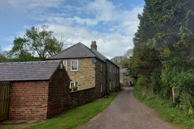
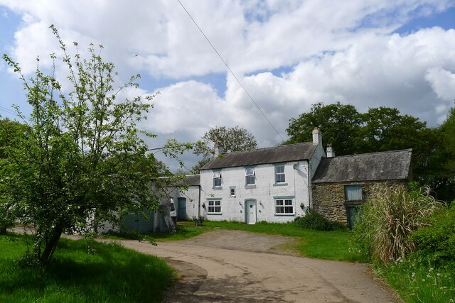
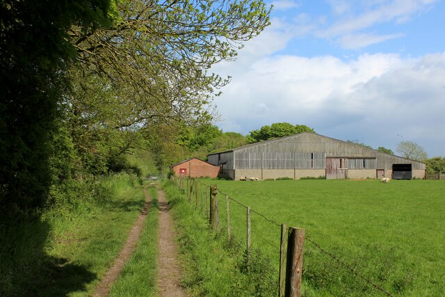
Houghall is a small village located in County Durham, England. It is situated approximately three miles east of the city of Durham, making it easily accessible for both residents and visitors alike. The village is known for its beautiful rural surroundings and tranquil atmosphere.

One of the main attractions in Houghall is Houghall College, a renowned agricultural and horticultural college. The college offers a wide range of courses and practical training in subjects such as agriculture, animal care, and environmental conservation. It is well-regarded for its high-quality education and state-of-the-art facilities.

The village itself consists of several residential areas, a few local shops, and a primary school. The close-knit community fosters a friendly and welcoming environment, making it an ideal place to raise a family or retire.

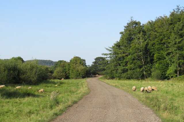
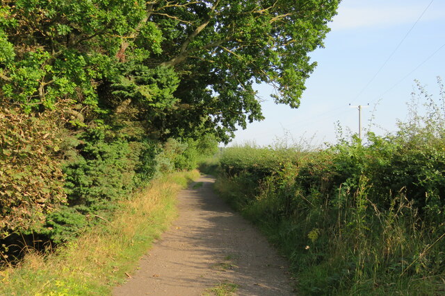
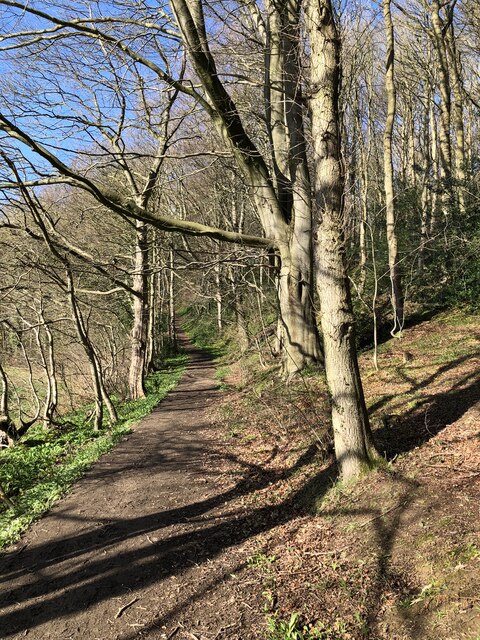
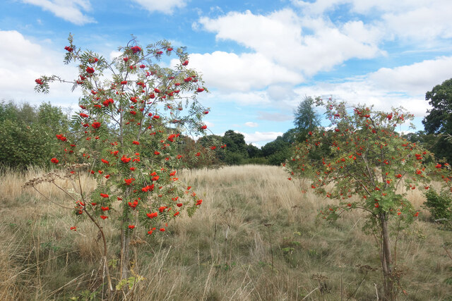
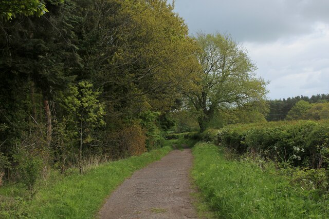
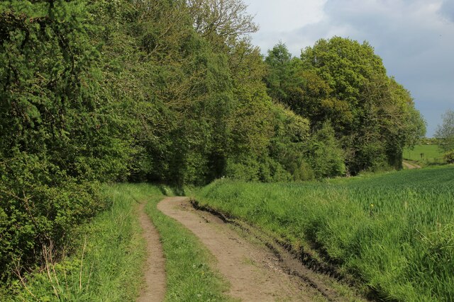
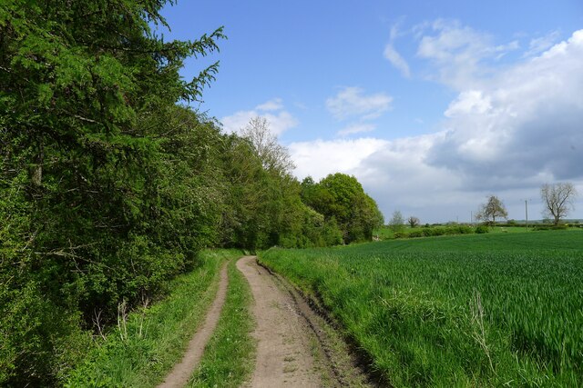
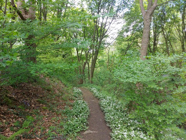
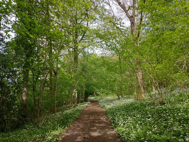
Houghall is surrounded by picturesque countryside, providing ample opportunities for outdoor activities and leisurely walks. The nearby Houghall Woods offers a peaceful retreat for nature lovers, with its diverse wildlife and scenic trails. Additionally, the village is conveniently located near several major road networks, making it easy to explore the wider region.

Overall, Houghall is a charming village with a strong emphasis on education and a close connection to nature. Its peaceful ambiance, coupled with its proximity to Durham city, makes it an attractive place for residents and visitors seeking a tranquil and rural lifestyle.

If you have any feedback on the listing, please let us know in the comments section below.
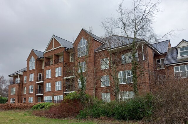
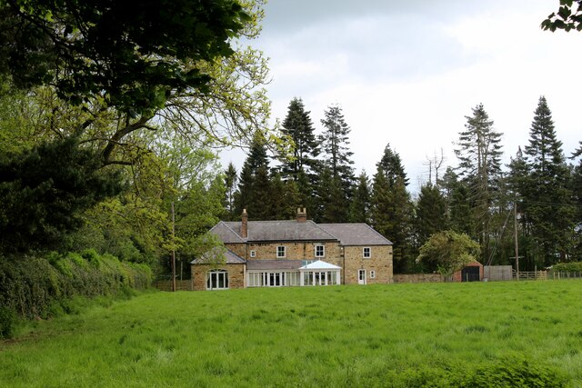
Houghall Images

Images are sourced within 2km of 54.756983/-1.5682312 or Grid Reference NZ2740. Thanks to Geograph Open Source API. All images are credited.

Track to Low Butterby Farm
Track Alongside Croxdale Wood The Weardale Way used this track from High Butterby Farm to Croxdale Hall.
Track Alongside Croxdale Wood
The Weardale Way used this track from High Butterby Farm to Croxdale Hall.
Path through Shincliffe Wood
Stone Spiral in Gary's Wood Gary's Wood is part of the Woodland Trust land at Lower Burnhall, a relatively new woodland area with extensive footpath access. It has various sculptures and stone features at intervals along the tracks.
Stone Spiral in Gary's Wood
Gary's Wood is part of the Woodland Trust land at Lower Burnhall, a relatively new woodland area with extensive footpath access. It has various sculptures and stone features at intervals along the tracks.
Rowan Trees, Low Burnhall Low Burnhall is a fairly recently established bit of forest managed by the Woodland Trust.
Rowan Trees, Low Burnhall
Low Burnhall is a fairly recently established bit of forest managed by the Woodland Trust.
Wicker Man, Low Burnhall A wickerwork figure of a miner sits beside a path in Low Burnhall Wood. There are several sculptures and features at intervals around the wood.
Wicker Man, Low Burnhall
A wickerwork figure of a miner sits beside a path in Low Burnhall Wood. There are several sculptures and features at intervals around the wood.
Wickerwork Figures, Low Burnhall Wood Some more of the wicker sculptures which can be seen in Low Burnhall Wood.
Wickerwork Figures, Low Burnhall Wood
Some more of the wicker sculptures which can be seen in Low Burnhall Wood.
Stone Circle, Low Burnhall Wood There are a lot of tracks and trails around Low Burnhall Wood with various features at intervals. Some stone, like this, some wickerwork, and some old industrial relics.
Stone Circle, Low Burnhall Wood
There are a lot of tracks and trails around Low Burnhall Wood with various features at intervals. Some stone, like this, some wickerwork, and some old industrial relics.
Durham, Cock of the North Hotel According to the OS benchmark database the OS Flush Bracket 8969 was embedded into the pub and hotel which was at this location. The pub has been demolished and replaced with new housing. It is likely the Flush Bracket has been destroyed.
Durham, Cock of the North Hotel
According to the OS benchmark database the OS Flush Bracket 8969 was embedded into the pub and hotel which was at this location. The pub has been demolished and replaced with new housing. It is likely the Flush Bracket has been destroyed.
The Cottage by Croxdale Wood As seen from the Weardale Way
The Cottage by Croxdale Wood
As seen from the Weardale Way
Weardale Way beside Butterby Wood A 77 mile route following the River Wear from the sea at the Lindesfarne Memorial, Sunderland to the headwaters in the east Pennines, keeping as close as is possible to the river. It visits Lumley Castle, Durham (where the Castle and Cathedral forms a World Heritage Site), Bishop Auckland and Stanhope. After Stanhope the Way makes a northward loop to Rookhope to take in part of a tributary, Rookhope Burn.
Weardale Way beside Butterby Wood
A 77 mile route following the River Wear from the sea at the Lindesfarne Memorial, Sunderland to the headwaters in the east Pennines, keeping as close as is possible to the river. It visits Lumley Castle, Durham (where the Castle and Cathedral forms a World Heritage Site), Bishop Auckland and Stanhope. After Stanhope the Way makes a northward loop to Rookhope to take in part of a tributary, Rookhope Burn.
Weardale Way above Butterby Wood A 77 mile route following the River Wear from the sea at the Lindesfarne Memorial, Sunderland to the headwaters in the east Pennines, keeping as close as is possible to the river. It visits Lumley Castle, Durham (where the Castle and Cathedral forms a World Heritage Site), Bishop Auckland and Stanhope. After Stanhope the Way makes a northward loop to Rookhope to take in part of a tributary, Rookhope Burn.
Weardale Way above Butterby Wood
A 77 mile route following the River Wear from the sea at the Lindesfarne Memorial, Sunderland to the headwaters in the east Pennines, keeping as close as is possible to the river. It visits Lumley Castle, Durham (where the Castle and Cathedral forms a World Heritage Site), Bishop Auckland and Stanhope. After Stanhope the Way makes a northward loop to Rookhope to take in part of a tributary, Rookhope Burn.
The Weardale Way passing The Cottage and Croxdale Wood House Entering the Croxdale Hall estate
The Weardale Way passing The Cottage and Croxdale Wood House
Entering the Croxdale Hall estate
The Weardale Way passing Butterby Wood The name 'Butterby' is linked to Low Butterby Farm on the bank of the Wear, below the wood. Its name is believed to have been given by the Normans, 'beau trouvé' = well-found, and later assimilated to a more Scandinavian '-by' type of place-name <span class="nowrap"><a title="https://altogetherarchaeology.org/Place%20Names/PLACE-NAMES%20OF%20NORTHUMBERLAND%20AND%20DURHAM.pdf" rel="nofollow ugc noopener" href="https://altogetherarchaeology.org/Place%20Names/PLACE-NAMES%20OF%20NORTHUMBERLAND%20AND%20DURHAM.pdf">Link</a><img style="margin-left:2px;" alt="External link" title="External link - shift click to open in new window" src="https://s1.geograph.org.uk/img/external.png" width="10" height="10"/></span> .
The Weardale Way passing Butterby Wood
The name 'Butterby' is linked to Low Butterby Farm on the bank of the Wear, below the wood. Its name is believed to have been given by the Normans, 'beau trouvé' = well-found, and later assimilated to a more Scandinavian '-by' type of place-name LinkExternal link .
High Butterby Farm The name 'Butterby' is linked to Low Butterby Farm on the bank of the Wear, below here. Its name is believed to have been given by the Normans, 'beau trouvé' = well-found, and later assimilated to a more Scandinavian '-by' type of place-name <span class="nowrap"><a title="https://altogetherarchaeology.org/Place%20Names/PLACE-NAMES%20OF%20NORTHUMBERLAND%20AND%20DURHAM.pdf" rel="nofollow ugc noopener" href="https://altogetherarchaeology.org/Place%20Names/PLACE-NAMES%20OF%20NORTHUMBERLAND%20AND%20DURHAM.pdf">Link</a><img style="margin-left:2px;" alt="External link" title="External link - shift click to open in new window" src="https://s1.geograph.org.uk/img/external.png" width="10" height="10"/></span> .
High Butterby Farm
The name 'Butterby' is linked to Low Butterby Farm on the bank of the Wear, below here. Its name is believed to have been given by the Normans, 'beau trouvé' = well-found, and later assimilated to a more Scandinavian '-by' type of place-name LinkExternal link .
The Weardale Way through Butterby Wood A path lined with wild garlic, leading down to the River Wear.
The Weardale Way through Butterby Wood
A path lined with wild garlic, leading down to the River Wear.
Wild garlic lining the path through a haunted Shincliffe Wood The garlic protecting us from something? Shincliffe apparently means a "Cliff or bank haunted by a phantom or demon" <span class="nowrap"><a title="https://www.oxfordreference.com/display/10.1093/acref/9780199609086.001.0001/acref-9780199609086-e-11814?rskey=WWHHoj&result=11961" rel="nofollow ugc noopener" href="https://www.oxfordreference.com/display/10.1093/acref/9780199609086.001.0001/acref-9780199609086-e-11814?rskey=WWHHoj&result=11961">Link</a><img style="margin-left:2px;" alt="External link" title="External link - shift click to open in new window" src="https://s1.geograph.org.uk/img/external.png" width="10" height="10"/></span>
Wild garlic lining the path through a haunted Shincliffe Wood
The garlic protecting us from something? Shincliffe apparently means a "Cliff or bank haunted by a phantom or demon" LinkExternal link
Weardale Way approaching High Butterby Farm A 77 mile route following the River Wear from the sea at the Lindesfarne Memorial, Sunderland to the headwaters in the east Pennines, keeping as close as is possible to the river. It visits Lumley Castle, Durham (where the Castle and Cathedral forms a World Heritage Site), Bishop Auckland and Stanhope. After Stanhope the Way makes a northward loop to Rookhope to take in part of a tributary, Rookhope Burn.
Weardale Way approaching High Butterby Farm
A 77 mile route following the River Wear from the sea at the Lindesfarne Memorial, Sunderland to the headwaters in the east Pennines, keeping as close as is possible to the river. It visits Lumley Castle, Durham (where the Castle and Cathedral forms a World Heritage Site), Bishop Auckland and Stanhope. After Stanhope the Way makes a northward loop to Rookhope to take in part of a tributary, Rookhope Burn.
Show me another place!

Houghall is located at Grid Ref: NZ2740 (Lat: 54.756983, Lng: -1.5682312)

Unitary Authority: County Durham

Police Authority: Durham

What 3 Words

///nails.food.sweep. Near Durham, Co. Durham

Related Wikis

Houghall

Houghall [pron: /ˈhɒfl/] is a hamlet in County Durham, in England. It is situated approximately 1.5 miles (2.4 km) to the south of Durham city centre....

Durham University Botanic Garden

The Durham University Botanic Garden is a botanical garden located in Durham, England. The site is set in 25 acres (10 ha) of mature woodlands in the southern...

Oakthorpe Invitational

Oakthorpe Invitational Rugby Football Club, also known as Oakthorpe, is an invitational rugby club based in Oxfordshire. The club was founded by a group...

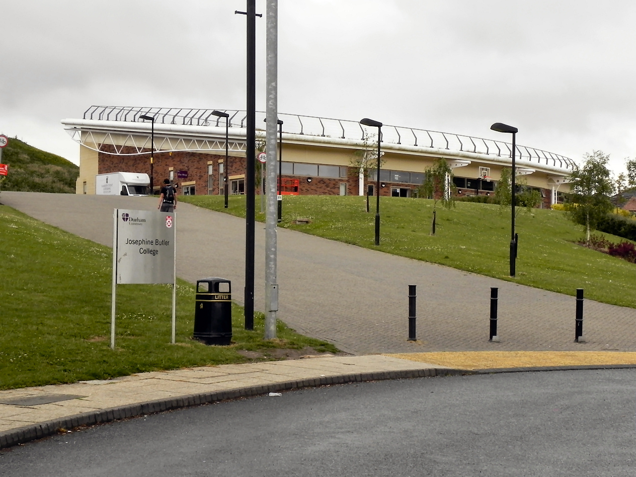
Josephine Butler College, Durham

Josephine Butler College is a constituent college of Durham University. The college was opened in 2006. It is named after Josephine Elizabeth Butler, a...

Collingwood College, Durham

Collingwood College is a college of Durham University in England. It is the largest of Durham's undergraduate colleges with around 1800 students. Founded...

Stephenson College, Durham

Stephenson College is a college of the University of Durham in England. It was founded in 2001 as part the university's Queen's Campus in Thornaby-on...

Grey College, Durham

Grey College is a college of Durham University in England. Although it was originally planned for the college to be named Oliver Cromwell College, this...

Van Mildert College, Durham

Van Mildert College (known colloquially as Mildert) is a college of Durham University in England. Founded in 1965, it takes its name from William Van Mildert...

Related Videos

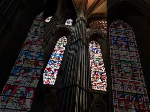
Durham Cathedral Tour #travel #travelvlog #uk #shorts

Durham Cathedral inside and out, including the view from the river. #shortswithcamilla #summeronyoutube.

Durham City Walk to Marketplace - Historic City in England - Walking Around 4K-HDR Walking Tour

Please subscribe and ring the , Like and share. Durham City is a beautiful historic city in North East England. It is very rare to ...

Nearby Amenities

Located within 500m of 54.756983,-1.5682312
Barrier: stile
Foot: yes
Stile: stepover
Lat/Long: 54.7592804/-1.5682983
Barrier: stile
Lat/Long: 54.7584036/-1.5683908
Bench
Ele: 79.91
Lat/Long: 54.7609305/-1.5707976
Barrier: stile
Lat/Long: 54.7609929/-1.5683112
Answer: Q
Ele: 63.09
Marker: post
Orienteering: marker
Ref: 20
Sport: orienteering
Lat/Long: 54.7566135/-1.5727696
Bench
Ele: 64.77
Lat/Long: 54.7603107/-1.571806
Answer: P
Ele: 67.66
Marker: post
Note: Photo taken July 2021 clearly shows answer of P not F
Orienteering: marker
Ref: 19
Sport: orienteering
Lat/Long: 54.7595412/-1.5738359
7. Durham University Woodland
Ele: 60.21
Information: map
Tourism: information
Lat/Long: 54.7589759/-1.5734219
Isolation Hospital site
Created By: Potlatch 0.10f
Historic: site
Lat/Long: 54.7609024/-1.5664611
Barrier: swing_gate
Lat/Long: 54.7595059/-1.5656689
9. The Pit Heap
Board Type: history
Ele: 41.22
Fixme: Is this correctly located? Recollection was that it was parallel to main road. Perhaps moved when access changed.
Information: board
Tourism: information
Lat/Long: 54.7604238/-1.5642166
Traffic Calming: bump
Lat/Long: 54.7594379/-1.5657564
Post Box
Collection Times: Mo-Fr 17:00; Sa 09:30; Su off
Ele: 37.38
Post Box Type: lamp
Ref: DH1 61
Royal Cypher: EIIR
Royal Cypher Wikidata: Q33102113
Lat/Long: 54.7583688/-1.5683211
8. Hospital Field
Ele: 50.35
Information: map
Tourism: information
Lat/Long: 54.7609709/-1.5683504
2. Houghall Railway Sidings
Board Type: history
Ele: 45.31
Information: board
Tourism: information
Lat/Long: 54.7594365/-1.5627875
Bench
Ele: 41.22
Lat/Long: 54.7593474/-1.5629334
Houghall Pit Village
End Date: 1955
Historic: ruins
Start Date: 1860
Lat/Long: 54.7588075/-1.5631823
Houghall Colliery
End Date: 1884
Historic: ruins
Operator: Love & Bell
Start Date: 1840
Lat/Long: 54.7591889/-1.5641951
3. The Pit Village
Board Type: history
Ele: 41.46
Information: board
Tourism: information
Lat/Long: 54.7587679/-1.5633969
4. Houghall Colliery
Board Type: history
Ele: 39.54
Information: board
Tourism: information
Lat/Long: 54.7593969/-1.5639033
Disused Man Made: mineshaft
Operator: Houghall Colliery
Lat/Long: 54.7591478/-1.5637927
Disused Man Made: mineshaft
Image: https://www.geograph.org.uk/photo/6185657
Operator: Houghall Colliery
Lat/Long: 54.7593558/-1.5639214
Answer: H
Ele: 43.14
Marker: post
Orienteering: marker
Ref: 21
Sport: orienteering
Lat/Long: 54.7591542/-1.5637488
5. The Pond
Ele: 36.66
Information: map
Tourism: information
Lat/Long: 54.7587228/-1.5674118
Bench
Ele: 41.7
Lat/Long: 54.7586144/-1.567285
Bench
Ele: 38.1
Lat/Long: 54.7583024/-1.5671048
Bench
Ele: 37.86
Lat/Long: 54.7583569/-1.5672335
Answer: A
Ele: 38.58
Fixme: Confirm ref. Seem to have 2 markers with ref=6!
Marker: post
Orienteering: marker
Ref: 6
Sport: orienteering
Lat/Long: 54.7579507/-1.5674481
Ele: 39.06
Leisure: bird_hide
Lat/Long: 54.7585896/-1.5675425
Bench
Ele: 36.18
Lat/Long: 54.7583866/-1.5678601
Houghall
Description: Houses built starting 1939
Place: hamlet
Wikidata: Q11710159
Wikipedia: en:Houghall
Lat/Long: 54.7576935/-1.5682592
Houghall Hall Site?
Historic: yes
Lat/Long: 54.7563177/-1.5688205
Barrier: stile
Ele: 44.83
Lat/Long: 54.7575892/-1.5706839
Barrier: stile
Lat/Long: 54.757614/-1.5707268
6. The Old Waggonway
Ele: 42.18
Information: map
Tourism: information
Lat/Long: 54.7579359/-1.5696454
Ele: 45.0
Traffic Calming: bump
Lat/Long: 54.7582494/-1.5682673
Ele: 47.0
Traffic Calming: bump
Lat/Long: 54.7580563/-1.5682666
Ele: 43.0
Lat/Long: 54.7572817/-1.5682637
Location Transition: yes
Power: pole
Lat/Long: 54.7591996/-1.5662229
Power: pole
Transformer: distribution
Lat/Long: 54.7594728/-1.5661132
Barrier: entrance
Lat/Long: 54.7570987/-1.566875
Power: pole
Lat/Long: 54.7574523/-1.5673628
Barrier: entrance
Lat/Long: 54.7589599/-1.568407
Power: pole
Lat/Long: 54.7603035/-1.5657283
Power: pole
Lat/Long: 54.7579652/-1.5656886
Power: pole
Lat/Long: 54.7578146/-1.5662741
Barrier: entrance
Lat/Long: 54.7589131/-1.5686593
Power: pole
Lat/Long: 54.7581389/-1.5650043
Barrier: entrance
Lat/Long: 54.7575729/-1.5662866
Power: pole
Lat/Long: 54.7570941/-1.5674286
Power: pole
Lat/Long: 54.7576627/-1.5668901
Answer: A
Marker: post
Orienteering: marker
Ref: 5
Sport: orienteering
Lat/Long: 54.7600038/-1.5656698
Alder
Board Type: nature
Information: board
Tourism: information
Lat/Long: 54.7584732/-1.5672522
Hawthorn
Board Type: nature
Information: board
Tourism: information
Lat/Long: 54.7587569/-1.5673707
Larch
Board Type: nature
Information: board
Tourism: information
Lat/Long: 54.7579994/-1.5675509
Tree
Board Type: nature
Information: board
Tourism: information
Lat/Long: 54.7586947/-1.5673365
Disused Tourism: information
Information: board
Lat/Long: 54.7600396/-1.565618
Power: pole
Ref: 10
Lat/Long: 54.7577489/-1.566803
Barrier: stile
Lat/Long: 54.7599957/-1.5656666
Bench
Backrest: yes
Colour: brown
Material: wood
Seats: 4
Lat/Long: 54.7606539/-1.5646115
Bench
Seats: 1
Lat/Long: 54.7612228/-1.5666346
Addr City: Durham
Addr Housenumber: 2
Addr Postcode: DH1 3SF
Addr Street: Farm Road
Lat/Long: 54.7570347/-1.5684678
Addr City: Durham
Addr Housenumber: 4
Addr Postcode: DH1 3SF
Lat/Long: 54.757201/-1.5684545
Addr City: Durham
Addr Housenumber: 3
Addr Postcode: DH1 3SF
Lat/Long: 54.7571586/-1.5684701
Addr City: Durham
Addr Housenumber: 11
Addr Postcode: DH1 3SF
Lat/Long: 54.7580621/-1.5684606
Addr City: Durham
Addr Housenumber: 2
Addr Postcode: DH1 3SL
Lat/Long: 54.75864/-1.5685966
Addr City: Durham
Addr Housenumber: 1
Addr Postcode: DH1 3SL
Lat/Long: 54.758523/-1.5685996
Addr City: Durham
Addr Housenumber: 1
Addr Postcode: DH1 3SF
Lat/Long: 54.7569839/-1.5684706
Bench
Backrest: yes
Colour: brown
Material: wood
Seats: 4
Lat/Long: 54.7608147/-1.5643563
Addr City: Durham
Addr Housename: Journeys End
Addr Housenumber: 9
Addr Postcode: DH1 3SF
Lat/Long: 54.7578828/-1.5684583
Addr City: Durham
Addr Housenumber: 10
Addr Postcode: DH1 3SF
Lat/Long: 54.7579879/-1.5684473
Passing Place
Lat/Long: 54.7597872/-1.5637735
Disused Marker: post
Ele: 36.66
Note: Not part of current Houghall Woods trail (area now out-of-bounds)
Orienteering: marker
Sport: orienteering
Lat/Long: 54.7606635/-1.5644793
Power: pole
Switch: mechanical
Lat/Long: 54.7606052/-1.564157
Answer: N
Marker: post
Orienteering: marker
Ref: 4
Sport: orienteering
Lat/Long: 54.7609518/-1.5663497
Disused Tourism: information
Information: board
Lat/Long: 54.7605409/-1.5639173
Barrier: entrance
Foot: yes
Lat/Long: 54.7605345/-1.5639546
Power: pole
Lat/Long: 54.7606462/-1.5641456
Answer: Z
Marker: post
Orienteering: marker
Ref: 6
Sport: orienteering
Lat/Long: 54.7606508/-1.5692693
The data included in this document is from www.openstreetmap.org. The data is made available under ODbL.

Have you been to Houghall?

Leave your review of Houghall below (or comments, questions and feedback).