Camden Brake

Wood, Forest in Berkshire Vale of White Horse

England

Camden Brake

Gateway into Easton Wood Last Geographed 10 years ago when the vegetation was cut back into a neat hedge <a href="https://www.geograph.org.uk/photo/2787414">SU2696 : New Lodges, near Faringdon</a>. Now it's hard to see the lodge house behind all the foliage.
This must have been a side entrance into Buscot Park via a woodland drive. It's quite a distance from the house.
Gateway into Easton Wood Credit: Des Blenkinsopp

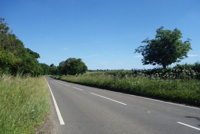
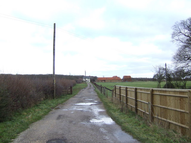
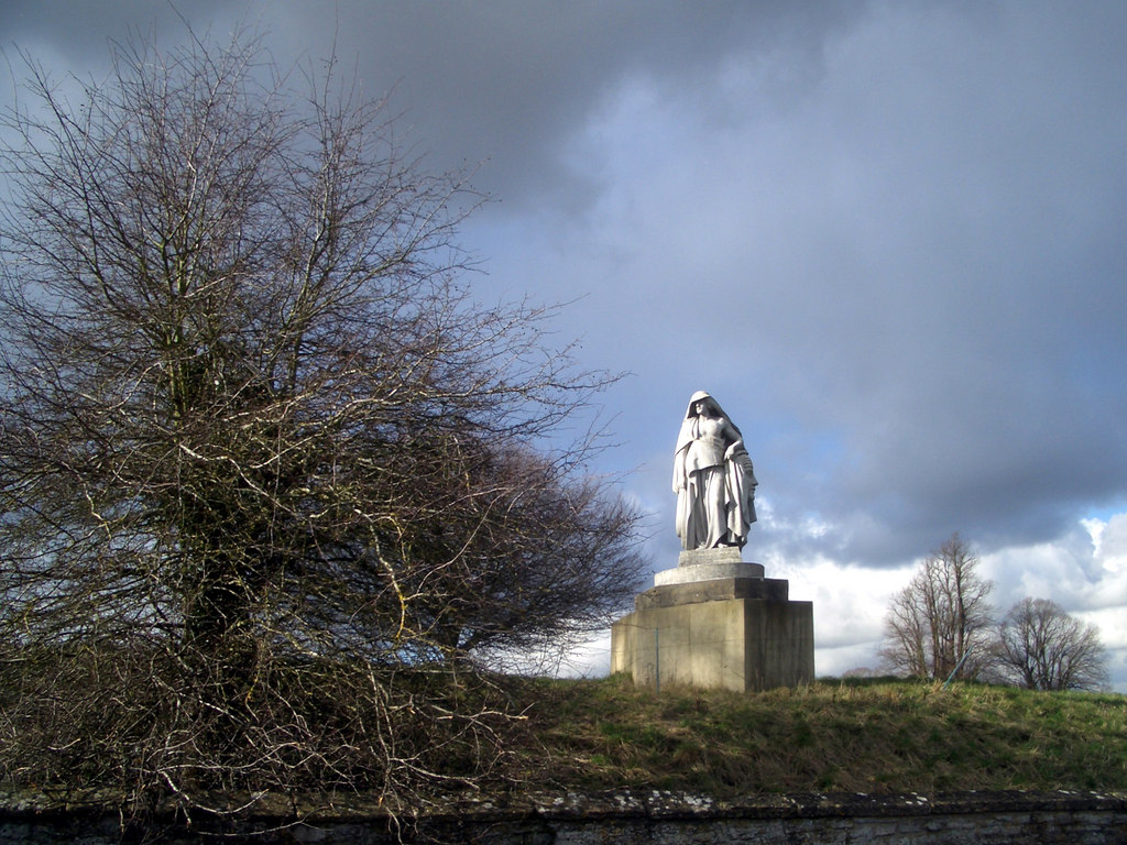
Camden Brake is a picturesque woodland area located in the county of Berkshire, England. Situated on the outskirts of the charming village of Camden, it offers a tranquil retreat for nature enthusiasts and outdoor lovers. Covering a vast area, Camden Brake is a haven for wildlife and a popular destination for hikers, walkers, and birdwatchers.

The woodland is characterized by a dense canopy of trees, predominantly oak and beech, which provide a beautiful natural setting. The forest floor is adorned with a carpet of ferns, wildflowers, and moss, creating a vibrant and lush environment. The area is also crisscrossed by a network of well-maintained walking paths, allowing visitors to explore and appreciate the beauty of the surroundings.

Camden Brake boasts a diverse range of fauna, including various species of birds, mammals, and insects. Nature enthusiasts can spot woodpeckers, owls, and squirrels, among other creatures, as they venture through the woodlands. The tranquil atmosphere and abundance of wildlife make Camden Brake a popular spot for photographers and nature lovers alike.

In addition to its natural beauty, the woodland also serves as an important conservation area. Local organizations and volunteers actively work towards preserving and maintaining the ecological balance of the forest, ensuring its long-term sustainability and protection.

Visitors to Camden Brake can enjoy a peaceful escape from the hustle and bustle of urban life, immersing themselves in the beauty of nature. Whether it's a leisurely stroll, a birdwatching expedition, or simply a moment of serenity, Camden Brake offers a rejuvenating experience for all who venture into its tranquil embrace.

If you have any feedback on the listing, please let us know in the comments section below.

Camden Brake Images

Images are sourced within 2km of 51.681282/-1.6034751 or Grid Reference SU2798. Thanks to Geograph Open Source API. All images are credited.

Gateway into Easton Wood Last Geographed 10 years ago when the vegetation was cut back into a neat hedge <a href="https://www.geograph.org.uk/photo/2787414">SU2696 : New Lodges, near Faringdon</a>. Now it's hard to see the lodge house behind all the foliage.
This must have been a side entrance into Buscot Park via a woodland drive. It's quite a distance from the house.
Gateway into Easton Wood
Last Geographed 10 years ago when the vegetation was cut back into a neat hedge SU2696 : New Lodges, near Faringdon. Now it's hard to see the lodge house behind all the foliage. This must have been a side entrance into Buscot Park via a woodland drive. It's quite a distance from the house.
Road to Crabtree Farm Named rather anciently on the map as Crabbe-Tree Farm, the name on the gate uses the normal spelling.
Road to Crabtree Farm
Named rather anciently on the map as Crabbe-Tree Farm, the name on the gate uses the normal spelling.
A417 towards Faringdon Quiet just now, but this is quite a busy country A road between Lechlade and Faringdon.
A417 towards Faringdon
Quiet just now, but this is quite a busy country A road between Lechlade and Faringdon.
St Michael's Church, Eaton Hastings
Canoeing at Radcot Bridge, Oxfordshire Radcot Bridge is the oldest bridge on the River Thames. Its origins date back to ca.1200AD, but it was extensively rebuilt in the 14th-15th centuries
Canoeing at Radcot Bridge, Oxfordshire
Radcot Bridge is the oldest bridge on the River Thames. Its origins date back to ca.1200AD, but it was extensively rebuilt in the 14th-15th centuries
Thames at Radcot View of the River Thames at Radcot, Oxfordshire.
Thames at Radcot
View of the River Thames at Radcot, Oxfordshire.
Track towards Northfield Farm
St. Michael's Church, Eaton Hastings
The Swan Hotel, Radcot An English scene at Radcot, where both boats and cars stop for a refreshing drink at the Swan Hotel.
The Swan Hotel, Radcot
An English scene at Radcot, where both boats and cars stop for a refreshing drink at the Swan Hotel.
Aerial view from Paramotor of Field Near Faringdon Taken from 500' agl, group of people playing rounders near tree
Aerial view from Paramotor of Field Near Faringdon
Taken from 500' agl, group of people playing rounders near tree
Road to Faringdon Park Farm There is a tractor in the distance coming this way.
Road to Faringdon Park Farm
There is a tractor in the distance coming this way.
Faringdon Sewage Works Off the A417 north-west of the town.
Faringdon Sewage Works
Off the A417 north-west of the town.
Road to Manor Farm North of the A417 Lechlade Road.
Road to Manor Farm
North of the A417 Lechlade Road.
Cottage on Eaton Lane This charming little cottage lies beside the dead end lane leading to Eaton Hastings church.
Cottage on Eaton Lane
This charming little cottage lies beside the dead end lane leading to Eaton Hastings church.
A gem of a place! The tiny parish church of St Michaels is to be found at the end of a long dead-end lane almost on the bank of the Upper Thames.
A gem of a place!
The tiny parish church of St Michaels is to be found at the end of a long dead-end lane almost on the bank of the Upper Thames.
Road to Thrupp The farm at <a href="https://www.geograph.org.uk/photo/309837">SU3098 : Brixton or Thrupp Farm?</a> has possibly been renamed to avoid confusion with Thrupp Farm at the end of this lane.
Road to Thrupp
The farm at SU3098 : Brixton or Thrupp Farm? has possibly been renamed to avoid confusion with Thrupp Farm at the end of this lane.
Drive to house at Thrupp Turn There is a wooden summerhouse at the end of the drive.
Drive to house at Thrupp Turn
There is a wooden summerhouse at the end of the drive.
Pidnell Farm Off the A4095 south of Radcot Bridge
Pidnell Farm
Off the A4095 south of Radcot Bridge
Show me another place!

Camden Brake is located at Grid Ref: SU2798 (Lat: 51.681282, Lng: -1.6034751)

Administrative County: Oxfordshire

District: Vale of White Horse

Police Authority: Thames Valley

What 3 Words

///insisting.tries.moped. Near Faringdon, Oxfordshire

Nearby Locations

Camden Brake

Related Wikis

Grafton Lock

Grafton Lock is a lock on the River Thames in Oxfordshire, England. It is on the northern bank between Kelmscott and Radcot, about 1 mile (1.6 km) south...

Eaton Hastings

Eaton Hastings is a village and civil parish beside the River Thames about two-and-a-half miles (4 km) north-west of Faringdon. It was in Berkshire until...

Battle of Radcot Bridge

The Battle of Radcot Bridge was fought on 19 December 1387 in medieval England between troops loyal to Richard II, led by court favourite Robert de Vere...
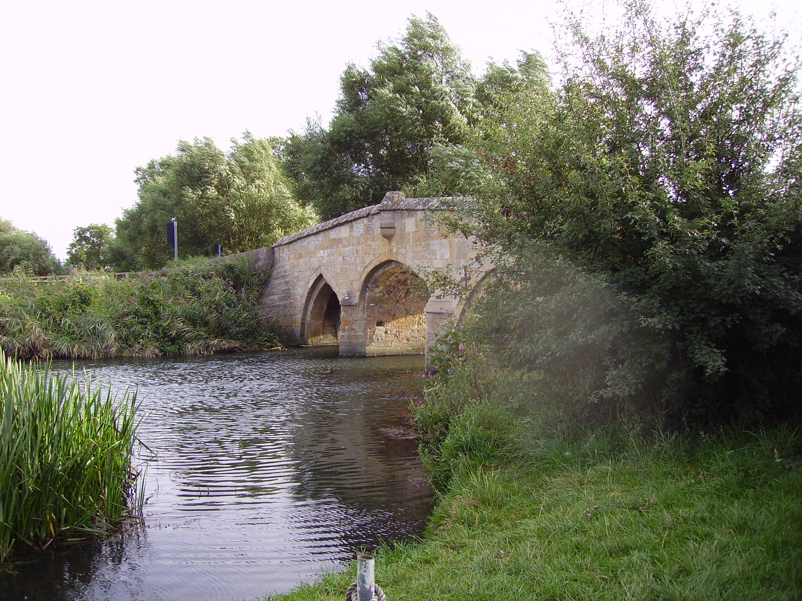
Radcot Bridge

Radcot Bridge is a crossing of the Thames in England, south of Radcot, Oxfordshire, and north of Faringdon, Oxfordshire which is in the district of that...

Grafton and Radcot

Grafton and Radcot is a civil parish in West Oxfordshire. The parish includes the hamlets of Radcot on the River Thames and Grafton.
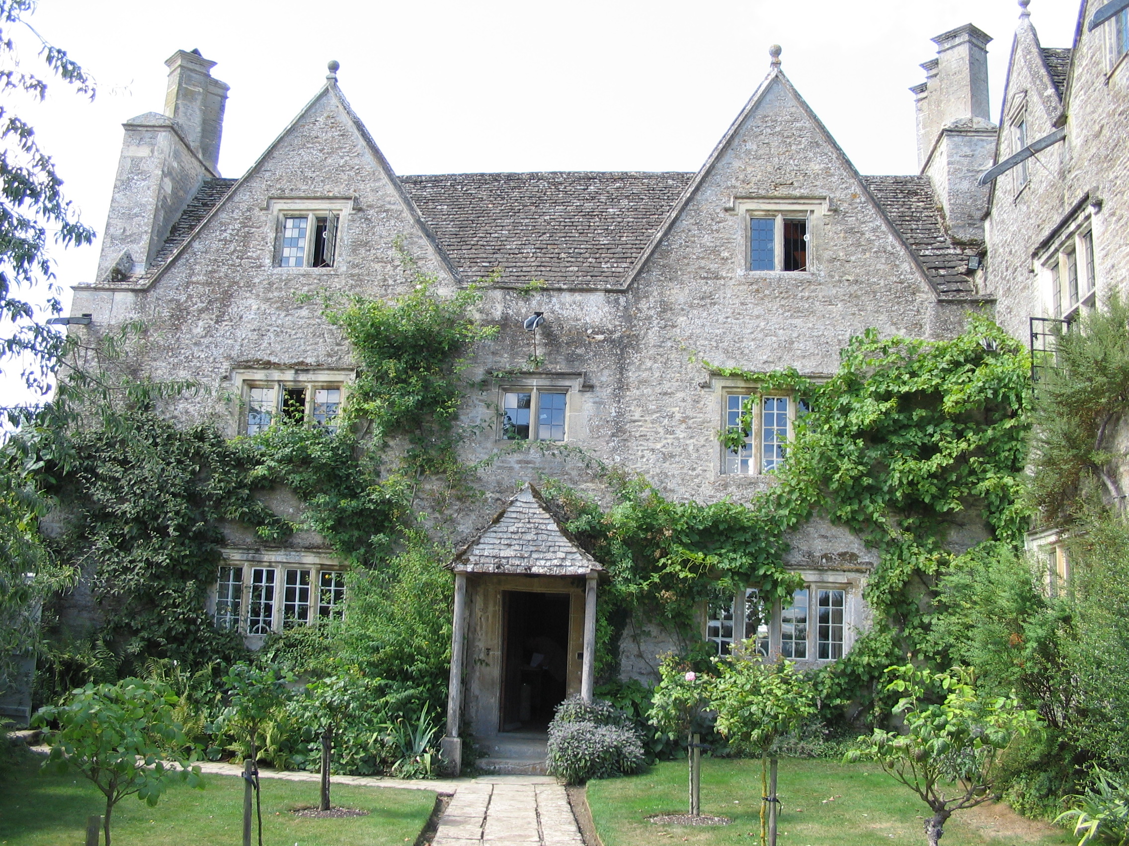
Kelmscott Manor

Kelmscott Manor is a limestone manor house in the Cotswolds village of Kelmscott, in West Oxfordshire, southern England. It dates from around 1570, with...

Faringdon House

Faringdon House is a Grade I listed 14,510 square feet house in Faringdon, Oxfordshire, England. It was built in about 1770–1785 for the Poet Laureate...

Grafton, Oxfordshire

Grafton is a hamlet and former civil parish, now in the parish of Grafton and Radcot, in the West Oxfordshire district, in the county of Oxfordshire, England...

Nearby Amenities

Located within 500m of 51.681282,-1.6034751
Power: pole
Lat/Long: 51.6853874/-1.605948
Power: pole
Lat/Long: 51.6851202/-1.6043218
Power: pole
Lat/Long: 51.6849236/-1.6031062
Power: pole
Lat/Long: 51.6855631/-1.6031074
The data included in this document is from www.openstreetmap.org. The data is made available under ODbL.

Have you been to Camden Brake?

Leave your review of Camden Brake below (or comments, questions and feedback).