Falls Plantation

Wood, Forest in Derbyshire Derbyshire Dales

England

Falls Plantation

Jebb's Lane crosses the Ecclesbourne Valley Railway
Jebb's Lane crosses the Ecclesbourne Valley Railway Credit: Tim Glover

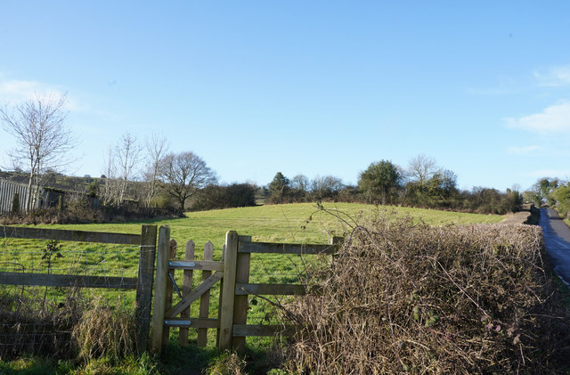
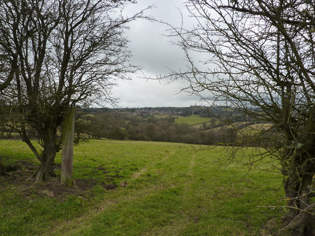
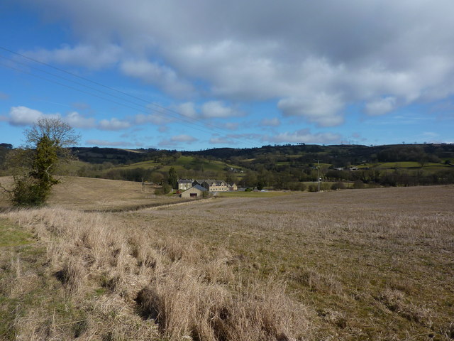
Falls Plantation, located in Derbyshire, England, is a picturesque woodland area renowned for its natural beauty and rich history. Spanning over several acres, this enchanting forest is characterized by its dense vegetation, towering trees, and tranquil streams that meander through the landscape.

The plantation is home to a diverse range of flora and fauna, making it a haven for wildlife enthusiasts and nature lovers alike. Walking through the woodland, visitors can spot an array of native species, including deer, foxes, badgers, and a variety of bird species. The forest's vibrant ecosystem also supports a wide range of plant life, with an abundance of wildflowers, ferns, and mosses dotting the forest floor.

Steeped in history, Falls Plantation has seen various transformations over the centuries. It was originally part of a larger estate owned by a local aristocratic family, who used the woodland for hunting and leisure activities. Later, during the Industrial Revolution, the forest was utilized for timber production, providing resources for the growing manufacturing sector.

Today, Falls Plantation is primarily a recreational area, attracting visitors who seek solace in its peaceful environment. The plantation offers numerous walking trails and picnic spots, allowing visitors to immerse themselves in the serenity of nature. Additionally, the forest hosts educational programs and guided tours, providing insights into the plantation's history and ecological significance.

Falls Plantation, with its breathtaking scenery and historical significance, is a true gem of Derbyshire, offering a sanctuary for all those who appreciate the beauty of nature.

If you have any feedback on the listing, please let us know in the comments section below.

Falls Plantation Images

Images are sourced within 2km of 53.057106/-1.590969 or Grid Reference SK2751. Thanks to Geograph Open Source API. All images are credited.

Jebb's Lane crosses the Ecclesbourne Valley Railway
Diesel locomotive 31206 at a foot crossing on the Ecclesbourne Valley Railway 31206 pulling a train during the Diesel Locomotive Weekend in 2017.
Diesel locomotive 31206 at a foot crossing on the Ecclesbourne Valley Railway
31206 pulling a train during the Diesel Locomotive Weekend in 2017.
Jebb's Lane crossing the Ecclesbourne
Looking up Top Lons Top Lons is the road along which the camera is pointing from the junction of the lane with Bottom Lons and Broadway.
Looking up Top Lons
Top Lons is the road along which the camera is pointing from the junction of the lane with Bottom Lons and Broadway.
Alton Mill Farm
Alton Mill Farm
Looking at Addcrofts Addcrofts is the name of the farm and the view on this bright sunny morning is from Hob Lane.
Looking at Addcrofts
Addcrofts is the name of the farm and the view on this bright sunny morning is from Hob Lane.
Hob Lane Hob Lane is one of many minor roads in this area that connects the many farms to more major roads.
Hob Lane
Hob Lane is one of many minor roads in this area that connects the many farms to more major roads.
Railway line. A view looking South towards Idridgehay along the Derby to Wirksworth railway line.
Railway line.
A view looking South towards Idridgehay along the Derby to Wirksworth railway line.
Boggy Field The stream at Winneyhill is overgrown and now makes the field unusable.
Boggy Field
The stream at Winneyhill is overgrown and now makes the field unusable.
Derelict Barn The remains of the field barn.
Derelict Barn
The remains of the field barn.
Broad Way Road Junction. The Broad Way leading to Kirk Ireton
Broad Way Road Junction.
The Broad Way leading to Kirk Ireton
Old Railway Goods Van Now used as a sheep pen,near road junction to Kirk Ireton.
Old Railway Goods Van
Now used as a sheep pen,near road junction to Kirk Ireton.
Paths leading to Idridgehay From Hob Lane.
Paths leading to Idridgehay
From Hob Lane.
Winneyhill Farm On a hill slope between Kirk Ireton and Idridgehay Green
Winneyhill Farm
On a hill slope between Kirk Ireton and Idridgehay Green
A view towards Kirk Ireton On a path from Hob Lane to Broadway, looking north.
A view towards Kirk Ireton
On a path from Hob Lane to Broadway, looking north.
Bottom Lons, Broadway and Top Lons Three lanes near Kirk Ireton.
Bottom Lons, Broadway and Top Lons
Three lanes near Kirk Ireton.
On Blackwall Lane Fields in January, empty of livestock. On a lane from Kirk Ireton to Blackwall.
On Blackwall Lane
Fields in January, empty of livestock. On a lane from Kirk Ireton to Blackwall.
Hob Lane, leading to Kirk Ireton
Show me another place!

Falls Plantation is located at Grid Ref: SK2751 (Lat: 53.057106, Lng: -1.590969)

Administrative County: Derbyshire

District: Derbyshire Dales

Police Authority: Derbyshire

What 3 Words

///condensed.quieter.nightlife. Near Wirksworth, Derbyshire

Related Wikis

Kirk Ireton

Kirk Ireton is a village and civil parish in Derbyshire, England, 4 miles (6.4 km) southwest of Wirksworth on a hillside near Carsington Water, 700 feet...

Holy Trinity Church, Kirk Ireton

Holy Trinity Church, Kirk Ireton, is a Grade I listed parish church in the Church of England in Kirk Ireton, Derbyshire. == History == The church dates...

Callow, Derbyshire

Callow is a village and a civil parish in the Derbyshire Dales District, in the English county of Derbyshire. At the 2011 Census the population of the...

Alderwasley Hall Sixth Form Centre

Alderwasley Hall Sixth Form is an independent special needs Sixth Form Centre located one mile south of Wirksworth in Derbyshire it is part of Alderwasley...

Haarlem Mill

Haarlem Mill, on the River Ecclesbourne in Wirksworth, Derbyshire, was an early cotton mill. Built by Richard Arkwright, it was the first cotton mill in...

Ashleyhay

Ashleyhay (Old English Enclosure at the ash-tree wood or clearing ) is a village and civil parish in the Amber Valley district of Derbyshire, England,...

Dream Cave

Dream Cave (sometimes called Dream Hole or Dream Mine) is a natural limestone cavern located near Wirksworth in Derbyshire, England. It was discovered...

Derby Road Ground

Derby Road Ground is a cricket ground in Wirksworth, Derbyshire. The first recorded match on the ground was in 1866, when Wirksworth played an All-England...

Nearby Amenities

Located within 500m of 53.057106,-1.590969
Passing Place
Lat/Long: 53.0554808/-1.5924335
Passing Place
Lat/Long: 53.0609299/-1.5875362
Passing Place
Lat/Long: 53.0563031/-1.5912058
Barrier: stile
Ele: 178.0000000
Steps: 2
Stile: stepover
Lat/Long: 53.0538899/-1.5935727
Barrier: stile
Ele: 159.0000000
Stile: squeezer
Lat/Long: 53.0549092/-1.5927731
Barrier: stile
Steps: 2
Stile: stepover
Lat/Long: 53.0570783/-1.5895061
Barrier: stile
Ele: 122.0000000
Steps: 1
Stile: stepover
Lat/Long: 53.0589919/-1.5871293
Material: wood
Power: pole
Lat/Long: 53.0610262/-1.5911679
Material: wood
Power: pole
Lat/Long: 53.0602018/-1.5915131
Material: wood
Power: pole
Lat/Long: 53.059501/-1.591772
Material: wood
Power: pole
Lat/Long: 53.0586912/-1.5920942
Material: wood
Power: pole
Lat/Long: 53.0580136/-1.5934084
Material: wood
Power: pole
Lat/Long: 53.0573093/-1.5947661
Material: wood
Power: pole
Lat/Long: 53.0561201/-1.5975964
Material: wood
Power: pole
Lat/Long: 53.0565752/-1.5965455
The data included in this document is from www.openstreetmap.org. The data is made available under ODbL.

Have you been to Falls Plantation?

Leave your review of Falls Plantation below (or comments, questions and feedback).