Little Close Wood

Wood, Forest in Derbyshire Derbyshire Dales

England

Little Close Wood

Seats along the path at Carsington Water At Fish Tail Creek, on the eastern shore of the reservoir.
Carsington Water is a reservoir operated by Severn Trent Water, the finished reservoir was opened by Queen Elizabeth II in 1992. It has a capacity of 36 million cubic metres, and a surface area of 296 hectares, it has a maximum depth of 31 metres. It is the ninth largest reservoir in England.
Seats along the path at Carsington Water Credit: Mat Fascione

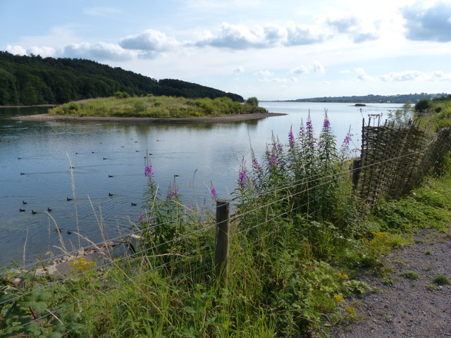
Little Close Wood is a picturesque woodland located in Derbyshire, England. Covering an area of approximately 50 acres, it is a popular destination for nature enthusiasts and hikers alike. The wood is situated in close proximity to the village of Little Close, and its tranquil atmosphere offers a peaceful escape from the hustle and bustle of everyday life.

The woodland is characterized by a diverse range of tree species, including oak, beech, and ash. These tall, majestic trees create a dense canopy that provides shade and shelter for a variety of wildlife. Visitors to Little Close Wood can expect to encounter a plethora of bird species, such as woodpeckers, nightingales, and tawny owls. Squirrels, badgers, and deer also call this woodland home, adding to the richness of the natural environment.

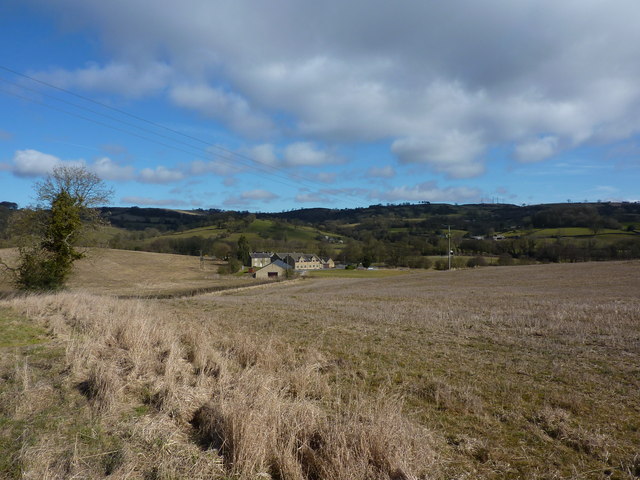
A network of well-maintained paths and trails wind their way through the wood, allowing visitors to explore its beauty at their own pace. These paths offer stunning views of the surrounding countryside, with rolling hills and fields stretching out into the distance.

Little Close Wood is also known for its seasonal displays of wildflowers, including bluebells and primroses, which carpet the forest floor during the spring months. This burst of color adds to the enchanting ambiance of the woodland and attracts photographers and nature enthusiasts from far and wide.

Overall, Little Close Wood is a hidden gem in Derbyshire, offering visitors a chance to connect with nature and enjoy the tranquility of a well-preserved woodland setting.

If you have any feedback on the listing, please let us know in the comments section below.

Little Close Wood Images

Images are sourced within 2km of 53.06413/-1.5894102 or Grid Reference SK2751. Thanks to Geograph Open Source API. All images are credited.

Seats along the path at Carsington Water At Fish Tail Creek, on the eastern shore of the reservoir.
Carsington Water is a reservoir operated by Severn Trent Water, the finished reservoir was opened by Queen Elizabeth II in 1992. It has a capacity of 36 million cubic metres, and a surface area of 296 hectares, it has a maximum depth of 31 metres. It is the ninth largest reservoir in England.
Seats along the path at Carsington Water
At Fish Tail Creek, on the eastern shore of the reservoir. Carsington Water is a reservoir operated by Severn Trent Water, the finished reservoir was opened by Queen Elizabeth II in 1992. It has a capacity of 36 million cubic metres, and a surface area of 296 hectares, it has a maximum depth of 31 metres. It is the ninth largest reservoir in England.
Track leading south into Hall Wood
Path along the shoreline of Carsington Water Next to the Reed Bed at the north east corner of the reservoir.
Carsington Water is a reservoir operated by Severn Trent Water, the finished reservoir was opened by Queen Elizabeth II in 1992. It has a capacity of 36 million cubic metres, and a surface area of 296 hectares, it has a maximum depth of 31 metres. It is the ninth largest reservoir in England.
Path along the shoreline of Carsington Water
Next to the Reed Bed at the north east corner of the reservoir. Carsington Water is a reservoir operated by Severn Trent Water, the finished reservoir was opened by Queen Elizabeth II in 1992. It has a capacity of 36 million cubic metres, and a surface area of 296 hectares, it has a maximum depth of 31 metres. It is the ninth largest reservoir in England.
The north east corner of Carsington Water Carsington Water is a reservoir operated by Severn Trent Water, the finished reservoir was opened by Queen Elizabeth II in 1992. It has a capacity of 36 million cubic metres, and a surface area of 296 hectares, it has a maximum depth of 31 metres. It is the ninth largest reservoir in England.
The north east corner of Carsington Water
Carsington Water is a reservoir operated by Severn Trent Water, the finished reservoir was opened by Queen Elizabeth II in 1992. It has a capacity of 36 million cubic metres, and a surface area of 296 hectares, it has a maximum depth of 31 metres. It is the ninth largest reservoir in England.
North Island at Carsington Water Carsington Water is a reservoir operated by Severn Trent Water, the finished reservoir was opened by Queen Elizabeth II in 1992. It has a capacity of 36 million cubic metres, and a surface area of 296 hectares, it has a maximum depth of 31 metres. It is the ninth largest reservoir in England.
North Island at Carsington Water
Carsington Water is a reservoir operated by Severn Trent Water, the finished reservoir was opened by Queen Elizabeth II in 1992. It has a capacity of 36 million cubic metres, and a surface area of 296 hectares, it has a maximum depth of 31 metres. It is the ninth largest reservoir in England.
Path along the shoreline of Carsington Water In the north east corner of the reservoir.
Carsington Water is a reservoir operated by Severn Trent Water, the finished reservoir was opened by Queen Elizabeth II in 1992. It has a capacity of 36 million cubic metres, and a surface area of 296 hectares, it has a maximum depth of 31 metres. It is the ninth largest reservoir in England.
Path along the shoreline of Carsington Water
In the north east corner of the reservoir. Carsington Water is a reservoir operated by Severn Trent Water, the finished reservoir was opened by Queen Elizabeth II in 1992. It has a capacity of 36 million cubic metres, and a surface area of 296 hectares, it has a maximum depth of 31 metres. It is the ninth largest reservoir in England.
Houses on Bournebrooke Avenue, Wirksworth This looks like a former council estate. The house on the extreme right has been extended and this allowed me to place the aerial image. Seen from the Ecclesbourne Valley Railway
Houses on Bournebrooke Avenue, Wirksworth
This looks like a former council estate. The house on the extreme right has been extended and this allowed me to place the aerial image. Seen from the Ecclesbourne Valley Railway
Breasley Pillows, Water Lane, Wirksworth Seen from the Ecclesbourne Valley Railway. There is a larger more modern block behind that is marked on the aerial photograph as Breasley Pillows and I am assuming this older set of mill buildings is part of the same complex.
Breasley Pillows, Water Lane, Wirksworth
Seen from the Ecclesbourne Valley Railway. There is a larger more modern block behind that is marked on the aerial photograph as Breasley Pillows and I am assuming this older set of mill buildings is part of the same complex.
Ecclesbourne Valley Railway - closing the Gorsey Bank crossing gates There are two sets of crossing gates on this line that are operated by the train crew. This is the set closest to Wirksworth.
Ecclesbourne Valley Railway - closing the Gorsey Bank crossing gates
There are two sets of crossing gates on this line that are operated by the train crew. This is the set closest to Wirksworth.
Alton Brook
Alton Brook
Derby Road crosses the Ecclesbourne Valley Railway
Footpath crossing the Ecclesbourne Valley Railway This looks like a sensible place for a footbridge but, judging by old Ordnance Survey maps, there never was one here and users of the footpath have to use the uneven steps, instead.
Footpath crossing the Ecclesbourne Valley Railway
This looks like a sensible place for a footbridge but, judging by old Ordnance Survey maps, there never was one here and users of the footpath have to use the uneven steps, instead.
Guidestone  by the B5035, Ashbourne Road, west of Hopton Carved stone post on the B5035 road (Ashbourne to Alfreton), in the Parish of Hopton, Derbyshire Dales District; Ashbourne Road, opposite Sycamore Farm on grass. Moorland guidestone.

Faint inscription reads:-
: BAKEWE / LL 1705 / E H : : (WIR)KS / WORTH / 1705 : : DARBY / 1705 : : ASBVR / N 1705 / F T : : Dated 1705 : 

Grade II Listed. List Entry Number: 1112545
<span class="nowrap"><a title="https://historicengland.org.uk/listing/the-list/list-entry/1112545" rel="nofollow ugc noopener" href="https://historicengland.org.uk/listing/the-list/list-entry/1112545">Link</a><img style="margin-left:2px;" alt="External link" title="External link - shift click to open in new window" src="https://s1.geograph.org.uk/img/external.png" width="10" height="10"/></span>

Milestone Society ID: DE_XHOT.
Guidestone by the B5035, Ashbourne Road, west of Hopton
Carved stone post on the B5035 road (Ashbourne to Alfreton), in the Parish of Hopton, Derbyshire Dales District; Ashbourne Road, opposite Sycamore Farm on grass. Moorland guidestone. Faint inscription reads:- : BAKEWE / LL 1705 / E H : : (WIR)KS / WORTH / 1705 : : DARBY / 1705 : : ASBVR / N 1705 / F T : : Dated 1705 : Grade II Listed. List Entry Number: 1112545 LinkExternal link Milestone Society ID: DE_XHOT.
Holehouse Farm
Holehouse Farm
Carsington Reservoir Circular Trail A relatively easy eight and a half mile walk or cycle around the reservoir constructed in the 1980s to store water for the East Midlands.
Carsington Reservoir Circular Trail
A relatively easy eight and a half mile walk or cycle around the reservoir constructed in the 1980s to store water for the East Midlands.
North end of Carsington Water The Scow Brook enters the reservoir at the north end. The reservoir is not filled from the brook but is reliant on pumping from the River Derwent at Ambergate.
North end of Carsington Water
The Scow Brook enters the reservoir at the north end. The reservoir is not filled from the brook but is reliant on pumping from the River Derwent at Ambergate.
3F 'Jinty' 47406 at a foot crossing near Barnsley Lane Bridge 47406 was on loan to the Ecclesbourne Valley Railway from the Great Central Railway, hauling weekend services during the summer of 2017.
3F 'Jinty' 47406 at a foot crossing near Barnsley Lane Bridge
47406 was on loan to the Ecclesbourne Valley Railway from the Great Central Railway, hauling weekend services during the summer of 2017.
Show me another place!

Little Close Wood is located at Grid Ref: SK2751 (Lat: 53.06413, Lng: -1.5894102)

Administrative County: Derbyshire

District: Derbyshire Dales

Police Authority: Derbyshire

What 3 Words

///scrubbing.tinsel.unclaimed. Near Wirksworth, Derbyshire

Related Wikis

Haarlem Mill

Haarlem Mill, on the River Ecclesbourne in Wirksworth, Derbyshire, was an early cotton mill. Built by Richard Arkwright, it was the first cotton mill in...

Dream Cave

Dream Cave (sometimes called Dream Hole or Dream Mine) is a natural limestone cavern located near Wirksworth in Derbyshire, England. It was discovered...

Callow, Derbyshire

Callow is a village and a civil parish in the Derbyshire Dales District, in the English county of Derbyshire. At the 2011 Census the population of the...

Kirk Ireton

Kirk Ireton is a village and civil parish in Derbyshire, England, 4 miles (6.4 km) southwest of Wirksworth on a hillside near Carsington Water, 700 feet...

Derby Road Ground

Derby Road Ground is a cricket ground in Wirksworth, Derbyshire. The first recorded match on the ground was in 1866, when Wirksworth played an All-England...

Alderwasley Hall Sixth Form Centre

Alderwasley Hall Sixth Form is an independent special needs Sixth Form Centre located one mile south of Wirksworth in Derbyshire it is part of Alderwasley...

Ashleyhay

Ashleyhay (Old English Enclosure at the ash-tree wood or clearing ) is a village and civil parish in the Amber Valley district of Derbyshire, England,...

Godfreyhole

Godfreyhole is a hamlet in Derbyshire, England. It is located at the junction of the B5035 and West End roads, 2 miles (3.2 km) west of Wirksworth, the...

Nearby Amenities

Located within 500m of 53.06413,-1.5894102
Ele: 124.0000000
Lat/Long: 53.0648221/-1.5829281
Ele: 126.0000000
Lat/Long: 53.0644526/-1.5833761
Passing Place
Lat/Long: 53.0609299/-1.5875362
Material: wood
Power: pole
Lat/Long: 53.0682704/-1.5874383
Material: wood
Power: pole
Lat/Long: 53.0672478/-1.5893431
Material: wood
Power: pole
Lat/Long: 53.0654736/-1.5912754
Material: wood
Power: pole
Lat/Long: 53.0644236/-1.5907536
Material: wood
Power: pole
Lat/Long: 53.0634108/-1.5902537
Material: wood
Power: pole
Lat/Long: 53.0627684/-1.5904838
Material: wood
Power: pole
Lat/Long: 53.0618304/-1.5908571
Material: wood
Power: pole
Lat/Long: 53.0610262/-1.5911679
Material: wood
Power: pole
Lat/Long: 53.0602018/-1.5915131
Power: pole
Lat/Long: 53.0677862/-1.5883183
Power: pole
Lat/Long: 53.0664952/-1.5901449
The data included in this document is from www.openstreetmap.org. The data is made available under ODbL.

Have you been to Little Close Wood?

Leave your review of Little Close Wood below (or comments, questions and feedback).