Herbage Hill

Hill, Mountain in Yorkshire

England

Herbage Hill

Paragliding from Holme Moss View with the Holme valley below
Paragliding from Holme Moss Credit: Kevin Waterhouse

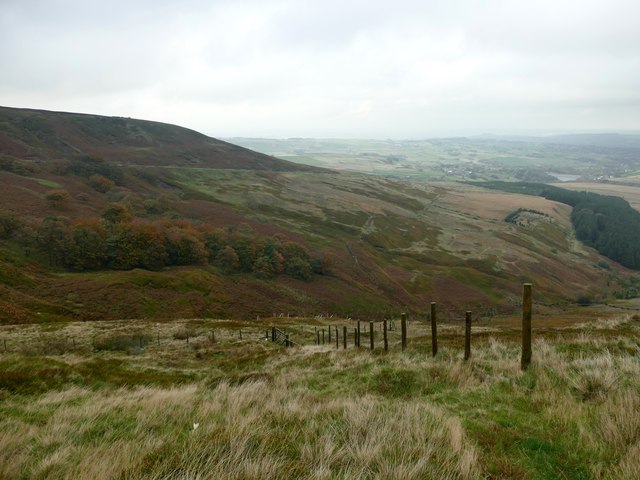
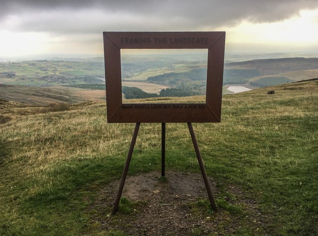
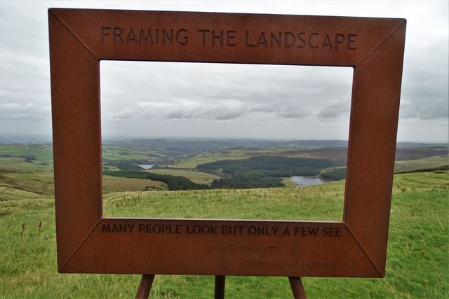
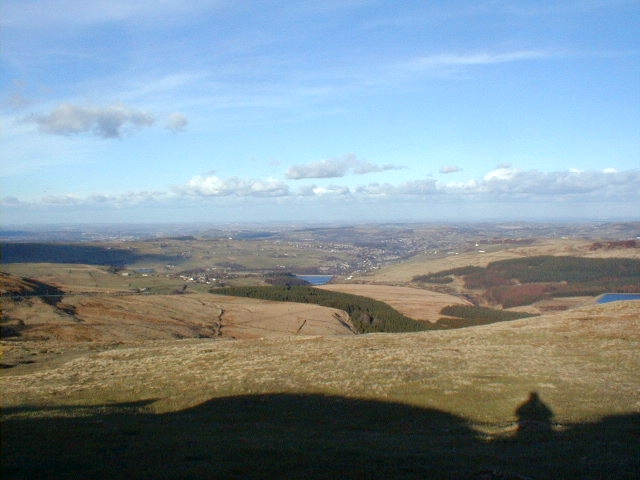
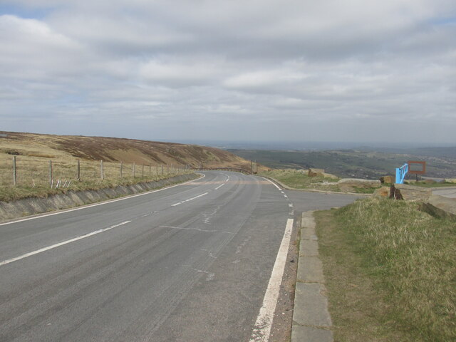
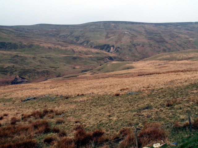
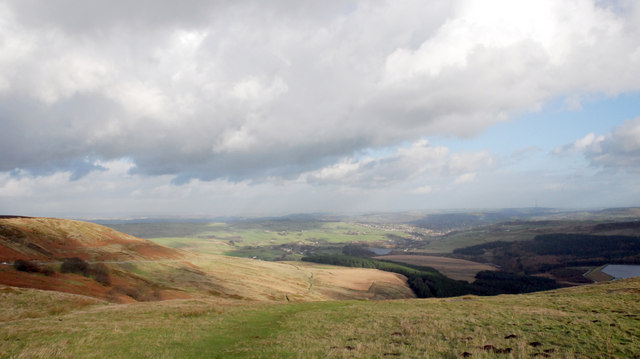
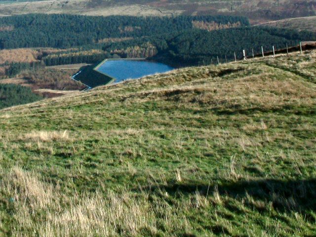
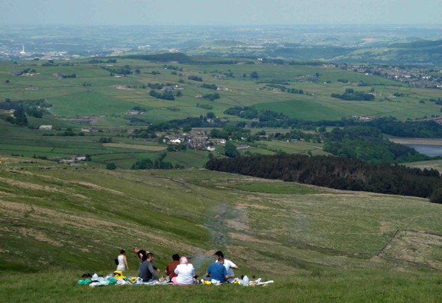
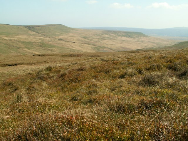
Herbage Hill is a prominent hill located in the county of Yorkshire, England. It is part of the Pennines, a range of hills and mountains that stretches across the northern part of England. Rising to an impressive height of approximately 1,450 feet (442 meters), Herbage Hill offers stunning panoramic views of the surrounding countryside.

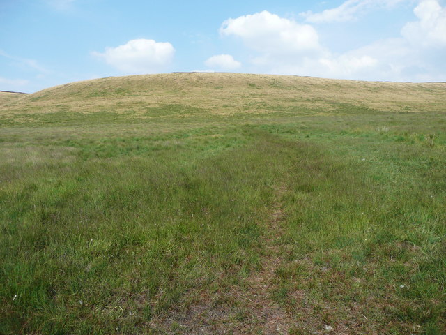
The hill is covered in lush green vegetation, which gives it its name. Herbage Hill is known for its diverse flora and fauna, with a variety of plant species thriving in its fertile soil. The hill is home to several rare and protected plant species, making it a popular destination for botanists and nature enthusiasts.

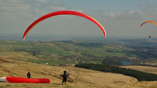
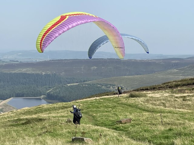
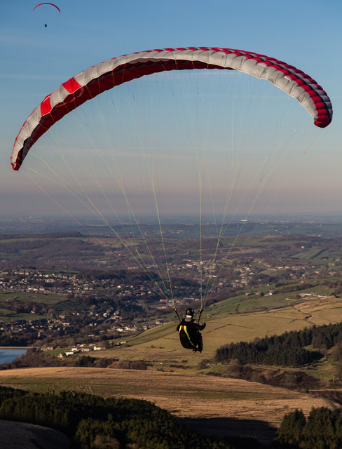
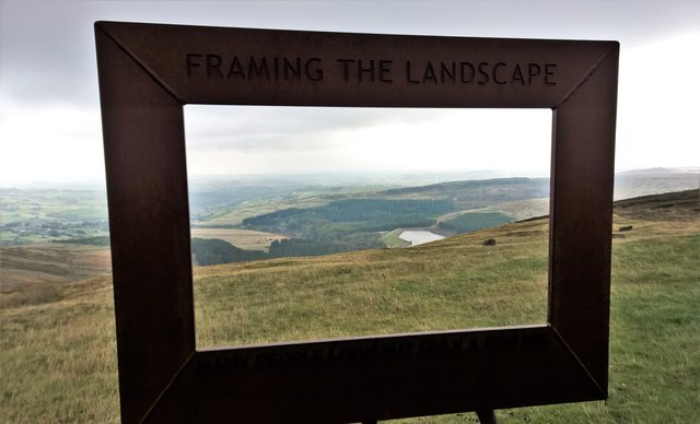
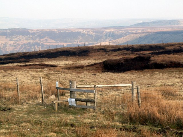
Herbage Hill is a popular location for outdoor activities such as hiking and walking. It offers a range of trails and paths suitable for all levels of experience, allowing visitors to explore the hill and enjoy its natural beauty. The hill's elevated position provides breathtaking views of the Yorkshire Dales and the rolling countryside, making it a favorite spot for photographers and artists.

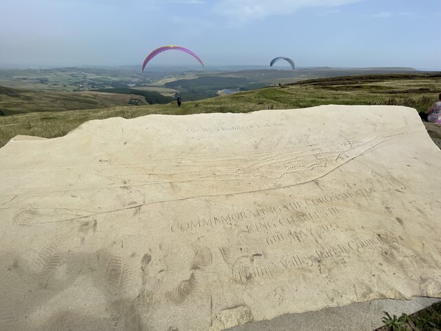
In addition to its natural beauty, Herbage Hill also has historical significance. It is believed to have been used as a lookout point during ancient times, and remnants of old settlements and fortifications have been discovered in the area.

Overall, Herbage Hill is a captivating destination for those seeking to immerse themselves in the natural beauty and history of Yorkshire. With its stunning views, diverse flora and fauna, and opportunities for outdoor activities, it continues to attract visitors from near and far.

If you have any feedback on the listing, please let us know in the comments section below.

Herbage Hill Images

Images are sourced within 2km of 53.528259/-1.8253811 or Grid Reference SE1103. Thanks to Geograph Open Source API. All images are credited.

Paragliding from Holme Moss View with the Holme valley below
Paragliding from Holme Moss
View with the Holme valley below
Car park on Holme Moss On a wet and misty Monday morning. There wasn't much of a view.
Car park on Holme Moss
On a wet and misty Monday morning. There wasn't much of a view.
Paragliders on Holme Moss Two paragliders on top of Holme Moss, near the car park.
Paragliders on Holme Moss
Two paragliders on top of Holme Moss, near the car park.
Holme Moss Commemorative stone for the coronation of King Charles III at top of Holme Moss. Paragliders in background.
Holme Moss
Commemorative stone for the coronation of King Charles III at top of Holme Moss. Paragliders in background.
Wilmer Hill Paragliding on Wilmer Hill.
Wilmer Hill
Paragliding on Wilmer Hill.
Path onto Britland Edge Hill. Tintwistle This was taken from the gate opposite the first layby down the hill. The path disappears when the steep slope is reached, but keep climbing and the edge of the peat is reached, and then the boundary fence can be seen.
Path onto Britland Edge Hill. Tintwistle
This was taken from the gate opposite the first layby down the hill. The path disappears when the steep slope is reached, but keep climbing and the edge of the peat is reached, and then the boundary fence can be seen.
Footbridge over a ditch alongside the A6024, Tintwistle This is opposite the first layby down the hill. The footbridge leads to a gate and the path shown in <a href="https://www.geograph.org.uk/photo/5857129">SE0902 : Path onto Britland Edge Hill. Tintwistle</a>.
Footbridge over a ditch alongside the A6024, Tintwistle
This is opposite the first layby down the hill. The footbridge leads to a gate and the path shown in SE0902 : Path onto Britland Edge Hill. Tintwistle.
Frame with a view In Holme Moss car park looking towards Yateholme Reservoir - on a dismal day as the clouds lifted and fell!

After visiting on this day it's easy to understand the gloomy colours in so many of local artist Ashley Jackson's paintings! See; <span class="nowrap"><a title="https://www.ashley-jackson.co.uk/" rel="nofollow ugc noopener" href="https://www.ashley-jackson.co.uk/">Link</a><img style="margin-left:2px;" alt="External link" title="External link - shift click to open in new window" src="https://s1.geograph.org.uk/img/external.png" width="10" height="10"/></span>
Frame with a view
In Holme Moss car park looking towards Yateholme Reservoir - on a dismal day as the clouds lifted and fell! After visiting on this day it's easy to understand the gloomy colours in so many of local artist Ashley Jackson's paintings! See; LinkExternal link
Above Holme Wood Dike The stream drains Holme Moss into Yateholme Reservoir
Above Holme Wood Dike
The stream drains Holme Moss into Yateholme Reservoir
Framing the Landscape 'Many people look but only a few see'. So says this art installation at Holme Moss framing the view over the Holme Valley. This is one of a series placed at viewpoints in Yorkshire by local artist Ashley Jackson. <span class="nowrap"><a title="http://www.framingthelandscape.co.uk/" rel="nofollow ugc noopener" href="http://www.framingthelandscape.co.uk/">Link</a><img style="margin-left:2px;" alt="External link" title="External link - shift click to open in new window" src="https://s1.geograph.org.uk/img/external.png" width="10" height="10"/></span>
Framing the Landscape
'Many people look but only a few see'. So says this art installation at Holme Moss framing the view over the Holme Valley. This is one of a series placed at viewpoints in Yorkshire by local artist Ashley Jackson. LinkExternal link
A view of the Holme Valley "Framing the Landscape" above the village of Holme.
A view of the Holme Valley
"Framing the Landscape" above the village of Holme.
Holme Valley View from the car park at the top of Holme Moss.
Holme Valley
View from the car park at the top of Holme Moss.
The A6024 Road at Holme Moss.
The A6024
Road at Holme Moss.
Wilmer Hill Looking to Great Twizle Head
Wilmer Hill
Looking to Great Twizle Head
Binns and Binns Moss Viewed from one of the car parks on the A6024 Woodhead to Holme Road
Binns and Binns Moss
Viewed from one of the car parks on the A6024 Woodhead to Holme Road
Holme Valley A view NE of the Holme Valley from the viewpoint at the Woodhead road summit above Holme village
Holme Valley
A view NE of the Holme Valley from the viewpoint at the Woodhead road summit above Holme village
Edge of Holme Moss Scrubland on the edge of Holme Moss. Over the edge in the distance is a glimpse of  Yateholme Reservoir. Only a thin fence guards the edge.
Edge of Holme Moss
Scrubland on the edge of Holme Moss. Over the edge in the distance is a glimpse of Yateholme Reservoir. Only a thin fence guards the edge.
BBQ time Looking down the Holme Valley.
BBQ time
Looking down the Holme Valley.
Show me another place!

Herbage Hill is located at Grid Ref: SE1103 (Lat: 53.528259, Lng: -1.8253811)

Division: West Riding

Unitary Authority: Kirklees

Police Authority: West Yorkshire

What 3 Words

///cosmic.taking.fighters. Near Holmfirth, West Yorkshire

Related Wikis

Britland Edge Hill

Britland Edge Hill is a hill, 523 metres (1,716 ft) high, in the Peak District in England. It is located on the border of Derbyshire and West Yorkshire...

Holme Moss

Holme Moss (1,719 feet or 524 metres a.s.l.) is high moorland on the border between the Holme Valley district of Kirklees in West Yorkshire and the High...

Holme Moss transmitting station

The Holme Moss transmitting station is a radio transmitting station at Holme Moss in West Yorkshire, England. The mast provides VHF coverage of both FM...

Underhill, Holme

Underhill at Holme, West Yorkshire, is a modern house designed by Arthur Quarmby in 1969 and built from 1973 to 1975. Underhill has been Grade II listed...

Holme, West Yorkshire

Holme is a village in the Holme Valley civil parish of Kirklees in West Yorkshire, England. The village straddles the A6024 road between Holmbridge and...

Holmbridge

Holmbridge is a small village on the A6024 to the southwest of Holmfirth and south of Huddersfield in West Yorkshire, England. It is in the parish of...

Lane, West Yorkshire

Lane Village is a small hamlet 3 miles (4.8 km) southwest of Holmfirth and approximately half a mile southwest of Holme Village on the A6024 Woodhead Road...

Hade Edge

Hade Edge is a small village to the south of Holmfirth and southeast of Hepworth in West Yorkshire, England. It is in the parish of Holme Valley and the...

Nearby Amenities

Located within 500m of 53.528259,-1.8253811
Ford: yes
Lat/Long: 53.526176/-1.8241181
Herbage Hill
Natural: peak
Source: OS Historic
Lat/Long: 53.5299486/-1.8250972
Bailie Causway Moss
Place: locality
Source: OS Historic
Lat/Long: 53.5247955/-1.8210224
Twizle Head Moss
Place: locality
Lat/Long: 53.5266602/-1.8323518
Ford: yes
Lat/Long: 53.5286508/-1.8288591
Ford: yes
Lat/Long: 53.5284272/-1.8277293
The data included in this document is from www.openstreetmap.org. The data is made available under ODbL.

Have you been to Herbage Hill?

Leave your review of Herbage Hill below (or comments, questions and feedback).