Shore Law

Hill, Mountain in Yorkshire

England

Shore Law

Moorland Pond By the side of the track from High Gate down to Dean Farm. The Cliviger Gorge is beyond
Moorland Pond Credit: Kevin Waterhouse

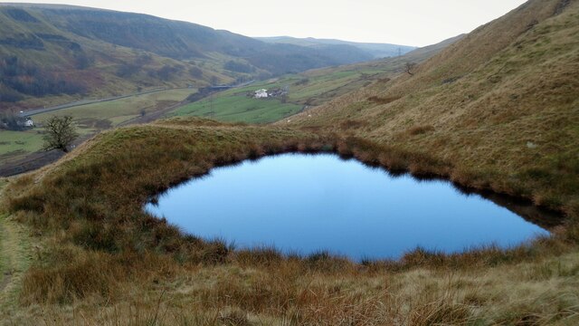
Shore Law, located in Yorkshire, England, is a prominent hill that forms part of the Yorkshire Dales National Park. Rising to an elevation of approximately 425 meters (1,394 feet), it is considered one of the highest points in the region, offering breathtaking panoramic views of the surrounding countryside.

This hill, commonly referred to as a mountain due to its significant height, is characterized by its rugged terrain and rocky slopes. It is a result of geological processes that occurred millions of years ago, during which the movement of tectonic plates created this distinctive landscape.

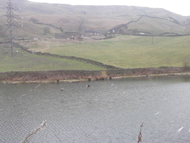
Shore Law is a popular destination for outdoor enthusiasts, hikers, and nature lovers alike. Its well-maintained footpaths provide access to the summit, allowing visitors to admire the picturesque scenery along the way. The hill offers a diverse range of flora and fauna, with heather-covered moors, grassy meadows, and a variety of plant species thriving in its ecosystem.

The hill's location within the Yorkshire Dales National Park ensures that it remains protected and preserved for future generations to enjoy. The park management actively promotes sustainable tourism, ensuring that visitors can experience the natural beauty of Shore Law while minimizing their impact on the environment.

In addition to its natural beauty, Shore Law also holds historical significance. The hill is believed to have been inhabited by humans since ancient times, with archaeological evidence suggesting the presence of settlements and burial sites dating back thousands of years.

Overall, Shore Law stands as a remarkable natural landmark, offering a combination of stunning views, ecological diversity, and historical significance, making it a must-visit destination for those exploring the Yorkshire Dales.

If you have any feedback on the listing, please let us know in the comments section below.
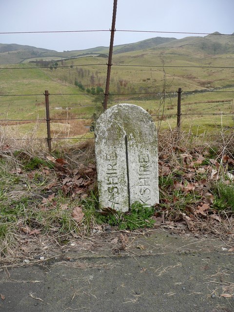
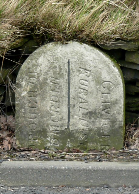
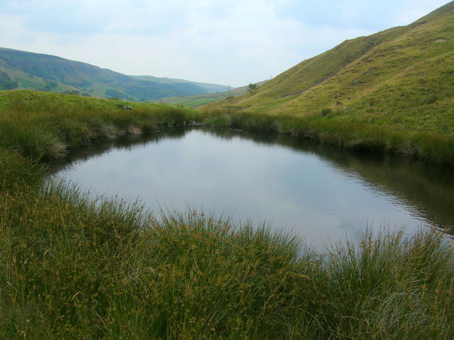
Shore Law Images

Images are sourced within 2km of 53.738691/-2.1319795 or Grid Reference SD9126. Thanks to Geograph Open Source API. All images are credited.

Moorland Pond By the side of the track from High Gate down to Dean Farm. The Cliviger Gorge is beyond
Moorland Pond
By the side of the track from High Gate down to Dean Farm. The Cliviger Gorge is beyond
Railway climbing to Copy Pit Summit On the Todmorden to Burnley line viewed from the Dean Farm Bridge. The infant Yorkshire River Calder runs by the railway
Railway climbing to Copy Pit Summit
On the Todmorden to Burnley line viewed from the Dean Farm Bridge. The infant Yorkshire River Calder runs by the railway
Dean Farm Portsmouth (Todmorden) Reservoir, Calderdale in the foreground
Dean Farm
Portsmouth (Todmorden) Reservoir, Calderdale in the foreground
Railway Bridge, Portsmouth
Railway to Burnley (Manchester Road) from Todmorden
Railway to Todmorden from Burnley (Manchester Road)
Dean Farm From the anglers' car park, note the warning for the overhead power lines
Dean Farm
From the anglers' car park, note the warning for the overhead power lines
The county boundary This marks the boundary between Lancashire and Yorkshire (West Riding) following the changes made in 1889.
The county boundary
This marks the boundary between Lancashire and Yorkshire (West Riding) following the changes made in 1889.
The district boundary This marks the boundary between the Borough of Todmorden and Cliviger. It appears to be inscribed 'Cliviger Rural District', but Cliviger Civil Parish was in Burnley Rural District according to Youngs's 'Guide to the Local Administrative Units of England'.
The district boundary
This marks the boundary between the Borough of Todmorden and Cliviger. It appears to be inscribed 'Cliviger Rural District', but Cliviger Civil Parish was in Burnley Rural District according to Youngs's 'Guide to the Local Administrative Units of England'.
Moorland Pool above the Cliviger Gorge
A646 and disused mill
Portsmouth Reservoir Seen from the track which descends to Dean Farm. It is now used only for fishing.
Portsmouth Reservoir
Seen from the track which descends to Dean Farm. It is now used only for fishing.
Dean Farm Overlooking Portsmouth Reservoir.
Dean Farm
Overlooking Portsmouth Reservoir.
Dean Farm Viewed from the A646 near a bus-stop of the same name. From here it appears to be halfway up the hillside, but it is relatively low down.
Dean Farm
Viewed from the A646 near a bus-stop of the same name. From here it appears to be halfway up the hillside, but it is relatively low down.
Entering Portsmouth At this point, you cross four boundaries, going into: West Yorkshire, Calderdale, Todmorden and Portsmouth.
Entering Portsmouth
At this point, you cross four boundaries, going into: West Yorkshire, Calderdale, Todmorden and Portsmouth.
Carr Road, Portsmouth
The line from Burnley to Todmorden From a bridge carrying a track from the A646 to Dean Farm.
The line from Burnley to Todmorden
From a bridge carrying a track from the A646 to Dean Farm.
Bridge over the railway At Portsmouth Reservoir. The bridge carries a road track from the A646 to Dean Farm.
Bridge over the railway
At Portsmouth Reservoir. The bridge carries a road track from the A646 to Dean Farm.
Show me another place!

Shore Law is located at Grid Ref: SD9126 (Lat: 53.738691, Lng: -2.1319795)

Division: West Riding

Unitary Authority: Calderdale

Police Authority: West Yorkshire

What 3 Words

///smooth.skate.easily. Near Cornholme, West Yorkshire

Related Wikis

Pudsey, Calderdale

Pudsey is a neighbourhood in the village of Cornholme, Calderdale, West Yorkshire, England. It is near the town of Todmorden and the A646 Burnley Road...

Cornholme railway station

Cornholme railway station served the village of Cornholme in West Yorkshire, England on the Copy Pit line. The station was opened by the Lancashire and...

Cornholme

Cornholme is a village near Todmorden, in the metropolitan borough of Calderdale, in West Yorkshire, England. It lies at the edge of Calderdale, on the...

Portsmouth (Lancs) railway station

Portsmouth railway station was on the Copy Pit line and served the village of Portsmouth, which was part of Lancashire, before being incorporated into...

Nearby Amenities

Located within 500m of 53.738691,-2.1319795
Mount Cross
Historic: monument
Lat/Long: 53.7418463/-2.130961
Generator Source: wind
Power: generator
Lat/Long: 53.7369981/-2.1364678
Barrier: stile
Stile: stepover
Lat/Long: 53.7363063/-2.1289222
Barrier: stile
Lat/Long: 53.7427877/-2.1347916
Barrier: stile
Lat/Long: 53.7422434/-2.1319238
Barrier: stile
Lat/Long: 53.742565/-2.133796
Barrier: stile
Stile: stepover
Lat/Long: 53.7345301/-2.1305926
Barrier: stile
Stile: stepover
Lat/Long: 53.7344973/-2.1306309
Barrier: stile
Material: wood
Stile: stepover
Lat/Long: 53.7355469/-2.1266233
Barrier: stile
Material: wood
Stile: stepover
Lat/Long: 53.7373514/-2.1257741
Barrier: stile
Stile: stepover
Lat/Long: 53.7361144/-2.1266276
Barrier: stile
Material: stone
Stile: stepover
Lat/Long: 53.7396854/-2.1263558
Barrier: stile
Stile: stepover
Lat/Long: 53.7397993/-2.126224
Barrier: cattle_grid
Lat/Long: 53.7366712/-2.1269884
Barrier: stile
Material: wood
Stile: stepover
Lat/Long: 53.737023/-2.1278273
Barrier: stile
Material: stone
Stile: stepover
Lat/Long: 53.736416/-2.1282076
Barrier: stile
Stile: squeezer
Lat/Long: 53.7347892/-2.1353213
Barrier: stile
Stile: stepover
Lat/Long: 53.7345559/-2.132824
Bench
Backrest: yes
Material: wood
Lat/Long: 53.7355936/-2.1314737
The data included in this document is from www.openstreetmap.org. The data is made available under ODbL.

Have you been to Shore Law?

Leave your review of Shore Law below (or comments, questions and feedback).