Wittonstall Clough

Valley in Yorkshire

England

Wittonstall Clough

Moorland Pond By the side of the track from High Gate down to Dean Farm. The Cliviger Gorge is beyond
Moorland Pond Credit: Kevin Waterhouse

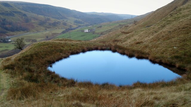
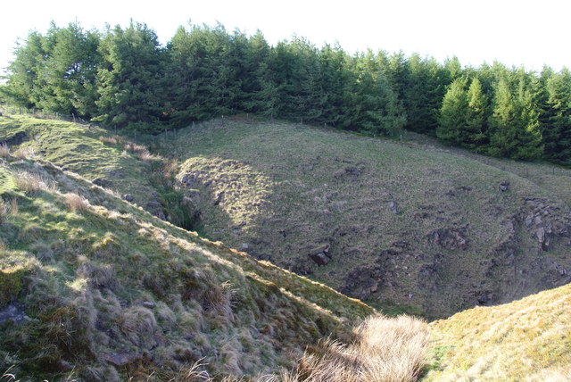
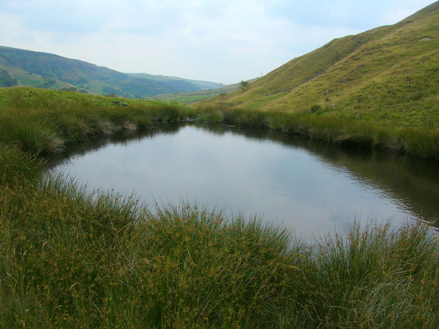
Wittonstall Clough is a picturesque valley located in the county of Yorkshire, England. Nestled amidst the rolling hills and abundant greenery, this hidden gem offers visitors a serene and tranquil escape from the bustling city life.

The clough, which is a local term for a narrow, steep-sided valley, stretches for approximately two miles and is carved out by the Wittonstall Beck, a small river that flows through the heart of the valley. The crystal-clear waters of the beck meander their way through the valley, creating soothing sounds and providing a habitat for various species of aquatic life.

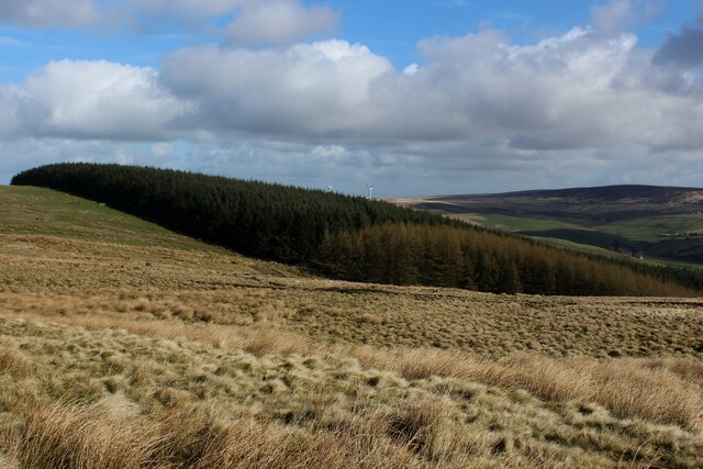
The surrounding landscape of Wittonstall Clough is a paradise for nature enthusiasts. Lush woodland covers the steep slopes, adorned with a rich tapestry of wildflowers and ancient trees. The valley is also home to a diverse range of wildlife, including rare birds, otters, and deer, making it a haven for birdwatching and wildlife spotting.

For hikers and walkers, Wittonstall Clough offers numerous scenic trails that wind through the valley and its surroundings. The paths lead visitors through enchanting forests, across babbling brooks, and up to breathtaking viewpoints that offer panoramic vistas of the surrounding countryside.

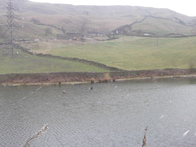
At the heart of the valley lies a quaint village, complete with charming cottages, a historic church, and a traditional village pub. The village provides a warm welcome for visitors, with locally sourced food and drink options available.

In summary, Wittonstall Clough is a natural paradise in the heart of Yorkshire, offering a peaceful retreat for those seeking solace in the beauty of nature. Its idyllic landscape, diverse wildlife, and charming village make it a must-visit destination for anyone exploring the region.

If you have any feedback on the listing, please let us know in the comments section below.

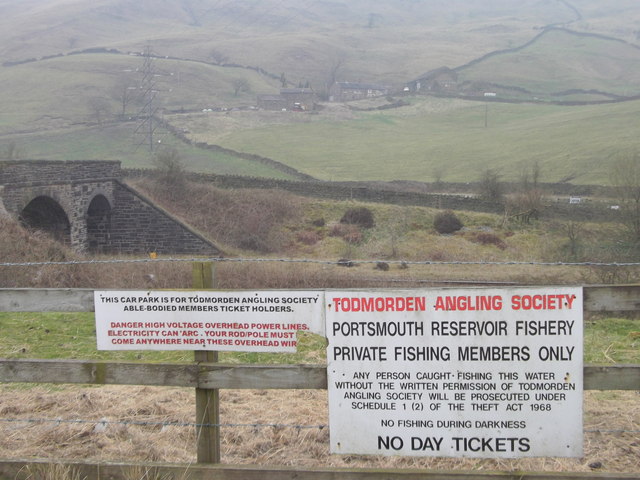
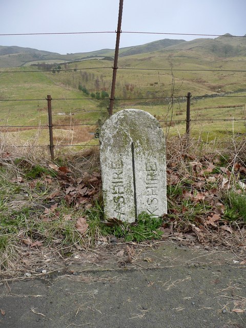
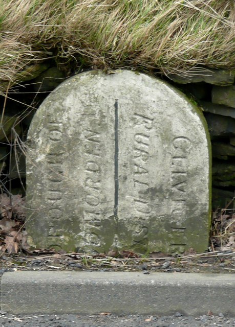
Wittonstall Clough Images

Images are sourced within 2km of 53.734099/-2.1313739 or Grid Reference SD9126. Thanks to Geograph Open Source API. All images are credited.

Moorland Pond By the side of the track from High Gate down to Dean Farm. The Cliviger Gorge is beyond
Moorland Pond
By the side of the track from High Gate down to Dean Farm. The Cliviger Gorge is beyond
Plantation on Carr and Craggs Moor
Dean Farm Portsmouth (Todmorden) Reservoir, Calderdale in the foreground
Dean Farm
Portsmouth (Todmorden) Reservoir, Calderdale in the foreground
Railway Bridge, Portsmouth
Railway to Todmorden from Burnley (Manchester Road)
Dean Farm From the anglers' car park, note the warning for the overhead power lines
Dean Farm
From the anglers' car park, note the warning for the overhead power lines
The county boundary This marks the boundary between Lancashire and Yorkshire (West Riding) following the changes made in 1889.
The county boundary
This marks the boundary between Lancashire and Yorkshire (West Riding) following the changes made in 1889.
The district boundary This marks the boundary between the Borough of Todmorden and Cliviger. It appears to be inscribed 'Cliviger Rural District', but Cliviger Civil Parish was in Burnley Rural District according to Youngs's 'Guide to the Local Administrative Units of England'.
The district boundary
This marks the boundary between the Borough of Todmorden and Cliviger. It appears to be inscribed 'Cliviger Rural District', but Cliviger Civil Parish was in Burnley Rural District according to Youngs's 'Guide to the Local Administrative Units of England'.
Streams converge at the head of Tower Clough These drain off Carr & Craggs Moor, and eventually into the River Calder.
Streams converge at the head of Tower Clough
These drain off Carr & Craggs Moor, and eventually into the River Calder.
Top corner of the forest on Carr & Craggs Moor The beginning of Tower Clough is in the foreground.
Top corner of the forest on Carr & Craggs Moor
The beginning of Tower Clough is in the foreground.
Moorland Pool above the Cliviger Gorge
A646 and disused mill
Portsmouth Reservoir Seen from the track which descends to Dean Farm. It is now used only for fishing.
Portsmouth Reservoir
Seen from the track which descends to Dean Farm. It is now used only for fishing.
Dean Farm Overlooking Portsmouth Reservoir.
Dean Farm
Overlooking Portsmouth Reservoir.
Dean Farm Viewed from the A646 near a bus-stop of the same name. From here it appears to be halfway up the hillside, but it is relatively low down.
Dean Farm
Viewed from the A646 near a bus-stop of the same name. From here it appears to be halfway up the hillside, but it is relatively low down.
Entering Portsmouth At this point, you cross four boundaries, going into: West Yorkshire, Calderdale, Todmorden and Portsmouth.
Entering Portsmouth
At this point, you cross four boundaries, going into: West Yorkshire, Calderdale, Todmorden and Portsmouth.
Carr Road, Portsmouth
The line from Burnley to Todmorden From a bridge carrying a track from the A646 to Dean Farm.
The line from Burnley to Todmorden
From a bridge carrying a track from the A646 to Dean Farm.
Show me another place!

Wittonstall Clough is located at Grid Ref: SD9126 (Lat: 53.734099, Lng: -2.1313739)

Division: West Riding

Unitary Authority: Calderdale

Police Authority: West Yorkshire

What 3 Words

///excusing.weeks.correct. Near Cornholme, West Yorkshire

Related Wikis

Cornholme railway station

Cornholme railway station served the village of Cornholme in West Yorkshire, England on the Copy Pit line. The station was opened by the Lancashire and...

Pudsey, Calderdale

Pudsey is a neighbourhood in the village of Cornholme, Calderdale, West Yorkshire, England. It is near the town of Todmorden and the A646 Burnley Road...

Cornholme

Cornholme is a village near Todmorden, in the metropolitan borough of Calderdale, in West Yorkshire, England. It lies at the edge of Calderdale, on the...

Portsmouth (Lancs) railway station

Portsmouth railway station was on the Copy Pit line and served the village of Portsmouth, which was part of Lancashire, before being incorporated into...

Nearby Amenities

Located within 500m of 53.734099,-2.1313739
Cornholme
Created By: YahooApplet 1.0
Place: village
Wikidata: Q5171740
Lat/Long: 53.7320661/-2.1380572
Bus Stop
Burnley Road
Bus: yes
Local Ref: 45018903
Naptan AtcoCode: 450018903
Naptan Bearing: SE
Naptan CommonName: Burnley Road
Naptan Crossing: Dundee Road
Naptan Indicator: Stop 45018903
Naptan Landmark: New Lay Wood
Naptan PlusbusZoneRef: LEEDS
Naptan ShortCommonName: Dundee Road
Naptan Street: Burnley Road
Naptan Verified: no
Public Transport: platform
Source: naptan_import
Lat/Long: 53.7297245/-2.1299462
Bus Stop
Burnley Road
Bus: yes
Local Ref: 45018904
Naptan AtcoCode: 450018904
Naptan Bearing: NW
Naptan CommonName: Burnley Road
Naptan Crossing: Dundee Road
Naptan Indicator: Stop 45018904
Naptan Landmark: New Lay Wood
Naptan PlusbusZoneRef: LEEDS
Naptan ShortCommonName: Dundee Road
Naptan Street: Burnley Road
Naptan Verified: no
Public Transport: platform
Source: naptan_import
Lat/Long: 53.7299843/-2.1306203
Bus Stop
Burnley Road Station Road
Bus: yes
Local Ref: 45018905
Naptan AtcoCode: 450018905
Naptan Bearing: NW
Naptan CommonName: Burnley Road Station Road
Naptan Crossing: Station Road
Naptan Indicator: Stop 45018905
Naptan PlusbusZoneRef: LEEDS
Naptan ShortCommonName: Station Road
Naptan Street: Burnley Road
Naptan Verified: no
Public Transport: platform
Source: naptan_import
Lat/Long: 53.7313391/-2.1330131
Bus Stop
Burnley Road
Bus: yes
Local Ref: 45018906
Naptan AtcoCode: 450018906
Naptan Bearing: SE
Naptan CommonName: Burnley Road
Naptan Crossing: Station Road
Naptan Indicator: Stop 45018906
Naptan PlusbusZoneRef: LEEDS
Naptan ShortCommonName: Station Road
Naptan Street: Burnley Road
Naptan Verified: no
Public Transport: platform
Source: naptan_import
Lat/Long: 53.731402/-2.1329981
Bus Stop
Burnley Road
Bus: yes
Local Ref: 45018907
Naptan AtcoCode: 450018907
Naptan Bearing: SE
Naptan CommonName: Burnley Road
Naptan Indicator: Stop 45018907
Naptan PlusbusZoneRef: LEEDS
Naptan ShortCommonName: Holme House Road
Naptan Street: Burnley Road
Naptan Verified: no
Public Transport: platform
Source: naptan_import
Lat/Long: 53.732263/-2.1346986
Bus Stop
Burnley Road Glen View Street
Bench: yes
Bin: yes
Bus: yes
Local Ref: 45018908
Naptan AtcoCode: 450018908
Naptan Bearing: W
Naptan CommonName: Burnley Road Glen View Street
Naptan Crossing: Glen View Street
Naptan Indicator: Stop 45018908
Naptan Landmark: Post Office
Naptan PlusbusZoneRef: LEEDS
Naptan ShortCommonName: Club Street
Naptan Street: Burnley Road
Naptan Verified: no
Public Transport: platform
Shelter: yes
Source: naptan_import
Tactile Paving: no
Lat/Long: 53.732295/-2.1381094
Communication Lte: yes
Communication Mobile Phone: yes
Man Made: tower
Tower Construction: tower
Tower Type: communication
Lat/Long: 53.7345554/-2.1255545
Generator Source: wind
Power: generator
Lat/Long: 53.7369981/-2.1364678
Barrier: stile
Lat/Long: 53.7337431/-2.137924
Historic: milestone
Inscription: To Todmorden 2 Miles To Burnley 7ΒΌ Miles
Lat/Long: 53.7305522/-2.1310196
Historic: memorial
Memorial: war_memorial
Lat/Long: 53.7322641/-2.1353723
Barrier: stile
Lat/Long: 53.7322099/-2.1286201
Barrier: stile
Lat/Long: 53.7342992/-2.1272693
Barrier: stile
Lat/Long: 53.7341525/-2.1272588
Barrier: stile
Material: wood
Stile: stepover
Lat/Long: 53.7334939/-2.1253433
Barrier: stile
Lat/Long: 53.7353595/-2.1253398
Barrier: cattle_grid
Lat/Long: 53.7353539/-2.1253177
Historic: ruins
Lat/Long: 53.7340115/-2.1270876
Barrier: stile
Stile: stepover
Lat/Long: 53.7345301/-2.1305926
Barrier: stile
Stile: stepover
Lat/Long: 53.7345084/-2.1306242
Barrier: stile
Stile: stepover
Lat/Long: 53.7317192/-2.1294973
Bench
Backrest: yes
Lat/Long: 53.7331817/-2.1318985
Barrier: stile
Stile: stepover
Lat/Long: 53.7317193/-2.1372449
The data included in this document is from www.openstreetmap.org. The data is made available under ODbL.

Have you been to Wittonstall Clough?

Leave your review of Wittonstall Clough below (or comments, questions and feedback).