Cnoc nan Caorach Beaga

Hill, Mountain in Sutherland

Scotland

Cnoc nan Caorach Beaga

An Ruadh Loch Looking west across An Ruadh Loch during a brief spell of good weather.
An Ruadh Loch Credit: George Brown

Cnoc nan Caorach Beaga, located in Sutherland, Scotland, is a prominent hill/mountain standing at an elevation of approximately 770 meters (2,526 feet). It is part of the wider mountain range known as the Foinaven Group, which is situated in the remote and rugged northwest corner of the Scottish Highlands.

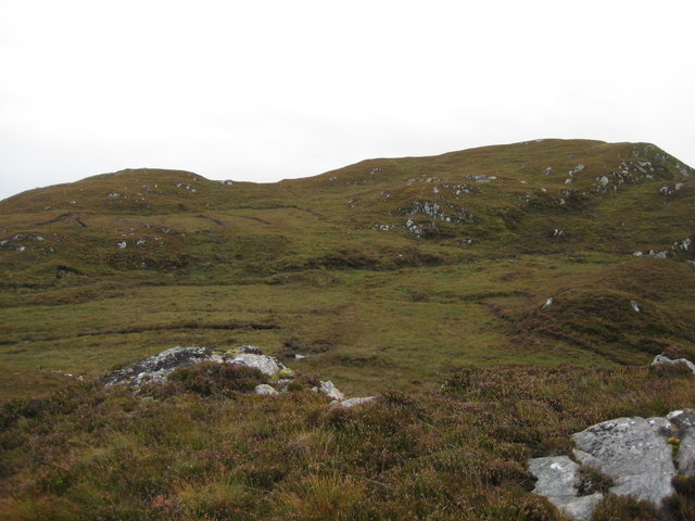
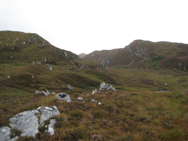
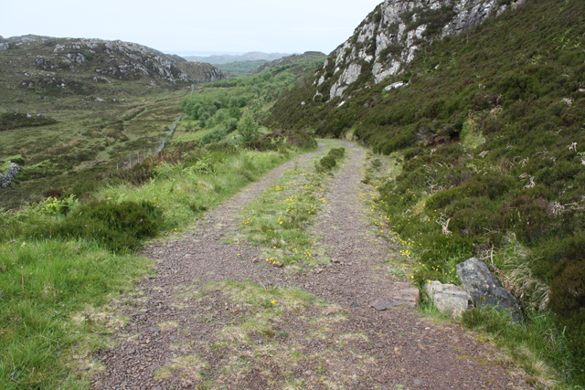
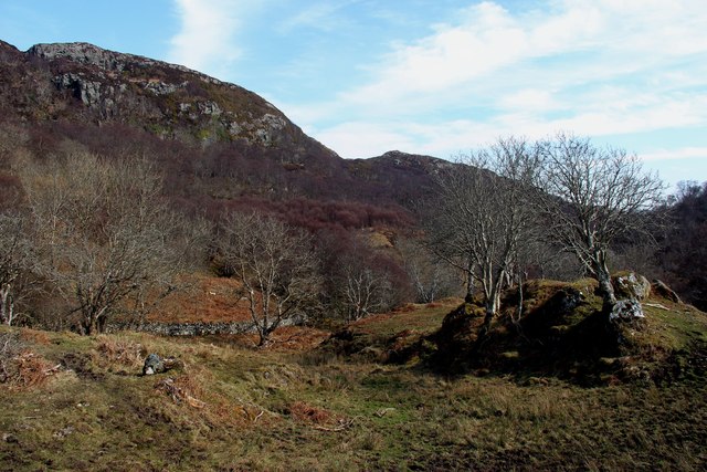
The hill/mountain is characterized by its distinctive peak, which offers panoramic views of the surrounding landscape. It is composed mainly of Torridonian sandstone, which gives it a unique reddish appearance. The terrain is rugged and challenging, with steep slopes and rocky outcrops, making it a popular destination for experienced hikers and climbers.

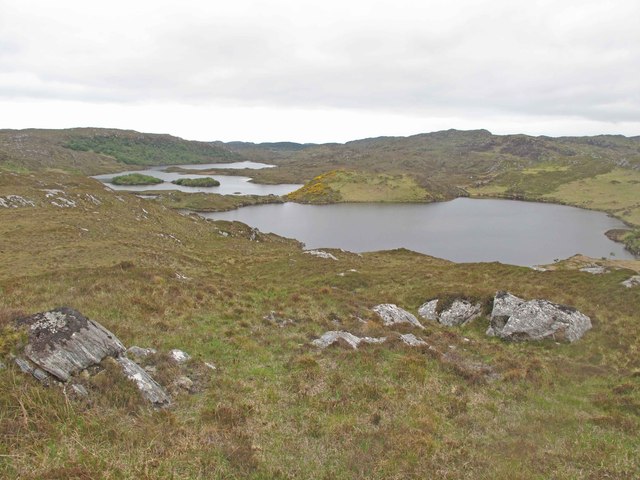
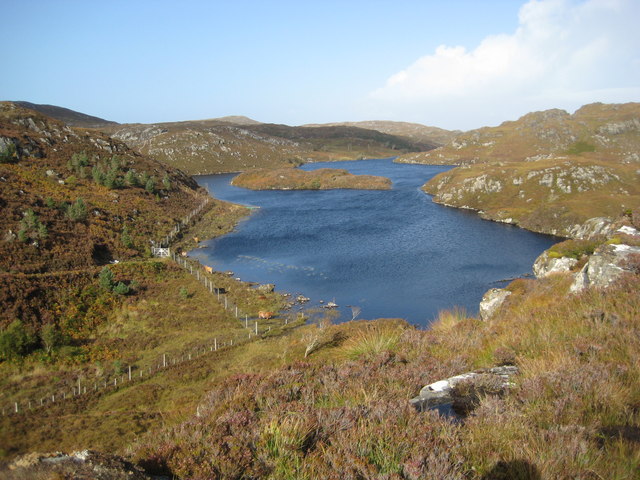
The surrounding area is known for its wild and untouched beauty, with vast stretches of moorland, lochs, and cascading waterfalls. Cnoc nan Caorach Beaga is situated in close proximity to other notable peaks, such as Foinaven and Arkle, adding to the allure for outdoor enthusiasts.

The hill/mountain is also home to a diverse range of flora and fauna, including heather, wildflowers, and various bird species. It is not uncommon to spot deer and other wildlife while exploring the area.

Due to its remote location, Cnoc nan Caorach Beaga offers a sense of solitude and tranquility, providing visitors with a unique opportunity to connect with nature and immerse themselves in the breathtaking Scottish Highlands. It is a destination that appeals to both avid hikers and those seeking a peaceful retreat in a remote and untouched natural environment.

If you have any feedback on the listing, please let us know in the comments section below.

Cnoc nan Caorach Beaga Images

Images are sourced within 2km of 58.181725/-5.2319725 or Grid Reference NC1025. Thanks to Geograph Open Source API. All images are credited.

An Ruadh Loch Looking west across An Ruadh Loch during a brief spell of good weather.
An Ruadh Loch
Looking west across An Ruadh Loch during a brief spell of good weather.
Loch an Tuir Loch an Tuir with Loch an Tuirc lying beyond it.
Loch an Tuir
Loch an Tuir with Loch an Tuirc lying beyond it.
Droighneach Ruins The remains of the former settlement of Droighneach.
Droighneach Ruins
The remains of the former settlement of Droighneach.
Southern end of Loch Crocach One of the larger lochs in this landscape of Lewissian gneiss and water
Southern end of Loch Crocach
One of the larger lochs in this landscape of Lewissian gneiss and water
Un-named spot heights 160/129m The highest point in this grid square of Lewissian gneiss landscape
Un-named spot heights 160/129m
The highest point in this grid square of Lewissian gneiss landscape
Cnoc Glas na h-Imrich Spot height of 175m above the N side of the Glac na h-Imrich down to the B869 road at Rhicarn. Area is now a recent mixed plantation.
Cnoc Glas na h-Imrich
Spot height of 175m above the N side of the Glac na h-Imrich down to the B869 road at Rhicarn. Area is now a recent mixed plantation.
Loch Crocach The boat mooring in the SW bay. The walk-in, from the parking near Rhicarn on the B869, is stunning and worth every uphill stride on the good track. (the fishing needed a wee breeze!)
Loch Crocach
The boat mooring in the SW bay. The walk-in, from the parking near Rhicarn on the B869, is stunning and worth every uphill stride on the good track. (the fishing needed a wee breeze!)
Loch nan Uidhean Beaga
Rowing Boats at Loch Crocach
Track from Loch Crocach
Moorland, Glac na h-Imrich Slopes with rocky outcrops.
Moorland, Glac na h-Imrich
Slopes with rocky outcrops.
Track, Glac na h-Imrich This track gives access to a fishing loch and peat bogs.
Track, Glac na h-Imrich
This track gives access to a fishing loch and peat bogs.
Cnoc Glac na h-Imrich Rocky moorland with stunted trees SE of the summit.
Cnoc Glac na h-Imrich
Rocky moorland with stunted trees SE of the summit.
View from Cnoc Glac na h-Imrich Looking towards Canisp, Suilven, Cul Mor, Cul Beg and Stac Pollaidh.
View from Cnoc Glac na h-Imrich
Looking towards Canisp, Suilven, Cul Mor, Cul Beg and Stac Pollaidh.
Rough wooded grazing ground at Rhicarn
Loch Crocach A most beautiful hill loch which provides excellent scenery and a great days fishing, with many thanks to the crofters trust, Assynt, for the hire of their boat.
Loch Crocach
A most beautiful hill loch which provides excellent scenery and a great days fishing, with many thanks to the crofters trust, Assynt, for the hire of their boat.
Loch Crocach islands
Unnamed, weedy lochan near Loch Crocach Lovely, tranquil spot. North-east bay has the only fishable, open water.
Unnamed, weedy lochan near Loch Crocach
Lovely, tranquil spot. North-east bay has the only fishable, open water.
Show me another place!

Cnoc nan Caorach Beaga is located at Grid Ref: NC1025 (Lat: 58.181725, Lng: -5.2319725)

Unitary Authority: Highland

Police Authority: Highlands and Islands

What 3 Words

///minute.hips.heckler. Near Clachtoll, Highland

Related Wikis

Loch an Tuirc

Loch an Tuirc is a large irregular shaped, shallow loch, located about two miles north-by-north-east of Lochinver in the Assynt district of Sutherland...

Loch Cròcach, Lochinver

Loch Cròcach is a large irregular shaped, shallow loch, located about three miles north of Lochinver in the Assynt district of Sutherland, Highland, Scotland...

Loch Beannach, Assynt

Loch Beannach is a small v-shaped loch, located 2 miles to the west of Loch Assynt and 3 miles northeast of Lochinver within the Assynt area of Sutherland...

Achmelvich

Achmelvich (Gaelic: Achadh Mhealbhaich) is a settlement situated in the Highland region of Scotland. The name comes from the Gaelic "Achadh" - a plain...

Have you been to Cnoc nan Caorach Beaga?

Leave your review of Cnoc nan Caorach Beaga below (or comments, questions and feedback).