An Socach

Hill, Mountain in Ross-shire

Scotland

An Socach

An Socach from the east
An Socach from the east Credit: Alan Reid

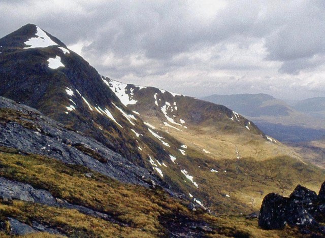
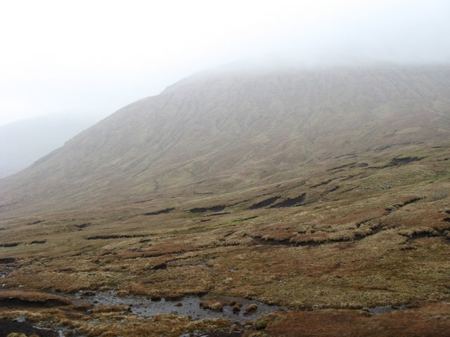
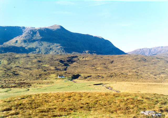
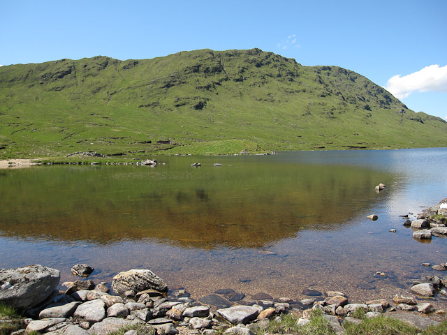
An Socach is a prominent hill located in Ross-shire, Scotland. It is part of the Ben Wyvis range and stands at an elevation of 1,069 meters (3,507 feet). The name An Socach translates to "The Snout" in Gaelic, which accurately describes the shape and appearance of the hill.

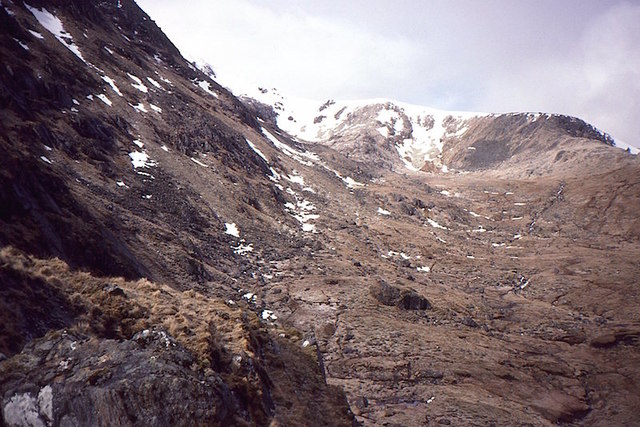
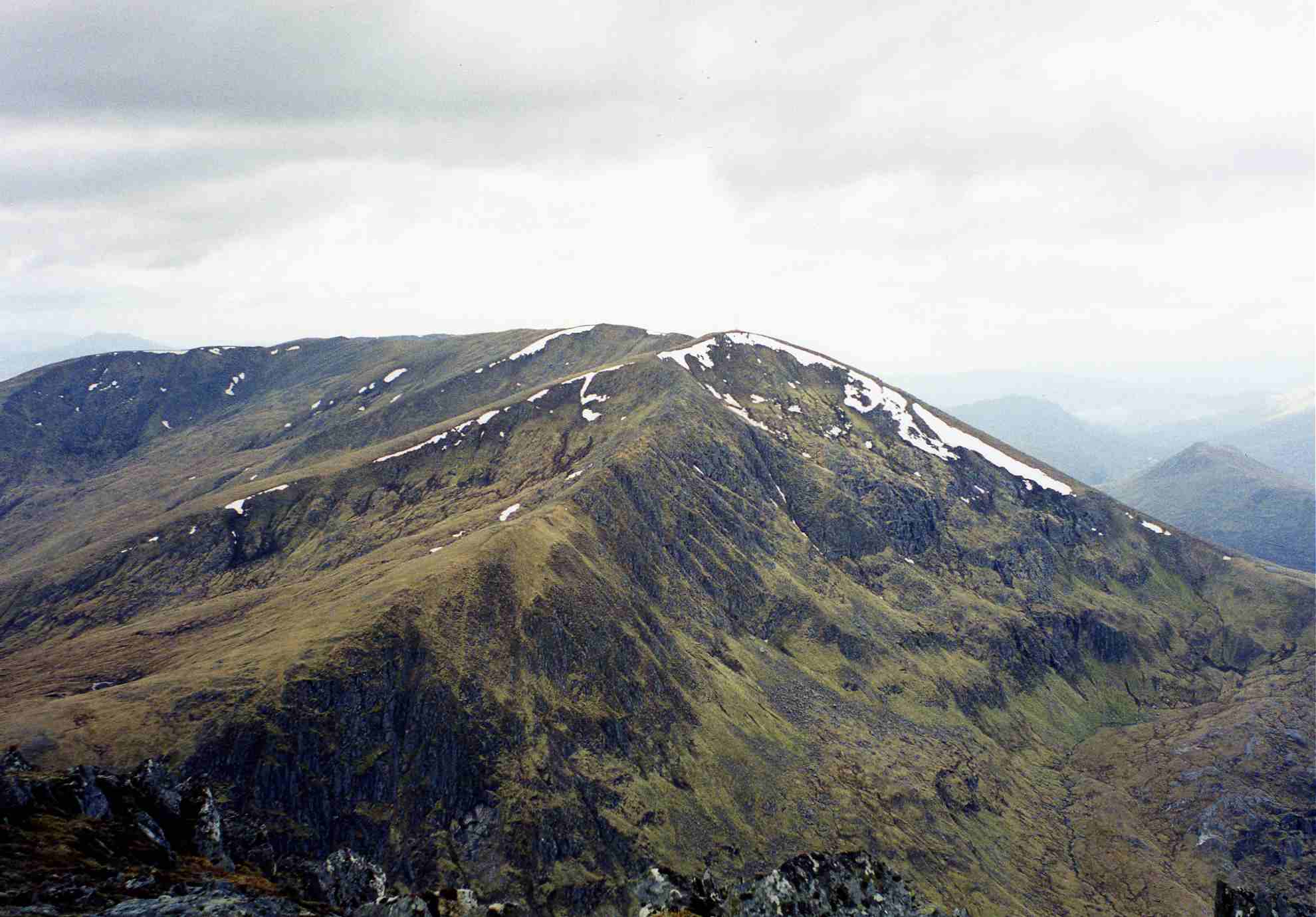
This mountain is a popular destination for hikers and outdoor enthusiasts due to its accessibility and stunning views. It can be reached via a well-maintained path that starts from the Garbat Forest and leads to the summit. The hike offers a moderate level of difficulty, with some steep sections, but rewards climbers with breathtaking vistas of the surrounding countryside.

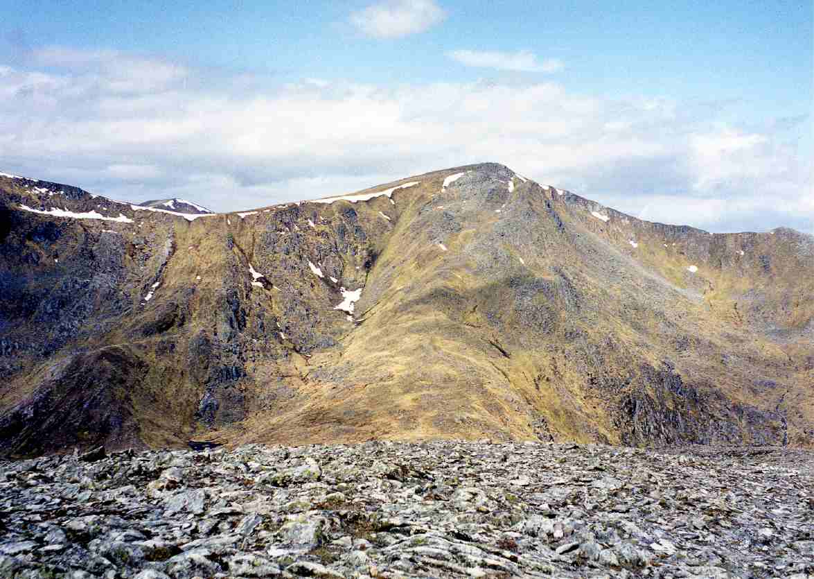
An Socach is known for its unique geological features, including the presence of Torridonian sandstone formations that were formed around 750 million years ago. The hill's slopes are covered in heather and grass, providing a beautiful contrast of colors, especially during the summer months.

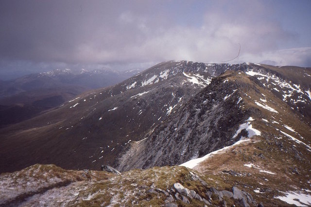
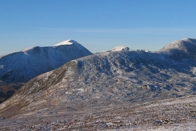
At the summit, hikers are treated to panoramic views of the Scottish Highlands, with Ben Wyvis to the northeast and the Black Isle to the east. On a clear day, it is even possible to spot the distant peaks of the Cairngorms National Park.

Overall, An Socach offers an enjoyable and rewarding hiking experience, with its stunning scenery, geological wonders, and relatively straightforward ascent. It is a must-visit destination for nature lovers and those seeking to explore the rugged beauty of the Scottish Highlands.

If you have any feedback on the listing, please let us know in the comments section below.

An Socach Images

Images are sourced within 2km of 57.35023/-5.1586248 or Grid Reference NH1033. Thanks to Geograph Open Source API. All images are credited.

An Socach from the east
Coire Gorm Beag Corrie on the north side of Meall a' Chaisg / An Socach.
Coire Gorm Beag
Corrie on the north side of Meall a' Chaisg / An Socach.
Bealach a' Bholla Col on the ridge north of Loch Mullardoch/Lungard.  View towards An Riabhachan.
Bealach a' Bholla
Col on the ridge north of Loch Mullardoch/Lungard. View towards An Riabhachan.
An Riabhachan and Bealach a' Bholla The col between Meall a' Chaisg / An Socach and An Riabhachan.  Weather looks lovely but I was about to have an epic.
An Riabhachan and Bealach a' Bholla
The col between Meall a' Chaisg / An Socach and An Riabhachan. Weather looks lovely but I was about to have an epic.
An Socach The summit ridge of An Socach / Meall a' Chaisg looking towards An Riabhachan.
An Socach
The summit ridge of An Socach / Meall a' Chaisg looking towards An Riabhachan.
Waterfall in  Coire na Brogaichain Waterfall draining the high corrie to the east of An Socach.
Waterfall in Coire na Brogaichain
Waterfall draining the high corrie to the east of An Socach.
Coire na Brogaichain Coire Mhàim leads to Coire na Brogaichain higher up the mountain. This is looking into the latter from the upper reaches of the former.
Coire na Brogaichain
Coire Mhàim leads to Coire na Brogaichain higher up the mountain. This is looking into the latter from the upper reaches of the former.
Coire Gorm Beag A fine steep corrie on the north side of Meall a' Chaisg  / An Socach.
Coire Gorm Beag
A fine steep corrie on the north side of Meall a' Chaisg / An Socach.
In Cloud on the Ridge to An Socach
Summit of An Socach The trig pillar looms out of the mist.
Summit of An Socach
The trig pillar looms out of the mist.
Trig Pillar on An Socach
South-East Spur of An Socach Typical of the large boulders strewn around this area. Unfortunately not the best conditions for photography due to cloud cover on the hills all day.
South-East Spur of An Socach
Typical of the large boulders strewn around this area. Unfortunately not the best conditions for photography due to cloud cover on the hills all day.
An Riabhachan - West Top This small pile of stones marks the summit of the listed Munro satellite top to the West of the main summit of An Riabhachan.
An Riabhachan - West Top
This small pile of stones marks the summit of the listed Munro satellite top to the West of the main summit of An Riabhachan.
Northern slope of An Socach On a boggy col on a rainy, cloudy day - must be Scotland ! An Socach used to be an unnamed hill on the OS maps.
Northern slope of An Socach
On a boggy col on a rainy, cloudy day - must be Scotland ! An Socach used to be an unnamed hill on the OS maps.
A Gloomy South Ridge of An Socach No wonderful vistas as the mountain tops were cloud covered the whole day. So some gloomy rocks will have to do.
A Gloomy South Ridge of An Socach
No wonderful vistas as the mountain tops were cloud covered the whole day. So some gloomy rocks will have to do.
Near the Summit of An Socach A bit gloomy but the cloud never cleared the whole day.
Near the Summit of An Socach
A bit gloomy but the cloud never cleared the whole day.
An Socach Looking to the east peak from near the summit. Loch Monar is below.
An Socach
Looking to the east peak from near the summit. Loch Monar is below.
South ridge, An Socach Looking up to Meall a' Chaisg and the summit beyond at what appears to not be the highest point.
South ridge, An Socach
Looking up to Meall a' Chaisg and the summit beyond at what appears to not be the highest point.
Show me another place!

An Socach is located at Grid Ref: NH1033 (Lat: 57.35023, Lng: -5.1586248)

Unitary Authority: Highland

Police Authority: Highlands and Islands

What 3 Words

///enacts.part.redeeming. Near Lochcarron, Highland

Nearby Locations

Coire Gorm Beag An Socach

Related Wikis

An Socach (Glen Cannich)

An Socach is a mountain at the head of Glen Cannich, in the Highlands of Scotland. It is situated between Loch Mullardoch in Glen Cannich, and Loch Monar...

An Riabhachan

An Riabhachan is a Scottish mountain in the Skye and Lochalsh district of the Highland council area. It is situated 35 kilometres east of Kyle of Lochalsh...

Aonach Buidhe

Aonach Buidhe (899 m) is a remote mountain in the Northwest Highlands of Ross and Cromarty in northwest Scotland. The nearest village is Dornie. The usual...

Beinn Fhionnlaidh (Mullardoch)

Beinn Fhionnlaidh is a mountain in the Highlands of Scotland. It is situated on the south side of Loch Mullardoch, at the end of Glen Cannich, about 60...

Sgùrr na Lapaich

Sgurr na Lapaich is a mountain in the Northwest Highlands of Scotland, situated north of Loch Mullardoch in the high ground that separates Glen Cannich...

Càrn Eighe

Carn Eighe (Scottish Gaelic: Càrn Èite) is a mountain in the Northwest Highlands of Scotland. Rising to 1,183 metres (3,881 ft) above sea level, it is...

Beinn Dronaig

Beinn Dronaig (797 m) is a mountain in the Northwest Highlands of Wester Ross, Scotland. A remote peak northeast of the village of Dornie, it is located...

Lurg Mhòr

Lurg Mhòr is a remote 986-metre (3,235 ft) mountain, a Munro, in the Northwest Highlands of Scotland at the high point of an east–west range of hills comprising...

Nearby Amenities

Located within 500m of 57.35023,-5.1586248
An Socach
Description: The projecting place, or snout
Ele: 1069
Marilyn: yes
Munro: yes
Munro Number: M067
Natural: peak
Prominence: 204
Source: NPE
Wikidata: Q13125511
Wikipedia: en:An Socach (Glen Cannich)
Lat/Long: 57.3502275/-5.1586027
The data included in this document is from www.openstreetmap.org. The data is made available under ODbL.

Have you been to An Socach?

Leave your review of An Socach below (or comments, questions and feedback).