Bad na Conaire

Downs, Moorland in Sutherland

Scotland

Bad na Conaire

Common Sandpiper by the river This little wader obligingly posed on one of the fishing piers on the River Inver.
Common Sandpiper by the river Credit: Gordon Hatton

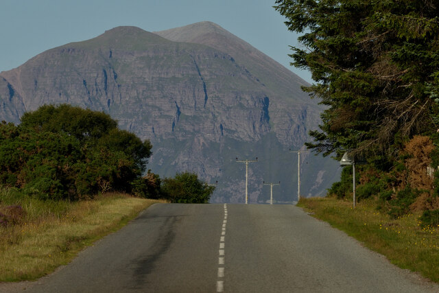
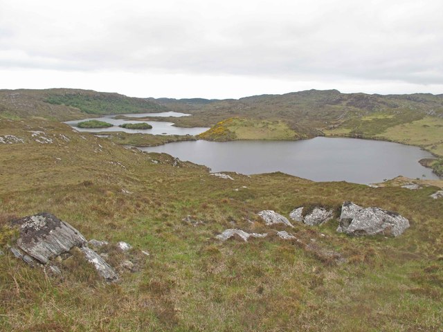
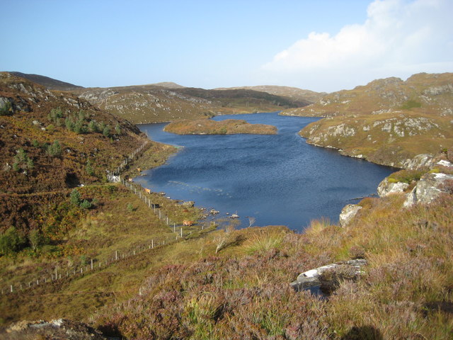
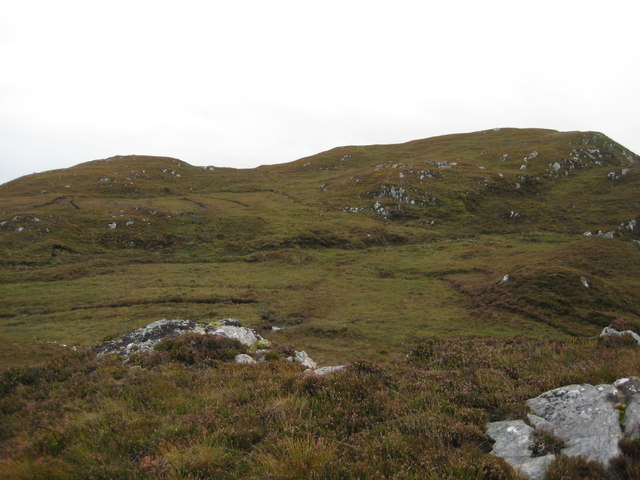
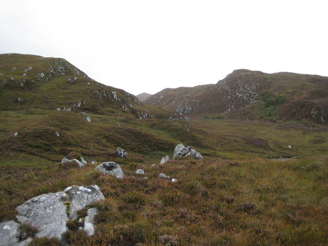
Bad na Conaire is a remote and rugged area located in Sutherland, Scotland. Situated in the northern part of the country, it is known for its stunning downs and moorlands. The name "Bad na Conaire" translates to "Ford of the Hounds" in English, which alludes to the area's historical connection with hunting.

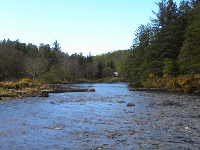
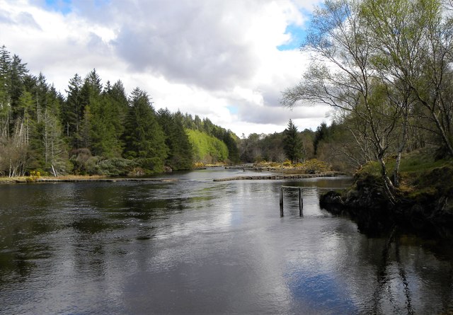
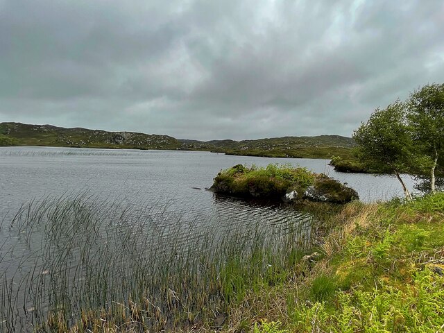
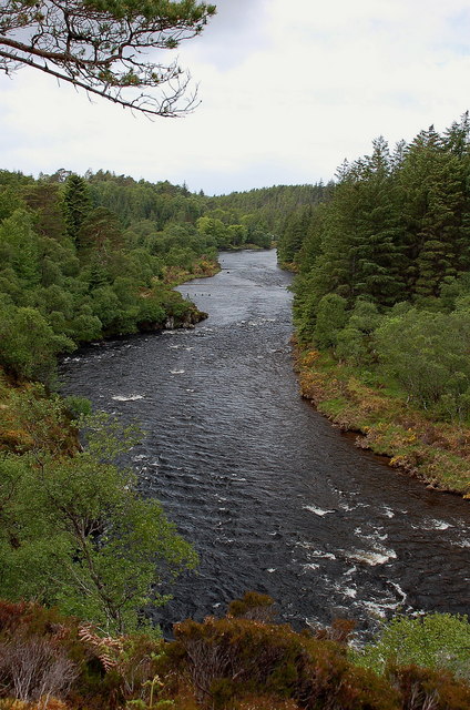
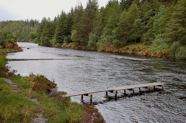
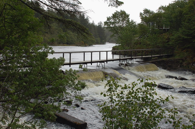
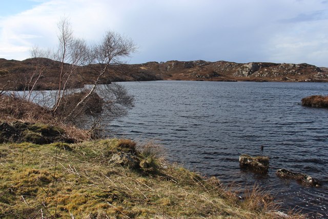
Covering a vast expanse of land, Bad na Conaire is characterized by its wild and untamed beauty. The downs, which are large elevated areas of grassland, provide breathtaking panoramic views of the surrounding landscape. These downs are interspersed with stretches of moorland, which are open areas of heath or peatland, covered in scrub and heather.

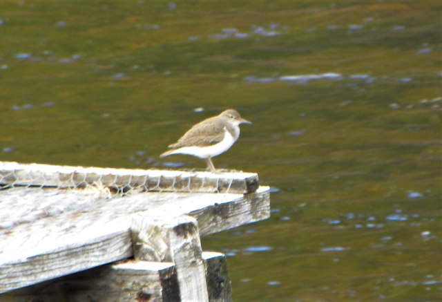
The flora and fauna found in Bad na Conaire are diverse and unique. Various species of wildflowers can be seen, including bog cotton, heather, and orchids. The area is also home to a variety of wildlife, such as red deer, mountain hares, and golden eagles. Birdwatchers flock to this region to catch a glimpse of rare bird species, including the black grouse and red-throated diver.

Due to its remote location, Bad na Conaire offers a sense of tranquility and solitude, making it a popular destination for outdoor enthusiasts and nature lovers. Hiking and trekking are popular activities, allowing visitors to explore the vast expanses of downs and moorlands. However, it is important for visitors to come prepared, as the terrain can be challenging and weather conditions can change rapidly.

In conclusion, Bad na Conaire in Sutherland, Scotland, is a captivating and untamed area characterized by its downs and moorlands. Its remote location, diverse flora and fauna, and stunning vistas make it a must-visit destination for those seeking a true wilderness experience.

If you have any feedback on the listing, please let us know in the comments section below.

Bad na Conaire Images

Images are sourced within 2km of 58.175894/-5.2230046 or Grid Reference NC1025. Thanks to Geograph Open Source API. All images are credited.

Common Sandpiper by the river This little wader obligingly posed on one of the fishing piers on the River Inver.
Common Sandpiper by the river
This little wader obligingly posed on one of the fishing piers on the River Inver.
Fishing piers on the Inver There are a number of timber and stone piers built out into the River Inver for the convenience of salmon fishermen.
Fishing piers on the Inver
There are a number of timber and stone piers built out into the River Inver for the convenience of salmon fishermen.
Upstream along the Inver This section of the river is relatively wide, shallow and slow running. There are both timber and stone piers to be seen either side of the river.
Upstream along the Inver
This section of the river is relatively wide, shallow and slow running. There are both timber and stone piers to be seen either side of the river.
Loch nan Eun A small loch beside the A837
Loch nan Eun
A small loch beside the A837
A Highland Road on the NC500, the A837 near Lochinver, Sutherland View looking east along the A837 as it leaves Lochinver towards Ullapool and the South.  Part of the NC500 tourist route, the A837 is an important route for transporting fish landed at Lochinver to Britain and the European continent.  The mountain in the background is Quinag, one of the impressive rocky peaks of the Assynt region in north western Scotland.
A Highland Road on the NC500, the A837 near Lochinver, Sutherland
View looking east along the A837 as it leaves Lochinver towards Ullapool and the South. Part of the NC500 tourist route, the A837 is an important route for transporting fish landed at Lochinver to Britain and the European continent. The mountain in the background is Quinag, one of the impressive rocky peaks of the Assynt region in north western Scotland.
Looking westwards along the River Inver A view of the river downstream before it descends to the sea at Loch Inver.
Looking westwards along the River Inver
A view of the river downstream before it descends to the sea at Loch Inver.
Fishing jetty and weirs, River Inver There are several weirs along this level stretch of the river, with fishing places.
Fishing jetty and weirs, River Inver
There are several weirs along this level stretch of the river, with fishing places.
Footbridge and weir, River Inver Plenty of water here after wet weather in the NW Highlands. An elegant fishing hut is just visible through the trees on the other bank.
Footbridge and weir, River Inver
Plenty of water here after wet weather in the NW Highlands. An elegant fishing hut is just visible through the trees on the other bank.
An Ruadh Loch Looking west across An Ruadh Loch during a brief spell of good weather.
An Ruadh Loch
Looking west across An Ruadh Loch during a brief spell of good weather.
Towards Lochan Cuilce Looking east-north-east towards Lochan Cuilce and Loch Bad nan Aighean. Moorland covered in heather with many bedrock outcrops.
Towards Lochan Cuilce
Looking east-north-east towards Lochan Cuilce and Loch Bad nan Aighean. Moorland covered in heather with many bedrock outcrops.
Loch an Tuir Loch an Tuir with Loch an Tuirc lying beyond it.
Loch an Tuir
Loch an Tuir with Loch an Tuirc lying beyond it.
Droighneach Ruins The remains of the former settlement of Droighneach.
Droighneach Ruins
The remains of the former settlement of Droighneach.
Cattle grid on the A837 near Cnoc an Tolla Bhaid
Road leading to Brackloch
Loch nan Eun
Loch nan Eun
Southern end of Loch Crocach One of the larger lochs in this landscape of Lewissian gneiss and water
Southern end of Loch Crocach
One of the larger lochs in this landscape of Lewissian gneiss and water
Un-named spot heights 160/129m The highest point in this grid square of Lewissian gneiss landscape
Un-named spot heights 160/129m
The highest point in this grid square of Lewissian gneiss landscape
Cnoc Glas na h-Imrich Spot height of 175m above the N side of the Glac na h-Imrich down to the B869 road at Rhicarn. Area is now a recent mixed plantation.
Cnoc Glas na h-Imrich
Spot height of 175m above the N side of the Glac na h-Imrich down to the B869 road at Rhicarn. Area is now a recent mixed plantation.
Show me another place!

Bad na Conaire is located at Grid Ref: NC1025 (Lat: 58.175894, Lng: -5.2230046)

Unitary Authority: Highland

Police Authority: Highlands and Islands

What 3 Words

///trifling.piper.quail. Near Clachtoll, Highland

Related Wikis

Loch an Tuirc

Loch an Tuirc is a large irregular shaped, shallow loch, located about two miles north-by-north-east of Lochinver in the Assynt district of Sutherland...

Loch Cròcach, Lochinver

Loch Cròcach is a large irregular shaped, shallow loch, located about three miles north of Lochinver in the Assynt district of Sutherland, Highland, Scotland...

Loch Culag

Loch Culag also known as Loch na Doire Daraich is a small freshwater shallow loch, located south of Lochinver in the Assynt district of Sutherland, Highland...

Loch Beannach, Assynt

Loch Beannach is a small v-shaped loch, located 2 miles to the west of Loch Assynt and 3 miles northeast of Lochinver within the Assynt area of Sutherland...

Strathan, Sutherland

Strathan is a remote scattered coastal village, located in Bàgh an t-strathain Bay, which lies on the south shore of the sea loch, Loch Inver, in the Assynt...

Achmelvich

Achmelvich (Gaelic: Achadh Mhealbhaich) is a settlement situated in the Highland region of Scotland. The name comes from the Gaelic "Achadh" - a plain...

Badnaban

Badnaban is a remote scattered coastal village, which lies on the south shore of the sea loch, Loch Inver, in the Assynt district of the west coast of...

Loch Inver

Loch Inver is a 3.62-kilometre-long (1+61⁄64-nautical-mile) sea loch in Assynt, Sutherland and is on the northwest coast of Scotland. The loch meets the...

Have you been to Bad na Conaire?

Leave your review of Bad na Conaire below (or comments, questions and feedback).