Cnoc an Fharaidh
Hill, Mountain in Argyllshire
Scotland
Cnoc an Fharaidh

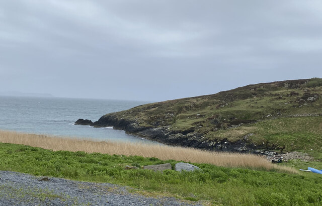
Cnoc an Fharaidh, also known as the Hill of the Sheepfold, is a prominent hill located in Argyllshire, Scotland. Situated in the western part of the county, it stands at an elevation of approximately 300 meters (984 feet) above sea level. The hill is part of the stunning Scottish landscape and offers breathtaking views of the surrounding countryside.
Cnoc an Fharaidh is characterized by its gentle slopes and rocky outcrops, making it a popular destination for hikers and nature enthusiasts. The hill is covered in a variety of vegetation, including heather, grasses, and scattered trees, adding to its natural beauty. Its diverse flora and fauna contribute to the overall appeal of the area.
At the summit of Cnoc an Fharaidh, visitors are rewarded with panoramic views of the Argyllshire region, including the nearby Loch Fyne and the surrounding mountains. On a clear day, one can even catch a glimpse of the Isle of Arran in the distance.
The hill is easily accessible, with well-marked trails leading to the top. It is a moderate hike, suitable for individuals of varying fitness levels. Along the way, hikers may encounter sheep grazing peacefully, adding a touch of rural charm to the experience.
Cnoc an Fharaidh is not only a popular spot for outdoor activities but also provides a peaceful retreat for those seeking solace in nature. With its stunning vistas and serene atmosphere, it undoubtedly captures the essence of the Scottish highlands.
If you have any feedback on the listing, please let us know in the comments section below.
Cnoc an Fharaidh Images
Images are sourced within 2km of 55.67577/-6.494933 or Grid Reference NR1751. Thanks to Geograph Open Source API. All images are credited.


Cnoc an Fharaidh is located at Grid Ref: NR1751 (Lat: 55.67577, Lng: -6.494933)
Unitary Authority: Argyll and Bute
Police Authority: Argyll and West Dunbartonshire
What 3 Words
///resettle.misted.stands. Near Portnahaven, Argyll & Bute
Related Wikis

Portnahaven
Portnahaven (Scottish Gaelic: Port na h-Abhainne, meaning river port) is a village on Islay in the Inner Hebrides, Scotland. The village is within the...

Orsay, Inner Hebrides
Orsay (Scottish Gaelic: Orasaigh) is a small island in the Inner Hebrides of Scotland. It lies a short distance off the west coast of the island of Islay...

Eilean Mhic Coinnich
Eilean Mhic Coinnich, also known as Mackenzie Island (although recorded on the Land Register as McKenseys Island), is an uninhabited island of 17.3 hectares...

Islay LIMPET
Islay LIMPET was the world's first commercial wave power device and was connected to the United Kingdom's National Grid. == History == Islay LIMPET (Land...
Nearby Amenities
Located within 500m of 55.67577,-6.494933Have you been to Cnoc an Fharaidh?
Leave your review of Cnoc an Fharaidh below (or comments, questions and feedback).