Liuthaid

Hill, Mountain in Ross-shire

Scotland

Liuthaid

The Langabhat Track with Loch Seaforth beyond
The Langabhat Track with Loch Seaforth beyond Credit: Mike Dunn

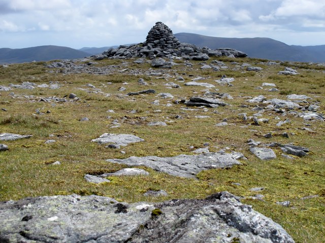
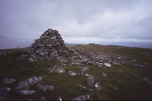
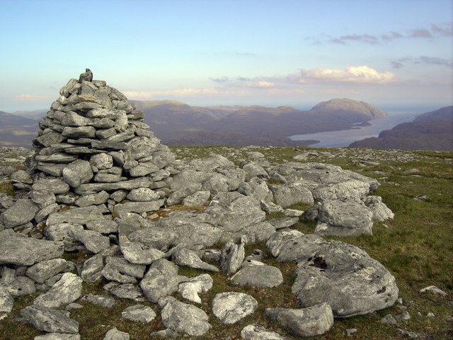
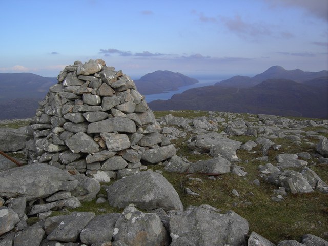
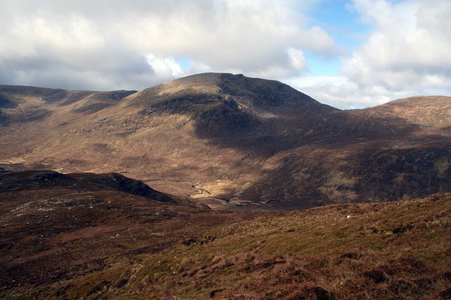
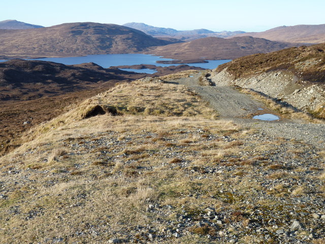
Liuthaid is a prominent hill situated in Ross-shire, a county located in the Highland region of Scotland. Standing at an elevation of approximately 573 meters (1,879 feet), it offers breathtaking panoramic views of the surrounding landscape.

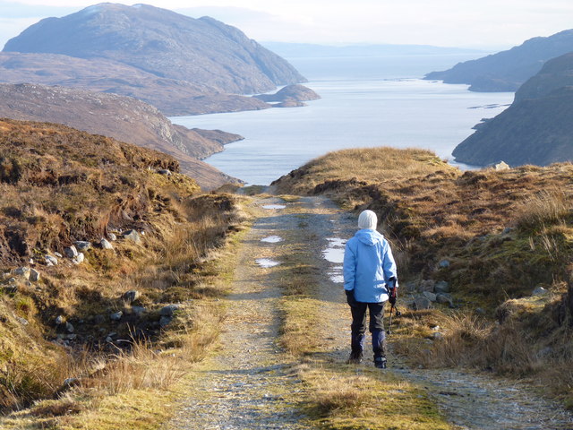
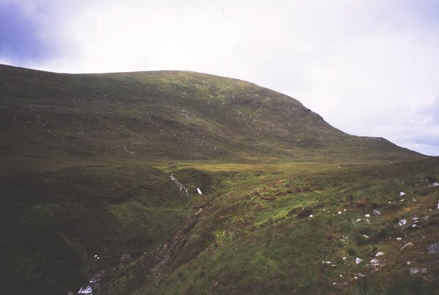
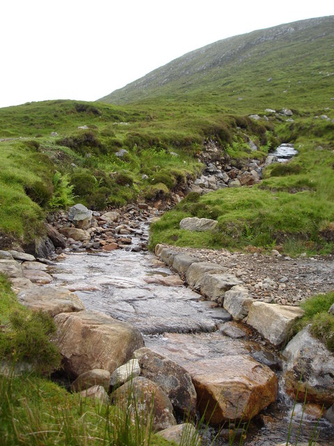
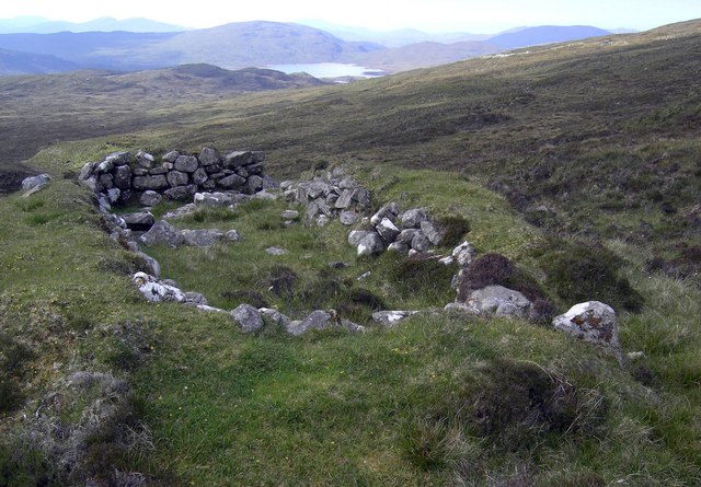
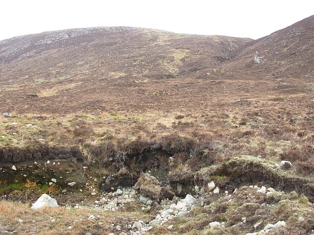
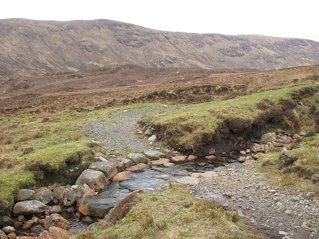
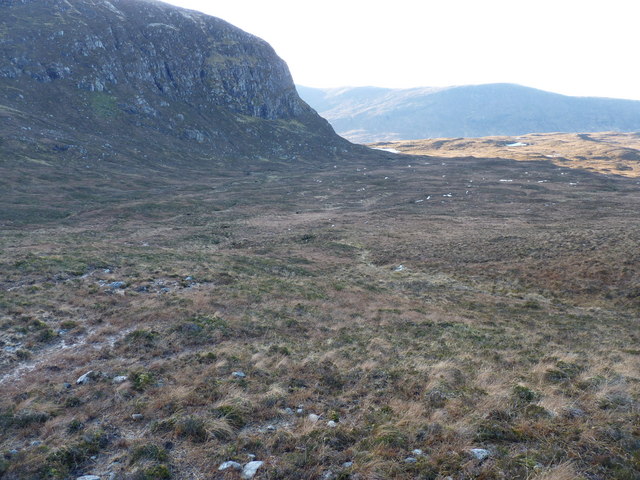
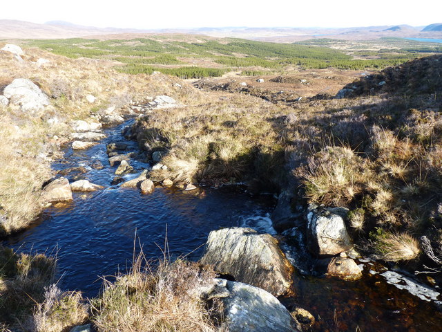
Liuthaid is known for its rugged terrain and steep slopes, making it a popular destination for hiking enthusiasts and outdoor adventurers. The hill is covered in lush vegetation, including heather and moss, creating a picturesque and serene atmosphere.

The ascent to the summit of Liuthaid can be challenging, but the reward is well worth the effort. From the top, visitors can marvel at the stunning vistas of the surrounding countryside, with rolling hills, deep valleys, and sparkling lochs stretching out as far as the eye can see. On a clear day, it is even possible to catch a glimpse of the nearby mountain ranges, such as the Ben Wyvis and the Monadhliath Mountains.

The hill is also home to a variety of wildlife, including red deer, mountain hares, and various bird species. Nature enthusiasts can enjoy observing these animals in their natural habitat while taking in the breathtaking beauty of the Scottish Highlands.

Overall, Liuthaid in Ross-shire is a magnificent hill that offers a challenging yet rewarding experience for outdoor enthusiasts, providing stunning views, diverse flora and fauna, and a true taste of the Scottish wilderness.

If you have any feedback on the listing, please let us know in the comments section below.

Liuthaid Images

Images are sourced within 2km of 58.021765/-6.7857196 or Grid Reference NB1713. Thanks to Geograph Open Source API. All images are credited.

The Langabhat Track with Loch Seaforth beyond
Liuthaid Summit, Lewis From road via good track then up steep east slope, heavy shower with hail. In group with Jonathan de Ferranti, Jim Bloomer & Mat Webster. Then onto Cearnabhal.

Name: Liuthaid
Hill number: 1564
Height: 492m / 1614ft
Area: 24B: Harris and Nearby Islands
Class: Ma,4
Grid ref: NB 17537 13627
Summit feature: cairn
Drop: 307m
Col: 185m  NB156115
Liuthaid Summit, Lewis
From road via good track then up steep east slope, heavy shower with hail. In group with Jonathan de Ferranti, Jim Bloomer & Mat Webster. Then onto Cearnabhal. Name: Liuthaid Hill number: 1564 Height: 492m / 1614ft Area: 24B: Harris and Nearby Islands Class: Ma,4 Grid ref: NB 17537 13627 Summit feature: cairn Drop: 307m Col: 185m NB156115
Beinn a' Mhuil After Kearnaval with Jim Bloomer and Jonathan de Ferranti. This is a fantastic view point with Seaford Island to the south east.


Name: Beinn a' Mhuil
Hill number: 4937
Height: 370m / 1214ft
Area: 24A: Lewis and Nearby Islands
Class: Hu
Grid ref: NB 19474 13653
Summit feature: cairn
Drop: 117m
Col: 253m  NB187140
Beinn a' Mhuil
After Kearnaval with Jim Bloomer and Jonathan de Ferranti. This is a fantastic view point with Seaford Island to the south east. Name: Beinn a' Mhuil Hill number: 4937 Height: 370m / 1214ft Area: 24A: Lewis and Nearby Islands Class: Hu Grid ref: NB 19474 13653 Summit feature: cairn Drop: 117m Col: 253m NB187140
Liuthaid The Abhainn a'Mhuil starts its gorge below the 492m high hill of Liuthaid.
Liuthaid
The Abhainn a'Mhuil starts its gorge below the 492m high hill of Liuthaid.
New ford Ford where the newly upgraded track crosses the Allt Gill Lusge
New ford
Ford where the newly upgraded track crosses the Allt Gill Lusge
Liuthaid The summit (492m). A flat area, although the surrounding slopes are steep and very slippery.
Liuthaid
The summit (492m). A flat area, although the surrounding slopes are steep and very slippery.
The Sheiling A shieling close to the Loch Langavat path.
The Sheiling
A shieling close to the Loch Langavat path.
Liuthaid summit The cairn of Liuthaid looking towards Loch Seaforth.
Liuthaid summit
The cairn of Liuthaid looking towards Loch Seaforth.
Mullach Vigadale cairn The large well built cairn on the summit of Mullach Vigadale.
Mullach Vigadale cairn
The large well built cairn on the summit of Mullach Vigadale.
Lower slopes of Mullach Bhiogadail Beinn Mhor, Caiteseal and Todun on the skyline and Seaforth Island in the middle centre
Lower slopes of Mullach Bhiogadail
Beinn Mhor, Caiteseal and Todun on the skyline and Seaforth Island in the middle centre
Cleit Earscleit Cleit Earscleit in the foreground with Creag na Lubaig on the edge of Loch Lanagavat in the middle distance and the summit of Stuabhal behind
Cleit Earscleit
Cleit Earscleit in the foreground with Creag na Lubaig on the edge of Loch Lanagavat in the middle distance and the summit of Stuabhal behind
Stuabhal from the slopes of Mullach a Ruisg Stuabhal from the south western slopes of Mullach a Ruisg looking across Abhainn Langadail
Stuabhal from the slopes of Mullach a Ruisg
Stuabhal from the south western slopes of Mullach a Ruisg looking across Abhainn Langadail
Allt Gill Lùsga Looking up from the Langadail path towards a burn running off Mullach Bhìogadail.
Allt Gill Lùsga
Looking up from the Langadail path towards a burn running off Mullach Bhìogadail.
Allt Gill Lùsga Well constructed ford on the path to Langadail.
Allt Gill Lùsga
Well constructed ford on the path to Langadail.
Moorland below Creag na Clibhe
The track to Loch Langabhat
Abhainn Cuil Beinn a' Mhuil
Show me another place!

Liuthaid is located at Grid Ref: NB1713 (Lat: 58.021765, Lng: -6.7857196)

Unitary Authority: Na h-Eileanan an Iar

Police Authority: Highlands and Islands

What 3 Words

///cycled.mouse.arranges. Near Tarbert, Na h-Eileanan Siar

Nearby Locations

Liuthaid

Related Wikis

Ardvourlie Castle

Ardvourlie Castle is a 19th-century country house on Harris, one of the Western Isles off the north-west coast of Scotland. The house was built beside...

Seaforth Island

Seaforth Island (Scottish Gaelic: Eilean Shìphoirt/Shìophoirt or Mulag) is an uninhabited island in the Outer Hebrides of Scotland. Unlike many other...

Uisgneabhal Mor

Uisgnabhal Mor (729 m) is a mountain in Harris, in the Outer Hebrides of Scotland. A complex mountain of several ridges and summits, it lies in the centre...

Airidh a' Bhruaich

Airidh a' Bhruaich (Arivruaich - anglicised) is a scattered crofting township in the South Lochs district of the Isle of Lewis in the Outer Hebrides of...

Nearby Amenities

Located within 500m of 58.021765,-6.7857196
Liuthaid
Corbett: no
Ele: 492
Graham: no
Marilyn: yes
Munro: no
Natural: peak
Prominence: 307
Source: OS7
Lat/Long: 58.0217054/-6.7850644
The data included in this document is from www.openstreetmap.org. The data is made available under ODbL.

Have you been to Liuthaid?

Leave your review of Liuthaid below (or comments, questions and feedback).