Balintore

Settlement in Ross-shire

Scotland

Balintore

Delusions of grandeur? Hardly a harbour; more a jetty or breakwater. The sign reads, in full, 'Welcome to Hilton Harbour. Restored in 2004 by the Hilton Parliament', as can be seen <a href="https://www.geograph.org.uk/photo/353687">NH8776 : The Hilton Parliament?</a>.
Delusions of grandeur? Credit: Bob Jones

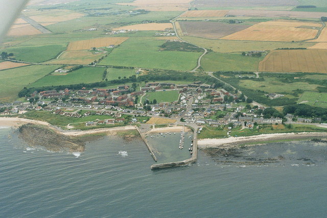
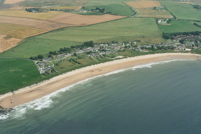
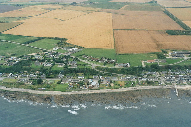
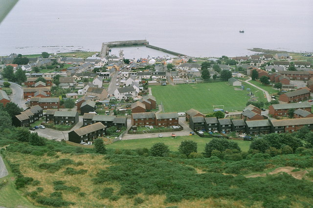
Balintore is a small coastal village located in the Ross-shire region of the Scottish Highlands. Situated on the east coast of Scotland, it lies on the shores of the Moray Firth, about 36 miles north of Inverness. The village is part of the larger Easter Ross area and falls within the Highland council area.

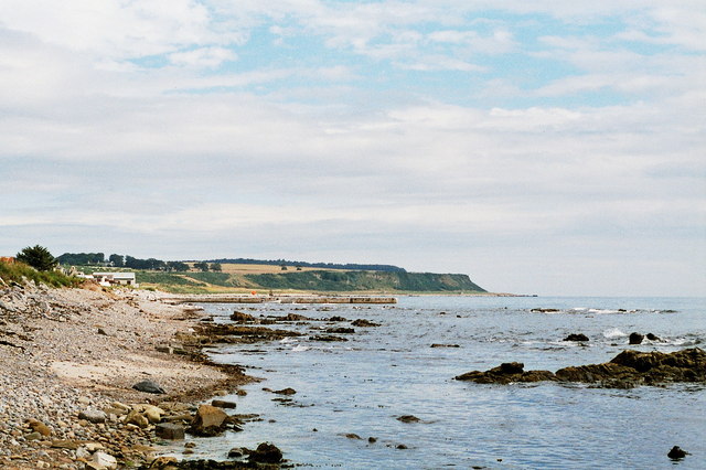
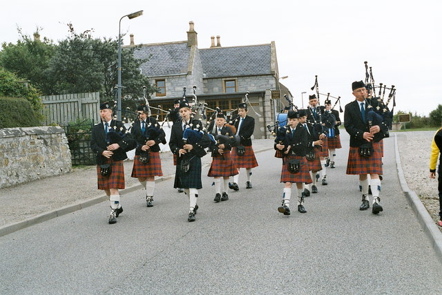
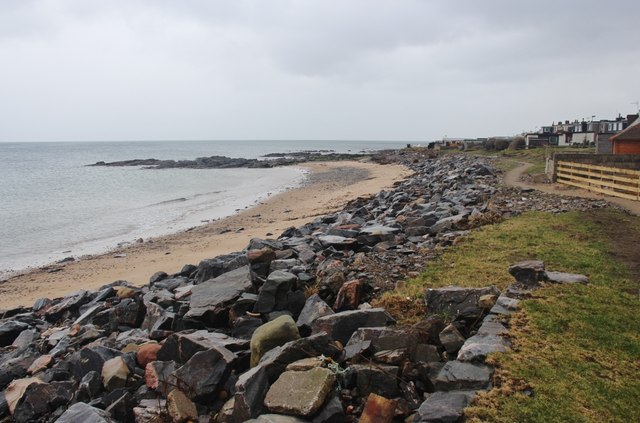
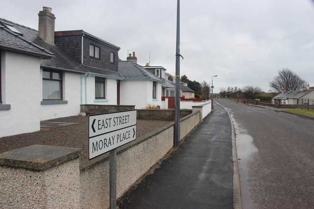
With a population of around 800 residents, Balintore is a close-knit community that enjoys a peaceful and picturesque setting. The village is characterized by its traditional Scottish charm, with many of the houses and buildings constructed from local stone. The stunning coastline and sandy beach add to the area's natural beauty, attracting visitors and locals alike.

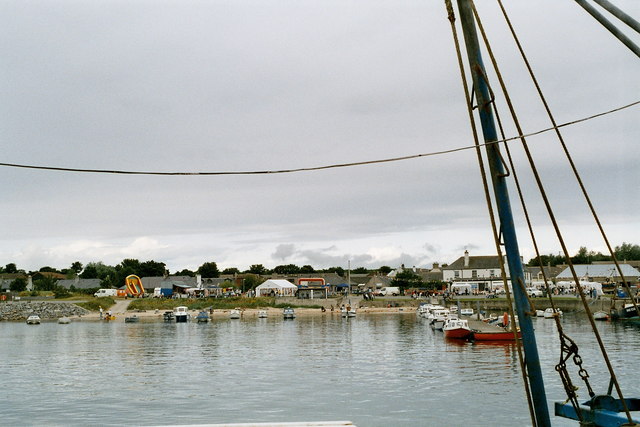
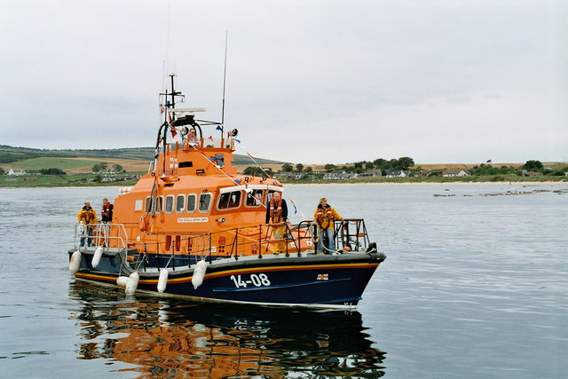
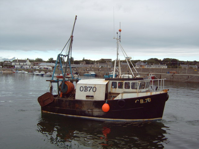
Balintore has a rich history, dating back to the 18th century when it was primarily a fishing village. Fishing remains an important part of the local economy, with the harbor still used by a small fleet of fishing boats. The village also has a small number of shops and amenities, including a post office, a primary school, and a community hall.

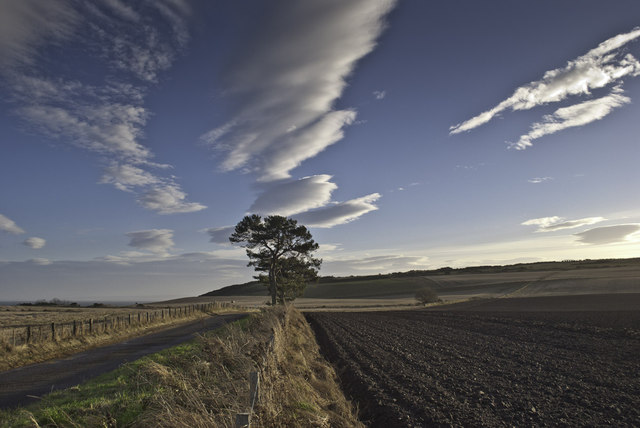
The surrounding area offers numerous opportunities for outdoor activities, such as coastal walks, birdwatching, and fishing. The nearby Tarbat Ness Lighthouse, built in 1830, is a popular landmark and provides stunning views of the coastline.

Overall, Balintore is a tranquil and picturesque village, offering a close community spirit, beautiful coastal scenery, and a glimpse into the traditional Scottish way of life.

If you have any feedback on the listing, please let us know in the comments section below.
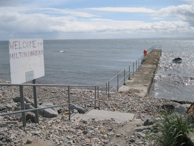
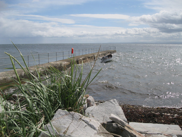
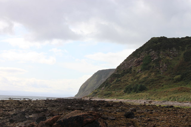
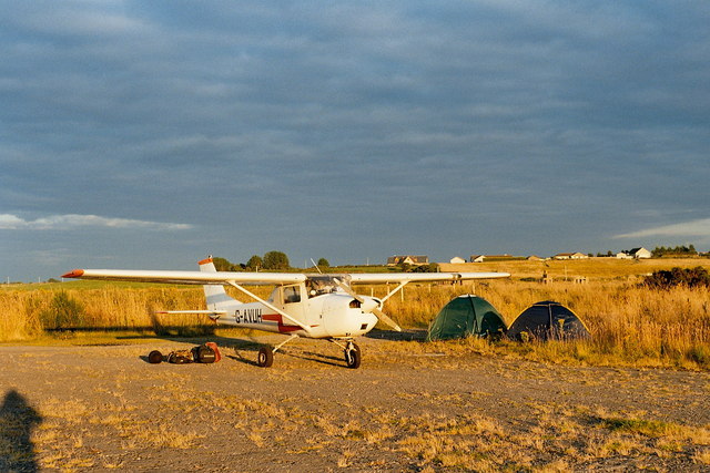
Balintore Images

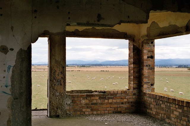
Images are sourced within 2km of 57.756773/-3.909256 or Grid Reference NH8675. Thanks to Geograph Open Source API. All images are credited.

Delusions of grandeur? Hardly a harbour; more a jetty or breakwater. The sign reads, in full, 'Welcome to Hilton Harbour. Restored in 2004 by the Hilton Parliament', as can be seen <a href="https://www.geograph.org.uk/photo/353687">NH8776 : The Hilton Parliament?</a>.
Delusions of grandeur?
Hardly a harbour; more a jetty or breakwater. The sign reads, in full, 'Welcome to Hilton Harbour. Restored in 2004 by the Hilton Parliament', as can be seen NH8776 : The Hilton Parliament?.
Hilton Harbour A narrow jetty offers minimal protection for a single boat.
Hilton Harbour
A narrow jetty offers minimal protection for a single boat.
The Cliffs at Old Shandwick The cliffs at Old Shandwick taken from the beach in Shandwick Bay
The Cliffs at Old Shandwick
The cliffs at Old Shandwick taken from the beach in Shandwick Bay
Fearn airfield (disused) 2007 Looking towards Shandwick.
This aircraft landed on one of the old runways, the new grass strip to the south had only just been seeded.
Fearn airfield, also referred to as Balintore airfield, was a World War II airfield built to the west of Balintore on the shores of the Moray Firth, and which lay to the south of RAF Tain. 
Fearn airfield was built as a satellite to RAF Tain, but was taken over by the Royal Navy in 1942, when it came to be known as HMS Owl. 
<span class="nowrap"><a title="http://www.secretscotland.org.uk/index.php/Secrets/FearnAirfield" rel="nofollow ugc noopener" href="http://www.secretscotland.org.uk/index.php/Secrets/FearnAirfield">Link</a><img style="margin-left:2px;" alt="External link" title="External link - shift click to open in new window" src="https://s1.geograph.org.uk/img/external.png" width="10" height="10"/></span>
Fearn airfield (disused) 2007
Looking towards Shandwick. This aircraft landed on one of the old runways, the new grass strip to the south had only just been seeded. Fearn airfield, also referred to as Balintore airfield, was a World War II airfield built to the west of Balintore on the shores of the Moray Firth, and which lay to the south of RAF Tain. Fearn airfield was built as a satellite to RAF Tain, but was taken over by the Royal Navy in 1942, when it came to be known as HMS Owl. LinkExternal link
Balintore 2007, aerial Fearn (disused) airfield is top left.
Balintore 2007, aerial
Fearn (disused) airfield is top left.
Shandwick 2007, aerial
Hilton of Cadbol 2007, aerial
Fearn airfield (disused) 2007: control tower From behind, with nissen hut.
See: <span class="nowrap"><a title="http://canmore.rcahms.gov.uk/en/site/114471/details/fearn+airfield/;" rel="nofollow ugc noopener" href="http://canmore.rcahms.gov.uk/en/site/114471/details/fearn+airfield/;">Link</a><img style="margin-left:2px;" alt="External link" title="External link - shift click to open in new window" src="https://s1.geograph.org.uk/img/external.png" width="10" height="10"/></span> <span class="nowrap"><a title="http://www.controltowers.co.uk/F/Fearn.htm" rel="nofollow ugc noopener" href="http://www.controltowers.co.uk/F/Fearn.htm">Link</a><img style="margin-left:2px;" alt="External link" title="External link - shift click to open in new window" src="https://s1.geograph.org.uk/img/external.png" width="10" height="10"/></span>.
In May 2003 it was offered for sale with planning permission for conversion to a house, but by 2007 there had been no development. See: <span class="nowrap"><a title="http://www.controltowers.co.uk/F/Fearn_for_sale.htm" rel="nofollow ugc noopener" href="http://www.controltowers.co.uk/F/Fearn_for_sale.htm">Link</a><img style="margin-left:2px;" alt="External link" title="External link - shift click to open in new window" src="https://s1.geograph.org.uk/img/external.png" width="10" height="10"/></span>
Fearn airfield (disused) 2007: control tower
From behind, with nissen hut. See: LinkExternal link LinkExternal link. In May 2003 it was offered for sale with planning permission for conversion to a house, but by 2007 there had been no development. See: LinkExternal link
Fearn airfield (disused) 2007: control tower With picture windows and panoramic views, in a pastoral setting: this old WW2 control tower was offered for sale in May 2003, with planning permission for conversion to a house, but by 2007 there had been no development. 
For history see: <span class="nowrap"><a title="http://www.controltowers.co.uk/F/Fearn_for_sale.htmSee:" rel="nofollow ugc noopener" href="http://www.controltowers.co.uk/F/Fearn_for_sale.htmSee:">Link</a><img style="margin-left:2px;" alt="External link" title="External link - shift click to open in new window" src="https://s1.geograph.org.uk/img/external.png" width="10" height="10"/></span> <span class="nowrap"><a title="http://canmore.rcahms.gov.uk/en/site/114471/details/fearn+airfield/;" rel="nofollow ugc noopener" href="http://canmore.rcahms.gov.uk/en/site/114471/details/fearn+airfield/;">Link</a><img style="margin-left:2px;" alt="External link" title="External link - shift click to open in new window" src="https://s1.geograph.org.uk/img/external.png" width="10" height="10"/></span> <span class="nowrap"><a title="http://www.controltowers.co.uk/F/Fearn.htm" rel="nofollow ugc noopener" href="http://www.controltowers.co.uk/F/Fearn.htm">Link</a><img style="margin-left:2px;" alt="External link" title="External link - shift click to open in new window" src="https://s1.geograph.org.uk/img/external.png" width="10" height="10"/></span>.
Fearn airfield (disused) 2007: control tower
With picture windows and panoramic views, in a pastoral setting: this old WW2 control tower was offered for sale in May 2003, with planning permission for conversion to a house, but by 2007 there had been no development. For history see: LinkExternal link LinkExternal link LinkExternal link.
Cadboll Pier, 2007 Thanks to Bob Jones and his photo <a href="https://www.geograph.org.uk/photo/2567820">NH8776 : Delusions of grandeur?</a>:
"Hardly a harbour; more a jetty or breakwater. The sign reads, in full, 'Welcome to Hilton Harbour. Restored in 2004 by the Hilton Parliament', as can be seen <a href="https://www.geograph.org.uk/photo/353687">NH8776 : The Hilton Parliament?</a> : The Hilton Parliament?."
Cadboll Pier, 2007
Thanks to Bob Jones and his photo NH8776 : Delusions of grandeur?: "Hardly a harbour; more a jetty or breakwater. The sign reads, in full, 'Welcome to Hilton Harbour. Restored in 2004 by the Hilton Parliament', as can be seen NH8776 : The Hilton Parliament? : The Hilton Parliament?."
Balintore harbour 2007 Fun day at Balintore.
Balintore harbour 2007
Fun day at Balintore.
Balintore gala 2007: pipers
Balintore 2007: lifeboat arrives for the gala
Balintore and the Swedish Houses 2007, aerial The wooden (eco?) houses in the foreground were referred to as the Swedish houses.
Balintore and the Swedish Houses 2007, aerial
The wooden (eco?) houses in the foreground were referred to as the Swedish houses.
Balintore harbour 2007
Trees, clouds and ploughed field
The beach at Hilton of Cadboll
Moray Place, Balintore North end of the village
Moray Place, Balintore
North end of the village
Show me another place!

Balintore is located at Grid Ref: NH8675 (Lat: 57.756773, Lng: -3.909256)

Unitary Authority: Highland

Police Authority: Highlands and Islands

What 3 Words

///originals.insert.thinking. Near Balintore, Highland

Related Wikis

Seaboard Villages

The Seaboard Villages (Scottish Gaelic: Na Trì Port Mara) are three contiguous coastal villages, situated about 10 km southeast of the town of Tain in...

Balintore, Easter Ross

Balintore (from the Scottish Gaelic: Baile an Todhair meaning "The Bleaching Town") is a village near Tain in Easter Ross, Scotland. It is one of three...

Shandwick

Shandwick (Scottish Gaelic: Seannduaig), a village near Tain in Easter Ross, and is in the Scottish council area of Highland, Scotland. Hilton, Balintore...

Hilton of Cadboll

Hilton of Cadboll, or simply Hilton, (Scottish Gaelic: Baile a' Chnuic) is a village about 15 km (9 mi) southeast of Tain in Easter Ross, in the Scottish...

Nearby Amenities

Located within 500m of 57.756773,-3.909256
Bus Stop
Chip Shop
Naptan AtcoCode: 6700712409C
Naptan Bearing: SW
Naptan CommonName: Chip Shop
Naptan Indicator: opp
Naptan Landmark: Chip Shop
Naptan NaptanCode: 45323676
Naptan Street: Shore Street
Naptan Verified: no
Source: naptan_import
Lat/Long: 57.7551657/-3.9121811
Bus Stop
Chip Shop
Naptan AtcoCode: 6700712409D
Naptan Bearing: NE
Naptan CommonName: Chip Shop
Naptan Indicator: o/s
Naptan Landmark: Chip Shop
Naptan NaptanCode: 45323675
Naptan Street: Shore Street
Naptan Verified: no
Source: naptan_import
Lat/Long: 57.7553329/-3.9124085
Parking
Lat/Long: 57.7545295/-3.9121629
Seamark Light Character: Fl
Seamark Light Colour: green
Seamark Light Height: 5
Seamark Light Period: 5
Seamark Light Range: 5
Seamark Light Reference: A 3503
Seamark Light Sequence: 0.5+(4.5)
Seamark Type: light_minor
Source: US NGA Pub. 114. 2011-05-26.
Lat/Long: 57.7537641/-3.9091647
Balintore
Name Gd: Baile an Todhair
Place: village
Population: 1000
Wikidata: Q1886025
Wikipedia: en:Balintore, Easter Ross
Lat/Long: 57.7553925/-3.9130427
Post Office
Balintore Post Office
Addr Postcode: IV20 1UE
Branch: Balintore
Brand: Post Office
Brand Wikidata: Q1783168
Check Date: 2020-02-20
Ref Pol Id: 3537
Lat/Long: 57.7562147/-3.9104845
Spar
Addr Housenumber: 8
Addr Postcode: IV20 1UE
Addr Street: Main Street
Alt Name: SPAR Balintore
Brand: Spar
Brand Wikidata: Q610492
Brand Wikipedia: en:Spar (retailer)
Shop: convenience
Website: https://www.spar.co.uk/store-locator/lan15394-spar-balintore/
Lat/Long: 57.7561732/-3.9104496
Restaurant
Lat/Long: 57.7591422/-3.9035294
Toilets
Drinking Water: yes
Opening Hours: Apr-Oct 09:00-21:00
Lat/Long: 57.7552809/-3.9106824
Recycling
Recycling Type: container
Lat/Long: 57.7553156/-3.9108056
Drinking Water
Bottle: yes
Lat/Long: 57.7552531/-3.9106957
Barrier: yes
Lat/Long: 57.7554002/-3.910843
Man Made: mast
Tower Type: communication
Lat/Long: 57.7577863/-3.9149376
Power: pole
Lat/Long: 57.7607313/-3.906687
Power: pole
Lat/Long: 57.7605348/-3.9078396
Power: pole
Lat/Long: 57.7602847/-3.9092925
Power: pole
Lat/Long: 57.7598918/-3.9105222
Power: pole
Lat/Long: 57.7595465/-3.9116261
Power: pole
Lat/Long: 57.7592011/-3.9127544
Power: pole
Lat/Long: 57.7586436/-3.9132414
Power: pole
Lat/Long: 57.758059/-3.9136979
Power: pole
Lat/Long: 57.7574506/-3.9147836
Power: pole
Lat/Long: 57.7590377/-3.9154532
Power: pole
Lat/Long: 57.7586674/-3.9147795
Mermaid of the North
Artwork Type: sculpture
Tourism: artwork
Lat/Long: 57.7573815/-3.9058404
Access: yes
Barrier: bollard
Bicycle: yes
Bollard: fixed
Foot: yes
Material: concrete
Wheelchair: yes
Lat/Long: 57.756331/-3.9112809
The data included in this document is from www.openstreetmap.org. The data is made available under ODbL.

Have you been to Balintore?

Leave your review of Balintore below (or comments, questions and feedback).