Tom and Mary Port

Sea, Estuary, Creek in Ross-shire

Scotland

Tom and Mary Port

Greylag geese feeding near Cadboll
Greylag geese feeding near Cadboll Credit: sylvia duckworth

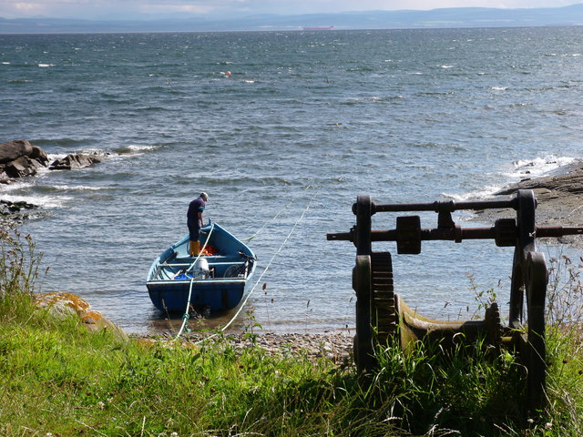
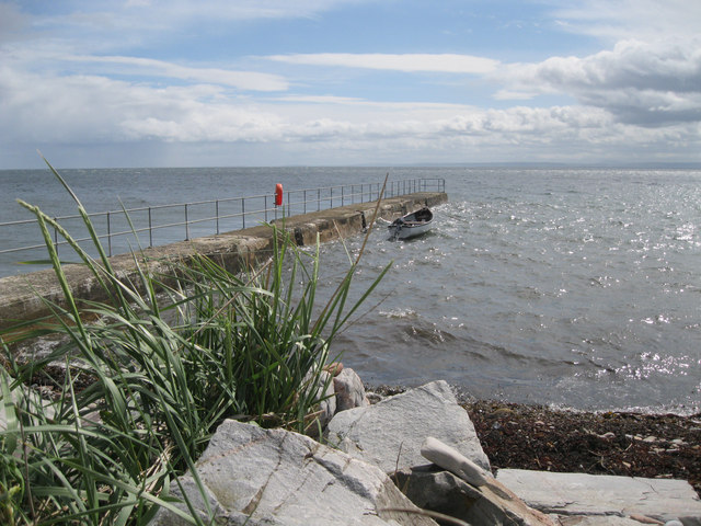
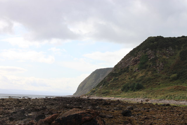
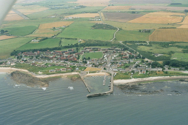
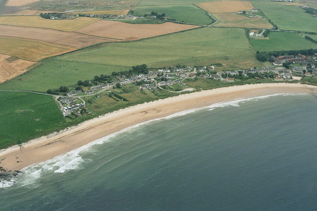
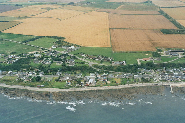
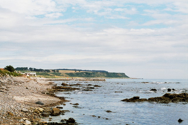
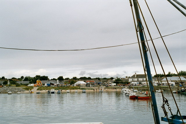
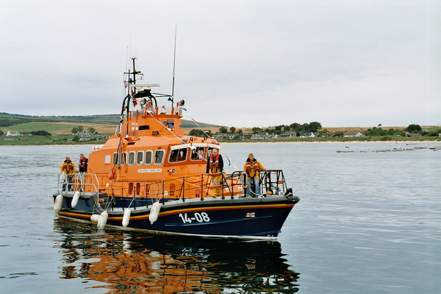
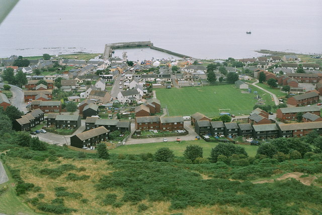
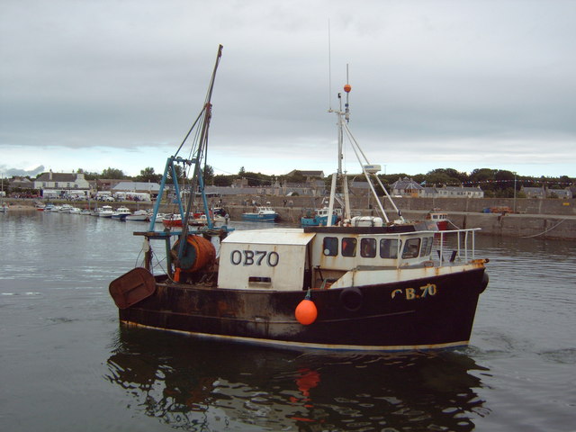
Tom and Mary Port is a picturesque coastal village located in Ross-shire, Scotland. Situated on the banks of a serene estuary, the village offers stunning views of the sea and surrounding countryside. The port serves as a hub for local fishermen and boat enthusiasts, with several small boats and fishing vessels dotting the waters.

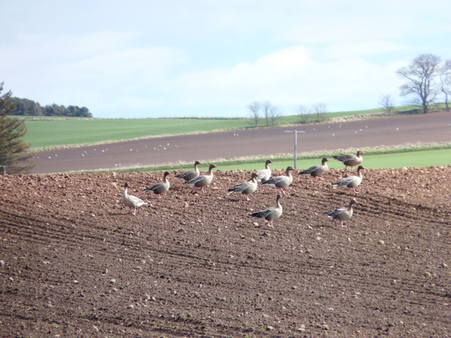
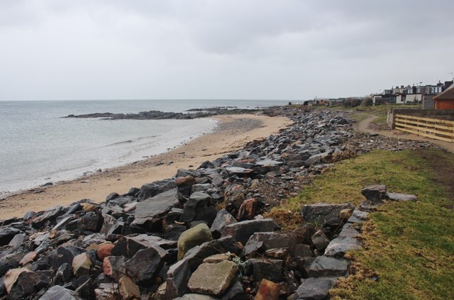
The estuary at Tom and Mary Port is a popular spot for birdwatching, with a variety of seabirds and waders frequenting the area. Visitors can often spot herons, oystercatchers, and even the occasional seal or otter.

In addition to the estuary, Tom and Mary Port is also home to a small creek that winds its way through the village. The creek provides a peaceful backdrop for leisurely walks and picnics, with charming stone bridges crossing its tranquil waters.

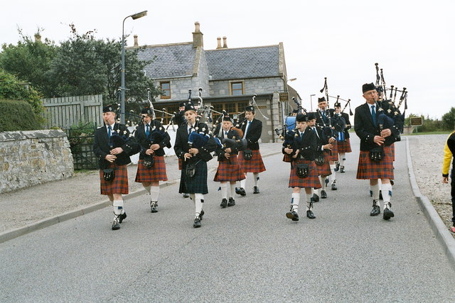
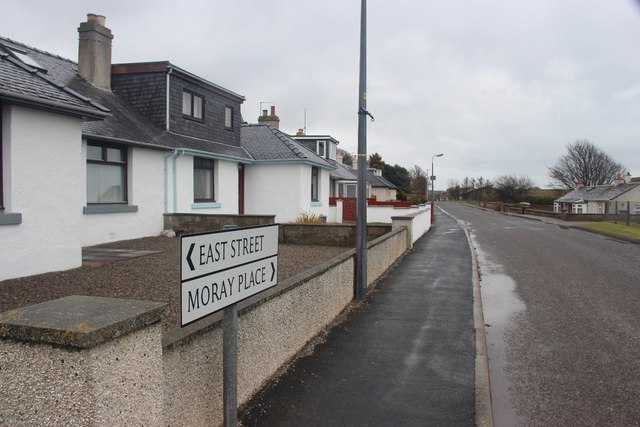
The village itself is a quaint and welcoming community, with a handful of shops, cafes, and pubs catering to both locals and visitors. Tom and Mary Port is a hidden gem in the Scottish Highlands, offering a peaceful retreat for those looking to escape the hustle and bustle of city life.

If you have any feedback on the listing, please let us know in the comments section below.

Tom and Mary Port Images

Images are sourced within 2km of 57.758392/-3.9010731 or Grid Reference NH8675. Thanks to Geograph Open Source API. All images are credited.

Greylag geese feeding near Cadboll
Fisherman at Cadboll Point
Dog and harvesters at Cadboll
Delusions of grandeur? Hardly a harbour; more a jetty or breakwater. The sign reads, in full, 'Welcome to Hilton Harbour. Restored in 2004 by the Hilton Parliament', as can be seen <a href="https://www.geograph.org.uk/photo/353687">NH8776 : The Hilton Parliament?</a>.
Delusions of grandeur?
Hardly a harbour; more a jetty or breakwater. The sign reads, in full, 'Welcome to Hilton Harbour. Restored in 2004 by the Hilton Parliament', as can be seen NH8776 : The Hilton Parliament?.
Hilton Harbour A narrow jetty offers minimal protection for a single boat.
Hilton Harbour
A narrow jetty offers minimal protection for a single boat.
The Cliffs at Old Shandwick The cliffs at Old Shandwick taken from the beach in Shandwick Bay
The Cliffs at Old Shandwick
The cliffs at Old Shandwick taken from the beach in Shandwick Bay
Balintore 2007, aerial Fearn (disused) airfield is top left.
Balintore 2007, aerial
Fearn (disused) airfield is top left.
Shandwick 2007, aerial
Hilton of Cadbol 2007, aerial
Cadboll Pier, 2007 Thanks to Bob Jones and his photo <a href="https://www.geograph.org.uk/photo/2567820">NH8776 : Delusions of grandeur?</a>:
"Hardly a harbour; more a jetty or breakwater. The sign reads, in full, 'Welcome to Hilton Harbour. Restored in 2004 by the Hilton Parliament', as can be seen <a href="https://www.geograph.org.uk/photo/353687">NH8776 : The Hilton Parliament?</a> : The Hilton Parliament?."
Cadboll Pier, 2007
Thanks to Bob Jones and his photo NH8776 : Delusions of grandeur?: "Hardly a harbour; more a jetty or breakwater. The sign reads, in full, 'Welcome to Hilton Harbour. Restored in 2004 by the Hilton Parliament', as can be seen NH8776 : The Hilton Parliament? : The Hilton Parliament?."
Balintore harbour 2007 Fun day at Balintore.
Balintore harbour 2007
Fun day at Balintore.
Balintore gala 2007: pipers
Balintore 2007: lifeboat arrives for the gala
Balintore and the Swedish Houses 2007, aerial The wooden (eco?) houses in the foreground were referred to as the Swedish houses.
Balintore and the Swedish Houses 2007, aerial
The wooden (eco?) houses in the foreground were referred to as the Swedish houses.
Balintore harbour 2007
The beach at Hilton of Cadboll
Moray Place, Balintore North end of the village
Moray Place, Balintore
North end of the village
East Street, Balintore
Show me another place!

Tom and Mary Port is located at Grid Ref: NH8675 (Lat: 57.758392, Lng: -3.9010731)

Unitary Authority: Highland

Police Authority: Highlands and Islands

What 3 Words

///overheat.spice.stubble. Near Balintore, Highland

Related Wikis

Seaboard Villages

The Seaboard Villages (Scottish Gaelic: Na Trì Port Mara) are three contiguous coastal villages, situated about 10 km southeast of the town of Tain in...

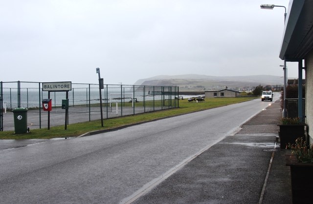
Balintore, Easter Ross

Balintore (from the Scottish Gaelic: Baile an Todhair meaning "The Bleaching Town") is a village near Tain in Easter Ross, Scotland. It is one of three...
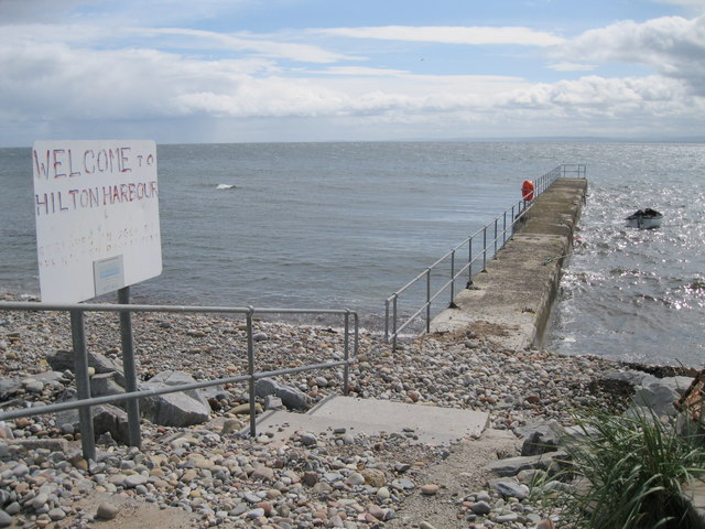
Hilton of Cadboll

Hilton of Cadboll, or simply Hilton, (Scottish Gaelic: Baile a' Chnuic) is a village about 15 km (9 mi) southeast of Tain in Easter Ross, in the Scottish...

Hilton of Cadboll Stone

The Hilton of Cadboll Stone is a Class II Pictish stone discovered at Hilton of Cadboll, on the East coast of the Tarbat Peninsula in Easter Ross, Scotland...

Nearby Amenities

Located within 500m of 57.758392,-3.9010731
Source: PGS
Lat/Long: 57.7622171/-3.8977278
Bus Stop
Bottom of Brae
Naptan AtcoCode: 6700713102A
Naptan Bearing: SW
Naptan CommonName: Bottom of Brae
Naptan Indicator: at Bus Shelter
Naptan Landmark: Harbour
Naptan NaptanCode: 45323674
Naptan Street: Lower Road
Naptan Verified: no
Source: naptan_import
Lat/Long: 57.7622691/-3.8980657
Bus Stop
Bottom of Brae
Naptan AtcoCode: 6700713102B
Naptan Bearing: NE
Naptan CommonName: Bottom of Brae
Naptan Indicator: opp Bus Shelter
Naptan Landmark: Harbour
Naptan NaptanCode: 45323673
Naptan Street: Lower Road
Naptan Verified: no
Source: naptan_import
Lat/Long: 57.7623176/-3.8984213
Bus Stop
School
Naptan AtcoCode: 6700713102C
Naptan Bearing: E
Naptan CommonName: School
Naptan Indicator: o/s
Naptan Landmark: Cowan Bank Place
Naptan NaptanCode: 45323672
Naptan Street: Top Road
Naptan Verified: no
Source: naptan_import
Lat/Long: 57.7614628/-3.9033018
Bus Stop
School
Naptan AtcoCode: 6700713102D
Naptan Bearing: W
Naptan CommonName: School
Naptan Indicator: opp
Naptan Landmark: Cowan Bank Place
Naptan NaptanCode: 45323586
Naptan Street: Top Road
Naptan Verified: no
Source: naptan_import
Lat/Long: 57.7612765/-3.9031408
Hilton of Cadboll
Alt Name: Hilton
Name Gd: Baile a' Chnuic
Place: village
Wikidata: Q2427020
Wikipedia: en:Hilton of Cadboll
Lat/Long: 57.762534/-3.8986842
Restaurant
Lat/Long: 57.7591422/-3.9035294
Power: pole
Lat/Long: 57.7607313/-3.906687
Power: pole
Lat/Long: 57.7609472/-3.9055324
Power: pole
Lat/Long: 57.7605348/-3.9078396
Mermaid of the North
Artwork Type: sculpture
Tourism: artwork
Lat/Long: 57.7573815/-3.9058404
The data included in this document is from www.openstreetmap.org. The data is made available under ODbL.

Have you been to Tom and Mary Port?

Leave your review of Tom and Mary Port below (or comments, questions and feedback).