Shandwick Bay

Bay in Ross-shire

Scotland

Shandwick Bay

Delusions of grandeur? Hardly a harbour; more a jetty or breakwater. The sign reads, in full, 'Welcome to Hilton Harbour. Restored in 2004 by the Hilton Parliament', as can be seen <a href="https://www.geograph.org.uk/photo/353687">NH8776 : The Hilton Parliament?</a>.
Delusions of grandeur? Credit: Bob Jones

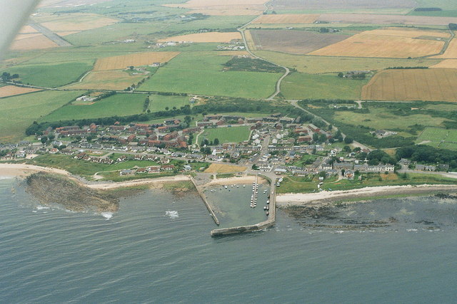
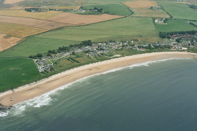
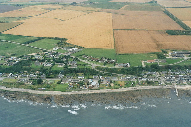
Shandwick Bay is a picturesque stretch of coastline located in Ross-shire, Scotland. Situated on the eastern shore of the Moray Firth, the bay is known for its stunning natural beauty and rich history.

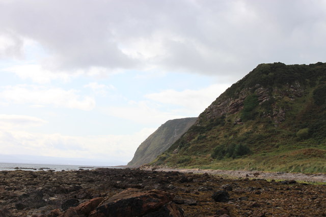
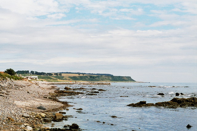
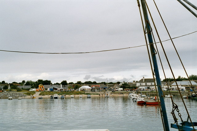
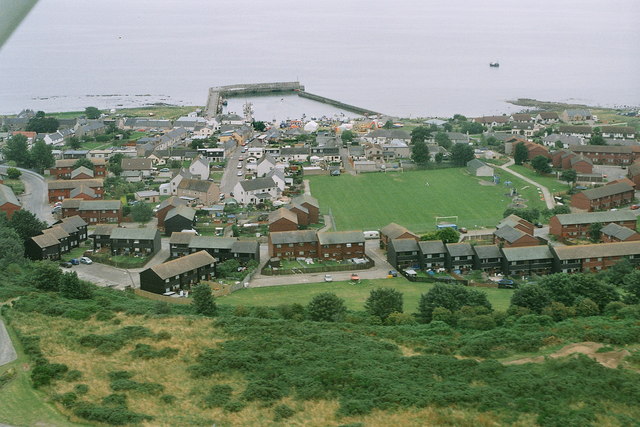
The bay itself is a sandy beach that stretches for approximately one mile, offering visitors a tranquil and secluded spot to enjoy the beauty of the Scottish coast. The golden sands are framed by rugged cliffs, creating a dramatic backdrop against the sparkling blue waters of the Moray Firth.

Shandwick Bay is also home to several interesting geological formations, including the famous "Ammonite Stone." This large rock, embedded with fossilized ammonites, is a popular attraction for fossil enthusiasts and nature lovers alike.

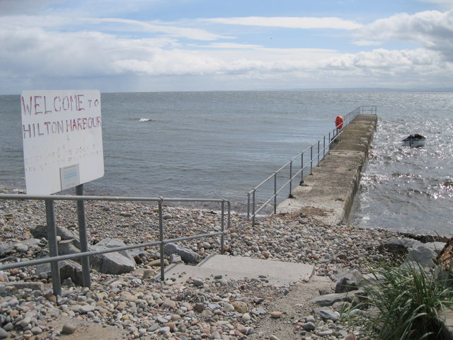
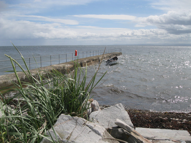
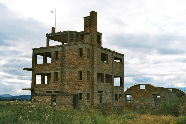
In addition to its natural beauty, Shandwick Bay has a fascinating history. The area was once a thriving fishing village and served as a bustling hub for trade and commerce. Remnants of this past can still be seen in the form of old fisherman's cottages and stone structures that dot the shoreline.

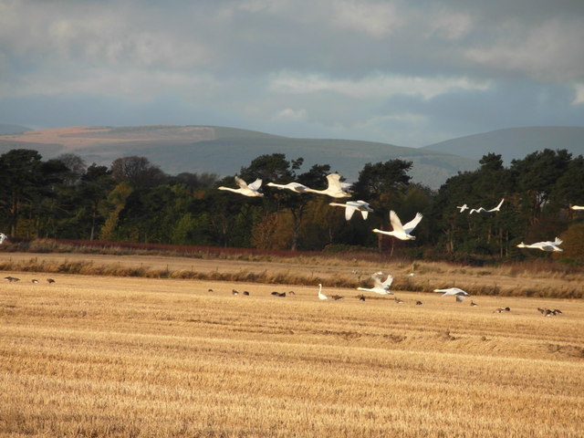
Today, Shandwick Bay offers visitors a peaceful escape from the hustle and bustle of everyday life. The beach is a popular spot for walking, picnicking, and wildlife spotting. It is not uncommon to see dolphins and seals frolicking in the waters, adding to the area's charm.

Overall, Shandwick Bay is a hidden gem along the Scottish coast, offering a perfect blend of natural beauty, history, and tranquility. Whether you are a nature lover, history enthusiast, or simply seeking a peaceful retreat, Shandwick Bay is a must-visit destination in Ross-shire.

If you have any feedback on the listing, please let us know in the comments section below.

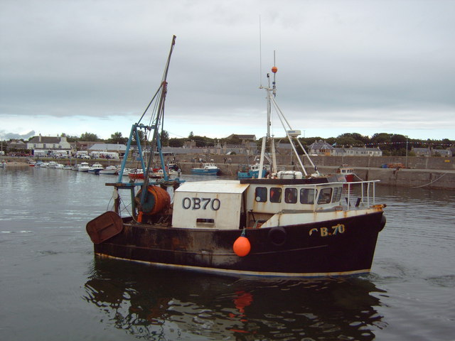
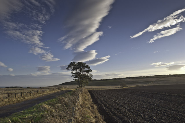
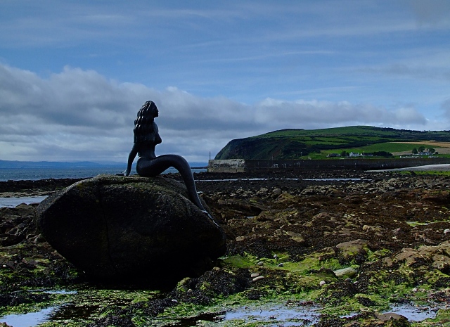
Shandwick Bay Images

Images are sourced within 2km of 57.751145/-3.914002 or Grid Reference NH8675. Thanks to Geograph Open Source API. All images are credited.

Delusions of grandeur? Hardly a harbour; more a jetty or breakwater. The sign reads, in full, 'Welcome to Hilton Harbour. Restored in 2004 by the Hilton Parliament', as can be seen <a href="https://www.geograph.org.uk/photo/353687">NH8776 : The Hilton Parliament?</a>.
Delusions of grandeur?
Hardly a harbour; more a jetty or breakwater. The sign reads, in full, 'Welcome to Hilton Harbour. Restored in 2004 by the Hilton Parliament', as can be seen NH8776 : The Hilton Parliament?.
Hilton Harbour A narrow jetty offers minimal protection for a single boat.
Hilton Harbour
A narrow jetty offers minimal protection for a single boat.
The Cliffs at Old Shandwick The cliffs at Old Shandwick taken from the beach in Shandwick Bay
The Cliffs at Old Shandwick
The cliffs at Old Shandwick taken from the beach in Shandwick Bay
Old airfield near Fearn The two areas of white dots in the stubble fields are just part of a very large flock of newly-arrived Whooper swans.
Old airfield near Fearn
The two areas of white dots in the stubble fields are just part of a very large flock of newly-arrived Whooper swans.
Whooper swans - and a few Greylag geese - on the old airfield at Fearn
Fearn airfield (disused) 2007 Looking towards Shandwick.
This aircraft landed on one of the old runways, the new grass strip to the south had only just been seeded.
Fearn airfield, also referred to as Balintore airfield, was a World War II airfield built to the west of Balintore on the shores of the Moray Firth, and which lay to the south of RAF Tain. 
Fearn airfield was built as a satellite to RAF Tain, but was taken over by the Royal Navy in 1942, when it came to be known as HMS Owl. 
<span class="nowrap"><a title="http://www.secretscotland.org.uk/index.php/Secrets/FearnAirfield" rel="nofollow ugc noopener" href="http://www.secretscotland.org.uk/index.php/Secrets/FearnAirfield">Link</a><img style="margin-left:2px;" alt="External link" title="External link - shift click to open in new window" src="https://s1.geograph.org.uk/img/external.png" width="10" height="10"/></span>
Fearn airfield (disused) 2007
Looking towards Shandwick. This aircraft landed on one of the old runways, the new grass strip to the south had only just been seeded. Fearn airfield, also referred to as Balintore airfield, was a World War II airfield built to the west of Balintore on the shores of the Moray Firth, and which lay to the south of RAF Tain. Fearn airfield was built as a satellite to RAF Tain, but was taken over by the Royal Navy in 1942, when it came to be known as HMS Owl. LinkExternal link
Balintore 2007, aerial Fearn (disused) airfield is top left.
Balintore 2007, aerial
Fearn (disused) airfield is top left.
Shandwick 2007, aerial
Hilton of Cadbol 2007, aerial
Fearn airfield (disused) 2007: control tower From behind, with nissen hut.
See: <span class="nowrap"><a title="http://canmore.rcahms.gov.uk/en/site/114471/details/fearn+airfield/;" rel="nofollow ugc noopener" href="http://canmore.rcahms.gov.uk/en/site/114471/details/fearn+airfield/;">Link</a><img style="margin-left:2px;" alt="External link" title="External link - shift click to open in new window" src="https://s1.geograph.org.uk/img/external.png" width="10" height="10"/></span> <span class="nowrap"><a title="http://www.controltowers.co.uk/F/Fearn.htm" rel="nofollow ugc noopener" href="http://www.controltowers.co.uk/F/Fearn.htm">Link</a><img style="margin-left:2px;" alt="External link" title="External link - shift click to open in new window" src="https://s1.geograph.org.uk/img/external.png" width="10" height="10"/></span>.
In May 2003 it was offered for sale with planning permission for conversion to a house, but by 2007 there had been no development. See: <span class="nowrap"><a title="http://www.controltowers.co.uk/F/Fearn_for_sale.htm" rel="nofollow ugc noopener" href="http://www.controltowers.co.uk/F/Fearn_for_sale.htm">Link</a><img style="margin-left:2px;" alt="External link" title="External link - shift click to open in new window" src="https://s1.geograph.org.uk/img/external.png" width="10" height="10"/></span>
Fearn airfield (disused) 2007: control tower
From behind, with nissen hut. See: LinkExternal link LinkExternal link. In May 2003 it was offered for sale with planning permission for conversion to a house, but by 2007 there had been no development. See: LinkExternal link
Fearn airfield (disused) 2007: control tower With picture windows and panoramic views, in a pastoral setting: this old WW2 control tower was offered for sale in May 2003, with planning permission for conversion to a house, but by 2007 there had been no development. 
For history see: <span class="nowrap"><a title="http://www.controltowers.co.uk/F/Fearn_for_sale.htmSee:" rel="nofollow ugc noopener" href="http://www.controltowers.co.uk/F/Fearn_for_sale.htmSee:">Link</a><img style="margin-left:2px;" alt="External link" title="External link - shift click to open in new window" src="https://s1.geograph.org.uk/img/external.png" width="10" height="10"/></span> <span class="nowrap"><a title="http://canmore.rcahms.gov.uk/en/site/114471/details/fearn+airfield/;" rel="nofollow ugc noopener" href="http://canmore.rcahms.gov.uk/en/site/114471/details/fearn+airfield/;">Link</a><img style="margin-left:2px;" alt="External link" title="External link - shift click to open in new window" src="https://s1.geograph.org.uk/img/external.png" width="10" height="10"/></span> <span class="nowrap"><a title="http://www.controltowers.co.uk/F/Fearn.htm" rel="nofollow ugc noopener" href="http://www.controltowers.co.uk/F/Fearn.htm">Link</a><img style="margin-left:2px;" alt="External link" title="External link - shift click to open in new window" src="https://s1.geograph.org.uk/img/external.png" width="10" height="10"/></span>.
Fearn airfield (disused) 2007: control tower
With picture windows and panoramic views, in a pastoral setting: this old WW2 control tower was offered for sale in May 2003, with planning permission for conversion to a house, but by 2007 there had been no development. For history see: LinkExternal link LinkExternal link LinkExternal link.
Cadboll Pier, 2007 Thanks to Bob Jones and his photo <a href="https://www.geograph.org.uk/photo/2567820">NH8776 : Delusions of grandeur?</a>:
"Hardly a harbour; more a jetty or breakwater. The sign reads, in full, 'Welcome to Hilton Harbour. Restored in 2004 by the Hilton Parliament', as can be seen <a href="https://www.geograph.org.uk/photo/353687">NH8776 : The Hilton Parliament?</a> : The Hilton Parliament?."
Cadboll Pier, 2007
Thanks to Bob Jones and his photo NH8776 : Delusions of grandeur?: "Hardly a harbour; more a jetty or breakwater. The sign reads, in full, 'Welcome to Hilton Harbour. Restored in 2004 by the Hilton Parliament', as can be seen NH8776 : The Hilton Parliament? : The Hilton Parliament?."
Balintore harbour 2007 Fun day at Balintore.
Balintore harbour 2007
Fun day at Balintore.
Balintore gala 2007: pipers
Balintore 2007: lifeboat arrives for the gala
Balintore and the Swedish Houses 2007, aerial The wooden (eco?) houses in the foreground were referred to as the Swedish houses.
Balintore and the Swedish Houses 2007, aerial
The wooden (eco?) houses in the foreground were referred to as the Swedish houses.
Balintore harbour 2007
Trees, clouds and ploughed field
Show me another place!

Shandwick Bay is located at Grid Ref: NH8675 (Lat: 57.751145, Lng: -3.914002)

Unitary Authority: Highland

Police Authority: Highlands and Islands

What 3 Words

///wonderfully.nightfall.quietest. Near Balintore, Highland

Related Wikis

Shandwick

Shandwick (Scottish Gaelic: Seannduaig), a village near Tain in Easter Ross, and is in the Scottish council area of Highland, Scotland. Hilton, Balintore...

Seaboard Villages

The Seaboard Villages (Scottish Gaelic: Na Trì Port Mara) are three contiguous coastal villages, situated about 10 km southeast of the town of Tain in...

Balintore, Easter Ross

Balintore (from the Scottish Gaelic: Baile an Todhair meaning "The Bleaching Town") is a village near Tain in Easter Ross, Scotland. It is one of three...
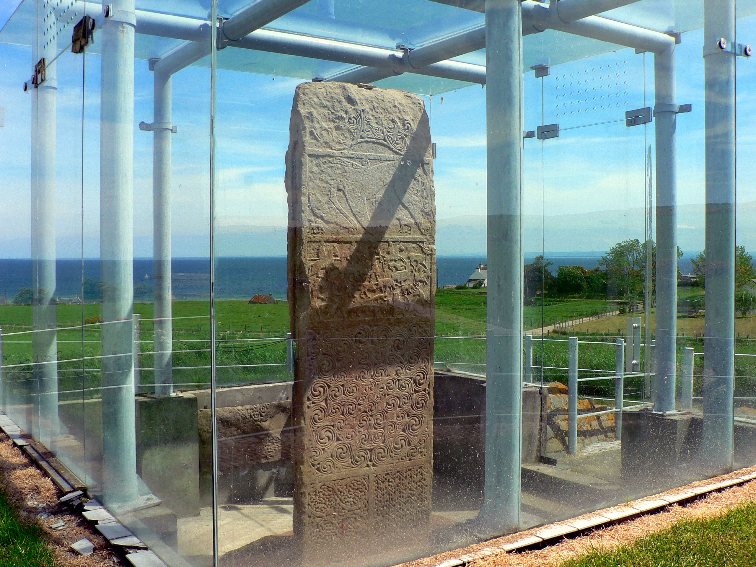
Clach a' Charridh

The Clach a' Charridh or Shandwick Stone is a Class II Pictish stone located near Shandwick on the Tarbat peninsula in Easter Ross, Scotland. It is a scheduled...

Nearby Amenities

Located within 500m of 57.751145,-3.914002
Bus Stop
Church
Naptan AtcoCode: 6700712409A
Naptan Bearing: NE
Naptan CommonName: Church
Naptan Indicator: o/s
Naptan Landmark: Church
Naptan NaptanCode: 45323679
Naptan Street: Park Street
Naptan Verified: no
Source: naptan_import
Lat/Long: 57.7534682/-3.9174864
Bus Stop
Church
Naptan AtcoCode: 6700712409B
Naptan Bearing: SW
Naptan CommonName: Church
Naptan Indicator: opp
Naptan Landmark: Church
Naptan NaptanCode: 45323678
Naptan Street: Park Street
Naptan Verified: no
Source: naptan_import
Lat/Long: 57.753282/-3.9173253
Bus Stop
Chip Shop
Naptan AtcoCode: 6700712409C
Naptan Bearing: SW
Naptan CommonName: Chip Shop
Naptan Indicator: opp
Naptan Landmark: Chip Shop
Naptan NaptanCode: 45323676
Naptan Street: Shore Street
Naptan Verified: no
Source: naptan_import
Lat/Long: 57.7551657/-3.9121811
Bus Stop
Chip Shop
Naptan AtcoCode: 6700712409D
Naptan Bearing: NE
Naptan CommonName: Chip Shop
Naptan Indicator: o/s
Naptan Landmark: Chip Shop
Naptan NaptanCode: 45323675
Naptan Street: Shore Street
Naptan Verified: no
Source: naptan_import
Lat/Long: 57.7553329/-3.9124085
Bus Stop
Telephone Box
Naptan AtcoCode: 6700713103A
Naptan Bearing: S
Naptan CommonName: Telephone Box
Naptan Indicator: o/s
Naptan Landmark: Telephone Box
Naptan NaptanCode: 45323683
Naptan Street: Main Street
Naptan Verified: no
Source: naptan_import
Lat/Long: 57.749973/-3.9198724
Bus Stop
Telephone Box
Naptan AtcoCode: 6700713103B
Naptan Bearing: N
Naptan CommonName: Telephone Box
Naptan Indicator: opp
Naptan Landmark: Telephone Box
Naptan NaptanCode: 45323682
Naptan Street: Main Street
Naptan Verified: no
Source: naptan_import
Lat/Long: 57.7502547/-3.9202571
Parking
Lat/Long: 57.7545295/-3.9121629
Seamark Light Character: Fl
Seamark Light Colour: green
Seamark Light Height: 5
Seamark Light Period: 5
Seamark Light Range: 5
Seamark Light Reference: A 3503
Seamark Light Sequence: 0.5+(4.5)
Seamark Type: light_minor
Source: US NGA Pub. 114. 2011-05-26.
Lat/Long: 57.7537641/-3.9091647
Balintore
Name Gd: Baile an Todhair
Place: village
Population: 1000
Wikidata: Q1886025
Wikipedia: en:Balintore, Easter Ross
Lat/Long: 57.7553925/-3.9130427
Shandwick
Name Gd: Seannduaig
Place: village
Wikidata: Q3778582
Wikipedia: en:Shandwick
Lat/Long: 57.7511011/-3.9192068
Toilets
Drinking Water: yes
Opening Hours: Apr-Oct 09:00-21:00
Lat/Long: 57.7552809/-3.9106824
Drinking Water
Bottle: yes
Lat/Long: 57.7552531/-3.9106957
Shandwick Bay
Natural: bay
Lat/Long: 57.7484884/-3.9122711
Power: pole
Lat/Long: 57.7537139/-3.9202289
Power: pole
Lat/Long: 57.748862/-3.9208306
Power: pole
Lat/Long: 57.7495442/-3.920861
Power: pole
Lat/Long: 57.7502058/-3.9209158
Power: pole
Lat/Long: 57.7515549/-3.9211005
Power: pole
Lat/Long: 57.7522349/-3.9207332
Power: pole
Lat/Long: 57.7527957/-3.920445
Power: pole
Lat/Long: 57.7535017/-3.9200828
Power: pole
Lat/Long: 57.7539835/-3.9204298
The data included in this document is from www.openstreetmap.org. The data is made available under ODbL.

Have you been to Shandwick Bay?

Leave your review of Shandwick Bay below (or comments, questions and feedback).