Appuldurcombe Park
Downs, Moorland in Hampshire
England
Appuldurcombe Park

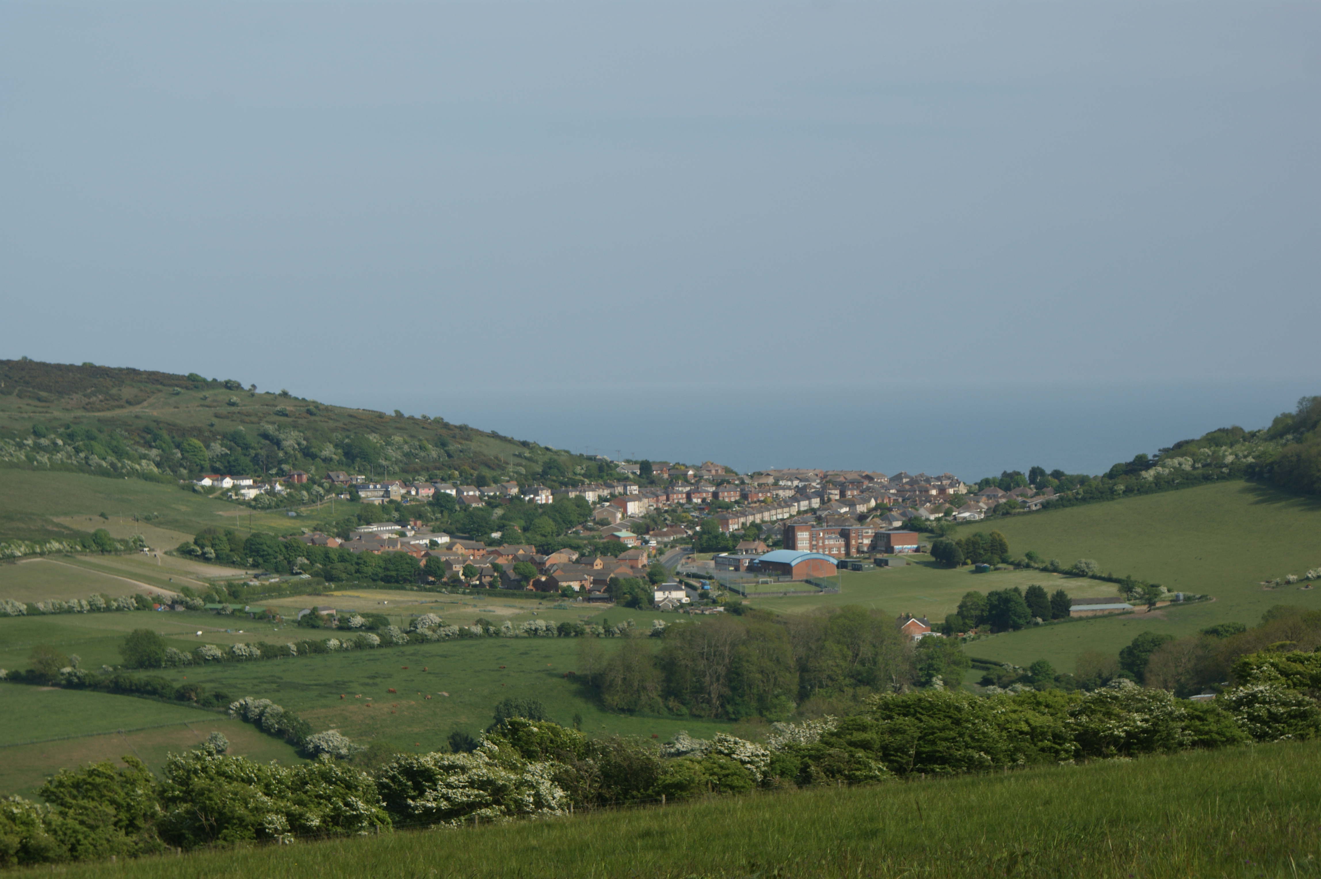
Appuldurcombe Park is a historic country estate located in the picturesque Isle of Wight, Hampshire, England. Spanning over 300 acres, the park is known for its stunning landscape, combining rolling downs and picturesque moorland.
The centerpiece of Appuldurcombe Park is the grand Appuldurcombe House, a magnificent 18th-century mansion that stands as a testament to the island's rich architectural heritage. The house was built in the Palladian style and was once the stately home of the Worsley family. Although the house is now a ruin, its impressive facade and ornate interiors still exude an air of grandeur.
Visitors to Appuldurcombe Park can explore the estate's extensive grounds, which include beautiful parkland, meandering footpaths, and a delightful walled garden. The park offers a tranquil and serene atmosphere, making it a popular destination for nature walks and picnics. The rolling downs provide breathtaking panoramic views of the surrounding countryside, while the moorland offers a unique habitat for a variety of wildlife.
In addition to its natural beauty, Appuldurcombe Park also hosts a range of events throughout the year, including historical reenactments, outdoor theater performances, and craft fairs. These events provide visitors with the opportunity to immerse themselves in the park's rich history and cultural heritage.
Overall, Appuldurcombe Park is a captivating destination that offers a perfect blend of natural beauty, history, and cultural experiences. Whether you are interested in exploring the ruins of the grand house, taking a leisurely stroll through the parkland, or attending one of its lively events, Appuldurcombe Park is sure to leave a lasting impression.
If you have any feedback on the listing, please let us know in the comments section below.
Appuldurcombe Park Images
Images are sourced within 2km of 50.613272/-1.2384103 or Grid Reference SZ5379. Thanks to Geograph Open Source API. All images are credited.


Appuldurcombe Park is located at Grid Ref: SZ5379 (Lat: 50.613272, Lng: -1.2384103)
Unitary Authority: Isle of Wight
Police Authority: Hampshire
What 3 Words
///bypassed.gashes.november. Near Wroxall, Isle of Wight
Nearby Locations
Related Wikis

Stenbury Down
Stenbury Down is a chalk down on the Isle of Wight. It is located close to the town of Ventnor, in the southeast of the island, and rises to 226 metres...
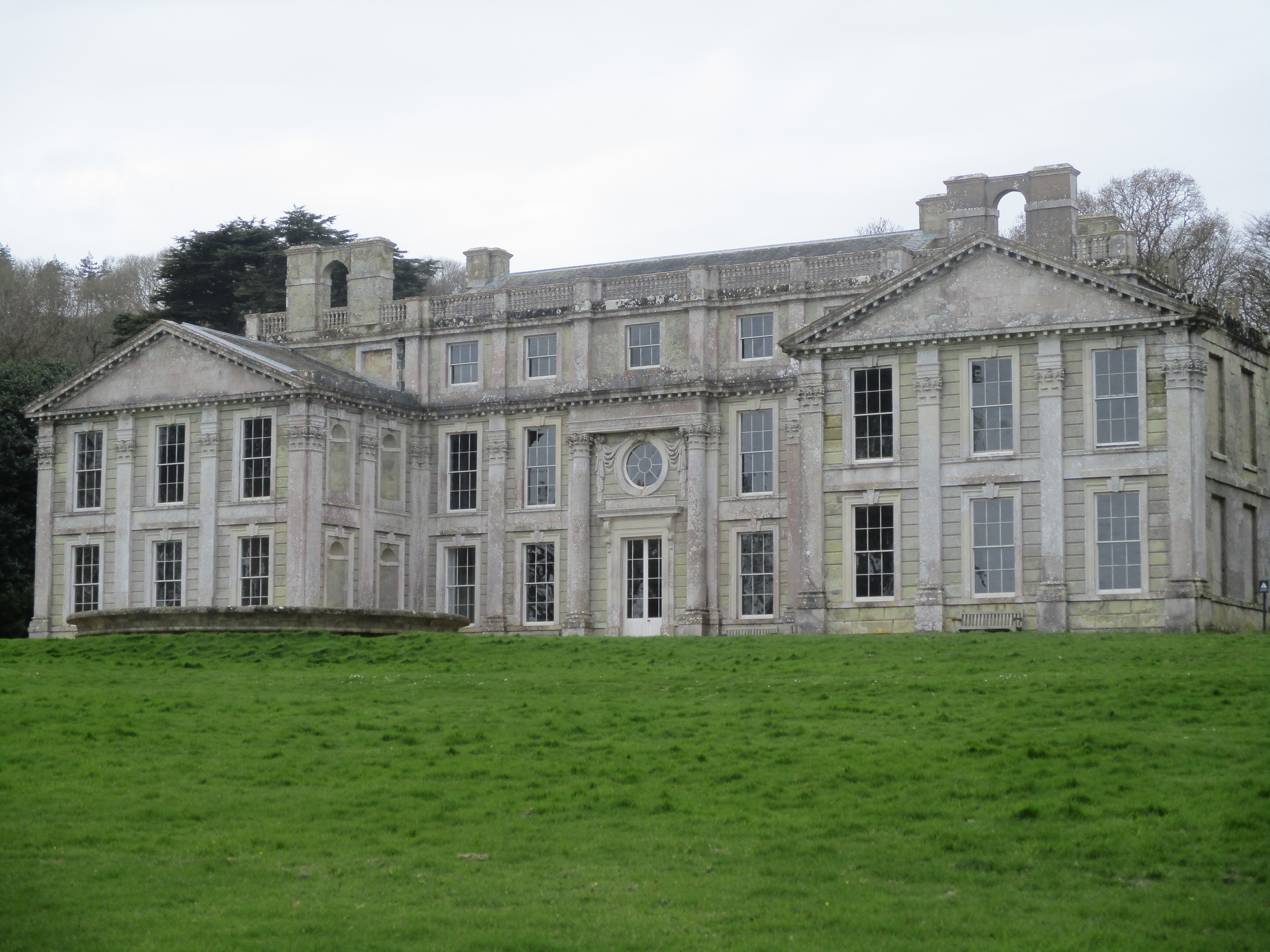
Appuldurcombe House
Appuldurcombe House (also spelt Appledorecombe or Appledore Combe) is the shell of a large 18th-century English Baroque country house of the Worsley family...
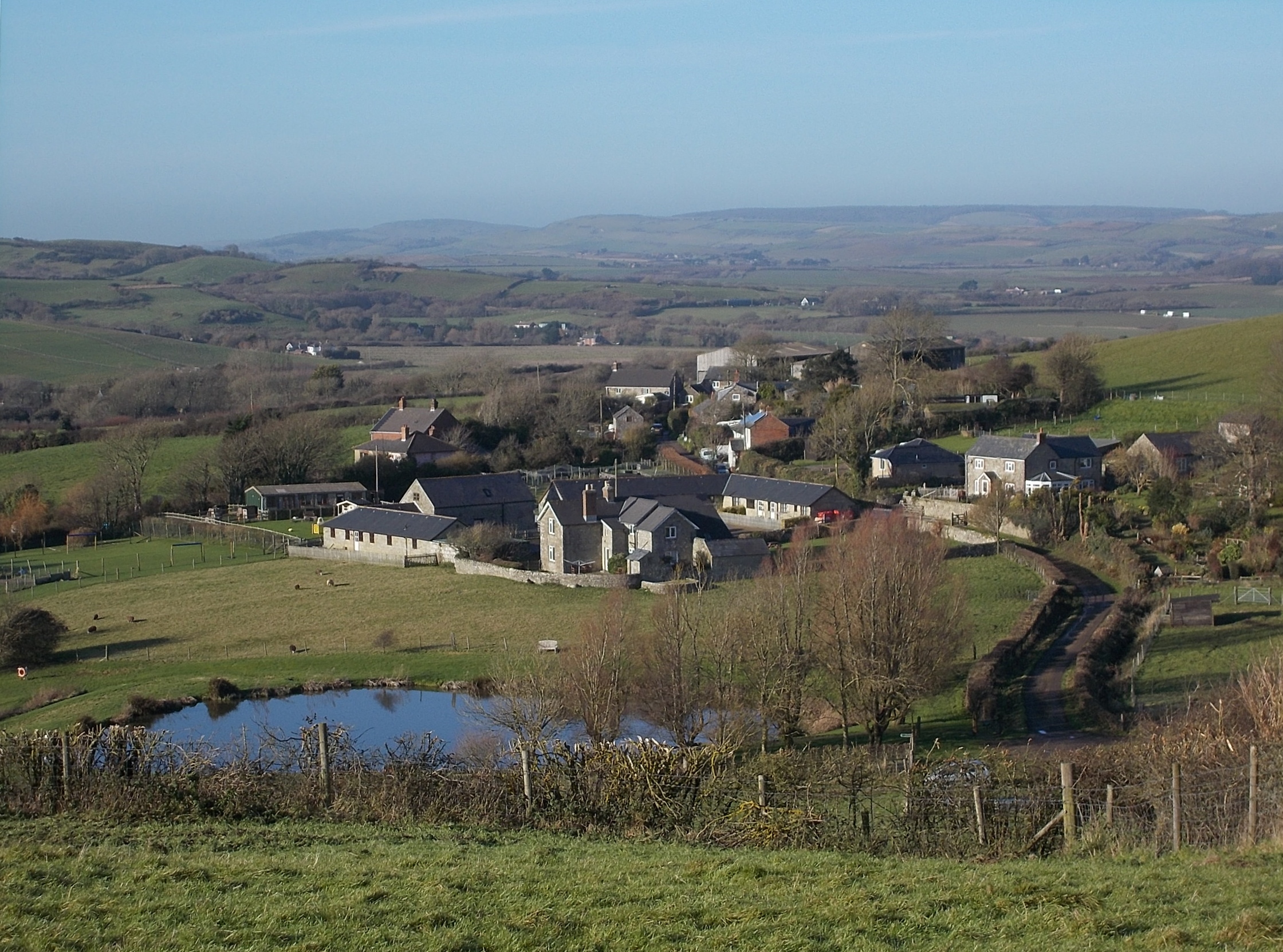
Wroxall, Isle of Wight
Wroxall is a village and civil parish in the central south of the Isle of Wight. It is close to Appuldurcombe House.The parish church is St. John's Church...

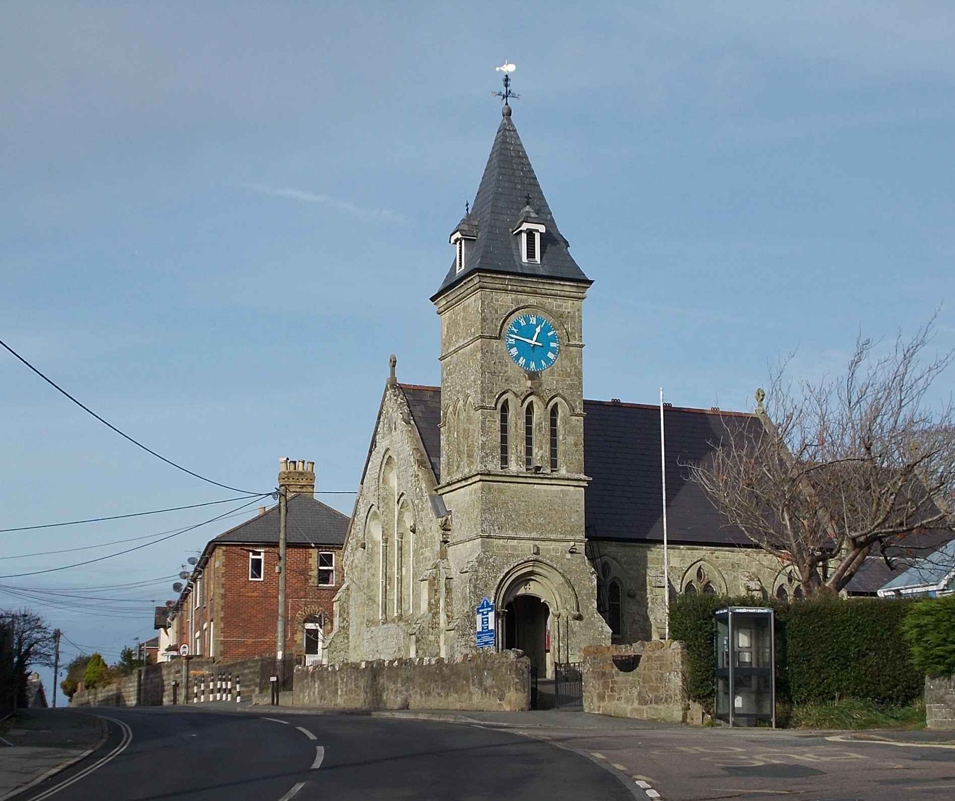
St John's Church, Wroxall
St. John's Church, Wroxall is a parish church in the Church of England located in Wroxall, Isle of Wight. == History == The church dates from 1875 to 1877...

Wroxall railway station
Wroxall railway station was an intermediate station on the Isle of Wight Railway line from Ryde, situated between Shanklin and Ventnor with an upland situation...
Nettlecombe, Isle of Wight
Nettlecombe is a farming hamlet on the Isle of Wight. It is the site of a deserted medieval village and there is evidence of earthworks close to the present...
Sandford, Isle of Wight
Sandford is a hamlet on the Isle of Wight. Sandford is on the outskirts of Godshill (where the 2011 population was listed) in the southeast part of the...
Rew Down
Rew Down is a 23.5-hectare biological Site of Special Scientific Interest and Local Nature Reserve located on the south-east edge of the Isle of Wight...
Nearby Amenities
Located within 500m of 50.613272,-1.2384103Have you been to Appuldurcombe Park?
Leave your review of Appuldurcombe Park below (or comments, questions and feedback).