Black Park

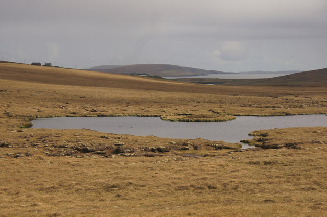
Downs, Moorland in Shetland

Scotland

Black Park

Smithfield, Gutcher The Loch of Gutcher is behind, with a view across Bluemull Sound to Unst.
Smithfield, Gutcher Credit: Mike Pennington

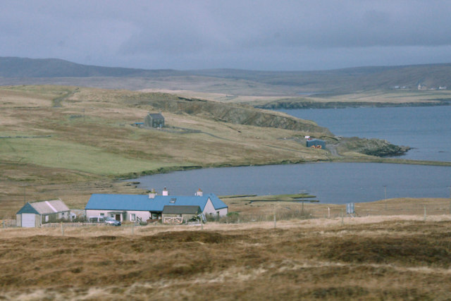
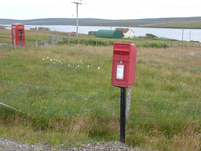
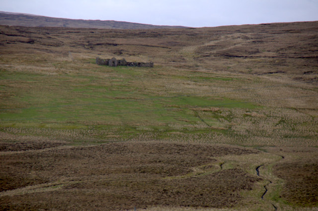
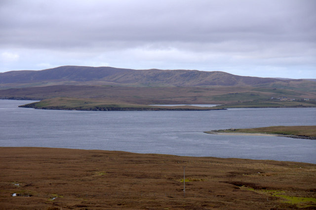
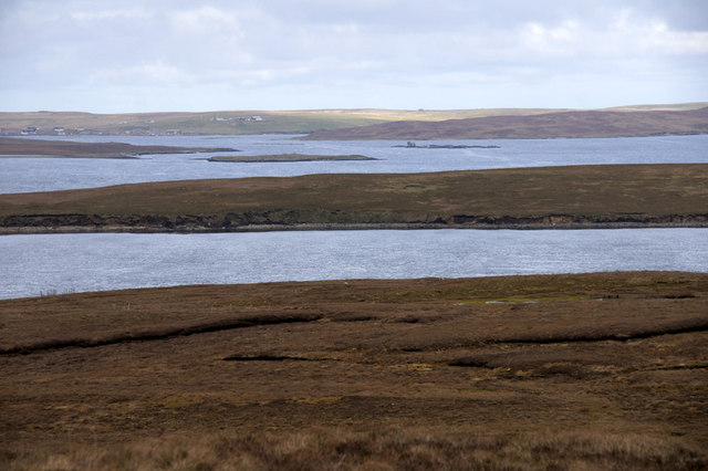
Black Park is a picturesque nature reserve located in the Shetland Islands, Scotland. Spanning over 2,000 hectares, it encompasses a diverse range of landscapes, including downs, moorland, and wetland areas. The park is renowned for its stunning beauty and abundant wildlife, making it a popular destination for nature enthusiasts and hikers.

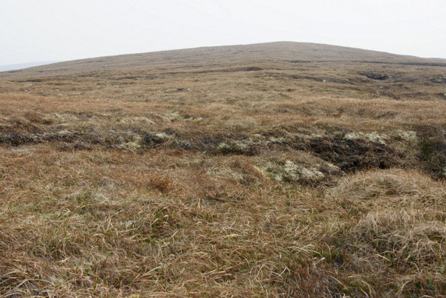
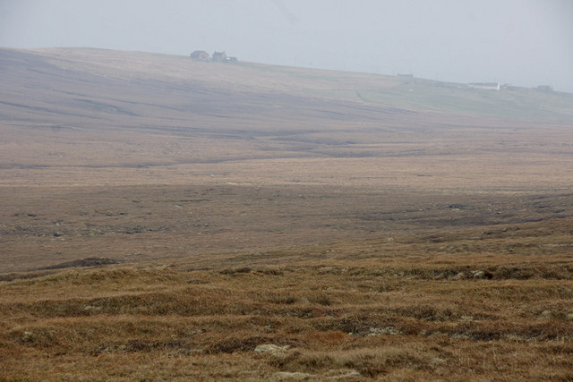
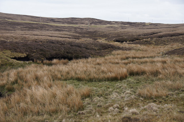
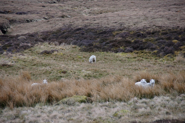
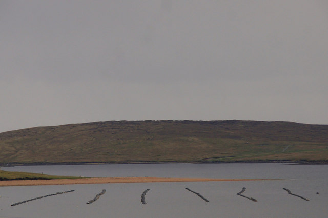
The downs in Black Park offer panoramic views of the surrounding countryside, with rolling hills and heather-covered slopes creating a serene and tranquil atmosphere. The moorland areas are characterized by vast expanses of open space, dotted with patches of dense heather and scattered rocks. This terrain provides a perfect habitat for several species of birds, such as golden plovers and red-throated divers, which can be spotted throughout the year.

Black Park is also home to a variety of wetland habitats, including marshes and lochs, which attract a wide array of birdlife. Birdwatchers can catch glimpses of rare and migratory species, including whooper swans and pintails, during certain seasons. The wetlands are also teeming with insect life, providing food for dragonflies and damselflies.

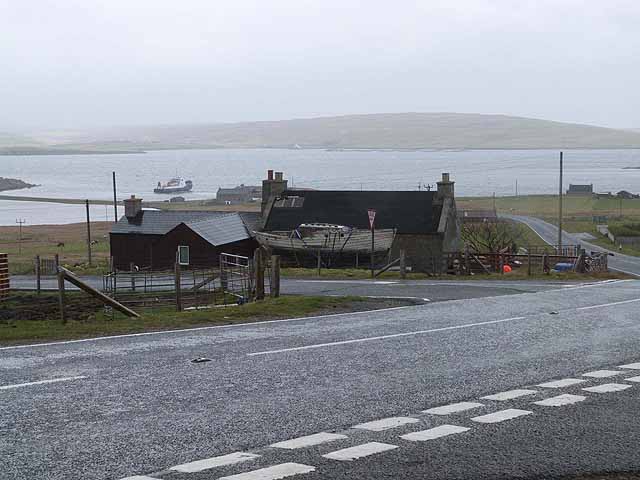
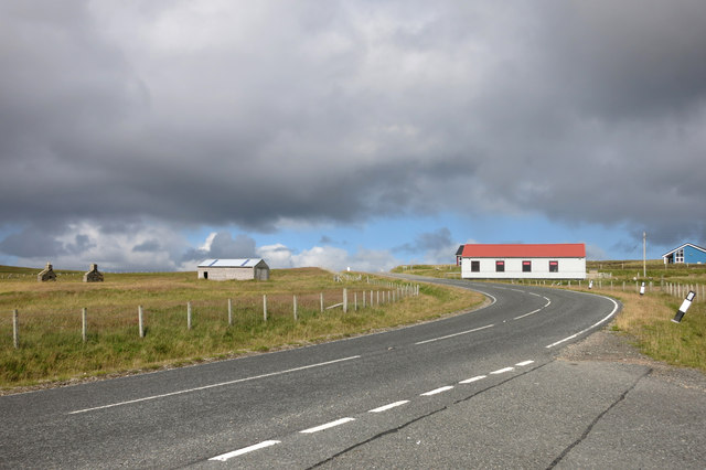
In addition to its natural beauty, Black Park offers several walking trails and picnic areas, allowing visitors to explore the diverse landscapes at their own pace. The park is managed by local authorities, who aim to preserve its unique ecological features and promote environmental education.

Overall, Black Park in Shetland is a haven for nature lovers, offering a blend of downs, moorland, and wetland habitats, as well as a wide range of wildlife species. It is a must-visit destination for those seeking a peaceful and immersive nature experience.

If you have any feedback on the listing, please let us know in the comments section below.

Black Park Images

Images are sourced within 2km of 60.654396/-1.015641 or Grid Reference HU5397. Thanks to Geograph Open Source API. All images are credited.

Smithfield, Gutcher The Loch of Gutcher is behind, with a view across Bluemull Sound to Unst.
Smithfield, Gutcher
The Loch of Gutcher is behind, with a view across Bluemull Sound to Unst.
Hill of Bixsetter, east of Sellafirth
Black Park, North Sandwick Looking towards North Sandwick.
Black Park, North Sandwick
Looking towards North Sandwick.
Sellafirth: telephone box A traditional red phone box, still in working order although as is often the case these days it no longer accepts coins, just off the main road.
Sellafirth: telephone box
A traditional red phone box, still in working order although as is often the case these days it no longer accepts coins, just off the main road.
Sellafirth: postbox № ZE2 87 This postbox stands at a junction of the A968 and is emptied at 9:45 each weekday and Saturday morning. In the background is <a href="https://www.geograph.org.uk/photo/2647764">HU5297 : Sellafirth: telephone box</a>, just down the side road, despite the 1:50,000 and 1:25,000 maps suggesting it is on the corner with the postbox.
Sellafirth: postbox № ZE2 87
This postbox stands at a junction of the A968 and is emptied at 9:45 each weekday and Saturday morning. In the background is HU5297 : Sellafirth: telephone box, just down the side road, despite the 1:50,000 and 1:25,000 maps suggesting it is on the corner with the postbox.
Burns of Gutcher The burn flowing north from near the A road, just before its confluence with the burn flowing south.
Burns of Gutcher
The burn flowing north from near the A road, just before its confluence with the burn flowing south.
Sheep along the Burns of Gutcher
Setter, North Sandwick Ruined crofthouse across the valley from the extant houses.
Setter, North Sandwick
Ruined crofthouse across the valley from the extant houses.
Mid House, North Sandwick
North Sand Wick, Yell View across the bay to Burra Ness, with Fetlar in the distance.
North Sand Wick, Yell
View across the bay to Burra Ness, with Fetlar in the distance.
North Sand Wick, Yell Burra Ness and Hascosay in the background.
North Sand Wick, Yell
Burra Ness and Hascosay in the background.
View across Bluemull Sound from the Hill of Gutcher Yell in the foreground, the north end of Linga in the sound and Unst in the distance, with Loch of Belmont in the centre and the Valla Field ridge in the background.
View across Bluemull Sound from the Hill of Gutcher
Yell in the foreground, the north end of Linga in the sound and Unst in the distance, with Loch of Belmont in the centre and the Valla Field ridge in the background.
View to Uyeasound from the Hill of Gutcher Looking from Yell in the foreground and across Linga to the Holm of Heogland off the coast of Unst. Uyea Sound, separating Uyea from Unst, is beyond Heogland, and the settlement of Uyeasound is visible on the far left.
View to Uyeasound from the Hill of Gutcher
Looking from Yell in the foreground and across Linga to the Holm of Heogland off the coast of Unst. Uyea Sound, separating Uyea from Unst, is beyond Heogland, and the settlement of Uyeasound is visible on the far left.
Gutcher on a dreich day Looking along the main road which runs the length of Yell towards the ferry terminal. The loch of Gutcher <a href="https://www.geograph.org.uk/gridref/HU5499">HU5499</a> can be seen to the left separated from the sea by a shingle bar. A ferry has just departed for Unst (seen dimly in the distance).
Gutcher on a dreich day
Looking along the main road which runs the length of Yell towards the ferry terminal. The loch of Gutcher HU5499 can be seen to the left separated from the sea by a shingle bar. A ferry has just departed for Unst (seen dimly in the distance).
North Ayre of Cunnister Mussel ropes in Basta Voe in the foreground.
North Ayre of Cunnister
Mussel ropes in Basta Voe in the foreground.
Un-named lochan west of Hill of Gutcher Looking down towards North Sandwick and Fetlar in the distance.
Un-named lochan west of Hill of Gutcher
Looking down towards North Sandwick and Fetlar in the distance.
View towards Gutcher Looking down over the ferry terminal with Unst island in the background.
View towards Gutcher
Looking down over the ferry terminal with Unst island in the background.
A968  at Sellafirth
A968 at Sellafirth
Show me another place!

Black Park is located at Grid Ref: HU5397 (Lat: 60.654396, Lng: -1.015641)

Unitary Authority: Shetland Islands

Police Authority: Highlands and Islands

What 3 Words

///graceful.knees.veal. Near Gutcher, Shetland Islands

Related Wikis

North Isles

The North Isles are the northern islands of the Shetland Islands, Scotland. The main islands in the group are Yell, Unst and Fetlar. Sometimes the islands...

Gutcher

Gutcher is a settlement on the northeast coast of Yell in the Shetland islands. From here, rollon/roll off ferry services to Belmont on Unst and Hamars...

Linga, Bluemull Sound

Linga is a very small uninhabited island in the Bluemull Sound, Shetland, Scotland. It is one of many islands in Shetland called Linga. It has an area...

Burra Ness Broch

Burra Ness Broch is an iron-age broch located on the east coast of the island of Yell, Shetland, Scotland. == Location == Burra Ness Broch (grid reference...

Have you been to Black Park?

Leave your review of Black Park below (or comments, questions and feedback).