Appuldurcombe Down
Hill, Mountain in Hampshire
England
Appuldurcombe Down

Appuldurcombe Down is a prominent hill located in the county of Hampshire, England. Situated near the village of Wroxall, the hill offers breathtaking panoramic views of the surrounding countryside. With an elevation of approximately 147 meters (482 feet), it is not classified as a mountain, but rather a hill.
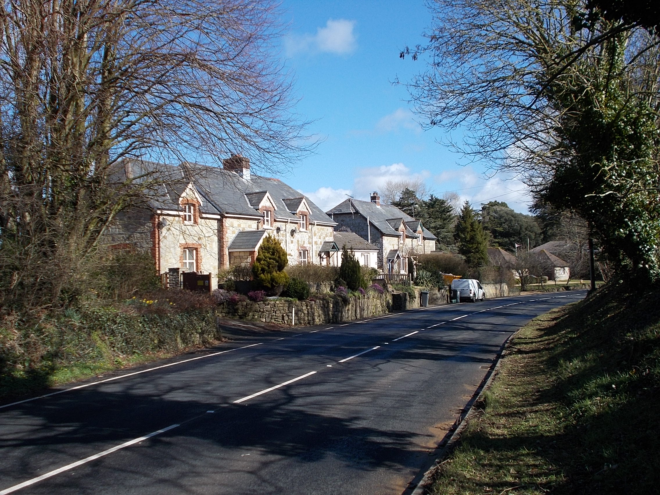
The area surrounding Appuldurcombe Down is characterized by rolling green fields and picturesque landscapes. It is a popular spot for outdoor activities such as hiking and walking, attracting both locals and tourists alike. The hill is accessible via well-maintained footpaths, making it an ideal destination for nature enthusiasts to explore the area's flora and fauna.
At the top of Appuldurcombe Down, there is a viewpoint that provides a stunning vista of the Isle of Wight and the English Channel. On clear days, visitors can admire the distant coastline and enjoy the serenity of the countryside. It is also a favored spot for photographers, who often capture the beauty of the hill and its surroundings.
Appuldurcombe Down holds historical significance as well. In close proximity to the hill lies the Appuldurcombe House, a grand 18th-century mansion that was once the seat of the Worsley family. Although the house is now in ruins, its impressive architectural remnants attract history buffs seeking to learn about its past.
Overall, Appuldurcombe Down offers a picturesque and peaceful retreat, showcasing the natural beauty of Hampshire. Whether for recreational activities, sightseeing, or historical exploration, this hill provides a wonderful experience for visitors of all interests.
If you have any feedback on the listing, please let us know in the comments section below.
Appuldurcombe Down Images
Images are sourced within 2km of 50.614116/-1.2438242 or Grid Reference SZ5379. Thanks to Geograph Open Source API. All images are credited.


Appuldurcombe Down is located at Grid Ref: SZ5379 (Lat: 50.614116, Lng: -1.2438242)
Unitary Authority: Isle of Wight
Police Authority: Hampshire
What 3 Words
///innocence.spare.chainsaw. Near Wroxall, Isle of Wight
Nearby Locations
Related Wikis

Stenbury Down
Stenbury Down is a chalk down on the Isle of Wight. It is located close to the town of Ventnor, in the southeast of the island, and rises to 226 metres...
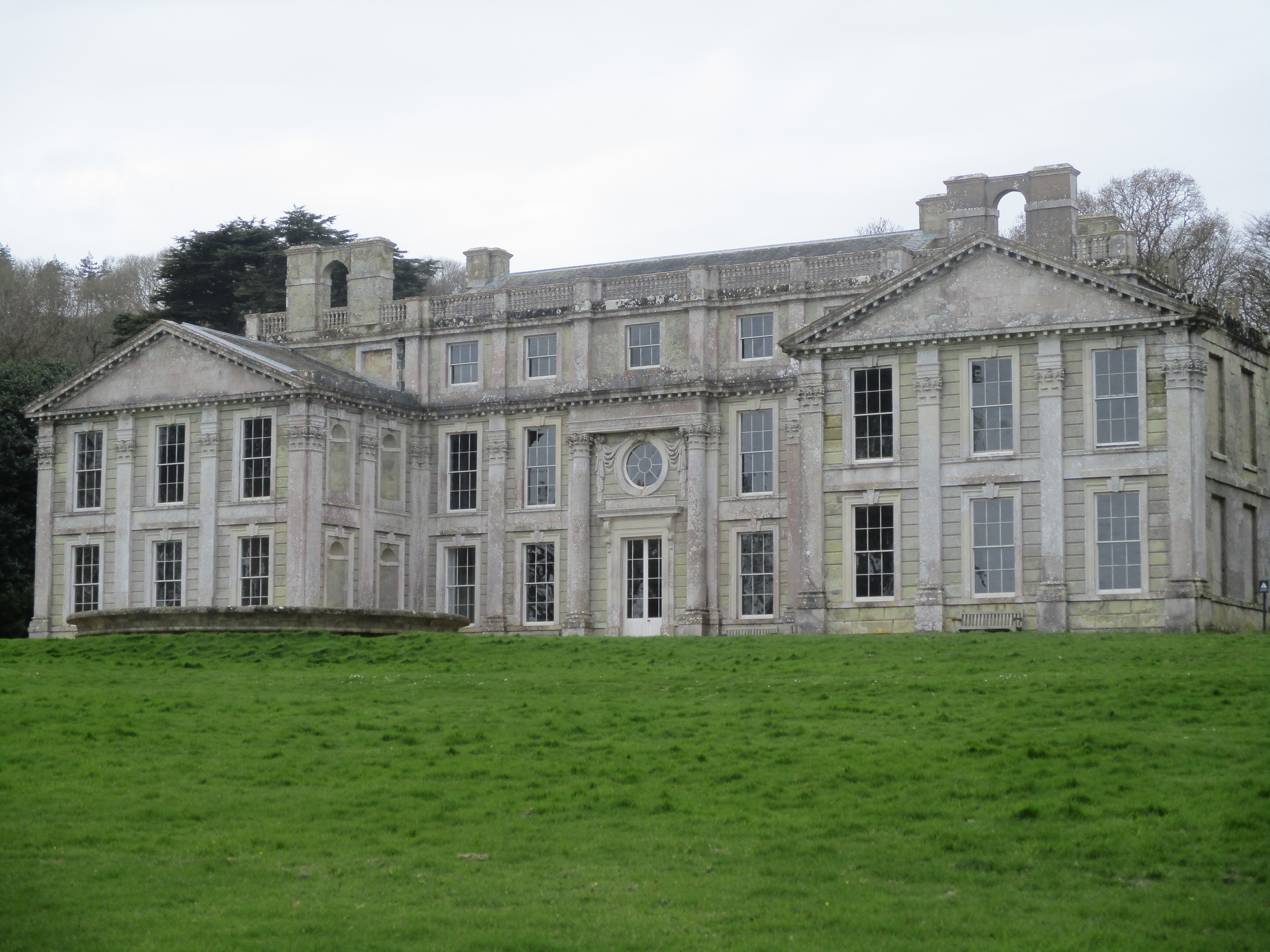
Appuldurcombe House
Appuldurcombe House (also spelt Appledorecombe or Appledore Combe) is the shell of a large 18th-century English Baroque country house of the Worsley family...
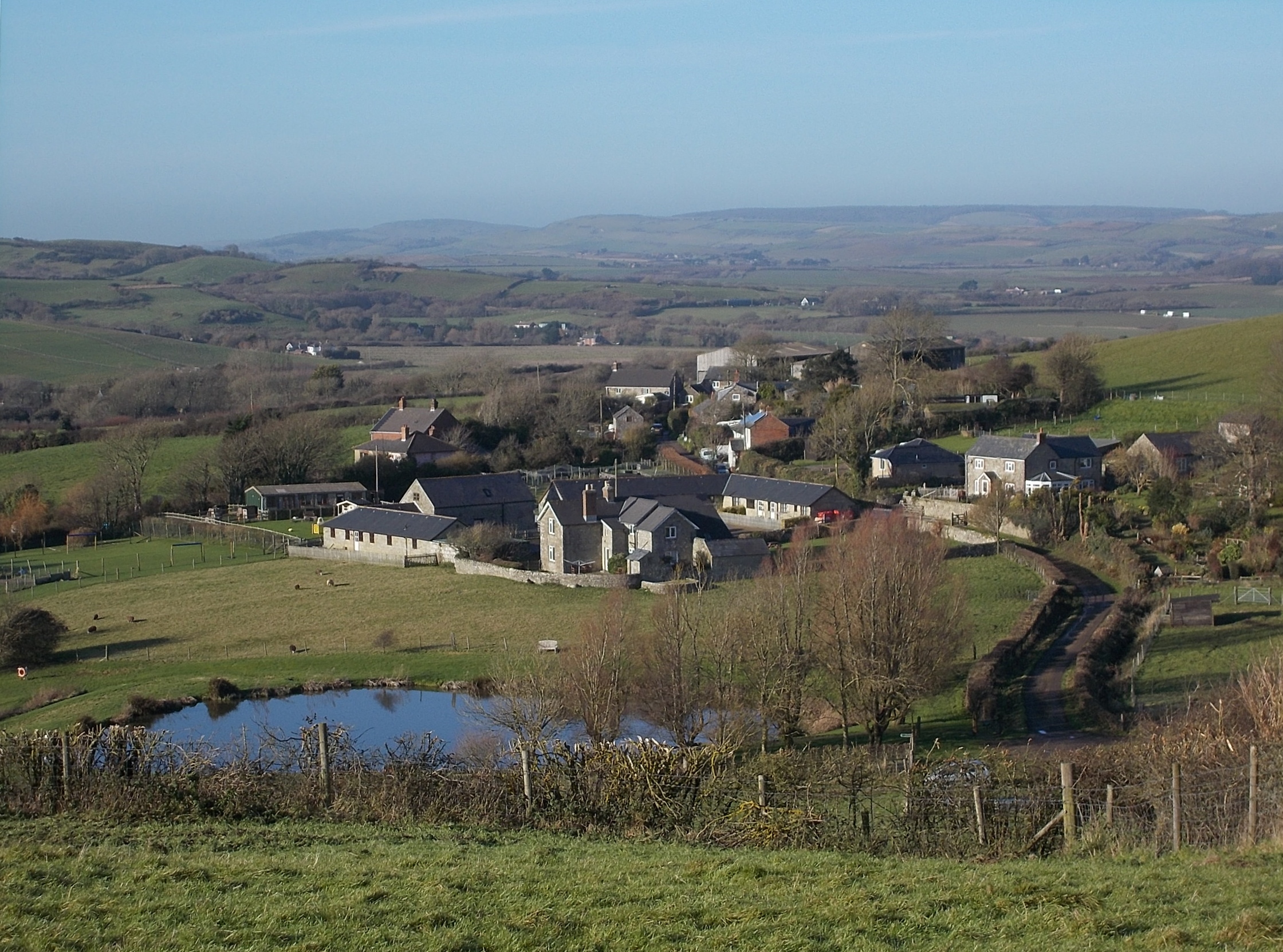
Wroxall, Isle of Wight
Wroxall is a village and civil parish in the central south of the Isle of Wight. It is close to Appuldurcombe House.The parish church is St. John's Church...

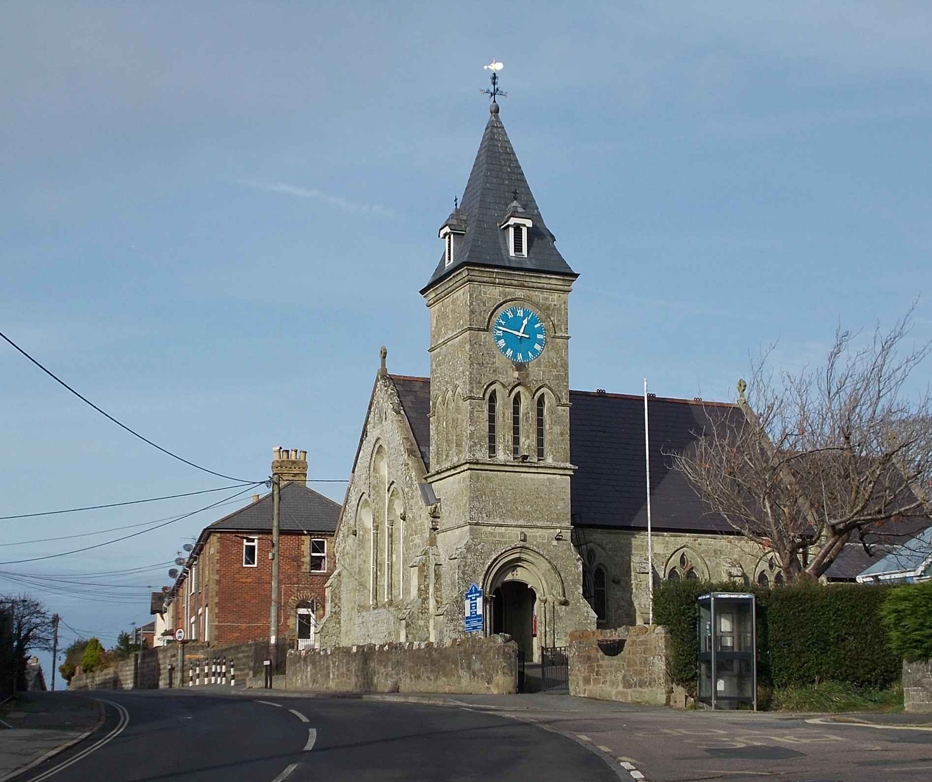
St John's Church, Wroxall
St. John's Church, Wroxall is a parish church in the Church of England located in Wroxall, Isle of Wight. == History == The church dates from 1875 to 1877...

Wroxall railway station
Wroxall railway station was an intermediate station on the Isle of Wight Railway line from Ryde, situated between Shanklin and Ventnor with an upland situation...
Nettlecombe, Isle of Wight
Nettlecombe is a farming hamlet on the Isle of Wight. It is the site of a deserted medieval village and there is evidence of earthworks close to the present...
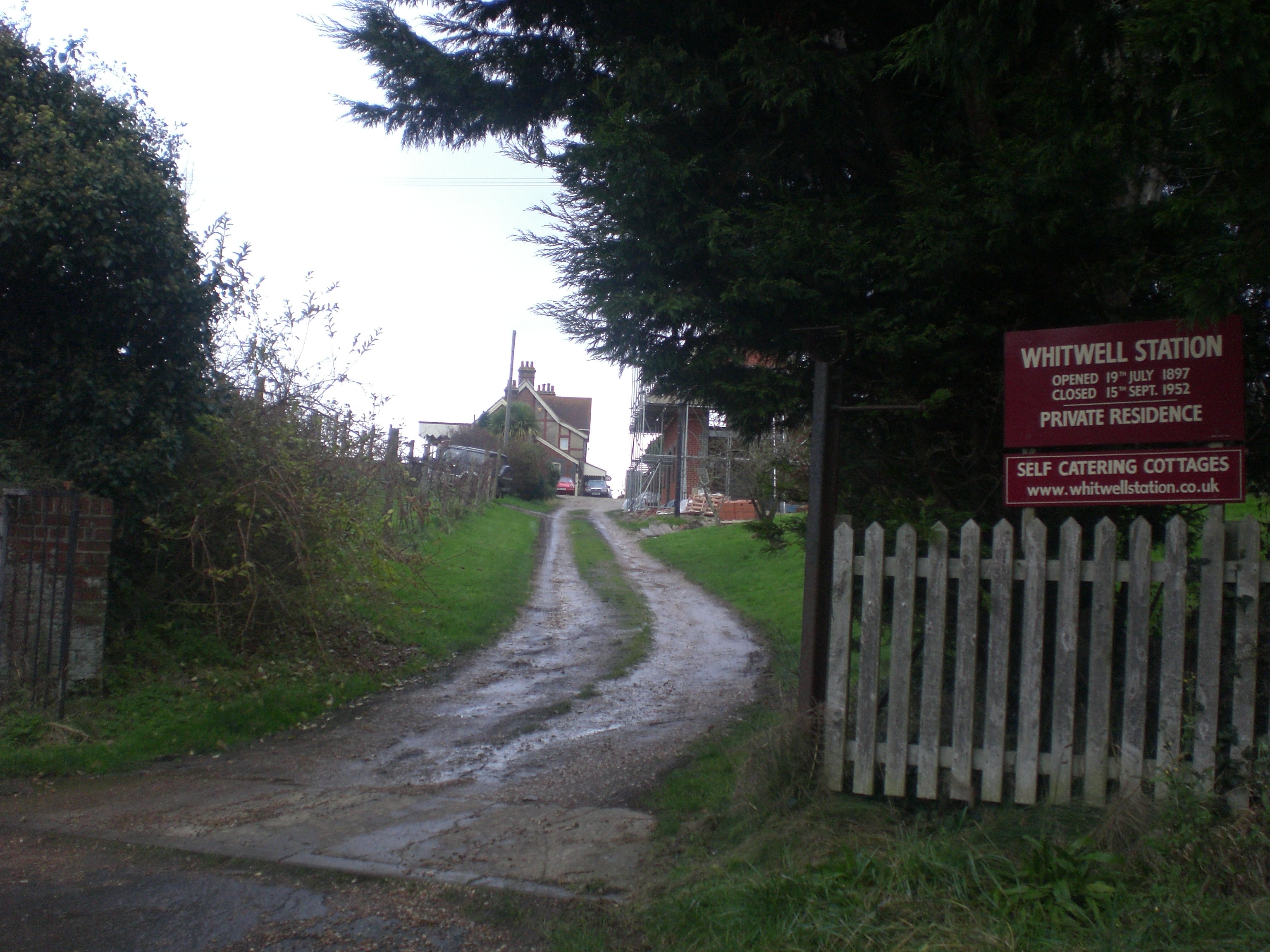
Whitwell Halt railway station
Whitwell Station, on the Ventnor West branch of the Isle of Wight Central Railway, was opened on 20 July 1897 along with the other stations on the branch...
Sandford, Isle of Wight
Sandford is a hamlet on the Isle of Wight. Sandford is on the outskirts of Godshill (where the 2011 population was listed) in the southeast part of the...
Nearby Amenities
Located within 500m of 50.614116,-1.2438242Have you been to Appuldurcombe Down?
Leave your review of Appuldurcombe Down below (or comments, questions and feedback).