Appuldurcombe Down
Downs, Moorland in Hampshire
England
Appuldurcombe Down

Appuldurcombe Down is a picturesque area located in the county of Hampshire, England. Situated in the southern part of the Isle of Wight, this downland region encompasses a mix of downs and moorland, creating a diverse landscape that attracts nature enthusiasts and hikers alike.
The downs in Appuldurcombe Down are characterized by their gently rolling hills covered in lush green grasses and scattered with wildflowers. This terrain provides a stunning backdrop for walkers, who can enjoy panoramic views of the surrounding countryside, including the Solent and the English Channel. The area is also home to a variety of wildlife, including rabbits, squirrels, and a wide range of bird species, making it a haven for birdwatchers.
In addition to the downs, Appuldurcombe Down boasts areas of moorland, characterized by open expanses of heather and gorse. This moorland is home to rare plant species and provides a habitat for several bird species, including the iconic red grouse. The rugged beauty of the moorland attracts visitors seeking a more remote and untouched experience.
The area is crisscrossed with walking trails, allowing visitors to explore the downs and moorland at their own pace. These paths are well-maintained and offer breathtaking views at every turn. Appuldurcombe Down is also rich in history, with remnants of ancient settlements and burial mounds scattered throughout the area, providing a fascinating glimpse into the past.
Overall, Appuldurcombe Down is a stunning natural landscape that offers visitors the opportunity to immerse themselves in the beauty of the Hampshire countryside. With its downs, moorland, and rich history, this area is a must-visit destination for nature lovers and history enthusiasts alike.
If you have any feedback on the listing, please let us know in the comments section below.
Appuldurcombe Down Images
Images are sourced within 2km of 50.615353/-1.2445817 or Grid Reference SZ5379. Thanks to Geograph Open Source API. All images are credited.


Appuldurcombe Down is located at Grid Ref: SZ5379 (Lat: 50.615353, Lng: -1.2445817)
Unitary Authority: Isle of Wight
Police Authority: Hampshire
What 3 Words
///zone.shelf.schematic. Near Wroxall, Isle of Wight
Nearby Locations
Related Wikis

Stenbury Down
Stenbury Down is a chalk down on the Isle of Wight. It is located close to the town of Ventnor, in the southeast of the island, and rises to 226 metres...
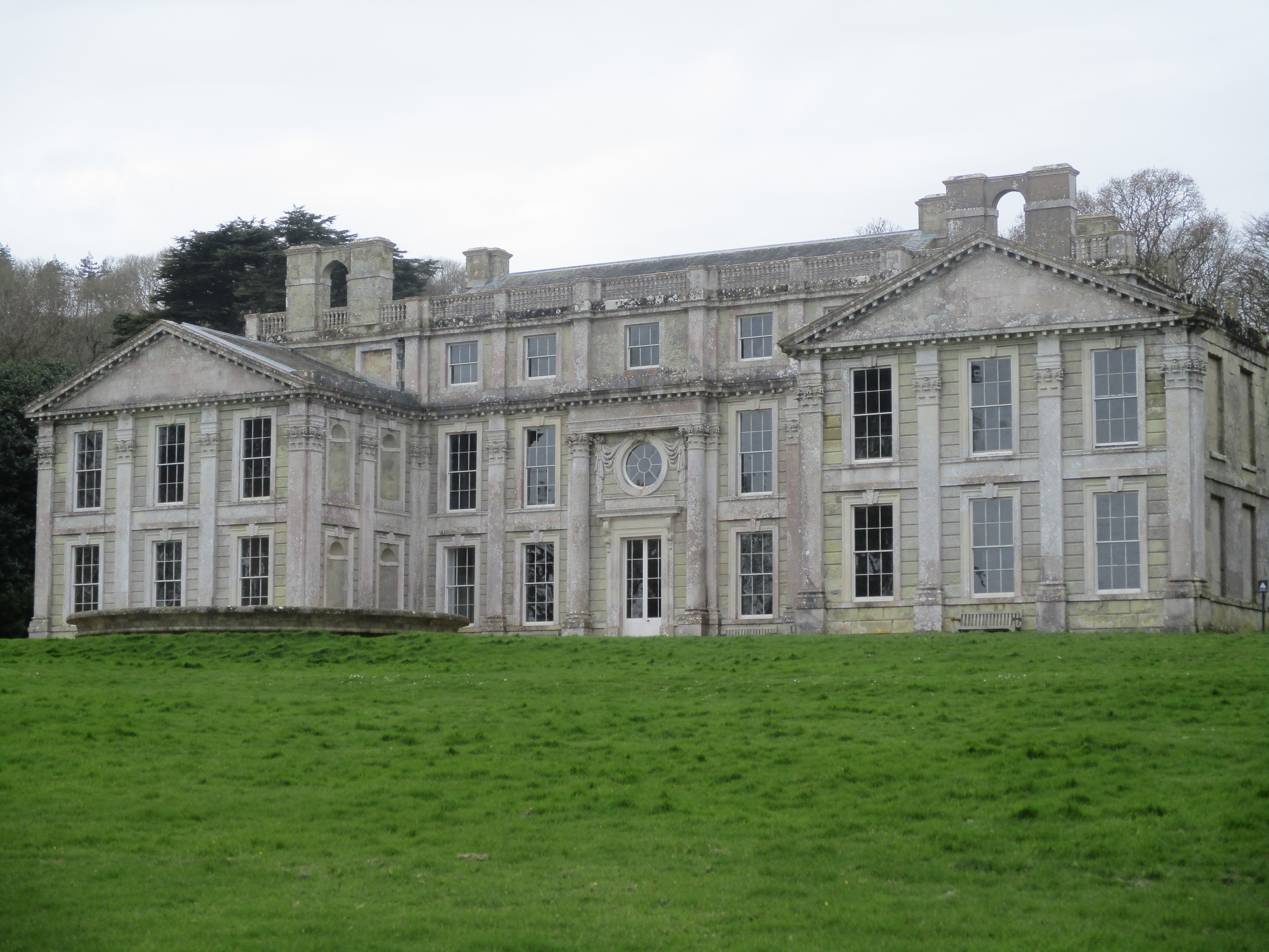
Appuldurcombe House
Appuldurcombe House (also spelt Appledorecombe or Appledore Combe) is the shell of a large 18th-century English Baroque country house of the Worsley family...
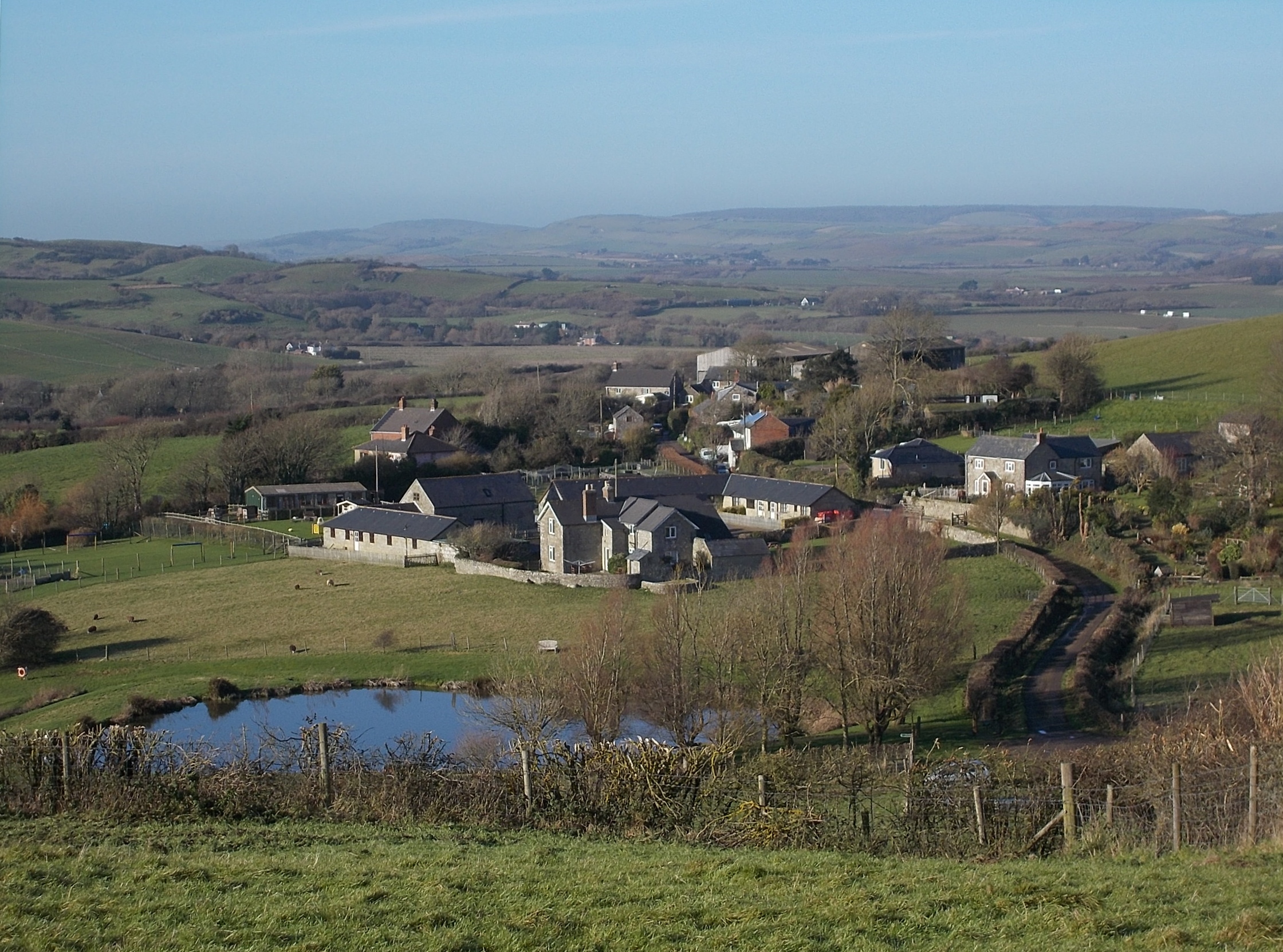
Wroxall, Isle of Wight
Wroxall is a village and civil parish in the central south of the Isle of Wight. It is close to Appuldurcombe House.The parish church is St. John's Church...

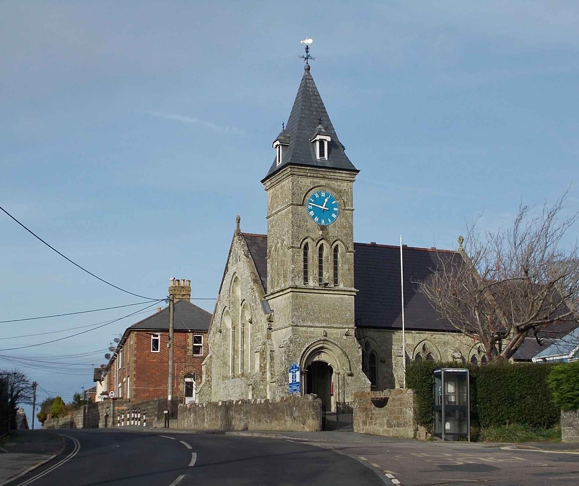
St John's Church, Wroxall
St. John's Church, Wroxall is a parish church in the Church of England located in Wroxall, Isle of Wight. == History == The church dates from 1875 to 1877...

Wroxall railway station
Wroxall railway station was an intermediate station on the Isle of Wight Railway line from Ryde, situated between Shanklin and Ventnor with an upland situation...
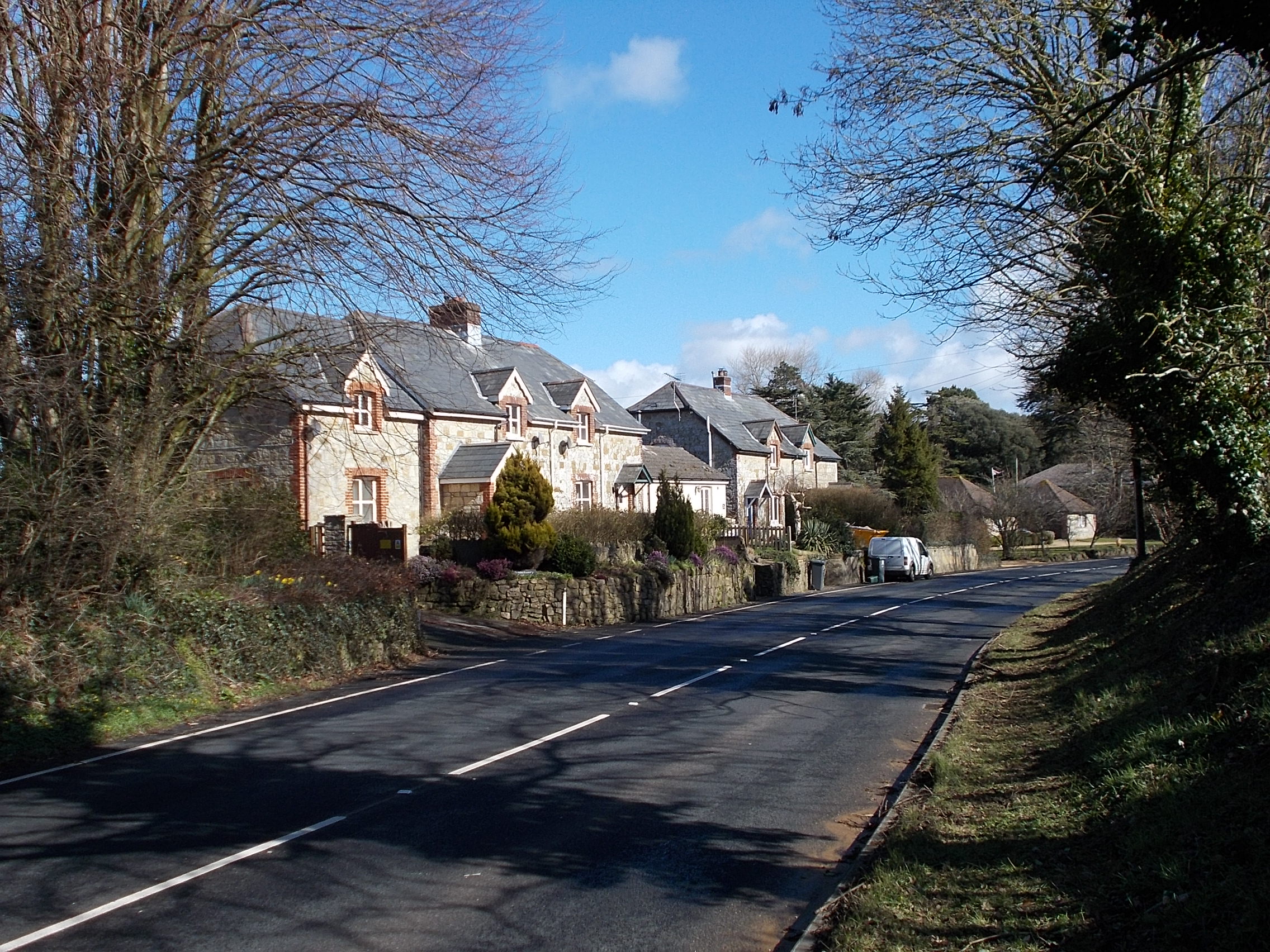
Nettlecombe, Isle of Wight
Nettlecombe is a farming hamlet on the Isle of Wight. It is the site of a deserted medieval village and there is evidence of earthworks close to the present...
Sandford, Isle of Wight
Sandford is a hamlet on the Isle of Wight. Sandford is on the outskirts of Godshill (where the 2011 population was listed) in the southeast part of the...
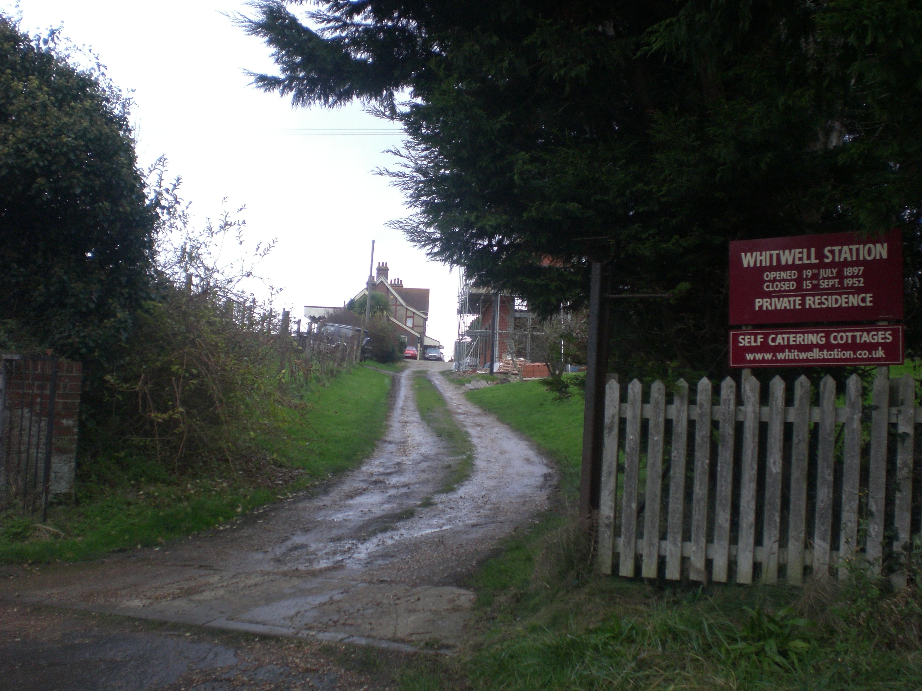
Whitwell Halt railway station
Whitwell Station, on the Ventnor West branch of the Isle of Wight Central Railway, was opened on 20 July 1897 along with the other stations on the branch...
Nearby Amenities
Located within 500m of 50.615353,-1.2445817Have you been to Appuldurcombe Down?
Leave your review of Appuldurcombe Down below (or comments, questions and feedback).