Turri Field

Downs, Moorland in Shetland

Scotland

Turri Field

Mail Burial Ground Adjacent to the sea as is usual on Scottish islands.
Mail Burial Ground Credit: Oliver Dixon

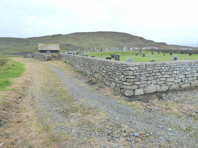
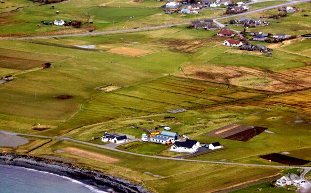
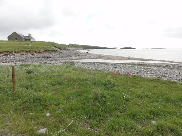
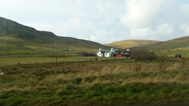
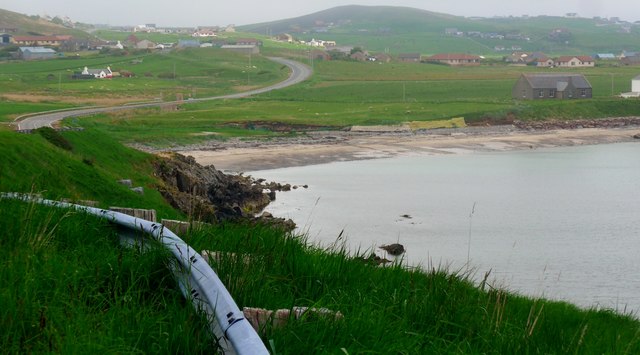
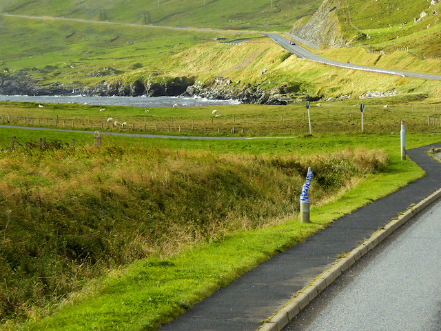
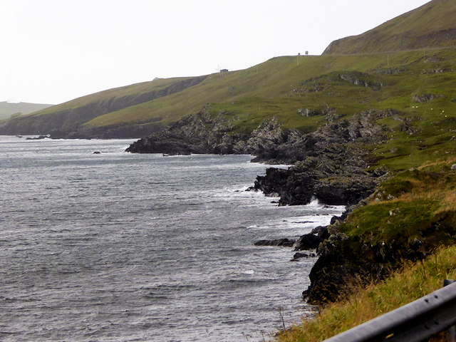
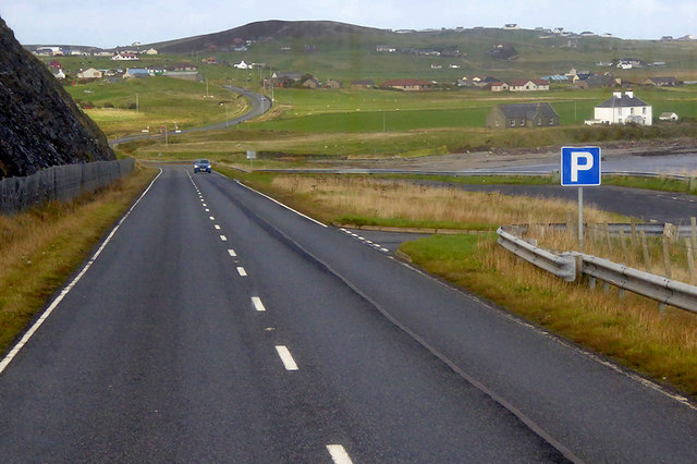
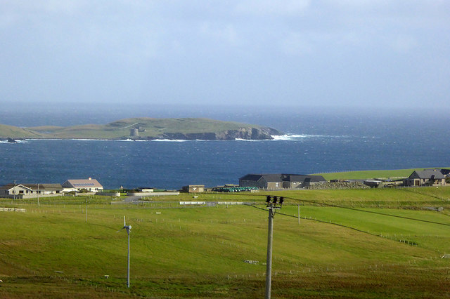
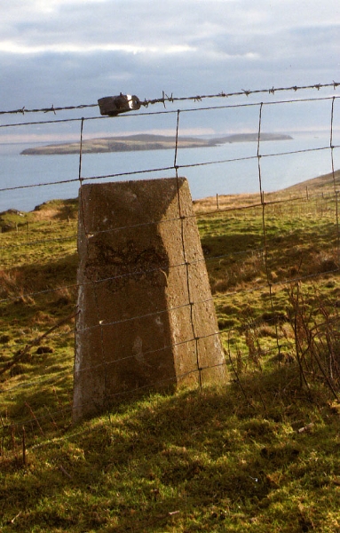
Turri Field, located in Shetland, is a vast expanse of land that encompasses various landscapes, including downs and moorland. Stretching over a considerable area, Turri Field is renowned for its stunning natural beauty and diverse flora and fauna.

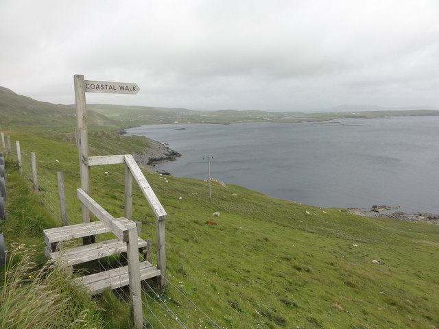
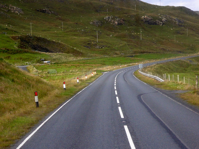
The downs of Turri Field are characterized by gently rolling hills covered in lush vegetation. These grassy slopes create a picturesque scenery that is often dotted with wildflowers during the warmer months. The downs are known for their rich biodiversity, with a variety of plant species such as heather, gorse, and sea thrift thriving in this environment. The area also serves as a habitat for numerous bird species, including skylarks and meadow pipits, which can be spotted soaring above the downs.

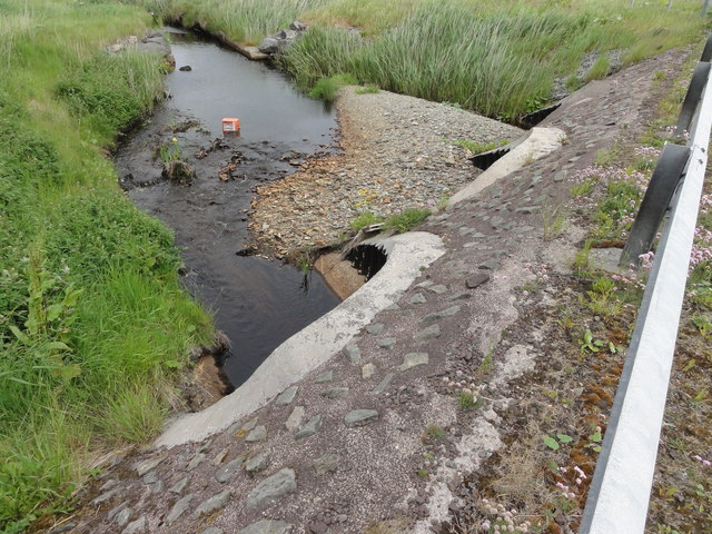
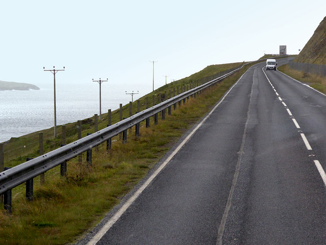
Adjacent to the downs, the moorland of Turri Field offers a contrasting landscape. Moorland is characterized by vast stretches of open, treeless land covered in heather, moss, and grasses. This unique ecosystem supports a wide range of wildlife, including mountain hares, red grouse, and various bird species like curlews and golden plovers. The moorland also features small streams and lochs, providing water sources for the wildlife inhabiting this area.

Turri Field is a popular destination for nature enthusiasts, hikers, and photographers who seek to immerse themselves in the beauty of the Shetland landscape. The expansive views, vibrant flora, and diverse wildlife make it an ideal location for nature lovers to explore and appreciate the natural wonders of the region.

If you have any feedback on the listing, please let us know in the comments section below.

Turri Field Images

Images are sourced within 2km of 60.029076/-1.2466512 or Grid Reference HU4227. Thanks to Geograph Open Source API. All images are credited.

Mail Burial Ground Adjacent to the sea as is usual on Scottish islands.
Mail Burial Ground
Adjacent to the sea as is usual on Scottish islands.
South Voxter, Cunningsburgh, from the air
Mail, Cunningsburgh, from the air
Shoreline with joining stream Small sandy pebble beach with joining stream to the sea
Shoreline with joining stream
Small sandy pebble beach with joining stream to the sea
Road bridge Road bridge buttress as it passes over the stream. It should have been the location of an Ordnance Survey OSBM Bolt, which seems to have been destroyed in the rebuilding of the road.
Road bridge
Road bridge buttress as it passes over the stream. It should have been the location of an Ordnance Survey OSBM Bolt, which seems to have been destroyed in the rebuilding of the road.
Coastal Walk View out to sea and the Coastal Walk stile
Coastal Walk
View out to sea and the Coastal Walk stile
Vadsgarth, Cunningsburgh
Small beach at the Sands of Mail The road is the A970 approaching Cunningsburgh.
Small beach at the Sands of Mail
The road is the A970 approaching Cunningsburgh.
Bus Stop at Cunningsburgh Cunningsburgh, formerly also known as Coningsburgh (from the Old Norse: Konungsborgr meaning "King's castle"), is a hamlet on the coast of Mainland Shetland, nine miles south-west of Lerwick, about halfway between there and Sumburgh Head.
Bus Stop at Cunningsburgh
Cunningsburgh, formerly also known as Coningsburgh (from the Old Norse: Konungsborgr meaning "King's castle"), is a hamlet on the coast of Mainland Shetland, nine miles south-west of Lerwick, about halfway between there and Sumburgh Head.
Coastal Sheep Farm near Mail
Cunningsburgh, A970 Cunningsburgh, formerly also known as Coningsburgh (from the Old Norse: Konungsborgr meaning "King's castle"), is a hamlet on the coast of Mainland Shetland, nine miles south-west of Lerwick, about halfway between there and Sumburgh Head.
Cunningsburgh, A970
Cunningsburgh, formerly also known as Coningsburgh (from the Old Norse: Konungsborgr meaning "King's castle"), is a hamlet on the coast of Mainland Shetland, nine miles south-west of Lerwick, about halfway between there and Sumburgh Head.
Rocky Shoreline near Mail
Southbound A970, Layby near Mail The A970 runs for 71 miles across most of the length of the "Mainland" in the Shetland Islands. It is a good-quality single-carriageway road for most of its route. Travelling from south to north, the road begins at Grutness near Sumburgh Airport and winds around the many hills and inlets passing close to a number of small villages without going through any large ones before Lerwick. After looping around Lerwick, a short spur runs to Scalloway whilst the main route continues northwards towards Brae where it crosses the narrow isthmus of Mavis Grind. At Sandy Lochs the road splits and a four-mile spur goes through Urafirth to Hillswick. The main route continuing to the right towards its northern terminus at Isbister. This last part of the route tends to be narrower with passing places.

<span class="nowrap"><a title="https://www.sabre-roads.org.uk/wiki/index.php?title=A970" rel="nofollow ugc noopener" href="https://www.sabre-roads.org.uk/wiki/index.php?title=A970">Link</a><img style="margin-left:2px;" alt="External link" title="External link - shift click to open in new window" src="https://s1.geograph.org.uk/img/external.png" width="10" height="10"/></span>  SABRE
Southbound A970, Layby near Mail
The A970 runs for 71 miles across most of the length of the "Mainland" in the Shetland Islands. It is a good-quality single-carriageway road for most of its route. Travelling from south to north, the road begins at Grutness near Sumburgh Airport and winds around the many hills and inlets passing close to a number of small villages without going through any large ones before Lerwick. After looping around Lerwick, a short spur runs to Scalloway whilst the main route continues northwards towards Brae where it crosses the narrow isthmus of Mavis Grind. At Sandy Lochs the road splits and a four-mile spur goes through Urafirth to Hillswick. The main route continuing to the right towards its northern terminus at Isbister. This last part of the route tends to be narrower with passing places. LinkExternal link SABRE
Layby and Viewpoint on the A970 near Mail The A970 runs for 71 miles across most of the length of the "Mainland" in the Shetland Islands. It is a good-quality single-carriageway road for most of its route. Travelling from south to north, the road begins at Grutness near Sumburgh Airport and winds around the many hills and inlets passing close to a number of small villages without going through any large ones before Lerwick. After looping around Lerwick, a short spur runs to Scalloway whilst the main route continues northwards towards Brae where it crosses the narrow isthmus of Mavis Grind. At Sandy Lochs the road splits and a four-mile spur goes through Urafirth to Hillswick. The main route continuing to the right towards its northern terminus at Isbister. This last part of the route tends to be narrower with passing places.

<span class="nowrap"><a title="https://www.sabre-roads.org.uk/wiki/index.php?title=A970" rel="nofollow ugc noopener" href="https://www.sabre-roads.org.uk/wiki/index.php?title=A970">Link</a><img style="margin-left:2px;" alt="External link" title="External link - shift click to open in new window" src="https://s1.geograph.org.uk/img/external.png" width="10" height="10"/></span>  SABRE
Layby and Viewpoint on the A970 near Mail
The A970 runs for 71 miles across most of the length of the "Mainland" in the Shetland Islands. It is a good-quality single-carriageway road for most of its route. Travelling from south to north, the road begins at Grutness near Sumburgh Airport and winds around the many hills and inlets passing close to a number of small villages without going through any large ones before Lerwick. After looping around Lerwick, a short spur runs to Scalloway whilst the main route continues northwards towards Brae where it crosses the narrow isthmus of Mavis Grind. At Sandy Lochs the road splits and a four-mile spur goes through Urafirth to Hillswick. The main route continuing to the right towards its northern terminus at Isbister. This last part of the route tends to be narrower with passing places. LinkExternal link SABRE
Southbound A970 The A970 runs for 71 miles across most of the length of the "Mainland" in the Shetland Islands. It is a good-quality single-carriageway road for most of its route. Travelling from south to north, the road begins at Grutness near Sumburgh Airport and winds around the many hills and inlets passing close to a number of small villages without going through any large ones before Lerwick. After looping around Lerwick, a short spur runs to Scalloway whilst the main route continues northwards towards Brae where it crosses the narrow isthmus of Mavis Grind. At Sandy Lochs the road splits and a four-mile spur goes through Urafirth to Hillswick. The main route continuing to the right towards its northern terminus at Isbister. This last part of the route tends to be narrower with passing places.

<span class="nowrap"><a title="https://www.sabre-roads.org.uk/wiki/index.php?title=A970" rel="nofollow ugc noopener" href="https://www.sabre-roads.org.uk/wiki/index.php?title=A970">Link</a><img style="margin-left:2px;" alt="External link" title="External link - shift click to open in new window" src="https://s1.geograph.org.uk/img/external.png" width="10" height="10"/></span>  SABRE
Southbound A970
The A970 runs for 71 miles across most of the length of the "Mainland" in the Shetland Islands. It is a good-quality single-carriageway road for most of its route. Travelling from south to north, the road begins at Grutness near Sumburgh Airport and winds around the many hills and inlets passing close to a number of small villages without going through any large ones before Lerwick. After looping around Lerwick, a short spur runs to Scalloway whilst the main route continues northwards towards Brae where it crosses the narrow isthmus of Mavis Grind. At Sandy Lochs the road splits and a four-mile spur goes through Urafirth to Hillswick. The main route continuing to the right towards its northern terminus at Isbister. This last part of the route tends to be narrower with passing places. LinkExternal link SABRE
Northbound A970 near White Stane The A970 runs for 71 miles across most of the length of the "Mainland" in the Shetland Islands. It is a good-quality single-carriageway road for most of its route. Travelling from south to north, the road begins at Grutness near Sumburgh Airport and winds around the many hills and inlets passing close to a number of small villages without going through any large ones before Lerwick. After looping around Lerwick, a short spur runs to Scalloway whilst the main route continues northwards towards Brae where it crosses the narrow isthmus of Mavis Grind. At Sandy Lochs the road splits and a four-mile spur goes through Urafirth to Hillswick. The main route continuing to the right towards its northern terminus at Isbister. This last part of the route tends to be narrower with passing places.

<span class="nowrap"><a title="https://www.sabre-roads.org.uk/wiki/index.php?title=A970" rel="nofollow ugc noopener" href="https://www.sabre-roads.org.uk/wiki/index.php?title=A970">Link</a><img style="margin-left:2px;" alt="External link" title="External link - shift click to open in new window" src="https://s1.geograph.org.uk/img/external.png" width="10" height="10"/></span>  SABRE
Northbound A970 near White Stane
The A970 runs for 71 miles across most of the length of the "Mainland" in the Shetland Islands. It is a good-quality single-carriageway road for most of its route. Travelling from south to north, the road begins at Grutness near Sumburgh Airport and winds around the many hills and inlets passing close to a number of small villages without going through any large ones before Lerwick. After looping around Lerwick, a short spur runs to Scalloway whilst the main route continues northwards towards Brae where it crosses the narrow isthmus of Mavis Grind. At Sandy Lochs the road splits and a four-mile spur goes through Urafirth to Hillswick. The main route continuing to the right towards its northern terminus at Isbister. This last part of the route tends to be narrower with passing places. LinkExternal link SABRE
View over Sandwick towards Mousa and Mousa Sound A view from the A970 road.
View over Sandwick towards Mousa and Mousa Sound
A view from the A970 road.
Old Milestone by the old A970, on cut off road above Mid Gumble Shetland concrete by the Old A970, in parish of Dunrossness (Mainland District), Cunningsburgh Cliffs, behind wire fence, Mousa in distance.

Surveyed

Milestone Society National ID: SH_LWSB12.
Old Milestone by the old A970, on cut off road above Mid Gumble
Shetland concrete by the Old A970, in parish of Dunrossness (Mainland District), Cunningsburgh Cliffs, behind wire fence, Mousa in distance. Surveyed Milestone Society National ID: SH_LWSB12.
Show me another place!

Turri Field is located at Grid Ref: HU4227 (Lat: 60.029076, Lng: -1.2466512)

Unitary Authority: Shetland Islands

Police Authority: Highlands and Islands

What 3 Words

///educated.verifying.swimsuits. Near Sandwick, Shetland Islands

Related Wikis

Catpund

Catpund is a quarry site in Shetland, Scotland, where steatite vessels were cut from the rock from prehistory onwards. The quarrying marks are still visible...

Mail, Shetland

Mail is a hamlet on the island of Mainland, in the Shetland Islands, Scotland. == Geography == Mail is located on the south-eastern side of the island...

Bremirehoull

Bremirehoull is a settlement on the island of Mainland, in Shetland, Scotland. Bremirehoull is situated on the A970 in the Cunningsburgh area. == References... ==
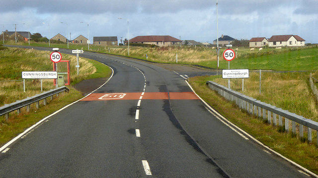
Cunningsburgh

Cunningsburgh, formerly also known as Coningsburgh (Old Norse: Konungsborgr meaning "King's castle"), is a new hamlet and ancient parish in the south of...

Nearby Amenities

Located within 500m of 60.029076,-1.2466512
Hoo Field
Corbett: no
Ele: 247
Graham: no
Marilyn: no
Munro: no
Natural: peak
Lat/Long: 60.0313733/-1.2472018
Power: pole
Lat/Long: 60.0268675/-1.2389955
Power: pole
Lat/Long: 60.0277171/-1.2385958
Power: pole
Lat/Long: 60.0285425/-1.2382016
Power: pole
Lat/Long: 60.029459/-1.237767
The data included in this document is from www.openstreetmap.org. The data is made available under ODbL.

Have you been to Turri Field?

Leave your review of Turri Field below (or comments, questions and feedback).