Blenheim Park
Downs, Moorland in Oxfordshire West Oxfordshire
England
Blenheim Park
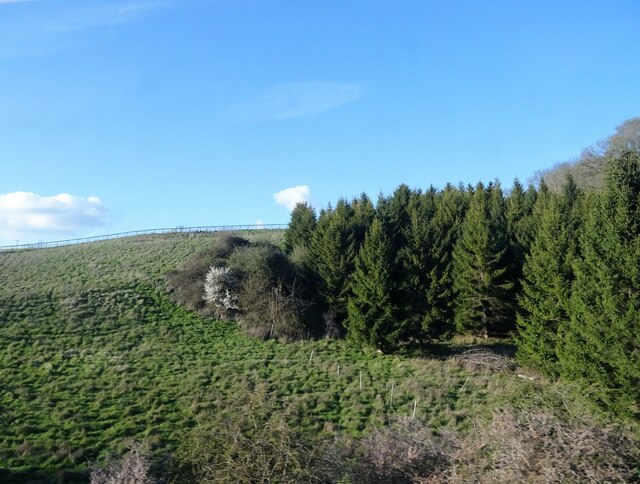
Blenheim Park is a picturesque estate located in Oxfordshire, England. Spanning over 2,000 acres, the park is a combination of downs and moorland, offering visitors a diverse and captivating landscape to explore. The park is situated within the larger Blenheim Palace estate, a UNESCO World Heritage Site, and is open to the public throughout the year.
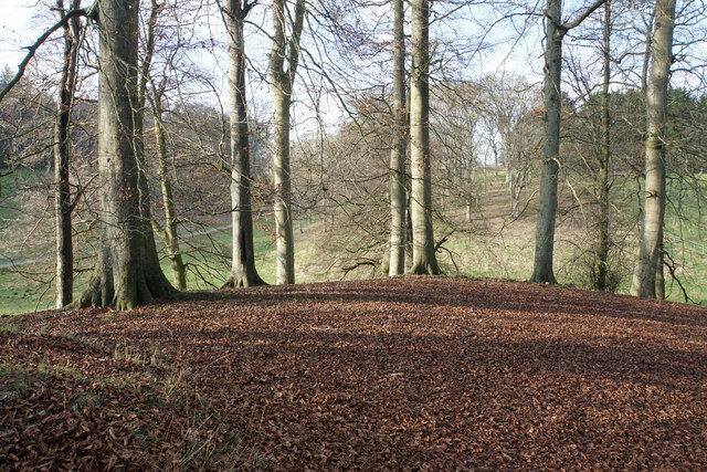
The downs of Blenheim Park are characterized by rolling hills covered in lush grasses and scattered with ancient oak trees. Walking paths wind through the downs, providing visitors with breathtaking views of the surrounding countryside. The open expanse of the downs creates a sense of tranquility and offers a perfect setting for outdoor activities such as picnicking, kite flying, and nature walks.
In contrast, the moorland areas of Blenheim Park feature heather-covered hills and small ponds. This unique landscape provides a habitat for a variety of wildlife, including birds, insects, and small mammals. Nature enthusiasts can spot rare species of birds and observe the flora and fauna that thrive in this diverse ecosystem.
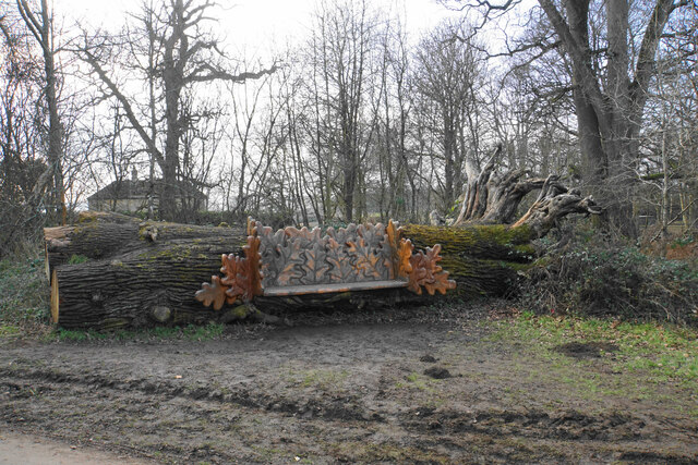
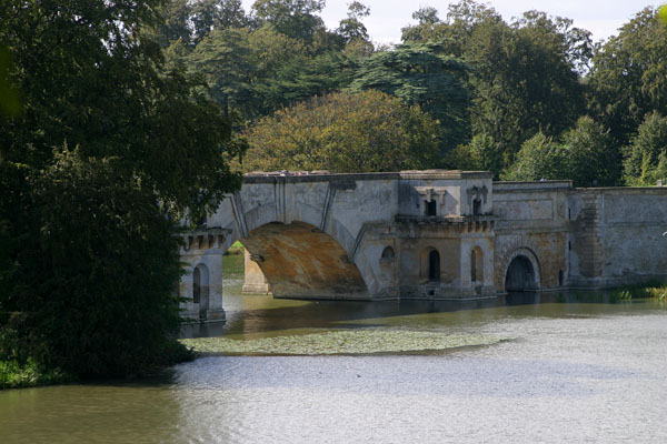
Blenheim Park also houses a number of historical landmarks, such as the Column of Victory, which commemorates the Duke of Marlborough's victory in the Battle of Blenheim. Additionally, the park is home to several man-made lakes, including the Great Lake, which offers opportunities for boating and fishing.
Overall, Blenheim Park in Oxfordshire offers a captivating blend of downs and moorland landscapes, providing visitors with a scenic and peaceful retreat. Whether one seeks a leisurely stroll, a wildlife adventure, or a glimpse into history, this park offers something for everyone to enjoy.
If you have any feedback on the listing, please let us know in the comments section below.
Blenheim Park Images
Images are sourced within 2km of 51.848311/-1.3912201 or Grid Reference SP4216. Thanks to Geograph Open Source API. All images are credited.


Blenheim Park is located at Grid Ref: SP4216 (Lat: 51.848311, Lng: -1.3912201)
Administrative County: Oxfordshire
District: West Oxfordshire
Police Authority: Thames Valley
What 3 Words
///homecare.brick.printer. Near Woodstock, Oxfordshire
Nearby Locations
Related Wikis

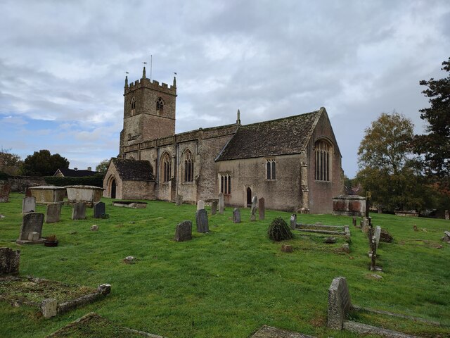
St Laurence's Church, Combe Longa
St Laurence's Church, Combe Longa is the Church of England parish church of Combe, Oxfordshire, England. The parish is part of the Benefice of Stonesfield...
Combe, Oxfordshire
Combe is a village and civil parish about 5 miles (8 km) northeast of Witney in Oxfordshire. It is bounded to the south and southwest by the River Evenlode...

Combe Mill
Combe Mill is a historic sawmill adjacent to the River Evenlode and close to Combe railway station, between the villages of Combe and Long Hanborough in...

Combe railway station
Combe railway station serves the village of Combe in Oxfordshire, England. It is on the Cotswold Line. This station and all trains serving it are run by...

Woodstock Palace
Woodstock Palace was a royal residence in the English town of Woodstock, Oxfordshire.Henry I of England built a hunting lodge here and in 1129 he built...

Blenheim Park
Blenheim Park is a 224.3-hectare (554-acre) biological Site of Special Scientific Interest on the outskirts of Woodstock in Oxfordshire. It occupies most...

Blenheim, Oxfordshire
Blenheim is a civil parish in West Oxfordshire, England, about 7 miles (11 km) north of Oxford. At its edge is Blenheim Palace, which is the birthplace...

Blenheim Palace
Blenheim Palace ( BLEN-im) is a country house in Woodstock, Oxfordshire, England. It is the seat of the Dukes of Marlborough and the only non-royal, non...
Nearby Amenities
Located within 500m of 51.848311,-1.3912201Have you been to Blenheim Park?
Leave your review of Blenheim Park below (or comments, questions and feedback).