Sands of Mail

Beach in Shetland

Scotland

Sands of Mail

Mail Burial Ground Adjacent to the sea as is usual on Scottish islands.
Mail Burial Ground Credit: Oliver Dixon

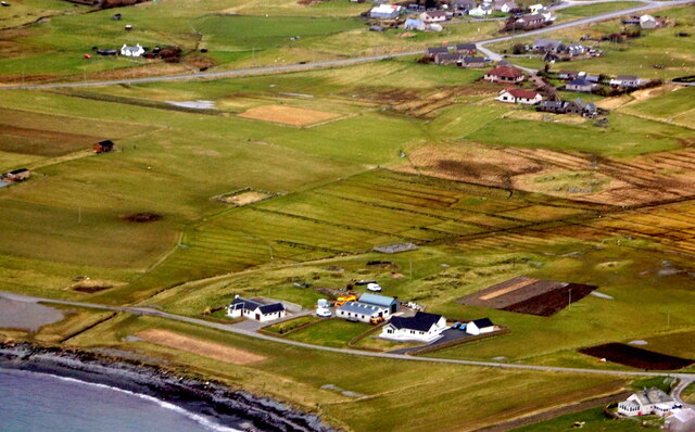
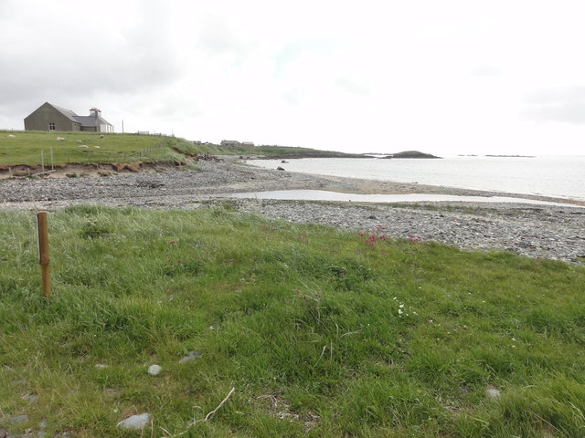
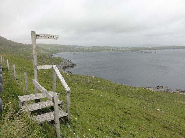
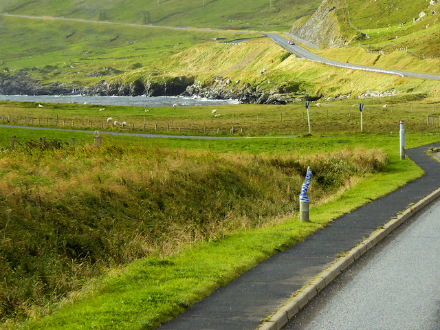
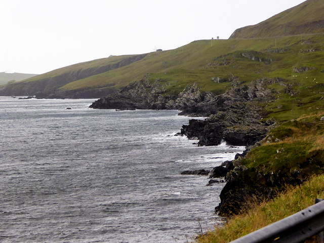
Sands of Mail is a picturesque beach located on the island of Shetland, Scotland. Known for its stunning natural beauty and pristine white sands, it is a popular destination among locals and tourists alike.

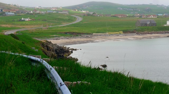
Situated on the west coast of Shetland, Sands of Mail offers breathtaking views of the Atlantic Ocean. The beach stretches over a mile long, providing ample space for visitors to enjoy a leisurely stroll or simply relax and soak in the peaceful surroundings. The sand is soft and powdery, perfect for sunbathing or building sandcastles.

The crystal-clear waters of Sands of Mail are also a big draw for visitors. The beach is known for its calm and shallow waters, making it ideal for swimming, particularly for families with young children. It is also a favored spot for snorkeling and diving enthusiasts, as the underwater world here is teeming with marine life and vibrant coral reefs.

Nature lovers will appreciate the rich biodiversity found in and around Sands of Mail. The beach is home to various seabird species, including puffins and terns, making it a popular spot for birdwatching. In addition, the surrounding dunes and grassy areas provide habitats for a variety of plant species, adding to the overall beauty of the landscape.

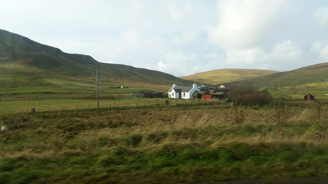
Facilities at Sands of Mail are limited, with no permanent structures or lifeguards present. However, there is a small car park available nearby, providing easy access to the beach. Visitors are advised to bring their own food, water, and other essentials as there are no amenities in the immediate vicinity.

Overall, Sands of Mail is a hidden gem on the island of Shetland, offering visitors a peaceful and scenic retreat surrounded by natural wonders. Whether it's enjoying a picnic on the soft sands, exploring the underwater world, or simply taking in the stunning views, Sands of Mail is a must-visit destination for nature enthusiasts and beach lovers.

If you have any feedback on the listing, please let us know in the comments section below.

Sands of Mail Images

Images are sourced within 2km of 60.033474/-1.2323553 or Grid Reference HU4227. Thanks to Geograph Open Source API. All images are credited.

Mail Burial Ground Adjacent to the sea as is usual on Scottish islands.
Mail Burial Ground
Adjacent to the sea as is usual on Scottish islands.
South Voxter, Cunningsburgh, from the air
Mail, Cunningsburgh, from the air
View to Mousa Just about showing Mousa's famous Broch, towards the right hand end of the island.
View to Mousa
Just about showing Mousa's famous Broch, towards the right hand end of the island.
North from the Viewpoint There is a lay by here for looking across to Mousa, and this scene northwards.
Not much dry land in HU4326, what this square's mostly about is views to somewhere else.
North from the Viewpoint
There is a lay by here for looking across to Mousa, and this scene northwards. Not much dry land in HU4326, what this square's mostly about is views to somewhere else.
Shoreline with joining stream Small sandy pebble beach with joining stream to the sea
Shoreline with joining stream
Small sandy pebble beach with joining stream to the sea
Road bridge Road bridge buttress as it passes over the stream. It should have been the location of an Ordnance Survey OSBM Bolt, which seems to have been destroyed in the rebuilding of the road.
Road bridge
Road bridge buttress as it passes over the stream. It should have been the location of an Ordnance Survey OSBM Bolt, which seems to have been destroyed in the rebuilding of the road.
Coastal Walk View out to sea and the Coastal Walk stile
Coastal Walk
View out to sea and the Coastal Walk stile
House under renovation, Cunningsburgh
Vadsgarth, Cunningsburgh
Small beach at the Sands of Mail The road is the A970 approaching Cunningsburgh.
Small beach at the Sands of Mail
The road is the A970 approaching Cunningsburgh.
A970 at Cunningsburgh Cunningsburgh, formerly also known as Coningsburgh (from the Old Norse: Konungsborgr meaning "King's castle"), is a hamlet on the coast of Mainland Shetland, nine miles south-west of Lerwick, about halfway between there and Sumburgh Head.
A970 at Cunningsburgh
Cunningsburgh, formerly also known as Coningsburgh (from the Old Norse: Konungsborgr meaning "King's castle"), is a hamlet on the coast of Mainland Shetland, nine miles south-west of Lerwick, about halfway between there and Sumburgh Head.
Bus Stop at Cunningsburgh Bus stop outside Cunningsburgh Primary School.
Bus Stop at Cunningsburgh
Bus stop outside Cunningsburgh Primary School.
Bus Stop on the A970 at Cunningsburgh Cunningsburgh, formerly also known as Coningsburgh (from the Old Norse: Konungsborgr meaning "King's castle"), is a hamlet on the coast of Mainland Shetland, nine miles south-west of Lerwick, about halfway between there and Sumburgh Head.
Bus Stop on the A970 at Cunningsburgh
Cunningsburgh, formerly also known as Coningsburgh (from the Old Norse: Konungsborgr meaning "King's castle"), is a hamlet on the coast of Mainland Shetland, nine miles south-west of Lerwick, about halfway between there and Sumburgh Head.
Bus Stop at Cunningsburgh Cunningsburgh, formerly also known as Coningsburgh (from the Old Norse: Konungsborgr meaning "King's castle"), is a hamlet on the coast of Mainland Shetland, nine miles south-west of Lerwick, about halfway between there and Sumburgh Head.
Bus Stop at Cunningsburgh
Cunningsburgh, formerly also known as Coningsburgh (from the Old Norse: Konungsborgr meaning "King's castle"), is a hamlet on the coast of Mainland Shetland, nine miles south-west of Lerwick, about halfway between there and Sumburgh Head.
Coastal Sheep Farm near Mail
Cunningsburgh, A970 Cunningsburgh, formerly also known as Coningsburgh (from the Old Norse: Konungsborgr meaning "King's castle"), is a hamlet on the coast of Mainland Shetland, nine miles south-west of Lerwick, about halfway between there and Sumburgh Head.
Cunningsburgh, A970
Cunningsburgh, formerly also known as Coningsburgh (from the Old Norse: Konungsborgr meaning "King's castle"), is a hamlet on the coast of Mainland Shetland, nine miles south-west of Lerwick, about halfway between there and Sumburgh Head.
Rocky Shoreline near Mail
Show me another place!

Sands of Mail is located at Grid Ref: HU4227 (Lat: 60.033474, Lng: -1.2323553)

Unitary Authority: Shetland Islands

Police Authority: Highlands and Islands

What 3 Words

///flagged.completed.activism. Near Sandwick, Shetland Islands

Related Wikis

Mail, Shetland

Mail is a hamlet on the island of Mainland, in the Shetland Islands, Scotland. == Geography == Mail is located on the south-eastern side of the island...

Catpund

Catpund is a quarry site in Shetland, Scotland, where steatite vessels were cut from the rock from prehistory onwards. The quarrying marks are still visible...

Bremirehoull

Bremirehoull is a settlement on the island of Mainland, in Shetland, Scotland. Bremirehoull is situated on the A970 in the Cunningsburgh area. == References... ==

Cunningsburgh

Cunningsburgh, formerly also known as Coningsburgh (Old Norse: Konungsborgr meaning "King's castle"), is a new hamlet and ancient parish in the south of...

Aithsetter

Aithsetter (Old Norse: Eiðseti, meaning "the farm at the isthmus") is a village on the island of Mainland, in Shetland, Scotland. Aithsetter is in the...

Sandwick, Dunrossness

see also Sandwick, Whalsay and Sandwick, OrkneySandwick (Old Norse: Sandvik "Sandy Bay") is a village and an ancient parish in the Shetland Islands, Scotland...

South Mainland

The South Mainland of the Shetland Islands is the southern peninsula of Mainland island. It lies south of Hellister (60° 14′N). The greater southern part...

Hoswick

Hoswick is a settlement in Sandwick in the south mainland of Shetland, Scotland, on the eastern part of the Dunrossness civil parish. It is separated from...

Nearby Amenities

Located within 500m of 60.033474,-1.2323553
Mail
Place: hamlet
Wikidata: Q6735662
Wikipedia: en:Mail, Shetland
Lat/Long: 60.0349959/-1.2280637
Parking
Parking: surface
Lat/Long: 60.0298572/-1.2349558
Power: pole
Lat/Long: 60.0350783/-1.2242599
Bus Stop
Bus: yes
Naptan AtcoCode: 6030122
Naptan NaptanCode: 45823937
Public Transport: platform
Shelter: yes
Lat/Long: 60.0355822/-1.2318474
Power: pole
Lat/Long: 60.0302335/-1.2373889
Power: pole
Lat/Long: 60.0311392/-1.2369356
Power: pole
Lat/Long: 60.0318962/-1.2370911
Power: pole
Lat/Long: 60.0326036/-1.2372521
Power: pole
Lat/Long: 60.0334048/-1.2374264
Power: pole
Lat/Long: 60.0340439/-1.2375686
Power: pole
Lat/Long: 60.0348785/-1.2377644
Power: pole
Lat/Long: 60.035835/-1.2379494
Power: pole
Lat/Long: 60.0365892/-1.2374023
Power: pole
Lat/Long: 60.0372523/-1.2369436
Power: pole
Lat/Long: 60.0345857/-1.2324454
Power: pole
Lat/Long: 60.0344987/-1.2336256
Power: pole
Lat/Long: 60.0346648/-1.2311365
Power: pole
Lat/Long: 60.0348272/-1.2284623
Passing Place
Lat/Long: 60.0347694/-1.2270713
Power: pole
Lat/Long: 60.0347432/-1.2298678
Street Lamp
Lat/Long: 60.0356953/-1.2313645
Street Lamp
Lat/Long: 60.0359398/-1.2310909
Power: pole
Lat/Long: 60.0349036/-1.2272298
Power: pole
Lat/Long: 60.0349843/-1.2259813
Street Lamp
Lat/Long: 60.0366719/-1.2303774
Street Lamp
Lat/Long: 60.0364228/-1.2306054
Street Lamp
Lat/Long: 60.036195/-1.2308428
Street Lamp
Lat/Long: 60.0369311/-1.2301602
Street Lamp
Lat/Long: 60.0372004/-1.2299657
Street Lamp
Lat/Long: 60.0374442/-1.2298182
Street Lamp
Lat/Long: 60.0377081/-1.2296787
Mail War Memorial
Historic: memorial
Wikidata: Q107612875
Lat/Long: 60.0339463/-1.2257418
Power: pole
Lat/Long: 60.0375852/-1.2302564
Power: pole
Lat/Long: 60.0371207/-1.2311147
Power: pole
Lat/Long: 60.0345596/-1.2273717
Power: pole
Lat/Long: 60.0343064/-1.2270076
Power: pole
Lat/Long: 60.0295218/-1.2363759
Power: pole
Lat/Long: 60.0300838/-1.2359948
Power: pole
Lat/Long: 60.0306111/-1.2356552
Power: pole
Lat/Long: 60.031315/-1.2354889
Power: pole
Lat/Long: 60.0315181/-1.2354473
Power: pole
Lat/Long: 60.032402/-1.2352486
Power: pole
Lat/Long: 60.033032/-1.23511
Power: pole
Lat/Long: 60.0337554/-1.2349553
Power: pole
Lat/Long: 60.0344408/-1.234782
Power: pole
Lat/Long: 60.0348111/-1.2347081
Power: pole
Lat/Long: 60.0352449/-1.234618
Power: pole
Lat/Long: 60.0356741/-1.2338118
Power: pole
Lat/Long: 60.036191/-1.2328439
Power: pole
Lat/Long: 60.0365337/-1.232211
The data included in this document is from www.openstreetmap.org. The data is made available under ODbL.

Have you been to Sands of Mail?

Leave your review of Sands of Mail below (or comments, questions and feedback).