Red Stane

Cliff, Slope in Shetland

Scotland

Red Stane

Mail Burial Ground Adjacent to the sea as is usual on Scottish islands.
Mail Burial Ground Credit: Oliver Dixon

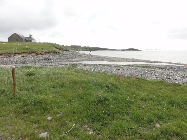
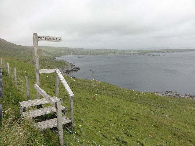
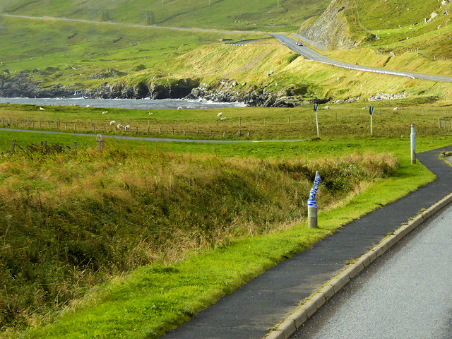
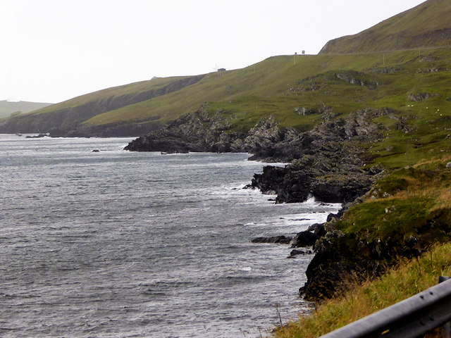
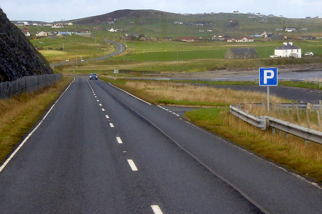
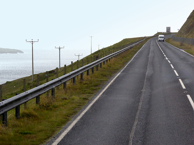
Red Stane is a prominent geological feature located on the northeastern coast of Shetland, an archipelago in Scotland. It is a cliff composed predominantly of red sandstone, hence the name. The cliff face stretches for approximately 200 meters, towering above the North Sea.

The formation of Red Stane dates back millions of years to the Devonian period, when sedimentary rocks were deposited in a shallow marine environment. Over time, the layers of sand and mud compacted and solidified, forming the distinctive red sandstone seen today.

The cliff exhibits striking geological characteristics, including horizontal bedding planes that are clearly visible. These bedding planes were formed when the sediment layers were deposited horizontally and subsequent tectonic forces caused them to tilt. The reddish hue of the sandstone is a result of iron oxide minerals present in the rock.

Red Stane is not only visually impressive but also provides a habitat for various bird species, including fulmars, kittiwakes, and puffins. The cliff face provides nesting sites and protection from predators. The surrounding area is also home to a diverse range of flora and fauna, making it a popular spot for nature enthusiasts and photographers.

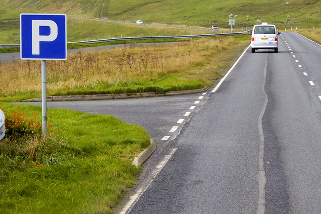
Visitors can access Red Stane via a footpath that winds along the coastline, offering breathtaking views of the rugged cliffs and the crashing waves below. However, caution is advised as the cliffs can be unstable, and it is important to adhere to safety guidelines and stay away from the cliff edge.

If you have any feedback on the listing, please let us know in the comments section below.
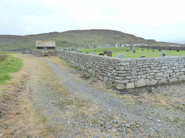
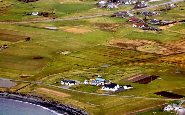
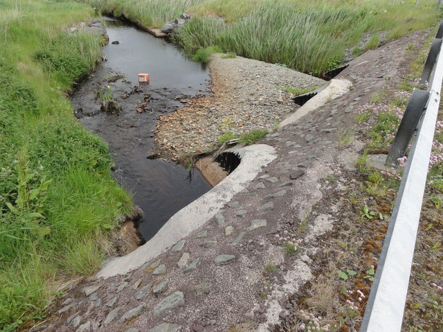
Red Stane Images

Images are sourced within 2km of 60.02768/-1.2334586 or Grid Reference HU4227. Thanks to Geograph Open Source API. All images are credited.

Mail Burial Ground Adjacent to the sea as is usual on Scottish islands.
Mail Burial Ground
Adjacent to the sea as is usual on Scottish islands.
South Voxter, Cunningsburgh, from the air
Mail, Cunningsburgh, from the air
View to Mousa Just about showing Mousa's famous Broch, towards the right hand end of the island.
View to Mousa
Just about showing Mousa's famous Broch, towards the right hand end of the island.
North from the Viewpoint There is a lay by here for looking across to Mousa, and this scene northwards.
Not much dry land in HU4326, what this square's mostly about is views to somewhere else.
North from the Viewpoint
There is a lay by here for looking across to Mousa, and this scene northwards. Not much dry land in HU4326, what this square's mostly about is views to somewhere else.
Shoreline with joining stream Small sandy pebble beach with joining stream to the sea
Shoreline with joining stream
Small sandy pebble beach with joining stream to the sea
Road bridge Road bridge buttress as it passes over the stream. It should have been the location of an Ordnance Survey OSBM Bolt, which seems to have been destroyed in the rebuilding of the road.
Road bridge
Road bridge buttress as it passes over the stream. It should have been the location of an Ordnance Survey OSBM Bolt, which seems to have been destroyed in the rebuilding of the road.
Coastal Walk View out to sea and the Coastal Walk stile
Coastal Walk
View out to sea and the Coastal Walk stile
House under renovation, Cunningsburgh
Vadsgarth, Cunningsburgh
Small beach at the Sands of Mail The road is the A970 approaching Cunningsburgh.
Small beach at the Sands of Mail
The road is the A970 approaching Cunningsburgh.
Bus Stop at Cunningsburgh Cunningsburgh, formerly also known as Coningsburgh (from the Old Norse: Konungsborgr meaning "King's castle"), is a hamlet on the coast of Mainland Shetland, nine miles south-west of Lerwick, about halfway between there and Sumburgh Head.
Bus Stop at Cunningsburgh
Cunningsburgh, formerly also known as Coningsburgh (from the Old Norse: Konungsborgr meaning "King's castle"), is a hamlet on the coast of Mainland Shetland, nine miles south-west of Lerwick, about halfway between there and Sumburgh Head.
Coastal Sheep Farm near Mail
Cunningsburgh, A970 Cunningsburgh, formerly also known as Coningsburgh (from the Old Norse: Konungsborgr meaning "King's castle"), is a hamlet on the coast of Mainland Shetland, nine miles south-west of Lerwick, about halfway between there and Sumburgh Head.
Cunningsburgh, A970
Cunningsburgh, formerly also known as Coningsburgh (from the Old Norse: Konungsborgr meaning "King's castle"), is a hamlet on the coast of Mainland Shetland, nine miles south-west of Lerwick, about halfway between there and Sumburgh Head.
Rocky Shoreline near Mail
Southbound A970, Layby near Mail The A970 runs for 71 miles across most of the length of the "Mainland" in the Shetland Islands. It is a good-quality single-carriageway road for most of its route. Travelling from south to north, the road begins at Grutness near Sumburgh Airport and winds around the many hills and inlets passing close to a number of small villages without going through any large ones before Lerwick. After looping around Lerwick, a short spur runs to Scalloway whilst the main route continues northwards towards Brae where it crosses the narrow isthmus of Mavis Grind. At Sandy Lochs the road splits and a four-mile spur goes through Urafirth to Hillswick. The main route continuing to the right towards its northern terminus at Isbister. This last part of the route tends to be narrower with passing places.

<span class="nowrap"><a title="https://www.sabre-roads.org.uk/wiki/index.php?title=A970" rel="nofollow ugc noopener" href="https://www.sabre-roads.org.uk/wiki/index.php?title=A970">Link</a><img style="margin-left:2px;" alt="External link" title="External link - shift click to open in new window" src="https://s1.geograph.org.uk/img/external.png" width="10" height="10"/></span>  SABRE
Southbound A970, Layby near Mail
The A970 runs for 71 miles across most of the length of the "Mainland" in the Shetland Islands. It is a good-quality single-carriageway road for most of its route. Travelling from south to north, the road begins at Grutness near Sumburgh Airport and winds around the many hills and inlets passing close to a number of small villages without going through any large ones before Lerwick. After looping around Lerwick, a short spur runs to Scalloway whilst the main route continues northwards towards Brae where it crosses the narrow isthmus of Mavis Grind. At Sandy Lochs the road splits and a four-mile spur goes through Urafirth to Hillswick. The main route continuing to the right towards its northern terminus at Isbister. This last part of the route tends to be narrower with passing places. LinkExternal link SABRE
Layby and Viewpoint on the A970 near Mail The A970 runs for 71 miles across most of the length of the "Mainland" in the Shetland Islands. It is a good-quality single-carriageway road for most of its route. Travelling from south to north, the road begins at Grutness near Sumburgh Airport and winds around the many hills and inlets passing close to a number of small villages without going through any large ones before Lerwick. After looping around Lerwick, a short spur runs to Scalloway whilst the main route continues northwards towards Brae where it crosses the narrow isthmus of Mavis Grind. At Sandy Lochs the road splits and a four-mile spur goes through Urafirth to Hillswick. The main route continuing to the right towards its northern terminus at Isbister. This last part of the route tends to be narrower with passing places.

<span class="nowrap"><a title="https://www.sabre-roads.org.uk/wiki/index.php?title=A970" rel="nofollow ugc noopener" href="https://www.sabre-roads.org.uk/wiki/index.php?title=A970">Link</a><img style="margin-left:2px;" alt="External link" title="External link - shift click to open in new window" src="https://s1.geograph.org.uk/img/external.png" width="10" height="10"/></span>  SABRE
Layby and Viewpoint on the A970 near Mail
The A970 runs for 71 miles across most of the length of the "Mainland" in the Shetland Islands. It is a good-quality single-carriageway road for most of its route. Travelling from south to north, the road begins at Grutness near Sumburgh Airport and winds around the many hills and inlets passing close to a number of small villages without going through any large ones before Lerwick. After looping around Lerwick, a short spur runs to Scalloway whilst the main route continues northwards towards Brae where it crosses the narrow isthmus of Mavis Grind. At Sandy Lochs the road splits and a four-mile spur goes through Urafirth to Hillswick. The main route continuing to the right towards its northern terminus at Isbister. This last part of the route tends to be narrower with passing places. LinkExternal link SABRE
Southbound A970 The A970 runs for 71 miles across most of the length of the "Mainland" in the Shetland Islands. It is a good-quality single-carriageway road for most of its route. Travelling from south to north, the road begins at Grutness near Sumburgh Airport and winds around the many hills and inlets passing close to a number of small villages without going through any large ones before Lerwick. After looping around Lerwick, a short spur runs to Scalloway whilst the main route continues northwards towards Brae where it crosses the narrow isthmus of Mavis Grind. At Sandy Lochs the road splits and a four-mile spur goes through Urafirth to Hillswick. The main route continuing to the right towards its northern terminus at Isbister. This last part of the route tends to be narrower with passing places.

<span class="nowrap"><a title="https://www.sabre-roads.org.uk/wiki/index.php?title=A970" rel="nofollow ugc noopener" href="https://www.sabre-roads.org.uk/wiki/index.php?title=A970">Link</a><img style="margin-left:2px;" alt="External link" title="External link - shift click to open in new window" src="https://s1.geograph.org.uk/img/external.png" width="10" height="10"/></span>  SABRE
Southbound A970
The A970 runs for 71 miles across most of the length of the "Mainland" in the Shetland Islands. It is a good-quality single-carriageway road for most of its route. Travelling from south to north, the road begins at Grutness near Sumburgh Airport and winds around the many hills and inlets passing close to a number of small villages without going through any large ones before Lerwick. After looping around Lerwick, a short spur runs to Scalloway whilst the main route continues northwards towards Brae where it crosses the narrow isthmus of Mavis Grind. At Sandy Lochs the road splits and a four-mile spur goes through Urafirth to Hillswick. The main route continuing to the right towards its northern terminus at Isbister. This last part of the route tends to be narrower with passing places. LinkExternal link SABRE
Show me another place!

Red Stane is located at Grid Ref: HU4227 (Lat: 60.02768, Lng: -1.2334586)

Unitary Authority: Shetland Islands

Police Authority: Highlands and Islands

What 3 Words

///reframe.endings.scrubber. Near Sandwick, Shetland Islands

Related Wikis

Catpund

Catpund is a quarry site in Shetland, Scotland, where steatite vessels were cut from the rock from prehistory onwards. The quarrying marks are still visible...

Mail, Shetland

Mail is a hamlet on the island of Mainland, in the Shetland Islands, Scotland. == Geography == Mail is located on the south-eastern side of the island...

Bremirehoull

Bremirehoull is a settlement on the island of Mainland, in Shetland, Scotland. Bremirehoull is situated on the A970 in the Cunningsburgh area. == References... ==
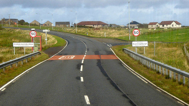
Cunningsburgh

Cunningsburgh, formerly also known as Coningsburgh (Old Norse: Konungsborgr meaning "King's castle"), is a new hamlet and ancient parish in the south of...

Sandwick, Dunrossness

see also Sandwick, Whalsay and Sandwick, OrkneySandwick (Old Norse: Sandvik "Sandy Bay") is a village and an ancient parish in the Shetland Islands, Scotland...

Hoswick

Hoswick is a settlement in Sandwick in the south mainland of Shetland, Scotland, on the eastern part of the Dunrossness civil parish. It is separated from...

Aithsetter

Aithsetter (Old Norse: EiĆ°seti, meaning "the farm at the isthmus") is a village on the island of Mainland, in Shetland, Scotland. Aithsetter is in the...

Broch of Mousa

Broch of Mousa (or Mousa Broch) is a preserved Iron Age broch or round tower. It is on the island of Mousa in Shetland, Scotland. It is the tallest broch...

Nearby Amenities

Located within 500m of 60.02768,-1.2334586
Parking
Parking: surface
Lat/Long: 60.0298572/-1.2349558
Power: pole
Lat/Long: 60.0261854/-1.238856
Power: pole
Lat/Long: 60.0255891/-1.2381962
Power: pole
Lat/Long: 60.0250089/-1.2376329
Power: pole
Lat/Long: 60.0246015/-1.2371823
Power: pole
Lat/Long: 60.0240567/-1.2369007
Power: pole
Lat/Long: 60.0239823/-1.237869
Power: pole
Lat/Long: 60.0245264/-1.2382954
Power: pole
Lat/Long: 60.0252903/-1.2388319
Power: pole
Lat/Long: 60.0260447/-1.2393898
Power: pole
Lat/Long: 60.0268675/-1.2389955
Power: pole
Lat/Long: 60.0277171/-1.2385958
Power: pole
Lat/Long: 60.0285425/-1.2382016
Power: pole
Lat/Long: 60.029459/-1.237767
Power: pole
Lat/Long: 60.0302335/-1.2373889
Power: pole
Lat/Long: 60.0311392/-1.2369356
Power: pole
Lat/Long: 60.0268203/-1.2383833
Power: pole
Lat/Long: 60.0273108/-1.2379975
Power: pole
Lat/Long: 60.0279409/-1.2375101
Power: pole
Lat/Long: 60.0285467/-1.237055
Power: pole
Lat/Long: 60.0292114/-1.2365861
Power: pole
Lat/Long: 60.0295218/-1.2363759
Power: pole
Lat/Long: 60.0300838/-1.2359948
Power: pole
Lat/Long: 60.0306111/-1.2356552
Power: pole
Lat/Long: 60.031315/-1.2354889
Power: pole
Lat/Long: 60.0315181/-1.2354473
The data included in this document is from www.openstreetmap.org. The data is made available under ODbL.

Have you been to Red Stane?

Leave your review of Red Stane below (or comments, questions and feedback).