Netherton Moor

Downs, Moorland in Yorkshire

England

Netherton Moor

Armitage Bridge The actual bridge which gives the area its name.
Armitage Bridge Credit: John Illingworth

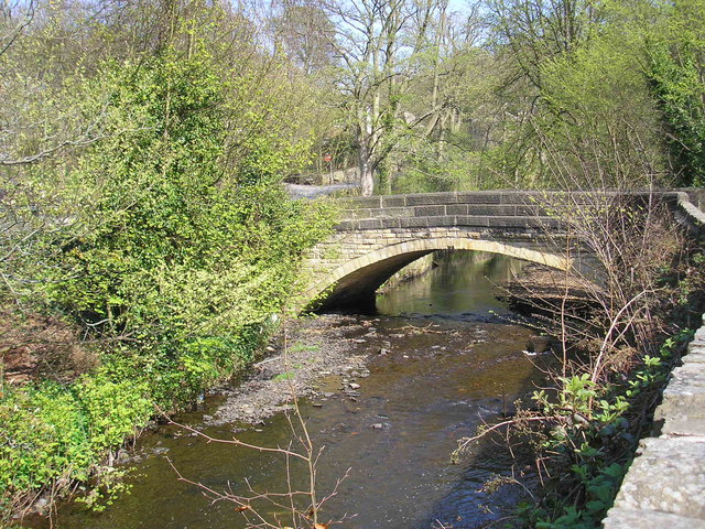
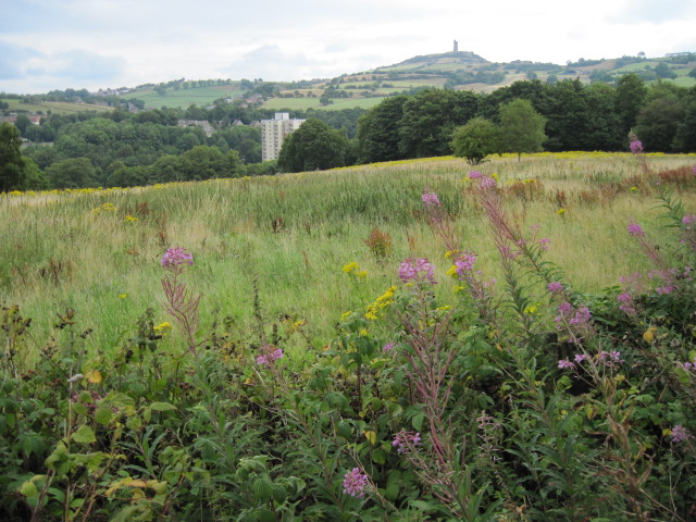
Netherton Moor is a picturesque expanse of moorland located in Yorkshire, England. Stretching across vast rolling hills and rugged terrain, it offers visitors a glimpse into the natural beauty of the region. Situated in the heart of the Yorkshire Dales, Netherton Moor is renowned for its stunning panoramic views, making it a popular destination for nature enthusiasts and hikers alike.

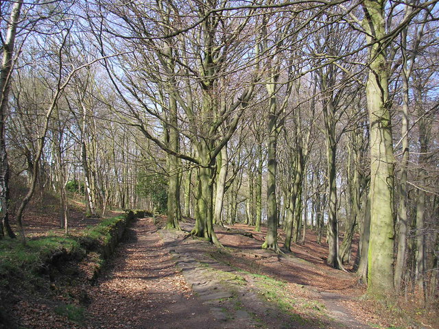
The moorland is characterized by its unique ecosystem, featuring heather-covered hillsides, scattered with patches of bracken and gorse. The vibrant purple hues of the heather create a captivating landscape during the summer months, attracting photographers and artists seeking inspiration. Additionally, the area is home to a diverse array of wildlife, including grouse, curlews, and skylarks, making it a haven for birdwatchers.

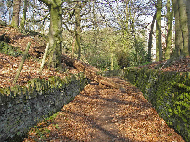
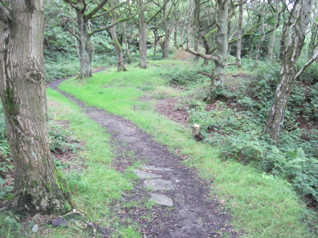
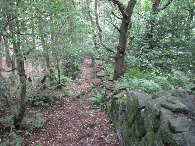
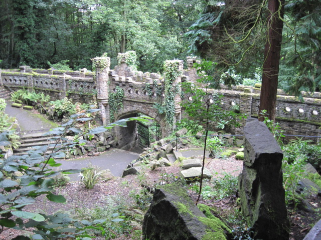
Netherton Moor offers numerous walking trails and footpaths, allowing visitors to explore the area at their own pace. The well-maintained paths guide hikers through the moorland, leading them to hidden waterfalls, ancient stone circles, and abandoned mine workings, adding a sense of intrigue to the experience. The rugged terrain also provides opportunities for more adventurous activities such as mountain biking and horseback riding.

For those seeking a peaceful retreat, Netherton Moor offers a tranquil setting, away from the hustle and bustle of city life. The vast open spaces and untouched landscapes provide a sense of solitude and serenity, allowing visitors to unwind and connect with nature.

Overall, Netherton Moor is a captivating destination that showcases the natural beauty of Yorkshire. With its breathtaking views, diverse wildlife, and opportunities for outdoor activities, it is a must-visit location for nature lovers and those looking to explore the region's rich natural heritage.

If you have any feedback on the listing, please let us know in the comments section below.

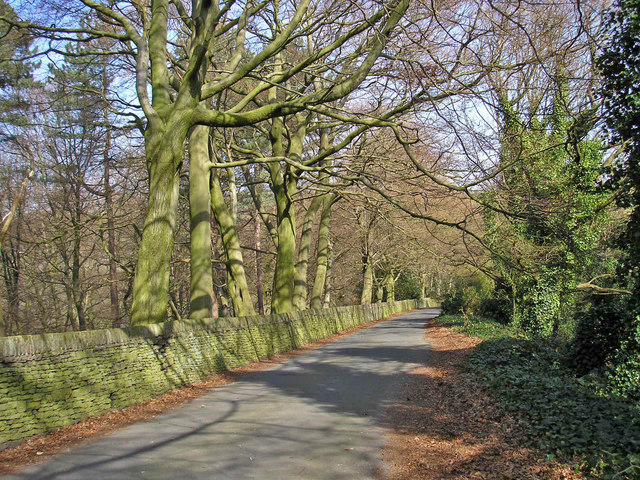
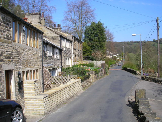
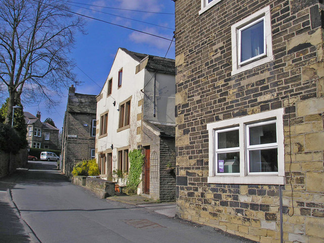
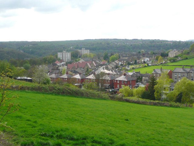
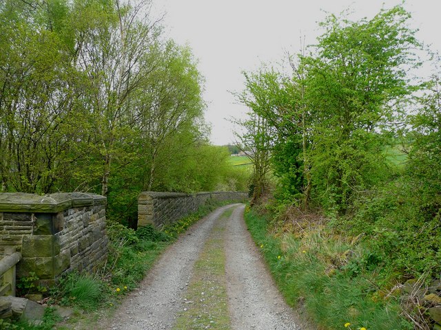
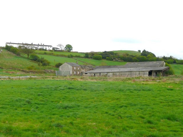
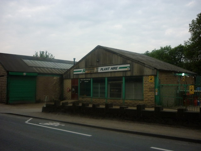
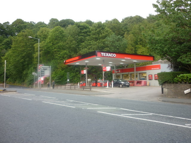
Netherton Moor Images

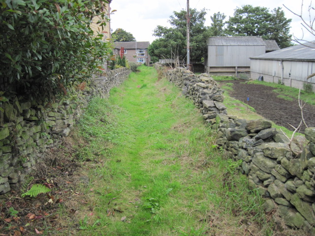
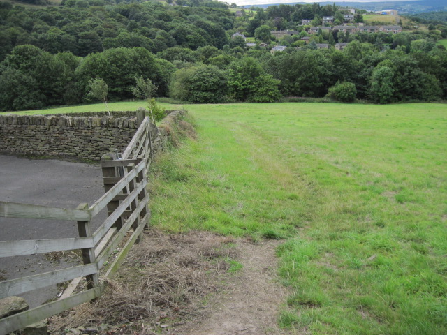
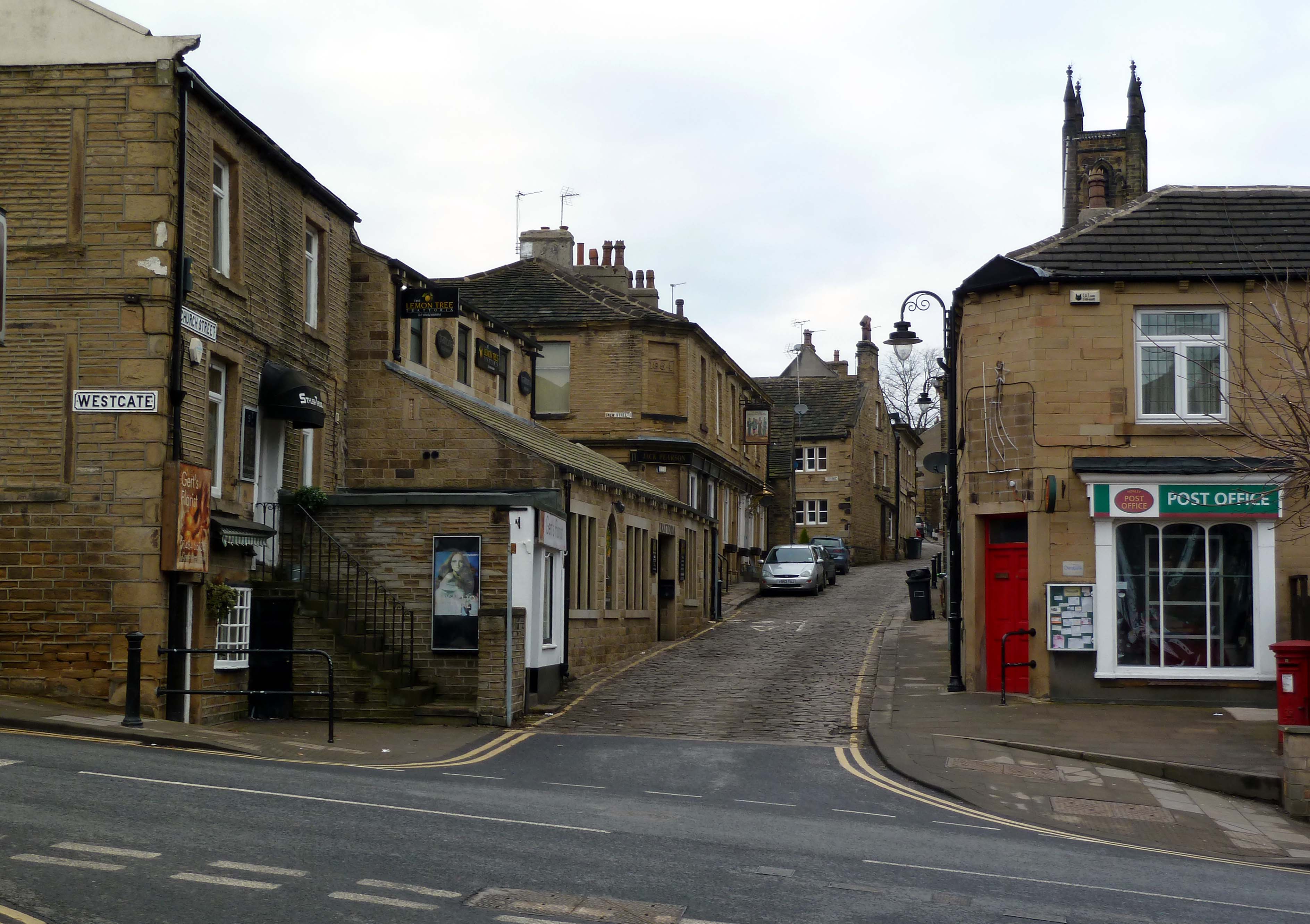
Images are sourced within 2km of 53.610797/-1.8013567 or Grid Reference SE1312. Thanks to Geograph Open Source API. All images are credited.

Armitage Bridge The actual bridge which gives the area its name.
Armitage Bridge
The actual bridge which gives the area its name.
Lane out of Armitage Bridge A walled lane leading into Mag Wood. A dead tree partly blocks the way.
Lane out of Armitage Bridge
A walled lane leading into Mag Wood. A dead tree partly blocks the way.
Mag Wood Woodland near Mag Dale on the Holme Valley Circular Walk.
Mag Wood
Woodland near Mag Dale on the Holme Valley Circular Walk.
Magdale Quiet Lane sign The Department for Transport guidance defines Quiet Lanes as "minor rural roads or networks of roads appropriate for shared use by walkers, cyclists, horse riders, and other vehicles."
Magdale Quiet Lane sign
The Department for Transport guidance defines Quiet Lanes as "minor rural roads or networks of roads appropriate for shared use by walkers, cyclists, horse riders, and other vehicles."
Road at Magdale An officially designated "quiet lane".
Road at Magdale
An officially designated "quiet lane".
Mag Dale A group of houses in Mag Dale. A row of mullioned windows on the top storey usually indicates a former weaver's cottage.
Mag Dale
A group of houses in Mag Dale. A row of mullioned windows on the top storey usually indicates a former weaver's cottage.
Church Street, Honley An interesting mix of buildings in the afternoon sun.
Church Street, Honley
An interesting mix of buildings in the afternoon sun.
View from Lady House Lane, Almondbury The Berry Brow primary and infants school can be seen in the distance, still in its 19C Huddersfield Board Elementary School buildings. In the middle, the houses are along Newsome Road South.
View from Lady House Lane, Almondbury
The Berry Brow primary and infants school can be seen in the distance, still in its 19C Huddersfield Board Elementary School buildings. In the middle, the houses are along Newsome Road South.
Cold Hill Lane, Almondbury The wall on the left surrounds an area that once contained a circular reservoir belonging to Huddersfield County Borough (maybe the structure is still in there).
Cold Hill Lane, Almondbury
The wall on the left surrounds an area that once contained a circular reservoir belonging to Huddersfield County Borough (maybe the structure is still in there).
Stirley Farm, Almondbury This farm looks disused, or at least the house is boarded up.
Stirley Farm, Almondbury
This farm looks disused, or at least the house is boarded up.
Rodgers Plant Hire, Honley
A Texaco garage on Huddersfield Road
Footpath in Dean Wood, Netherton
Footpath from Bourn View Road to Meltham Road
Lower Gate, Beaumont Park
Towards Berry Brow Flats and Castle Hill
Footpath towards Field End Lane
Footpath near High Royd Farm
Show me another place!

Netherton Moor is located at Grid Ref: SE1312 (Lat: 53.610797, Lng: -1.8013567)

Division: West Riding

Unitary Authority: Kirklees

Police Authority: West Yorkshire

What 3 Words

///edges.vague.broken. Near Meltham Mills, West Yorkshire

Related Wikis

Netherton, Kirklees

Netherton is a village, near Huddersfield, in the Kirklees metropolitan borough of West Yorkshire, England. It is 2 miles (3 km) south-west of the town...

Armitage Bridge

Armitage Bridge is a village approximately 3 miles (4.8 km) south of Huddersfield, in the Holme Valley, West Yorkshire, England. It is situated between...

Netherton railway station (Kirklees)

Netherton railway station served the village of Netherton, Kirklees, England, from 1869 to 1949 on the Meltham branch line. == History == The station was...

Honley

Honley is a village in the Holme Valley civil parish in Kirklees, West Yorkshire, England. Historically part of the West Riding of Yorkshire, it is situated...

Nearby Amenities

Located within 500m of 53.610797,-1.8013567
Bus Stop
Hawroyd Bank Road
Local Ref: 45021745
Naptan AtcoCode: 450021745
Naptan Bearing: N
Naptan CommonName: Hawroyd Bank Road
Naptan Crossing: Nr-At Moor Lane
Naptan Indicator: Stop 45021745
Naptan PlusbusZoneRef: LEEDS
Naptan ShortCommonName: Moor Lane
Naptan Street: Hawkroyd Bank Road
Naptan Verified: no
Source: naptan_import
Lat/Long: 53.6152062/-1.8004009
Bus Stop
Falconers Ride Hawkroyd Bank Road
Local Ref: 45021746
Naptan AtcoCode: 450021746
Naptan Bearing: NE
Naptan CommonName: Falconers Ride Hawkroyd Bank Road
Naptan Crossing: Hawkroyd Bank Road
Naptan Indicator: Stop 45021746
Naptan PlusbusZoneRef: LEEDS
Naptan ShortCommonName: Hawkroyd Bank Road
Naptan Street: Falconers Ride
Naptan Verified: no
Source: naptan_import
Lat/Long: 53.6140377/-1.8003913
Bus Stop
Falconers Ride Kingfisher Grove
Local Ref: 45021747
Naptan AtcoCode: 450021747
Naptan Bearing: NE
Naptan CommonName: Falconers Ride Kingfisher Grove
Naptan Crossing: Kingfisher Grove
Naptan Indicator: Stop 45021747
Naptan PlusbusZoneRef: LEEDS
Naptan ShortCommonName: Kingfisher Grove
Naptan Street: Falconers Ride
Naptan Verified: no
Source: naptan_import
Lat/Long: 53.6132781/-1.8030553
Bus Stop
Coppice Drive Lavender Court
Local Ref: 45021748
Naptan AtcoCode: 450021748
Naptan Bearing: NE
Naptan CommonName: Coppice Drive Lavender Court
Naptan Crossing: Lavender Court
Naptan Indicator: Stop 45021748
Naptan PlusbusZoneRef: LEEDS
Naptan ShortCommonName: Lavender Court
Naptan Street: Coppice Drive
Naptan Verified: no
Source: naptan_import
Lat/Long: 53.6120875/-1.8060537
Bus Stop
Coppice Drive Orchid Grove
Bus: yes
Local Ref: 45021750
Naptan AtcoCode: 450021750
Naptan Bearing: E
Naptan CommonName: Coppice Drive Orchid Grove
Naptan Crossing: Spruce Drive
Naptan Indicator: Stop 45021750
Naptan PlusbusZoneRef: LEEDS
Naptan ShortCommonName: Orchid Court
Naptan Street: Coppice Drive
Naptan Verified: no
Public Transport: platform
Source: naptan_import
Lat/Long: 53.6116214/-1.8080768
Sandbeds
Local Ref: 45024597
Naptan AtcoCode: 450024597
Naptan Bearing: E
Naptan BusStopType: CUS
Naptan CommonName: Sandbeds
Naptan Crossing: White Gate
Naptan Indicator: Stop 45024597
Naptan PlusbusZoneRef: LEEDS
Naptan ShortCommonName: White Gate
Naptan Street: Sandbeds
Naptan Verified: no
Source: naptan_import
Lat/Long: 53.6097485/-1.7944035
Post Box
Operator: Royal Mail
Lat/Long: 53.6143936/-1.7999429
Power: pole
Lat/Long: 53.6063845/-1.8000021
Power: pole
Lat/Long: 53.6072437/-1.7981593
Netherton Moor
Place: locality
Source: OS OD Streetview
Lat/Long: 53.6105988/-1.803506
Generator Method: photovoltaic
Generator Output Electricity: yes
Generator Source: solar
Generator Type: solar_photovoltaic_panel
Location: roof
Power: generator
Lat/Long: 53.6133376/-1.8003019
Generator Method: photovoltaic
Generator Output Electricity: yes
Generator Source: solar
Generator Type: solar_photovoltaic_panel
Location: roof
Power: generator
Lat/Long: 53.6134887/-1.8011763
Generator Method: photovoltaic
Generator Output Electricity: yes
Generator Source: solar
Generator Type: solar_photovoltaic_panel
Location: roof
Power: generator
Lat/Long: 53.6147282/-1.8032899
Generator Method: photovoltaic
Generator Output Electricity: yes
Generator Source: solar
Generator Type: solar_photovoltaic_panel
Location: roof
Power: generator
Lat/Long: 53.6145882/-1.8036842
Generator Method: photovoltaic
Generator Output Electricity: yes
Generator Source: solar
Generator Type: solar_photovoltaic_panel
Location: roof
Power: generator
Lat/Long: 53.6145389/-1.8038639
Generator Method: photovoltaic
Generator Output Electricity: yes
Generator Source: solar
Generator Type: solar_photovoltaic_panel
Location: roof
Power: generator
Lat/Long: 53.6150512/-1.8030056
Generator Method: photovoltaic
Generator Output Electricity: yes
Generator Source: solar
Generator Type: solar_photovoltaic_panel
Location: roof
Power: generator
Lat/Long: 53.6138929/-1.8047195
Generator Method: photovoltaic
Generator Output Electricity: yes
Generator Source: solar
Generator Type: solar_photovoltaic_panel
Location: roof
Power: generator
Lat/Long: 53.6130098/-1.8055081
Generator Method: photovoltaic
Generator Output Electricity: yes
Generator Source: solar
Generator Type: solar_photovoltaic_panel
Location: roof
Power: generator
Lat/Long: 53.6120965/-1.8055644
Generator Method: photovoltaic
Generator Output Electricity: yes
Generator Source: solar
Generator Type: solar_photovoltaic_panel
Location: roof
Power: generator
Lat/Long: 53.6114156/-1.8055929
Generator Method: photovoltaic
Generator Output Electricity: yes
Generator Source: solar
Generator Type: solar_photovoltaic_panel
Location: roof
Power: generator
Lat/Long: 53.6111353/-1.8083191
Generator Method: photovoltaic
Generator Output Electricity: yes
Generator Source: solar
Generator Type: solar_photovoltaic_panel
Location: roof
Power: generator
Lat/Long: 53.6118562/-1.8070289
Ford: yes
Lat/Long: 53.6075979/-1.7975009
Leisure: playground
Lat/Long: 53.6150122/-1.8008548
Man Made: adit
Lat/Long: 53.6136502/-1.7975554
Ford: yes
Lat/Long: 53.6136488/-1.7973781
Spring Head Well
Natural: spring
Lat/Long: 53.6076818/-1.7976338
The data included in this document is from www.openstreetmap.org. The data is made available under ODbL.

Have you been to Netherton Moor?

Leave your review of Netherton Moor below (or comments, questions and feedback).