Mag Wood

Wood, Forest in Yorkshire

England

Mag Wood

Armitage Bridge The actual bridge which gives the area its name.
Armitage Bridge Credit: John Illingworth

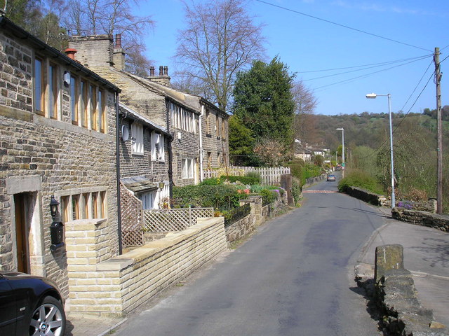
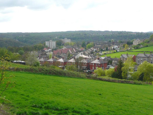
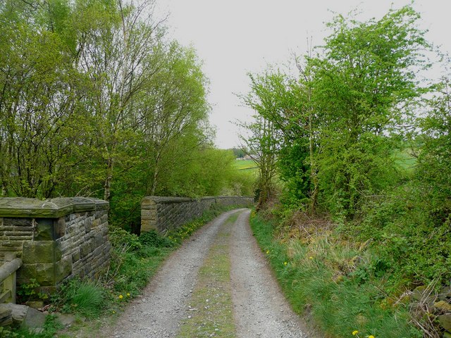
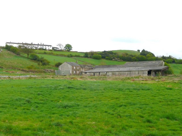
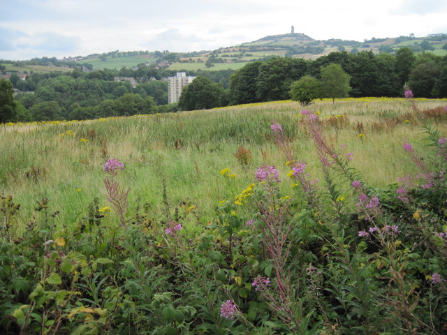
Mag Wood is a picturesque woodland located in Yorkshire, England. Situated near the village of Wood, it is a popular destination for nature enthusiasts and outdoor adventurers. Covering an area of approximately 50 acres, Mag Wood is known for its diverse range of flora and fauna, making it an important ecological site.

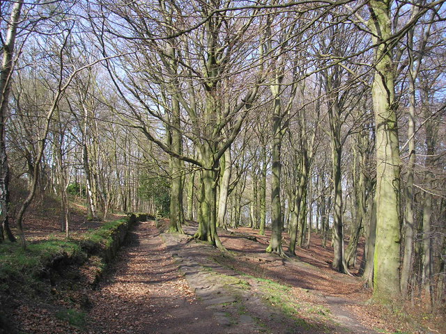
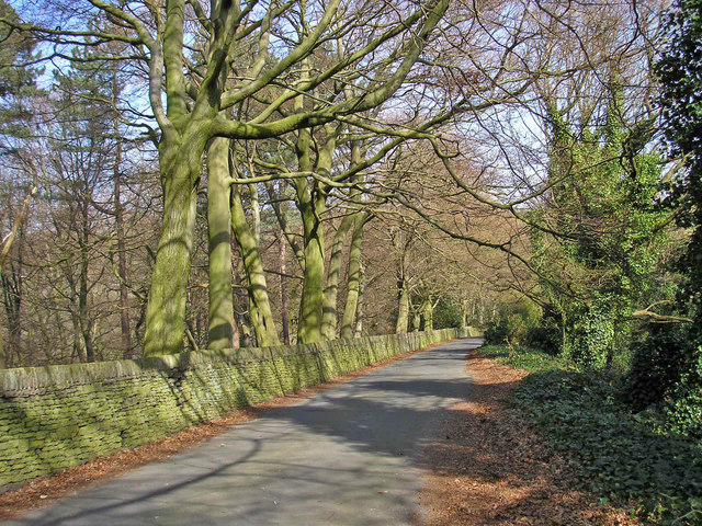
The woodland is characterized by its dense canopy of trees, primarily consisting of oak, beech, and birch. These majestic trees provide a tranquil and serene atmosphere, offering shelter to a variety of bird species such as woodpeckers, owls, and songbirds. Throughout the year, visitors can enjoy the melodic sounds of birdsong echoing through the woods.

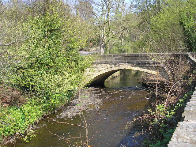
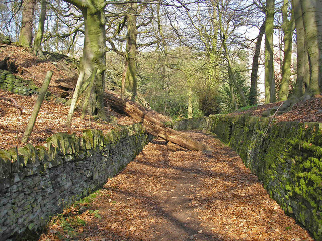
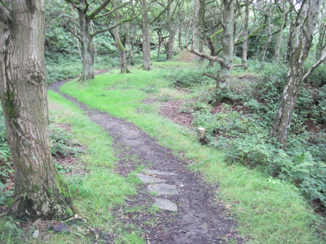
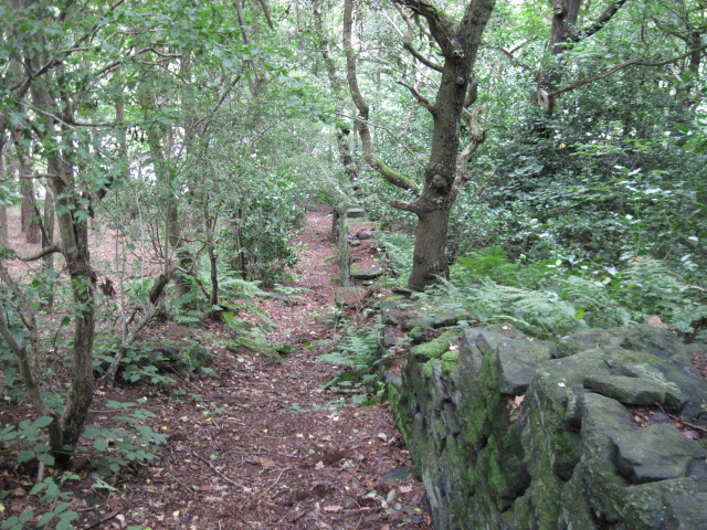
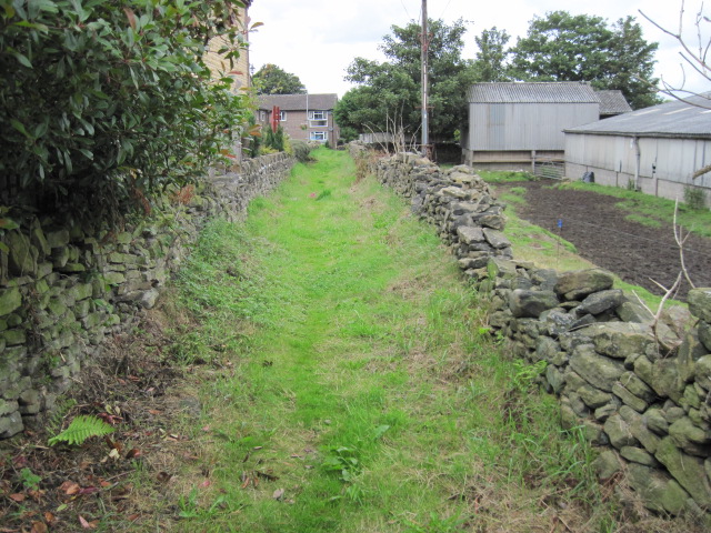
Mag Wood features a network of well-maintained footpaths, allowing visitors to explore its beauty at their own pace. These paths wind through the forest, leading to scenic viewpoints and hidden clearings. The wood is also home to a small stream, which adds to its natural charm.

The woodland is rich in biodiversity, hosting a wide array of wildlife. It provides a habitat for mammals including foxes, badgers, and squirrels, while the undergrowth is teeming with rabbits and hedgehogs. In spring, the forest floor is adorned with a colorful carpet of bluebells, adding a touch of enchantment to the surroundings.

Mag Wood, with its tranquil ambiance and natural beauty, offers a respite from the hustle and bustle of daily life. Whether it is a leisurely walk, birdwatching, or simply enjoying the peace and tranquility of nature, Mag Wood provides an idyllic retreat for visitors of all ages.

If you have any feedback on the listing, please let us know in the comments section below.

Mag Wood Images

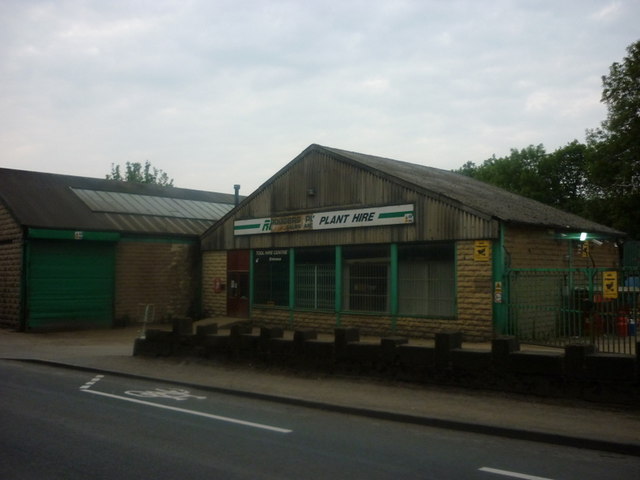
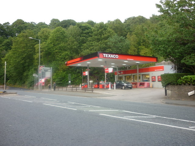
Images are sourced within 2km of 53.610812/-1.7943284 or Grid Reference SE1312. Thanks to Geograph Open Source API. All images are credited.

Armitage Bridge The actual bridge which gives the area its name.
Armitage Bridge
The actual bridge which gives the area its name.
Lane out of Armitage Bridge A walled lane leading into Mag Wood. A dead tree partly blocks the way.
Lane out of Armitage Bridge
A walled lane leading into Mag Wood. A dead tree partly blocks the way.
Mag Wood Woodland near Mag Dale on the Holme Valley Circular Walk.
Mag Wood
Woodland near Mag Dale on the Holme Valley Circular Walk.
Magdale Quiet Lane sign The Department for Transport guidance defines Quiet Lanes as "minor rural roads or networks of roads appropriate for shared use by walkers, cyclists, horse riders, and other vehicles."
Magdale Quiet Lane sign
The Department for Transport guidance defines Quiet Lanes as "minor rural roads or networks of roads appropriate for shared use by walkers, cyclists, horse riders, and other vehicles."
Road at Magdale An officially designated "quiet lane".
Road at Magdale
An officially designated "quiet lane".
Mag Dale A group of houses in Mag Dale. A row of mullioned windows on the top storey usually indicates a former weaver's cottage.
Mag Dale
A group of houses in Mag Dale. A row of mullioned windows on the top storey usually indicates a former weaver's cottage.
Church Street, Honley An interesting mix of buildings in the afternoon sun.
Church Street, Honley
An interesting mix of buildings in the afternoon sun.
View from Lady House Lane, Almondbury The Berry Brow primary and infants school can be seen in the distance, still in its 19C Huddersfield Board Elementary School buildings. In the middle, the houses are along Newsome Road South.
View from Lady House Lane, Almondbury
The Berry Brow primary and infants school can be seen in the distance, still in its 19C Huddersfield Board Elementary School buildings. In the middle, the houses are along Newsome Road South.
Cold Hill Lane, Almondbury The wall on the left surrounds an area that once contained a circular reservoir belonging to Huddersfield County Borough (maybe the structure is still in there).
Cold Hill Lane, Almondbury
The wall on the left surrounds an area that once contained a circular reservoir belonging to Huddersfield County Borough (maybe the structure is still in there).
Stirley Farm, Almondbury This farm looks disused, or at least the house is boarded up.
Stirley Farm, Almondbury
This farm looks disused, or at least the house is boarded up.
Direction indicator on Jubilee Tower Taken on one of the occasions when the tower was open to the public.
Direction indicator on Jubilee Tower
Taken on one of the occasions when the tower was open to the public.
Castle Hill car park Taken from the top of Jubilee Tower when it was open to the public.
Castle Hill car park
Taken from the top of Jubilee Tower when it was open to the public.
Rodgers Plant Hire, Honley
A Texaco garage on Huddersfield Road
Footpath in Dean Wood, Netherton
Footpath from Bourn View Road to Meltham Road
Towards Berry Brow Flats and Castle Hill
Footpath towards Field End Lane
Show me another place!

Mag Wood is located at Grid Ref: SE1312 (Lat: 53.610812, Lng: -1.7943284)

Division: West Riding

Unitary Authority: Kirklees

Police Authority: West Yorkshire

What 3 Words

///long.fresh.mixed. Near Meltham Mills, West Yorkshire

Related Wikis

Honley High School

Honley High School is a coeducational secondary school situated on the edge of the village of Honley in the Holme Valley, West Yorkshire, England. The...

Armitage Bridge

Armitage Bridge is a village approximately 3 miles (4.8 km) south of Huddersfield, in the Holme Valley, West Yorkshire, England. It is situated between...

Honley

Honley is a village in the Holme Valley civil parish in Kirklees, West Yorkshire, England. Historically part of the West Riding of Yorkshire, it is situated...

Honley railway station

Honley railway station serves the village of Honley in the Holme Valley of West Yorkshire, England. Honley station lies approximately 3 miles (4.8 km)...

Nearby Amenities

Located within 500m of 53.610812,-1.7943284
Reins Cottage
Tourism: yes
Lat/Long: 53.609687/-1.7875767
Bus Stop
Huddersfield Road Reins Terrace
Bench: no
Bin: no
Local Ref: 45022029
Naptan AtcoCode: 450022029
Naptan Bearing: NE
Naptan CommonName: Huddersfield Road Reins Terrace
Naptan Crossing: Reins Terrace
Naptan Indicator: Stop 45022029
Naptan PlusbusZoneRef: LEEDS
Naptan ShortCommonName: Honley High School
Naptan Street: Huddersfield Road
Naptan Verified: no
Shelter: no
Source: naptan_import
Tactile Paving: no
Lat/Long: 53.6088042/-1.7886419
Bus Stop
Huddersfield Road Reins Terrace
Bench: no
Bin: no
Local Ref: 45022030
Naptan AtcoCode: 450022030
Naptan Bearing: SW
Naptan CommonName: Huddersfield Road Reins Terrace
Naptan Crossing: Reins Terrace
Naptan Indicator: Stop 45022030
Naptan PlusbusZoneRef: LEEDS
Naptan ShortCommonName: Honley High School
Naptan Street: Huddersfield Road
Naptan Verified: no
Shelter: no
Source: naptan_import
Tactile Paving: no
Lat/Long: 53.6089295/-1.7883239
Bus Stop
Huddersfield Road Hanging Stone Road
Bench: no
Bin: no
Local Ref: 45022031
Naptan AtcoCode: 450022031
Naptan Bearing: SW
Naptan CommonName: Huddersfield Road Hanging Stone Road
Naptan Crossing: Nr-At Hanging Stone Road
Naptan Indicator: Stop 45022031
Naptan Landmark: Industrial Estate
Naptan PlusbusZoneRef: LEEDS
Naptan ShortCommonName: Industrial estate
Naptan Street: Huddersfield Road
Naptan Verified: no
Shelter: no
Source: naptan_import
Tactile Paving: no
Lat/Long: 53.6100332/-1.7873057
Bus Stop
Huddersfield Road Hanging Stone Road
Local Ref: 45022032
Naptan AtcoCode: 450022032
Naptan Bearing: N
Naptan CommonName: Huddersfield Road Hanging Stone Road
Naptan Crossing: Hanging Stone Road
Naptan Indicator: Stop 45022032
Naptan Landmark: Filling Station
Naptan Notes: Shelter belongs to Holme Valley Parish Council - has been removed by metro due to RTA - temp stop in place (no pole/plate) - installed 23/05/07
Naptan PlusbusZoneRef: LEEDS
Naptan ShortCommonName: Hanging Stone Road
Naptan Street: Huddersfield Road
Naptan Verified: no
Shelter: yes
Source: naptan_import
Lat/Long: 53.610662/-1.7870456
Sandbeds
Local Ref: 45024597
Naptan AtcoCode: 450024597
Naptan Bearing: E
Naptan BusStopType: CUS
Naptan CommonName: Sandbeds
Naptan Crossing: White Gate
Naptan Indicator: Stop 45024597
Naptan PlusbusZoneRef: LEEDS
Naptan ShortCommonName: White Gate
Naptan Street: Sandbeds
Naptan Verified: no
Source: naptan_import
Lat/Long: 53.6097485/-1.7944035
Bus Stop
Hanging Stone Road Park Wood
Local Ref: 45024986
Naptan AtcoCode: 450024986
Naptan Bearing: S
Naptan CommonName: Hanging Stone Road Park Wood
Naptan Crossing: Nr-At Park Lane
Naptan Indicator: Stop 45024986
Naptan PlusbusZoneRef: LEEDS
Naptan ShortCommonName: Park Lane
Naptan Street: Hanging Stone Road
Naptan Verified: no
Source: naptan_import
Lat/Long: 53.6149844/-1.7915437
Turning Circle
Lat/Long: 53.6067943/-1.7946049
Power: pole
Lat/Long: 53.6072437/-1.7981593
Power: pole
Lat/Long: 53.6077318/-1.7956385
Power: pole
Lat/Long: 53.6082472/-1.7929926
Power: pole
Lat/Long: 53.6085011/-1.7916697
Power: pole
Lat/Long: 53.6087939/-1.7901559
Material: wood
Power: pole
Lat/Long: 53.6092742/-1.7876286
Post Box
Post Box Type: wall
Royal Cypher: EIIR
Royal Cypher Wikidata: Q33102113
Lat/Long: 53.6104964/-1.7877628
Waterway: weir
Lat/Long: 53.6095047/-1.7899146
With Support Ltd
Addr City: Holmfirth
Addr Parentstreet: Huddersfield Road
Addr Postcode: HD9 6QZ
Addr Street: Queens Square
Addr Suburb: Honley
Office: company
Opening Hours: Mo-Fr 09:00-17:00
Smoking: no
Lat/Long: 53.610422/-1.7879696
Harper Collins
Office: publisher
Lat/Long: 53.6104692/-1.7879094
Defibrillator
Defibrillator Location: attached to wall at junction of Magdale with Huddersfield Road, Honley
Emergency: defibrillator
Indoor: no
Ref GB The Circuit: C7D39267-F674-4D70-AF6F-AEEC0158564E
Lat/Long: 53.6103329/-1.7873273
Fast Food
Mobile food trailer
Cuisine: burger;regional
Lat/Long: 53.6102703/-1.787381
Generator Method: photovoltaic
Generator Output Electricity: small_installation
Generator Source: solar
Generator Type: solar_photovoltaic_panel
Note: roof household
Power: generator
Lat/Long: 53.6067539/-1.7955013
Generator Method: photovoltaic
Generator Output Electricity: small_installation
Generator Source: solar
Generator Type: solar_photovoltaic_panel
Note: roof commercial building
Power: generator
Lat/Long: 53.6115973/-1.7888868
Generator Method: photovoltaic
Generator Output Electricity: small_installation
Generator Source: solar
Generator Type: solar_photovoltaic_panel
Note: roof commercial building
Power: generator
Lat/Long: 53.611516/-1.78819
Generator Method: photovoltaic
Generator Output Electricity: yes
Generator Source: solar
Generator Type: solar_photovoltaic_panel
Location: roof
Power: generator
Lat/Long: 53.6133376/-1.8003019
Ford: yes
Lat/Long: 53.6075979/-1.7975009
Speed Camera
Maxspeed: 30 mph
Lat/Long: 53.6119988/-1.7884011
Speed Camera
Maxspeed: 40 mph
Lat/Long: 53.6151342/-1.793489
Magdale
Place: hamlet
Lat/Long: 53.609802/-1.7932552
Steps
Place: hamlet
Lat/Long: 53.6115194/-1.7873022
inspire pilates
Lat/Long: 53.6098953/-1.7876704
Waterway: weir
Lat/Long: 53.6099301/-1.7896109
Bench
Backrest: yes
Lat/Long: 53.6085474/-1.7908936
Bench
Backrest: no
Lat/Long: 53.6093233/-1.7907229
Bench
Backrest: no
Lat/Long: 53.60932/-1.7903164
Bench
Backrest: yes
Lat/Long: 53.6072999/-1.7913218
Bench
Backrest: yes
Lat/Long: 53.6091871/-1.7902597
Barrier: kissing_gate
Lat/Long: 53.608511/-1.7910722
Barrier: stile
Note: Not sure this is really a stile - but it is used as one.
Stile: stepover
Lat/Long: 53.6064374/-1.7926909
Bench
Backrest: no
Lat/Long: 53.6067328/-1.7927984
Bench
Backrest: yes
Lat/Long: 53.6079929/-1.7923596
Waterway: weir
Lat/Long: 53.6076873/-1.7904416
Bench
Backrest: no
Lat/Long: 53.6094124/-1.7897446
Waterway: weir
Lat/Long: 53.6076251/-1.7953941
Man Made: adit
Lat/Long: 53.6136502/-1.7975554
Ford: yes
Lat/Long: 53.6136488/-1.7973781
Note: Goes further
Lat/Long: 53.6113114/-1.7933586
Spring Head Well
Natural: spring
Lat/Long: 53.6076818/-1.7976338
The data included in this document is from www.openstreetmap.org. The data is made available under ODbL.

Have you been to Mag Wood?

Leave your review of Mag Wood below (or comments, questions and feedback).