Prior Park Landscape Garden

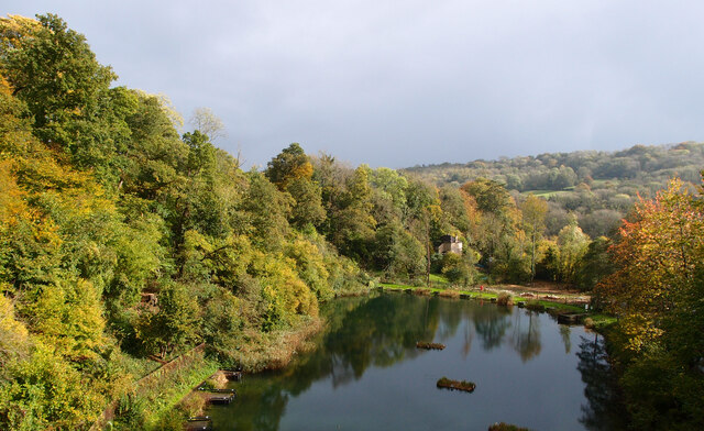
Downs, Moorland in Somerset
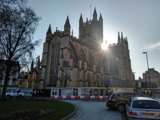
England

Prior Park Landscape Garden

Pulteney Bridge, Bath
Pulteney Bridge, Bath Credit: Sofia

Prior Park Landscape Garden is a picturesque garden located in Somerset, England. Spread across 28 acres, it offers visitors a stunning view of the surrounding countryside, including the Downs and Moorland. The garden was designed in the 18th century by the renowned poet Alexander Pope and landscape architect Capability Brown.

The garden features a large lake, which is the centerpiece and main focal point of the landscape. The lake is surrounded by lush greenery and a variety of trees and plants, including oak, beech, and conifers. The carefully manicured lawns and flower beds add to the beauty of the garden.

Visitors can explore the garden through a network of meandering paths and trails, which offer different vantage points to enjoy the panoramic views. The garden also boasts several architectural features, such as a Palladian bridge and a Gothic temple, which add a touch of elegance to the landscape.

In addition to its natural beauty, Prior Park Landscape Garden is also known for its historical significance. The garden was part of a larger estate owned by Ralph Allen, a prominent businessman and philanthropist in the 18th century. Allen's mansion, Prior Park, overlooks the garden and is now a private school.

Overall, Prior Park Landscape Garden in Somerset is a delightful destination for nature lovers and history enthusiasts alike. Its stunning views, well-maintained grounds, and historical significance make it a must-visit attraction in the region.

If you have any feedback on the listing, please let us know in the comments section below.

Prior Park Landscape Garden Images

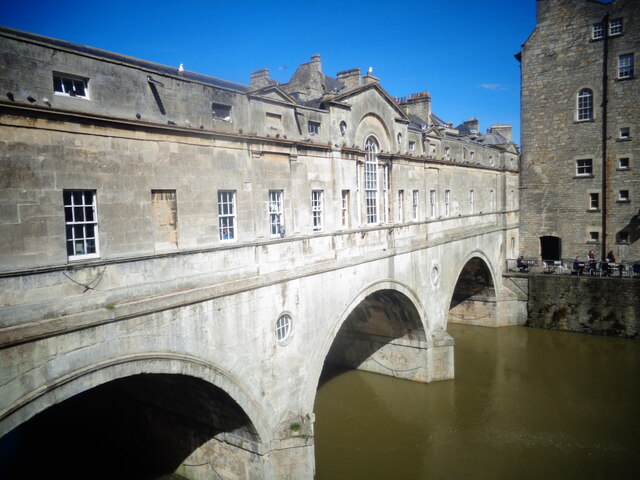
Images are sourced within 2km of 51.367139/-2.3443671 or Grid Reference ST7663. Thanks to Geograph Open Source API. All images are credited.

Pulteney Bridge, Bath
Grass Amphitheatre at The University of Bath
The Bear Hotel - Bear Flat
Greendown Terrace
Greendown Terrace
The Hadley Arms
The Hadley Arms
Ralph Allen School
Ralph Allen School
Norwood Avenue Entrance to University of Bath
Standing in York Street, Looking Down Abbey Street
Bath Abbey from Orange Grove NCN4 Bath Abbey with evening sun behind it.
Hoarding is up alongside the Abbey due to renovation work being carried out.
Photograph taken from the cycle way through Orange Grove, part of NCN4.
Bath Abbey from Orange Grove NCN4
Bath Abbey with evening sun behind it. Hoarding is up alongside the Abbey due to renovation work being carried out. Photograph taken from the cycle way through Orange Grove, part of NCN4.
Bath Spa station
Bath Spa station
The King's & Queen's Baths, Bath Spa
Bath Abbey
Bath Abbey
Pulteney Bridge & Weir, Bath Spa
Tucking Mill Reservoir Picture taken looking down from the Bath Two Tunnels cycling/walking route.
The Wessex Water website states "Try coarse fishing - it's free to disabled anglers".
Tucking Mill Reservoir
Picture taken looking down from the Bath Two Tunnels cycling/walking route. The Wessex Water website states "Try coarse fishing - it's free to disabled anglers".
COP26 Art Installation at Pulteney Bridge in Bath It is the COP26 Climate Change Summit in Glasgow this month.
COP26 Art Installation at Pulteney Bridge in Bath
It is the COP26 Climate Change Summit in Glasgow this month.
Bath Abbey at Night
Bath Abbey at Night
Old Boundary Marker south of Widcombe Hill, Bath Boundary Marker where a stone wall meets a fence in the middle of a wood south of Widcombe Hill, a road. Not marked on OS maps until 1904. On the former boundary of Bathwick and Claverton parishes, from 1900 Bath and Claverton parishes, from 1951 entirely in Bath parish. The inscription E B / V W does not relate to any of these. 

Milestone Society National ID: SO_BATH05bm
Old Boundary Marker south of Widcombe Hill, Bath
Boundary Marker where a stone wall meets a fence in the middle of a wood south of Widcombe Hill, a road. Not marked on OS maps until 1904. On the former boundary of Bathwick and Claverton parishes, from 1900 Bath and Claverton parishes, from 1951 entirely in Bath parish. The inscription E B / V W does not relate to any of these. Milestone Society National ID: SO_BATH05bm
Bath Abbey The west front of Bath Abbey.
Bath Abbey
The west front of Bath Abbey.
Show me another place!

Prior Park Landscape Garden is located at Grid Ref: ST7663 (Lat: 51.367139, Lng: -2.3443671)

Unitary Authority: Bath and North East Somerset

Police Authority: Avon and Somerset

What 3 Words

///jumpy.tulip.engine. Near Bath, Somerset

Related Wikis

Prior Park Landscape Garden

Prior Park Landscape Garden surrounding the Prior Park estate south of Bath, Somerset, England, was designed in the 18th century by the poet Alexander...
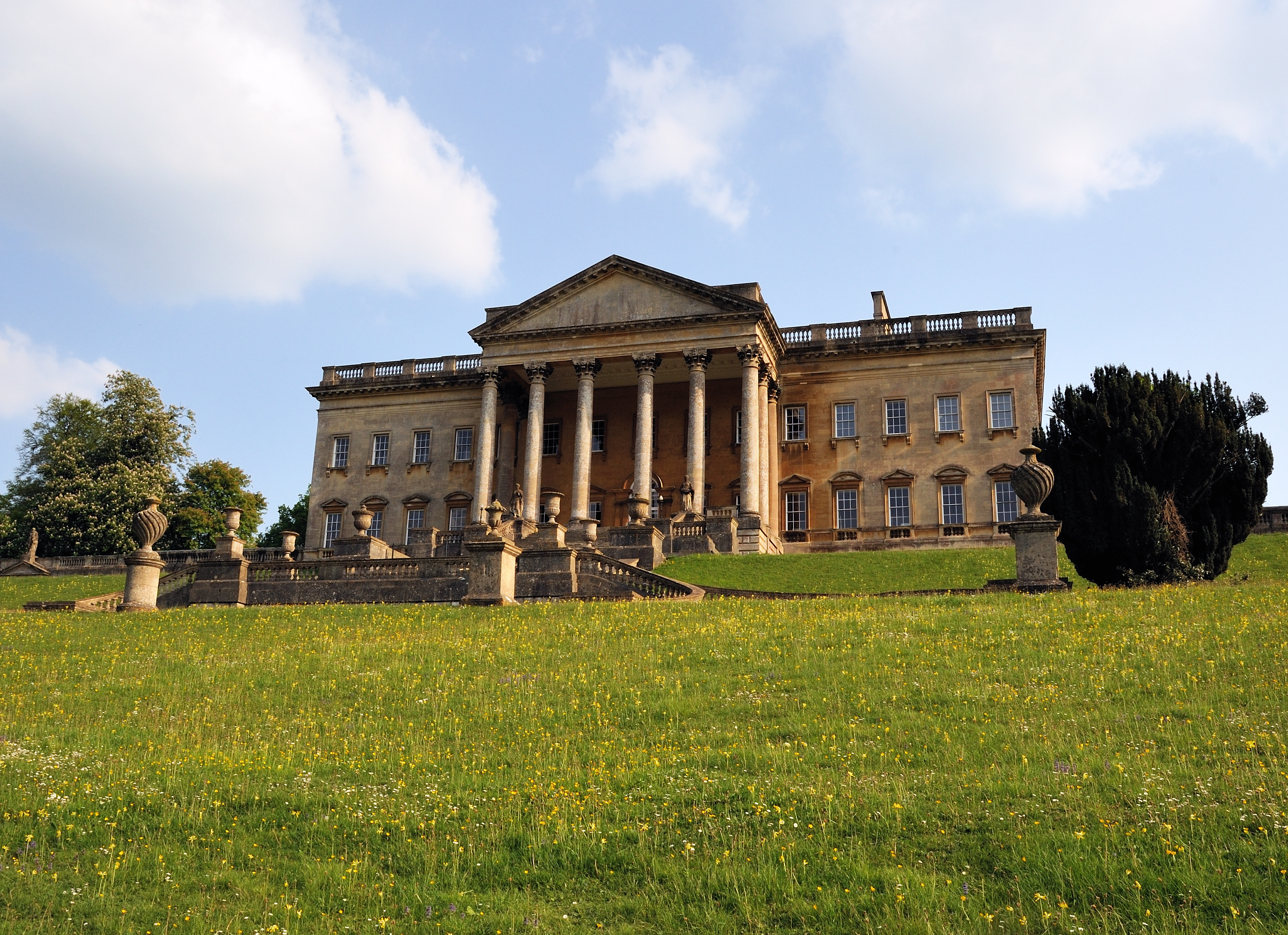
Prior Park

Prior Park is a Neo-Palladian house that was designed by John Wood, the Elder, and built in the 1730s and 1740s for Ralph Allen on a hill overlooking Bath...

Prior Park College

Prior Park College is a mixed Catholic public school for both boarding and day pupils in Bath, south-west England. Its main building, Prior Park, stands...
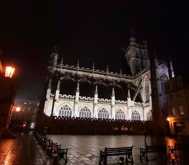
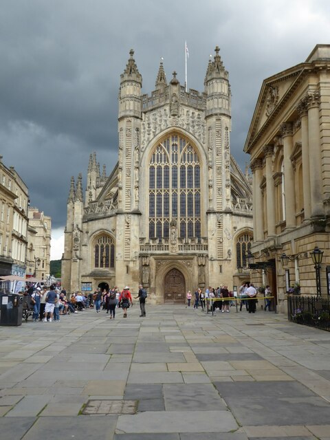
Bath Abbey Cemetery

The Anglican Bath Abbey Cemetery, officially dedicated as the Cemetery of St Peter and St Paul (the patron saints that Bath Abbey is dedicated to), was...

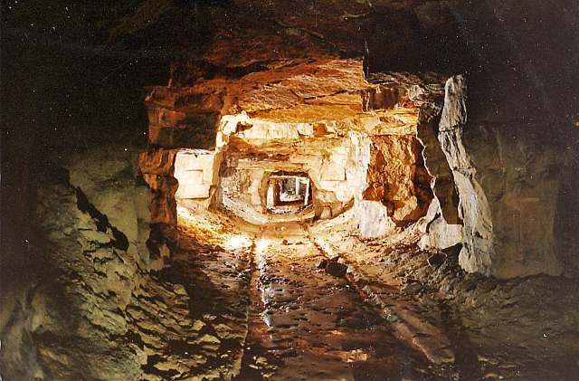
Combe Down and Bathampton Down Mines

Combe Down and Bathampton Down Quarries (grid reference ST761625) make up a 6.22 hectare (15.37 acre) Site of Special Scientific Interest (SSSI) in Bath...

Combe Down

Combe Down is a village on the outskirts of Bath, England, in the Bath and North East Somerset unitary authority area, within the ceremonial county of...

St Thomas à Becket Church, Widcombe

St Thomas à Becket Church is a parish church of Widcombe in Bath, Somerset southwest England, and is one of a number of churches named after Thomas Becket...

Widcombe Manor House

Widcombe Manor is a grade I listed Georgian house in Widcombe, Bath, England, built in 1656 and then rebuilt in 1727 for Philip Bennet the local MP. The...

Nearby Amenities

Located within 500m of 51.367139,-2.3443671
Barrier: stile
Lat/Long: 51.3688672/-2.343613
Barrier: kissing_gate
Lat/Long: 51.3677229/-2.3403987
Prior Park
Addr City: Bath
Addr Housename: Prior Park
Addr Postcode: BA2 5AH
Addr Street: Ralph Allen Drive
Description: 18th-century landscape garden designed with advice from famous garden designer Capabilility Brown.
Operator: National Trust
Toilets Wheelchair: yes
Tourism: attraction
Website: https://www.nationaltrust.org.uk/prior-park/
Wheelchair: limited
Wheelchair Description: Designated mobility parking phone to book 01225 833977 Partly accessible steep slopes dramatic view reachable from path with only slight slope at start See https://www.nationaltrust.org.uk/documents/access-guide/143173010503-prior-park-landscape-garden.p
Wikidata: Q7245410
Wikipedia: en:Prior Park
Lat/Long: 51.3666175/-2.3445083
Barrier: kissing_gate
Lat/Long: 51.3691348/-2.340232
Barrier: kissing_gate
Lat/Long: 51.3669252/-2.3426092
Barrier: kissing_gate
Lat/Long: 51.3680026/-2.3432405
Barrier: kissing_gate
Lat/Long: 51.3679755/-2.3433743
Barrier: kissing_gate
Lat/Long: 51.3672699/-2.3399503
Barrier: kissing_gate
Lat/Long: 51.3702926/-2.3393472
Barrier: kissing_gate
Lat/Long: 51.3678438/-2.3403772
Barrier: kissing_gate
Lat/Long: 51.3691913/-2.3396897
Barrier: kissing_gate
Lat/Long: 51.3701469/-2.3393899
Bus Stop
Middlehill Lodge
Bus: yes
Naptan AtcoCode: 0180BAC30106
Naptan Bearing: NW
Naptan CommonName: Middlehill Lodge
Naptan NaptanCode: bthjwpg
Naptan PlusbusZoneRef: BATHSPA
Naptan Street: Church Lane
Naptan Verified: no
Public Transport: platform
Source: naptan_import
Lat/Long: 51.3698029/-2.3460118
Bus Stop
Middlehill Lodge
Bus: yes
Naptan AtcoCode: 0180BAC30107
Naptan Bearing: NW
Naptan BusStopType: CUS
Naptan CommonName: Middlehill Lodge
Naptan NaptanCode: bthjwpa
Naptan PlusbusZoneRef: BATHSPA
Naptan Street: Church Lane
Naptan Verified: no
Public Transport: platform
Source: naptan_import
Lat/Long: 51.3698385/-2.3461414
Bus Stop
Prior Pk Gardens
Bench: no
Bin: no
Bus: yes
Lit: no
Naptan AtcoCode: 0180BAC30109
Naptan Bearing: S
Naptan CommonName: Prior Pk Gardens
Naptan Crossing: Priory Close
Naptan NaptanCode: bthjwpt
Naptan PlusbusZoneRef: BATHSPA
Naptan Street: Ralph Allen Drive
Naptan Verified: no
Public Transport: platform
Shelter: no
Source: naptan_import
Tactile Paving: yes
Lat/Long: 51.3660284/-2.3458272
Bus Stop
Prior Park College
Bus: yes
Naptan AtcoCode: 0180BAC30110
Naptan Bearing: N
Naptan CommonName: Prior Park College
Naptan NaptanCode: bthjwpd
Naptan PlusbusZoneRef: BATHSPA
Naptan Street: Ralph Allen Drive
Naptan Verified: no
Public Transport: platform
Shelter: yes
Source: naptan_import
Lat/Long: 51.365001/-2.3460906
Bus Stop
Prior Park College
Bus: yes
Naptan AtcoCode: 0180BAC30111
Naptan Bearing: S
Naptan CommonName: Prior Park College
Naptan NaptanCode: bthjwpw
Naptan PlusbusZoneRef: BATHSPA
Naptan Street: Ralph Allen Drive
Naptan Verified: no
Public Transport: platform
Source: naptan_import
Lat/Long: 51.3646963/-2.3457435
Barrier: stile
Lat/Long: 51.3666406/-2.3396435
Barrier: kissing_gate
Lat/Long: 51.3692982/-2.3433234
Barrier: kissing_gate
Lat/Long: 51.3702357/-2.3490049
Barrier: cycle_barrier
Lat/Long: 51.3639971/-2.3482331
Barrier: stile
Lat/Long: 51.3671407/-2.3394295
Source: Local Knowledge
Tourism: viewpoint
Lat/Long: 51.367414/-2.3481884
Cafe
The Tea Shed
Addr Postcode: BA2 5AH
Fhrs Id: 204874
Website: https://www.nationaltrust.org.uk/prior-park-landscape-garden/features/eating-and-shopping-at-prior-park
Lat/Long: 51.3694922/-2.3435565
Tourism: viewpoint
Lat/Long: 51.3702402/-2.3450684
Barrier: kissing_gate
Lat/Long: 51.367814/-2.345027
Cascade
Waterway: waterfall
Lat/Long: 51.3652472/-2.344943
Waterway: sluice_gate
Lat/Long: 51.3691553/-2.345075
Bicycle Parking
Capacity: 6
Lat/Long: 51.3657659/-2.3458042
Path
Lat/Long: 51.3657354/-2.3449928
Barrier: kissing_gate
Lat/Long: 51.3651785/-2.3437278
Barrier: stile
Lat/Long: 51.3671621/-2.3489526
Turning Circle
Lat/Long: 51.3630806/-2.3468634
Bench
Lat/Long: 51.3651021/-2.3434443
Bench
Lat/Long: 51.3651236/-2.3433233
Bench
Lat/Long: 51.3651634/-2.3432034
Bench
Lat/Long: 51.3652183/-2.3431156
Historic: ice_house
Lat/Long: 51.3695003/-2.3455036
Bench
Lat/Long: 51.3680485/-2.3434763
Bench
Lat/Long: 51.3667298/-2.3434525
Bench
Lat/Long: 51.3680526/-2.3437315
Bench
Lat/Long: 51.367102/-2.3434097
Leisure: picnic_table
Lat/Long: 51.3695312/-2.3439846
Leisure: picnic_table
Lat/Long: 51.3695599/-2.3440156
Leisure: picnic_table
Lat/Long: 51.3695607/-2.3439671
Leisure: picnic_table
Lat/Long: 51.3653269/-2.3449447
Leisure: picnic_table
Lat/Long: 51.3653468/-2.3449829
Leisure: picnic_table
Lat/Long: 51.3653134/-2.344904
Bench
Lat/Long: 51.3654947/-2.3447613
Leisure: picnic_table
Lat/Long: 51.3653837/-2.3449753
Leisure: picnic_table
Lat/Long: 51.365373/-2.3448798
Bench
Lat/Long: 51.3654503/-2.3447027
Bench
Lat/Long: 51.3655059/-2.3448476
Leisure: picnic_table
Lat/Long: 51.3653787/-2.3449282
Generator Method: photovoltaic
Generator Output Electricity: yes
Generator Source: solar
Generator Type: solar_photovoltaic_panel
Location: roof
Power: generator
Lat/Long: 51.3628792/-2.3444881
Generator Method: photovoltaic
Generator Output Electricity: yes
Generator Source: solar
Generator Type: solar_photovoltaic_panel
Location: roof
Power: generator
Lat/Long: 51.3648193/-2.3461792
Generator Method: photovoltaic
Generator Output Electricity: yes
Generator Source: solar
Generator Type: solar_photovoltaic_panel
Location: roof
Power: generator
Lat/Long: 51.365598/-2.347928
Parish of Lyncombe and Widcombe Parish Boundary Stone
Format: squared_stone
Format Top: rounded
Historic: boundary_stone
Inscription: P L and W 1894
Material: stone
Wikimedia Commons: File:Parish of Lyncombe and Widcombe Boundary Stone in Pope's Walk, Bath.jpg
Year: 1894
Lat/Long: 51.3641815/-2.3482528
Barrier: kissing_gate
Lat/Long: 51.3669252/-2.3426092
Barrier: kissing_gate
Lat/Long: 51.3669252/-2.3426092
Barrier: kissing_gate
Lat/Long: 51.3669252/-2.3426092
Barrier: stile
Lat/Long: 51.3664366/-2.3476017
Toilets
Lat/Long: 51.3695046/-2.3438465
Noexit: yes
Lat/Long: 51.3658116/-2.3442587
Noexit: yes
Lat/Long: 51.3658109/-2.344264
Board Type: history
Information: board
Tourism: information
Lat/Long: 51.3674151/-2.3421611
Bench
Backrest: no
Lat/Long: 51.3673908/-2.3421303
Bench
Backrest: no
Lat/Long: 51.3678129/-2.3421714
The data included in this document is from www.openstreetmap.org. The data is made available under ODbL.

Have you been to Prior Park Landscape Garden?

Leave your review of Prior Park Landscape Garden below (or comments, questions and feedback).