Thorneyburn Common

Downs, Moorland in Northumberland

England

Thorneyburn Common

Looking across Greystead Foot Bridge Over the River North Tyne.
Foot suspension bridge. Probably 1862. Ashlar, steel and wood. At each end a stone support tower with battered sides. Round-arched passage through each tower. Dentil cornices. Steel cables pass through the towers and support a wooden walkway with wooden railings.  Built to connect the south bank of the river to the railway which opened in 1862.
Looking across Greystead Foot Bridge Credit: Russel Wills

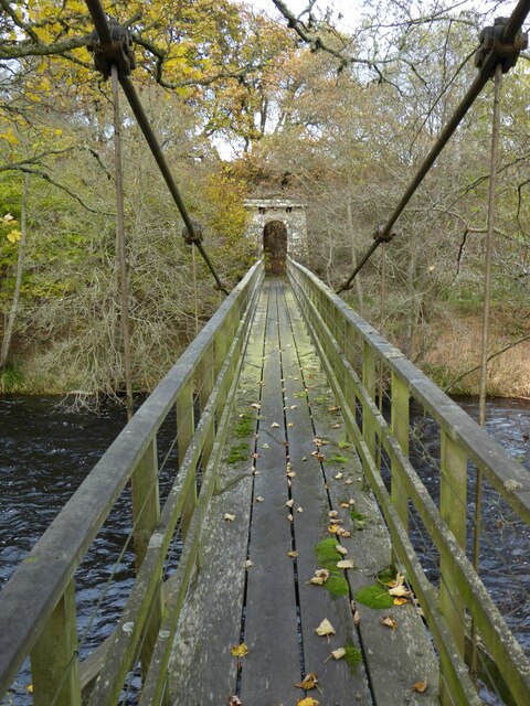
Thorneyburn Common is a picturesque area located in the county of Northumberland, England. It is situated in the northern part of the county, near the border with Scotland. The common is a vast expanse of downs and moorland, covering an area of approximately 500 hectares.

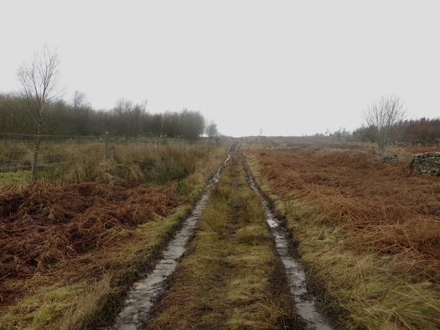
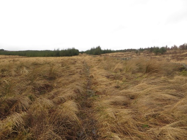
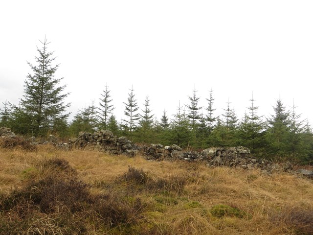
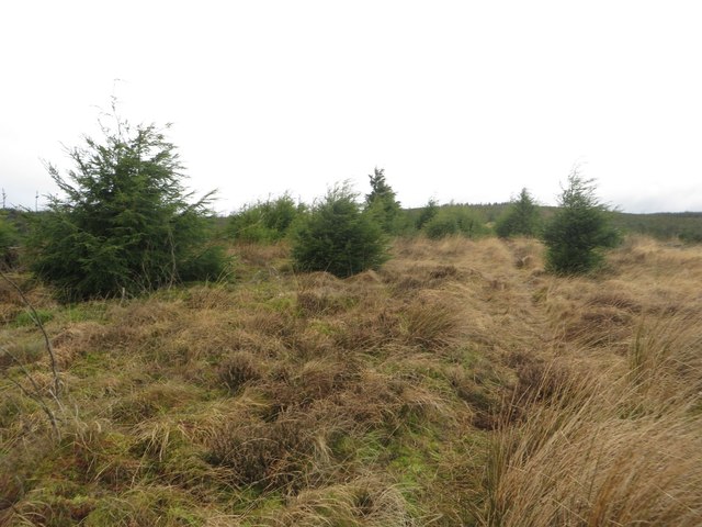
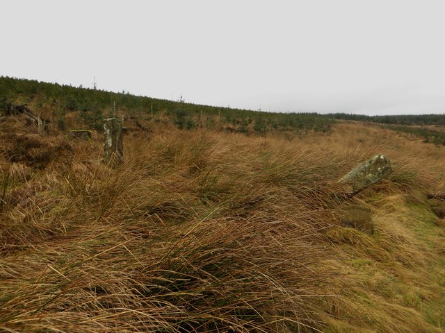
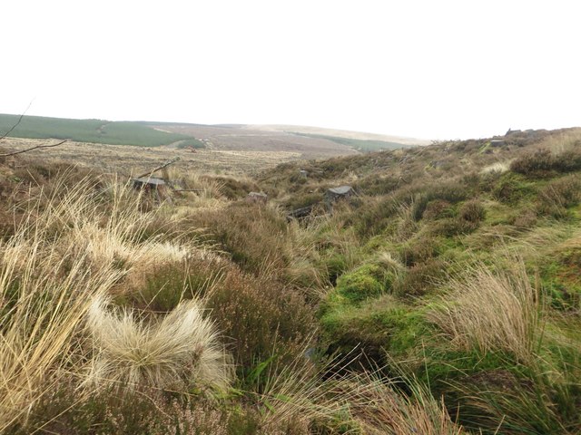
The landscape of Thorneyburn Common is characterized by rolling hills and open grasslands, dotted with patches of heather and gorse. The area is known for its stunning natural beauty, with panoramic views of the surrounding countryside. Visitors to the common can enjoy leisurely walks or hikes, taking in the peacefulness and tranquility of the countryside.

Thorneyburn Common is home to a diverse range of wildlife, including various bird species, such as curlews and lapwings, which can be spotted nesting in the grasslands. The area also supports a rich variety of plant life, including heather, bilberry, and cotton grass.

The common is popular with outdoor enthusiasts, who come to enjoy activities such as birdwatching, photography, and nature walks. It is also a haven for those seeking a peaceful retreat away from the hustle and bustle of city life.

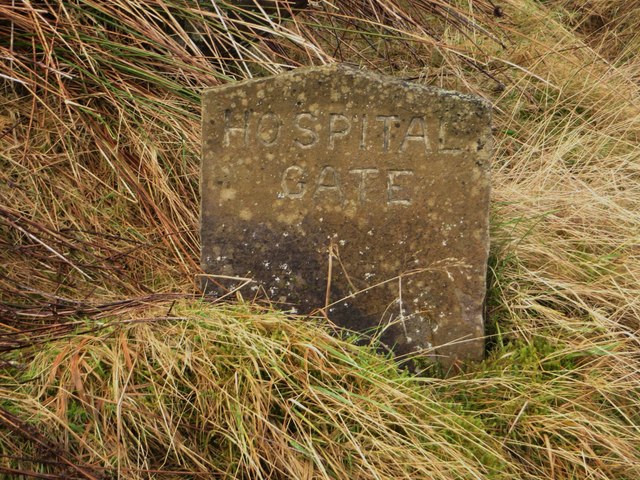
Access to Thorneyburn Common is available via a network of footpaths and bridleways, which allow visitors to explore the area at their own pace. The common is a designated Site of Special Scientific Interest, recognizing its importance for conservation and biodiversity.

Overall, Thorneyburn Common is a stunning natural landscape, offering visitors the opportunity to experience the beauty of Northumberland's downs and moorland.

If you have any feedback on the listing, please let us know in the comments section below.

Thorneyburn Common Images

Images are sourced within 2km of 55.181273/-2.3763278 or Grid Reference NY7687. Thanks to Geograph Open Source API. All images are credited.

Looking across Greystead Foot Bridge Over the River North Tyne.
Foot suspension bridge. Probably 1862. Ashlar, steel and wood. At each end a stone support tower with battered sides. Round-arched passage through each tower. Dentil cornices. Steel cables pass through the towers and support a wooden walkway with wooden railings.  Built to connect the south bank of the river to the railway which opened in 1862.
Looking across Greystead Foot Bridge
Over the River North Tyne. Foot suspension bridge. Probably 1862. Ashlar, steel and wood. At each end a stone support tower with battered sides. Round-arched passage through each tower. Dentil cornices. Steel cables pass through the towers and support a wooden walkway with wooden railings. Built to connect the south bank of the river to the railway which opened in 1862.
River North Tyne Looking upstream from Greystead Foot Bridge.
River North Tyne
Looking upstream from Greystead Foot Bridge.
Flittingford Bothy A remote bothy maintained by the Mountain Bothies Association.
Flittingford Bothy
A remote bothy maintained by the Mountain Bothies Association.
Minor road west of Rushend The minor road making its way west from Rushend. The tired sign on the left indicates that after 1 mile the road becomes unsuitable for motor vehicles. Beyond the farm at High Thorneyburn the road turns into a muddy track.
Minor road west of Rushend
The minor road making its way west from Rushend. The tired sign on the left indicates that after 1 mile the road becomes unsuitable for motor vehicles. Beyond the farm at High Thorneyburn the road turns into a muddy track.
A gate in the road To the east of Burnhead a gate is closed across the road. The gate forms part of a boundary, which is largely a stone wall, dividing large areas of rough upland grazing land.
A gate in the road
To the east of Burnhead a gate is closed across the road. The gate forms part of a boundary, which is largely a stone wall, dividing large areas of rough upland grazing land.
Rough grassland at Burnhead Looking across a distance of rough grassland to the small farm at Burnhead.
Rough grassland at Burnhead
Looking across a distance of rough grassland to the small farm at Burnhead.
Rough grazing land at Burnhead An expanse of rough upland grassland used for the grazing of sheep.
Rough grazing land at Burnhead
An expanse of rough upland grassland used for the grazing of sheep.
Roadside sheep pens Pens for the holding and sorting of sheep on the open hillside and beside the minor road to the west of Burnhead farm.
Roadside sheep pens
Pens for the holding and sorting of sheep on the open hillside and beside the minor road to the west of Burnhead farm.
High Thorneyburn farm The remote steading at High Thorneyburn.
High Thorneyburn farm
The remote steading at High Thorneyburn.
Byway north of High Thorneyburn A muddy track and byway which joins the minor road north of High Thorneyburn to the minor road west of Donkleywood.
Byway north of High Thorneyburn
A muddy track and byway which joins the minor road north of High Thorneyburn to the minor road west of Donkleywood.
Byway west of Slatyford The track and byway heading west from Slatyford.
Byway west of Slatyford
The track and byway heading west from Slatyford.
Bridleway west of Slaty Ford The bridleway passing through the edge of forest on Thorneyburn Common.
Bridleway west of Slaty Ford
The bridleway passing through the edge of forest on Thorneyburn Common.
Young trees near White Hill Young trees growing on the other side of a dry stone wall near White Hill.
Young trees near White Hill
Young trees growing on the other side of a dry stone wall near White Hill.
Bridleway near Hospital Gate A bridleway through rough ground which has been cleared of trees, though new trees have started growing from seed deposited by the felled mature trees.
Bridleway near Hospital Gate
A bridleway through rough ground which has been cleared of trees, though new trees have started growing from seed deposited by the felled mature trees.
Inscribed stone at Hospital Gate A small inscribed stone containing the words "Hospital Gate" provides the name of  a place where a gate once stood in a boundary wall. The gate is now in the middle of the massive Kielder Forest plantations and the boundary wall is all but gone. <a href="https://www.geograph.org.uk/photo/5669884">NY7588 : Hospital Gate</a> shows what remains of the gate.
Inscribed stone at Hospital Gate
A small inscribed stone containing the words "Hospital Gate" provides the name of a place where a gate once stood in a boundary wall. The gate is now in the middle of the massive Kielder Forest plantations and the boundary wall is all but gone. NY7588 : Hospital Gate shows what remains of the gate.
Hospital Gate An old set of gateposts amongst the countless trees of the surrounding plantations. A public bridleway follows the ride between two blocks of trees and passes through the old gateway. <a href="https://www.geograph.org.uk/photo/5669867">NY7588 : Inscribed stone at Hospital Gate</a> shows an inscribed stone to the right of the gate. <a href="https://www.geograph.org.uk/photo/1517412">NY7588 : Gateposts (could this be Hospital Gate?)</a> shows the scene 8 years earlier; in the intervening period the scene has changed completely with the felling of the surrounding mature trees.
Hospital Gate
An old set of gateposts amongst the countless trees of the surrounding plantations. A public bridleway follows the ride between two blocks of trees and passes through the old gateway. NY7588 : Inscribed stone at Hospital Gate shows an inscribed stone to the right of the gate. NY7588 : Gateposts (could this be Hospital Gate?) shows the scene 8 years earlier; in the intervening period the scene has changed completely with the felling of the surrounding mature trees.
Small stream in felled plantation A small stream flowing through land which has been clear felled.
Small stream in felled plantation
A small stream flowing through land which has been clear felled.
Forest tracks in Kielder Forest A pair of converging forest tracks in Kielder Forest close to White Hill.
Forest tracks in Kielder Forest
A pair of converging forest tracks in Kielder Forest close to White Hill.
Show me another place!

Thorneyburn Common is located at Grid Ref: NY7687 (Lat: 55.181273, Lng: -2.3763278)

Unitary Authority: Northumberland

Police Authority: Northumbria

What 3 Words

///glaze.edicts.commenced. Near Bellingham, Northumberland

Related Wikis

Thorneyburn

Thorneyburn is a village and former civil parish, now in the parish of Tarset, in Northumberland, England, to the northwest of Bellingham. In 1951 the...

Thorneyburn railway station

Thorneyburn railway station served the village of Thorneyburn, Northumberland, England from 1861 to 1956 on the Border Counties Railway. == History... ==

Greystead

Greystead is a village and civil parish in Northumberland, England west of Bellingham. The population as of the 2011 census was less than 100. It shares...

Black Middens Bastle House

Black Middens Bastle House lies about 7 miles (11 km) northwest of Bellingham, Northumberland. It is a two-storey fortified stone farmhouse from the 16th...

Nearby Amenities

Located within 500m of 55.181273,-2.3763278
Thorneyburn Common
Place: locality
Lat/Long: 55.1828475/-2.3769638
Bell Crag
Place: locality
Lat/Long: 55.182461/-2.3701288
Ford: yes
Lat/Long: 55.1801342/-2.3818581
The data included in this document is from www.openstreetmap.org. The data is made available under ODbL.

Have you been to Thorneyburn Common?

Leave your review of Thorneyburn Common below (or comments, questions and feedback).