Sale Fell

Downs, Moorland in Cumberland Allerdale

England

Sale Fell

Dead Crag Following a path up to Sale Fell.
Dead Crag Credit: steven ruffles

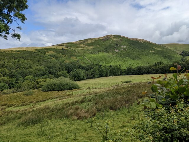
Sale Fell is a prominent hill located in the county of Cumberland, England. Situated in the Lake District National Park, it forms part of the Western Fells region. Rising to a height of 359 meters (1,178 feet), it offers stunning panoramic views of the surrounding landscape.

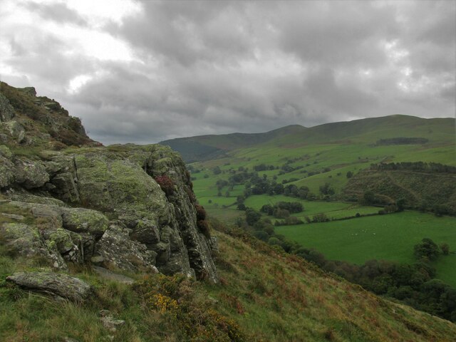
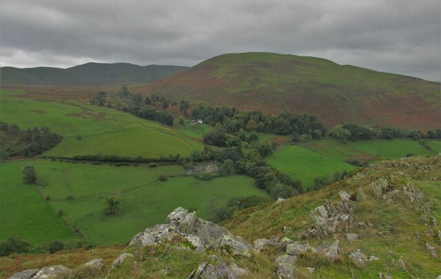
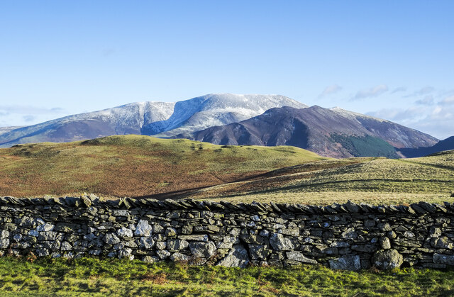
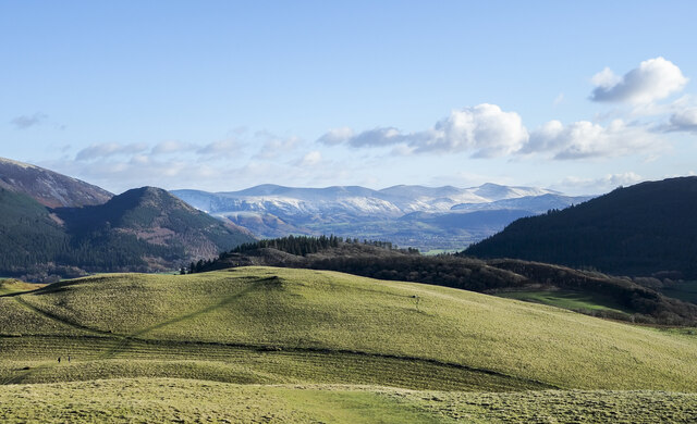
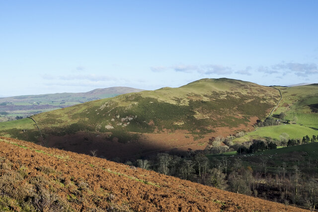
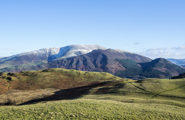
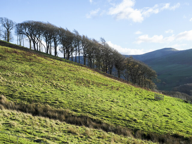
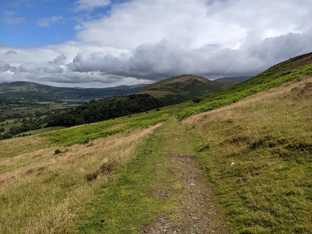
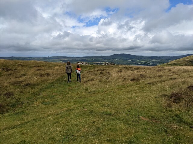
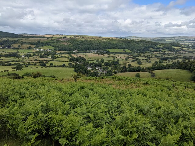
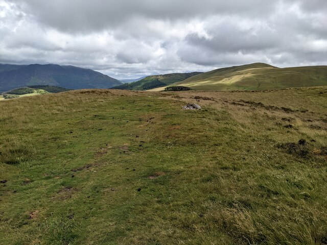
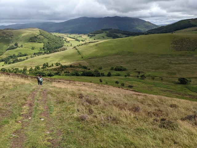
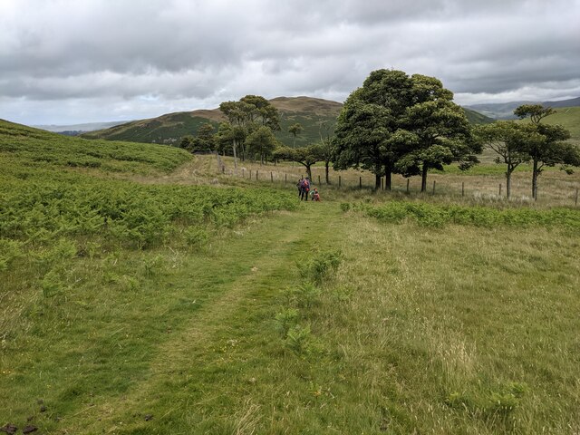
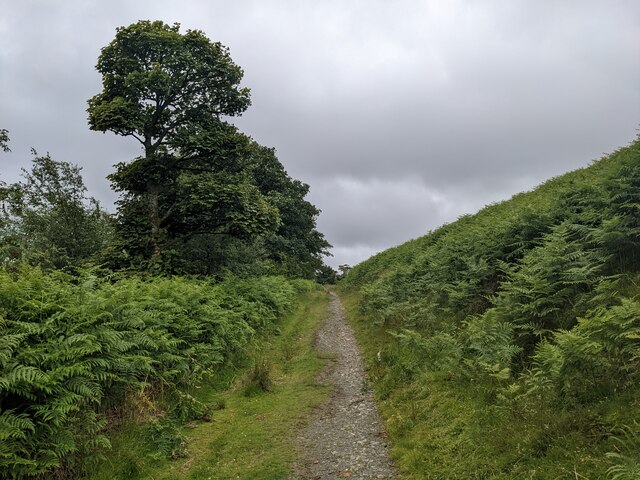
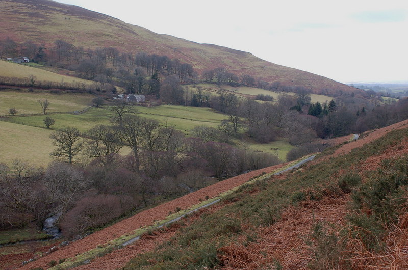
Covered in heather and grass, Sale Fell is characterized by its gentle slopes and rounded summit. The hill is easily accessible, with various footpaths leading to the top, making it a popular destination for walkers and hikers of all abilities. It is particularly renowned for its breathtaking views of Bassenthwaite Lake, which lies to the north, and the Skiddaw mountain range to the south.

The hill is also home to a variety of flora and fauna, including heather, bilberry, and bracken. It provides a habitat for a range of bird species such as skylarks, meadow pipits, and wheatears. Sale Fell is also a designated Site of Special Scientific Interest (SSSI) due to its geological importance, with evidence of volcanic activity visible in the surrounding landscape.

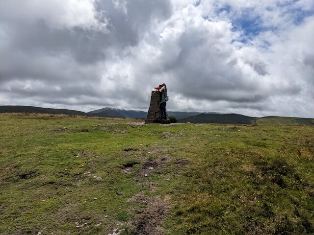
The summit of Sale Fell is marked by a trig point, offering a perfect spot for visitors to take in the breathtaking views. On a clear day, one can see as far as the Solway Firth and the Scottish hills in the distance. With its accessibility, natural beauty, and rich wildlife, Sale Fell is a must-visit destination for nature enthusiasts and those seeking tranquility amidst the stunning Lake District scenery.

If you have any feedback on the listing, please let us know in the comments section below.

Sale Fell Images

Images are sourced within 2km of 54.655624/-3.2476839 or Grid Reference NY1929. Thanks to Geograph Open Source API. All images are credited.

Dead Crag Following a path up to Sale Fell.
Dead Crag
Following a path up to Sale Fell.
Kelswick farm. Looking down on the farm from Sale Fell.
Kelswick farm.
Looking down on the farm from Sale Fell.
Grassy ridge beyond wall The ridge reaches Rivings, a shallow hill dome off to the right in the image.
The slightly more distant, elongated feature to the left is Lothwaite. The lightly snow-dusted mountain is of course, Skiddaw.
Grassy ridge beyond wall
The ridge reaches Rivings, a shallow hill dome off to the right in the image. The slightly more distant, elongated feature to the left is Lothwaite. The lightly snow-dusted mountain is of course, Skiddaw.
Rivings Rivings is the shallow hill dome beyond the wall.
The distant, lightly snowed sweep of mountains is the Helvellyn range. Skiddaw rises to the left out of the image, Dodd being the tree-covered cone there.
Rivings
Rivings is the shallow hill dome beyond the wall. The distant, lightly snowed sweep of mountains is the Helvellyn range. Skiddaw rises to the left out of the image, Dodd being the tree-covered cone there.
Dead bracken on hill slope The slope is on the eastern side of Ling Fell.
Sale Fell is the nearer hill across the valley; it partly conceals another hill, Binsey.
Dead bracken on hill slope
The slope is on the eastern side of Ling Fell. Sale Fell is the nearer hill across the valley; it partly conceals another hill, Binsey.
Kelswick Kelswick is a farm on the southern side of Sale Fell, south-west of its summit.
Kelswick
Kelswick is a farm on the southern side of Sale Fell, south-west of its summit.
Declining eastern slope of Sale Fell Short grass on the slope descending from Sale Fell towards the minor knoll of Rivings and the rib known as Lothwaite. The Skiddaw range is in the distance with the dark, grooved ridge of Ullock Pike, Long Side etc. before the main mountain.
Declining eastern slope of Sale Fell
Short grass on the slope descending from Sale Fell towards the minor knoll of Rivings and the rib known as Lothwaite. The Skiddaw range is in the distance with the dark, grooved ridge of Ullock Pike, Long Side etc. before the main mountain.
Trees along crest of ridge The trees are along the southern side of a shallow valley that runs down to join Wythop Beck.
Grisedale Pike is the distant mountain at the right side of the image.
Trees along crest of ridge
The trees are along the southern side of a shallow valley that runs down to join Wythop Beck. Grisedale Pike is the distant mountain at the right side of the image.
The Corpse Road on Ling Fell Presumably once used to carry coffins, but from where to where? It goes up to the summit of Ling Fell.
The Corpse Road on Ling Fell
Presumably once used to carry coffins, but from where to where? It goes up to the summit of Ling Fell.
A track on Ling Fell It served a line of grouse butts, off to the left.
A track on Ling Fell
It served a line of grouse butts, off to the left.
Looking down towards Wythop Mill
The summit plateau of Ling Fell
The trig point on Ling Fell A small boy is about to climb it - not very obvious in the shot!
The trig point on Ling Fell
A small boy is about to climb it - not very obvious in the shot!
A track down to Burthwaite
A small clump of trees below Ling Fell
The track to Burthwaite house
Looking towards Dodd Crag on Sale Fell
The trees above Burthwaite house
Show me another place!

Sale Fell is located at Grid Ref: NY1929 (Lat: 54.655624, Lng: -3.2476839)

Administrative County: Cumbria

District: Allerdale

Police Authority: Cumbria

What 3 Words

///maternal.originals.downward. Near Cockermouth, Cumbria

Related Wikis

Sale Fell

Sale Fell is a small hill near Cockermouth in the English Lake District. It is popular with locals, as it offers gentle walking and lovely views across...
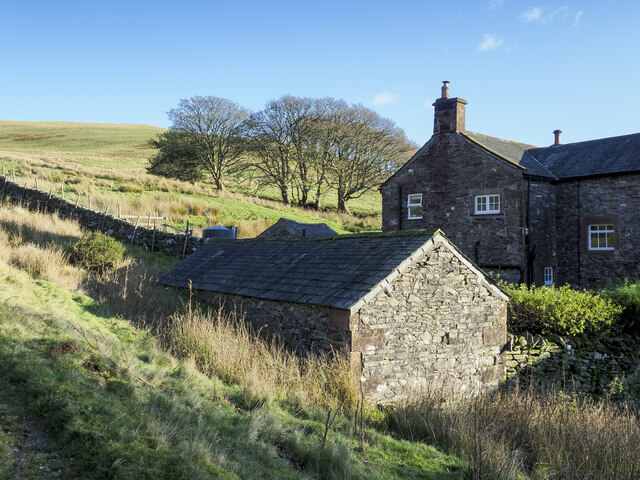
Routenbeck

Routenbeck is a hamlet in Cumbria, England. It is located at the northern foot of Sale Fell, near the north-west edge of Bassenthwaite Lake. Routenbeck...

Pheasant Inn, Bassenthwaite

The Pheasant Inn is a public house at The Pheasant Inn, Bassenthwaite, Cumbria CA13 9YE. It is Grade II listed. It is on the Campaign for Real Ale's National...

Wythop

Wythop is a civil parish in the north of Cumbria, England, between Cockermouth and Keswick. Population details are no longer maintained and can be found...

Nearby Amenities

Located within 500m of 54.655624,-3.2476839
Sale Fell
Ele: 359
Natural: peak
Old Name: Wythop
Source: npe
Wikidata: Q7403796
Wikipedia: en:Sale Fell
Lat/Long: 54.655611/-3.2501218
Rivings
Place: locality
Lat/Long: 54.6541606/-3.244451
Ele: 359
Man Made: survey_point
Source: npe
Lat/Long: 54.6561838/-3.2491915
Barrier: stile
Lat/Long: 54.6590778/-3.246557
The data included in this document is from www.openstreetmap.org. The data is made available under ODbL.

Have you been to Sale Fell?

Leave your review of Sale Fell below (or comments, questions and feedback).