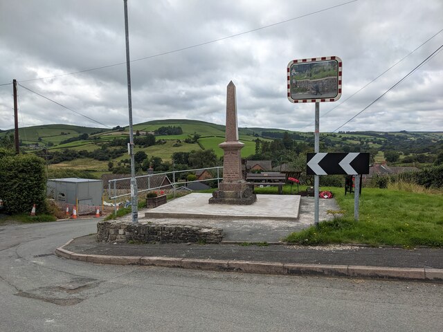
Flat Wood

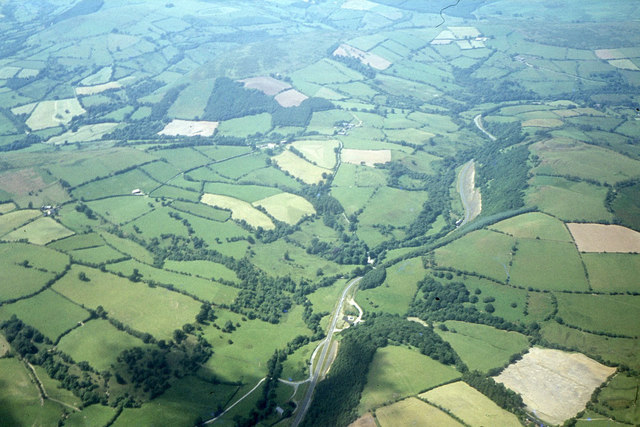
Downs, Moorland in Radnorshire

Wales

Flat Wood

Glyndwr's Way near Yr Allt
Glyndwr's Way near Yr Allt Credit: Dave Kelly

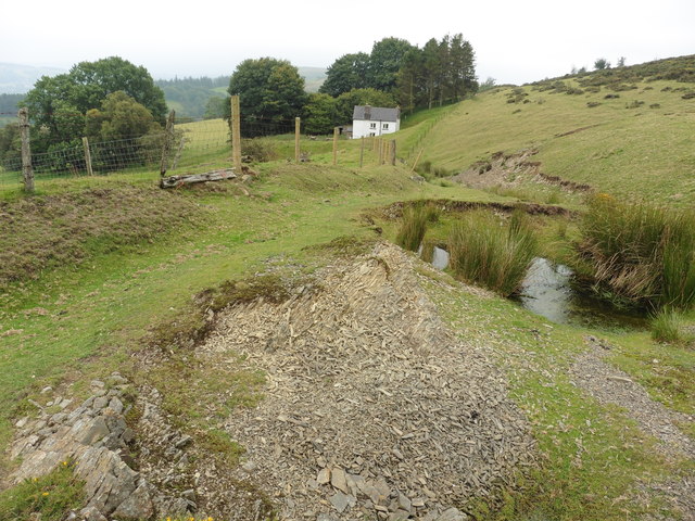
Flat Wood, located in Radnorshire, is a picturesque natural area known for its expansive downs and moorland landscapes. Situated amidst the rolling hills of the Welsh countryside, this enchanting woodland offers visitors a unique experience of pristine beauty and tranquility.

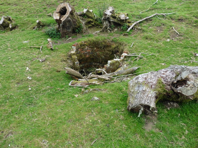
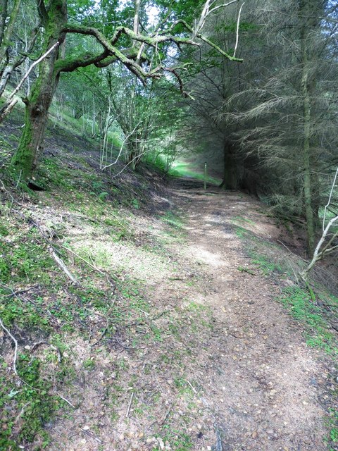
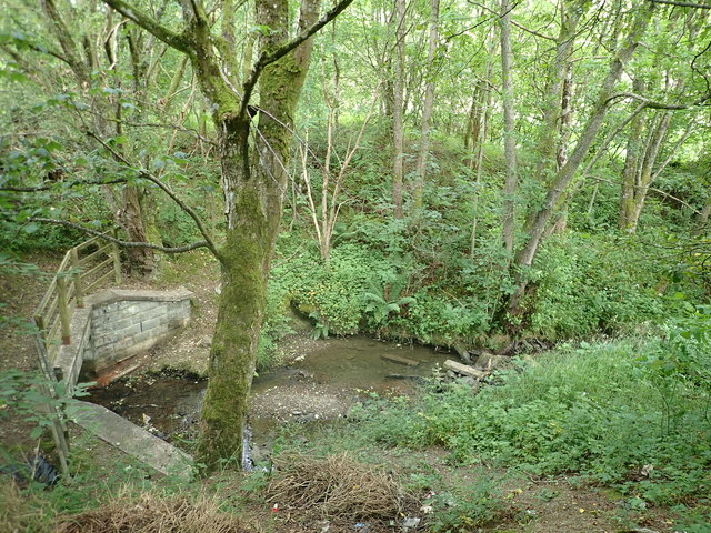
Covering a vast area, Flat Wood boasts a diverse range of flora and fauna, making it a haven for nature enthusiasts and wildlife lovers. The wood is home to a variety of tree species, including oak, beech, and birch, which create a lush green canopy that provides shelter and shade.

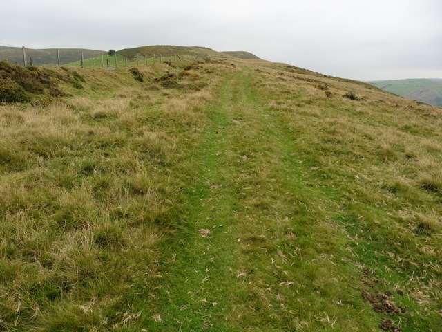
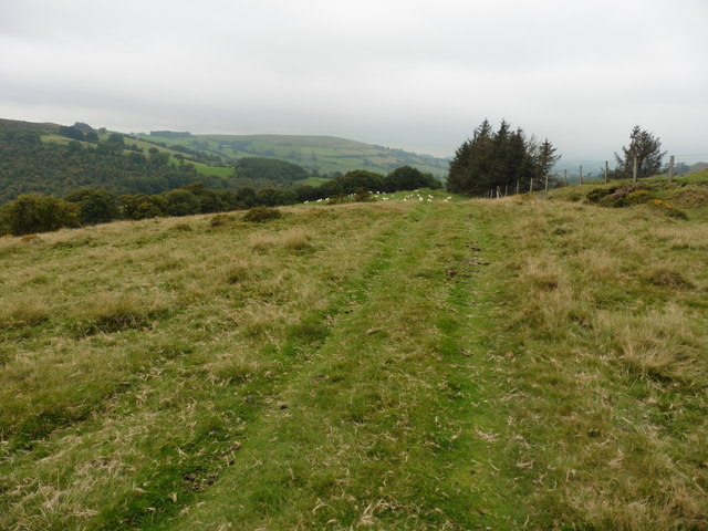
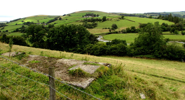
The downs of Flat Wood offer breathtaking views of the surrounding countryside, with undulating hills stretching as far as the eye can see. These open grasslands are ideal for leisurely walks, picnics, and even kite flying, attracting both locals and tourists alike.

Moreover, the moorland within Flat Wood adds to its allure, featuring a tapestry of heather, gorse, and bracken, which paint the landscape in vibrant hues throughout the year. This unique habitat provides a sanctuary for numerous bird species, such as curlews, lapwings, and red grouse, making it a popular spot for birdwatching enthusiasts.

Visitors to Flat Wood can enjoy various recreational activities, including hiking, cycling, and horseback riding, thanks to the well-maintained trails that crisscross the woodland and its surroundings. Additionally, the area offers opportunities for camping and outdoor exploration, with designated camping sites and picnic areas available.

Flat Wood, Radnorshire, with its stunning downs and moorland, encapsulates the natural beauty and tranquility that Wales has to offer, making it a must-visit destination for those seeking a peaceful escape in the heart of nature.

If you have any feedback on the listing, please let us know in the comments section below.

Flat Wood Images

Images are sourced within 2km of 52.358358/-3.3321736 or Grid Reference SO0974. Thanks to Geograph Open Source API. All images are credited.

Glyndwr's Way near Yr Allt
Glyndwr's Way near Yr Allt A disused well by the side of the path
Glyndwr's Way near Yr Allt
A disused well by the side of the path
Glyndwr's Way near Bwlch
Glyndwr's Way in Neuadd-fach wood
Hillside view from Llanbister Viewed across the valley of the River Ithon.
Hillside view from Llanbister
Viewed across the valley of the River Ithon.
Migram's Brook A tributary of the river Ithon
Migram's Brook
A tributary of the river Ithon
Public toilets off the A483 Between Llananno and Llanbister - very welcome on this lonely stretch of road
Public toilets off the A483
Between Llananno and Llanbister - very welcome on this lonely stretch of road
St Anno's Church On the A483 between Llandrindod Wells and Newtown the small church of Llananno sits in isolation, hidden in a small dip of the valley next to the River Ithon. I find now that it has a truly magnificent rood screen dating from the C15th - I shall have to stop and visit next time I pass this way.
St Anno's Church
On the A483 between Llandrindod Wells and Newtown the small church of Llananno sits in isolation, hidden in a small dip of the valley next to the River Ithon. I find now that it has a truly magnificent rood screen dating from the C15th - I shall have to stop and visit next time I pass this way.
Aerial view - Llananno and A483 northwest of Llanbister
Book exchange A former telephone box, Llanbister.
Book exchange
A former telephone box, Llanbister.
The Red Lion, Llanbister
Llanbister war memorial This war memorial is situated opposite the parish church of St. Cynllo and is placed by the B4356 road.
Llanbister war memorial
This war memorial is situated opposite the parish church of St. Cynllo and is placed by the B4356 road.
Path to St. Cynllo's church (Llanbister) The parish church at Llanbister was built on a steep hill, and the structure was built in the early C14. The bell tower was built at the east end in the C15 or C16, and the belfry was remodelled in 1752 when the church was altered that year. The church was restored by W.D. Caröe and H. Passmore in 1908, who rebuilt most of the nave south wall and added two features in the west end; the baptistery and south porch. This was grade II* listed in October 1951, and the interior was full of screeching bats on my visit.
Path to St. Cynllo's church (Llanbister)
The parish church at Llanbister was built on a steep hill, and the structure was built in the early C14. The bell tower was built at the east end in the C15 or C16, and the belfry was remodelled in 1752 when the church was altered that year. The church was restored by W.D. Caröe and H. Passmore in 1908, who rebuilt most of the nave south wall and added two features in the west end; the baptistery and south porch. This was grade II* listed in October 1951, and the interior was full of screeching bats on my visit.
Yew trees at St. Cynllo's church (Llanbister) There are many yew trees south of the parish church building at Llanbister.
Yew trees at St. Cynllo's church (Llanbister)
There are many yew trees south of the parish church building at Llanbister.
Doorway inside St. Cynllo's church (Llanbister) This is the early C14 south doorway at Llanbister parish church, protected by the south porch of 1908.
Doorway inside St. Cynllo's church (Llanbister)
This is the early C14 south doorway at Llanbister parish church, protected by the south porch of 1908.
Windows inside St. Cynllo's church (Llanbister) These windows were inserted in the restoration of 1908 at Llanbister parish church, situated in the west end of the nave.
Windows inside St. Cynllo's church (Llanbister)
These windows were inserted in the restoration of 1908 at Llanbister parish church, situated in the west end of the nave.
Inside St. Cynllo's church (Llanbister) The interior at Llanbister parish church from the west end of the nave, with the panelled and painted reredos of c.1950 in the distance.
Inside St. Cynllo's church (Llanbister)
The interior at Llanbister parish church from the west end of the nave, with the panelled and painted reredos of c.1950 in the distance.
Show me another place!

Flat Wood is located at Grid Ref: SO0974 (Lat: 52.358358, Lng: -3.3321736)

Unitary Authority: Powys

Police Authority: Dyfed Powys

What 3 Words

///tickling.unrealistic.bravest. Near Penybont, Powys

Related Wikis

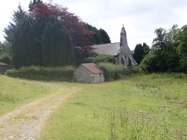
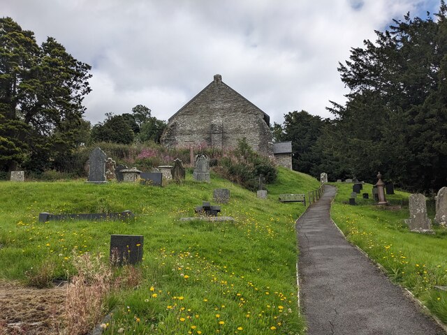
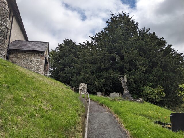
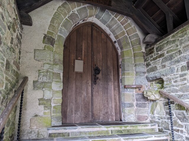
St Anno's Church, Llananno

The Church of St Anno in Llananno, Powys, Wales, is a redundant church dating from the 14th century. Its medieval rood screen is considered "one of the...
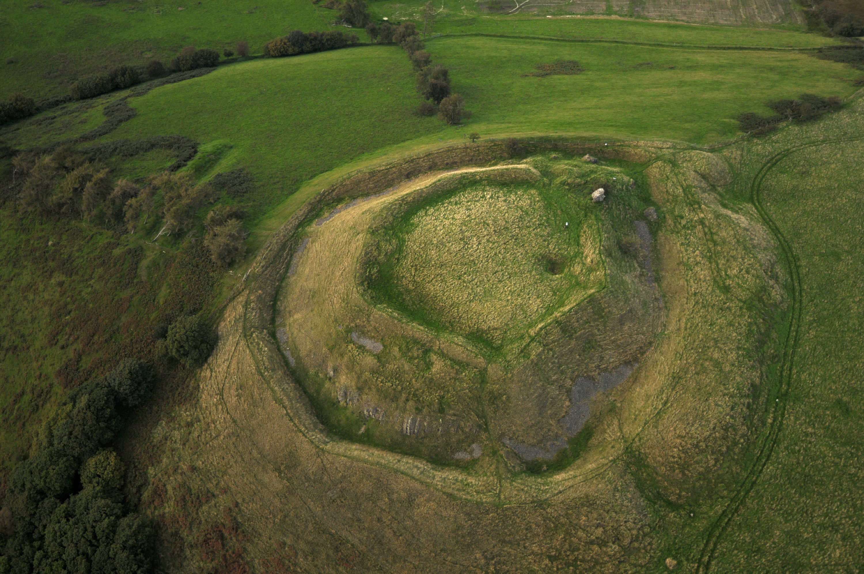
Tinboeth Castle

Tinboeth Castle (Welsh: Castell Dinbod) was a medieval castle situated midway between Llanbister and Llanbadarn Fynydd in Wales, on a bend in the River...

Llanbister

Llanbister is a small village and community with a 2011 population of 382 in Powys, mid Wales, in the historic county of Radnorshire. == Facilities... ==

Rhwng Gwy a Hafren

Rhwng Gwy a Hafren (English: Between Wye and Severn) was a region of medieval Wales, located in the Welsh Marches between Powys to the north and Brycheiniog...

Llanbadarn Fynydd

Llanbadarn Fynydd (meaning Church of Padarn in the mountain) is a village and community in Radnorshire, Powys, Wales, and is 63 miles (101 km) from Cardiff...

Red Lion Hill

Red Lion Hill (Welsh: Bryn Llew Goch) or Banc y Dolau is a hill in Powys, Wales, with a summit 484.6 metres (1,590 ft) above sea level. It is located in...

Buddugre Castle

Buddugre Castle (sometimes referred to as Tomen Bedd-Ugre, Castell Cwm Aran, Tomen Bedd Turc and Bedd-y-gre) was a motte and bailey defensive fortification...

Abbeycwmhir

Abbeycwmhir or Abbey Cwmhir (Welsh: Abaty Cwm Hir, "Abbey in the Long Valley") is a village and community in the valley of the Nant Clywedog in Radnorshire...

Nearby Amenities

Located within 500m of 52.358358,-3.3321736
Parking
Source: GPS Survey
Lat/Long: 52.3617105/-3.3323394
Parking
Parking: layby
Lat/Long: 52.3606945/-3.3310783
The data included in this document is from www.openstreetmap.org. The data is made available under ODbL.

Have you been to Flat Wood?

Leave your review of Flat Wood below (or comments, questions and feedback).