Roughground Wood
Downs, Moorland in Cumberland Copeland
England
Roughground Wood
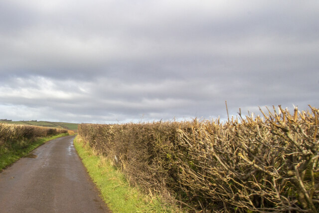
Roughground Wood, located in Cumberland, is a picturesque natural area that encompasses a diverse range of landscapes, including downs, moorland, and woodlands. Covering an extensive area, the wood is home to an abundance of flora and fauna, making it a haven for nature enthusiasts and wildlife lovers.
The wood’s most prominent feature is its rolling downs, which offer breathtaking views of the surrounding countryside. These open grassy areas are perfect for picnicking, leisurely walks, or simply enjoying the serene atmosphere. The downs are covered in a vibrant carpet of wildflowers during the spring and summer months, creating a colorful spectacle that attracts visitors from far and wide.
In addition to the downs, Roughground Wood boasts expansive moorland, characterized by its rugged and untamed beauty. The moorland is dotted with heather, gorse, and various grasses, providing a habitat for a variety of bird species, including skylarks and curlews. Walking through the moorland, visitors can experience the sense of isolation and tranquility that this remote landscape offers.
The wood itself is a mix of deciduous and coniferous trees, creating a rich tapestry of colors throughout the seasons. Ancient oaks, beeches, and birches can be found alongside towering pines and spruces. This diverse woodland provides a habitat for a multitude of wildlife, including deer, squirrels, and a wide array of bird species.
Roughground Wood is a true gem of Cumberland, offering visitors a chance to immerse themselves in the beauty of nature and experience the tranquility of its downs, moorland, and woodlands. Whether it's a leisurely walk, bird-watching, or simply enjoying the scenery, this natural wonder is a must-visit for anyone seeking a connection with the great outdoors.
If you have any feedback on the listing, please let us know in the comments section below.
Roughground Wood Images
Images are sourced within 2km of 54.472712/-3.4852091 or Grid Reference NY0309. Thanks to Geograph Open Source API. All images are credited.


Roughground Wood is located at Grid Ref: NY0309 (Lat: 54.472712, Lng: -3.4852091)
Administrative County: Cumbria
District: Copeland
Police Authority: Cumbria
What 3 Words
///corrects.stretch.hedge. Near Egremont, Cumbria
Nearby Locations
Related Wikis

Haile, Cumbria
Haile is a small village and civil parish in Copeland district, in the county of Cumbria, England. It had a population of 617 at the 2011 Census. Nearby...
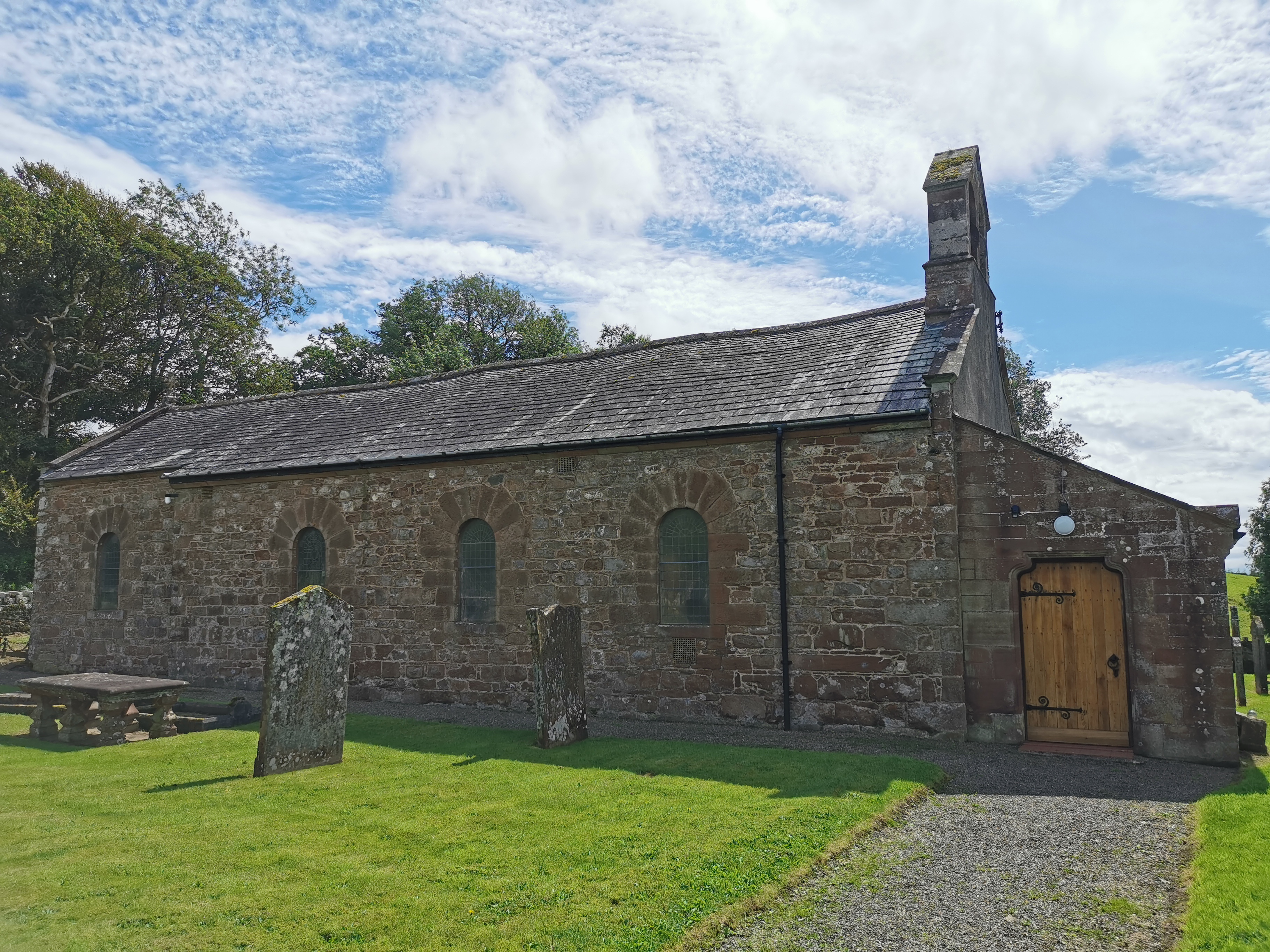
Haile Parish Church
Haile Parish Church is near Haile, Cumbria, England. It is an active Anglican parish church in the deanery of Calder, and the diocese of Carlisle. Its...
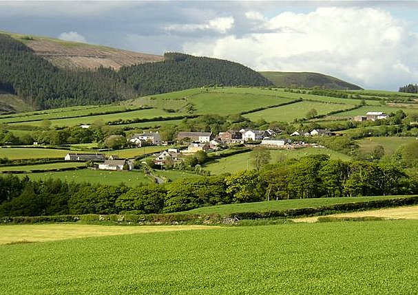
Wilton, Cumbria
Wilton is a hamlet in the Copeland district, in the county of Cumbria, England. It is near the small town of Egremont. In 1870-72 it had a population of...

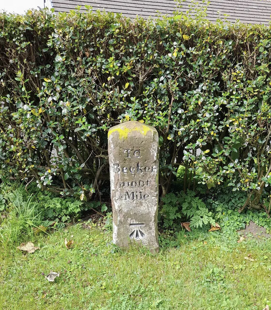
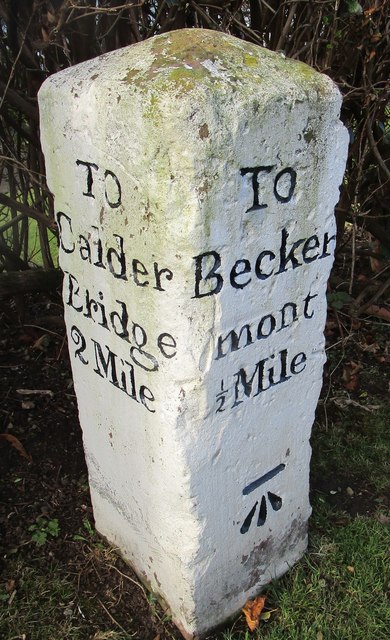
Beckermet Mines railway station
Beckermet Mines railway station was situated at Pit No.1 of the mine of the same name. It was used by workmen's trains which travelled along a branch which...
Nearby Amenities
Located within 500m of 54.472712,-3.4852091Have you been to Roughground Wood?
Leave your review of Roughground Wood below (or comments, questions and feedback).