Parc yr Ocar

Downs, Moorland in Caernarfonshire

Wales

Parc yr Ocar

Electrical cabinet on Bangor Road, Bethesda
Electrical cabinet on Bangor Road, Bethesda Credit: Meirion

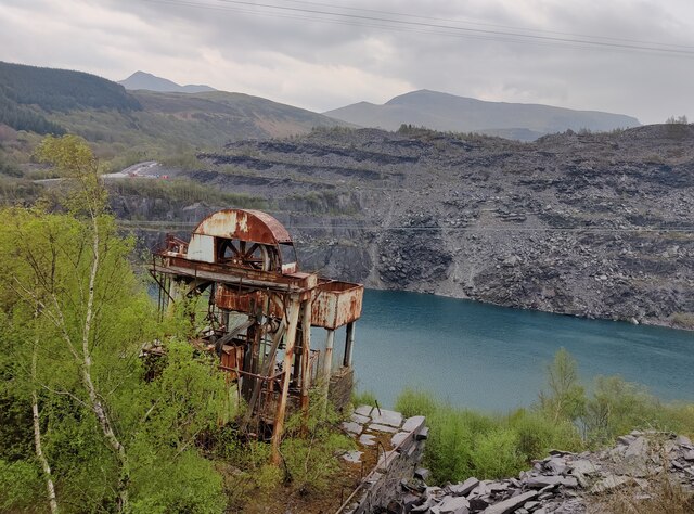
Parc yr Ocar is a picturesque area located in Caernarfonshire, Wales. It is characterized by its beautiful downs and moorland landscapes, making it a popular destination for nature enthusiasts and hikers. The park is situated in a rural setting, with rolling hills and open fields stretching as far as the eye can see.

The downs of Parc yr Ocar are a sight to behold, with their lush greenery and panoramic views of the surrounding countryside. The area is home to a variety of plant and animal species, including wildflowers, heather, and grazing sheep. Visitors can enjoy leisurely walks along the well-maintained trails, taking in the fresh air and stunning vistas.

The moorland of Parc yr Ocar presents a different but equally captivating landscape. The terrain is more rugged and untamed, with rocky outcrops and patches of gorse and bracken. This area is ideal for those seeking a more challenging hike or a chance to explore the natural wonders of the Welsh countryside.

Parc yr Ocar offers a tranquil escape from the hustle and bustle of city life. Its natural beauty and serene atmosphere make it a haven for wildlife and a paradise for nature lovers. Whether you are a seasoned hiker or simply looking for a peaceful retreat, this area in Caernarfonshire is sure to leave you with a lasting impression of Wales' stunning countryside.

If you have any feedback on the listing, please let us know in the comments section below.
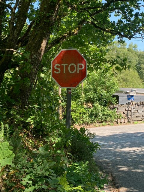
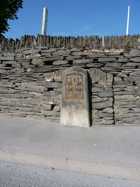
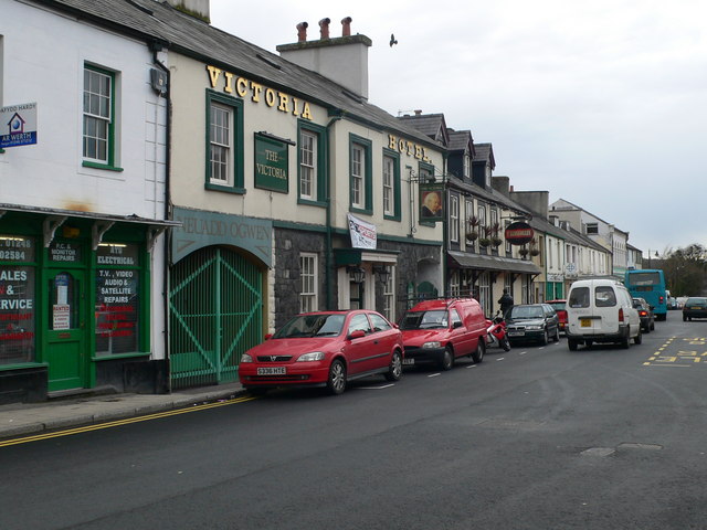
Parc yr Ocar Images

Images are sourced within 2km of 53.173374/-4.078863 or Grid Reference SH6166. Thanks to Geograph Open Source API. All images are credited.

Electrical cabinet on Bangor Road, Bethesda
Electrical cabinet on Ffordd Gerlan, Bethesda
Electrical cabinet on Carneddi Road, Bethesda
Hydrant marker on Gerlan Road, Bethesda
Elizabeth II post box on Braichmelyn, Bethesda LL57 21
Elizabeth II post box on Braichmelyn, Bethesda
LL57 21
Hydrant sign on Cefnfaes Road, Bethesda
Hydrant marker on Braichmelyn, Bethesda
Sluice valve marker at the junction of Station Road and Bangor Road, Bethesda
Damaged sluice valve marker on Bangor Road, Bethesda
Sluice valve marker on Bangor Road, Bethesda
Wooden fingerpost, Sling
Flooded Penrhyn Slate Quarry Penrhyn Quarry is home to Zip World which has the world's fastest and Europe's longest zip line. Velocity 2 has four parallel lines that span 1.5 kilometres over Penrhyn Quarry lake, it is possible to reach speeds of over 100 mph.
Flooded Penrhyn Slate Quarry
Penrhyn Quarry is home to Zip World which has the world's fastest and Europe's longest zip line. Velocity 2 has four parallel lines that span 1.5 kilometres over Penrhyn Quarry lake, it is possible to reach speeds of over 100 mph.
Benchmark on Llwyn Bleddyn Road, Rachub For more details see: <span class="nowrap"><a title="https://www.bench-marks.org.uk/bm29697" rel="nofollow ugc noopener" href="https://www.bench-marks.org.uk/bm29697">Link</a><img style="margin-left:2px;" alt="External link" title="External link - shift click to open in new window" src="https://s1.geograph.org.uk/img/external.png" width="10" height="10"/></span>
Benchmark on Llwyn Bleddyn Road, Rachub
For more details see: LinkExternal link
Benchmark on boulder, Mynydd Llandegai For more details see: <span class="nowrap"><a title="https://www.bench-marks.org.uk/bm114242" rel="nofollow ugc noopener" href="https://www.bench-marks.org.uk/bm114242">Link</a><img style="margin-left:2px;" alt="External link" title="External link - shift click to open in new window" src="https://s1.geograph.org.uk/img/external.png" width="10" height="10"/></span>
Benchmark on boulder, Mynydd Llandegai
For more details see: LinkExternal link
Give way 100 yards sign, Tregarth
Stop sign at the junction of Coetmor New Road and Ffordd Bangor, Bethesda
Stop sign at the junction of Allt Bryn Eglwys and the B4409, Tanysgafell
Telford milestone by Bethesda football ground Located on the west side of the A5 coaching route through Bethesda, and showing Holyhead 30 miles, Bangor 5 miles and Capel Curig 9 miles & 3 furlongs. The stone was Grade II listed by Cadw in 1997 <span class="nowrap"><a title="https://britishlistedbuildings.co.uk/300018379-milestone-by-bethesda-football-club-bethesda" rel="nofollow ugc noopener" href="https://britishlistedbuildings.co.uk/300018379-milestone-by-bethesda-football-club-bethesda">Link</a><img style="margin-left:2px;" alt="External link" title="External link - shift click to open in new window" src="https://s1.geograph.org.uk/img/external.png" width="10" height="10"/></span>
Telford milestone by Bethesda football ground
Located on the west side of the A5 coaching route through Bethesda, and showing Holyhead 30 miles, Bangor 5 miles and Capel Curig 9 miles & 3 furlongs. The stone was Grade II listed by Cadw in 1997 LinkExternal link
Show me another place!

Parc yr Ocar is located at Grid Ref: SH6166 (Lat: 53.173374, Lng: -4.078863)

Unitary Authority: Gwynedd

Police Authority: North Wales

What 3 Words

///intention.consoles.speaking. Near Bethesda, Gwynedd

Related Wikis

Felin Fawr Slate Works

Felin Fawr Works is a former slate works to Penrhyn Quarry Railway in Bethesda, Wales. It dates back to 1803; This is when the first mill was supposedly...

Mynydd Llandygai

Mynydd Llandygái (also spelt Mynydd Llandegai, [ˌmənɨðˌɬandəˈɡai] ; from Welsh mynydd "mountain", Llandygai "Church of St Tegai") is a small, partly forested...

Bethesda railway station

Bethesda railway station was a station in Bethesda, Gwynedd, Wales. == History == The station was opened by the London and North Western Railway on 1 July...

Penrhyn quarry

The Penrhyn quarry is a slate quarry located near Bethesda, North Wales. At the end of the nineteenth century it was the world's largest slate quarry;...

Ogwen (electoral ward)

Ogwen is the name of an electoral ward covering part of the village and community of Bethesda in Gwynedd, Wales. It elects councillors to the community...

Afon Llafar

For the river which flows into Bala Lake see Afon Llafar (Dee)Afon Llafar is a river in the Carneddau, Snowdonia. It rises where many streams flow down...

Bethesda, Gwynedd

Bethesda (; Welsh: [bɛθ'ɛsda]) is a town and community in Gwynedd, Wales. It is on the banks of Afon Ogwen and on the edge of Snowdonia. It is 5 miles...

Bethesda Athletic F.C.

Bethesda Athletic F.C. (; Welsh: [bɛθ'ɛsda]) is a football club based in the Welsh town of Bethesda, in northwest Wales. They play in the Ardal NW which...

Nearby Amenities

Located within 500m of 53.173374,-4.078863
Waterway: weir
Lat/Long: 53.1747926/-4.0749351
Power: pole
Lat/Long: 53.1745917/-4.0726074
Power: pole
Lat/Long: 53.1744599/-4.0746888
Power: pole
Lat/Long: 53.1745325/-4.0740899
Power: pole
Lat/Long: 53.1723152/-4.0757993
Power: pole
Lat/Long: 53.1696623/-4.0758958
Power: pole
Lat/Long: 53.1746965/-4.0728024
Power: pole
Lat/Long: 53.1737126/-4.0749589
Power: pole
Lat/Long: 53.1709132/-4.0750482
Power: pole
Lat/Long: 53.1743152/-4.0742597
Power: pole
Lat/Long: 53.1702688/-4.0754685
Power: pole
Lat/Long: 53.1711769/-4.0751877
Power: pole
Lat/Long: 53.1717075/-4.0754828
Power: pole
Lat/Long: 53.1769029/-4.0781318
Power: pole
Lat/Long: 53.1703619/-4.0752466
Power: pole
Lat/Long: 53.1767074/-4.0823008
Power: pole
Lat/Long: 53.177353/-4.0785798
Power: pole
Lat/Long: 53.1766078/-4.0810026
Power: pole
Lat/Long: 53.1770322/-4.0828694
Power: pole
Lat/Long: 53.1764599/-4.078873
Power: pole
Lat/Long: 53.1746127/-4.0757884
Power: pole
Lat/Long: 53.1728677/-4.0752699
Power: pole
Lat/Long: 53.1764116/-4.0776177
Power: pole
Lat/Long: 53.1724841/-4.0755765
Power: pole
Lat/Long: 53.1738796/-4.0745304
Power: pole
Lat/Long: 53.1751908/-4.0763723
Power: pole
Lat/Long: 53.1709063/-4.0748649
Power: pole
Lat/Long: 53.1696104/-4.07575
Power: pole
Lat/Long: 53.1743394/-4.0735541
Power: pole
Lat/Long: 53.1757294/-4.0769275
Power: pole
Lat/Long: 53.1711539/-4.0750232
Power: pole
Lat/Long: 53.1777459/-4.0792538
Power: pole
Lat/Long: 53.170841/-4.0748791
Power: pole
Lat/Long: 53.1718243/-4.0752967
Power: pole
Lat/Long: 53.1748107/-4.0718802
Power: pole
Lat/Long: 53.1733009/-4.0750279
Power: pole
Lat/Long: 53.1730587/-4.0753627
Power: pole
Lat/Long: 53.176521/-4.0798734
Power: pole
Lat/Long: 53.176275/-4.0780898
Barrier: kissing_gate
Bicycle: no
Foot: yes
Horse: no
Material: metal
Motor Vehicle: no
Wheelchair: no
Lat/Long: 53.1735473/-4.0784494
Access: no
Barrier: kissing_gate
Foot: yes
Lat/Long: 53.1760555/-4.0826446
Description: Mid-C19 masonry dam, associated with the water-powered slate works at Felin Fawr (NPRN 570). Constructed from massive slate blocks. Two cast-iron sluices.
Material: stone,_slate
Waterway: dam
Lat/Long: 53.1747216/-4.0747761
Direction: SE
Generator Method: photovoltaic
Generator Output Electricity: yes
Generator Solar Modules: 16
Generator Source: solar
Generator Type: solar_photovoltaic_panel
Location: roof
Power: generator
Lat/Long: 53.1750484/-4.0837182
Direction: 215
Generator Method: photovoltaic
Generator Output Electricity: yes
Generator Solar Modules: 16
Generator Source: solar
Generator Type: solar_photovoltaic_panel
Location: roof
Power: generator
Lat/Long: 53.1772548/-4.0768678
Direction: 210
Generator Method: photovoltaic
Generator Output Electricity: yes
Generator Solar Modules: 7
Generator Source: solar
Generator Type: solar_photovoltaic_panel
Location: roof
Power: generator
Lat/Long: 53.1758024/-4.0726809
Direction: 120
Generator Method: photovoltaic
Generator Output Electricity: yes
Generator Solar Modules: 9
Generator Source: solar
Generator Type: solar_photovoltaic_panel
Location: roof
Power: generator
Lat/Long: 53.1757936/-4.0727533
The data included in this document is from www.openstreetmap.org. The data is made available under ODbL.

Have you been to Parc yr Ocar?

Leave your review of Parc yr Ocar below (or comments, questions and feedback).