Cil-geraint

Settlement in Caernarfonshire

Wales

Cil-geraint

Electrical cabinet on Bangor Road, Bethesda
Electrical cabinet on Bangor Road, Bethesda Credit: Meirion

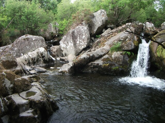
Cil-geraint is a small hamlet located in the county of Caernarfonshire, Wales. Situated in the heart of Snowdonia National Park, it is surrounded by breathtaking natural beauty. The hamlet is nestled amongst rolling hills, lush green meadows, and dense forests, making it an idyllic retreat for nature lovers and outdoor enthusiasts.

Cil-geraint is characterized by its tranquil and serene atmosphere. Its remote location ensures a peaceful and secluded environment, away from the hustle and bustle of city life. The hamlet is dotted with traditional Welsh cottages, displaying the region's rich cultural heritage.

The surrounding landscape offers a variety of outdoor activities for visitors to enjoy. Hiking trails wind through the nearby mountains, providing stunning panoramic views of the surrounding countryside. The area is also renowned for its excellent fishing spots, with numerous rivers and lakes teeming with trout and salmon.

For those interested in history and culture, Cil-geraint is within close proximity to several notable attractions. Caernarfon Castle, a UNESCO World Heritage Site, is just a short drive away. This medieval fortress is an impressive example of Welsh military architecture and offers a glimpse into the region's past.

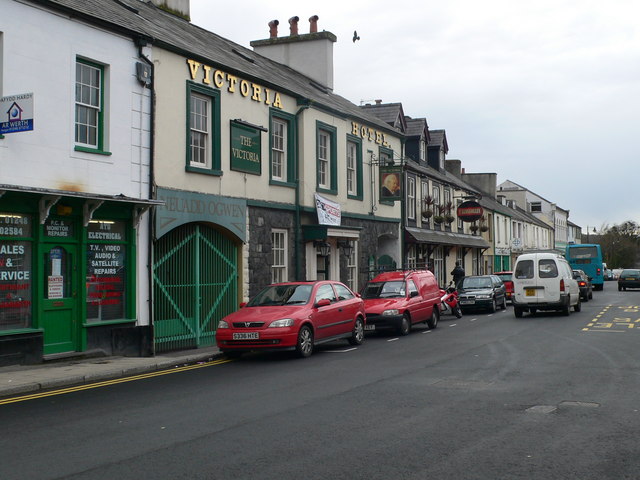
Despite its remote location, Cil-geraint is not far from amenities and services. The nearby town of Caernarfon provides grocery stores, restaurants, and shops, ensuring that residents and visitors have easy access to the essentials.

In conclusion, Cil-geraint is a picturesque hamlet in Caernarfonshire, offering a peaceful retreat in the heart of Snowdonia National Park. Its stunning natural surroundings, outdoor activities, and proximity to historical sites make it a charming destination for those seeking a tranquil and scenic getaway.

If you have any feedback on the listing, please let us know in the comments section below.

Cil-geraint Images

Images are sourced within 2km of 53.178286/-4.0766463 or Grid Reference SH6166. Thanks to Geograph Open Source API. All images are credited.

Electrical cabinet on Bangor Road, Bethesda
Hydrant sign on Ffordd Gerlan, Bethesda
Electrical cabinet on Ffordd Gerlan, Bethesda
Electrical cabinet on Carneddi Road, Bethesda
Hydrant marker on Gerlan Road, Bethesda
Elizabeth II post box on Braichmelyn, Bethesda LL57 21
Elizabeth II post box on Braichmelyn, Bethesda
LL57 21
Hydrant sign on Cefnfaes Road, Bethesda
Hydrant marker on Braichmelyn, Bethesda
Sluice valve marker at the junction of Station Road and Bangor Road, Bethesda
Damaged sluice valve marker on Bangor Road, Bethesda
Sluice valve marker on Bangor Road, Bethesda
Waterfall on Afon Caseg, Bethesda
Wooden fingerpost, Sling
Flooded Penrhyn Slate Quarry Penrhyn Quarry is home to Zip World which has the world's fastest and Europe's longest zip line. Velocity 2 has four parallel lines that span 1.5 kilometres over Penrhyn Quarry lake, it is possible to reach speeds of over 100 mph.
Flooded Penrhyn Slate Quarry
Penrhyn Quarry is home to Zip World which has the world's fastest and Europe's longest zip line. Velocity 2 has four parallel lines that span 1.5 kilometres over Penrhyn Quarry lake, it is possible to reach speeds of over 100 mph.
Benchmark on Llwyn Bleddyn Road, Rachub For more details see: <span class="nowrap"><a title="https://www.bench-marks.org.uk/bm29697" rel="nofollow ugc noopener" href="https://www.bench-marks.org.uk/bm29697">Link</a><img style="margin-left:2px;" alt="External link" title="External link - shift click to open in new window" src="https://s1.geograph.org.uk/img/external.png" width="10" height="10"/></span>
Benchmark on Llwyn Bleddyn Road, Rachub
For more details see: LinkExternal link
Benchmark on boulder, Mynydd Llandegai For more details see: <span class="nowrap"><a title="https://www.bench-marks.org.uk/bm114242" rel="nofollow ugc noopener" href="https://www.bench-marks.org.uk/bm114242">Link</a><img style="margin-left:2px;" alt="External link" title="External link - shift click to open in new window" src="https://s1.geograph.org.uk/img/external.png" width="10" height="10"/></span>
Benchmark on boulder, Mynydd Llandegai
For more details see: LinkExternal link
Dŵr Cymru / Welsh Water sign on Britannia Street, Rachub
Sign at Tan y Bwlch substation on Tan y Garth, Rachub
Show me another place!

Cil-geraint is located at Grid Ref: SH6166 (Lat: 53.178286, Lng: -4.0766463)

Unitary Authority: Gwynedd

Police Authority: North Wales

What 3 Words

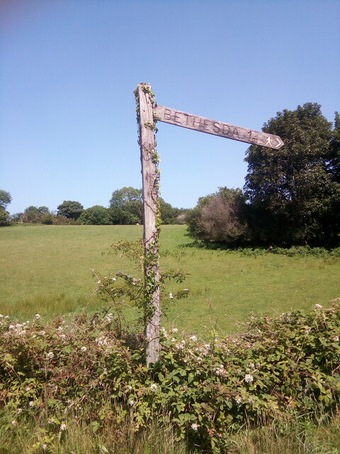
///blurs.internal.bother. Near Bethesda, Gwynedd

Related Wikis

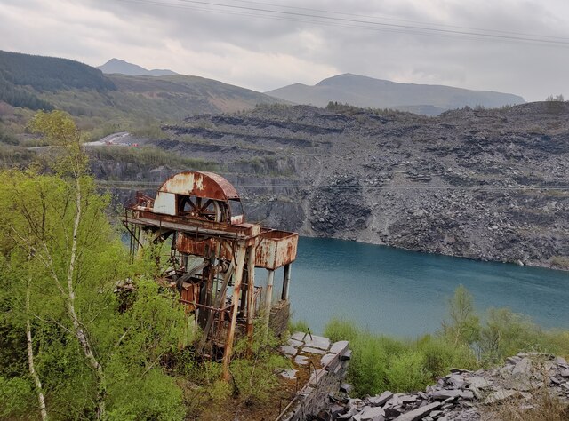
Felin Fawr Slate Works

Felin Fawr Works is a former slate works to Penrhyn Quarry Railway in Bethesda, Wales. It dates back to 1803; This is when the first mill was supposedly...

Bethesda railway station

Bethesda railway station was a station in Bethesda, Gwynedd, Wales. == History == The station was opened by the London and North Western Railway on 1 July...

Ogwen (electoral ward)

Ogwen is the name of an electoral ward covering part of the village and community of Bethesda in Gwynedd, Wales. It elects councillors to the community...

Ysgol Dyffryn Ogwen

Ysgol Dyffryn Ogwen ("Ogwen Valley School") is a bilingual secondary school for pupils aged 11 to 19 years. It is situated in Bethesda in the Ogwen valley...

Bethesda, Gwynedd

Bethesda (; Welsh: [bɛθ'ɛsda]) is a town and community in Gwynedd, Wales. It is on the banks of Afon Ogwen and on the edge of Snowdonia. It is 5 miles...

Jerusalem Chapel, Bethesda

Jerusalem Chapel, Bethesda, Gwynedd, Wales is a Presbyterian Church of Wales chapel built in 1841–1842 and reconstructed in 1872–1875. Of colossal size...

Pantdreiniog quarry

The Pantdreiniog quarry (also known as the Pant Dreiniog quarry) was a slate quarry within the town of Bethesda in North Wales. It was worked between about...

Bethesda Athletic F.C.

Bethesda Athletic F.C. (; Welsh: [bɛθ'ɛsda]) is a football club based in the Welsh town of Bethesda, in northwest Wales. They play in the Ardal NW which...

Nearby Amenities

Located within 500m of 53.178286,-4.0766463
Waterway: weir
Lat/Long: 53.1747926/-4.0749351
Barrier: kissing_gate
Lat/Long: 53.1796872/-4.0765778
Post Box
Post Box Type: lamp
Ref: LL59 19
Lat/Long: 53.1770288/-4.0736257
Telephone
Booth: K6
Covered: booth
Lat/Long: 53.1770219/-4.0736607
Man Made: mast
Mast: telecommunication
Lat/Long: 53.1779967/-4.0741136
Barrier: kissing_gate
Bicycle: yes
Foot: yes
Lat/Long: 53.1787967/-4.0735103
Barrier: kissing_gate
Lat/Long: 53.1805195/-4.0734911
Barrier: kissing_gate
Lat/Long: 53.1803595/-4.0771361
Power: pole
Lat/Long: 53.1745917/-4.0726074
Power: pole
Lat/Long: 53.1744599/-4.0746888
Power: pole
Lat/Long: 53.1745325/-4.0740899
Power: pole
Lat/Long: 53.1746965/-4.0728024
Power: pole
Lat/Long: 53.1743152/-4.0742597
Power: pole
Lat/Long: 53.1769029/-4.0781318
Power: pole
Lat/Long: 53.1767074/-4.0823008
Power: pole
Lat/Long: 53.177353/-4.0785798
Power: pole
Lat/Long: 53.1766078/-4.0810026
Power: pole
Lat/Long: 53.1770322/-4.0828694
Power: pole
Lat/Long: 53.1764599/-4.078873
Power: pole
Lat/Long: 53.1746127/-4.0757884
Power: pole
Lat/Long: 53.1764116/-4.0776177
Power: pole
Lat/Long: 53.1785593/-4.0815766
Power: pole
Lat/Long: 53.1751908/-4.0763723
Power: pole
Lat/Long: 53.1793213/-4.0837224
Power: pole
Lat/Long: 53.178233/-4.0806164
Power: pole
Lat/Long: 53.1743394/-4.0735541
Power: pole
Lat/Long: 53.1757294/-4.0769275
Power: pole
Lat/Long: 53.1774116/-4.0835185
Power: pole
Lat/Long: 53.1777459/-4.0792538
Power: pole
Lat/Long: 53.1788722/-4.0824717
Pont Sarnau
Place: locality
Lat/Long: 53.1800326/-4.0714084
Power: pole
Lat/Long: 53.1748107/-4.0718802
Pont Galedffrwd
Place: locality
Lat/Long: 53.1770254/-4.0723018
Bench
Lat/Long: 53.1818639/-4.0731224
Bench
Lat/Long: 53.1819636/-4.0731304
Power: pole
Lat/Long: 53.176521/-4.0798734
Power: pole
Lat/Long: 53.176275/-4.0780898
Direction: 170
Man Made: adit
Note: Outfall of the George drainage adit.
Lat/Long: 53.1807712/-4.0730475
Access: no
Barrier: kissing_gate
Foot: yes
Lat/Long: 53.1760555/-4.0826446
Ford: yes
Lat/Long: 53.1806747/-4.0819735
Ford: yes
Lat/Long: 53.1802501/-4.0808515
Description: Mid-C19 masonry dam, associated with the water-powered slate works at Felin Fawr (NPRN 570). Constructed from massive slate blocks. Two cast-iron sluices.
Material: stone,_slate
Waterway: dam
Lat/Long: 53.1747216/-4.0747761
Ford: yes
Lat/Long: 53.1798934/-4.0773818
Direction: 215
Generator Method: photovoltaic
Generator Output Electricity: yes
Generator Solar Modules: 16
Generator Source: solar
Generator Type: solar_photovoltaic_panel
Location: roof
Power: generator
Lat/Long: 53.1772548/-4.0768678
Direction: 255
Generator Method: photovoltaic
Generator Output Electricity: yes
Generator Solar Modules: 14
Generator Source: solar
Generator Type: solar_photovoltaic_panel
Location: roof
Power: generator
Lat/Long: 53.1786301/-4.0760404
Direction: 210
Generator Method: photovoltaic
Generator Output Electricity: yes
Generator Solar Modules: 7
Generator Source: solar
Generator Type: solar_photovoltaic_panel
Location: roof
Power: generator
Lat/Long: 53.1758024/-4.0726809
Direction: 120
Generator Method: photovoltaic
Generator Output Electricity: yes
Generator Solar Modules: 9
Generator Source: solar
Generator Type: solar_photovoltaic_panel
Location: roof
Power: generator
Lat/Long: 53.1757936/-4.0727533
Tanysgafell
Place: hamlet
Lat/Long: 53.1806647/-4.0752724
Information: board
Tourism: information
Lat/Long: 53.1799726/-4.0715478
The data included in this document is from www.openstreetmap.org. The data is made available under ODbL.

Have you been to Cil-geraint?

Leave your review of Cil-geraint below (or comments, questions and feedback).